Academic Profile
Statistics
Similar Authors
Papers on arXiv
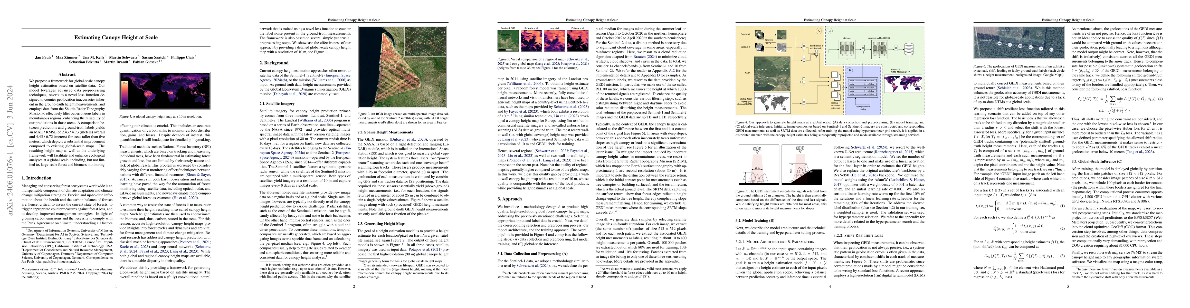
We propose a framework for global-scale canopy height estimation based on satellite data. Our model leverages advanced data preprocessing techniques, resorts to a novel loss function designed to cou...
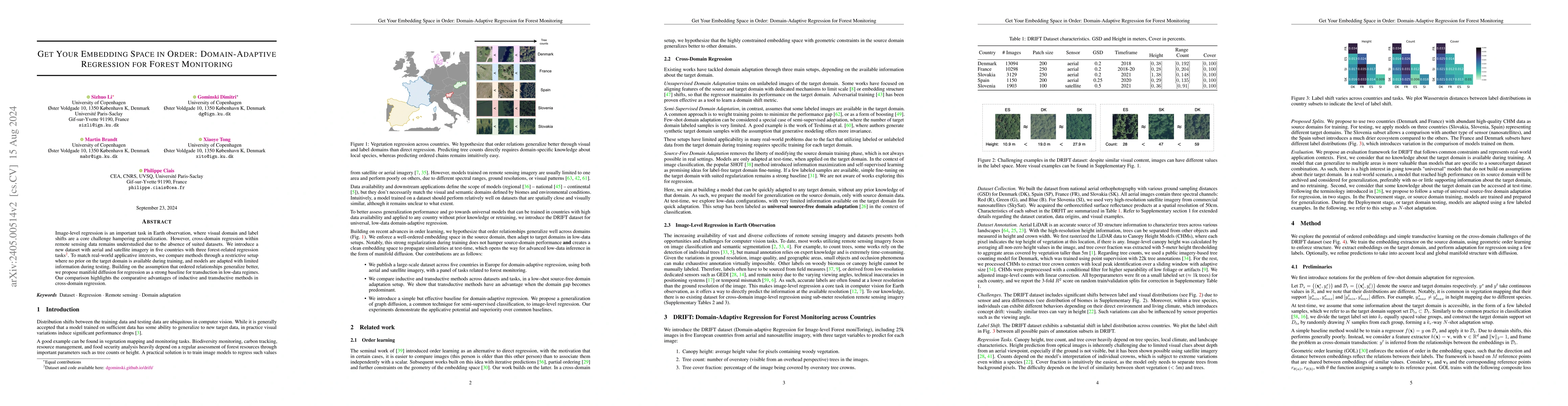
Image-level regression is an important task in Earth observation, where visual domain and label shifts are a core challenge hampering generalization. However, cross-domain regression with remote sen...
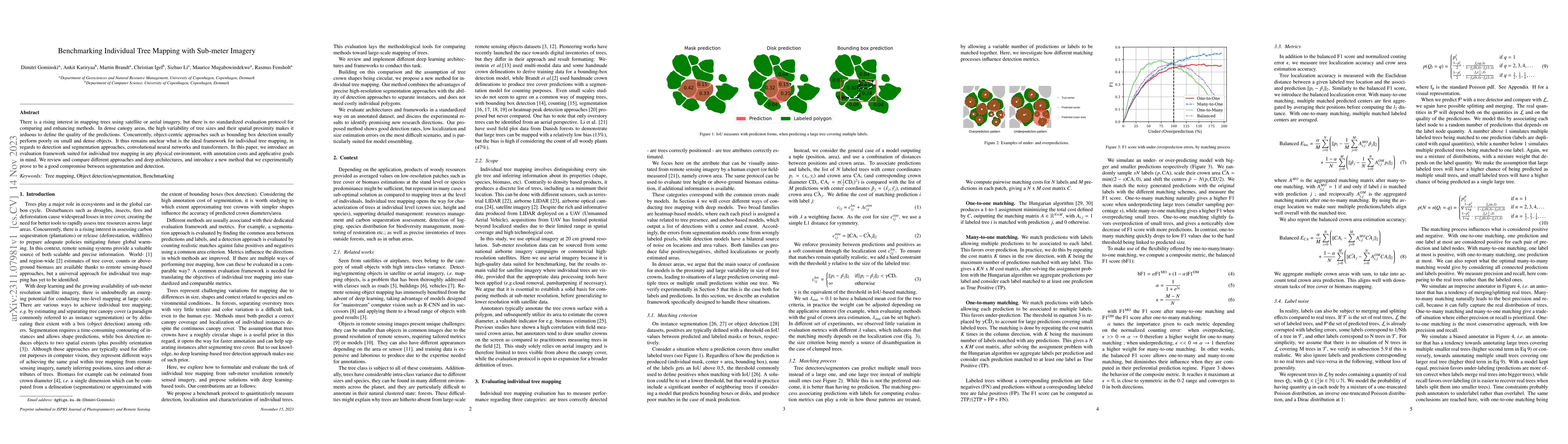
There is a rising interest in mapping trees using satellite or aerial imagery, but there is no standardized evaluation protocol for comparing and enhancing methods. In dense canopy areas, the high v...
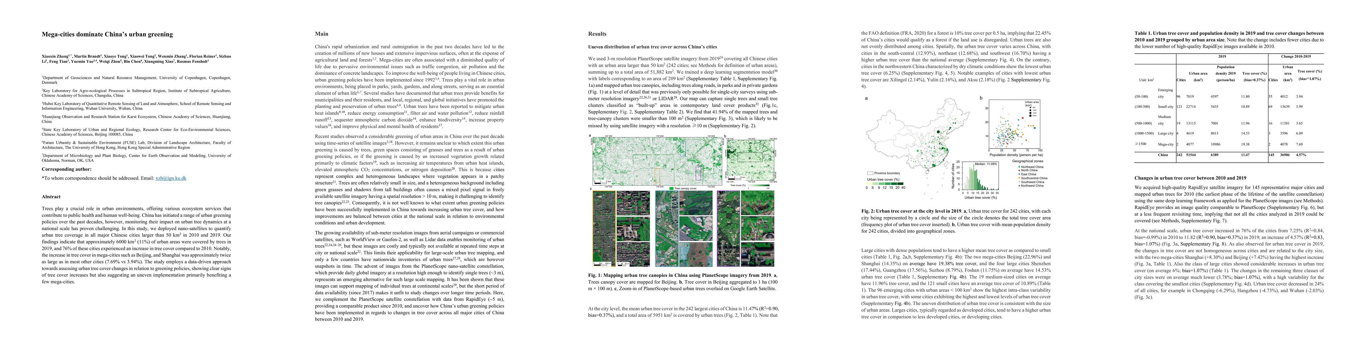
Trees play a crucial role in urban environments, offering various ecosystem services that contribute to public health and human well-being. China has initiated a range of urban greening policies ove...
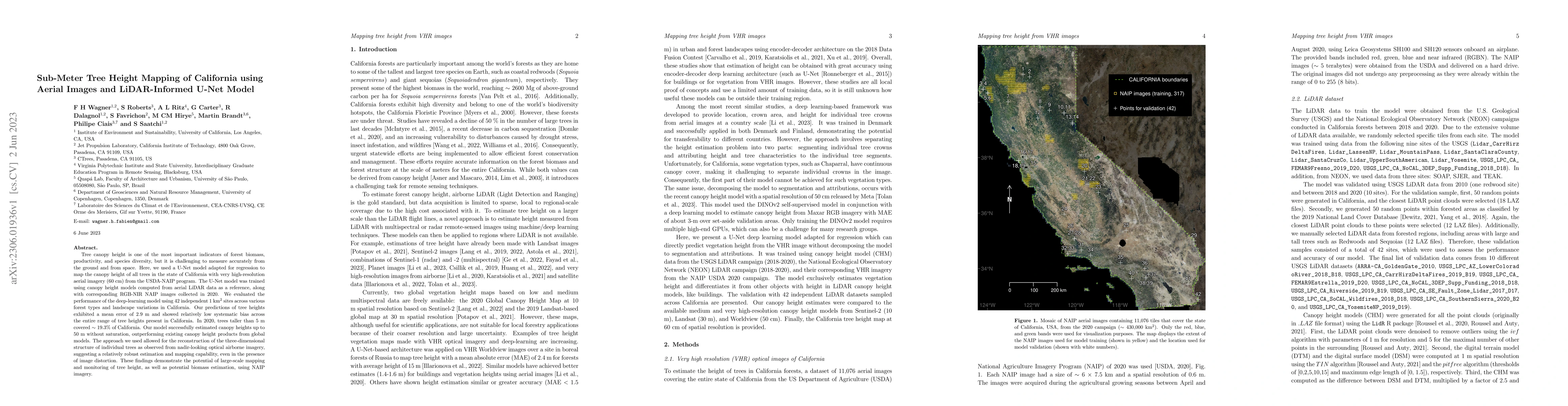
Tree canopy height is one of the most important indicators of forest biomass, productivity, and species diversity, but it is challenging to measure accurately from the ground and from space. Here, w...
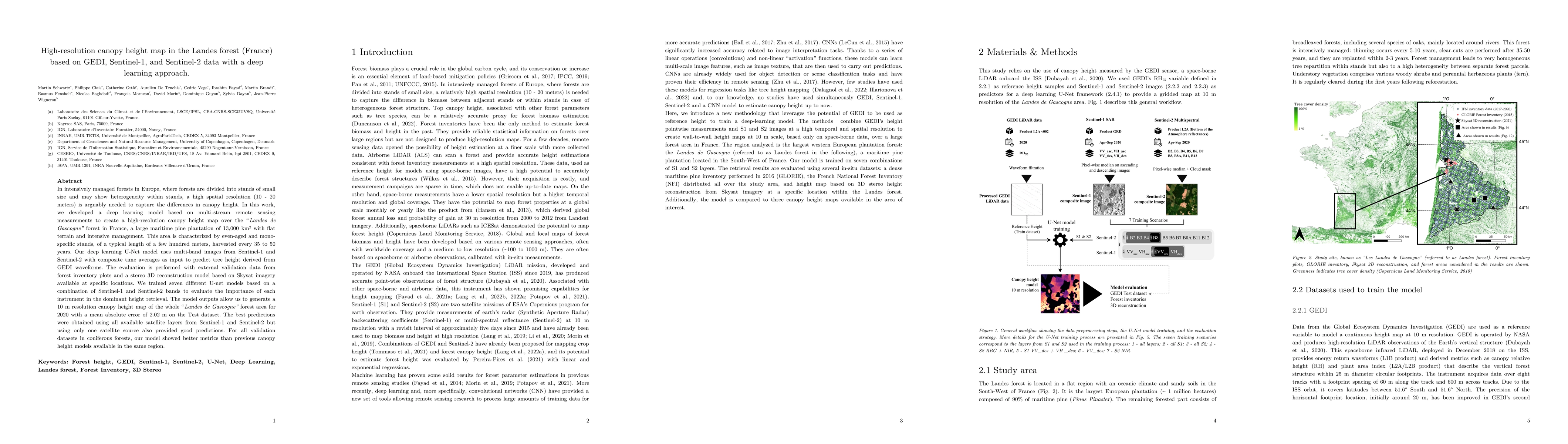
In intensively managed forests in Europe, where forests are divided into stands of small size and may show heterogeneity within stands, a high spatial resolution (10 - 20 meters) is arguably needed ...
Spatial-temporal dynamics of aboveground biomass (AGB) and forest area affect the carbon cycle, climate, and biodiversity in the Brazilian Amazon. Here we investigate inter-annual changes of AGB and...
The karst area in Yunnan-Guangxi-Guizhou region in southwest China is known for widespread rocky desertification but several studies report a greening trend since the year 2000. While the start of t...
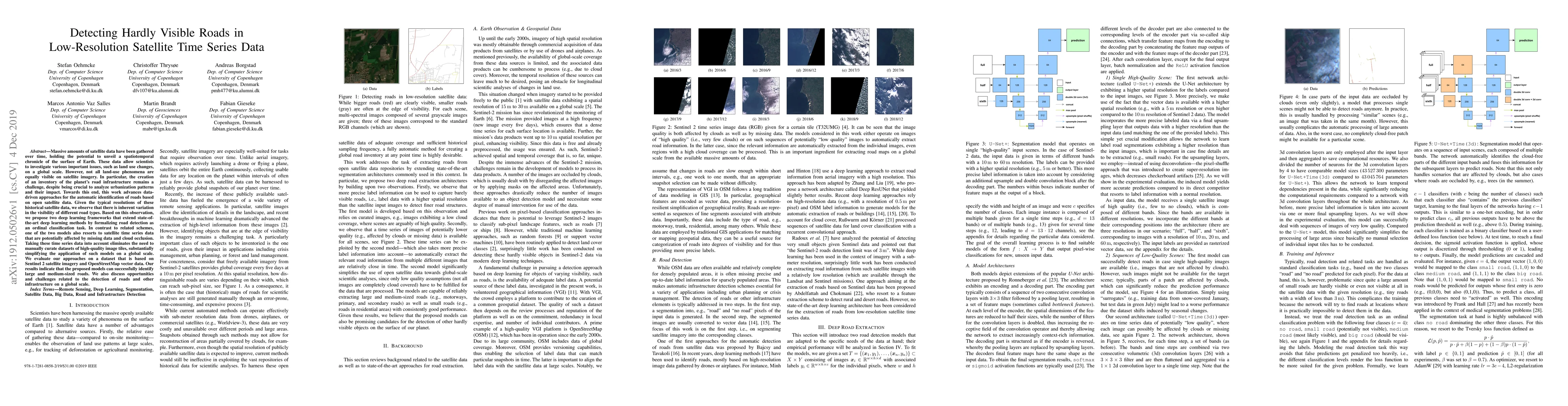
Massive amounts of satellite data have been gathered over time, holding the potential to unveil a spatiotemporal chronicle of the surface of Earth. These data allow scientists to investigate various...
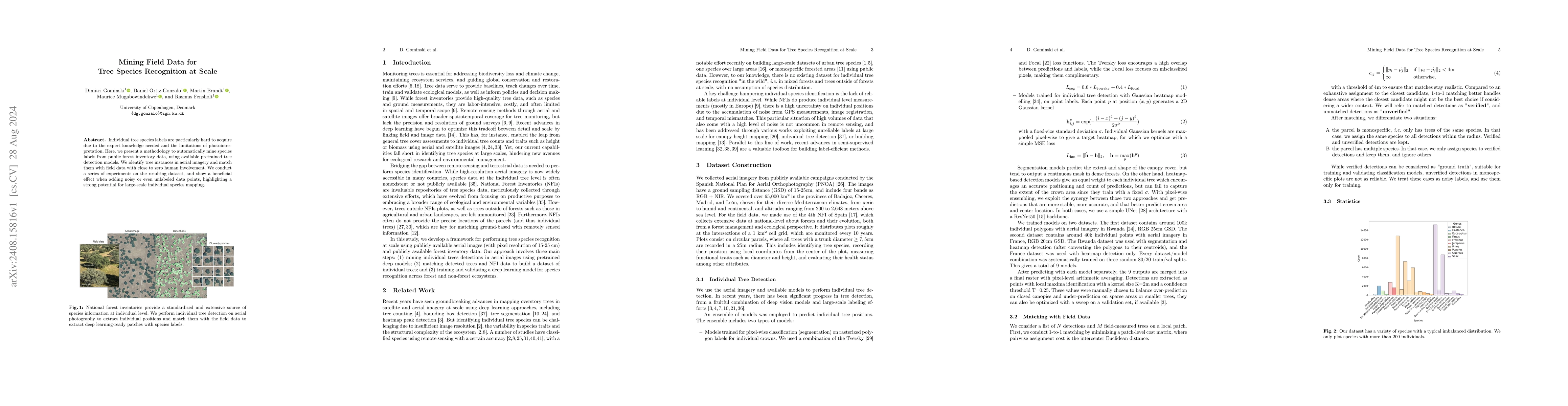
Individual tree species labels are particularly hard to acquire due to the expert knowledge needed and the limitations of photointerpretation. Here, we present a methodology to automatically mine spec...
Tree canopy height is one of the most important indicators of forest biomass, productivity, and ecosystem structure, but it is challenging to measure accurately from the ground and from space. Here, w...
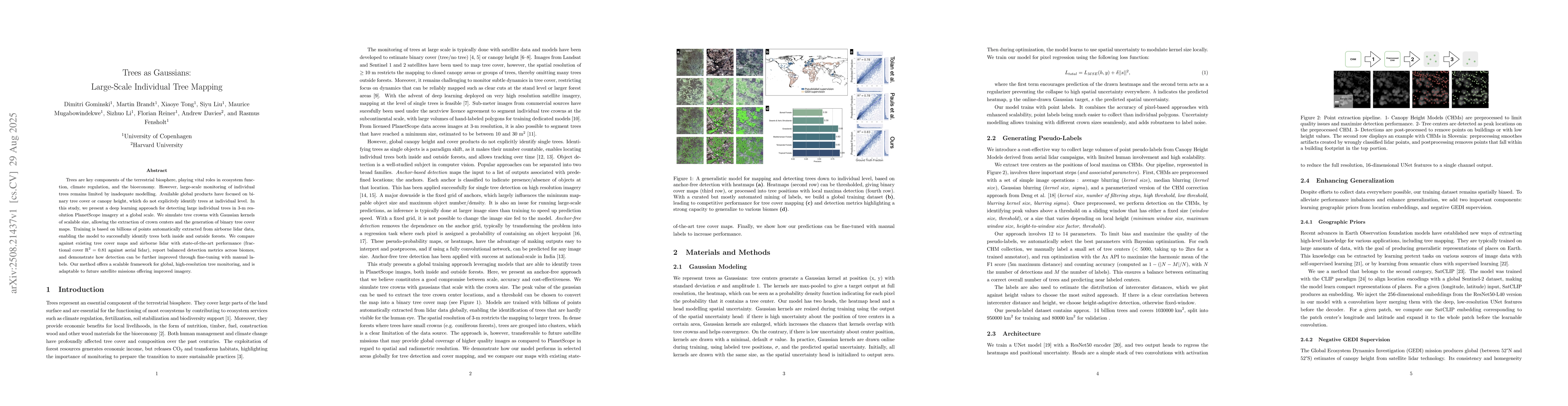
Trees are key components of the terrestrial biosphere, playing vital roles in ecosystem function, climate regulation, and the bioeconomy. However, large-scale monitoring of individual trees remains li...
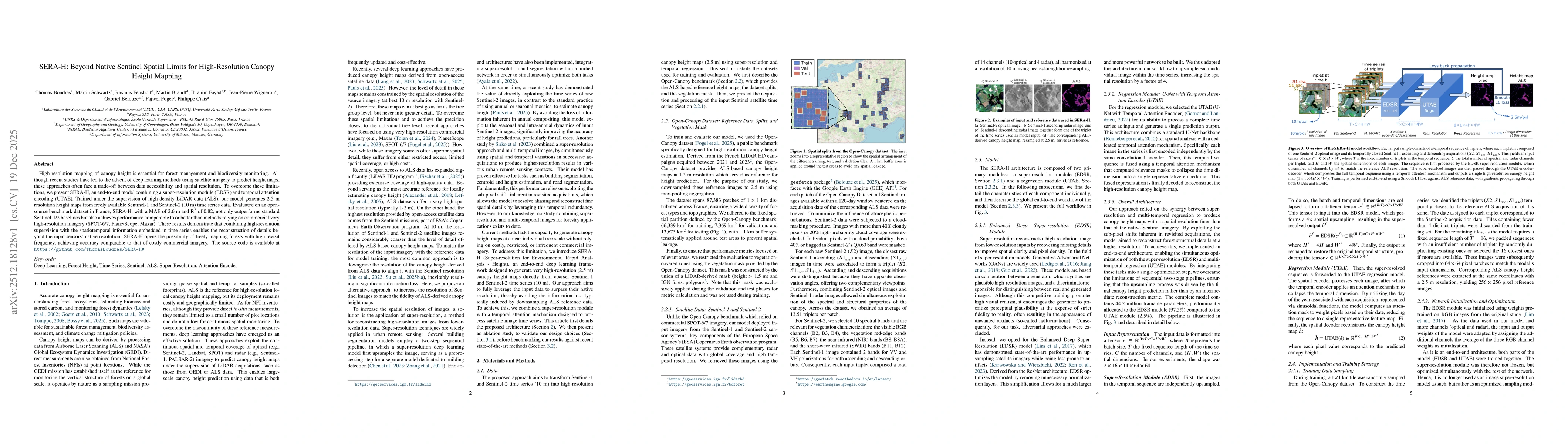
High-resolution mapping of canopy height is essential for forest management and biodiversity monitoring. Although recent studies have led to the advent of deep learning methods using satellite imagery...

Counting individual trees is a fundamental task for environmental monitoring, yet remains largely unexplored with satellite imagery. At these resolutions, isolated trees may still be identifiable, but...
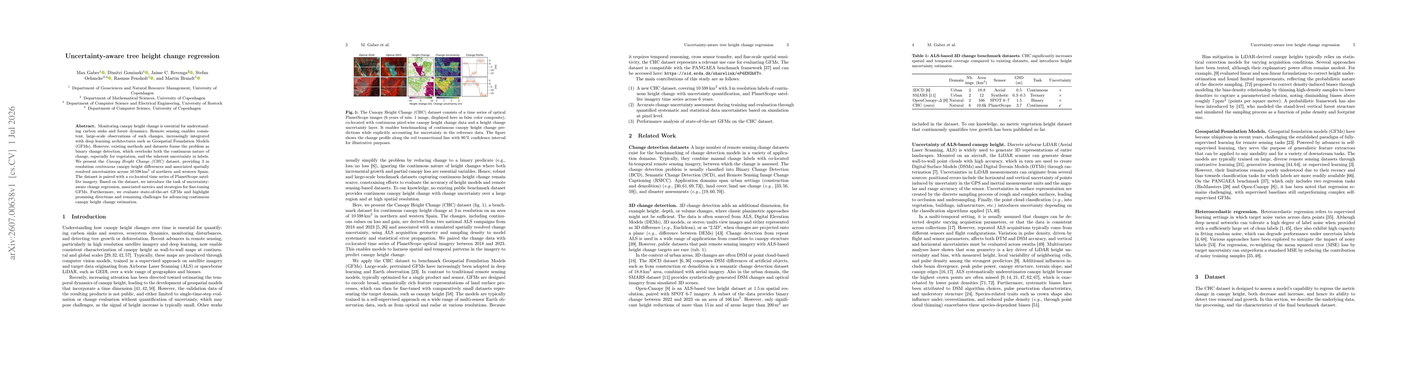
Monitoring canopy height change is essential for understanding carbon sinks and forest dynamics. Remote sensing enables consistent, large-scale observations of such changes, increasingly integrated wi...