Academic Profile
Statistics
Similar Authors
Papers on arXiv
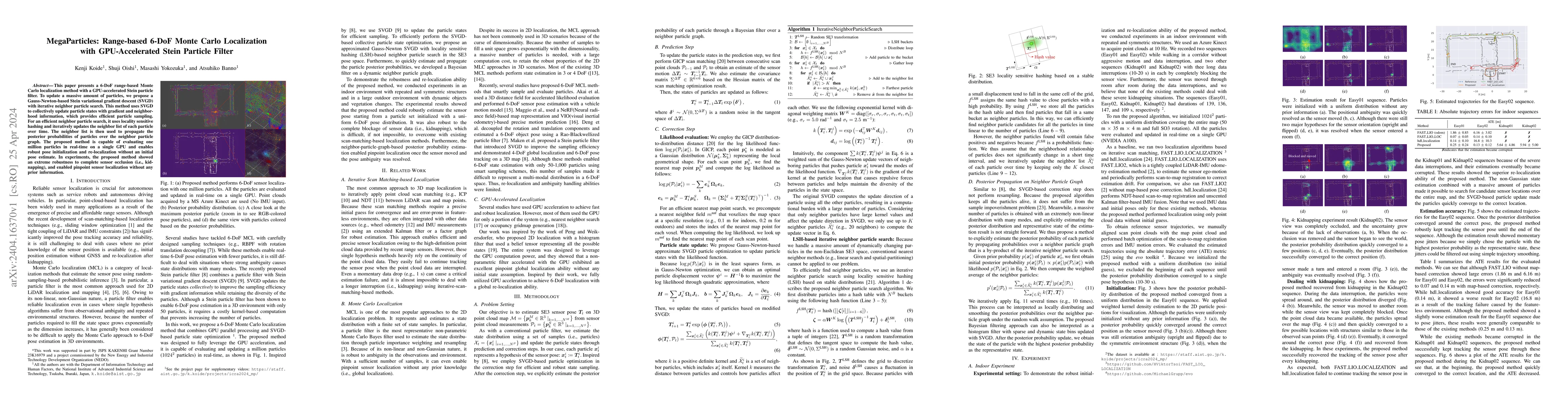
This paper presents a 6-DoF range-based Monte Carlo localization method with a GPU-accelerated Stein particle filter. To update a massive amount of particles, we propose a Gauss-Newton-based Stein v...
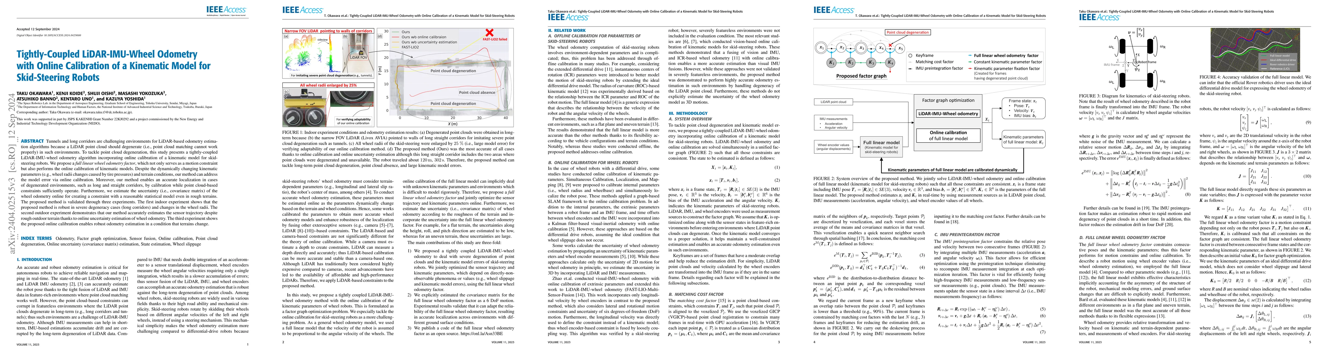
Tunnels and long corridors are challenging environments for mobile robots because a LiDAR point cloud should degenerate in these environments. To tackle point cloud degeneration, this study presents...
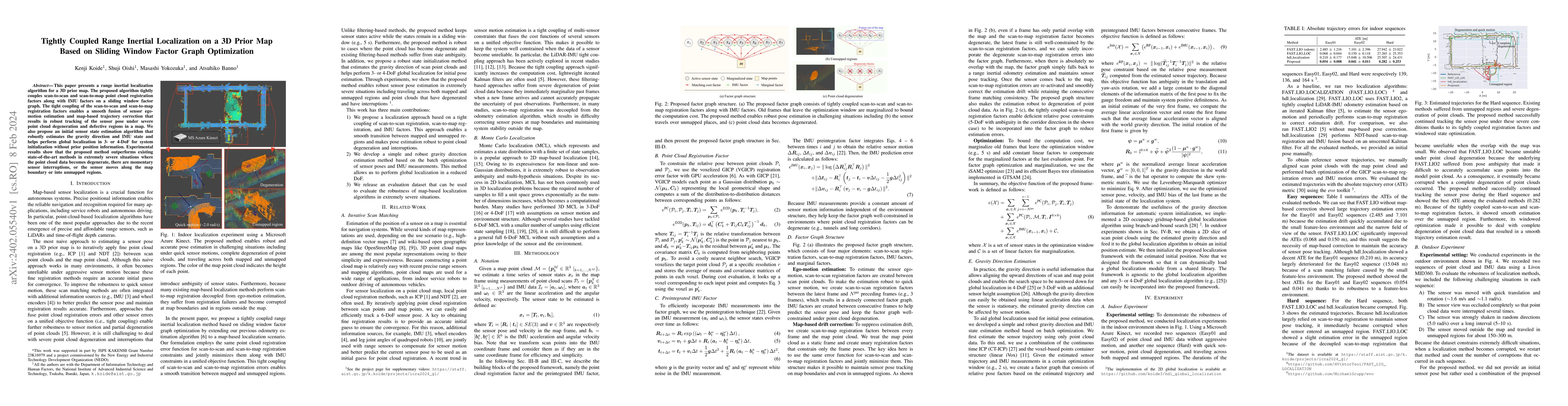
This paper presents a range inertial localization algorithm for a 3D prior map. The proposed algorithm tightly couples scan-to-scan and scan-to-map point cloud registration factors along with IMU fa...
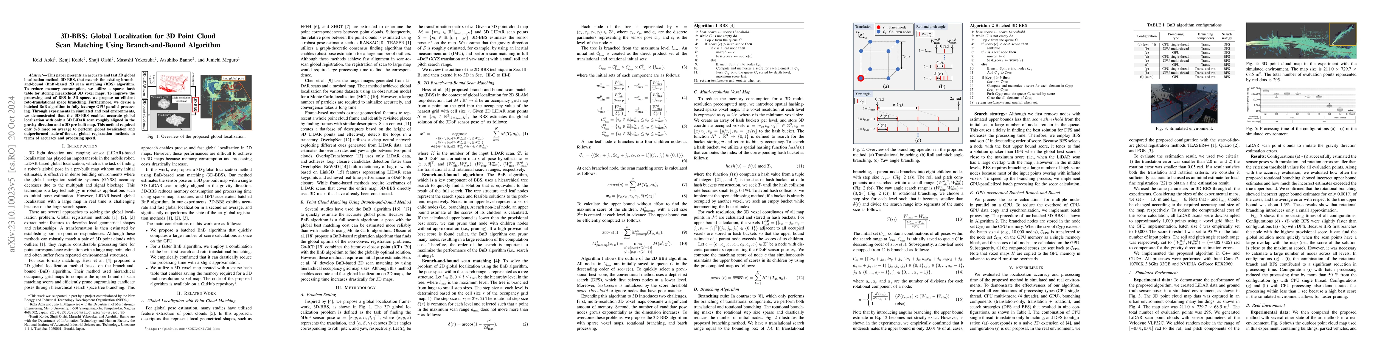
This paper presents an accurate and fast 3D global localization method, 3D-BBS, that extends the existing branch-and-bound (BnB)-based 2D scan matching (BBS) algorithm. To reduce memory consumption,...
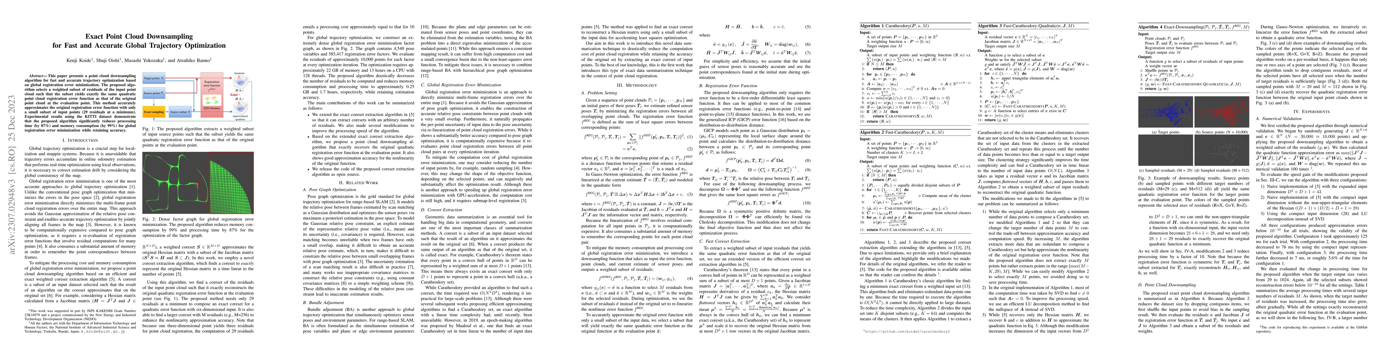
This paper presents a point cloud downsampling algorithm for fast and accurate trajectory optimization based on global registration error minimization. The proposed algorithm selects a weighted subs...
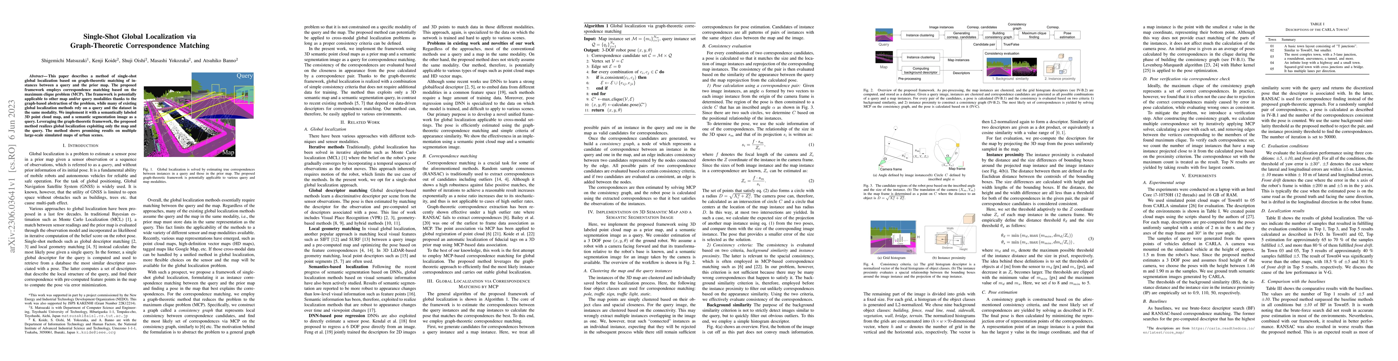
This paper describes a method of global localization based on graph-theoretic association of instances between a query and the prior map. The proposed framework employs correspondence matching based...
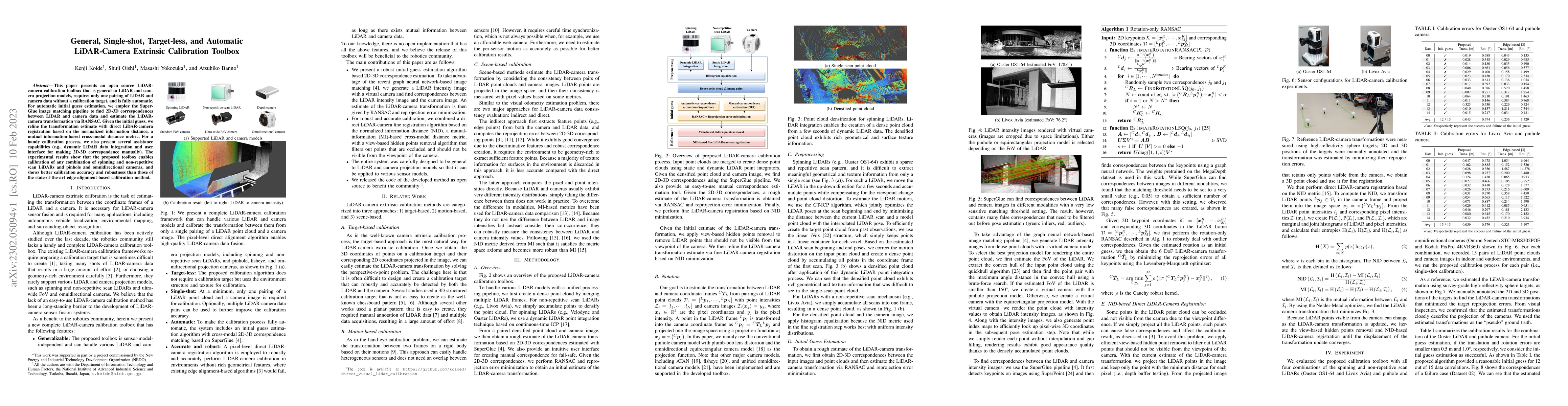
This paper presents an open source LiDAR-camera calibration toolbox that is general to LiDAR and camera projection models, requires only one pairing of LiDAR and camera data without a calibration ta...
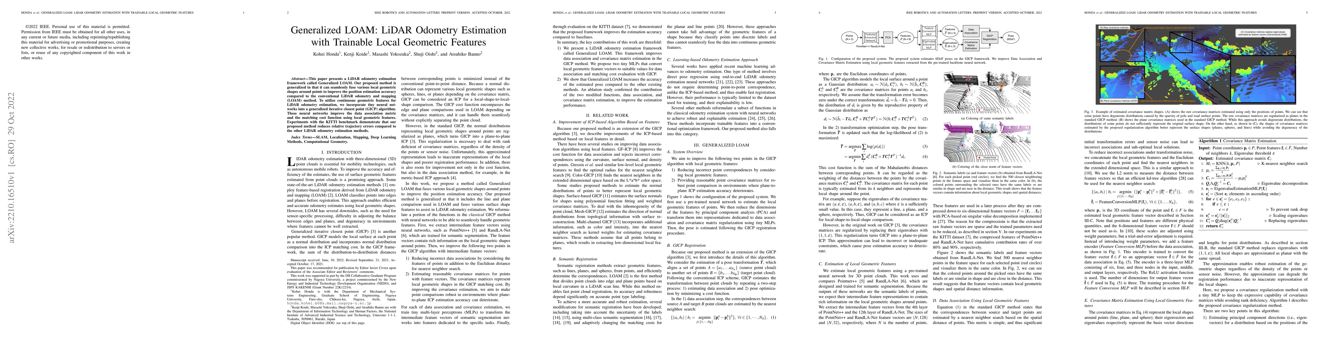
This paper presents a LiDAR odometry estimation framework called Generalized LOAM. Our proposed method is generalized in that it can seamlessly fuse various local geometric shapes around points to i...
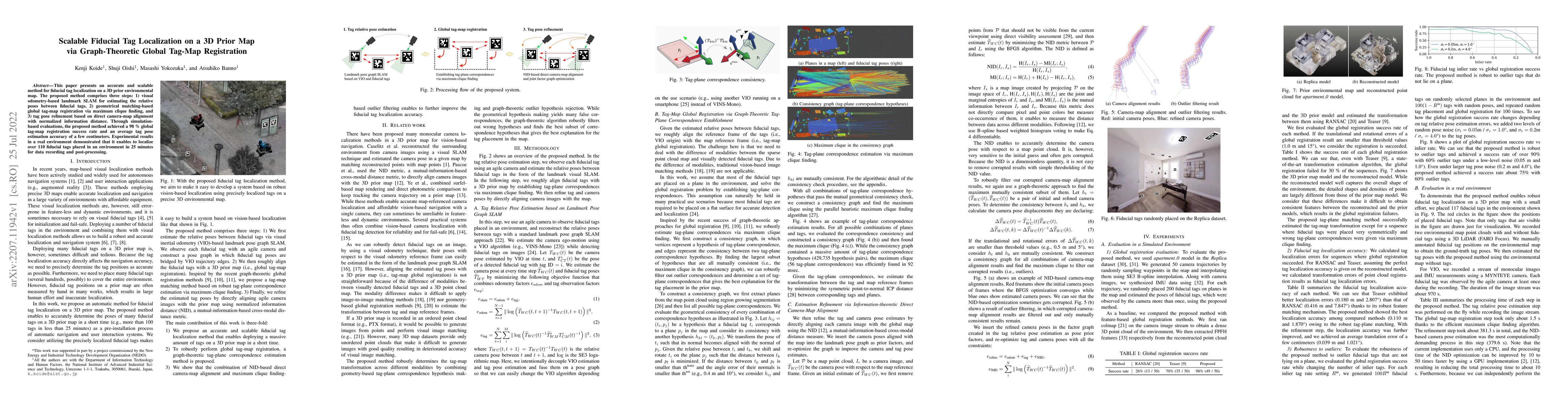
This paper presents an accurate and scalable method for fiducial tag localization on a 3D prior environmental map. The proposed method comprises three steps: 1) visual odometry-based landmark SLAM f...
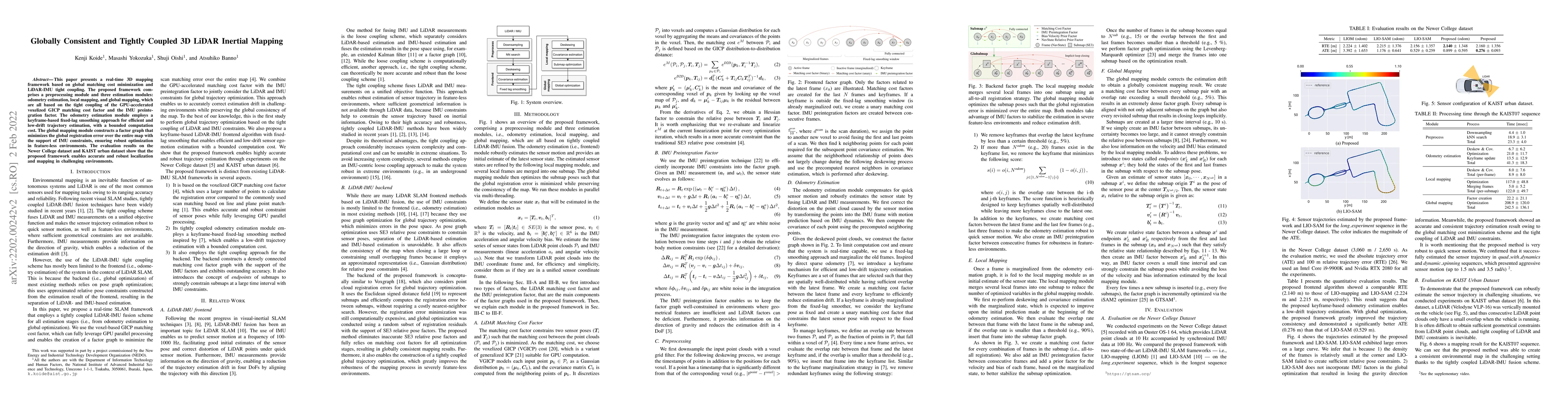
This paper presents a real-time 3D mapping framework based on global matching cost minimization and LiDAR-IMU tight coupling. The proposed framework comprises a preprocessing module and three estima...
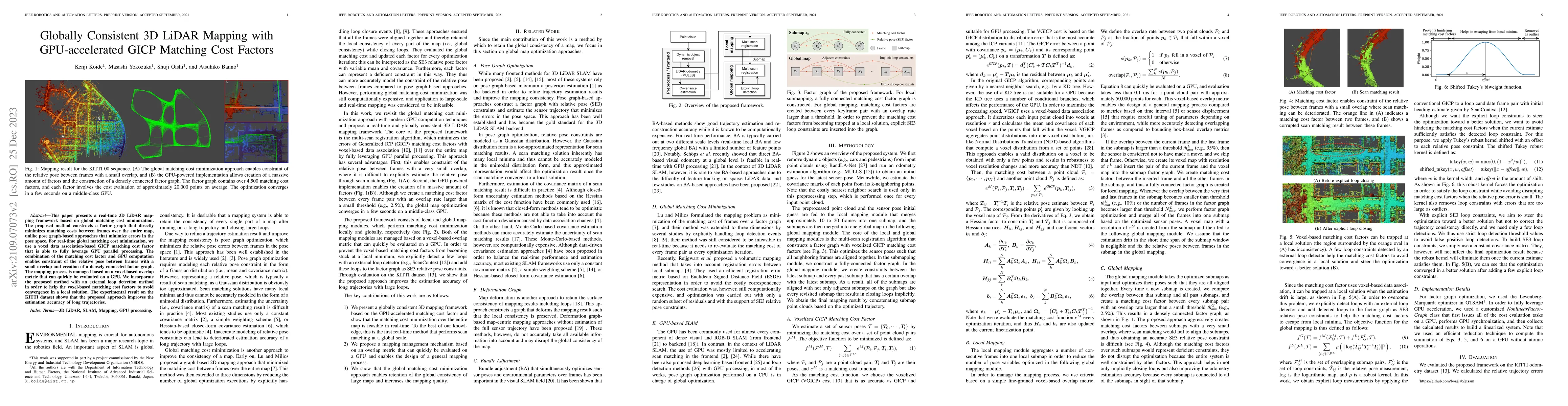
This paper presents a real-time 3D LiDAR mapping framework based on global matching cost minimization. The proposed method constructs a factor graph that directly minimizes matching costs between fr...
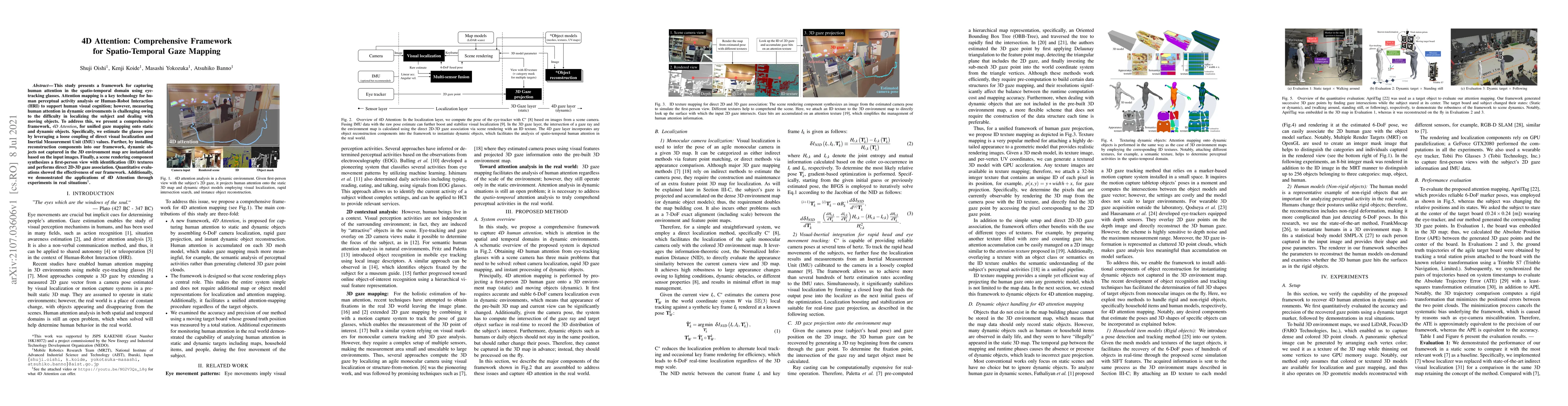
This study presents a framework for capturing human attention in the spatio-temporal domain using eye-tracking glasses. Attention mapping is a key technology for human perceptual activity analysis o...
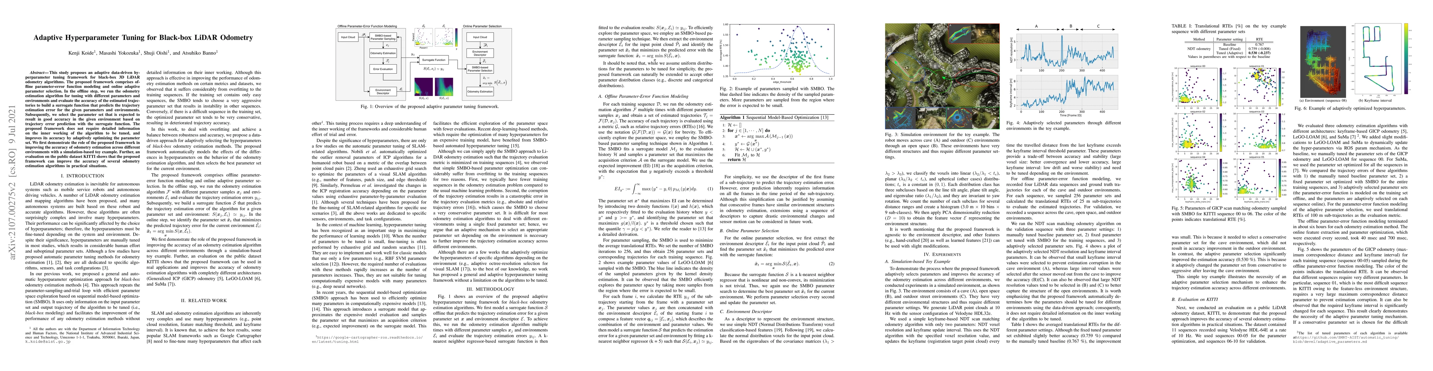
This study proposes an adaptive data-driven hyperparameter tuning framework for black-box 3D LiDAR odometry algorithms. The proposed framework comprises offline parameter-error function modeling and...
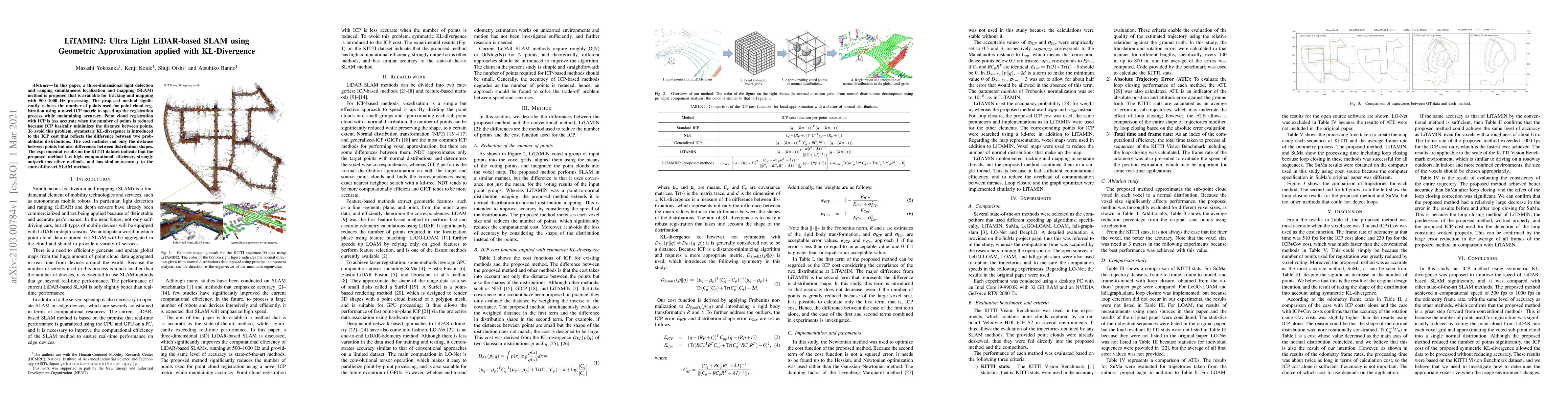
In this paper, a three-dimensional light detection and ranging simultaneous localization and mapping (SLAM) method is proposed that is available for tracking and mapping with 500--1000 Hz processing...
Environments lacking geometric features (e.g., tunnels and long straight corridors) are challenging for LiDAR-based odometry algorithms because LiDAR point clouds degenerate in such environments. For ...
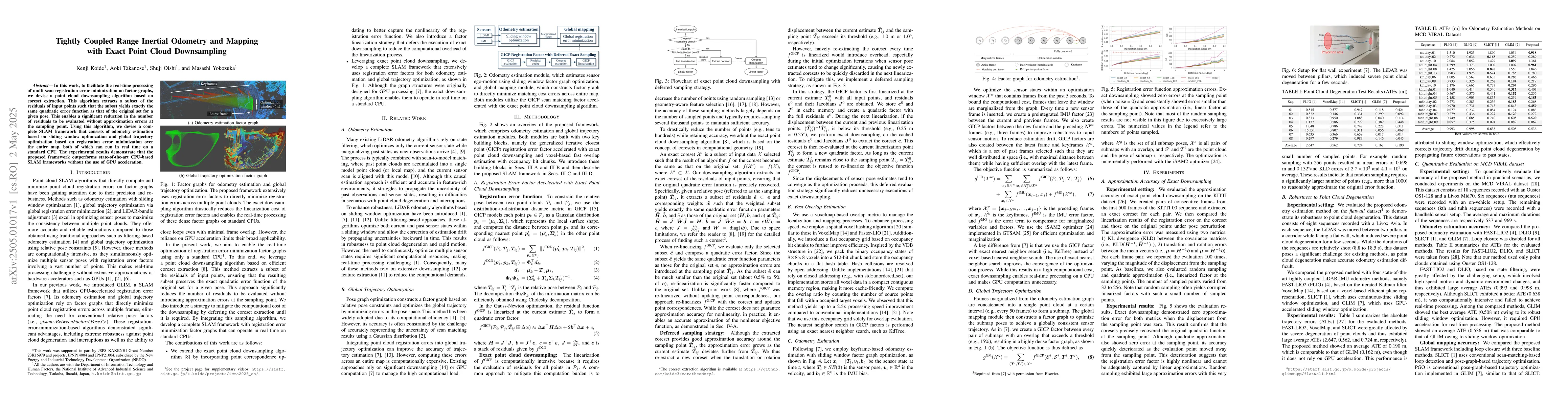
In this work, to facilitate the real-time processing of multi-scan registration error minimization on factor graphs, we devise a point cloud downsampling algorithm based on coreset extraction. This al...
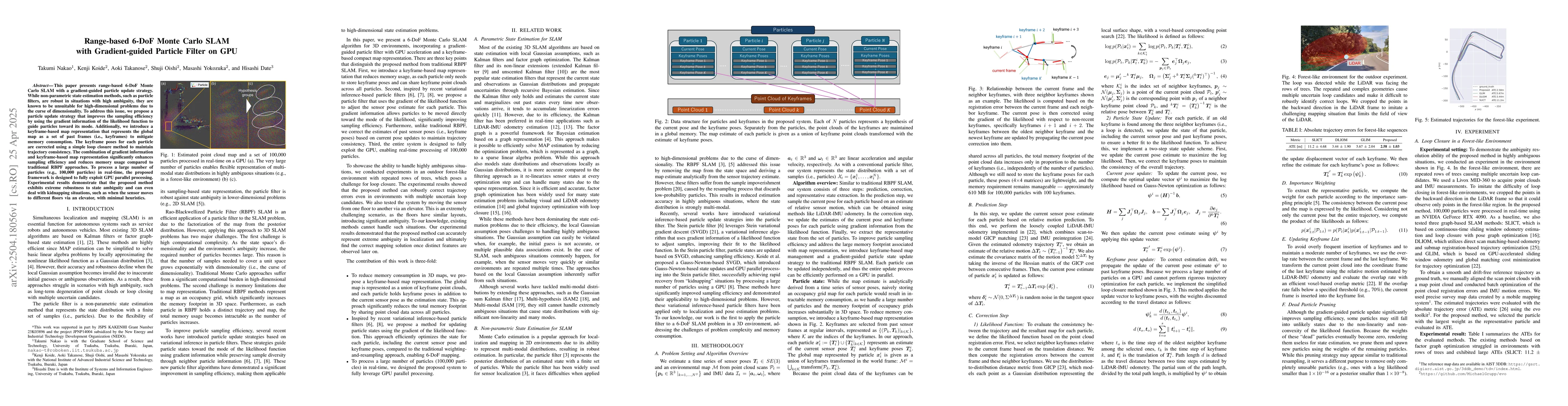
This paper presents range-based 6-DoF Monte Carlo SLAM with a gradient-guided particle update strategy. While non-parametric state estimation methods, such as particle filters, are robust in situation...
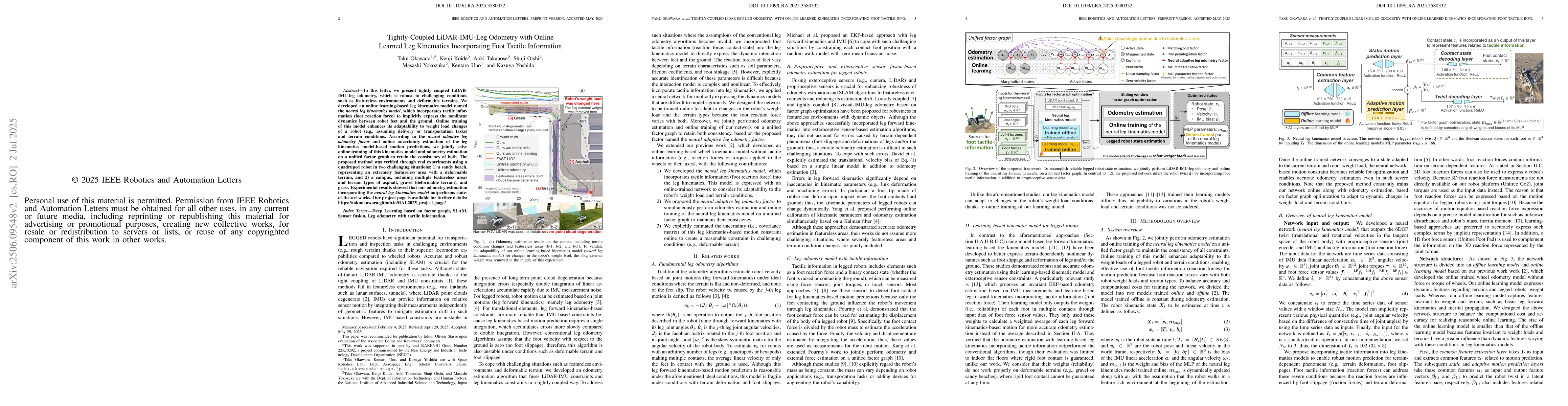
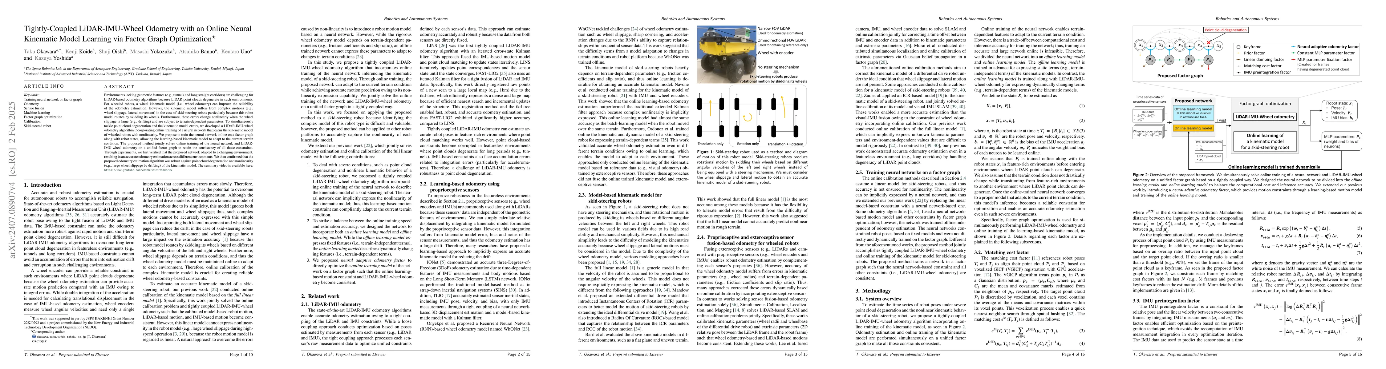
In this letter, we present tightly coupled LiDAR-IMU-leg odometry, which is robust to challenging conditions such as featureless environments and deformable terrains. We developed an online learning-b...