Academic Profile
Statistics
Similar Authors
Papers on arXiv
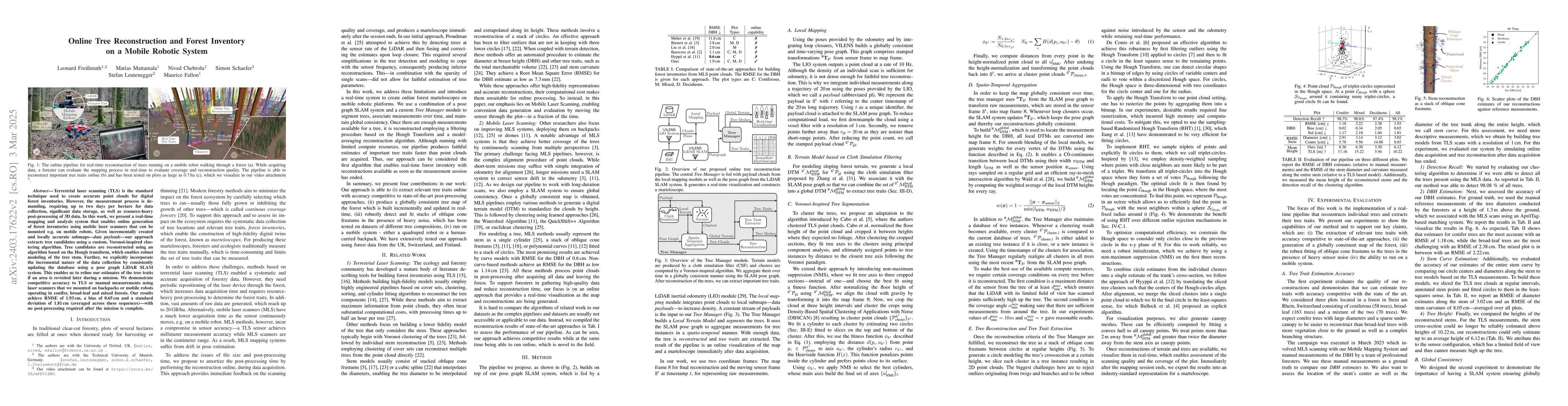
Terrestrial laser scanning (TLS) is the standard technique used to create accurate point clouds for digital forest inventories. However, the measurement process is demanding, requiring up to two day...
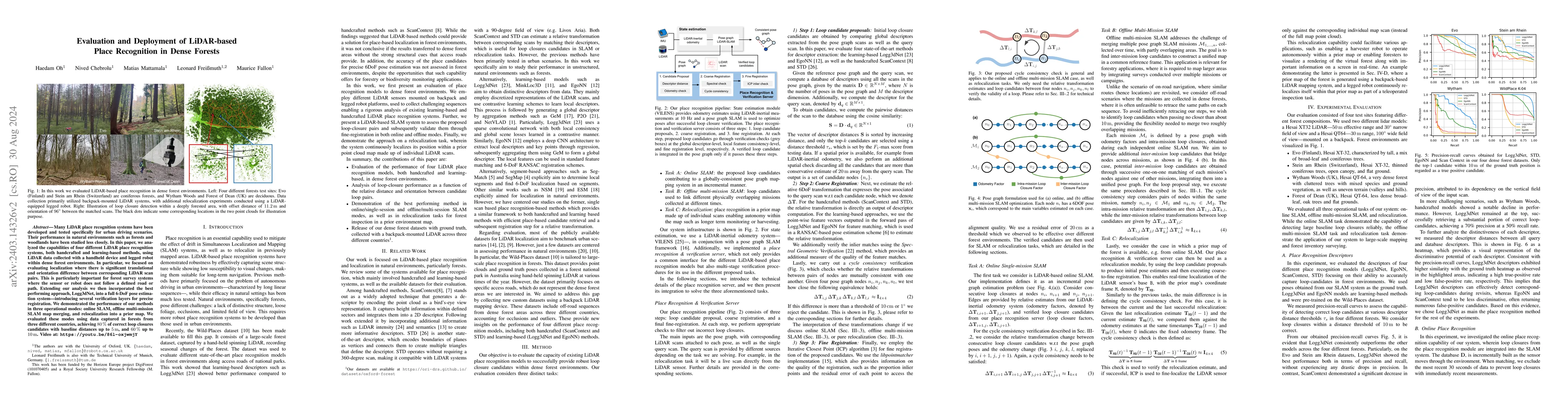
Many LiDAR place recognition systems have been developed and tested specifically for urban driving scenarios. Their performance in natural environments such as forests and woodlands have been studie...
Exoskeletons for daily use by those with mobility impairments are being developed. They will require accurate and robust scene understanding systems. Current research has used vision to identify imm...
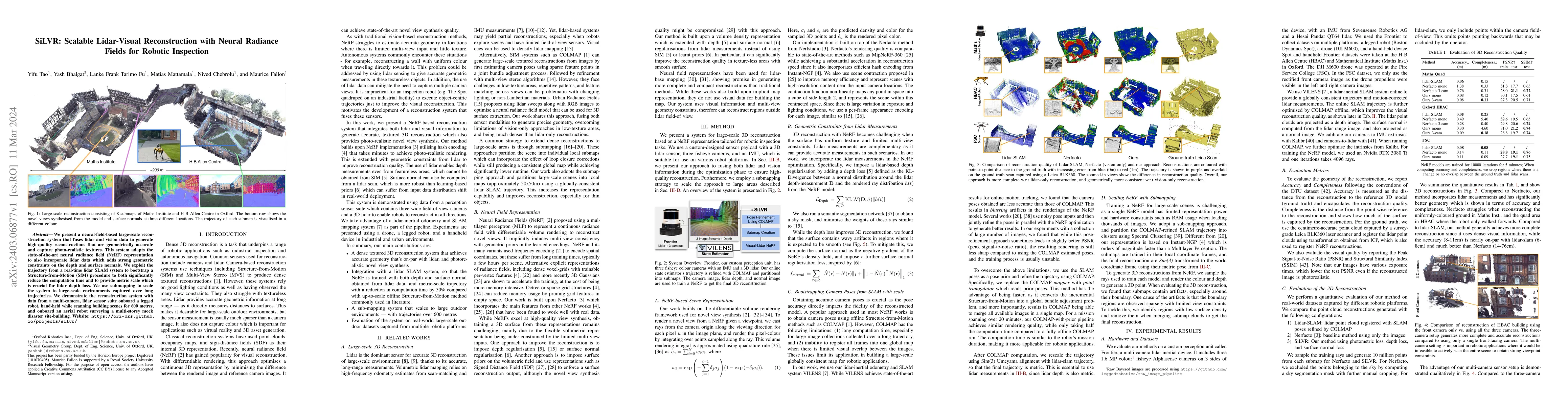
We present a neural-field-based large-scale reconstruction system that fuses lidar and vision data to generate high-quality reconstructions that are geometrically accurate and capture photo-realisti...
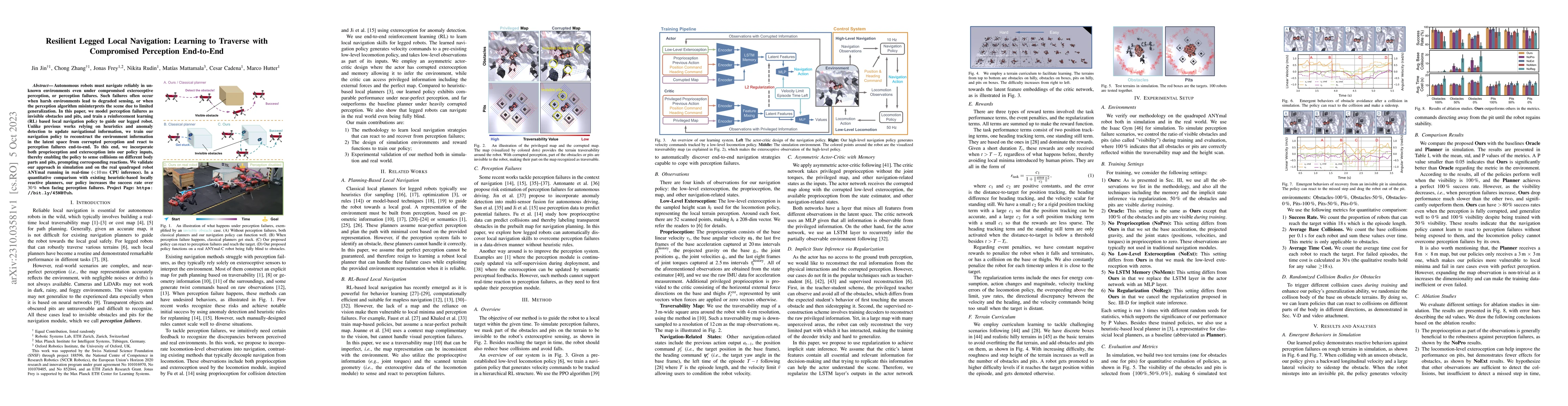
Autonomous robots must navigate reliably in unknown environments even under compromised exteroceptive perception, or perception failures. Such failures often occur when harsh environments lead to de...
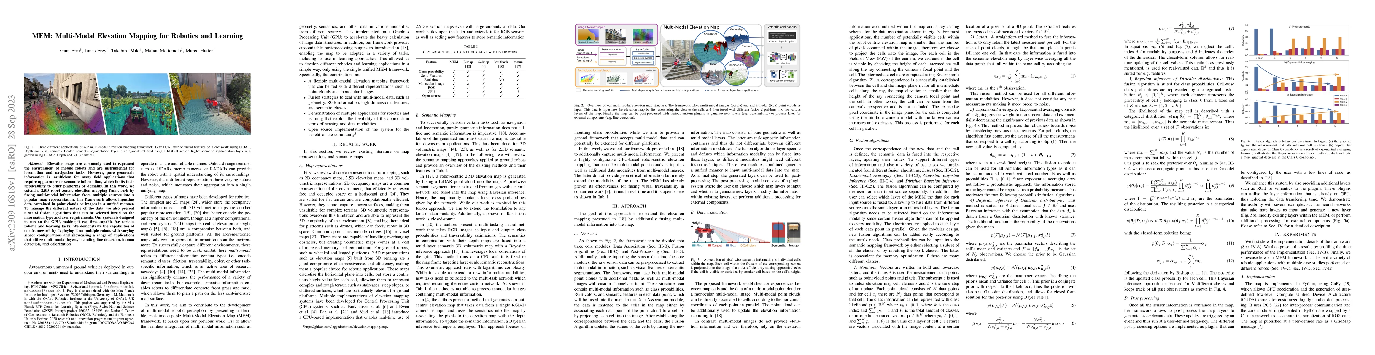
Elevation maps are commonly used to represent the environment of mobile robots and are instrumental for locomotion and navigation tasks. However, pure geometric information is insufficient for many ...
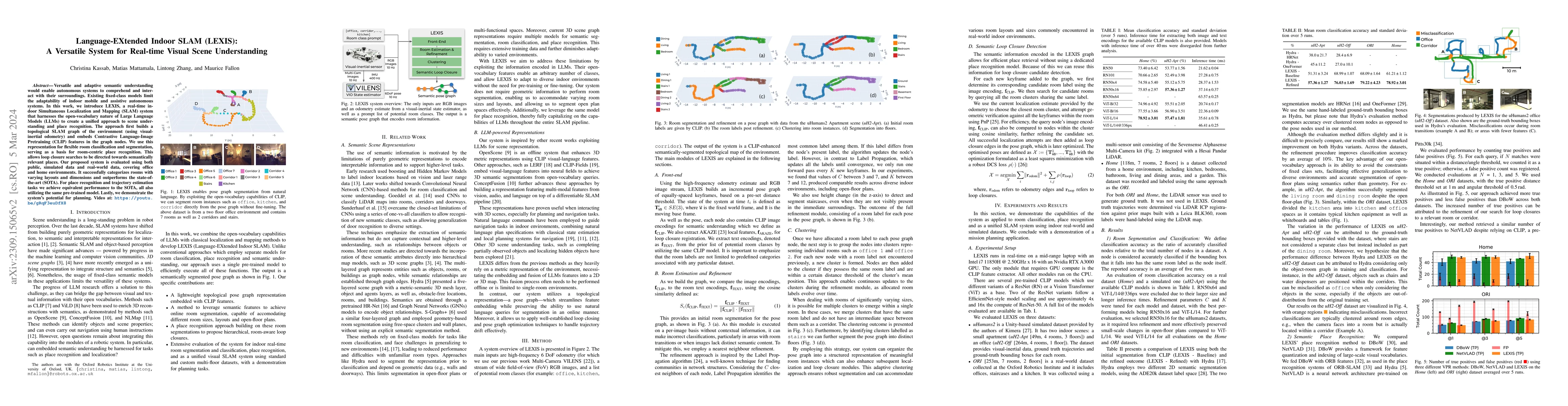
Versatile and adaptive semantic understanding would enable autonomous systems to comprehend and interact with their surroundings. Existing fixed-class models limit the adaptability of indoor mobile ...
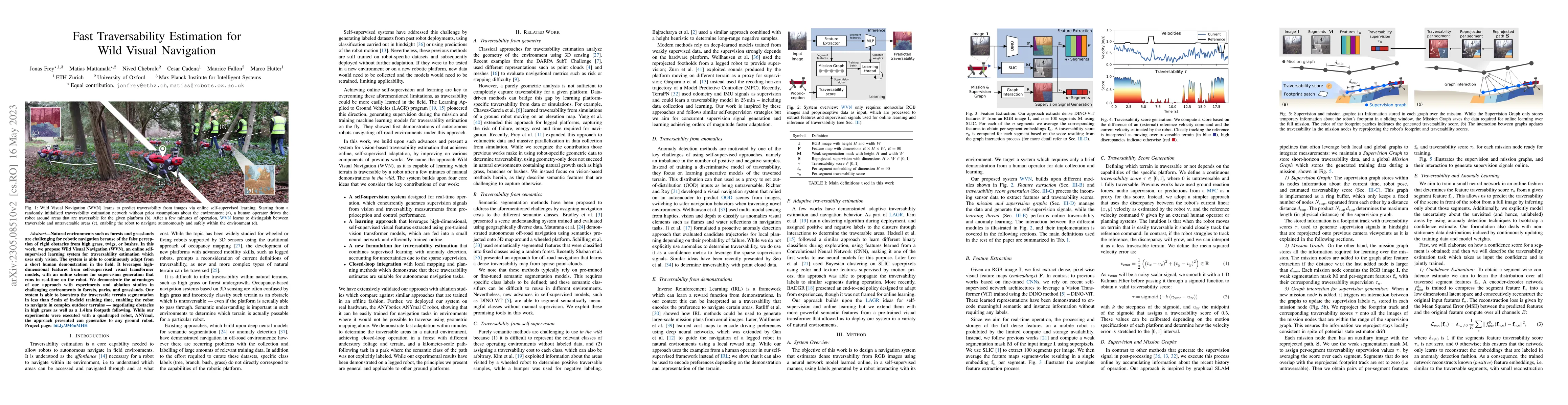
Natural environments such as forests and grasslands are challenging for robotic navigation because of the false perception of rigid obstacles from high grass, twigs, or bushes. In this work, we prop...
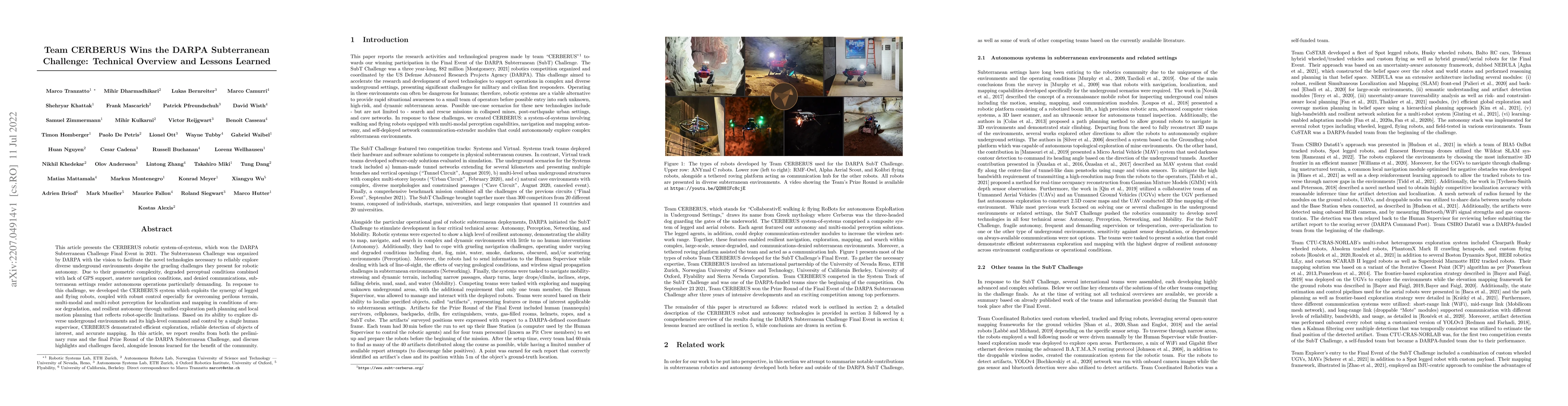
This article presents the CERBERUS robotic system-of-systems, which won the DARPA Subterranean Challenge Final Event in 2021. The Subterranean Challenge was organized by DARPA with the vision to fac...
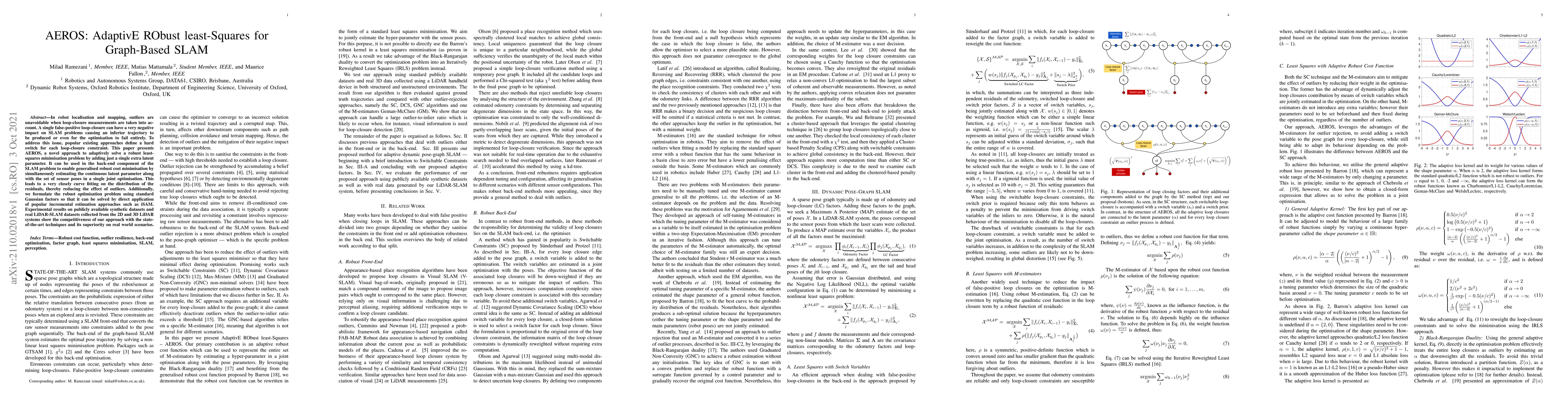
In robot localisation and mapping, outliers are unavoidable when loop-closure measurements are taken into account. A single false-positive loop-closure can have a very negative impact on SLAM proble...
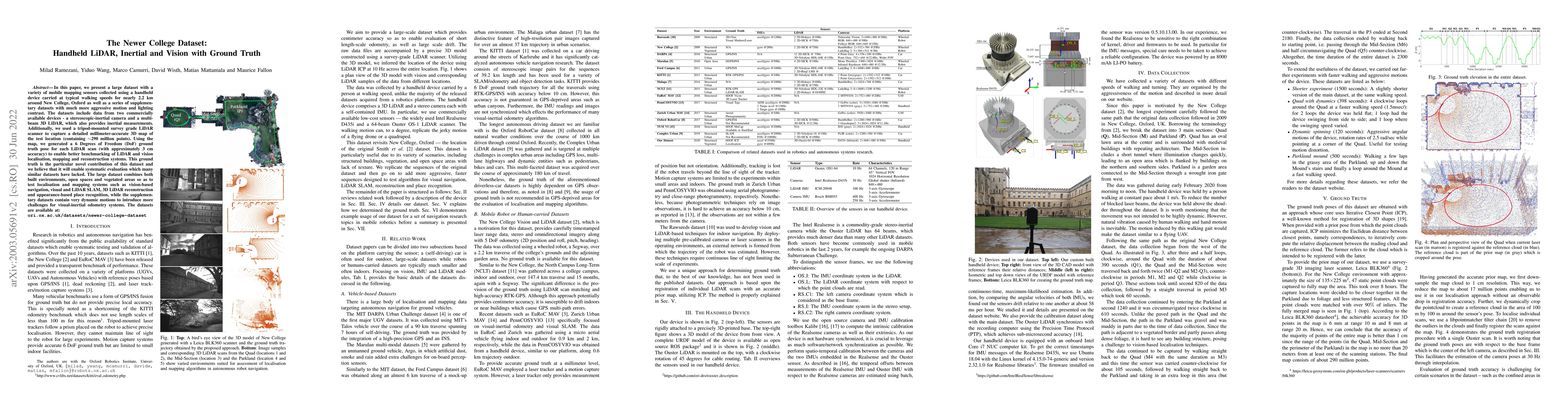
In this paper we present a large dataset with a variety of mobile mapping sensors collected using a handheld device carried at typical walking speeds for nearly 2.2 km through New College, Oxford. T...
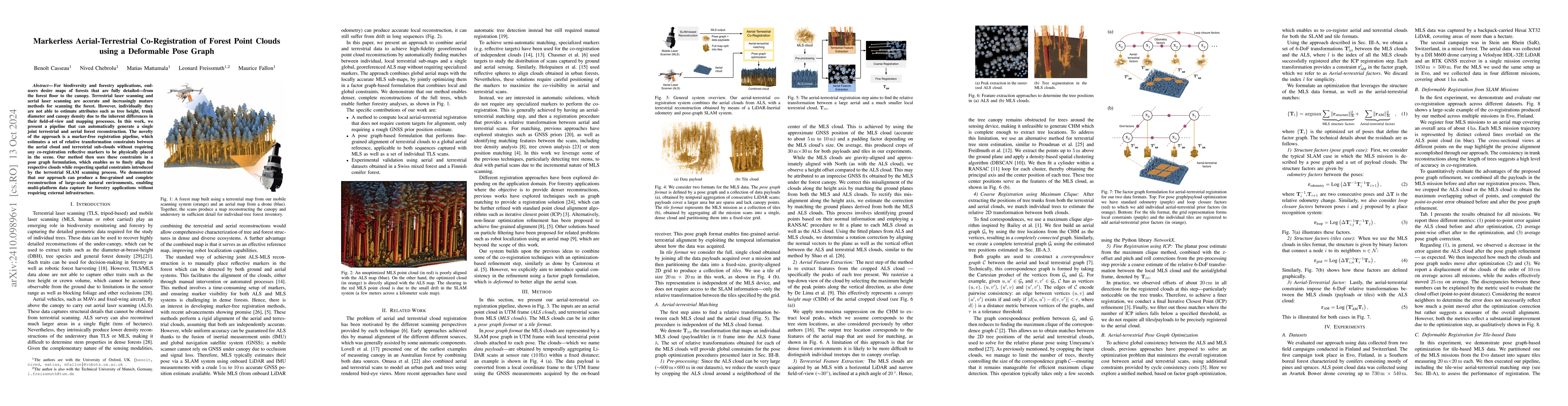
For biodiversity and forestry applications, end-users desire maps of forests that are fully detailed, from the forest floor to the canopy. Terrestrial laser scanning and aerial laser scanning are accu...
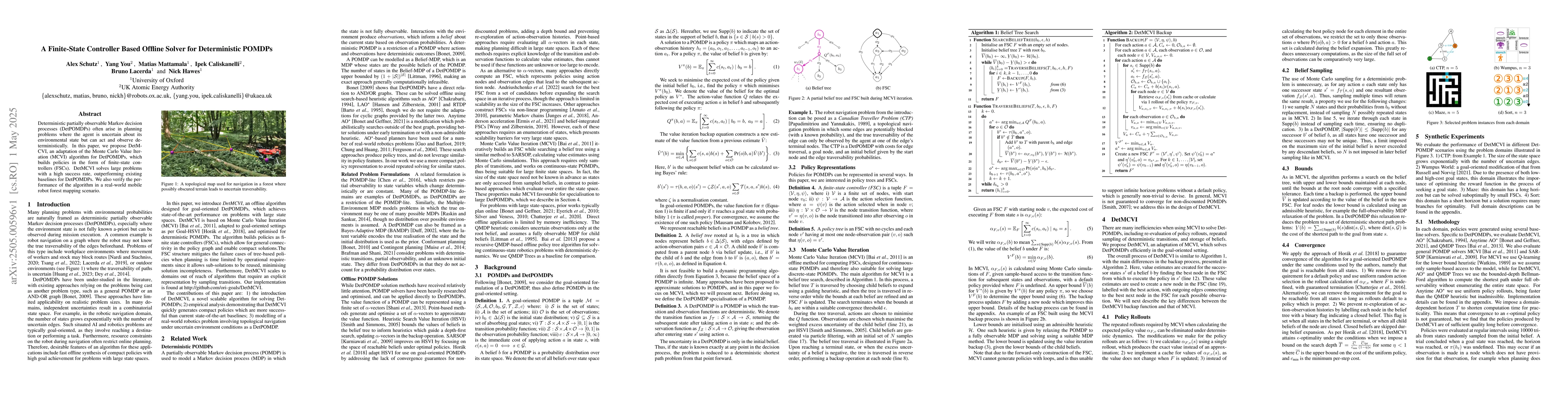
Deterministic partially observable Markov decision processes (DetPOMDPs) often arise in planning problems where the agent is uncertain about its environmental state but can act and observe determinist...
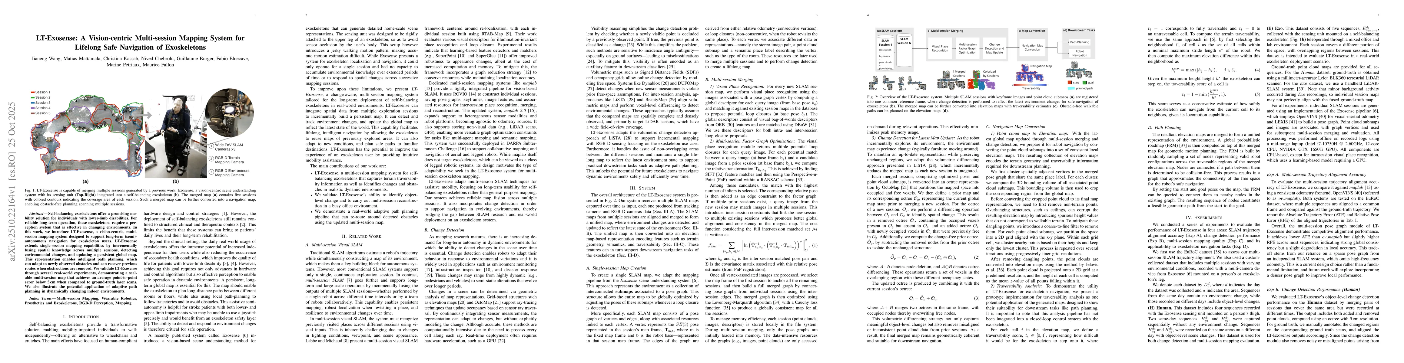
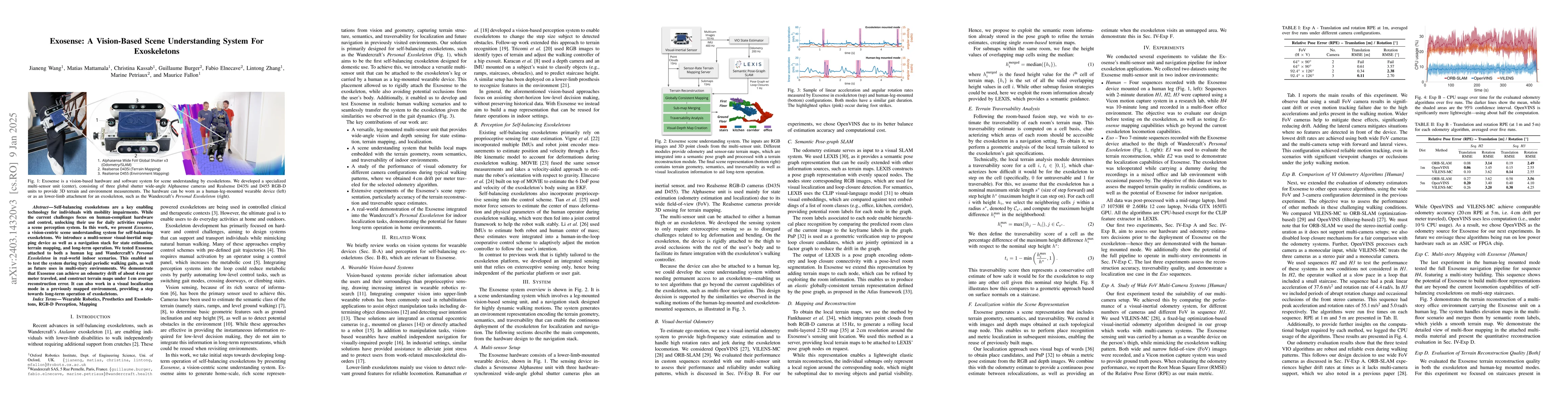
Self-balancing exoskeletons offer a promising mobility solution for individuals with lower-limb disabilities. For reliable long-term operation, these exoskeletons require a perception system that is e...
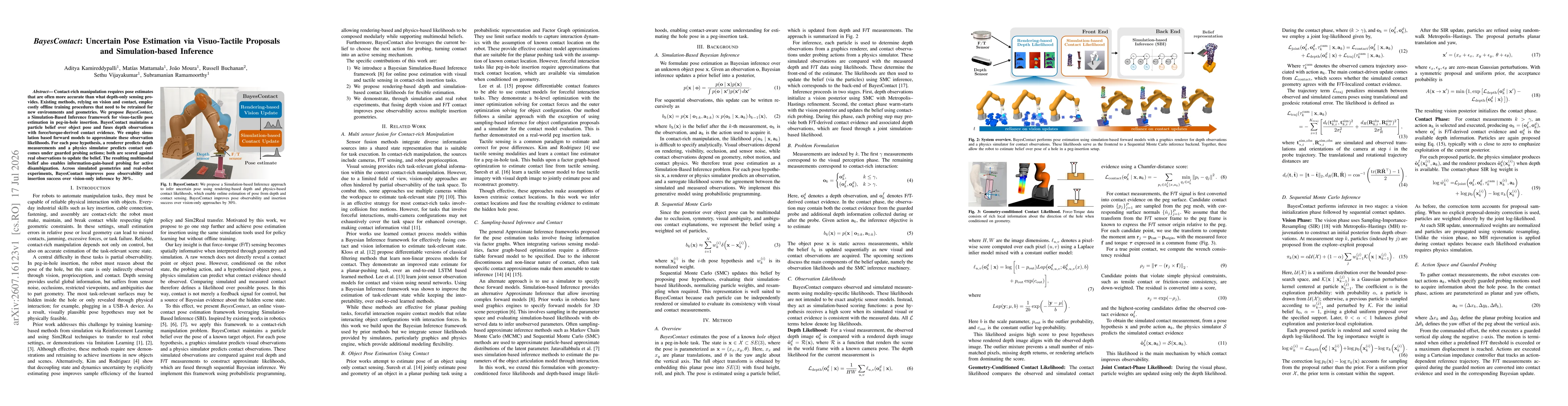
Contact-rich manipulation requires pose estimates that are often more accurate than what depth-only sensing provides. Existing methods, relying on vision and contact, employ costly offline training pr...