Academic Profile
Statistics
Similar Authors
Papers on arXiv
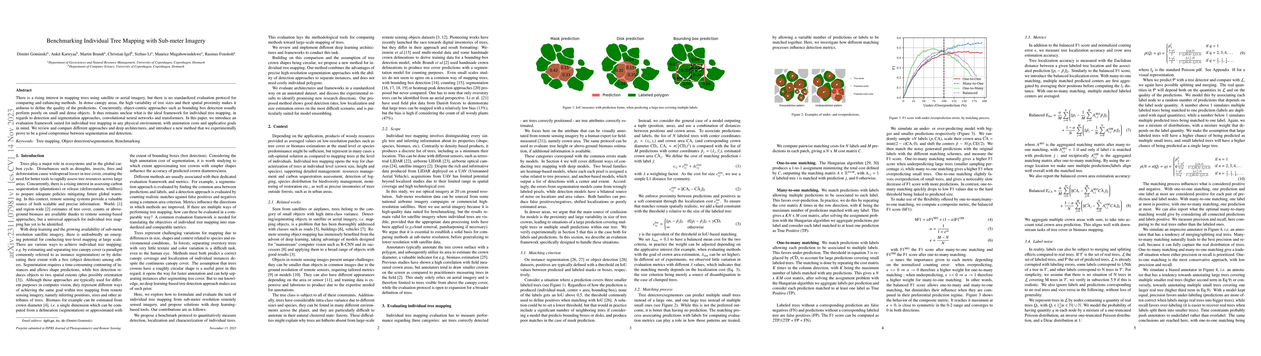
There is a rising interest in mapping trees using satellite or aerial imagery, but there is no standardized evaluation protocol for comparing and enhancing methods. In dense canopy areas, the high v...
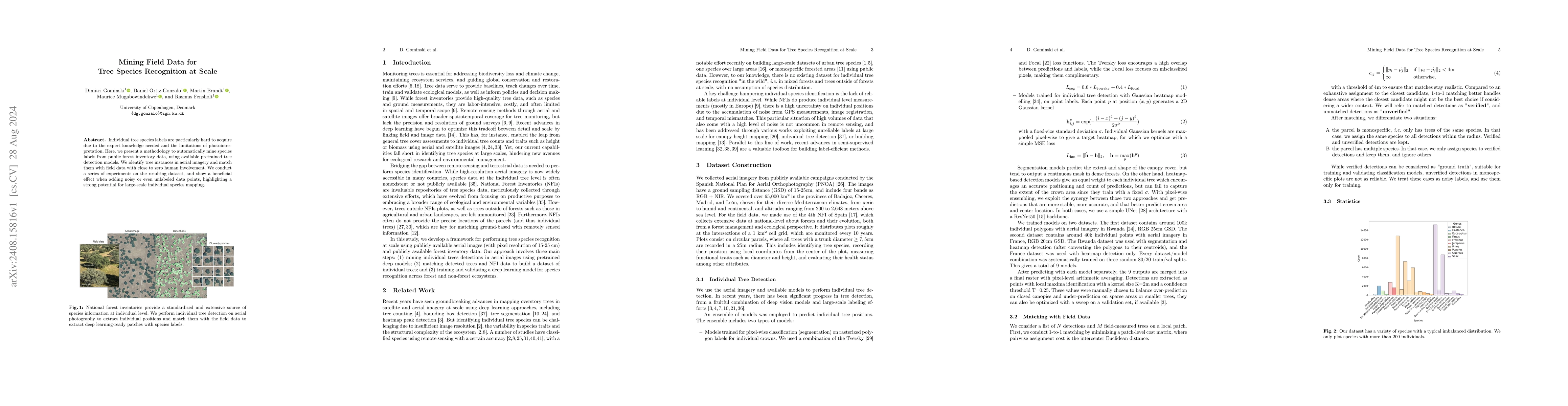
Individual tree species labels are particularly hard to acquire due to the expert knowledge needed and the limitations of photointerpretation. Here, we present a methodology to automatically mine spec...
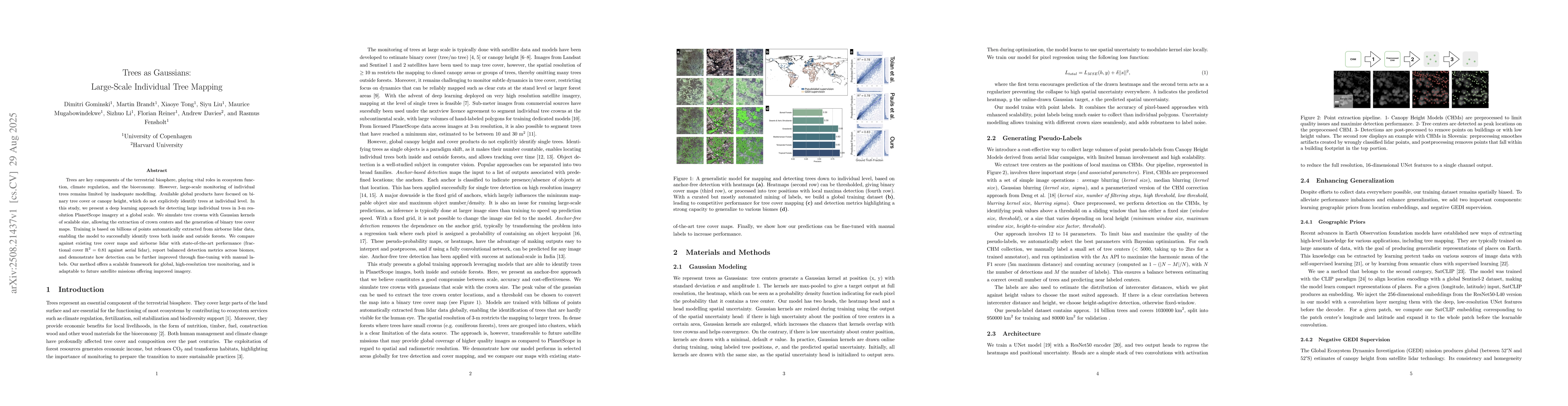
Trees are key components of the terrestrial biosphere, playing vital roles in ecosystem function, climate regulation, and the bioeconomy. However, large-scale monitoring of individual trees remains li...

Counting individual trees is a fundamental task for environmental monitoring, yet remains largely unexplored with satellite imagery. At these resolutions, isolated trees may still be identifiable, but...