Academic Profile
Statistics
Similar Authors
Papers on arXiv
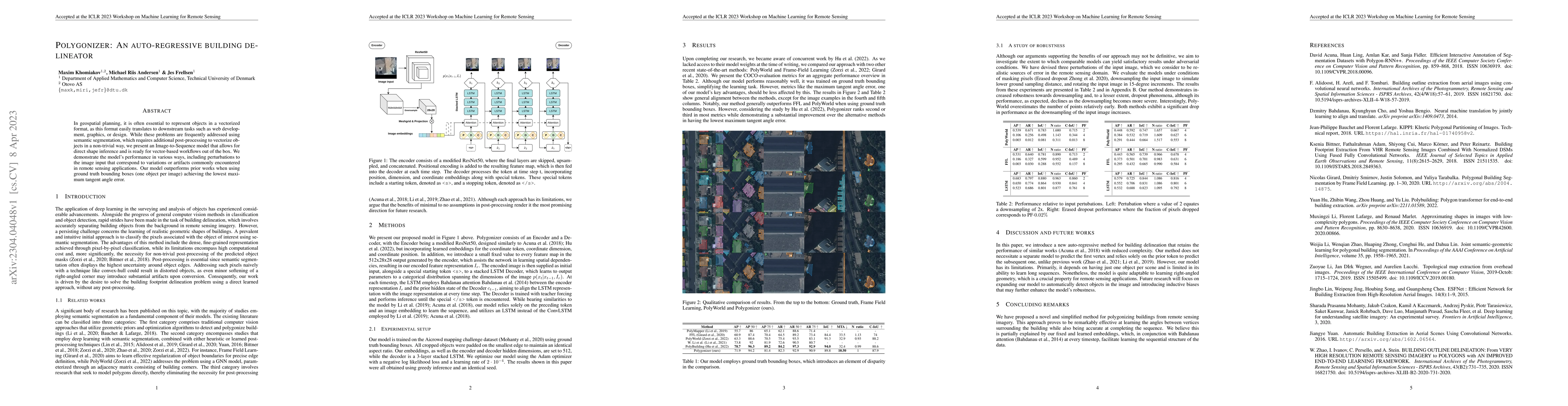
In geospatial planning, it is often essential to represent objects in a vectorized format, as this format easily translates to downstream tasks such as web development, graphics, or design. While th...
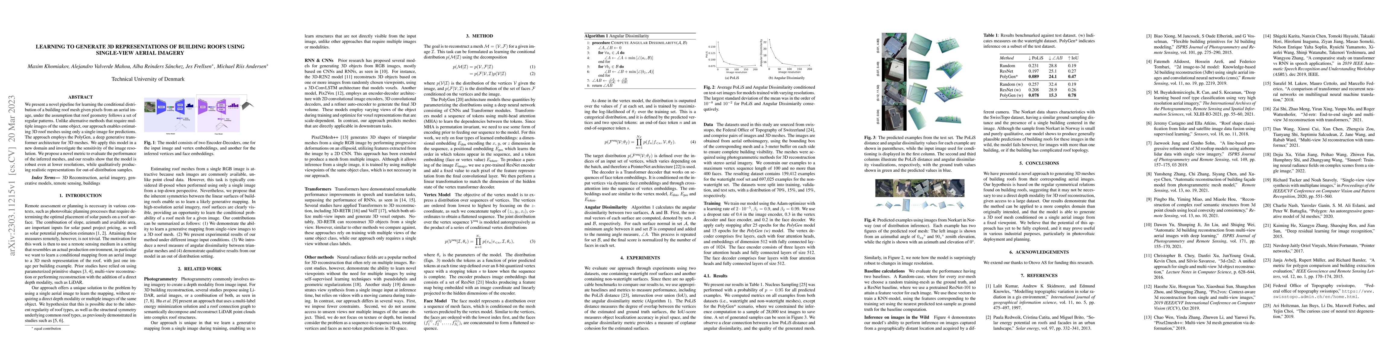
We present a novel pipeline for learning the conditional distribution of a building roof mesh given pixels from an aerial image, under the assumption that roof geometry follows a set of regular patt...
The body of research on classification of solar panel arrays from aerial imagery is increasing, yet there are still not many public benchmark datasets. This paper introduces two novel benchmark data...

In remote sensing there exists a common need for learning scale invariant shapes of objects like buildings. Prior works relies on tweaking multiple loss functions to convert segmentation maps into the...
Large language models (LLMs) are increasingly used as automated judges and synthetic labelers, especially in low-label settings. Yet these systems are stochastic and often overconfident, which makes d...