ArxivLens
M
Researcher

Menghui Jiang

7 papers on arXiv

7 arXiv Papers
4 Total Publications
Profile

Academic Profile

Name Jia Menghui
Total Papers 4
Scholar Profile View on Semantic Scholar
Metrics

Statistics

7 arXiv Papers
4 Total Publications
Publications

Papers on arXiv

Thumbnail for A physics-constrained machine learning method for mapping gapless land
  surface temperature
arXiv
A physics-constrained machine learning method for mapping gapless land surface temperature

More accurate, spatio-temporally, and physically consistent LST estimation has been a main interest in Earth system research. Developing physics-driven mechanism models and data-driven machine learn...

Thumbnail for An Integrated Framework for the Heterogeneous Spatio-Spectral-Temporal
  Fusion of Remote Sensing Images
arXiv
An Integrated Framework for the Heterogeneous Spatio-Spectral-Temporal Fusion of Remote Sensing Images

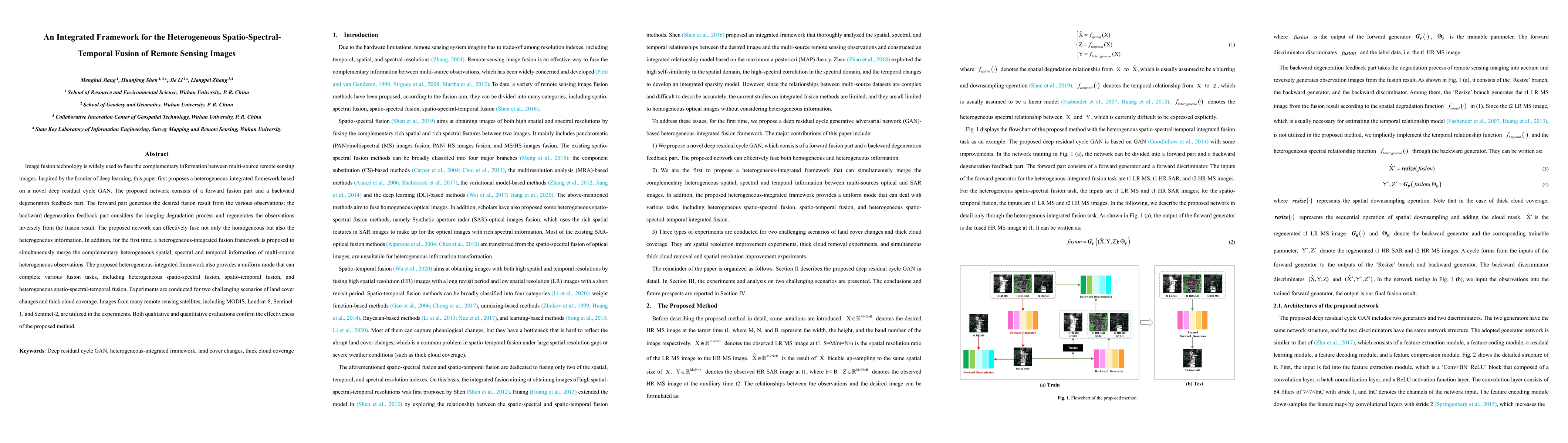
Image fusion technology is widely used to fuse the complementary information between multi-source remote sensing images. Inspired by the frontier of deep learning, this paper first proposes a hetero...

Thumbnail for Coupling Model-Driven and Data-Driven Methods for Remote Sensing Image
  Restoration and Fusion
arXiv
Coupling Model-Driven and Data-Driven Methods for Remote Sensing Image Restoration and Fusion

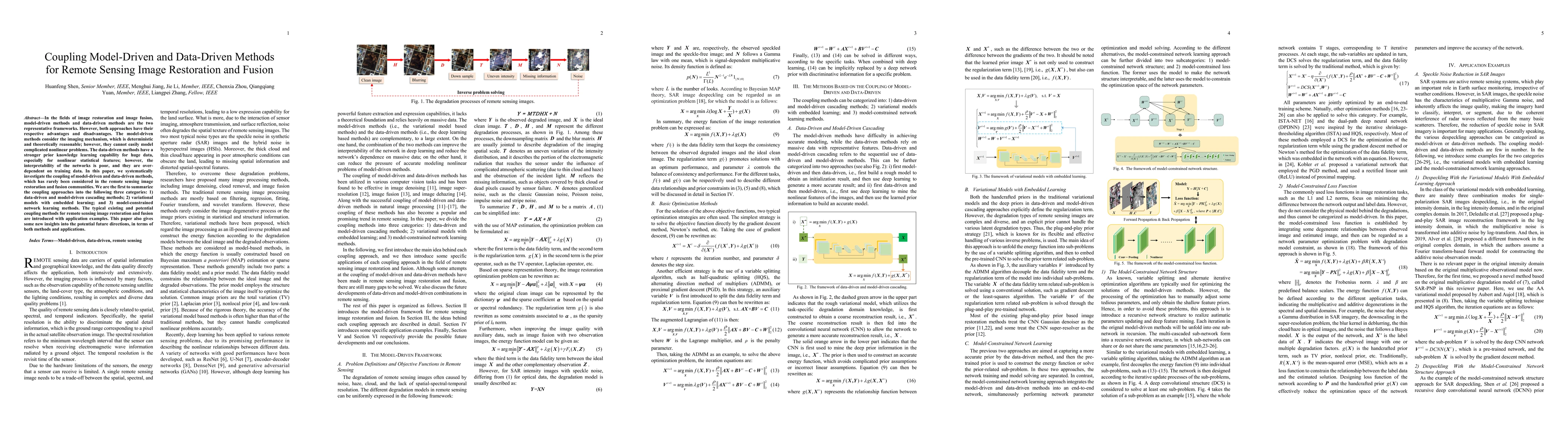
In the fields of image restoration and image fusion, model-driven methods and data-driven methods are the two representative frameworks. However, both approaches have their respective advantages and...

Thumbnail for Spatial-Spectral Fusion by Combining Deep Learning and Variation Model
arXiv
Spatial-Spectral Fusion by Combining Deep Learning and Variation Model

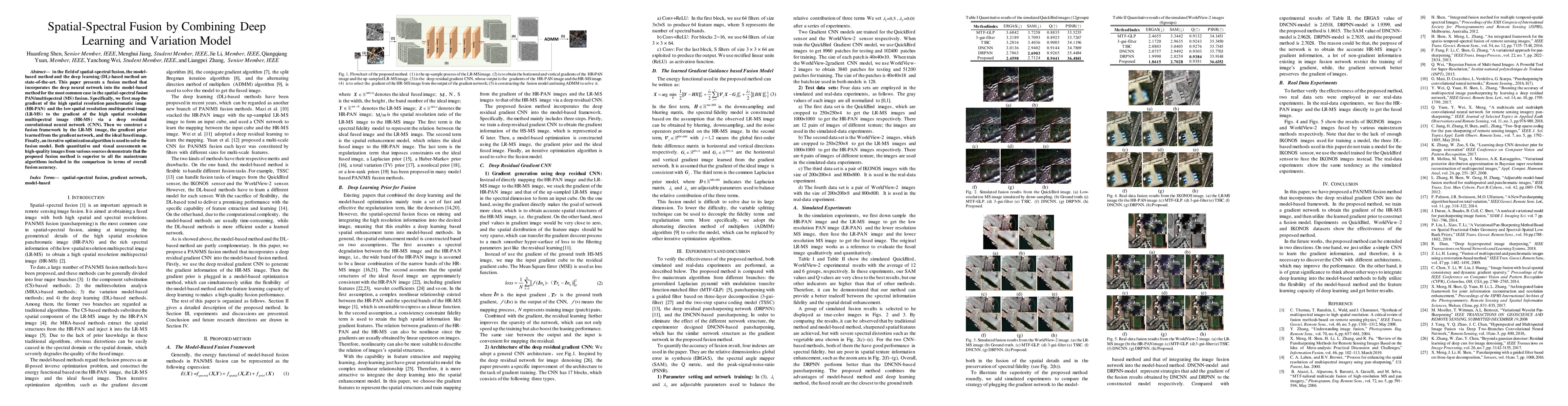
In the field of spatial-spectral fusion, the model-based method and the deep learning (DL)-based method are state-of-the-art. This paper presents a fusion method that incorporates the deep neural ne...

Thumbnail for A Mechanism-Learning Deeply Coupled Model for Remote Sensing Retrieval
  of Global Land Surface Temperature
arXiv
A Mechanism-Learning Deeply Coupled Model for Remote Sensing Retrieval of Global Land Surface Temperature

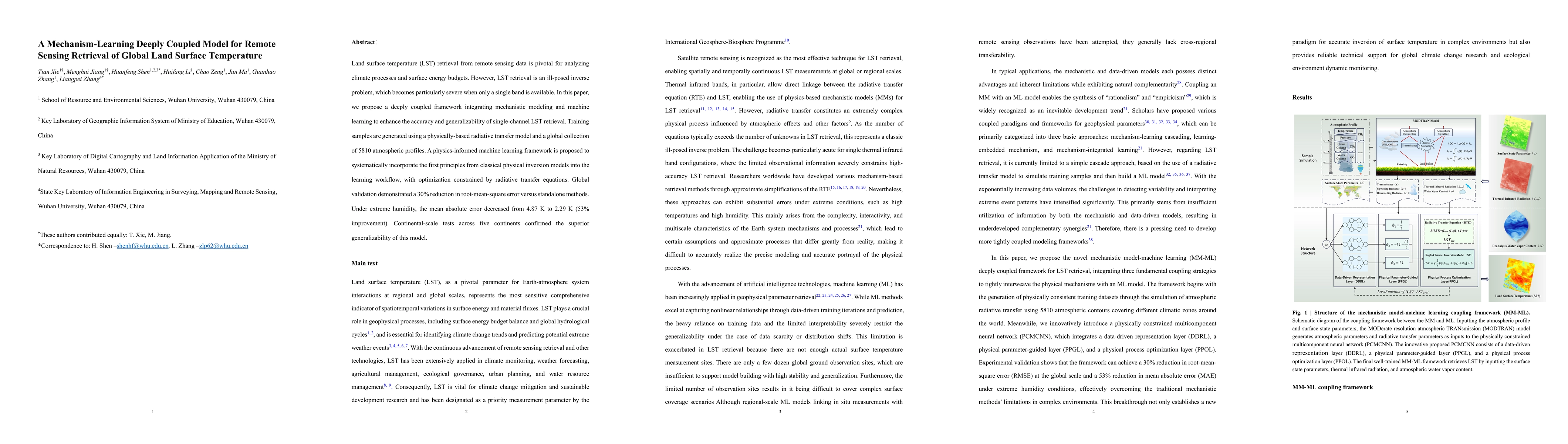
Land surface temperature (LST) retrieval from remote sensing data is pivotal for analyzing climate processes and surface energy budgets. However, LST retrieval is an ill-posed inverse problem, which b...

Thumbnail for High-Resolution Global Land Surface Temperature Retrieval via a Coupled
  Mechanism-Machine Learning Framework
arXiv
High-Resolution Global Land Surface Temperature Retrieval via a Coupled Mechanism-Machine Learning Framework

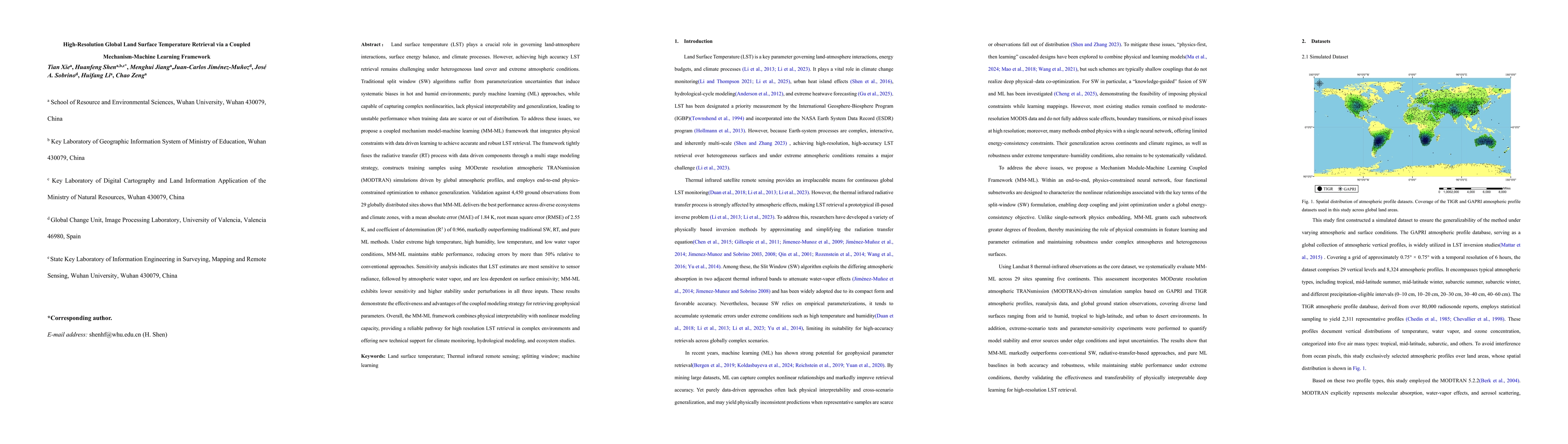
Land surface temperature (LST) is vital for land-atmosphere interactions and climate processes. Accurate LST retrieval remains challenging under heterogeneous land cover and extreme atmospheric condit...

Thumbnail for 30-meter Land Surface Temperature from Landsat via Progressive Self-Training Downscaling
arXiv
30-meter Land Surface Temperature from Landsat via Progressive Self-Training Downscaling

Land surface temperature (LST) is a critical parameter for characterizing surface energy balance and hydrothermal processes. While Landsat provides invaluable LST observations at medium spatial resolu...

This website uses cookies to ensure you get the best experience. Learn more