Academic Profile
Statistics
Similar Authors
Papers on arXiv
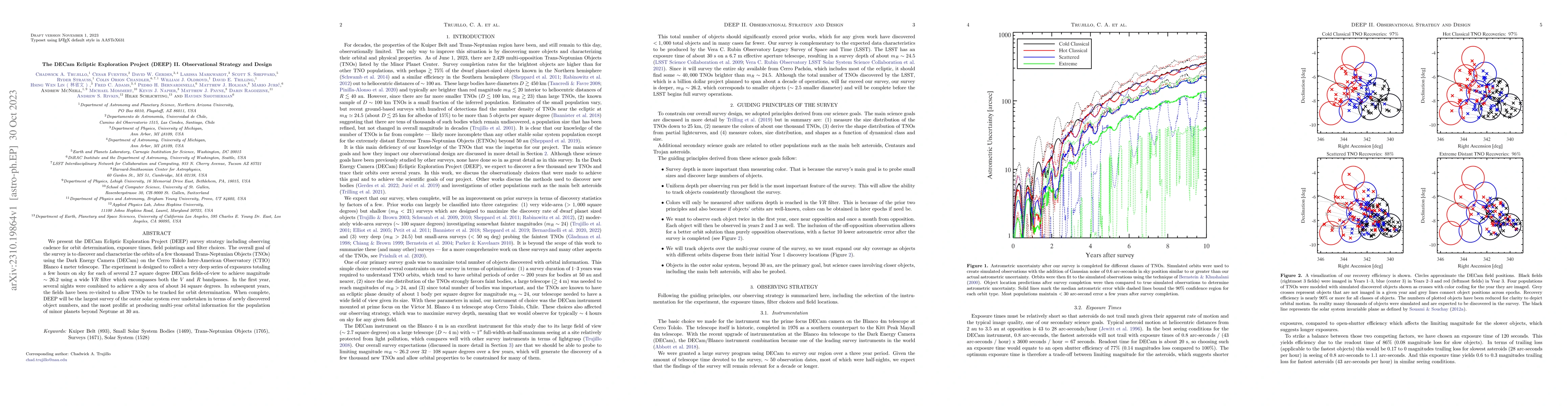
We present the DECam Ecliptic Exploration Project (DEEP) survey strategy including observing cadence for orbit determination, exposure times, field pointings and filter choices. The overall goal of ...
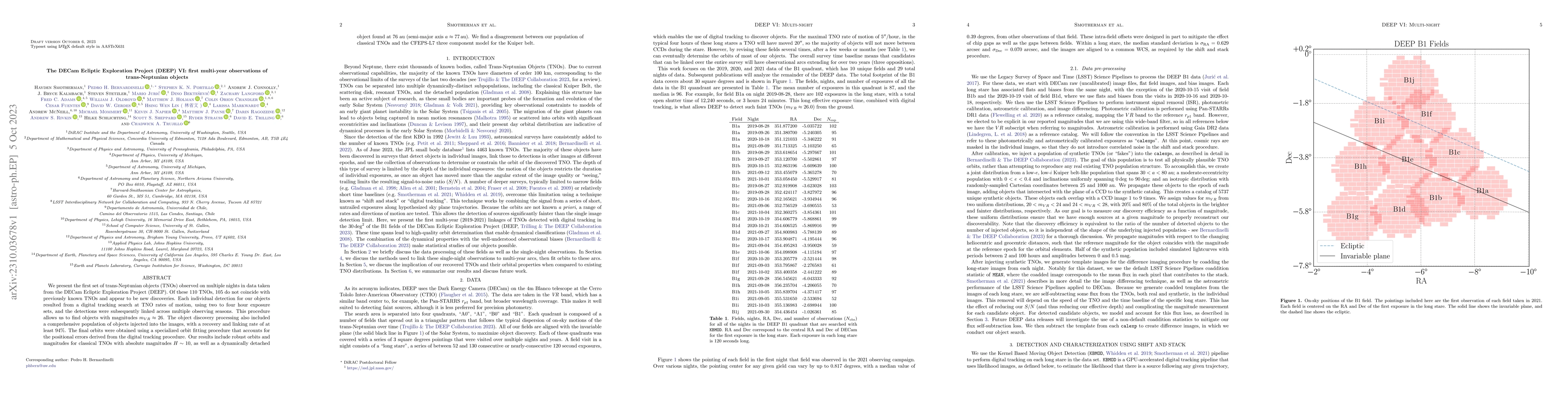
We present the first set of trans-Neptunian objects (TNOs) observed on multiple nights in data taken from the DECam Ecliptic Exploration Project (DEEP). Of these 110 TNOs, 105 do not coincide with p...
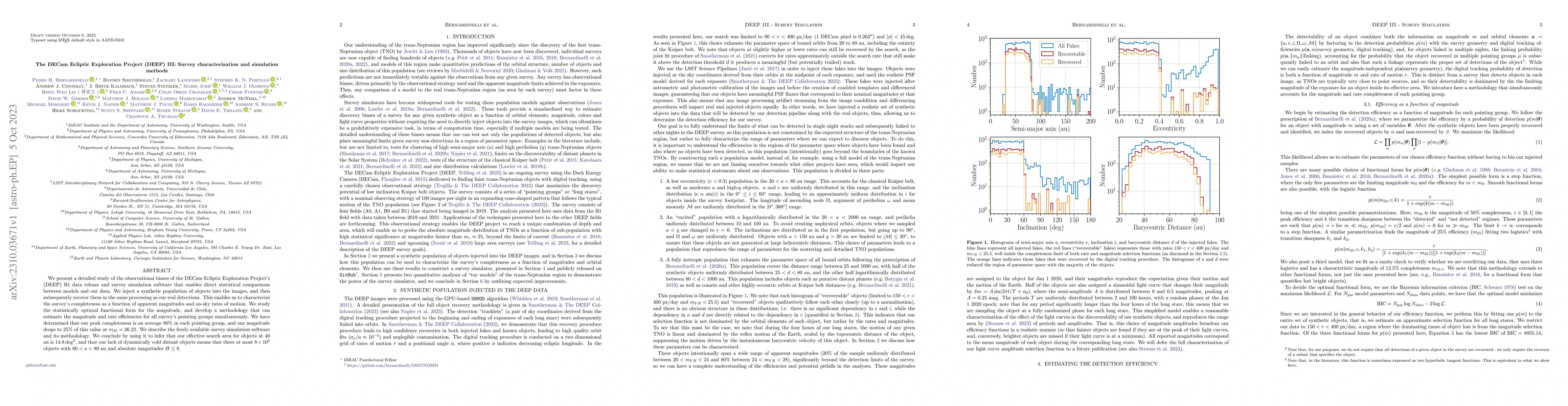
We present a detailed study of the observational biases of the DECam Ecliptic Exploration Project's (DEEP) B1 data release and survey simulation software that enables direct statistical comparisons ...
We present here the DECam Ecliptic Exploration Project (DEEP), a three year NOAO/NOIRLab Survey that was allocated 46.5 nights to discover and measure the properties of thousands of trans-Neptunian ...
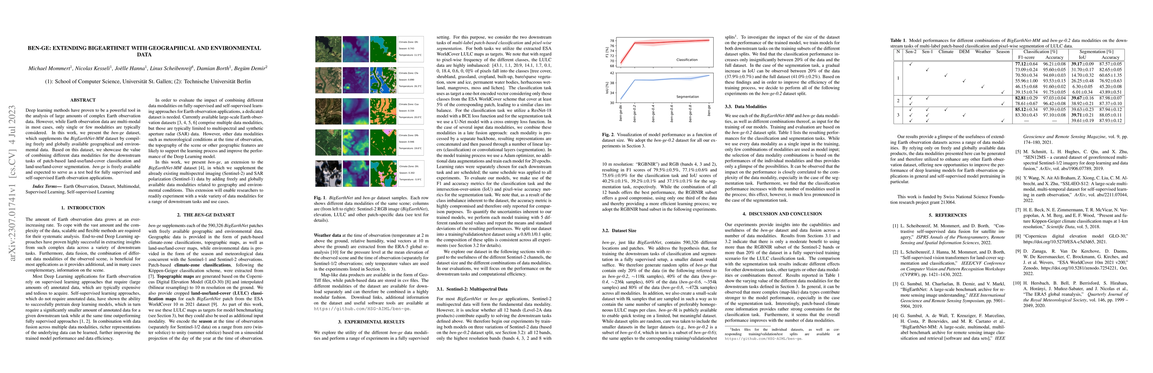
Deep learning methods have proven to be a powerful tool in the analysis of large amounts of complex Earth observation data. However, while Earth observation data are multi-modal in most cases, only ...
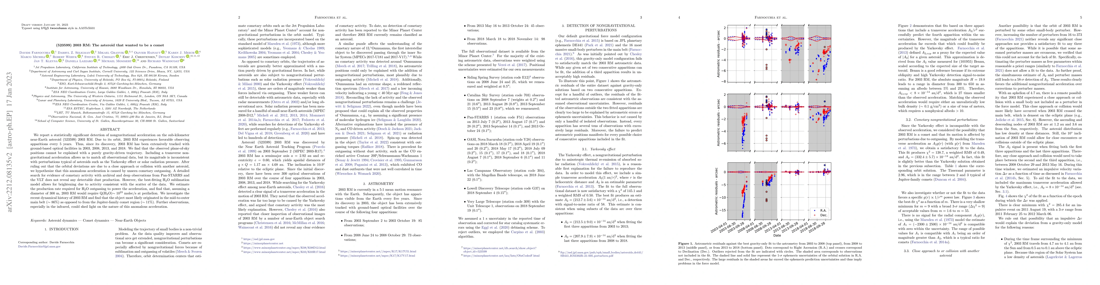
We report a statistically significant detection of nongravitational acceleration on the sub-kilometer near-Earth asteroid (523599) 2003 RM. Due to its orbit, 2003 RM experiences favorable observing ...

Active asteroids show (typically transient) cometary activity, driven by a range of processes. A sub-set, sometimes called main-belt comets, may be driven by sublimation and so could be useful for t...
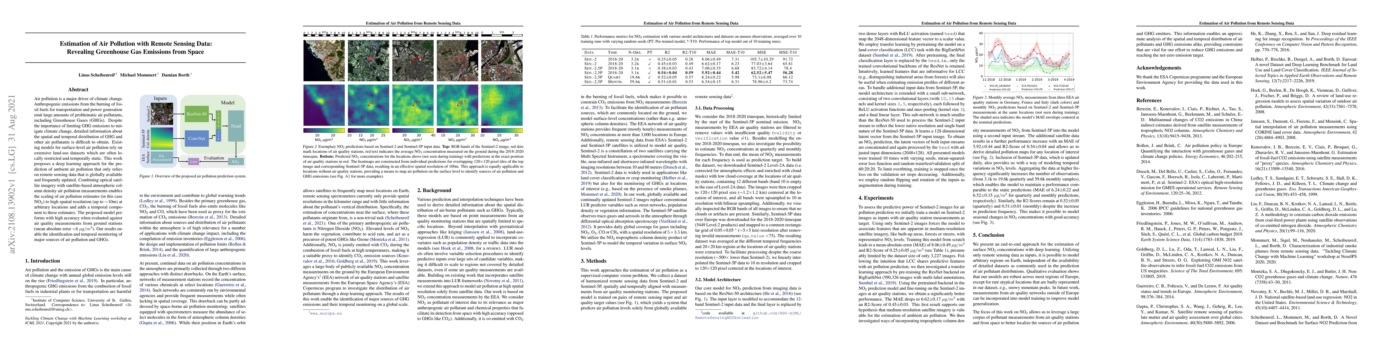
Air pollution is a major driver of climate change. Anthropogenic emissions from the burning of fossil fuels for transportation and power generation emit large amounts of problematic air pollutants, ...
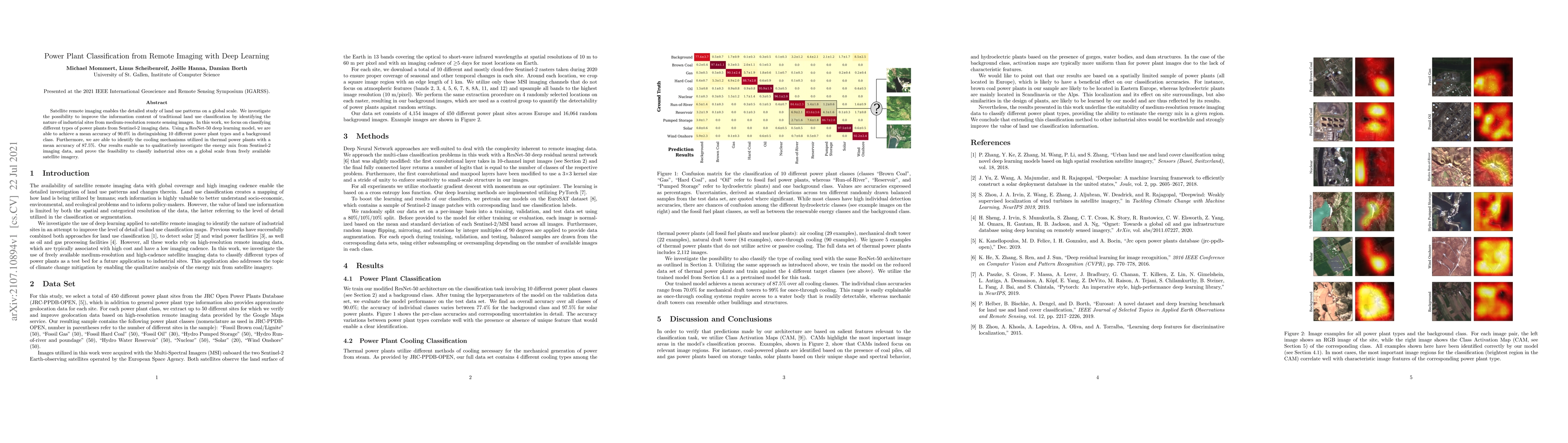
Satellite remote imaging enables the detailed study of land use patterns on a global scale. We investigate the possibility to improve the information content of traditional land use classification b...
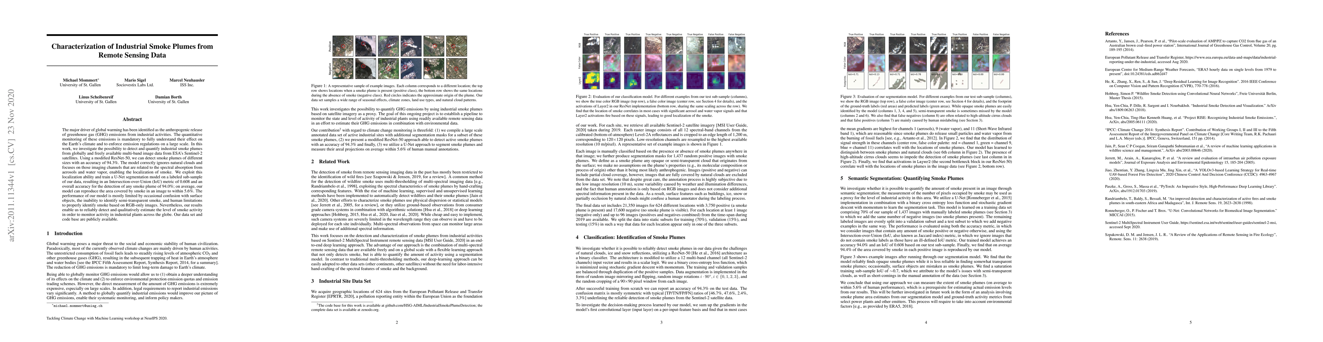
The major driver of global warming has been identified as the anthropogenic release of greenhouse gas (GHG) emissions from industrial activities. The quantitative monitoring of these emissions is ma...
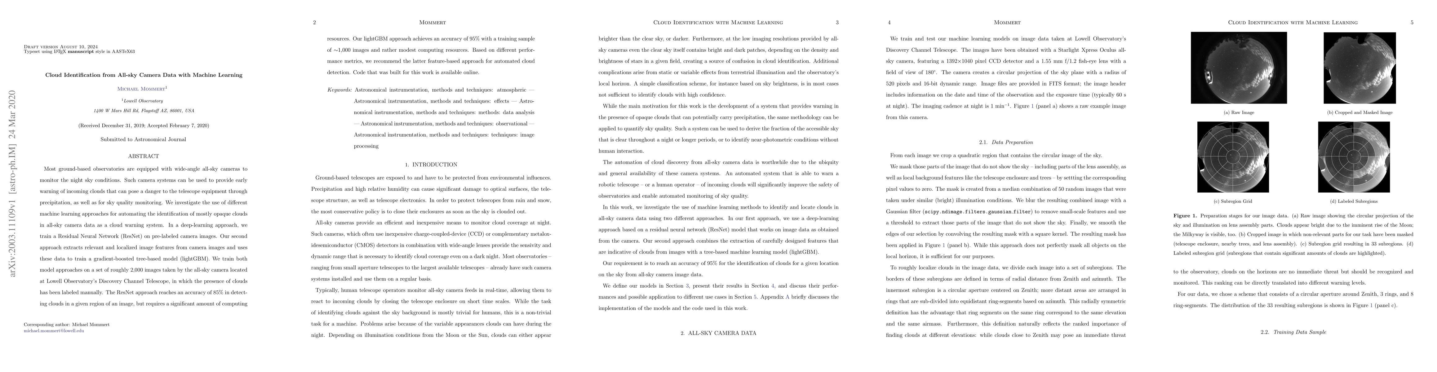
Most ground-based observatories are equipped with wide-angle all-sky cameras to monitor the night sky conditions. Such camera systems can be used to provide early warning of incoming clouds that can...
The mass-loss rates of red supergiant stars (RSGs) are poorly constrained by direct measurements, and yet the subsequent evolution of these stars depends critically on how much mass is lost during t...
The Mission Accessible Near-Earth Object Survey (MANOS) aims to observe and characterize small (mean absolute magnitude H ~ 25 mag) Near-Earth Objects (NEOs) that are accessible by spacecraft (mean ...
The Large Synoptic Survey Telescope (LSST) is expected to increase known small solar system object populations by an order of magnitude or more over the next decade, enabling a broad array of transf...
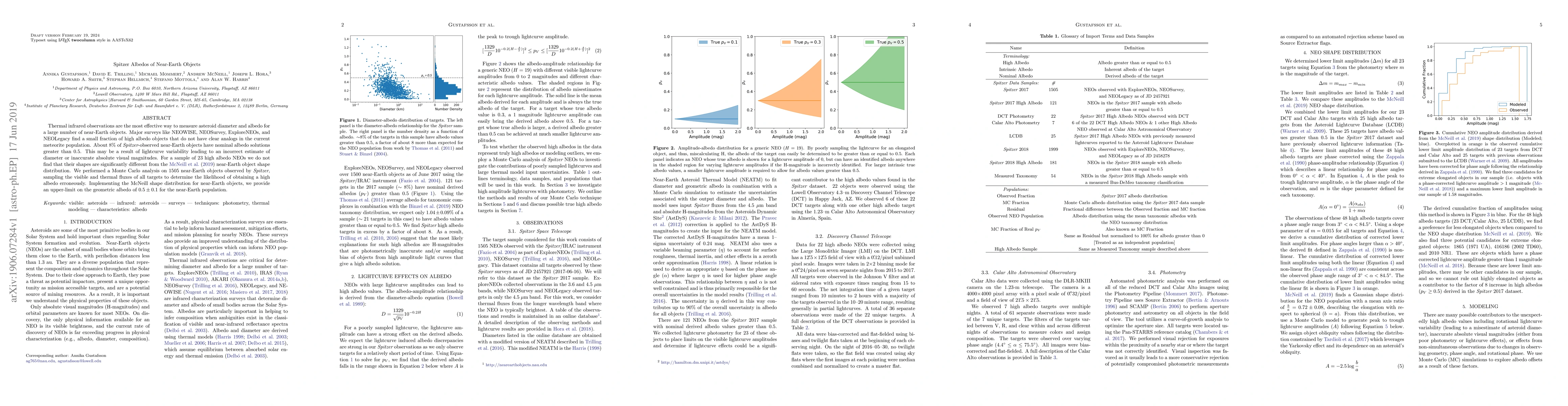
Thermal infrared observations are the most effective way to measure asteroid diameter and albedo for a large number of near-Earth objects. Major surveys like NEOWISE, NEOSurvey, ExploreNEOs, and NEO...
Though pairs of dynamically associated asteroids in the Main Belt have been identified and studied for over a decade, very few pair systems have been identified in the near-Earth asteroid population...
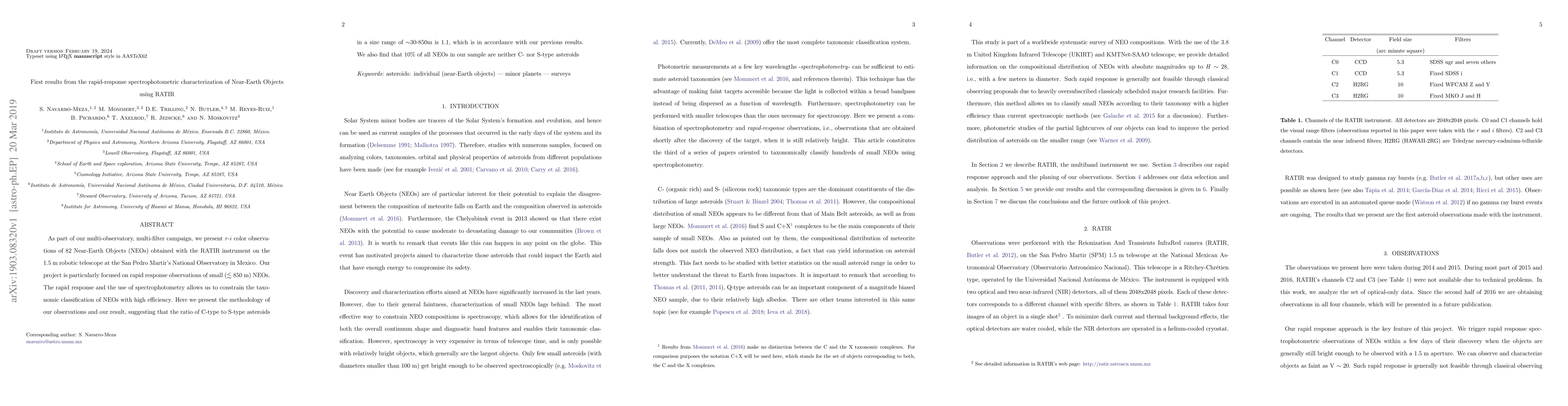
As part of our multi-observatory, multi-filter campaign, we present \rmi color observations of 82 Near-Earth Objects (NEOs) obtained with the RATIR instrument on the 1.5m robotic telescope at the Sa...
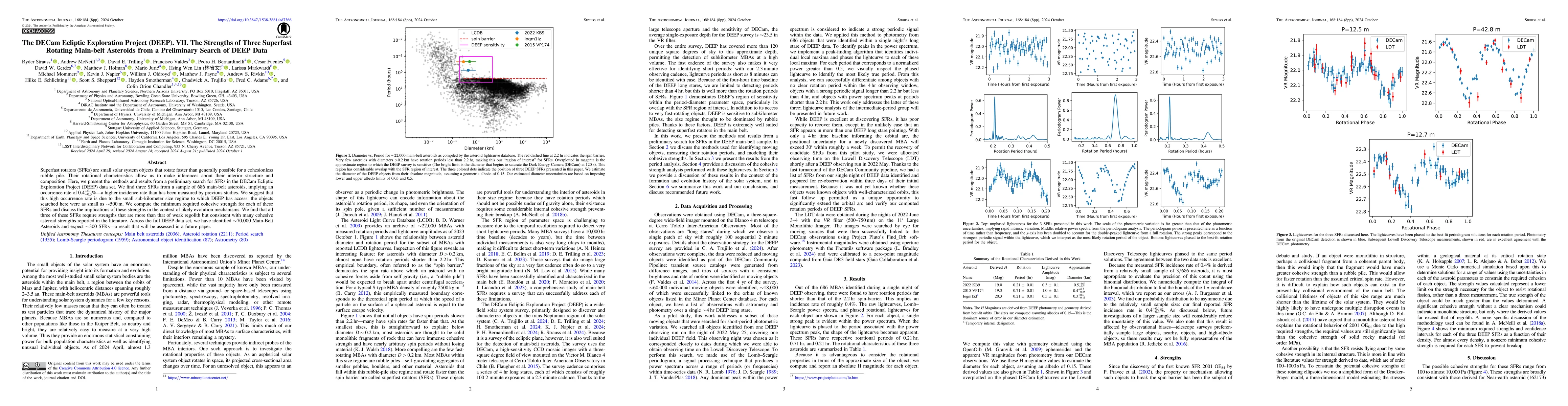
Superfast rotators (SFRs) are small solar system objects that rotate faster than generally possible for a cohesionless rubble pile. Their rotational characteristics allow us to make inferences about t...
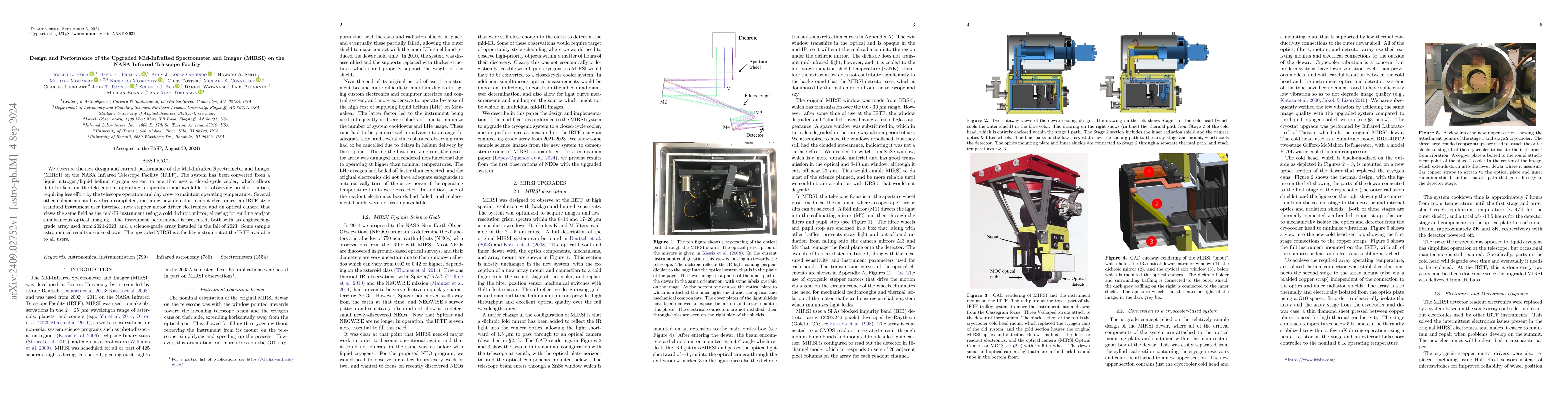
We describe the new design and current performance of the Mid-InfraRed Spectrometer and Imager (MIRSI) on the NASA Infrared Telescope Facility (IRTF). The system has been converted from a liquid nitro...
We present a method to infer temperature fields from stereo particle-image velocimetry (PIV) data in turbulent Rayleigh-B\'enard convection (RBC) using Physics-informed neural networks (PINNs). The ph...
We use the local curvature derived from velocity vector fields or particle tracks as a surrogate for structure size to compute curvature-based energy spectra. An application to homogeneous isotropic t...
The boundary of solar system object discovery lies in detecting its faintest members. However, their discovery in detection catalogs from imaging surveys is fundamentally limited by the practice of th...
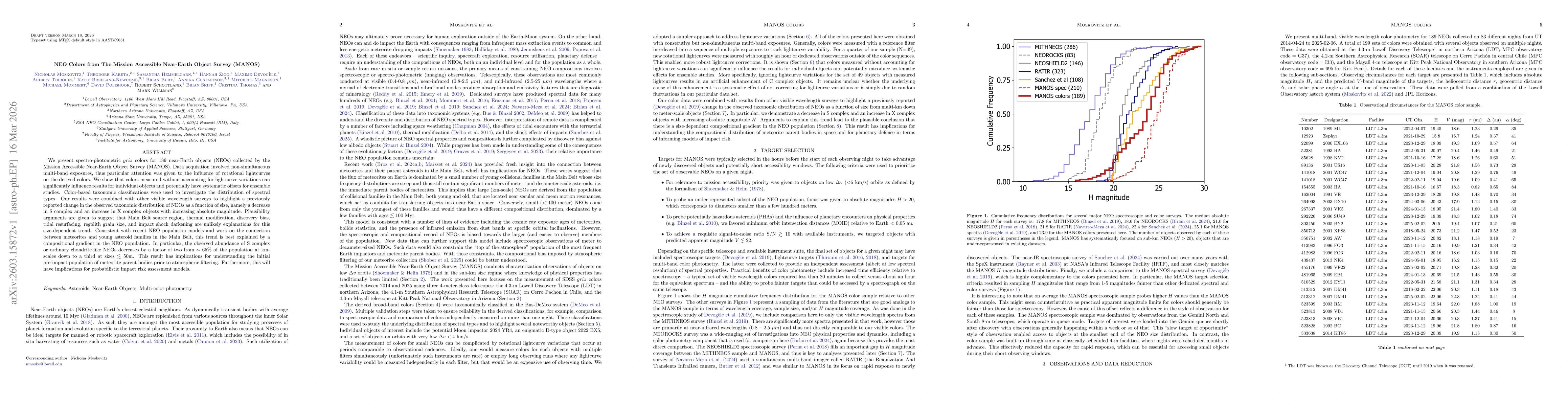
We present spectro-photometric griz colors for 189 near-Earth objects (NEOs) collected by the Mission Accessible Near-Earth Object Survey (MANOS). Data acquisition involved non-simultaneous multi-band...