Academic Profile
Statistics
Similar Authors
Papers on arXiv
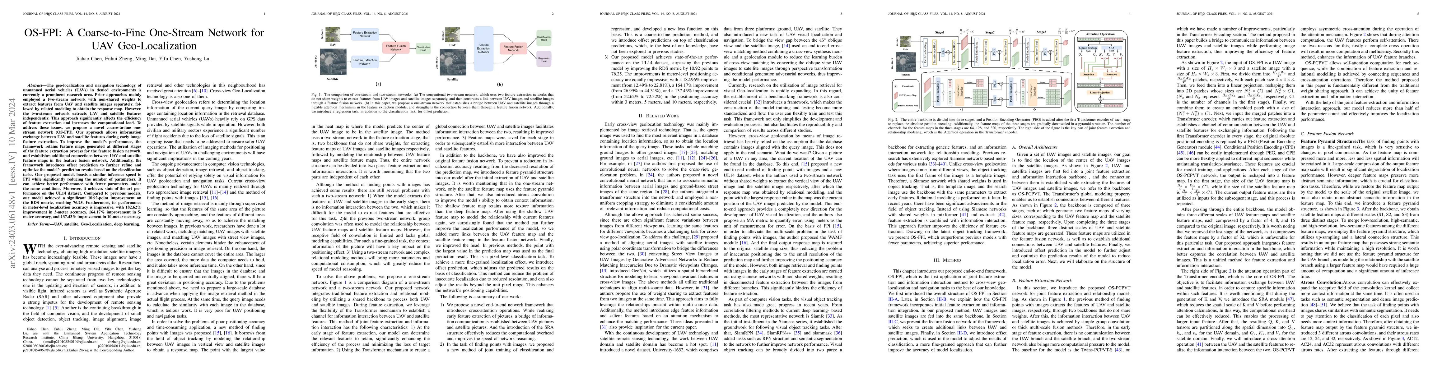
The geo-localization and navigation technology of unmanned aerial vehicles (UAVs) in denied environments is currently a prominent research area. Prior approaches mainly employed a two-stream network...
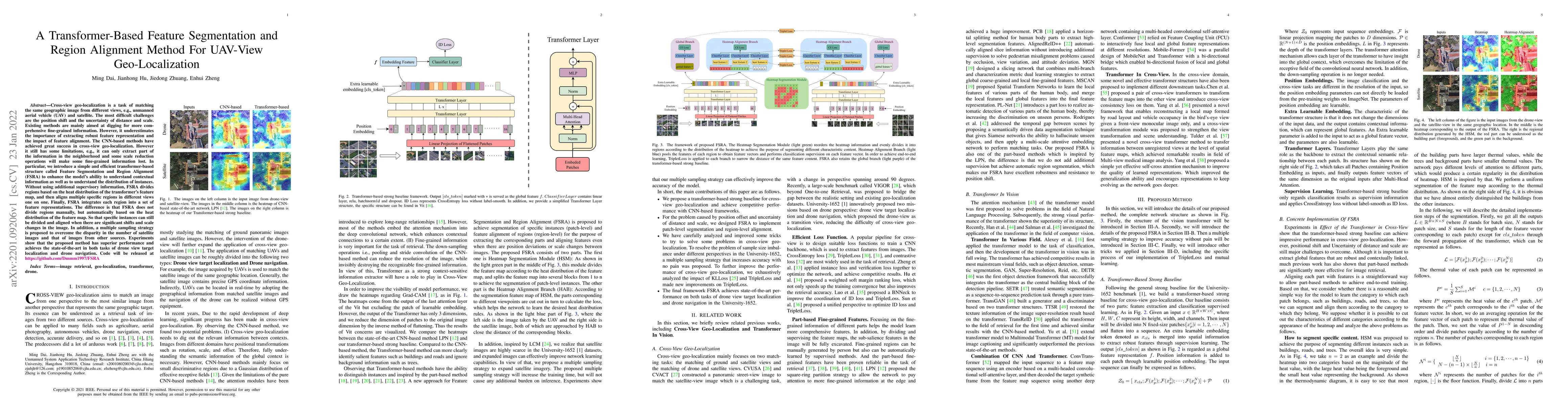
Cross-view geo-localization is a task of matching the same geographic image from different views, e.g., unmanned aerial vehicle (UAV) and satellite. The most difficult challenges are the position sh...
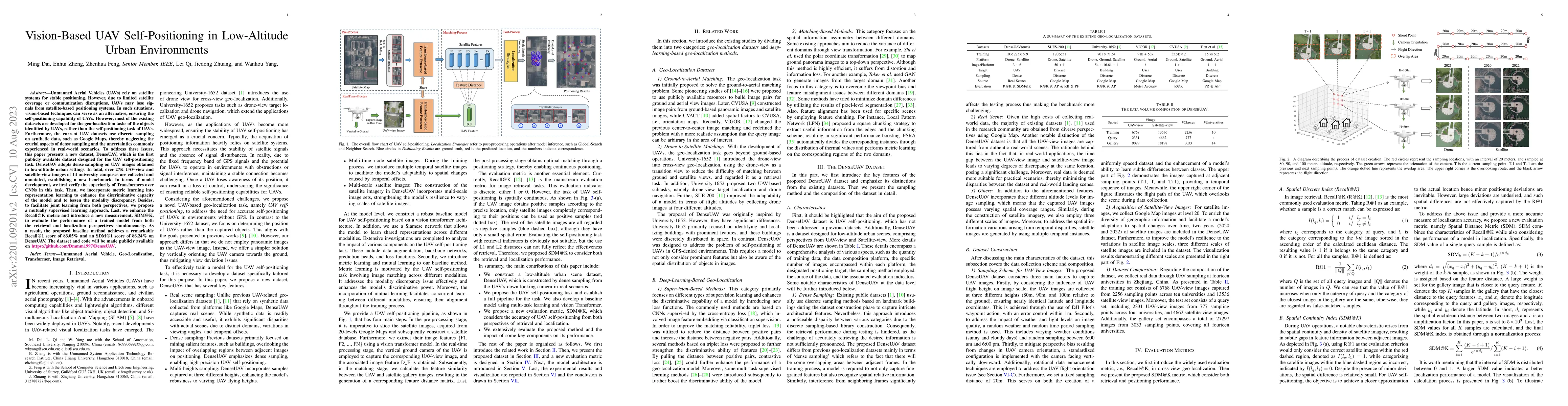
Unmanned Aerial Vehicles (UAVs) rely on satellite systems for stable positioning. However, due to limited satellite coverage or communication disruptions, UAVs may lose signals from satellite-based ...
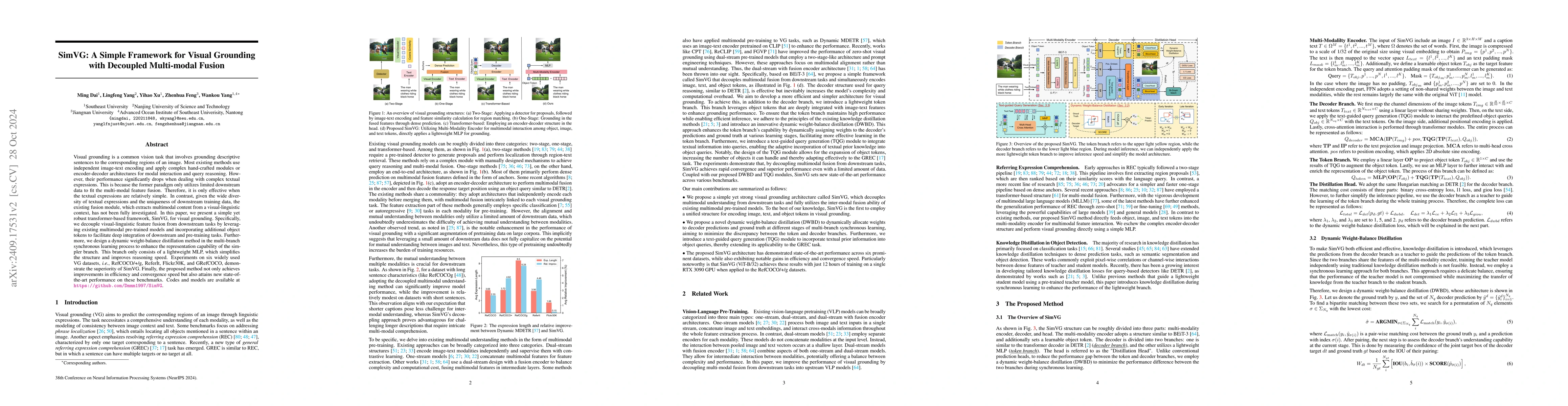
Visual grounding is a common vision task that involves grounding descriptive sentences to the corresponding regions of an image. Most existing methods use independent image-text encoding and apply com...
Multimodal large language models (MLLMs) enhance their perceptual capabilities by integrating visual and textual information. However, processing the massive number of visual tokens incurs a significa...
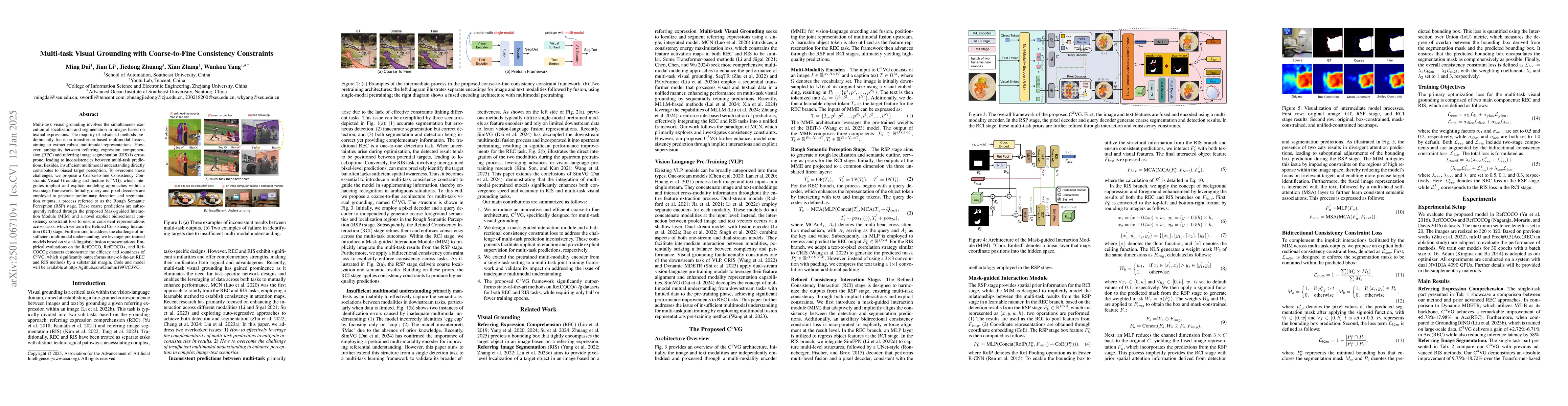
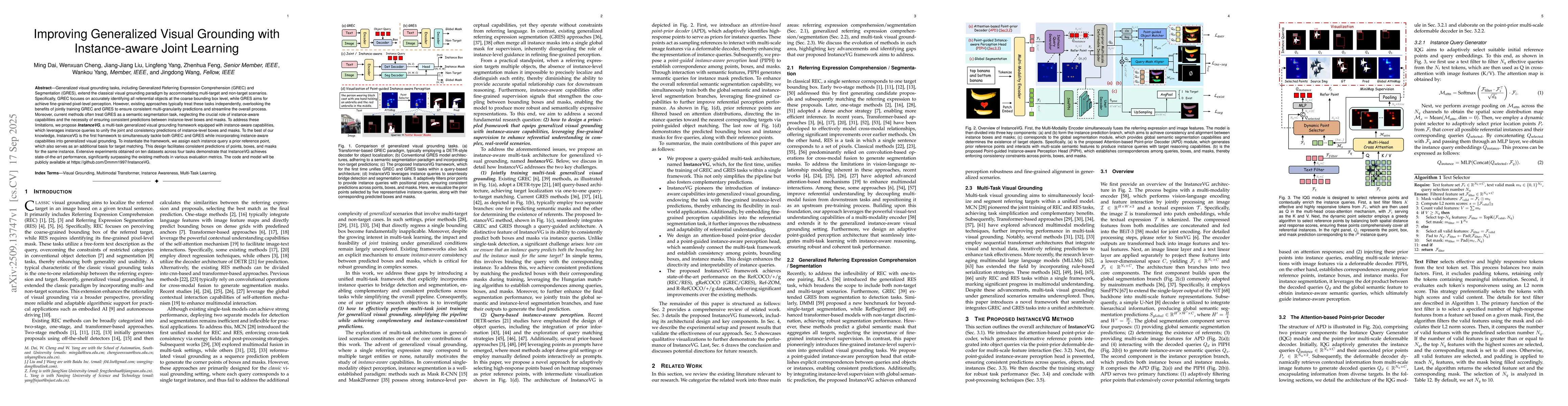
Multi-task visual grounding involves the simultaneous execution of localization and segmentation in images based on textual expressions. The majority of advanced methods predominantly focus on transfo...
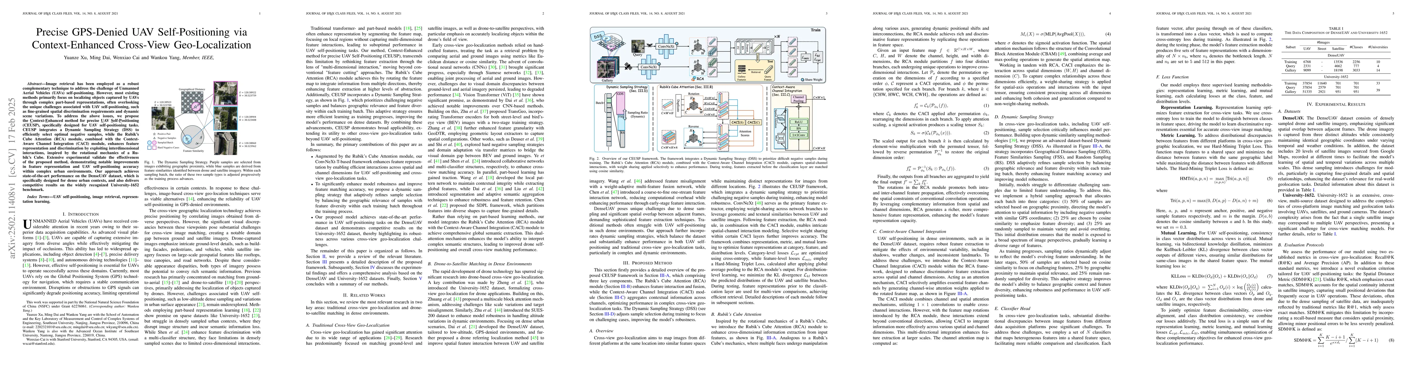
Image retrieval has been employed as a robust complementary technique to address the challenge of Unmanned Aerial Vehicles (UAVs) self-positioning. However, most existing methods primarily focus on lo...
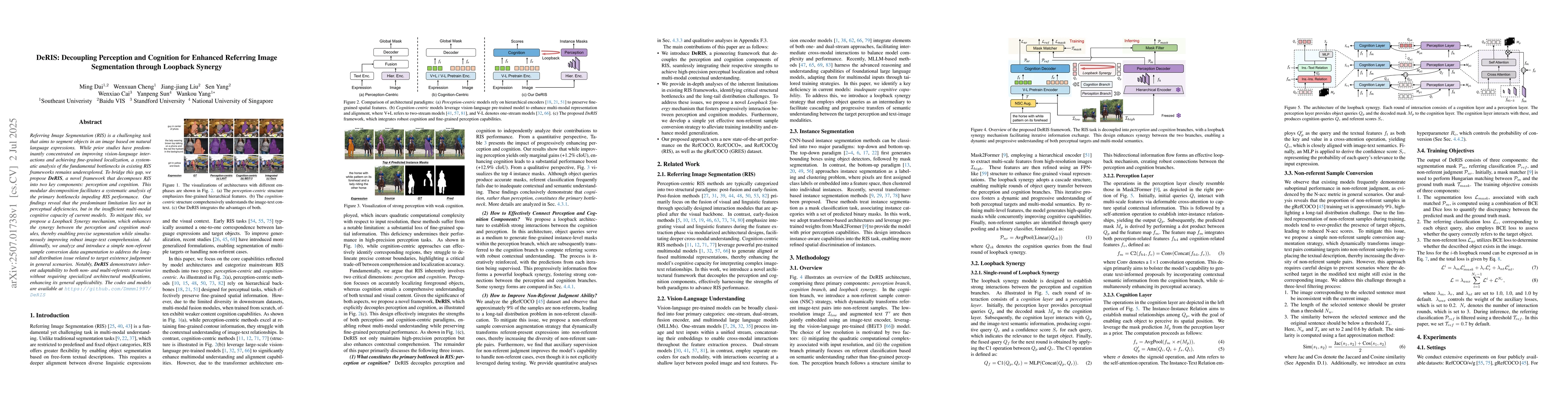
Referring Image Segmentation (RIS) is a challenging task that aims to segment objects in an image based on natural language expressions. While prior studies have predominantly concentrated on improvin...
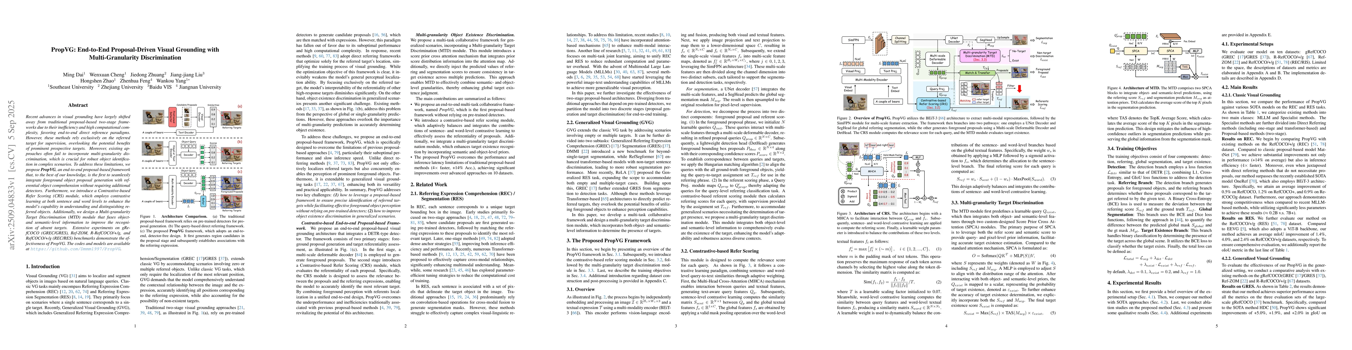
Recent advances in visual grounding have largely shifted away from traditional proposal-based two-stage frameworks due to their inefficiency and high computational complexity, favoring end-to-end dire...
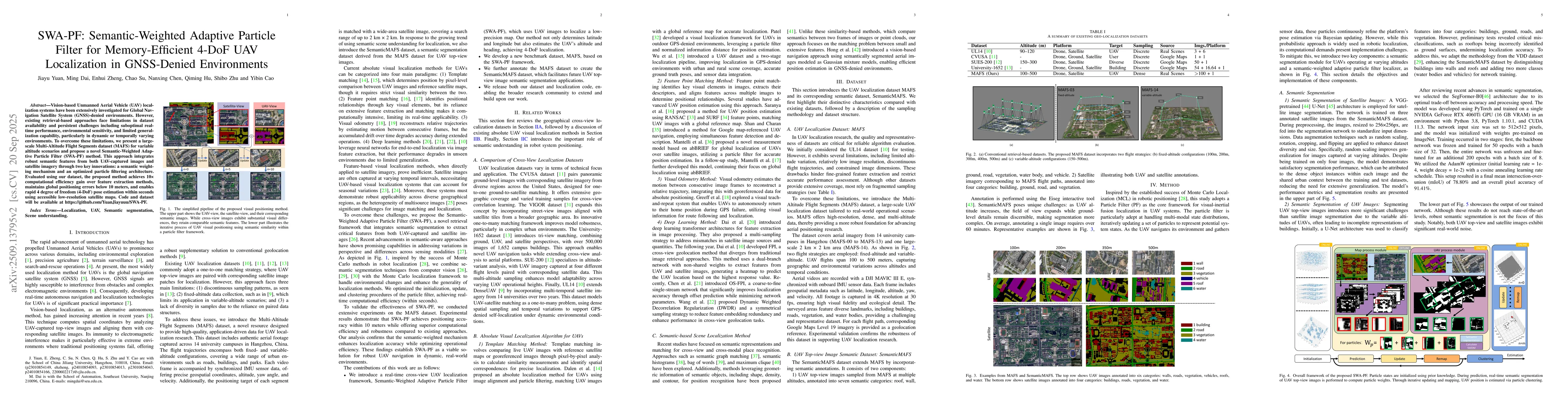
Vision-based Unmanned Aerial Vehicle (UAV) localization systems have been extensively investigated for Global Navigation Satellite System (GNSS)-denied environments. However, existing retrieval-based ...
Generalized visual grounding tasks, including Generalized Referring Expression Comprehension (GREC) and Segmentation (GRES), extend the classical visual grounding paradigm by accommodating multi-targe...
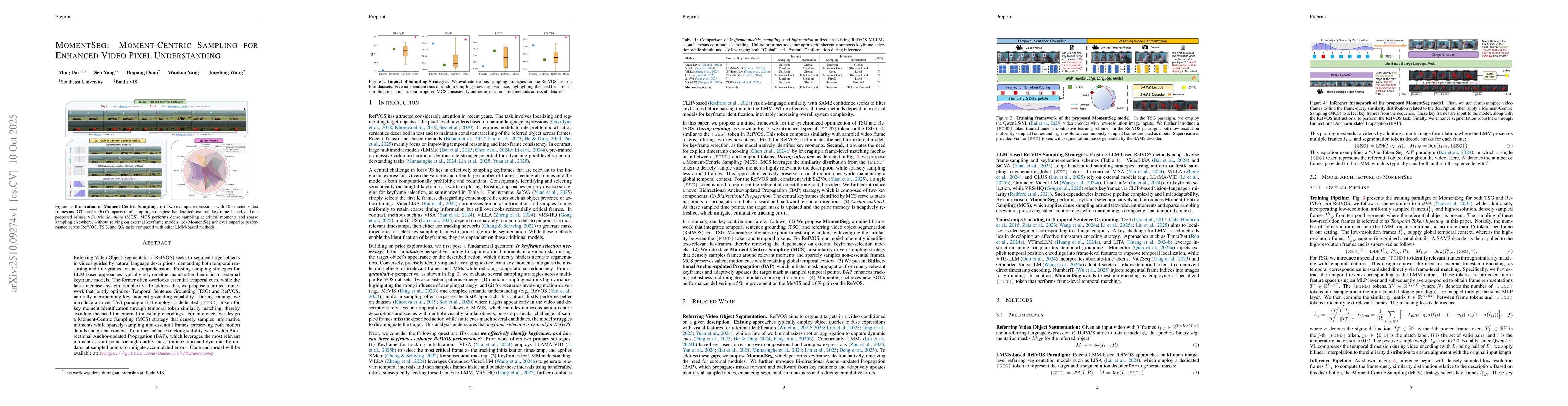
Referring Video Object Segmentation (RefVOS) seeks to segment target objects in videos guided by natural language descriptions, demanding both temporal reasoning and fine-grained visual comprehension....
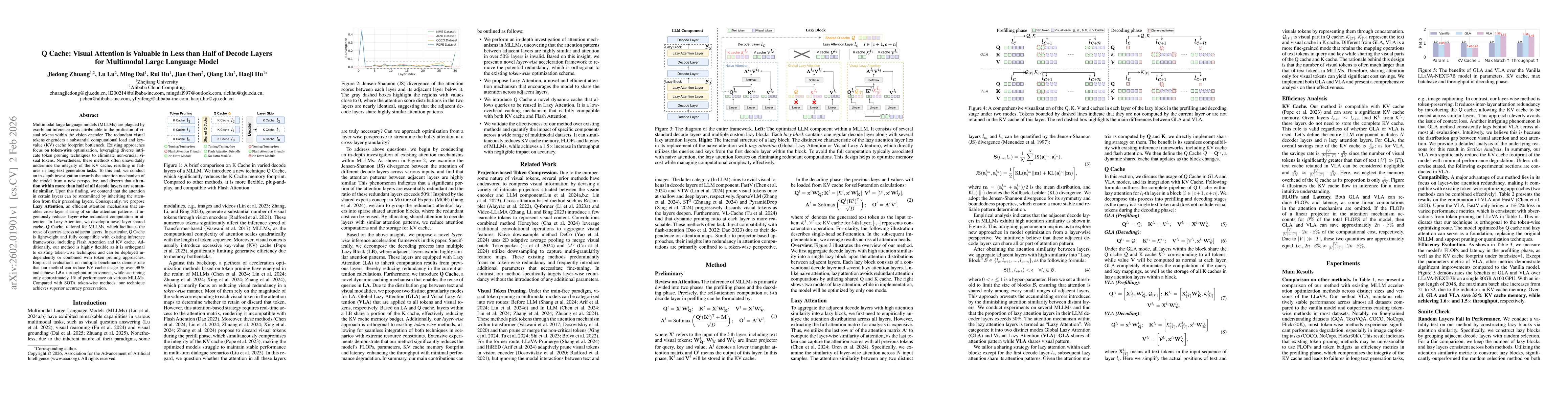
Multimodal large language models (MLLMs) are plagued by exorbitant inference costs attributable to the profusion of visual tokens within the vision encoder. The redundant visual tokens engenders a sub...
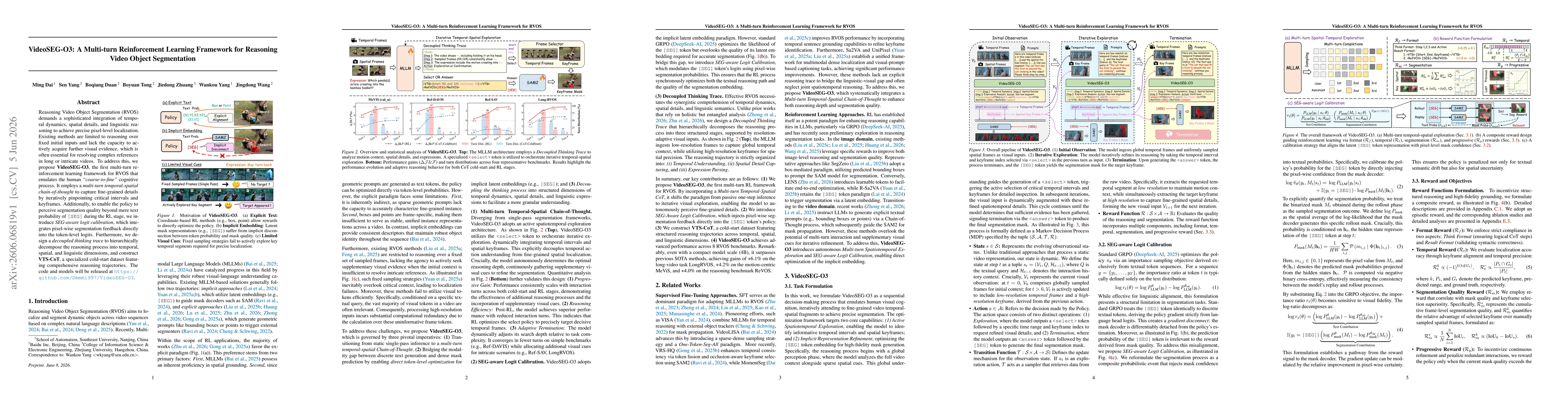
Reasoning Video Object Segmentation (RVOS) demands a sophisticated integration of temporal dynamics, spatial details, and linguistic reasoning to achieve precise pixel-level localization. Existing met...
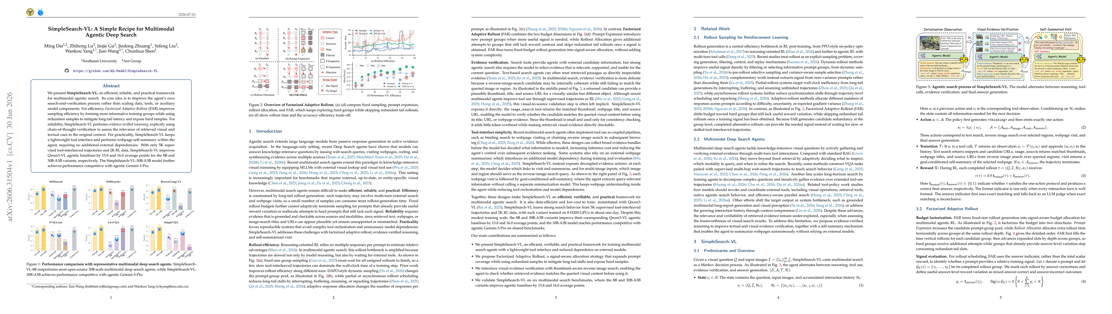
We present SimpleSearch-VL, an efficient, reliable, and practical framework for multimodal agentic search. Its core idea is to improve the agent's own search-and-verification process rather than scali...