Academic Profile
Statistics
Similar Authors
Papers on arXiv
In recent years, machine learning has become crucial in remote sensing analysis, particularly in the domain of Land-use/Land-cover (LULC). The synergy of machine learning and satellite imagery analy...
Remote sensing imagery from systems such as Sentinel provides full coverage of the Earth's surface at around 10-meter resolution. The remote sensing community has transitioned to extensive use of deep...
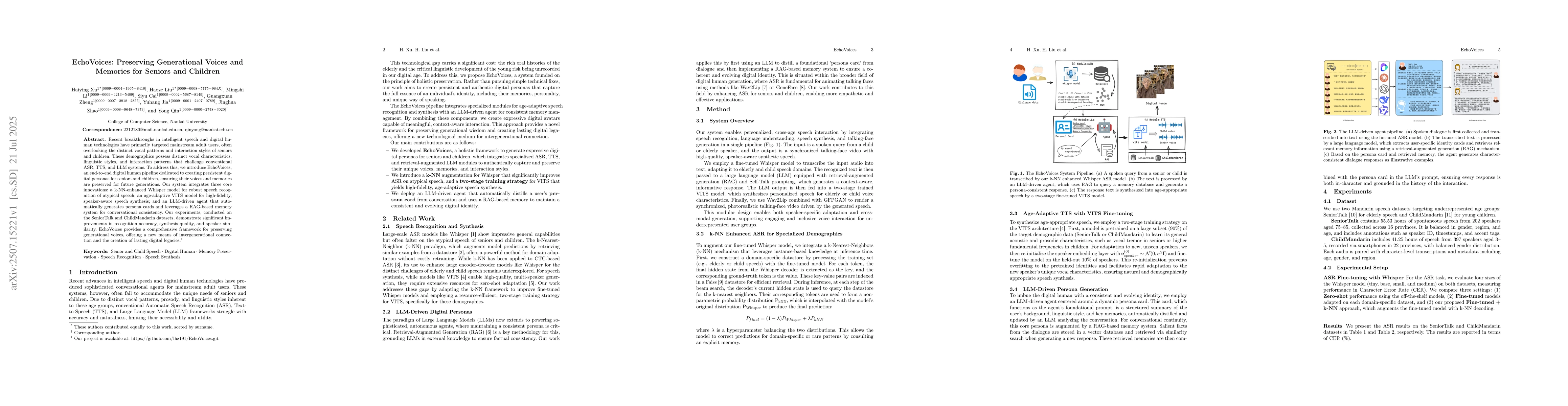
Recent breakthroughs in intelligent speech and digital human technologies have primarily targeted mainstream adult users, often overlooking the distinct vocal patterns and interaction styles of senior...