Academic Profile
Statistics
Similar Authors
Papers on arXiv
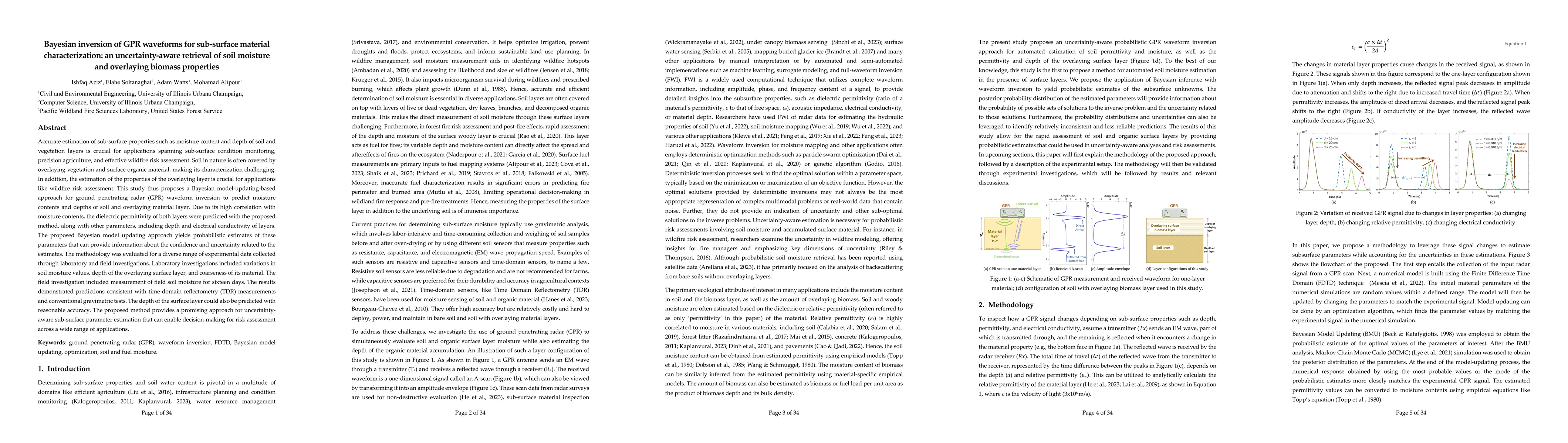
Accurate estimation of sub-surface properties such as moisture content and depth of soil and vegetation layers is crucial for applications spanning sub-surface condition monitoring, precision agricult...
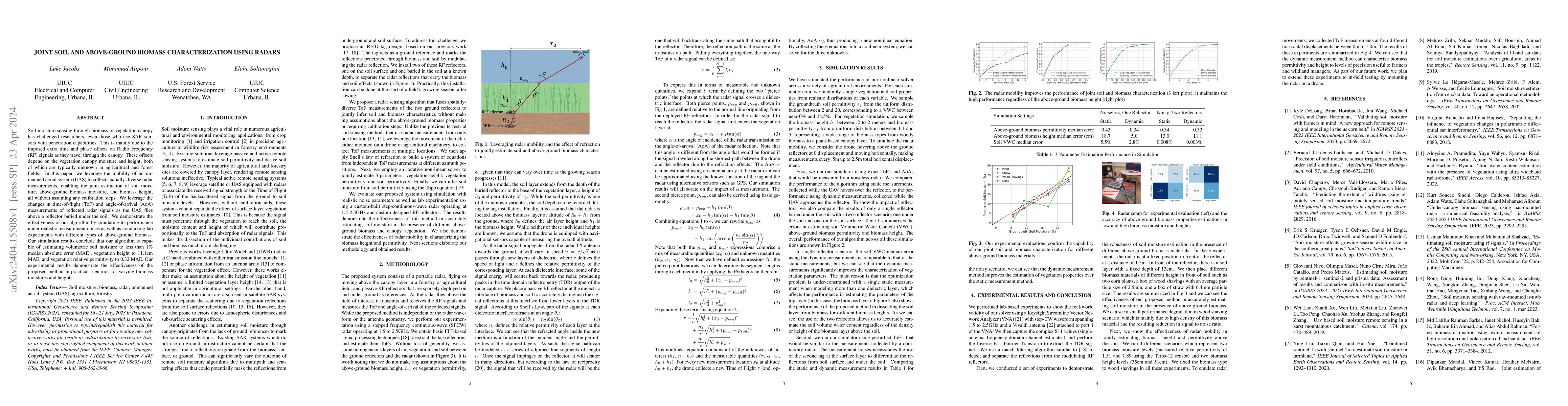
Soil moisture sensing through biomass or vegetation canopy has challenged researchers, even those who use SAR sensors with penetration capabilities. This is mainly due to the imposed extra time and ...
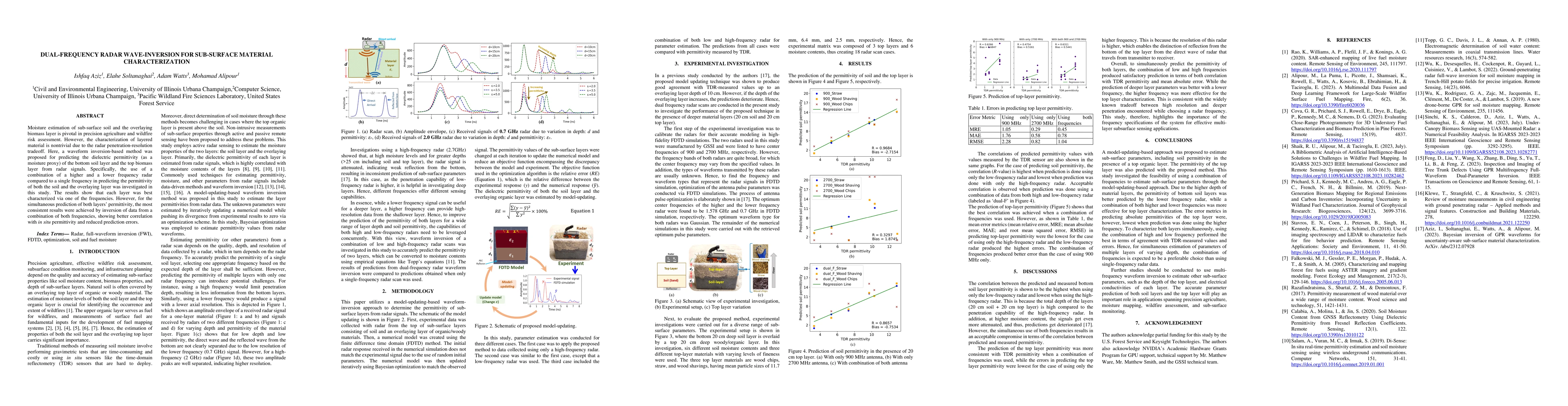
Moisture estimation of sub-surface soil and the overlaying biomass layer is pivotal in precision agriculture and wildfire risk assessment. However, the characterization of layered material is nontri...
Accurate assessment of fuel conditions is a prerequisite for fire ignition and behavior prediction, and risk management. The method proposed herein leverages diverse data sources including Landsat-8...
Unmanned Aerial Systems (UAS) have gained significant traction for their application in infrastructure inspections. However, considering the enormous scale and complex nature of infrastructure, auto...
Spaceborne microwave passive soil moisture products are known for their accuracy but are often limited by coarse spatial resolutions. This limits their ability to capture finer soil moisture gradients...
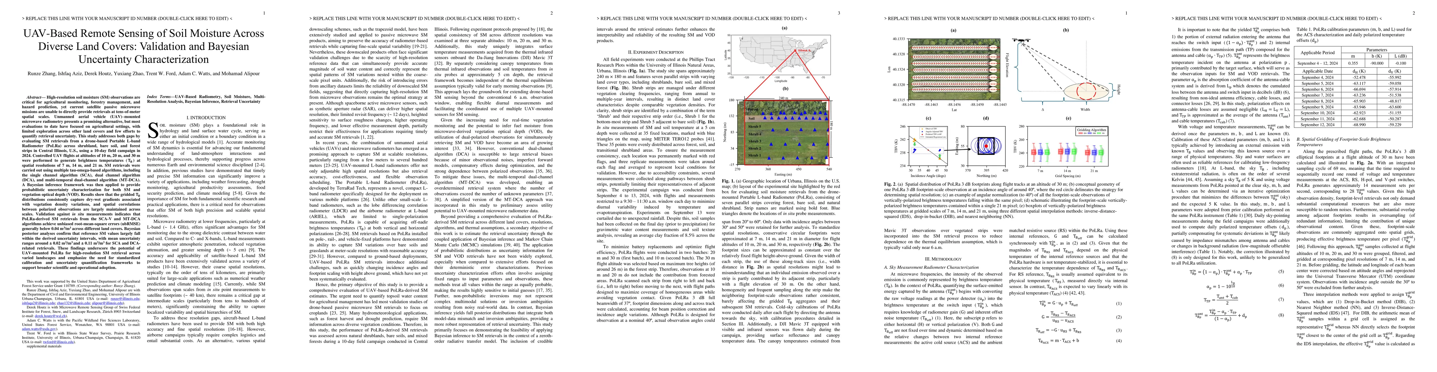
High-resolution soil moisture (SM) observations are critical for agricultural monitoring, forestry management, and hazard prediction, yet current satellite passive microwave missions cannot directly p...
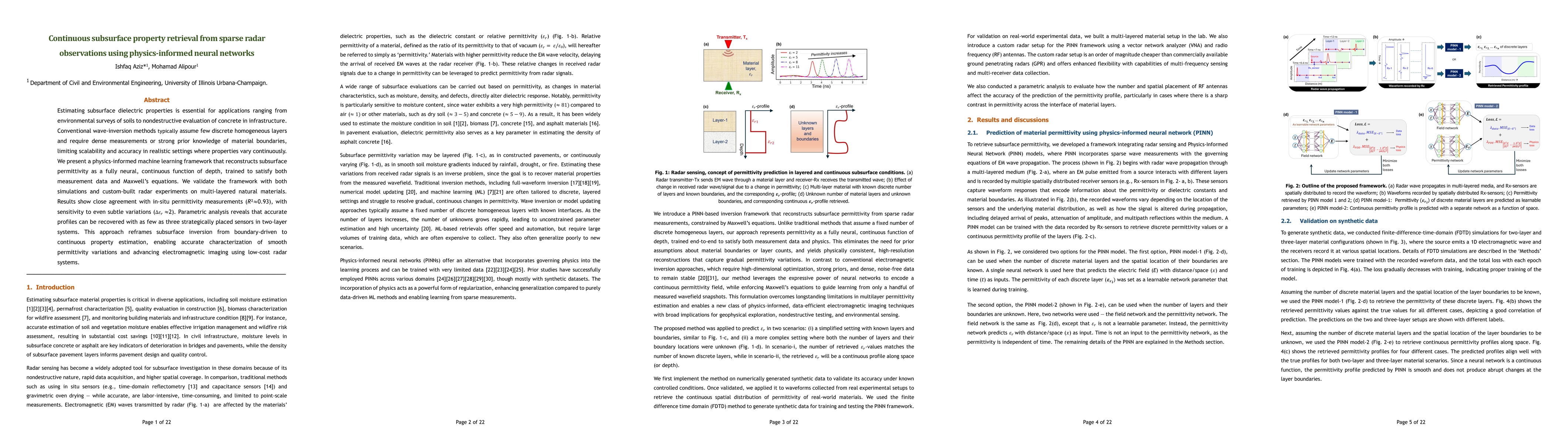
Estimating subsurface dielectric properties is essential for applications ranging from environmental surveys of soils to nondestructive evaluation of concrete in infrastructure. Conventional wave inve...
Accurate estimation of subsurface material properties, such as soil moisture, is critical for wildfire risk assessment and precision agriculture. Ground-penetrating radar (GPR) is a non-destructive ge...
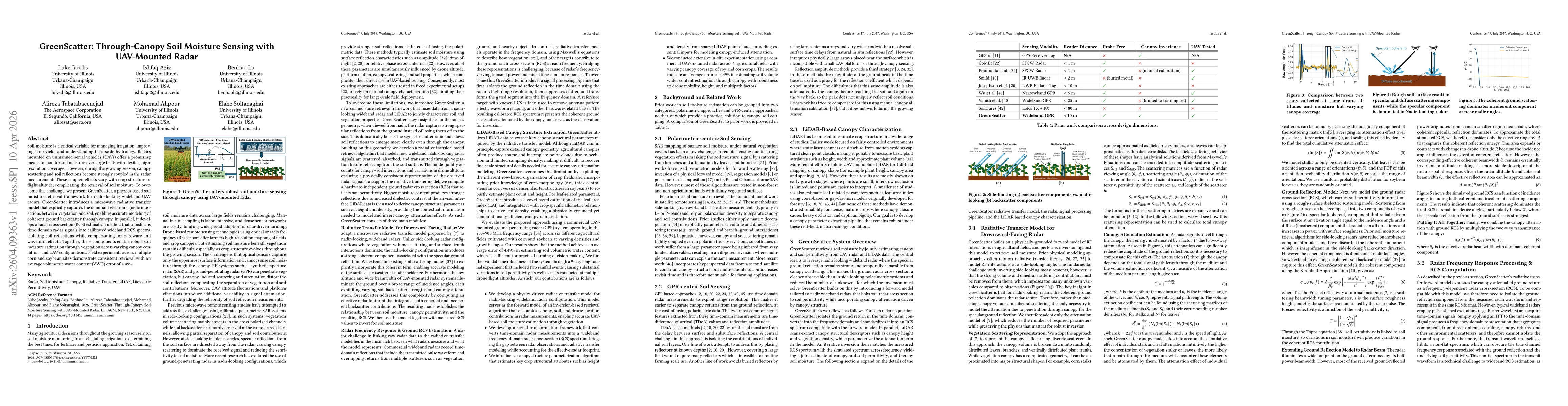
Soil moisture is a critical variable for managing irrigation, improving crop yield, and understanding field-scale hydrology. Radars mounted on unmanned aerial vehicles (UAVs) offer a promising means t...
Visual bridge inspection is a knowledge-intensive task in which inspectors coordinate visual search, spatial navigation, structural reasoning, and defect identification and documentation. It is a cent...