Academic Profile
Statistics
Similar Authors
Papers on arXiv
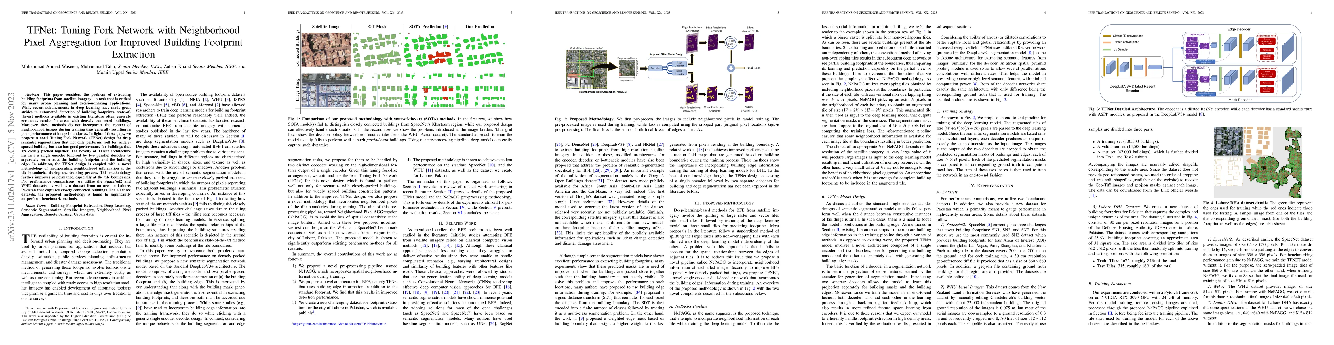
This paper considers the problem of extracting building footprints from satellite imagery -- a task that is critical for many urban planning and decision-making applications. While recent advancemen...
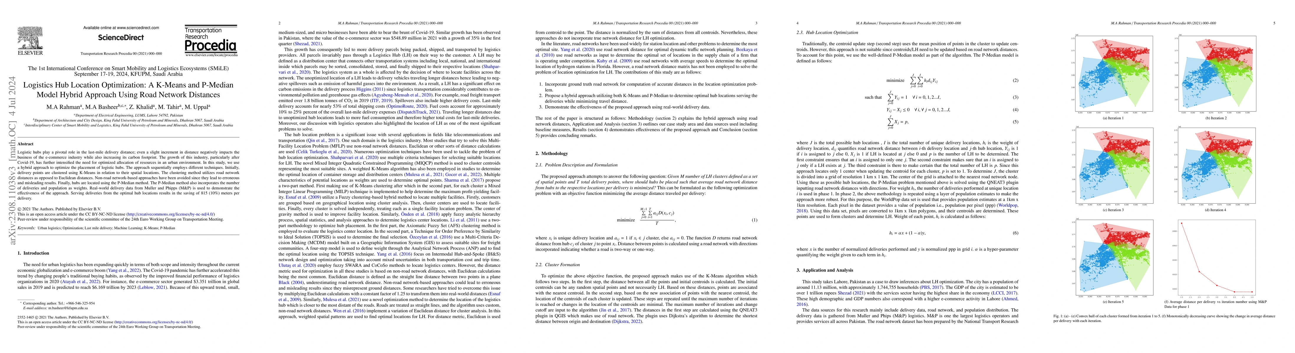
Logistic hubs play a pivotal role in the last-mile delivery distance; even a slight increment in distance negatively impacts the business of the e-commerce industry while also increasing its carbon ...
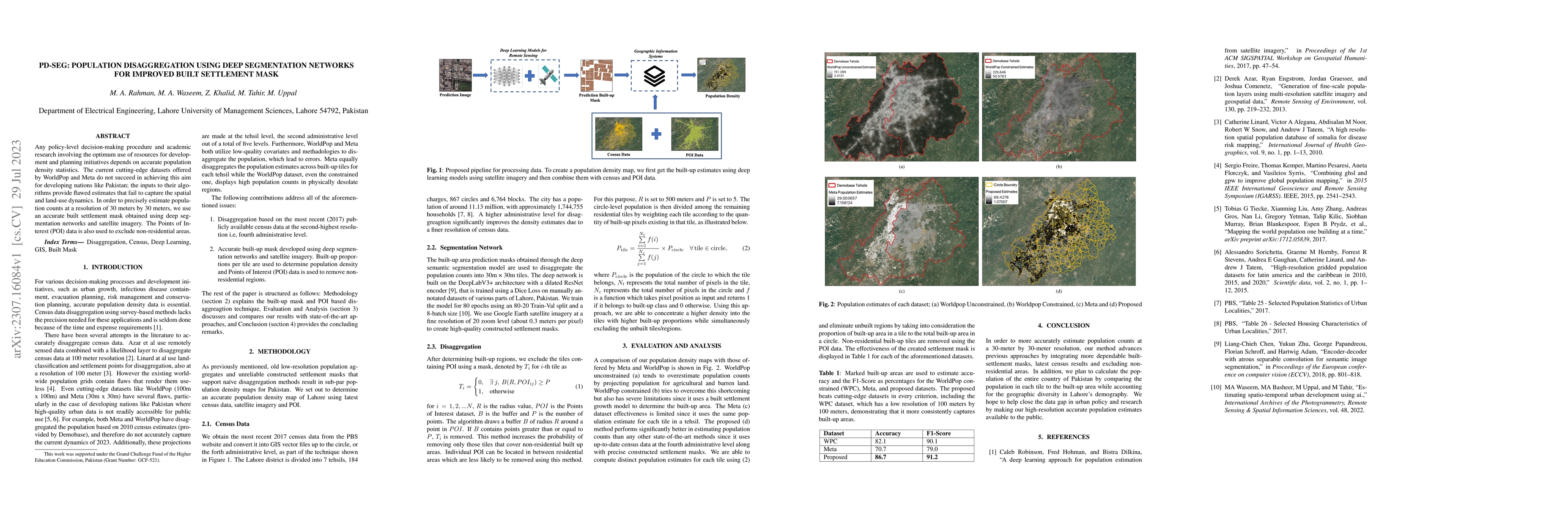
Any policy-level decision-making procedure and academic research involving the optimum use of resources for development and planning initiatives depends on accurate population density statistics. Th...
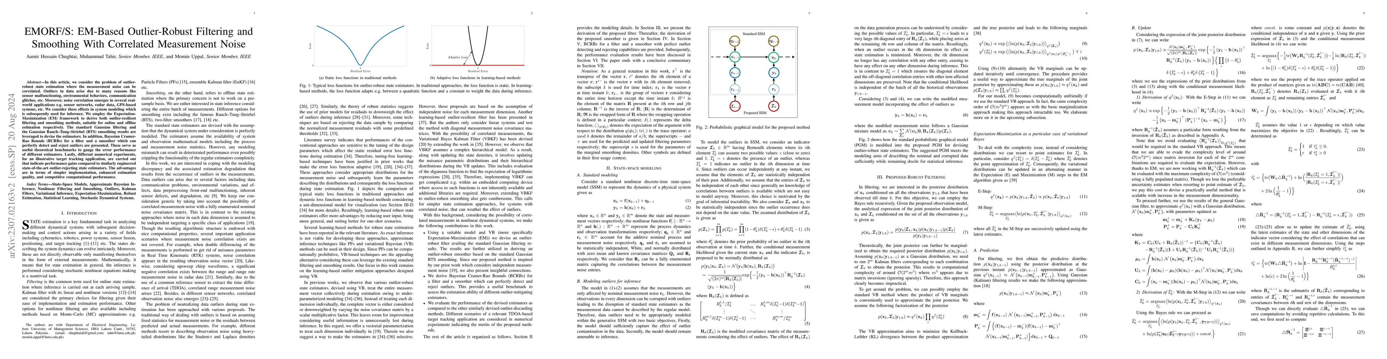
In this article, we consider the problem of outlier-robust state estimation where the measurement noise can be correlated. Outliers in data arise due to many reasons like sensor malfunctioning, envi...
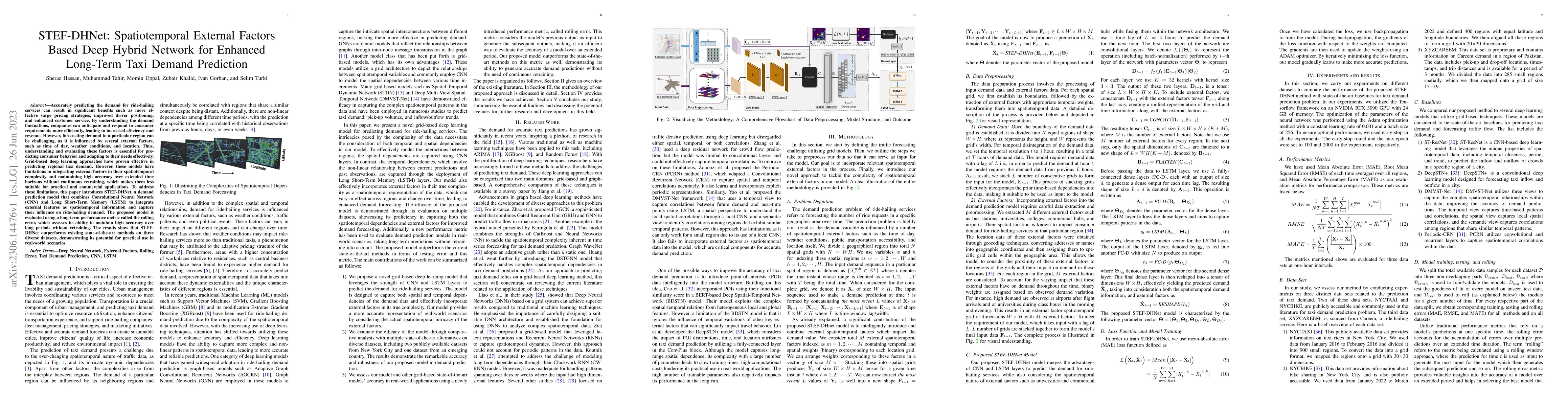
Accurately predicting the demand for ride-hailing services can result in significant benefits such as more effective surge pricing strategies, improved driver positioning, and enhanced customer serv...
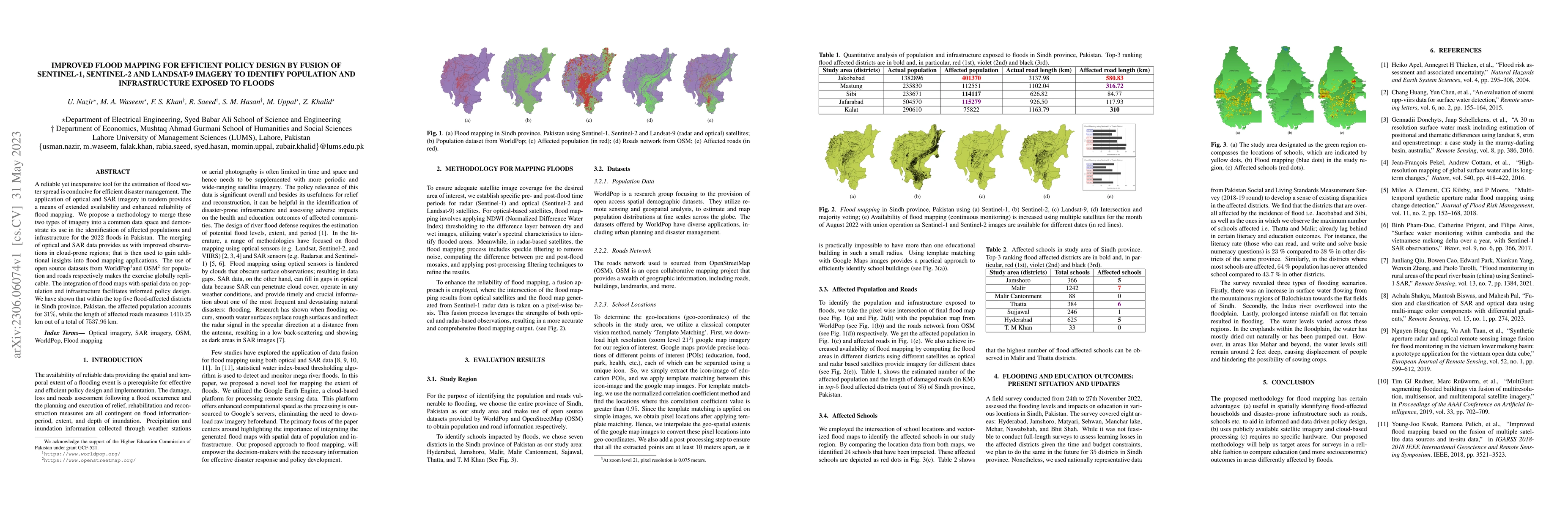
A reliable yet inexpensive tool for the estimation of flood water spread is conducive for efficient disaster management. The application of optical and SAR imagery in tandem provides a means of exte...
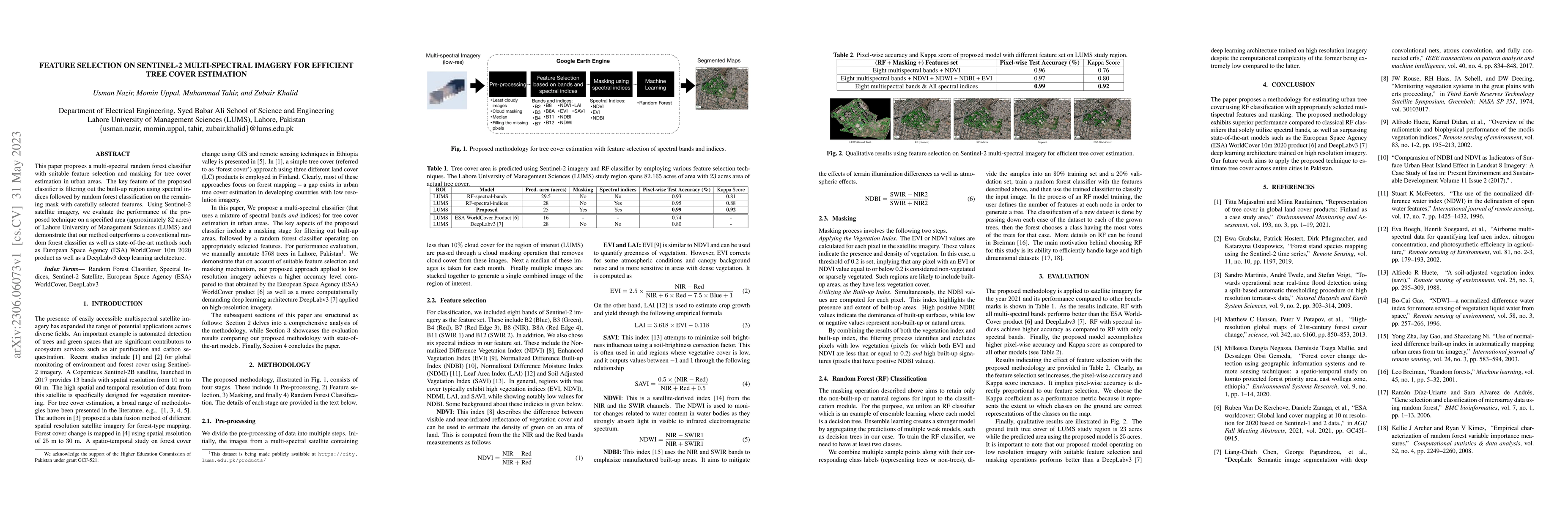
This paper proposes a multi-spectral random forest classifier with suitable feature selection and masking for tree cover estimation in urban areas. The key feature of the proposed classifier is filt...
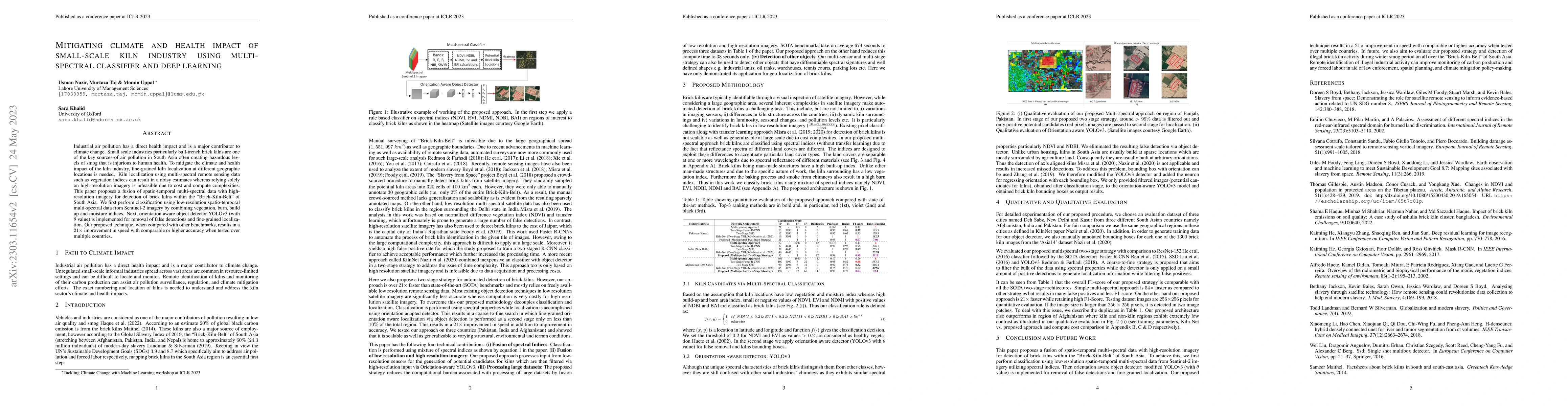
Industrial air pollution has a direct health impact and is a major contributor to climate change. Small scale industries particularly bull-trench brick kilns are one of the key sources of air pollut...
Spatial perception is a key task in several machine intelligence applications such as robotics and computer vision. In general, it involves the nonlinear estimation of hidden variables that represen...
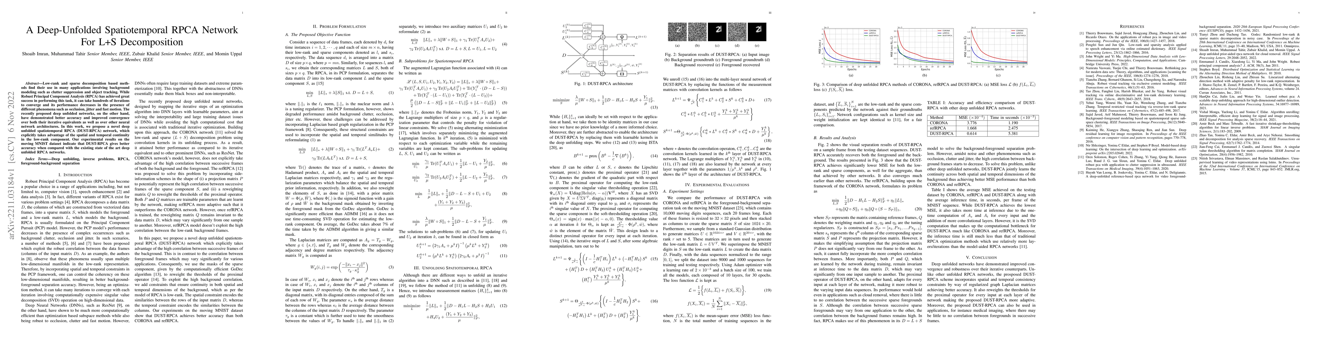
Low-rank and sparse decomposition based methods find their use in many applications involving background modeling such as clutter suppression and object tracking. While Robust Principal Component An...
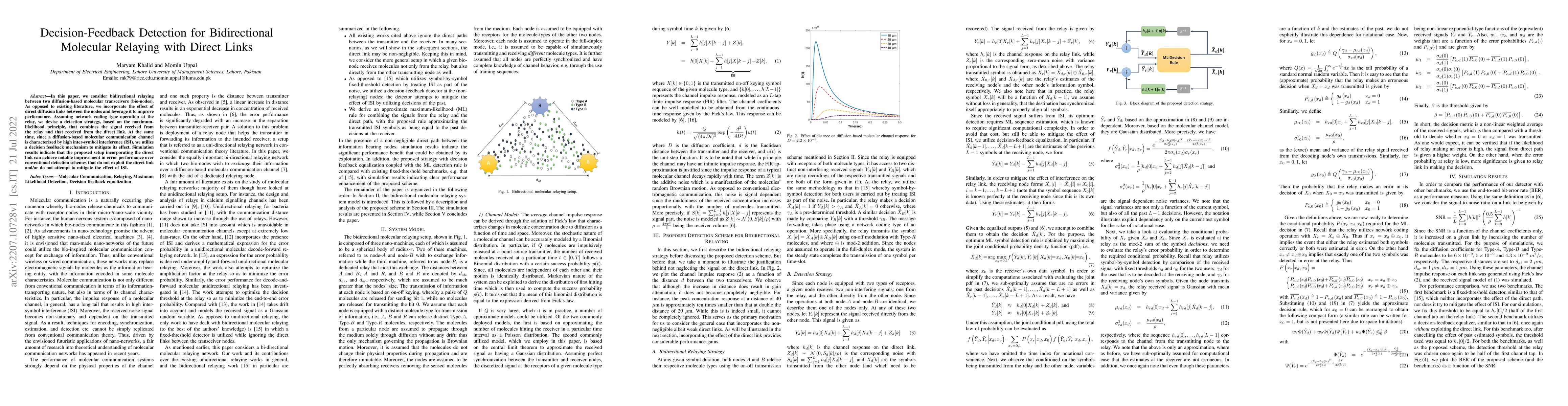
In this paper, we consider bidirectional relaying between two diffusion-based molecular transceivers (bio-nodes). As opposed to existing literature, we incorporate the effect of direct diffusion lin...
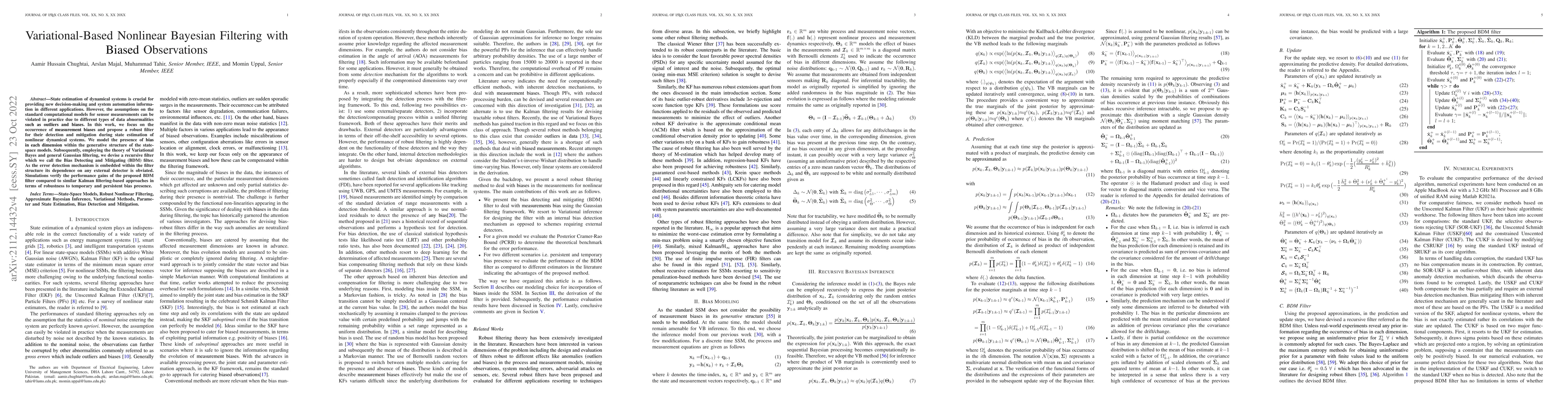
State estimation of dynamical systems is crucial for providing new decision-making and system automation information in different applications. However, the assumptions on the standard computational...
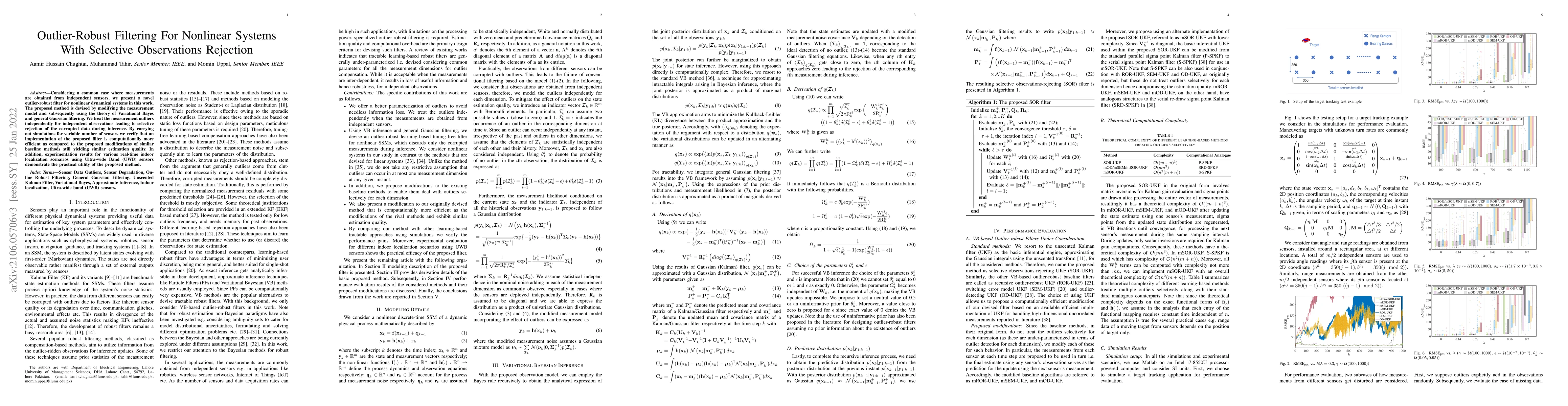
Considering a common case where measurements are obtained from independent sensors, we present a novel outlier-robust filter for nonlinear dynamical systems in this work. The proposed method is devi...
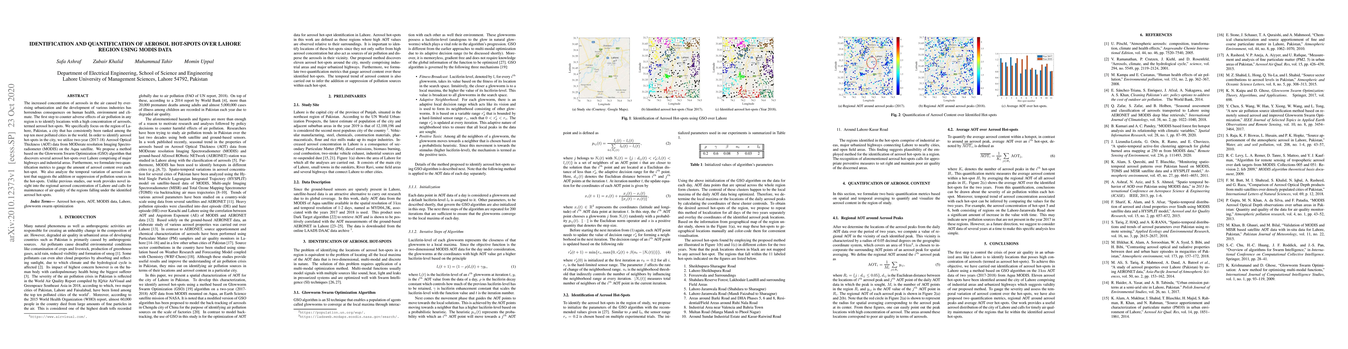
The increased concentration of aerosols in the air caused by ever-rising urbanization and the development of various industries has horrendous consequences on human health, environment and climate. ...
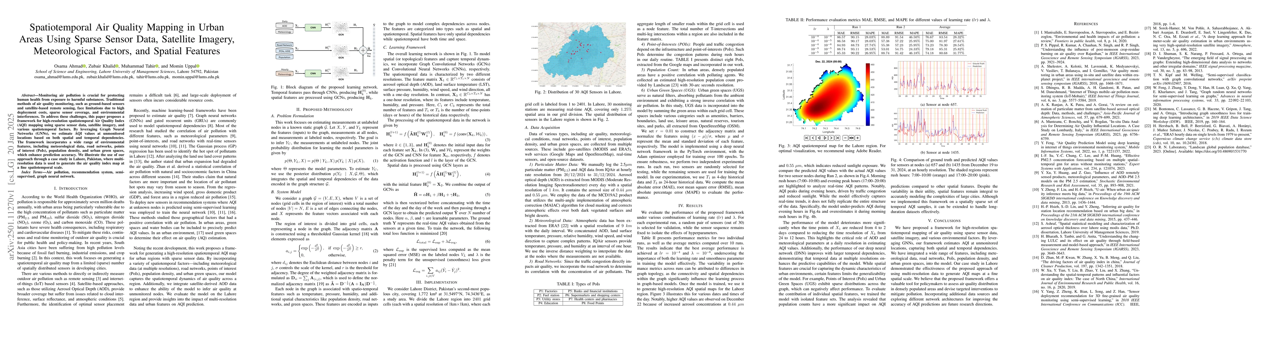
Monitoring air pollution is crucial for protecting human health from exposure to harmful substances. Traditional methods of air quality monitoring, such as ground-based sensors and satellite-based rem...