Academic Profile
Statistics
Similar Authors
Papers on arXiv
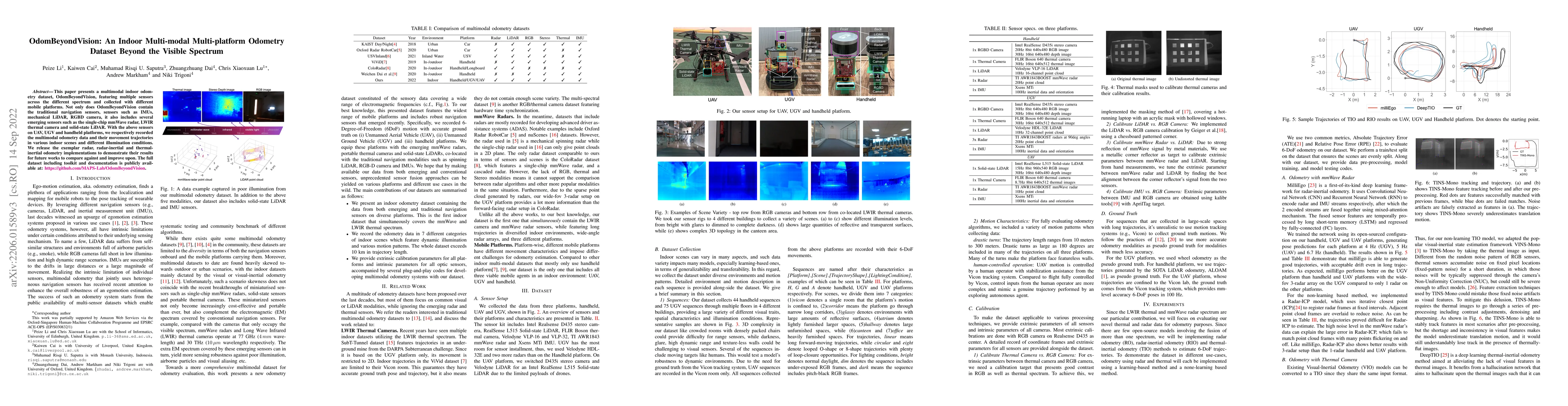
This paper presents a multimodal indoor odometry dataset, OdomBeyondVision, featuring multiple sensors across the different spectrum and collected with different mobile platforms. Not only does Odom...
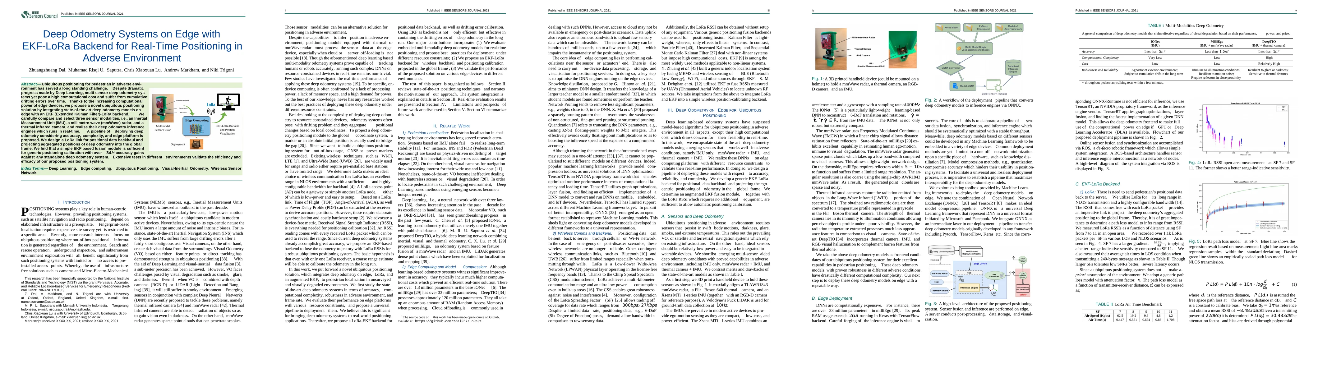
Ubiquitous positioning for pedestrian in adverse environment has served a long standing challenge. Despite dramatic progress made by Deep Learning, multi-sensor deep odometry systems yet pose a high...
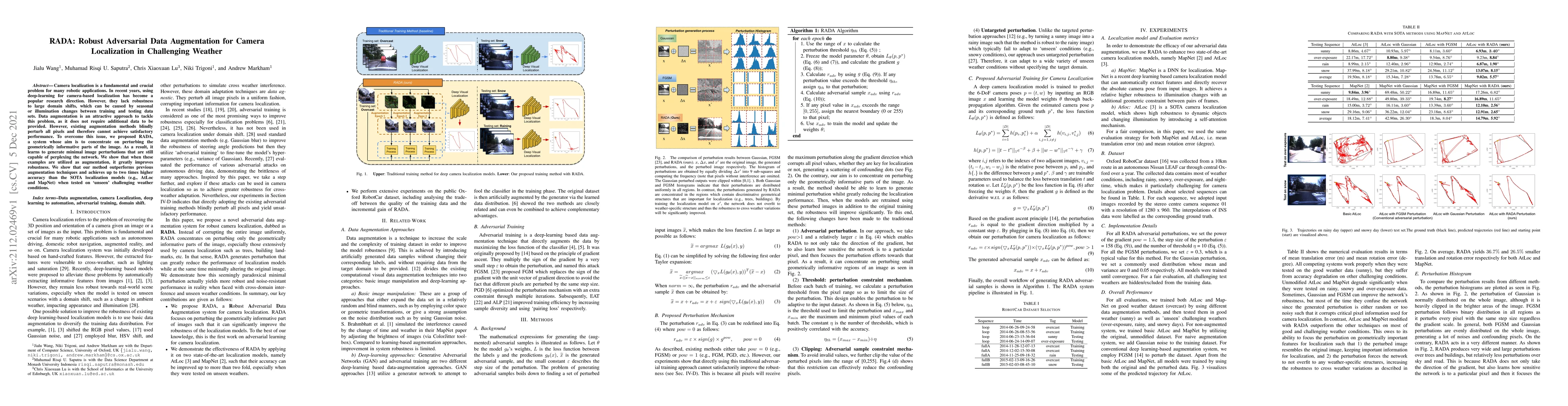
Camera localization is a fundamental and crucial problem for many robotic applications. In recent years, using deep-learning for camera-based localization has become a popular research direction. Ho...
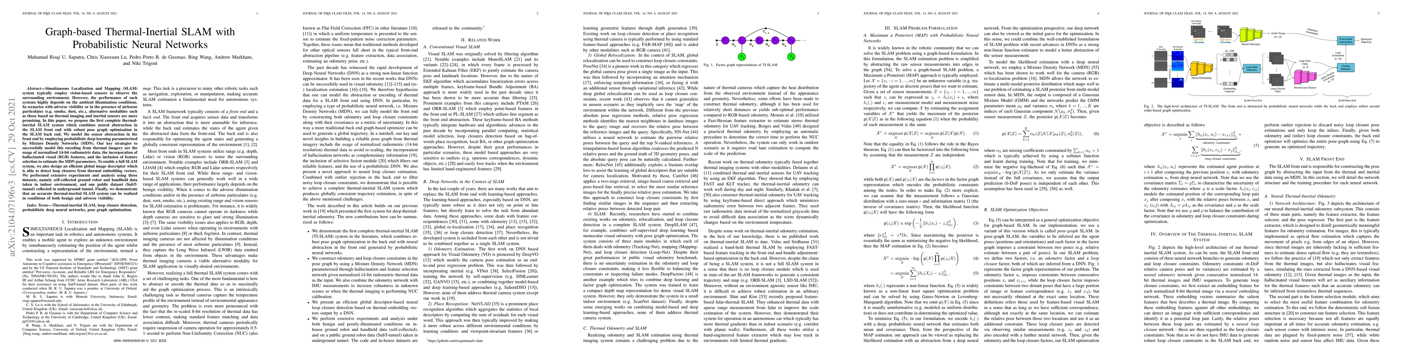
Simultaneous Localization and Mapping (SLAM) system typically employ vision-based sensors to observe the surrounding environment. However, the performance of such systems highly depends on the ambie...
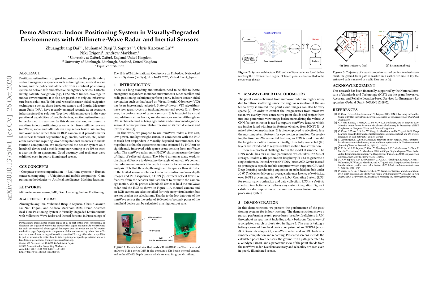
Positional estimation is of great importance in the public safety sector. Emergency responders such as fire fighters, medical rescue teams, and the police will all benefit from a resilient positioni...
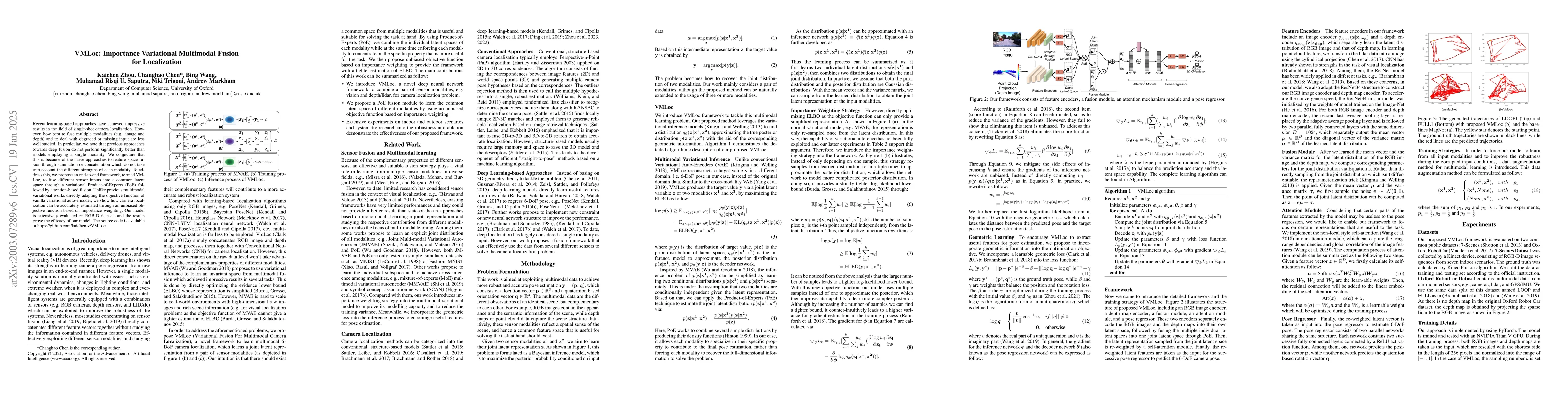
Recent learning-based approaches have achieved impressive results in the field of single-shot camera localization. However, how best to fuse multiple modalities (e.g., image and depth) and to deal w...
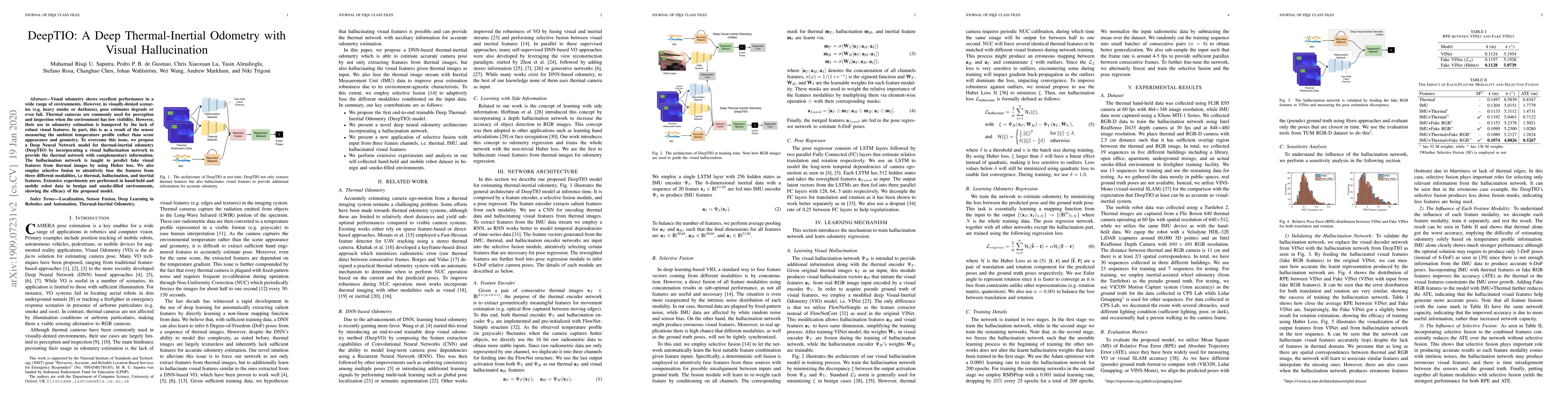
Visual odometry shows excellent performance in a wide range of environments. However, in visually-denied scenarios (e.g. heavy smoke or darkness), pose estimates degrade or even fail. Thermal camera...
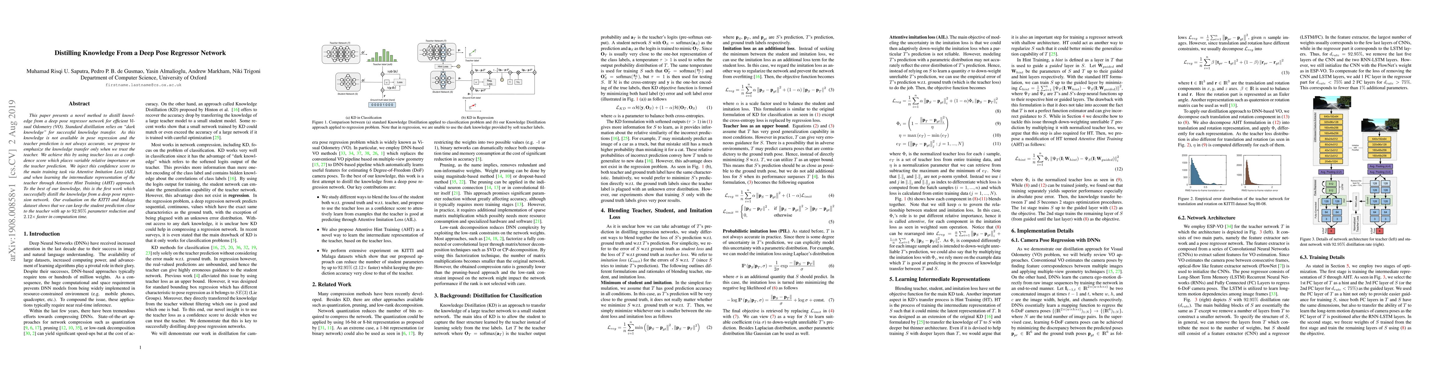
This paper presents a novel method to distill knowledge from a deep pose regressor network for efficient Visual Odometry (VO). Standard distillation relies on "dark knowledge" for successful knowled...
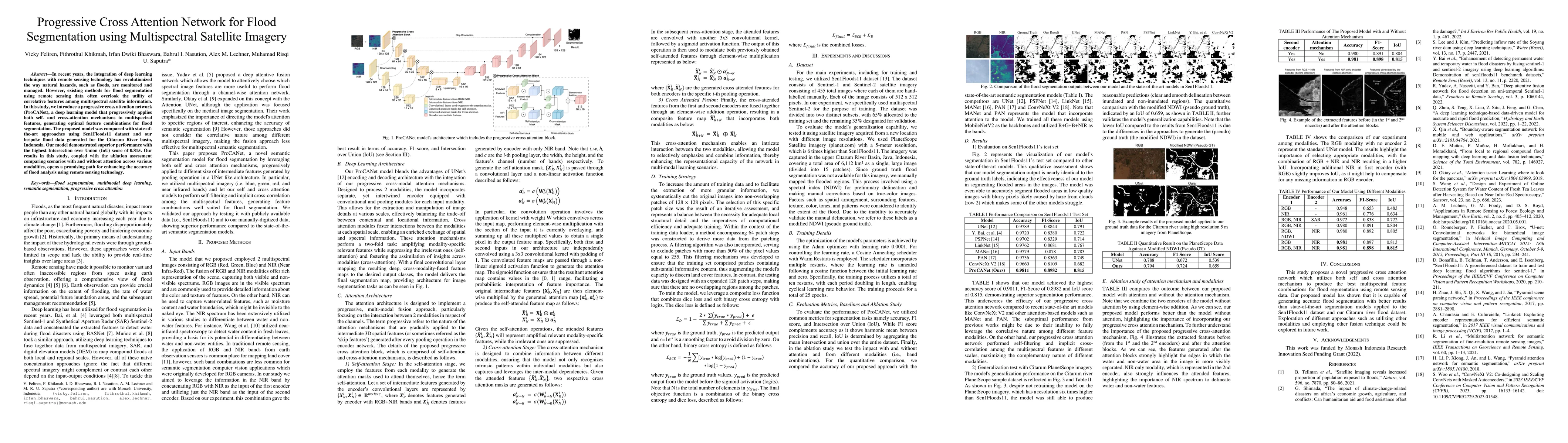
In recent years, the integration of deep learning techniques with remote sensing technology has revolutionized the way natural hazards, such as floods, are monitored and managed. However, existing met...
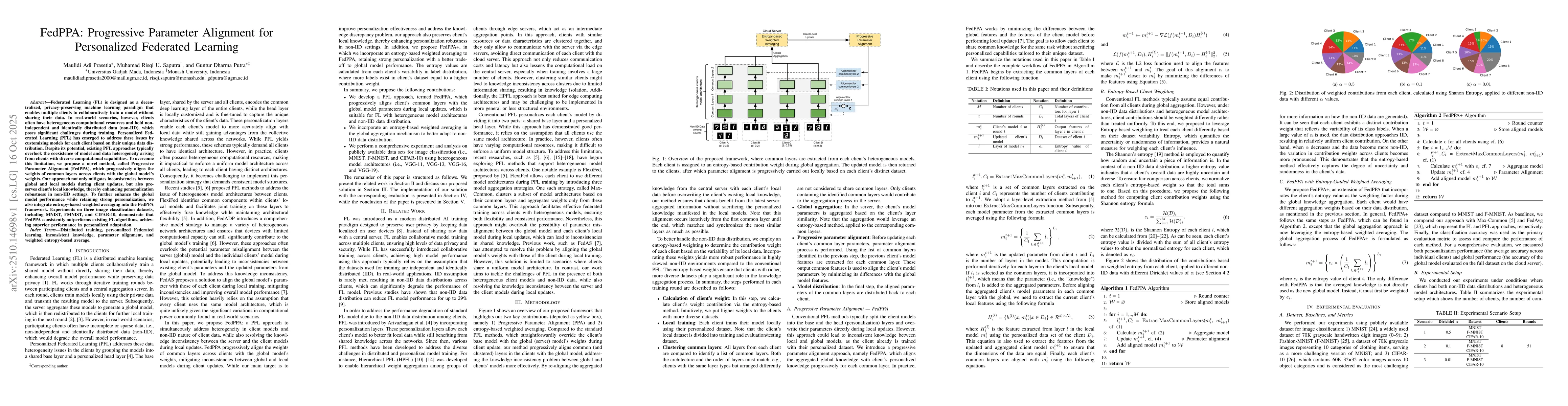
Federated Learning (FL) is designed as a decentralized, privacy-preserving machine learning paradigm that enables multiple clients to collaboratively train a model without sharing their data. In real-...
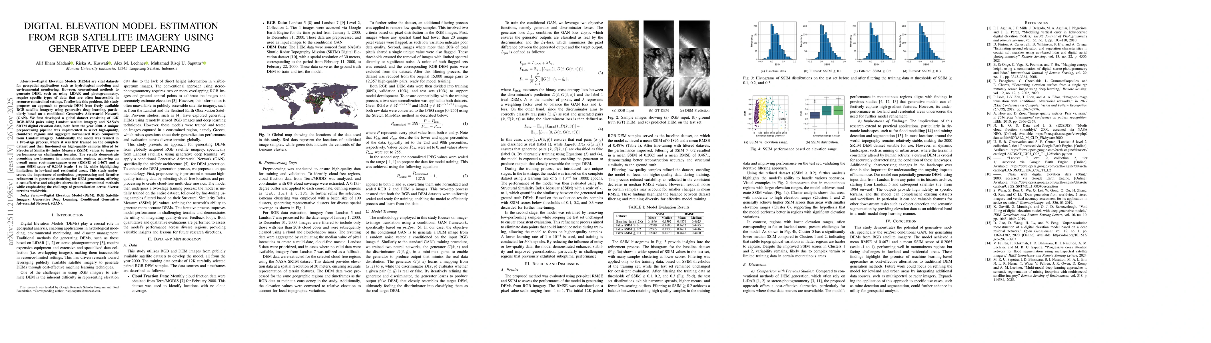
Digital Elevation Models (DEMs) are vital datasets for geospatial applications such as hydrological modeling and environmental monitoring. However, conventional methods to generate DEM, such as using ...
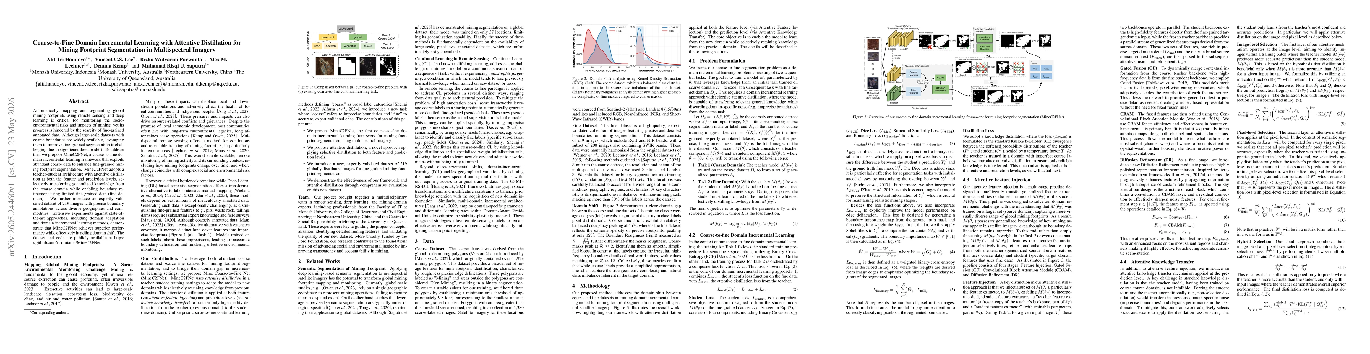
Automatically mapping and segmenting global mining footprints using remote sensing and deep learning is critical for monitoring the socio-environmental risks and impacts of mining, yet its progress is...