Academic Profile
Statistics
Similar Authors
Papers on arXiv
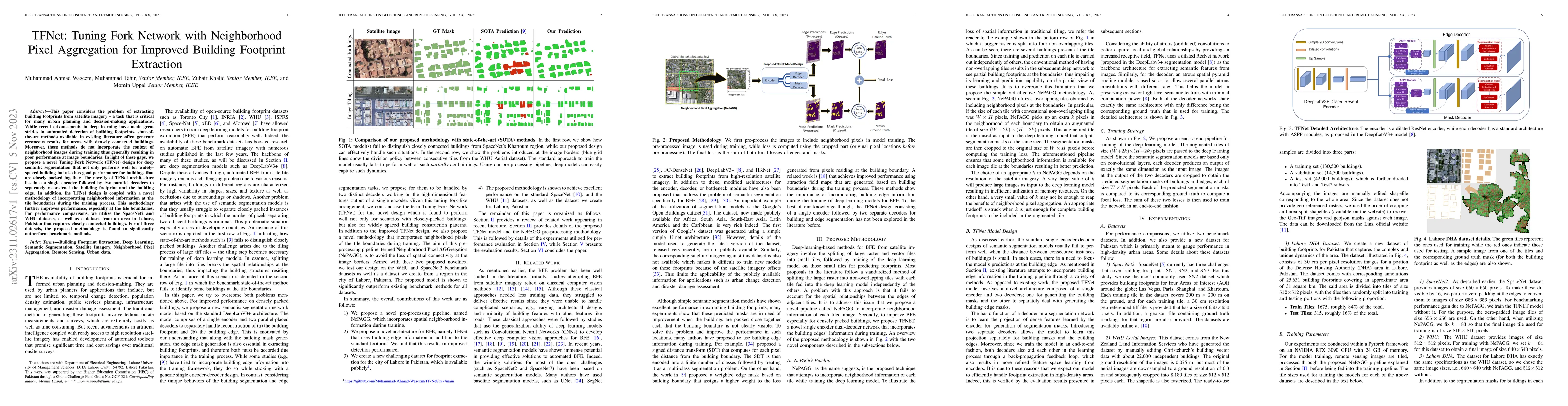
This paper considers the problem of extracting building footprints from satellite imagery -- a task that is critical for many urban planning and decision-making applications. While recent advancemen...
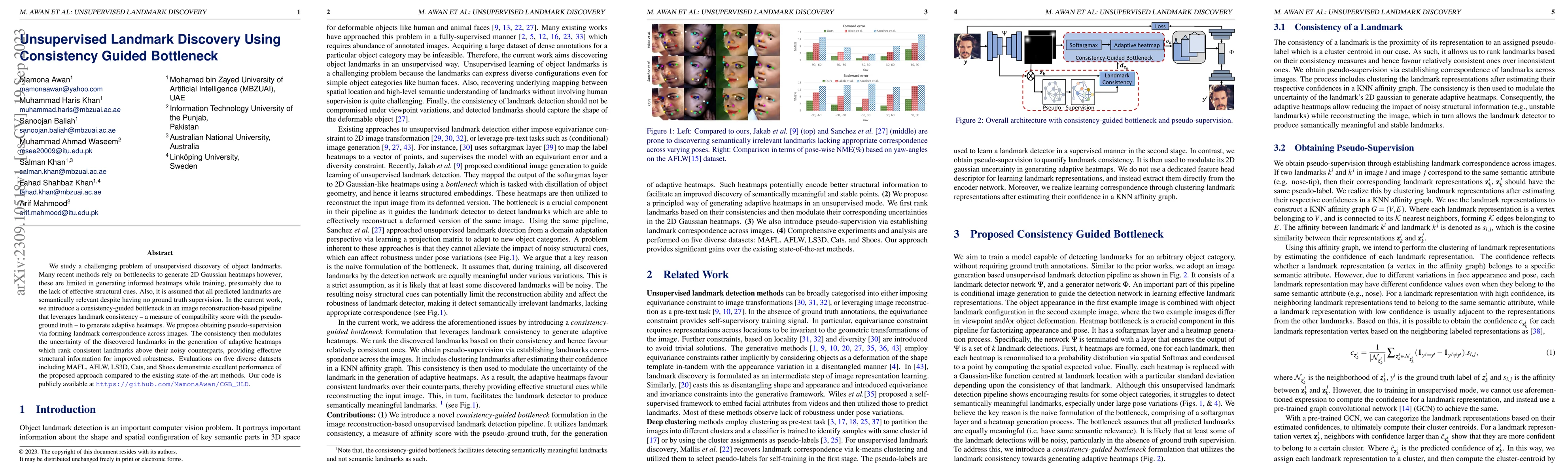
We study a challenging problem of unsupervised discovery of object landmarks. Many recent methods rely on bottlenecks to generate 2D Gaussian heatmaps however, these are limited in generating inform...
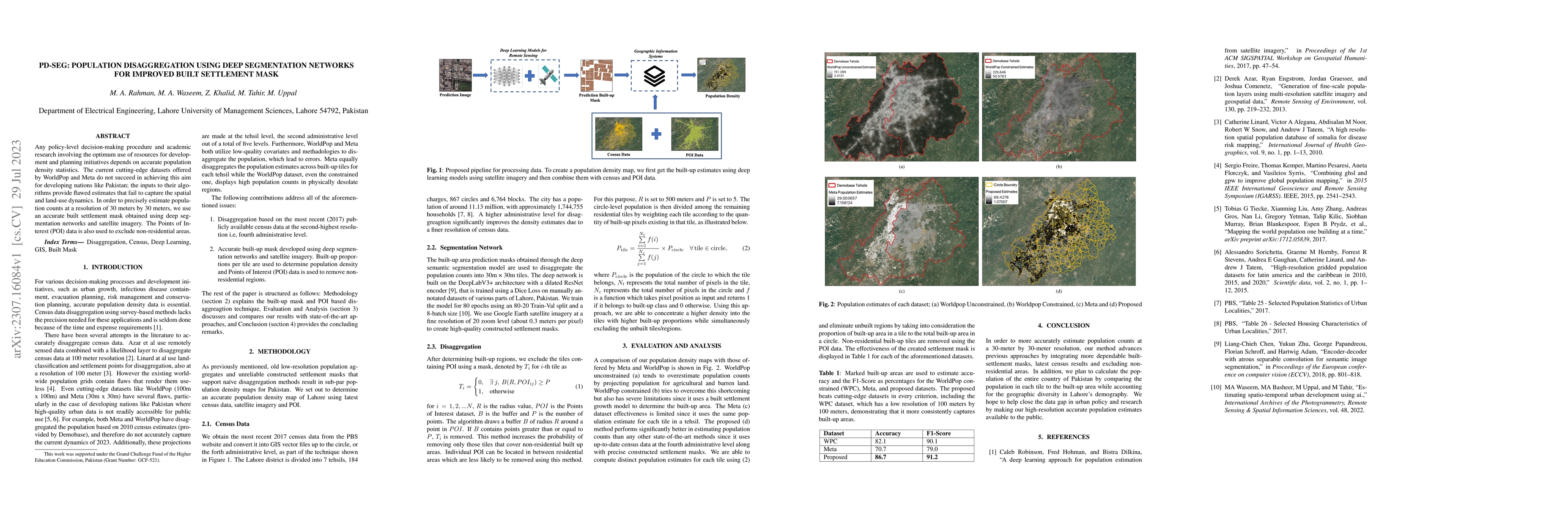
Any policy-level decision-making procedure and academic research involving the optimum use of resources for development and planning initiatives depends on accurate population density statistics. Th...
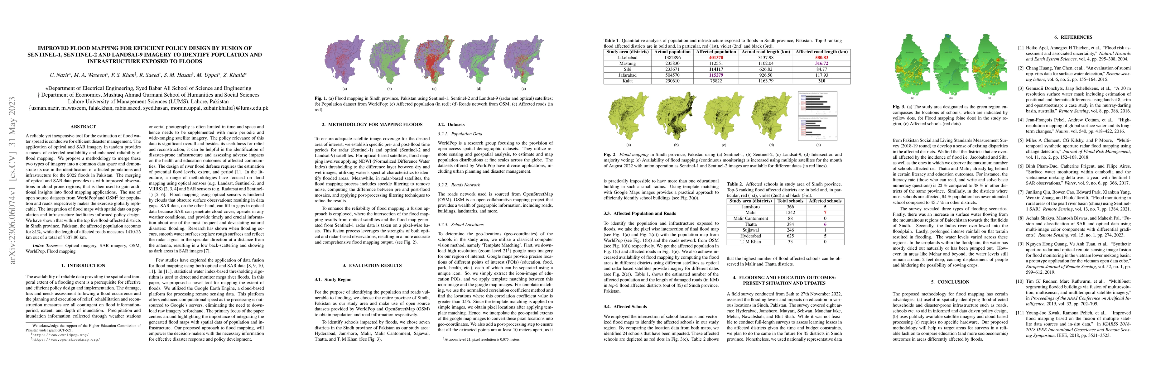
A reliable yet inexpensive tool for the estimation of flood water spread is conducive for efficient disaster management. The application of optical and SAR imagery in tandem provides a means of exte...