Academic Profile
Statistics
Similar Authors
Papers on arXiv
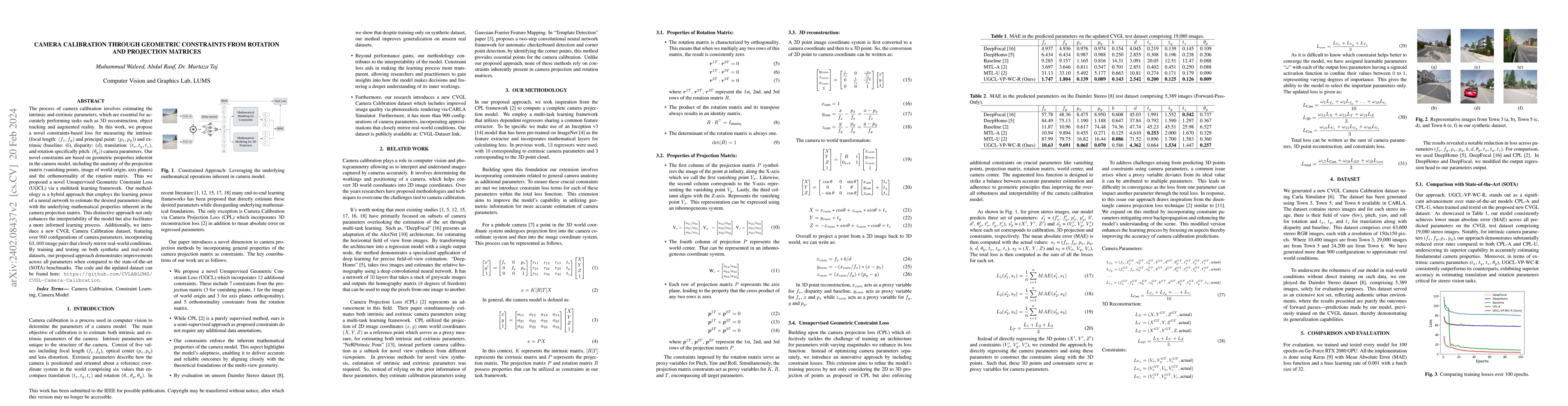
The process of camera calibration involves estimating the intrinsic and extrinsic parameters, which are essential for accurately performing tasks such as 3D reconstruction, object tracking and augme...
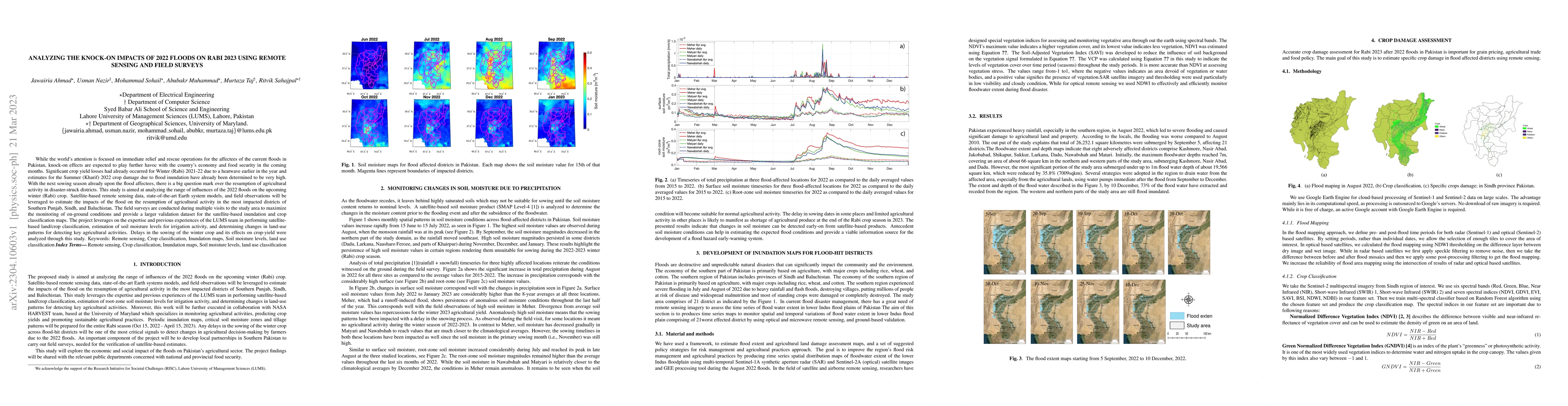
While the world's attention is focused on immediate relief and rescue operations for the affectees of the current floods in Pakistan, knock-on effects are expected to play further havoc with the cou...
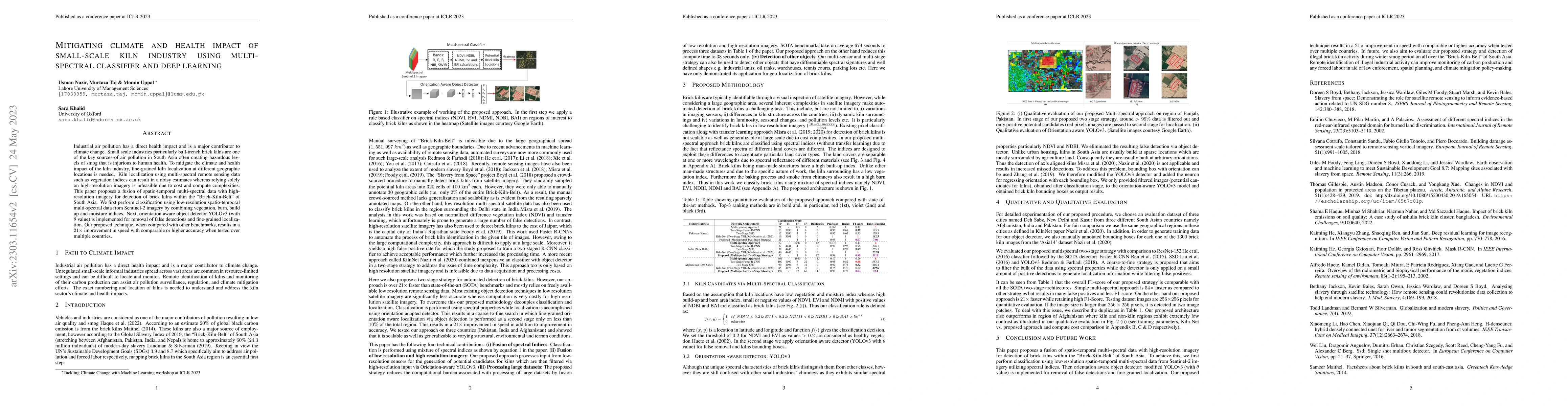
Industrial air pollution has a direct health impact and is a major contributor to climate change. Small scale industries particularly bull-trench brick kilns are one of the key sources of air pollut...
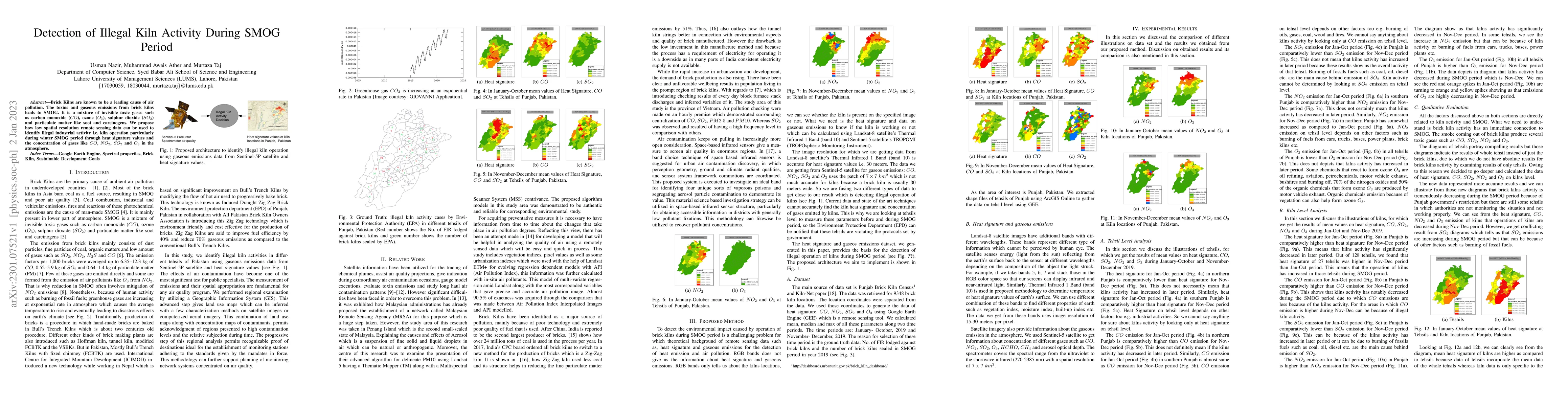
Brick Kilns are known to be a leading cause of air pollution. The toxins and gaseous emissions from brick kilns leads to SMOG. It is a mixture of invisible toxic gases such as carbon monoxide (CO), ...
For a number of tasks, such as 3D reconstruction, robotic interface, autonomous driving, etc., camera calibration is essential. In this study, we present a unique method for predicting intrinsic (pr...
Network pruning reduces the size of neural networks by removing (pruning) neurons such that the performance drop is minimal. Traditional pruning approaches focus on designing metrics to quantify the...
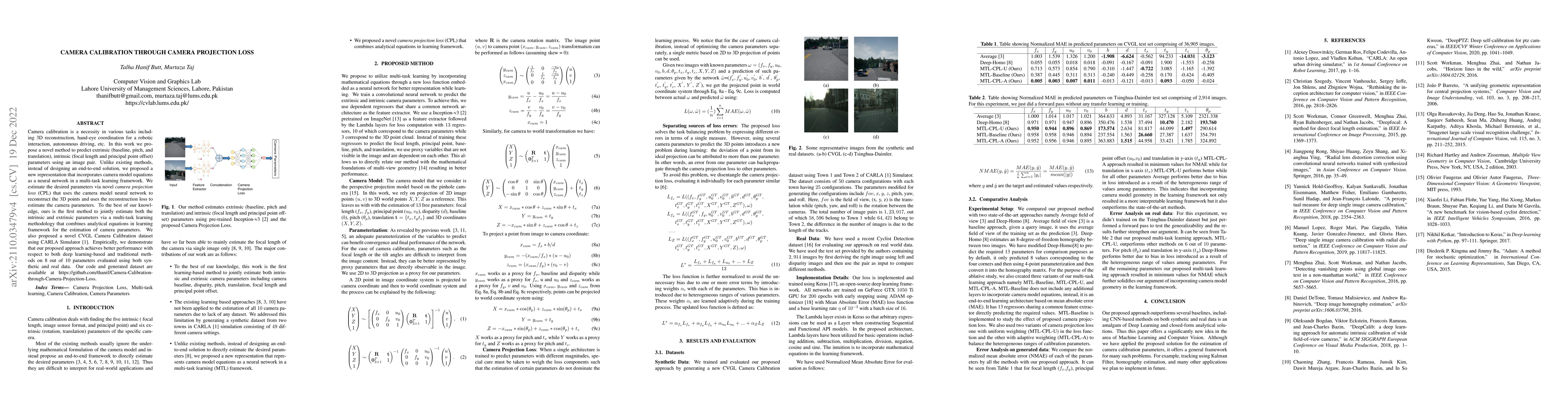
Camera calibration is a necessity in various tasks including 3D reconstruction, hand-eye coordination for a robotic interaction, autonomous driving, etc. In this work we propose a novel method to pr...
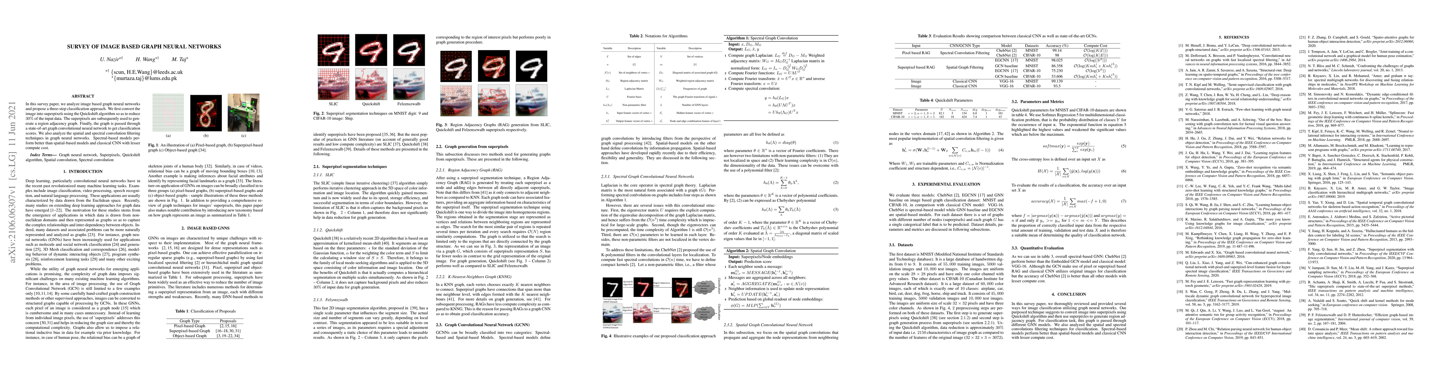
In this survey paper, we analyze image based graph neural networks and propose a three-step classification approach. We first convert the image into superpixels using the Quickshift algorithm so as ...
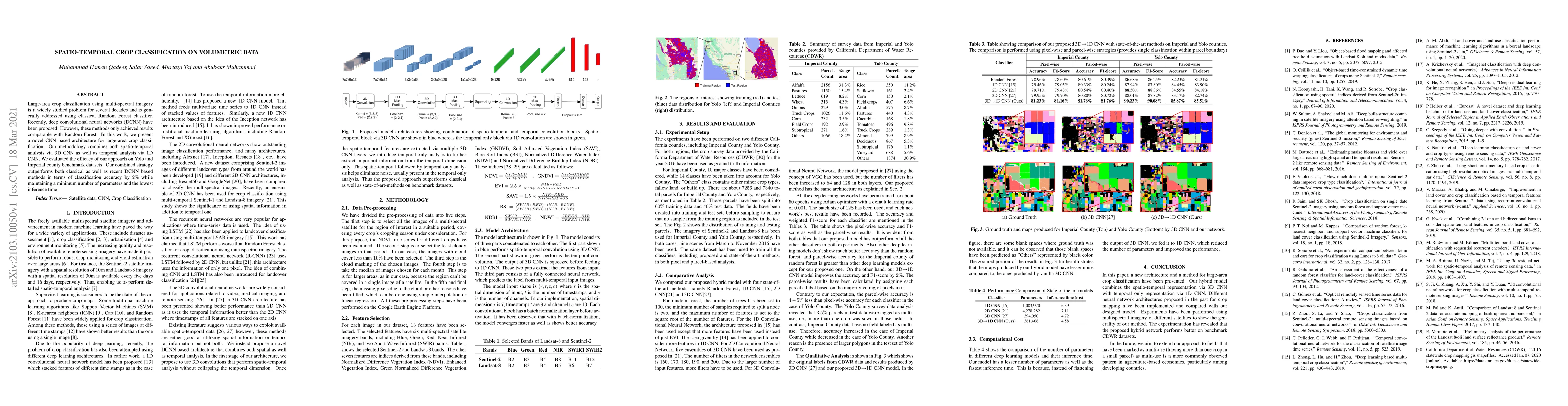
Large-area crop classification using multi-spectral imagery is a widely studied problem for several decades and is generally addressed using classical Random Forest classifier. Recently, deep convol...
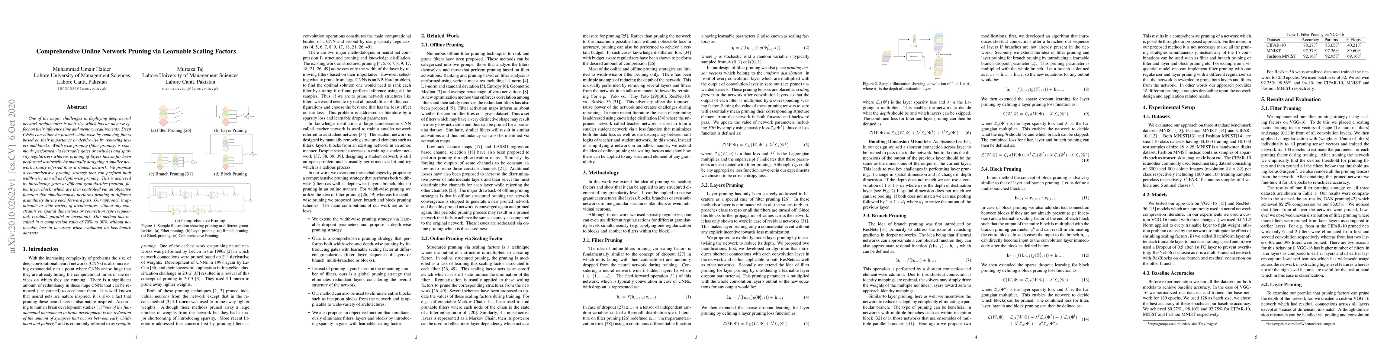
One of the major challenges in deploying deep neural network architectures is their size which has an adverse effect on their inference time and memory requirements. Deep CNNs can either be pruned w...
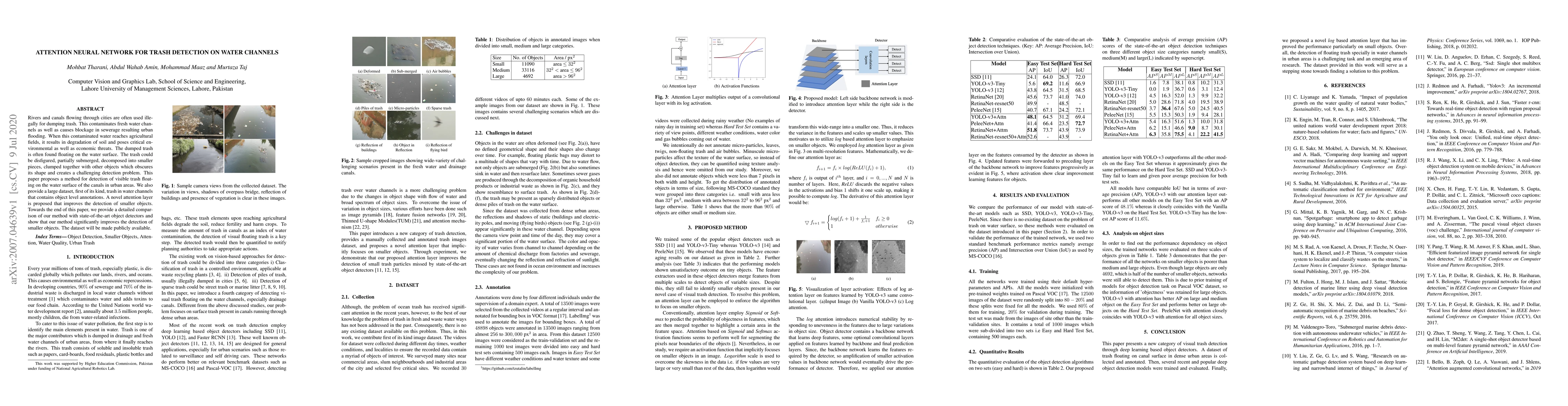
Rivers and canals flowing through cities are often used illegally for dumping the trash. This contaminates freshwater channels as well as causes blockage in sewerage resulting in urban flooding. Whe...
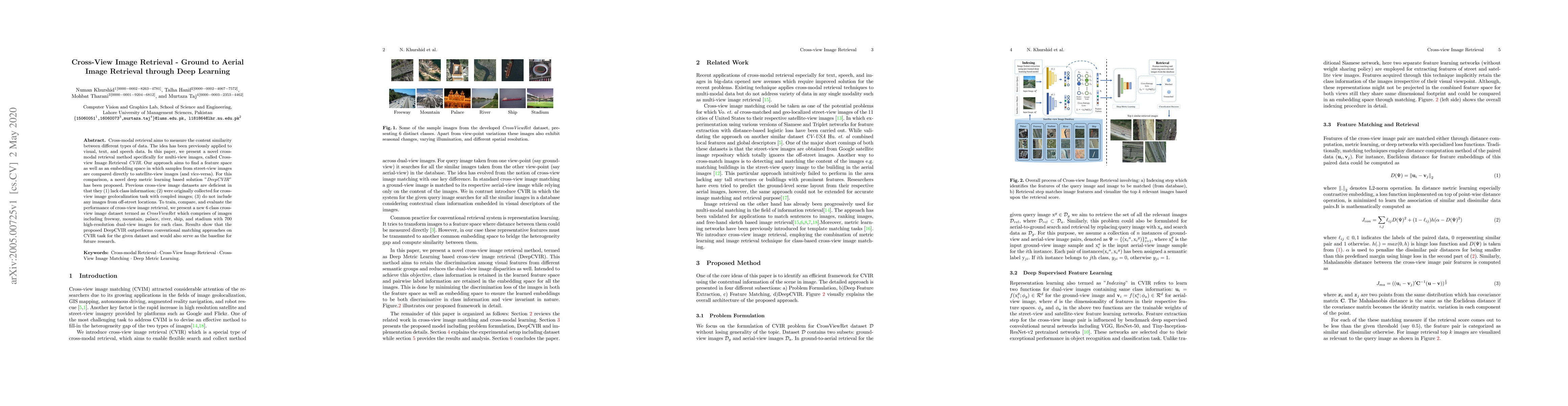
Cross-modal retrieval aims to measure the content similarity between different types of data. The idea has been previously applied to visual, text, and speech data. In this paper, we present a novel...
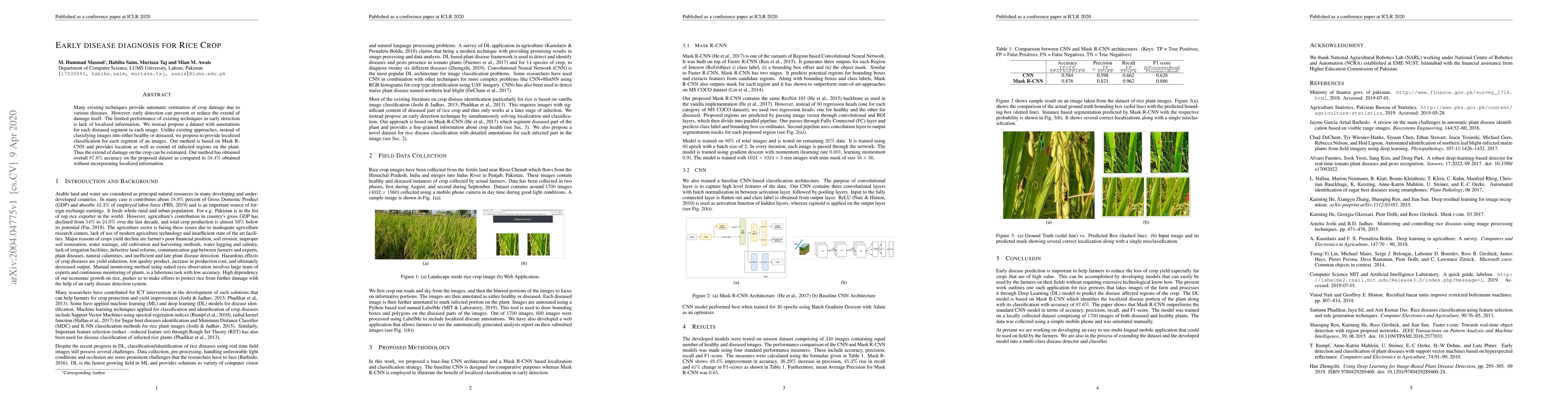
Many existing techniques provide automatic estimation of crop damage due to various diseases. However, early detection can prevent or reduce the extend of damage itself. The limited performance of e...
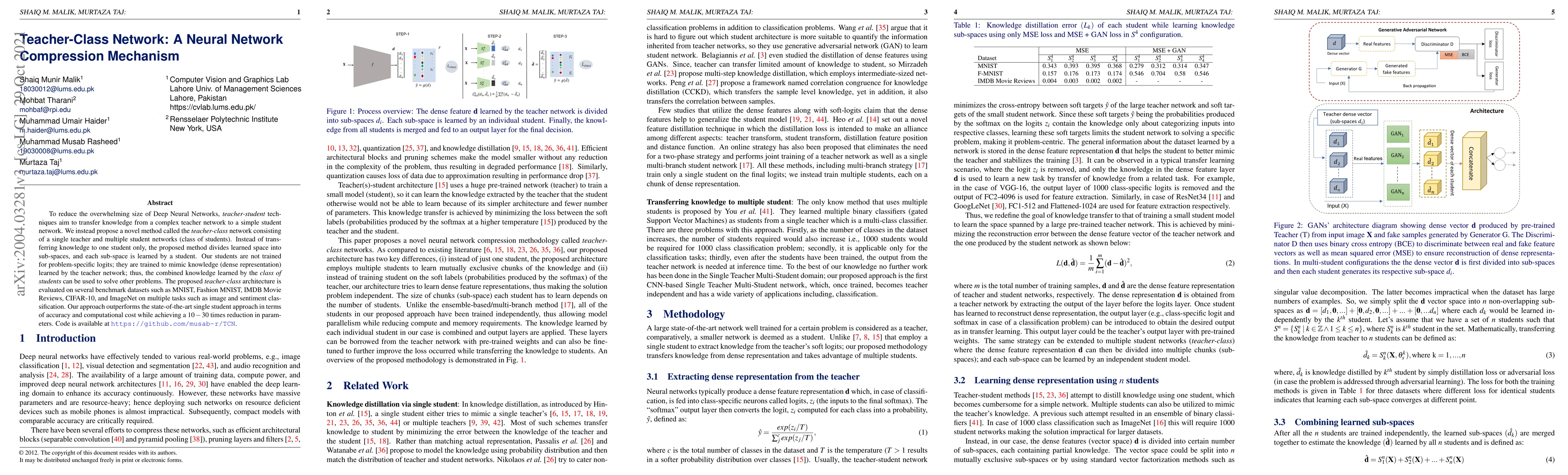
To reduce the overwhelming size of Deep Neural Networks (DNN) teacher-student methodology tries to transfer knowledge from a complex teacher network to a simple student network. We instead propose a...
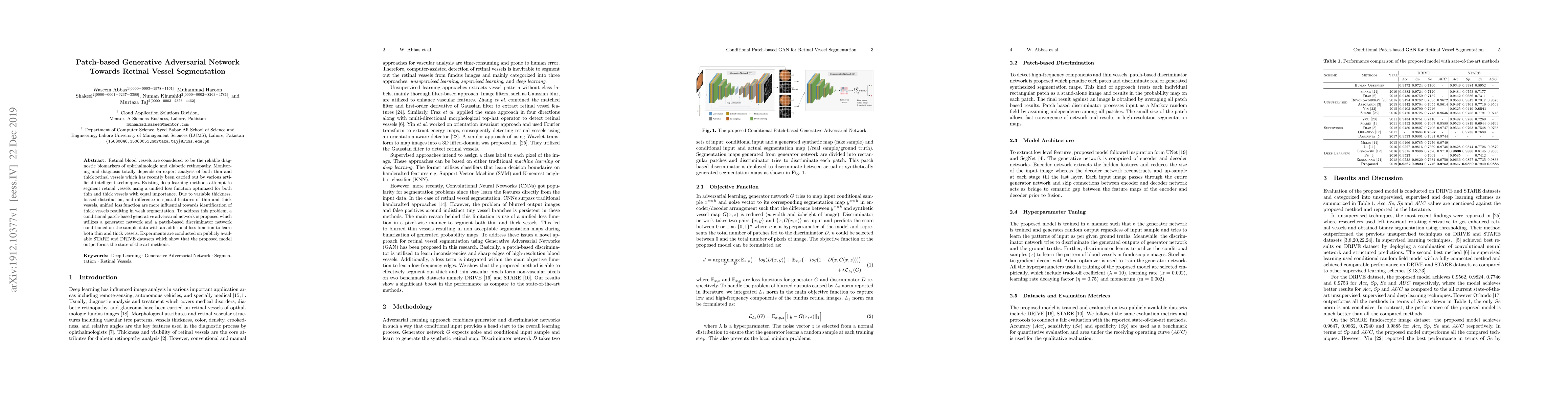
Retinal blood vessels are considered to be the reliable diagnostic biomarkers of ophthalmologic and diabetic retinopathy. Monitoring and diagnosis totally depends on expert analysis of both thin and...
The advent of deep perceptual networks brought about a paradigm shift in machine vision and image perception. Image apprehension lately carried out by hand-crafted features in the latent space have ...
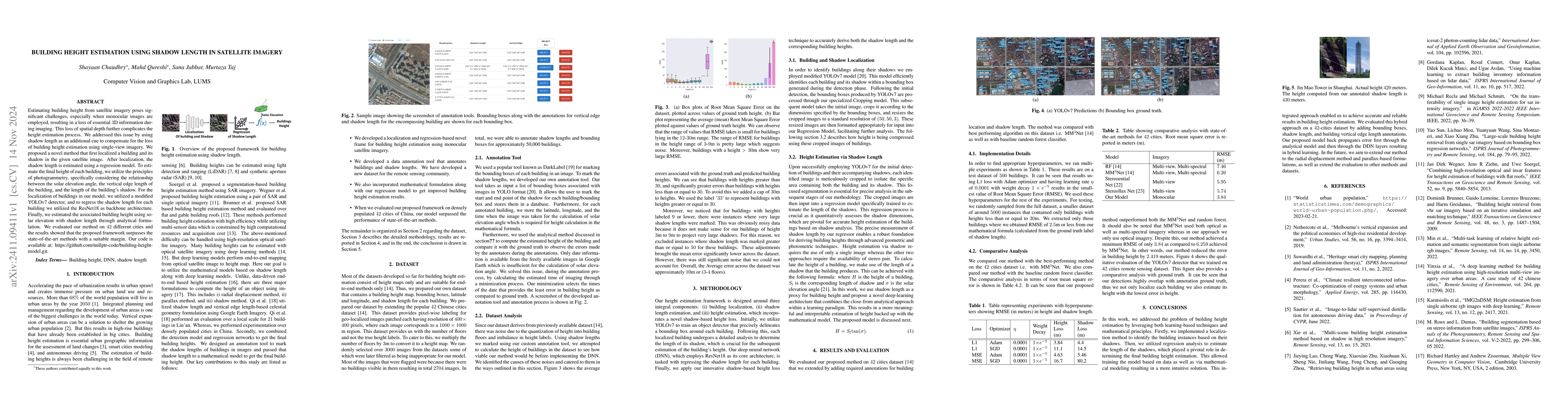
Estimating building height from satellite imagery poses significant challenges, especially when monocular images are employed, resulting in a loss of essential 3D information during imaging. This loss...
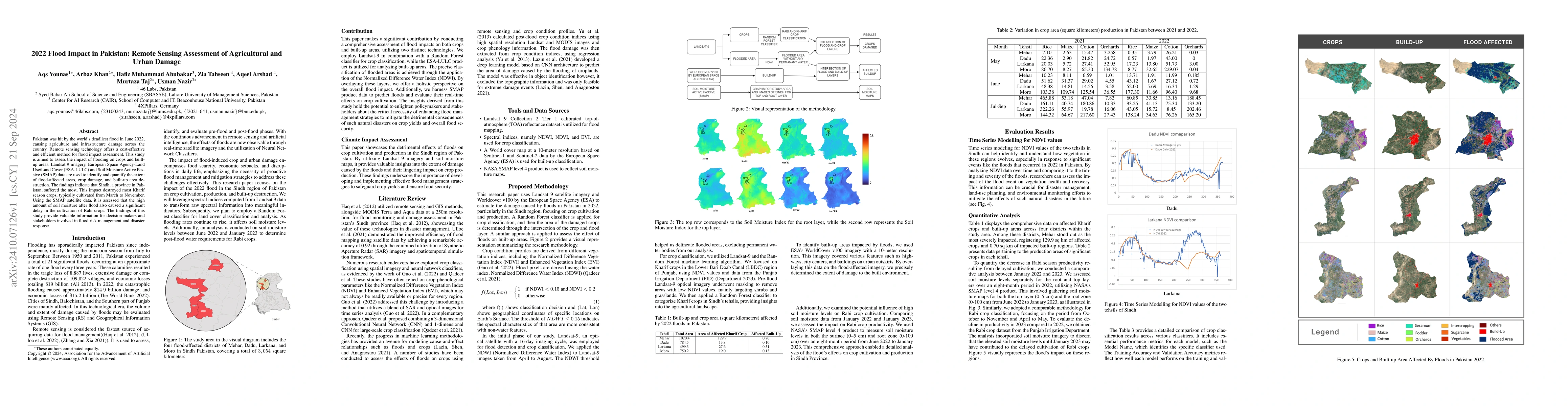
Pakistan was hit by the world's deadliest flood in June 2022, causing agriculture and infrastructure damage across the country. Remote sensing technology offers a cost-effective and efficient method f...
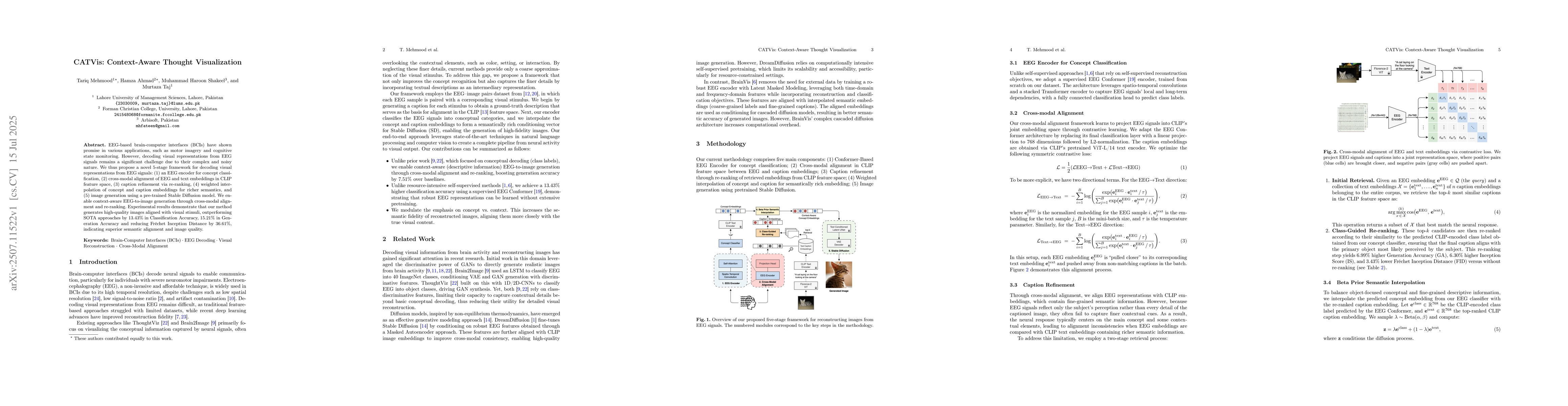
EEG-based brain-computer interfaces (BCIs) have shown promise in various applications, such as motor imagery and cognitive state monitoring. However, decoding visual representations from EEG signals r...
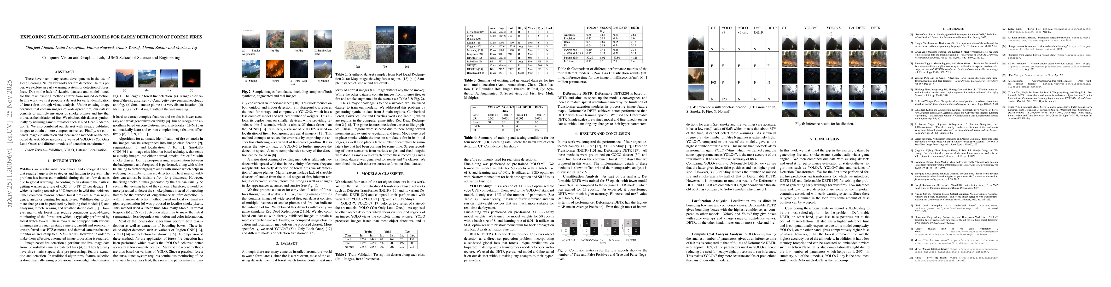
There have been many recent developments in the use of Deep Learning Neural Networks for fire detection. In this paper, we explore an early warning system for detection of forest fires. Due to the lac...
Liver fibrosis represents a significant global health burden, necessitating accurate staging for effective clinical management. This report introduces the LiQA (Liver Fibrosis Quantification and Analy...