Academic Profile
Statistics
Similar Authors
Papers on arXiv
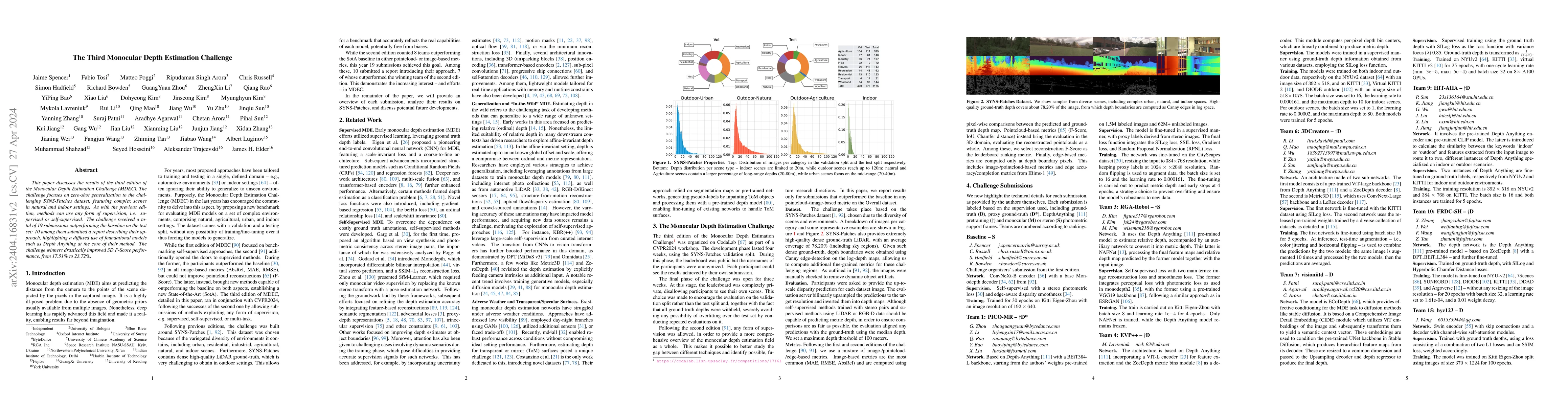
This paper discusses the results of the third edition of the Monocular Depth Estimation Challenge (MDEC). The challenge focuses on zero-shot generalization to the challenging SYNS-Patches dataset, f...
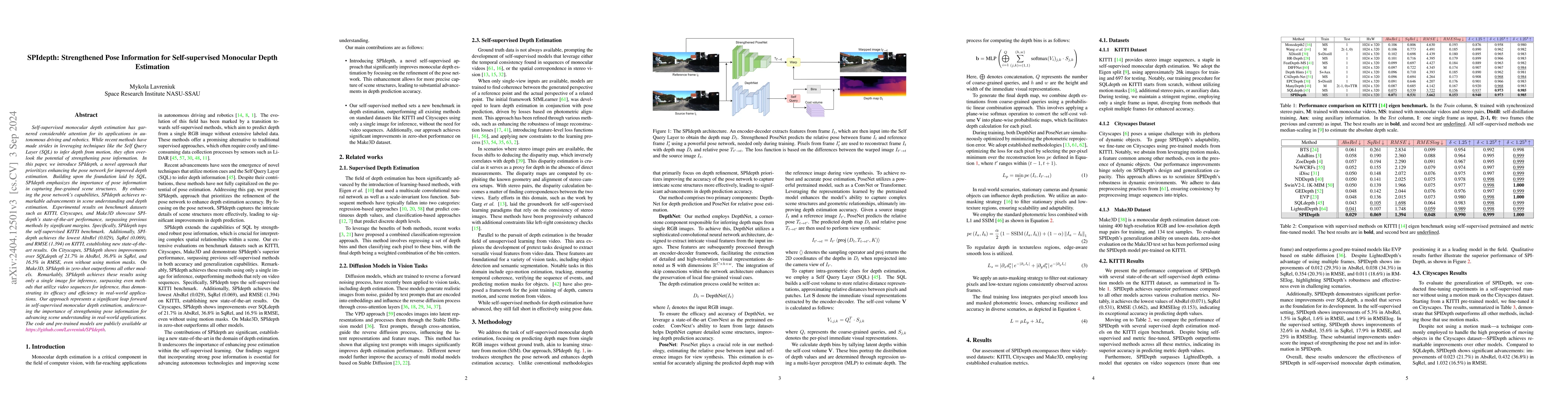
Self-supervised monocular depth estimation has garnered considerable attention for its applications in autonomous driving and robotics. While recent methods have made strides in leveraging technique...
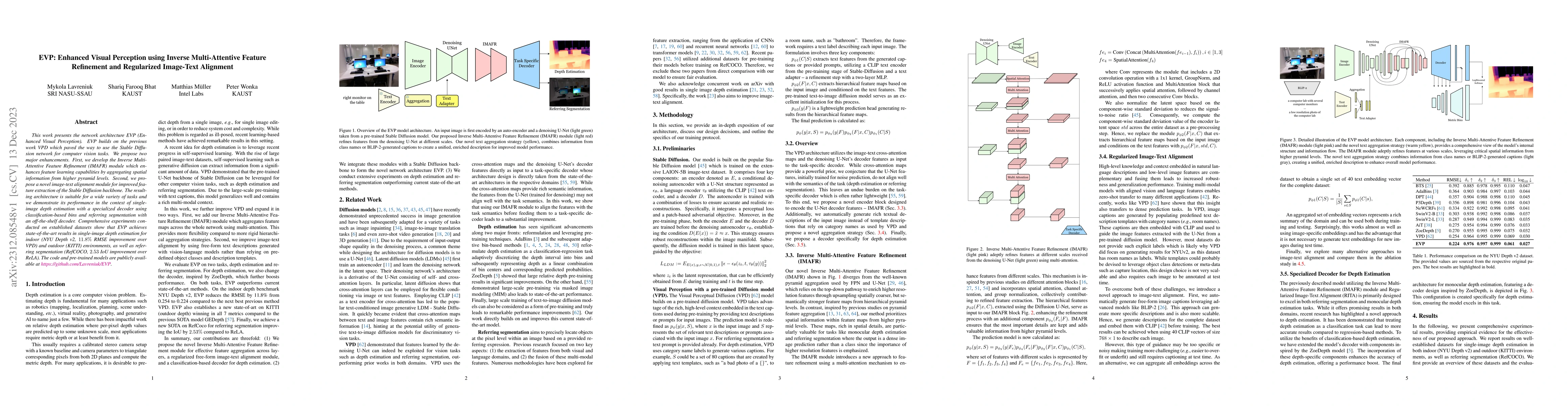
This work presents the network architecture EVP (Enhanced Visual Perception). EVP builds on the previous work VPD which paved the way to use the Stable Diffusion network for computer vision tasks. W...
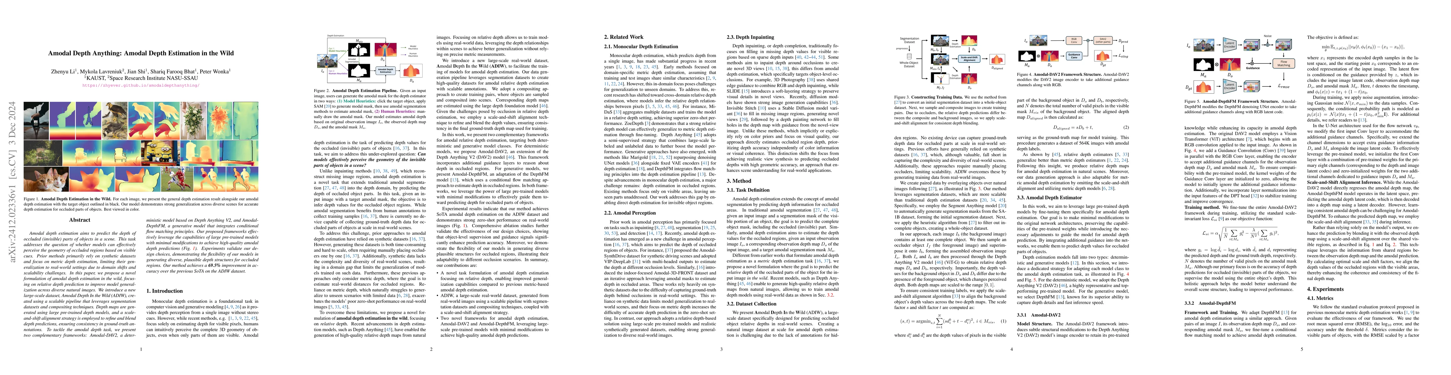
Amodal depth estimation aims to predict the depth of occluded (invisible) parts of objects in a scene. This task addresses the question of whether models can effectively perceive the geometry of occlu...
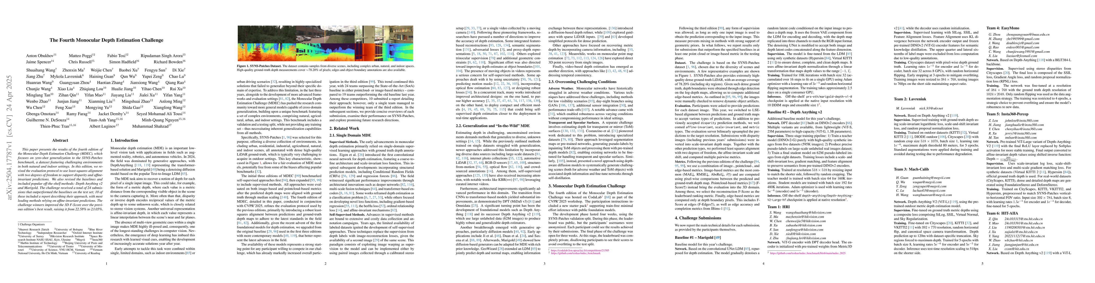
This paper presents the results of the fourth edition of the Monocular Depth Estimation Challenge (MDEC), which focuses on zero-shot generalization to the SYNS-Patches benchmark, a dataset featuring c...
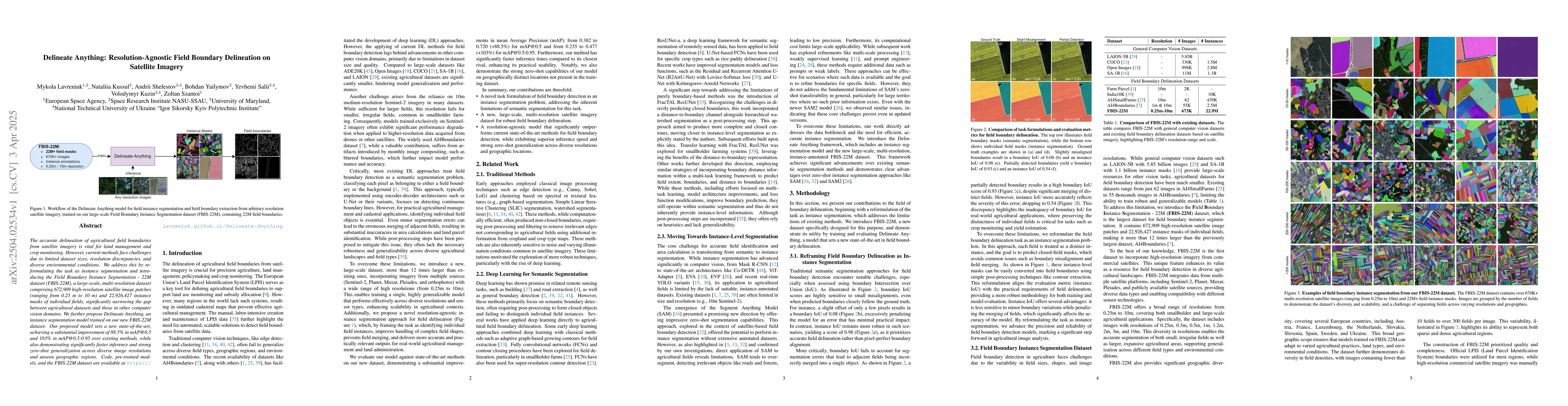
The accurate delineation of agricultural field boundaries from satellite imagery is vital for land management and crop monitoring. However, current methods face challenges due to limited dataset sizes...
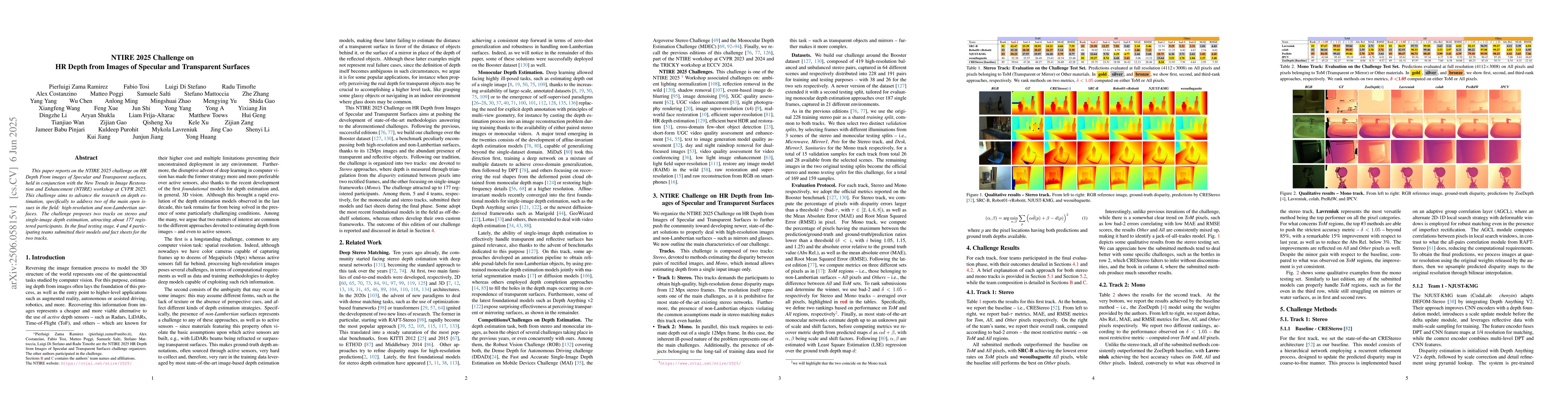
This paper reports on the NTIRE 2025 challenge on HR Depth From images of Specular and Transparent surfaces, held in conjunction with the New Trends in Image Restoration and Enhancement (NTIRE) worksh...
Accurate delineation of agricultural field boundaries from satellite imagery is essential for land management and crop monitoring, yet existing methods often produce incomplete boundaries, merge adjac...
Joint estimation of surface normals and depth is essential for holistic 3D scene understanding, yet high-resolution prediction remains difficult due to the trade-off between preserving fine local deta...