Academic Profile
Statistics
Similar Authors
Papers on arXiv
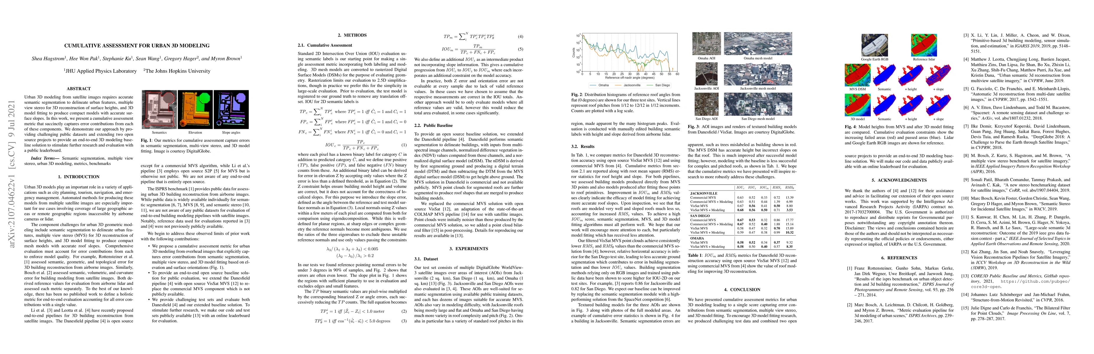
Urban 3D modeling from satellite images requires accurate semantic segmentation to delineate urban features, multiple view stereo for 3D reconstruction of surface heights, and 3D model fitting to pr...
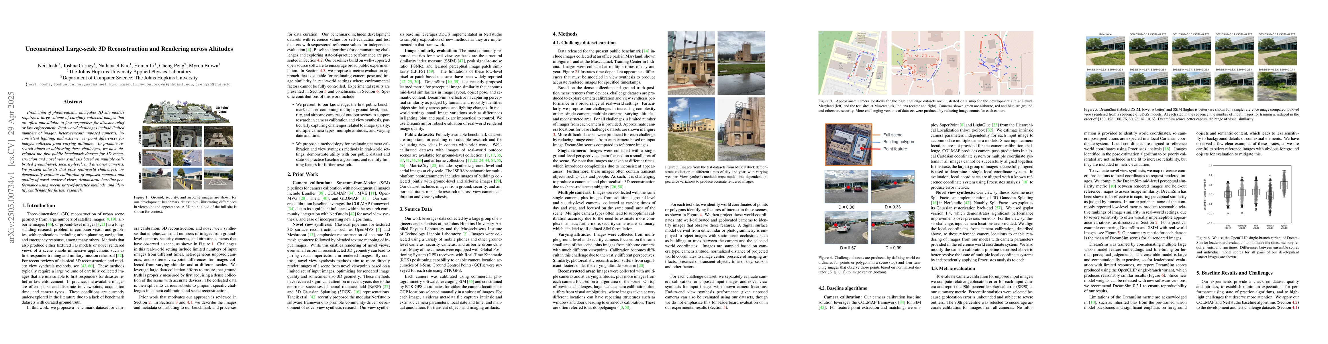
Production of photorealistic, navigable 3D site models requires a large volume of carefully collected images that are often unavailable to first responders for disaster relief or law enforcement. Real...
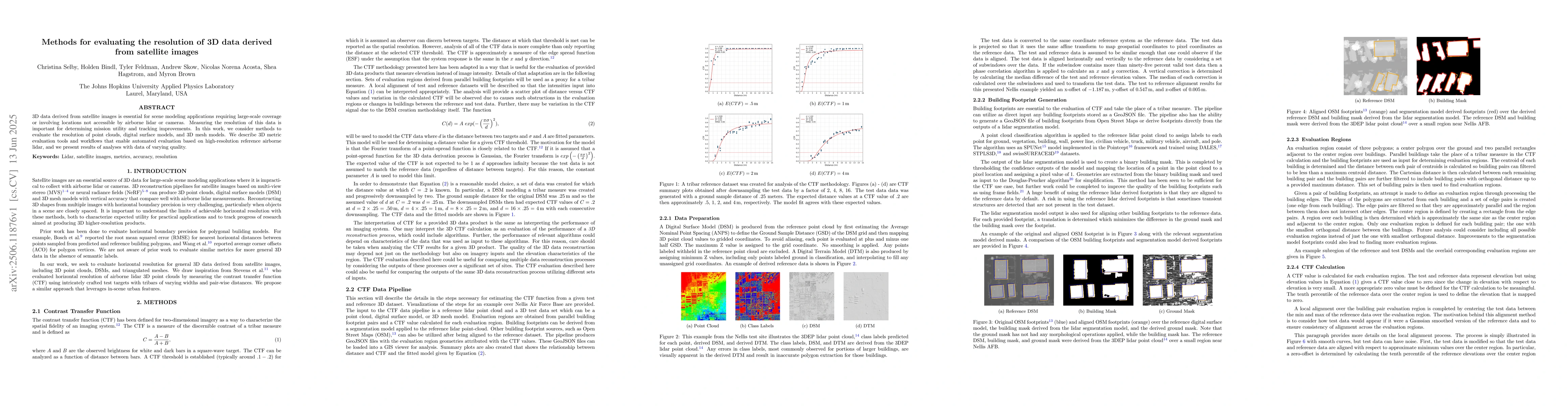
3D data derived from satellite images is essential for scene modeling applications requiring large-scale coverage or involving locations not accessible by airborne lidar or cameras. Measuring the reso...