Academic Profile
Statistics
Similar Authors
Papers on arXiv
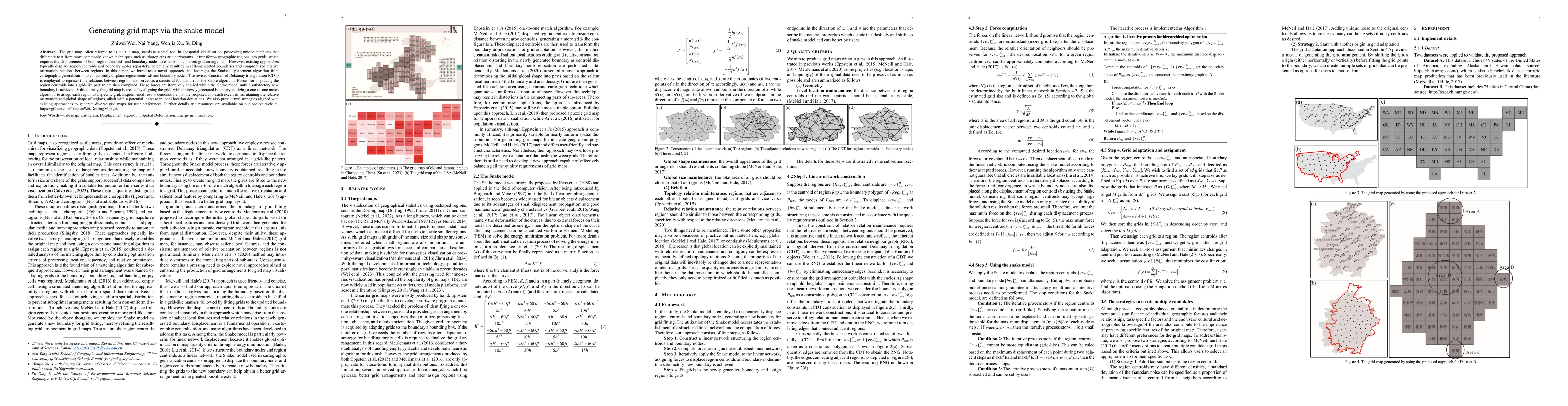
The grid map, often referred to as the tile map, stands as a vital tool in geospatial visualization, possessing unique attributes that differentiate it from more commonly known techniques such as ch...
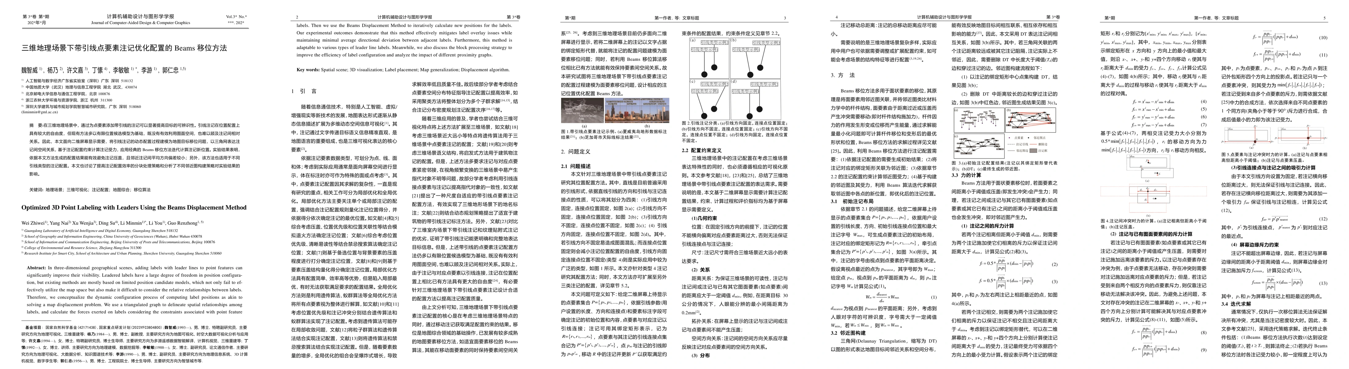
In three-dimensional geographical scenes, adding labels with leader lines to point features can significantly improve their visibility. Leadered labels have a large degree of freedom in position con-f...
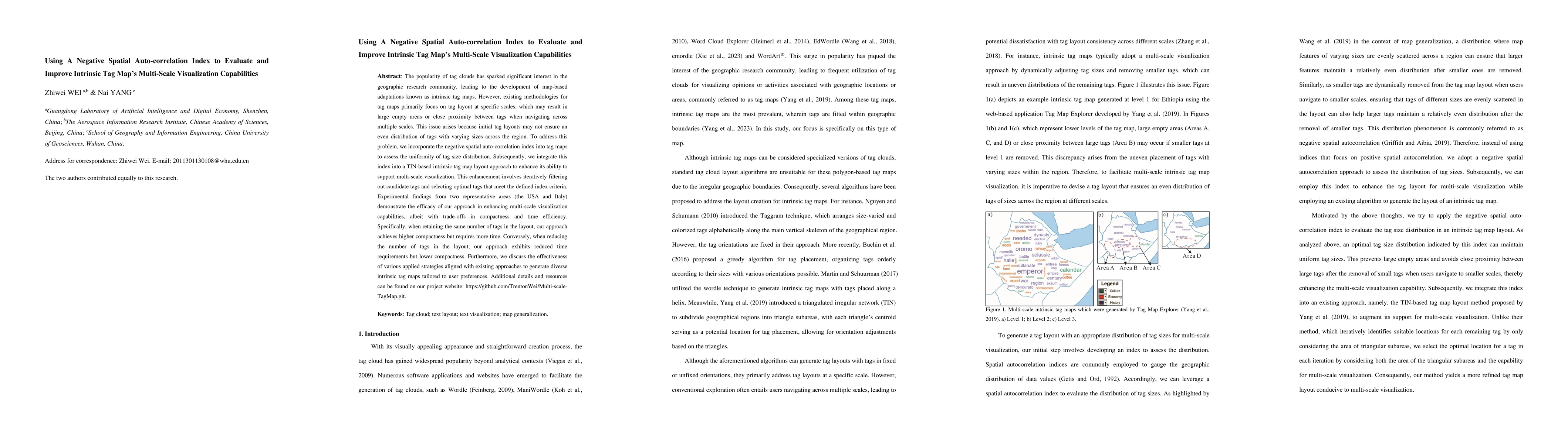
The popularity of tag clouds has sparked significant interest in the geographic research community, leading to the development of map-based adaptations known as intrinsic tag maps. However, existing m...
Choropleth maps, which utilize color schemes to visualize spatial patterns and trends, are simple yet effective tools for geographic data analysis. As such, color scheme design is a critical aspect of...
Understanding urban perception from street view imagery has become a central topic in urban analytics and human centered urban design. However, most existing studies treat urban scenes as static and l...
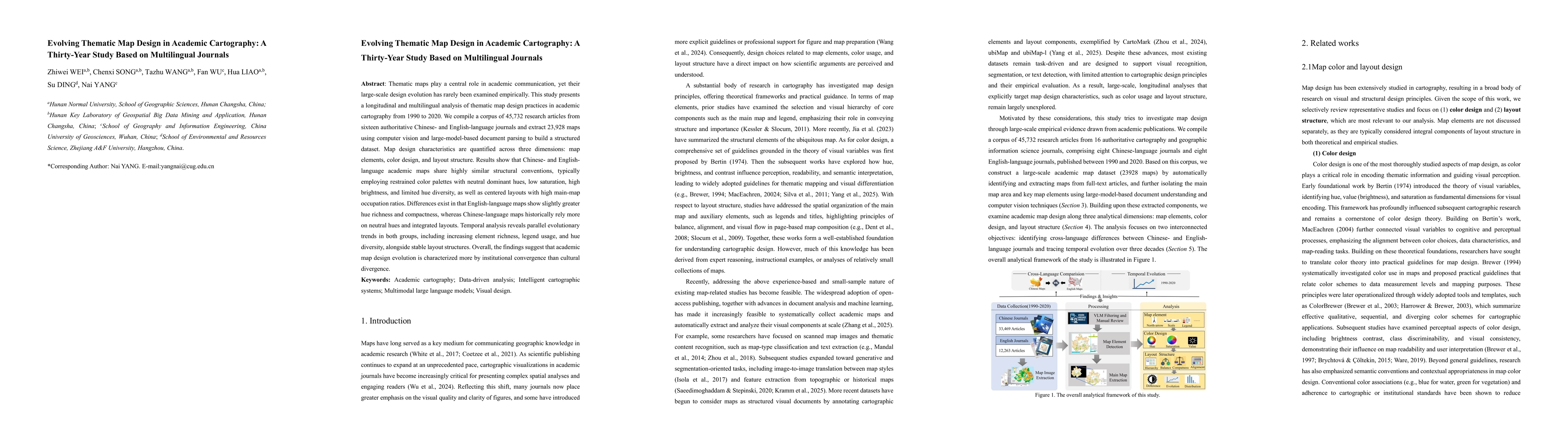
Thematic maps play a central role in academic communication, yet their large-scale design evolution has rarely been examined empirically. This study presents a longitudinal and multilingual analysis o...