Academic Profile
Statistics
Similar Authors
Papers on arXiv
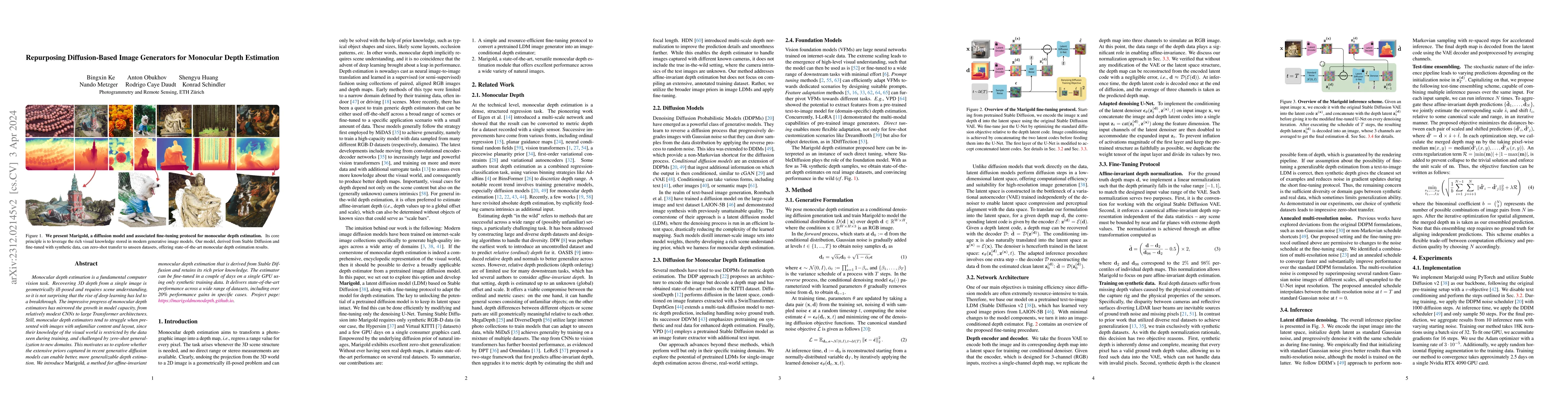
Monocular depth estimation is a fundamental computer vision task. Recovering 3D depth from a single image is geometrically ill-posed and requires scene understanding, so it is not surprising that th...
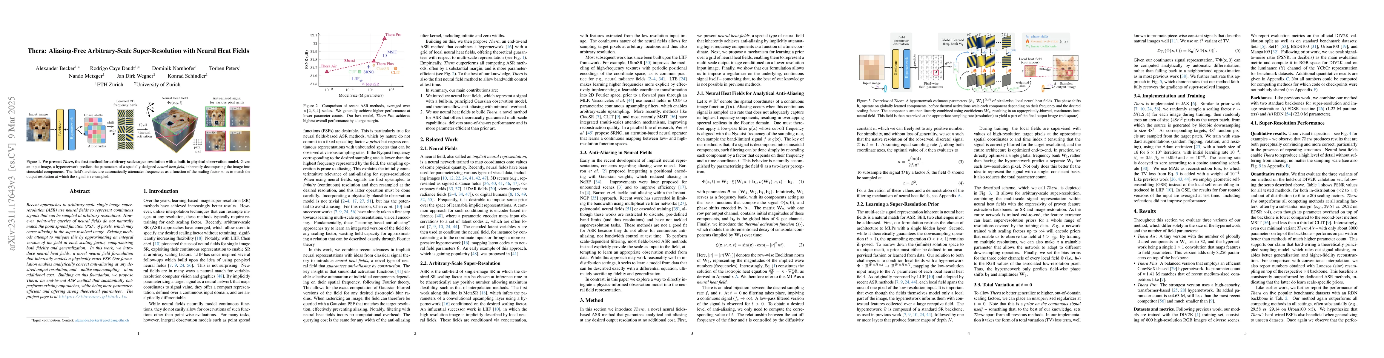
Recent approaches for arbitrary-scale single image super-resolution (ASSR) have used local neural fields to represent continuous signals that can be sampled at arbitrary rates. However, the point-wi...
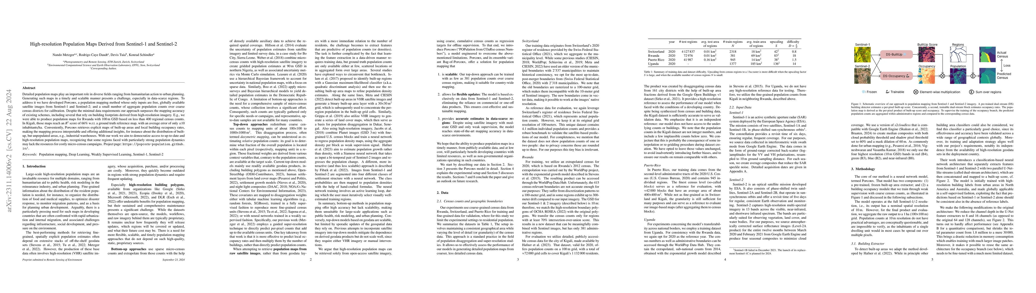
Detailed population maps play an important role in diverse fields ranging from humanitarian action to urban planning. Generating such maps in a timely and scalable manner presents a challenge, espec...
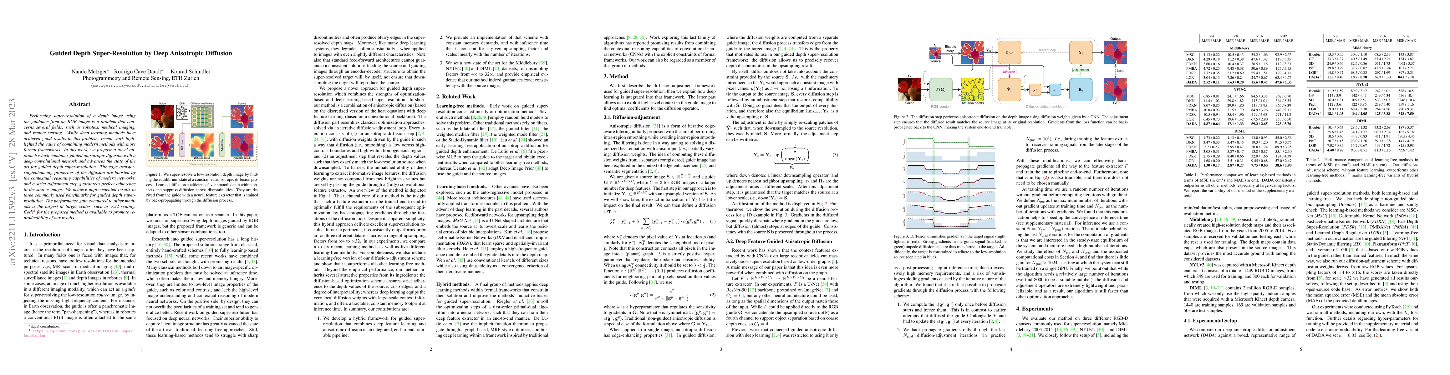
Performing super-resolution of a depth image using the guidance from an RGB image is a problem that concerns several fields, such as robotics, medical imaging, and remote sensing. While deep learnin...
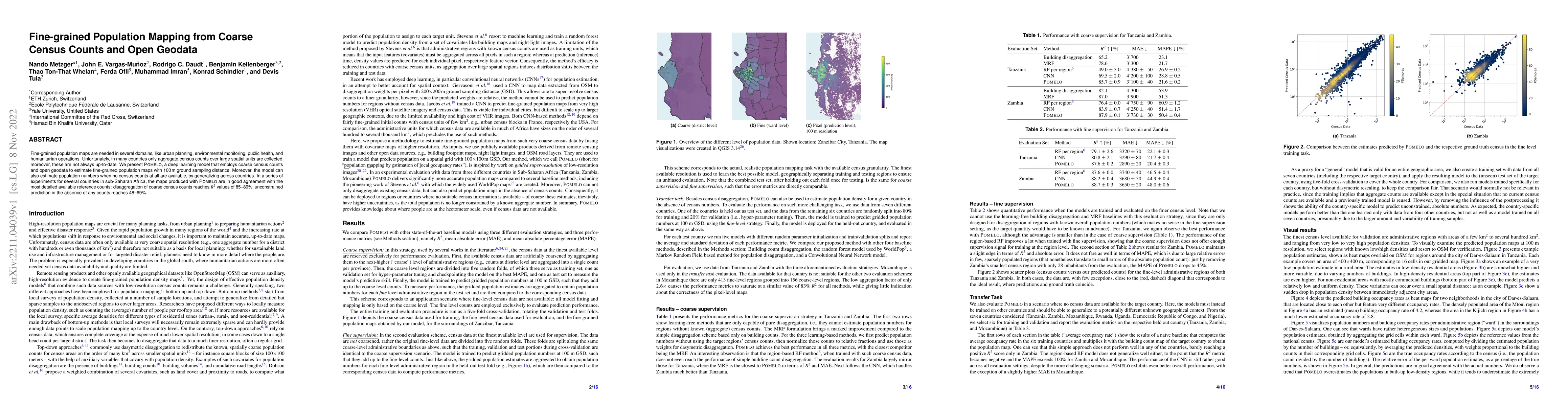
Fine-grained population maps are needed in several domains, like urban planning, environmental monitoring, public health, and humanitarian operations. Unfortunately, in many countries only aggregate...
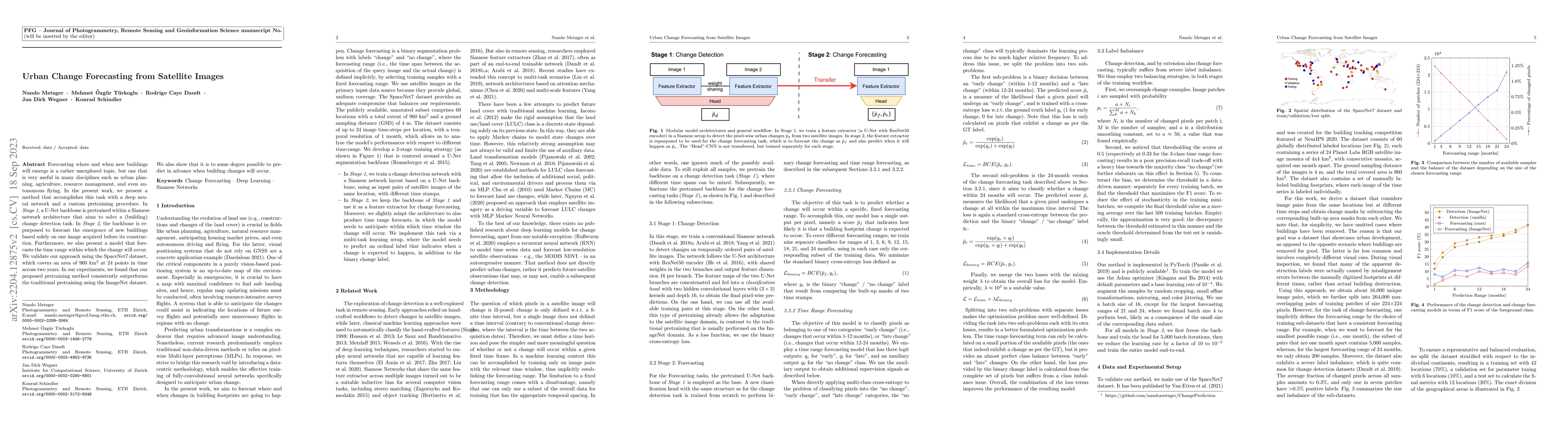
Forecasting where and when new buildings will emerge is a rather unexplored topic, but one that is very useful in many disciplines such as urban planning, agriculture, resource management, and even ...
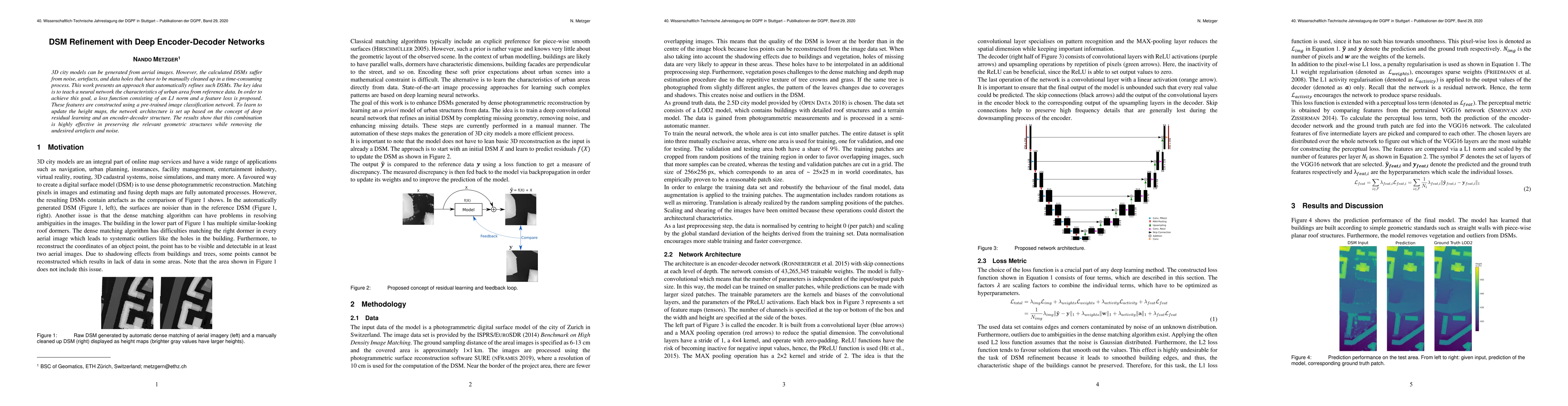
3D city models can be generated from aerial images. However, the calculated DSMs suffer from noise, artefacts, and data holes that have to be manually cleaned up in a time-consuming process. This wo...
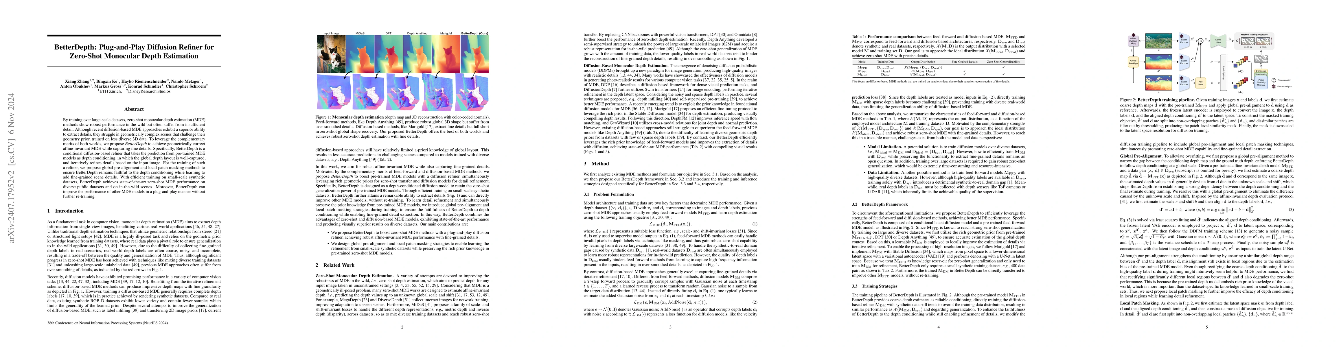
By training over large-scale datasets, zero-shot monocular depth estimation (MDE) methods show robust performance in the wild but often suffer from insufficiently precise details. Although recent diff...
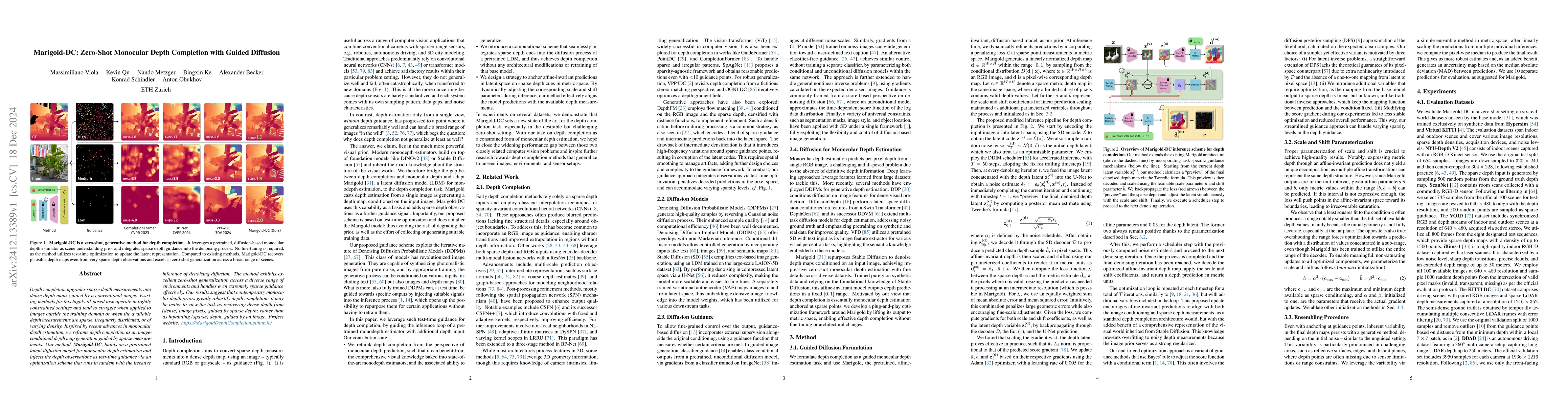
Depth completion upgrades sparse depth measurements into dense depth maps guided by a conventional image. Existing methods for this highly ill-posed task operate in tightly constrained settings and te...
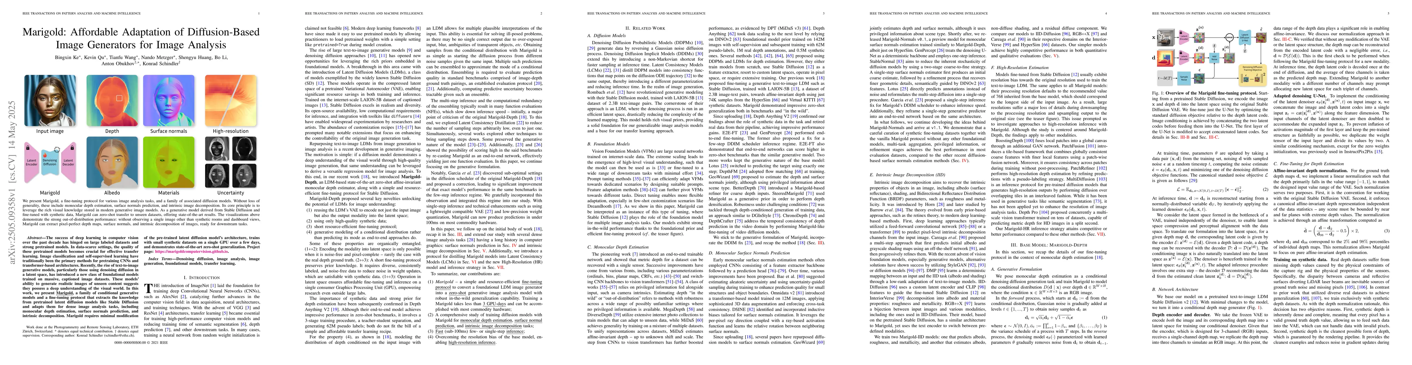
The success of deep learning in computer vision over the past decade has hinged on large labeled datasets and strong pretrained models. In data-scarce settings, the quality of these pretrained models ...
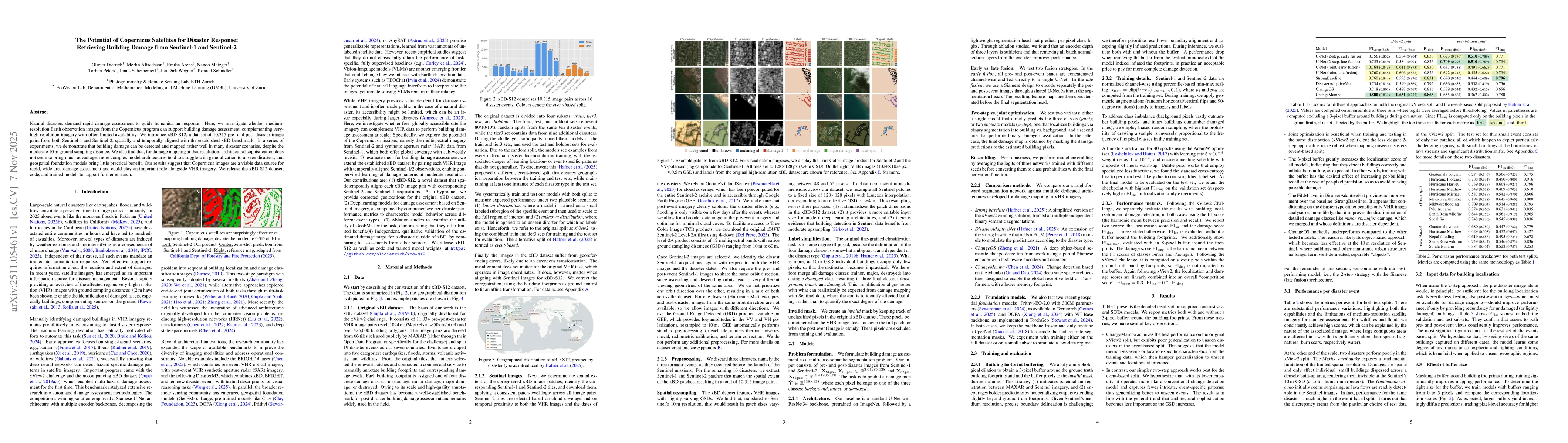
Natural disasters demand rapid damage assessment to guide humanitarian response. Here, we investigate whether medium-resolution Earth observation images from the Copernicus program can support buildin...
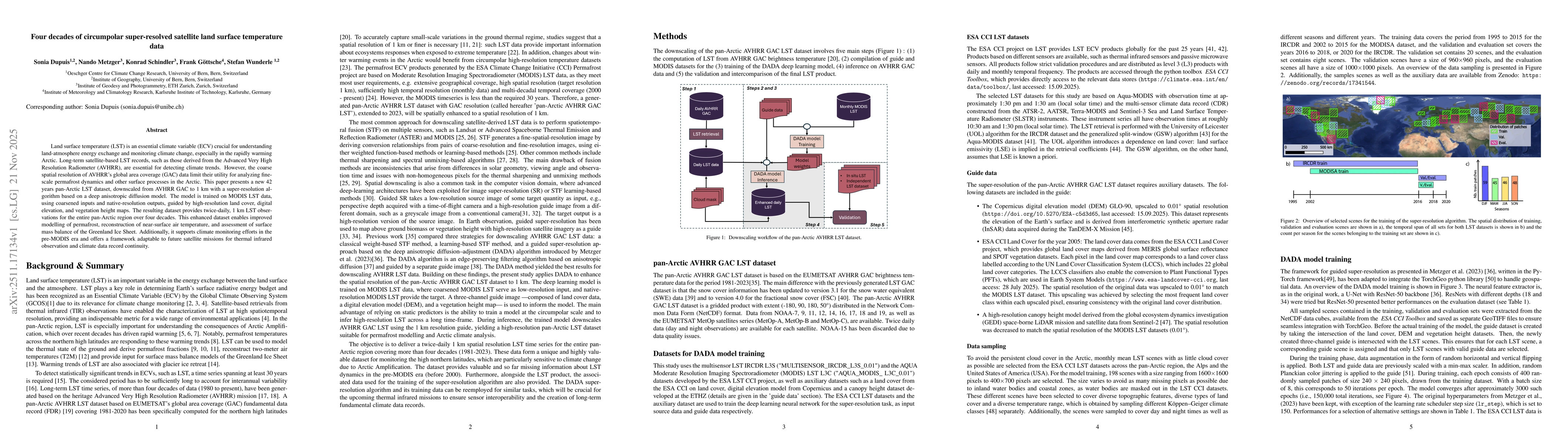
Land surface temperature (LST) is an essential climate variable (ECV) crucial for understanding land-atmosphere energy exchange and monitoring climate change, especially in the rapidly warming Arctic....
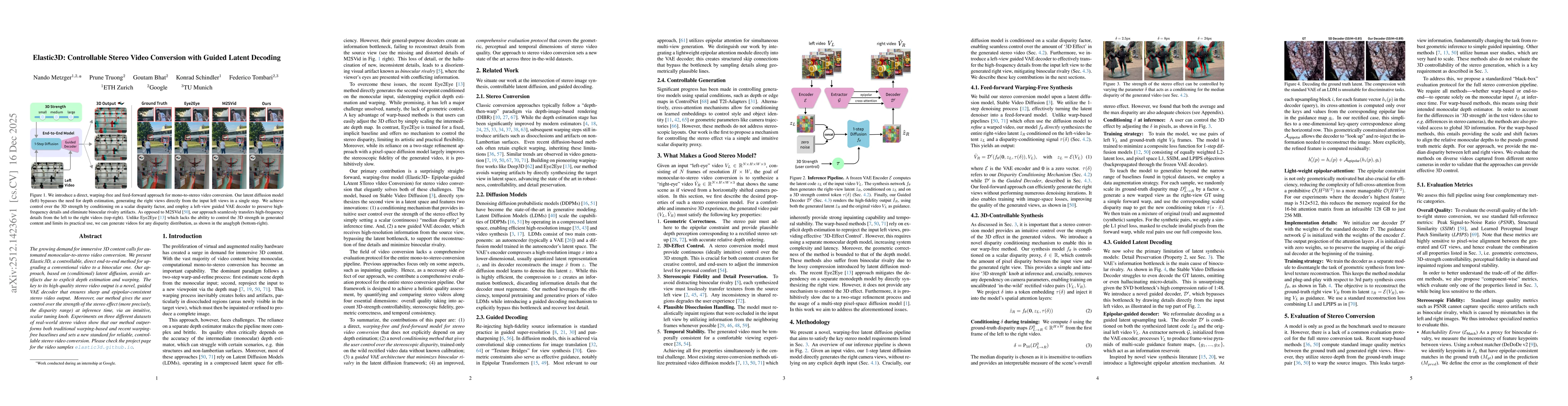
The growing demand for immersive 3D content calls for automated monocular-to-stereo video conversion. We present Elastic3D, a controllable, direct end-to-end method for upgrading a conventional video ...
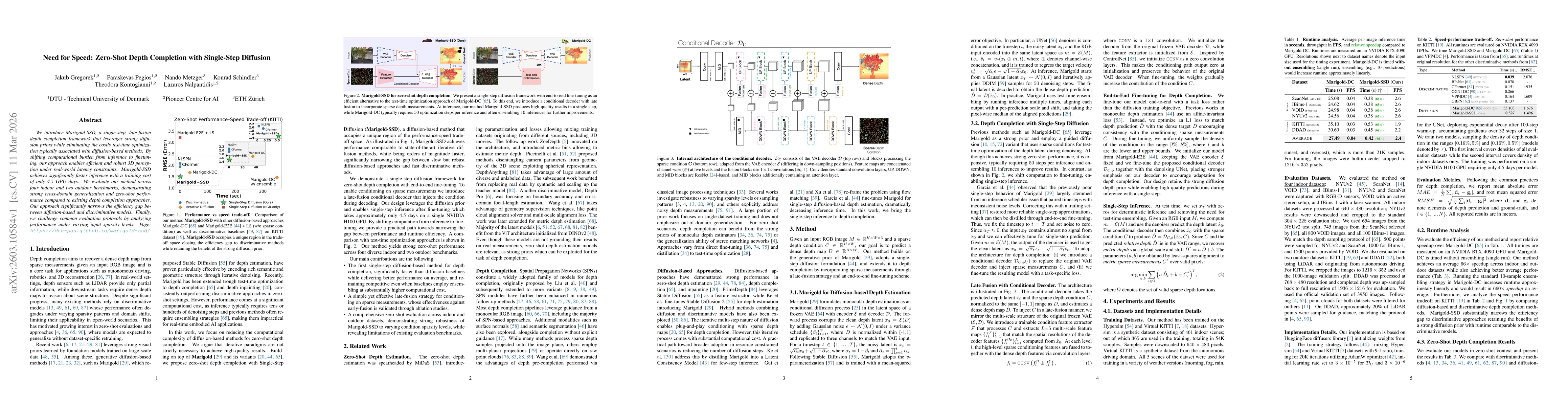
We introduce Marigold-SSD, a single-step, late-fusion depth completion framework that leverages strong diffusion priors while eliminating the costly test-time optimization typically associated with di...
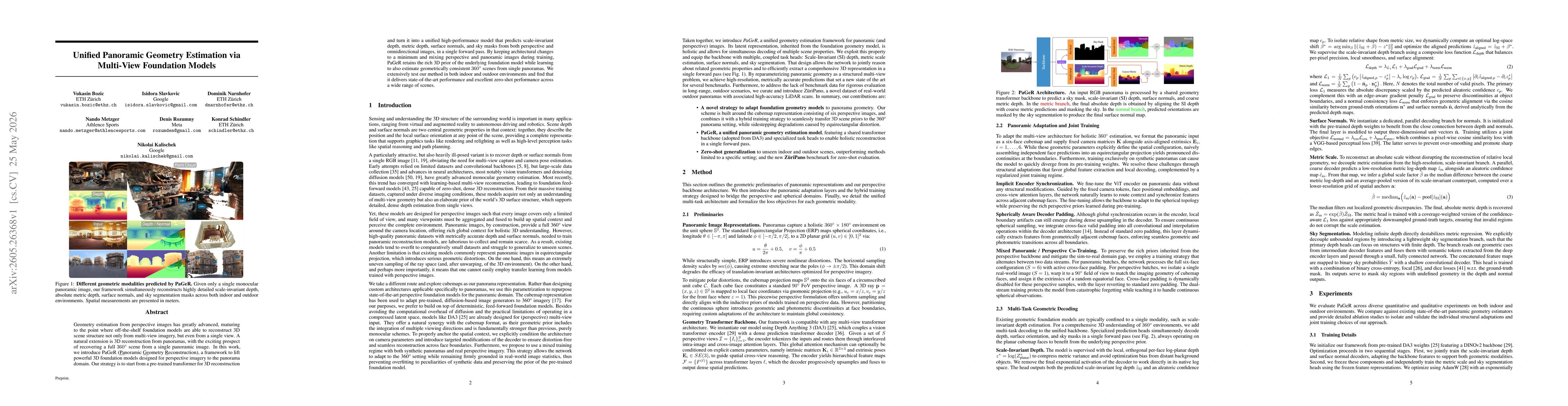
Geometry estimation from perspective images has greatly advanced, maturing to the point where off-the-shelf foundation models are able to reconstruct 3D scene structure not only from multi-view imager...