Academic Profile
Statistics
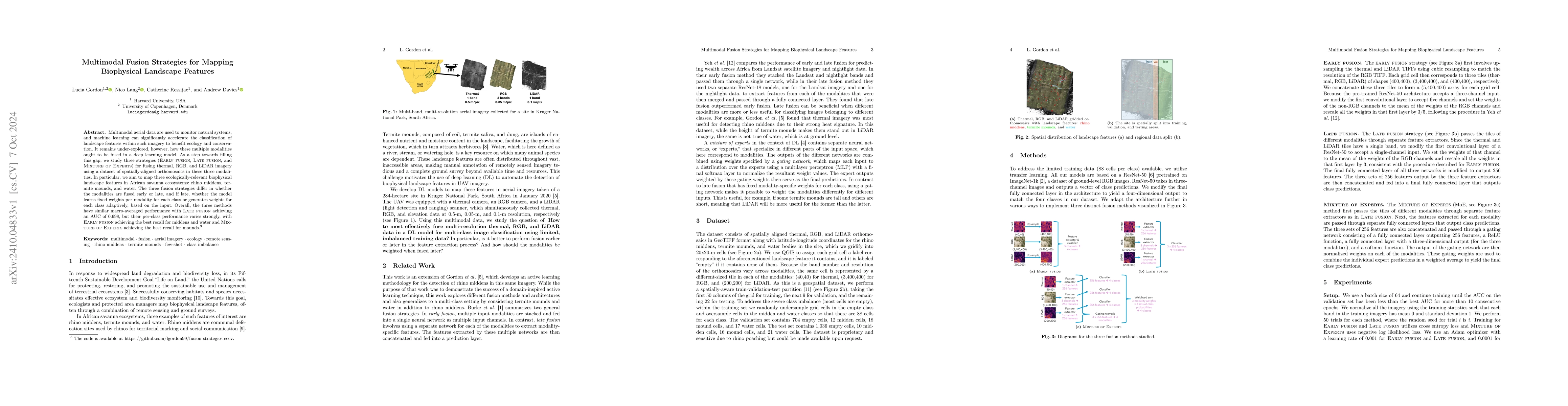
Similar Authors
Papers on arXiv
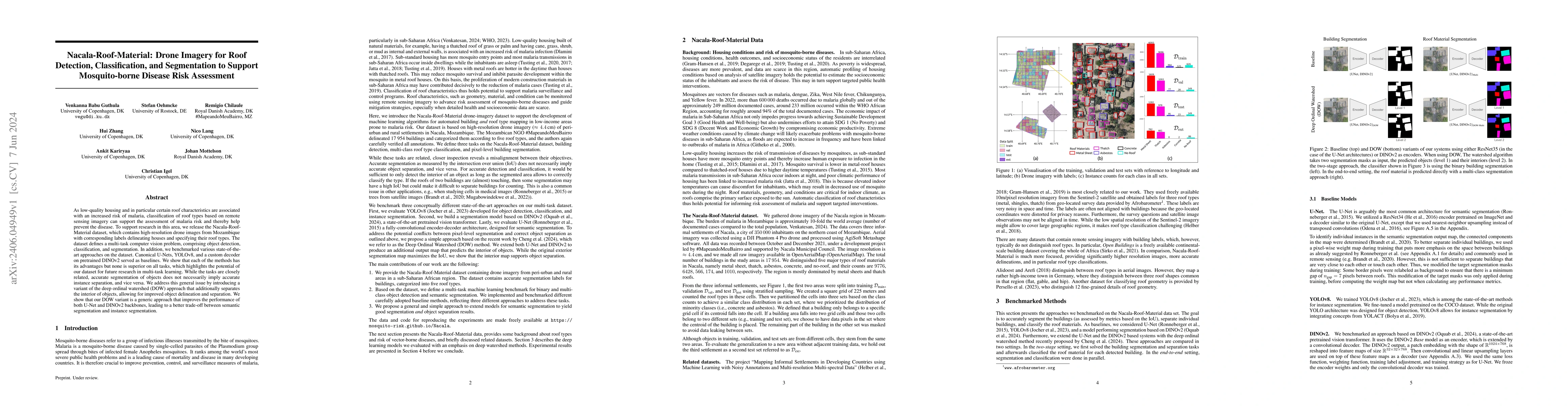
As low-quality housing and in particular certain roof characteristics are associated with an increased risk of malaria, classification of roof types based on remote sensing imagery can support the a...
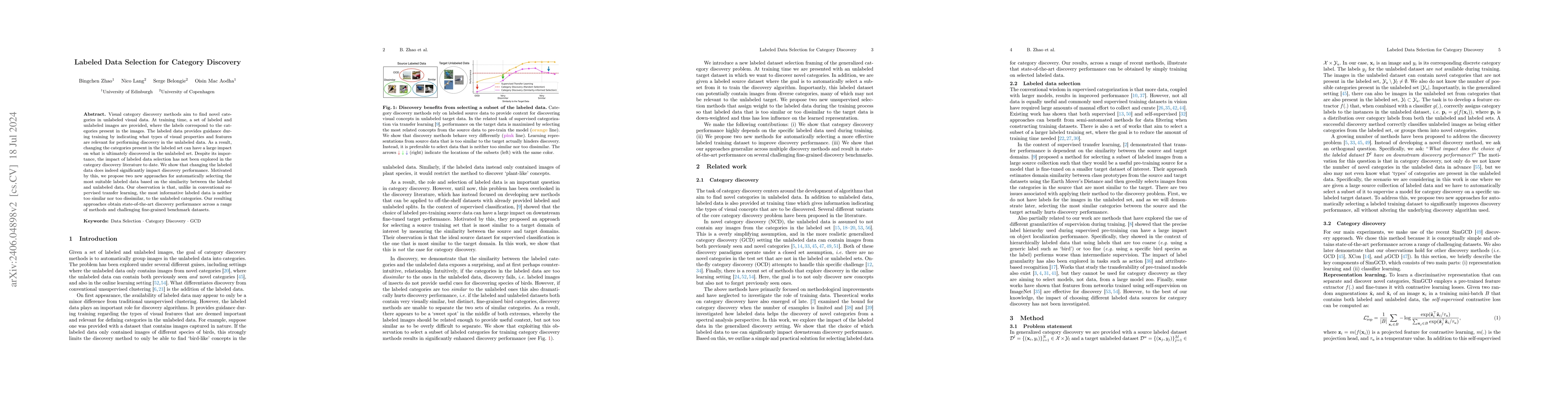
Category discovery methods aim to find novel categories in unlabeled visual data. At training time, a set of labeled and unlabeled images are provided, where the labels correspond to the categories ...
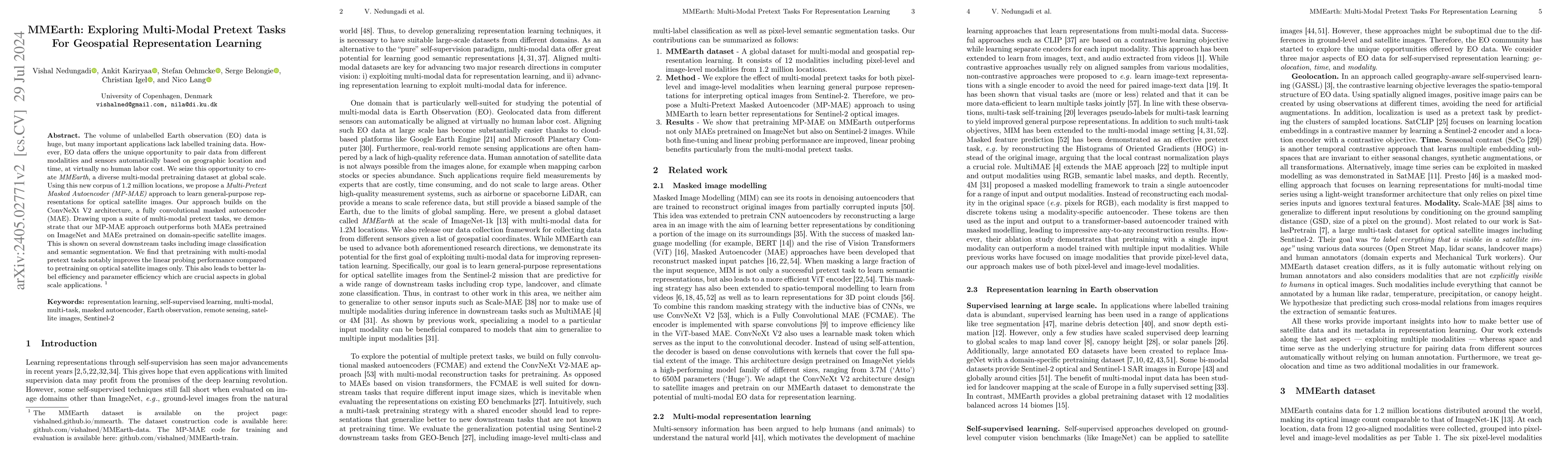
The volume of unlabelled Earth observation (EO) data is huge, but many important applications lack labelled training data. However, EO data offers the unique opportunity to pair data from different ...
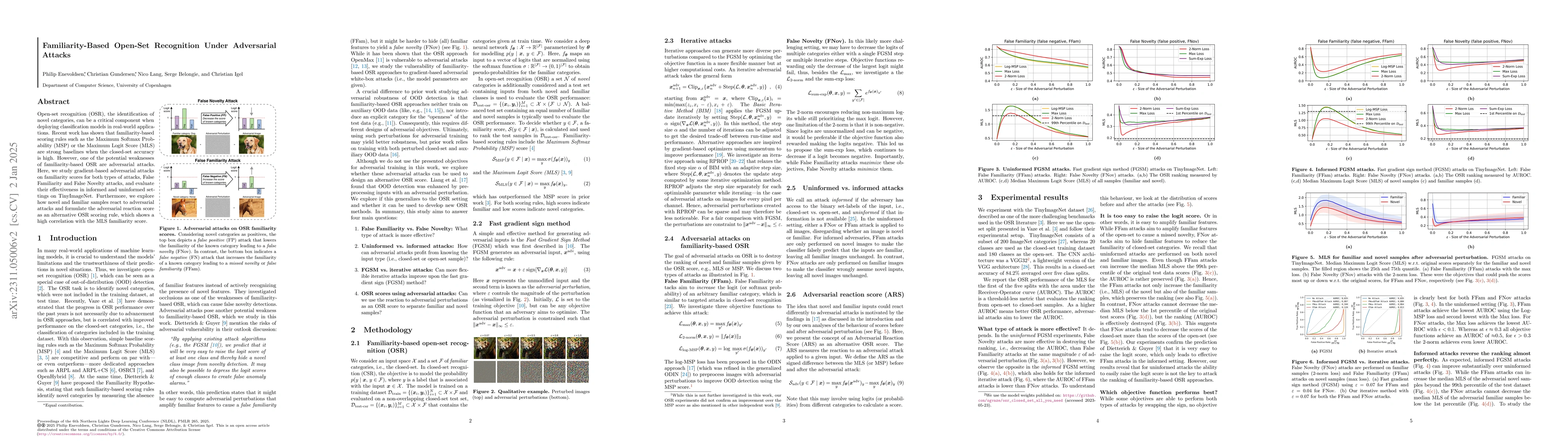
Open-set recognition (OSR), the identification of novel categories, can be a critical component when deploying classification models in real-world applications. Recent work has shown that familiarit...
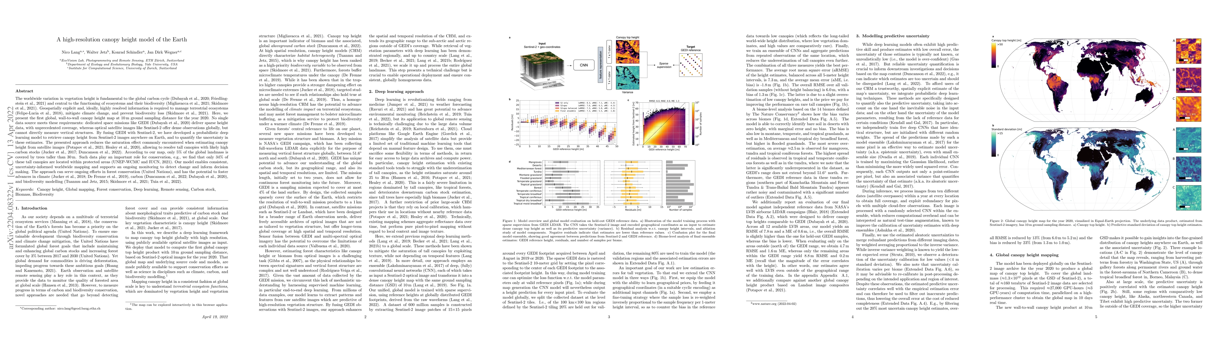
The worldwide variation in vegetation height is fundamental to the global carbon cycle and central to the functioning of ecosystems and their biodiversity. Geospatially explicit and, ideally, highly...
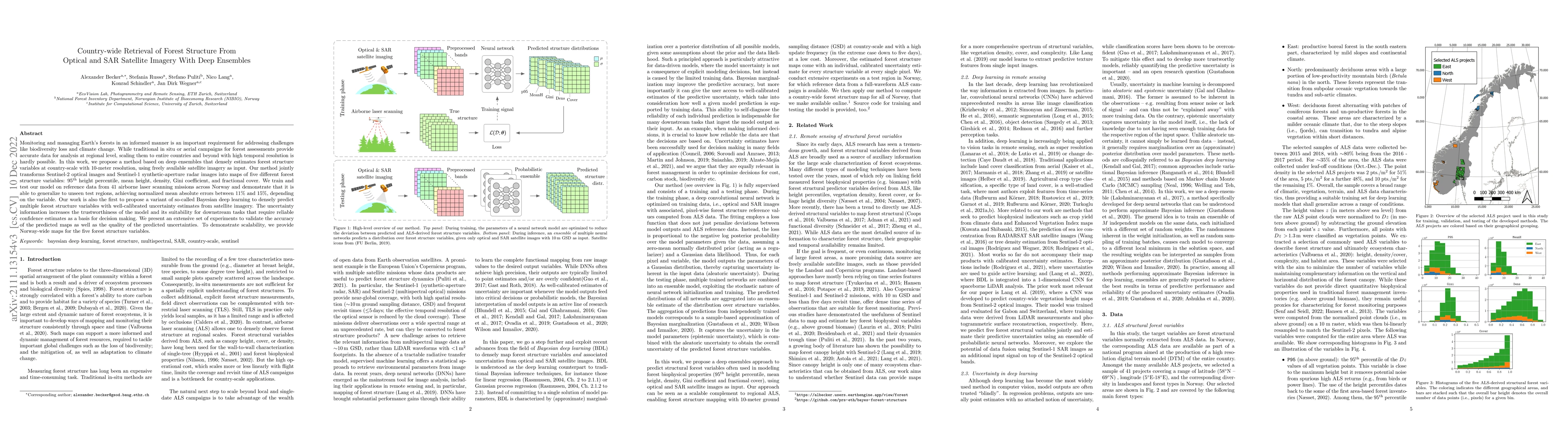
Monitoring and managing Earth's forests in an informed manner is an important requirement for addressing challenges like biodiversity loss and climate change. While traditional in situ or aerial cam...
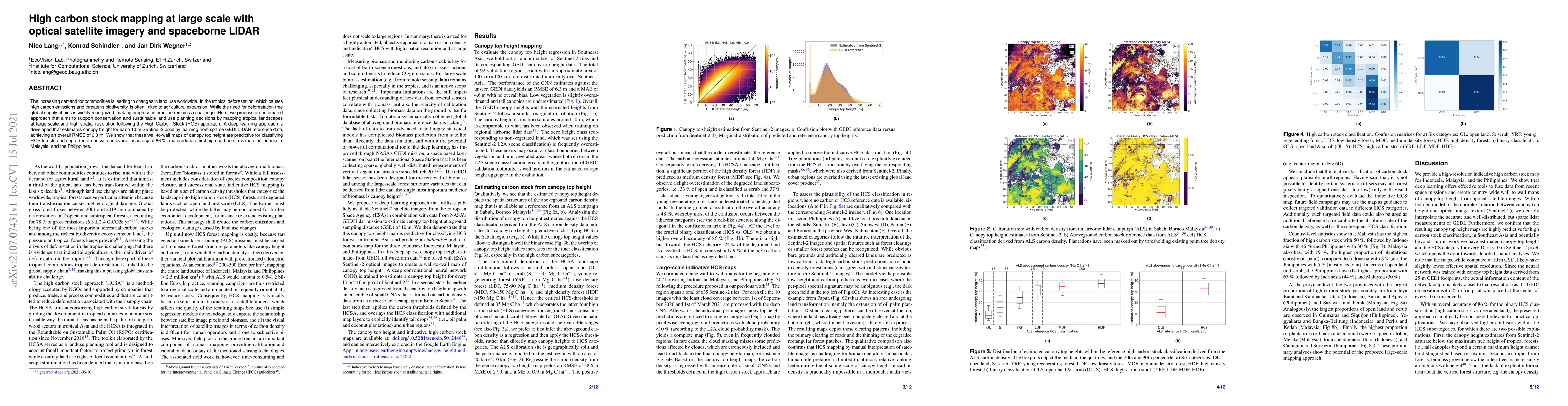
The increasing demand for commodities is leading to changes in land use worldwide. In the tropics, deforestation, which causes high carbon emissions and threatens biodiversity, is often linked to ag...
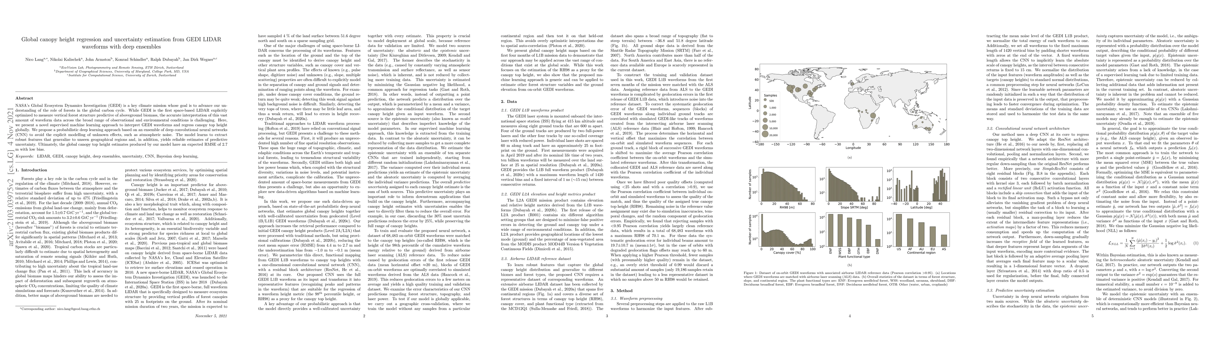
NASA's Global Ecosystem Dynamics Investigation (GEDI) is a key climate mission whose goal is to advance our understanding of the role of forests in the global carbon cycle. While GEDI is the first s...
We introduce an approach for updating older tree inventories with geographic coordinates using street-level panorama images and a global optimization framework for tree instance matching. Geolocatio...
Up-to-date catalogs of the urban tree population are important for municipalities to monitor and improve quality of life in cities. Despite much research on automation of tree mapping, mainly relyin...
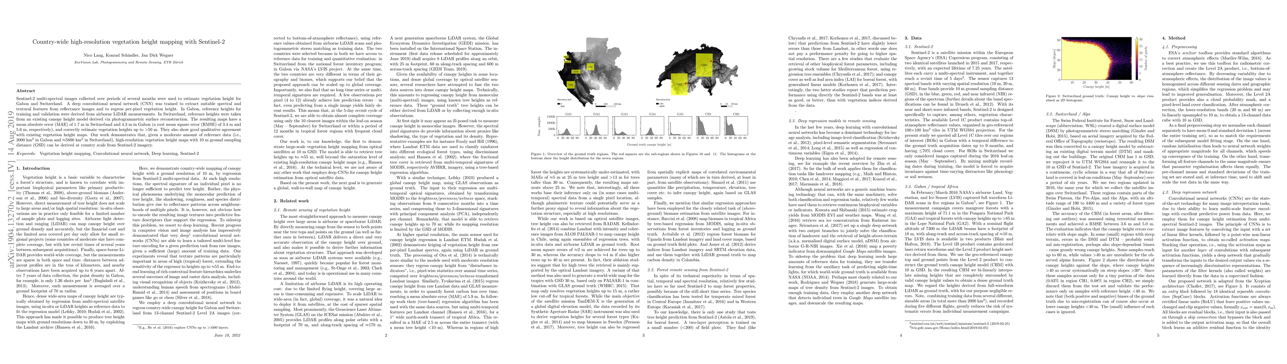
Sentinel-2 multi-spectral images collected over periods of several months were used to estimate vegetation height for Gabon and Switzerland. A deep convolutional neural network (CNN) was trained to ...
Multimodal aerial data are used to monitor natural systems, and machine learning can significantly accelerate the classification of landscape features within such imagery to benefit ecology and conser...
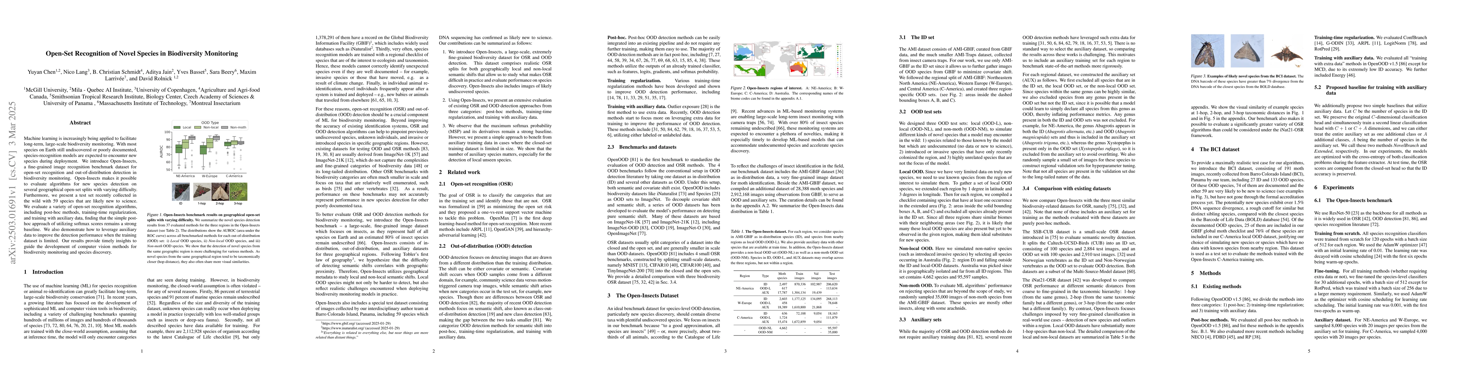
Machine learning is increasingly being applied to facilitate long-term, large-scale biodiversity monitoring. With most species on Earth still undiscovered or poorly documented, species-recognition mod...
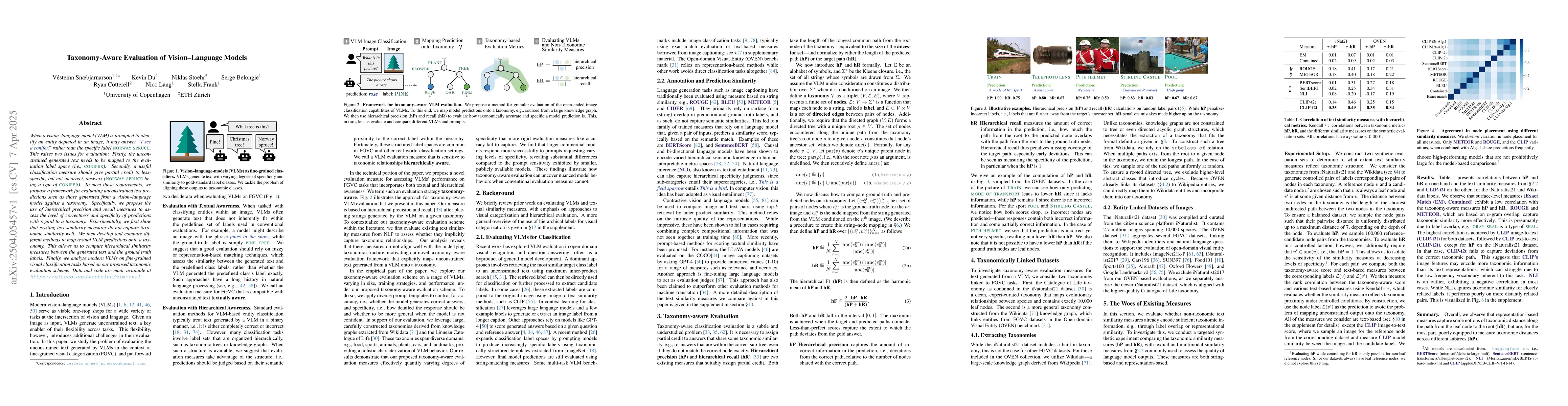
When a vision-language model (VLM) is prompted to identify an entity depicted in an image, it may answer 'I see a conifer,' rather than the specific label 'norway spruce'. This raises two issues for e...

High-resolution imagery is often hindered by limitations in sensor technology, atmospheric conditions, and costs. Such challenges occur in satellite remote sensing, but also with handheld cameras, suc...
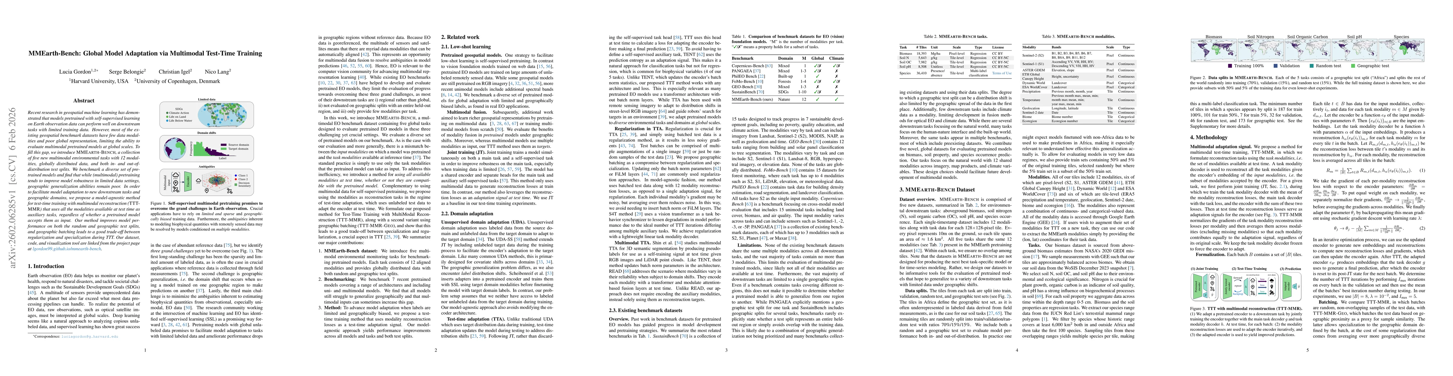
Recent research in geospatial machine learning has demonstrated that models pretrained with self-supervised learning on Earth observation data can perform well on downstream tasks with limited trainin...
Supervised learning for image segmentation typically requires spatially aligned image and label sets. When images and labels originate from different sources, the pairing may be misaligned, which can ...