Academic Profile
Statistics
Similar Authors
Papers on arXiv
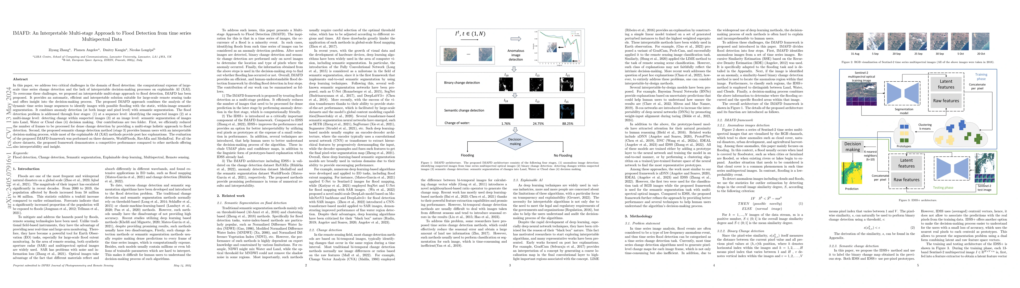
In this paper, we address two critical challenges in the domain of flood detection: the computational expense of large-scale time series change detection and the lack of interpretable decision-makin...
Remote sensing (RS) applications in the space domain demand machine learning (ML) models that are reliable, robust, and quality-assured, making red teaming a vital approach for identifying and expos...
Artificial intelligence onboard satellites has the potential to reduce data transmission requirements, enable real-time decision-making and collaboration within constellations. This study deploys a ...
Cloud detection is a pivotal satellite image pre-processing step that can be performed both on the ground and on board a satellite to tag useful images. In the latter case, it can reduce the amount ...
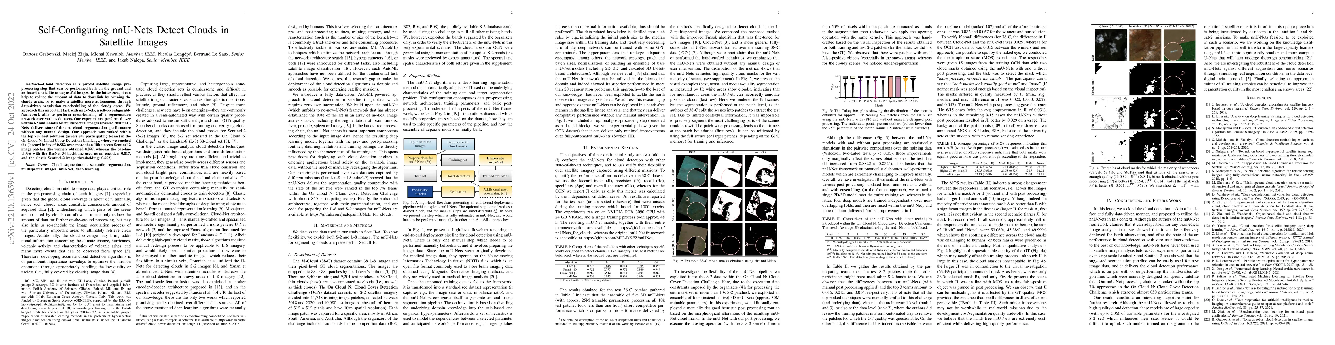
Cloud detection is a pivotal satellite image pre-processing step that can be performed both on the ground and on board a satellite to tag useful images. In the latter case, it can help to reduce the...
Hyperspectral unmixing remains one of the most challenging tasks in the analysis of such data. Deep learning has been blooming in the field and proved to outperform other classic unmixing techniques...
Maintaining farm sustainability through optimizing the agricultural management practices helps build more planet-friendly environment. The emerging satellite missions can acquire multi- and hyperspe...
Remote sensing of rainfall events is critical for both operational and scientific needs, including for example weather forecasting, extreme flood mitigation, water cycle monitoring, etc. Ground-base...
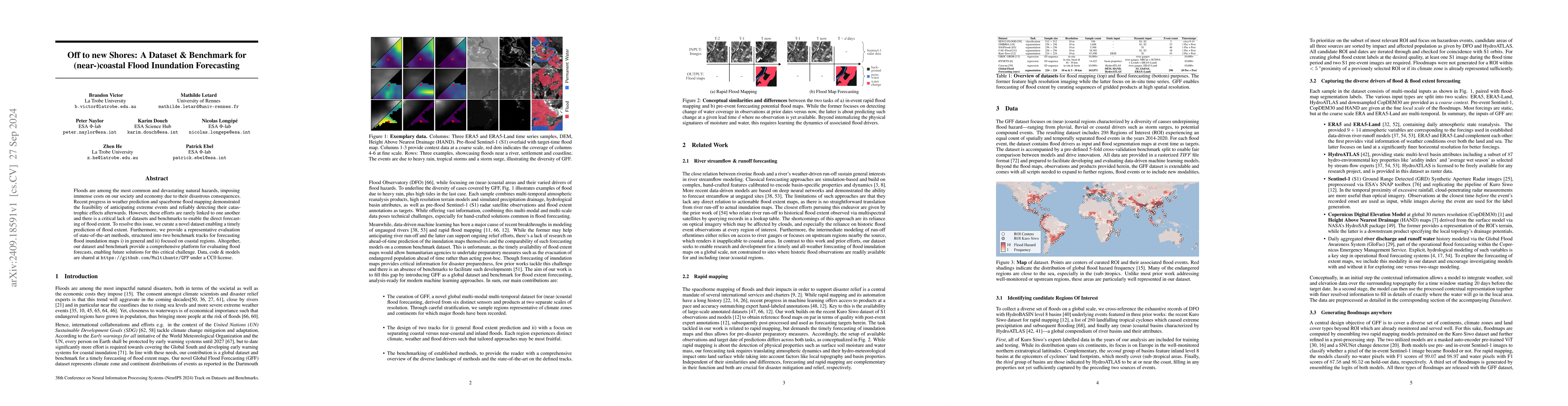
Floods are among the most common and devastating natural hazards, imposing immense costs on our society and economy due to their disastrous consequences. Recent progress in weather prediction and spac...
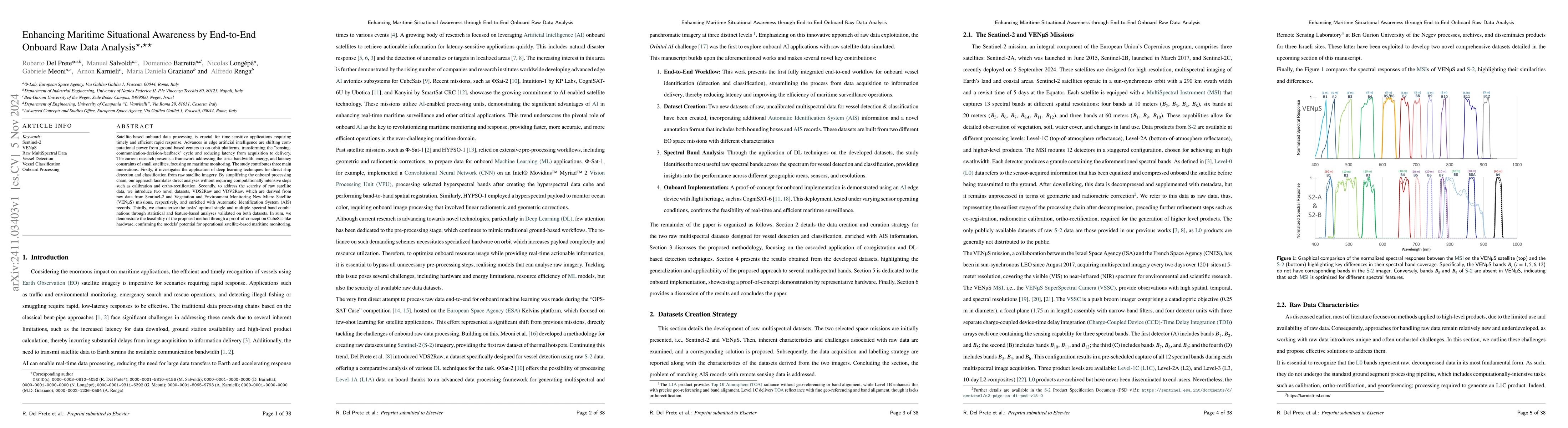
Satellite-based onboard data processing is crucial for time-sensitive applications requiring timely and efficient rapid response. Advances in edge artificial intelligence are shifting computational po...
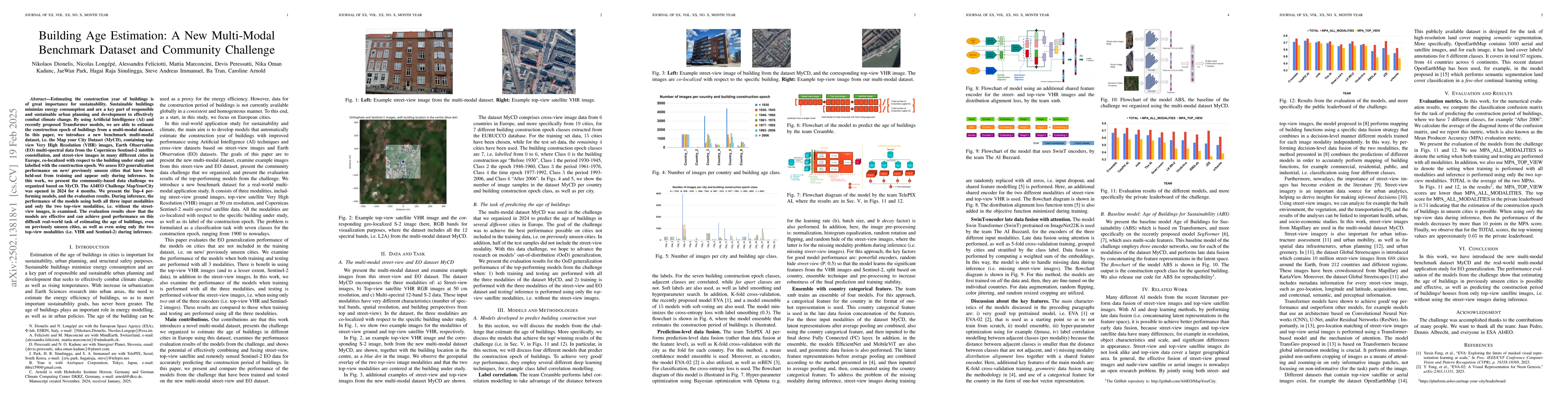
Estimating the construction year of buildings is of great importance for sustainability. Sustainable buildings minimize energy consumption and are a key part of responsible and sustainable urban plann...
Performing accurate confidence quantification and assessment is important for deep neural networks to predict their failures, improve their performance and enhance their capabilities in real-world app...
Super-resolution is aimed at reconstructing high-resolution images from low-resolution observations. State-of-the-art approaches underpinned with deep learning allow for obtaining outstanding results,...
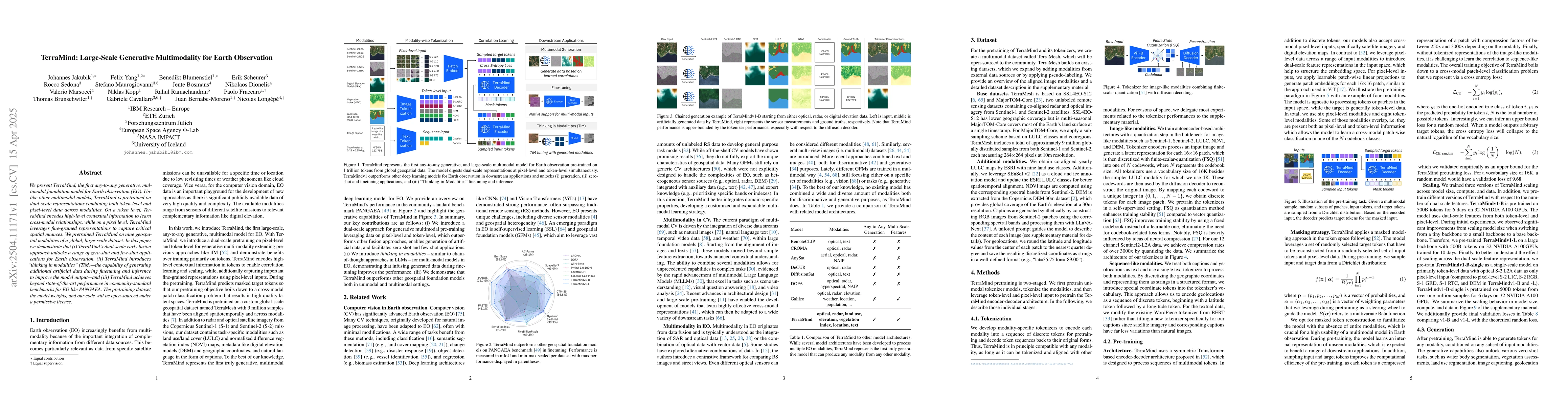
We present TerraMind, the first any-to-any generative, multimodal foundation model for Earth observation (EO). Unlike other multimodal models, TerraMind is pretrained on dual-scale representations com...
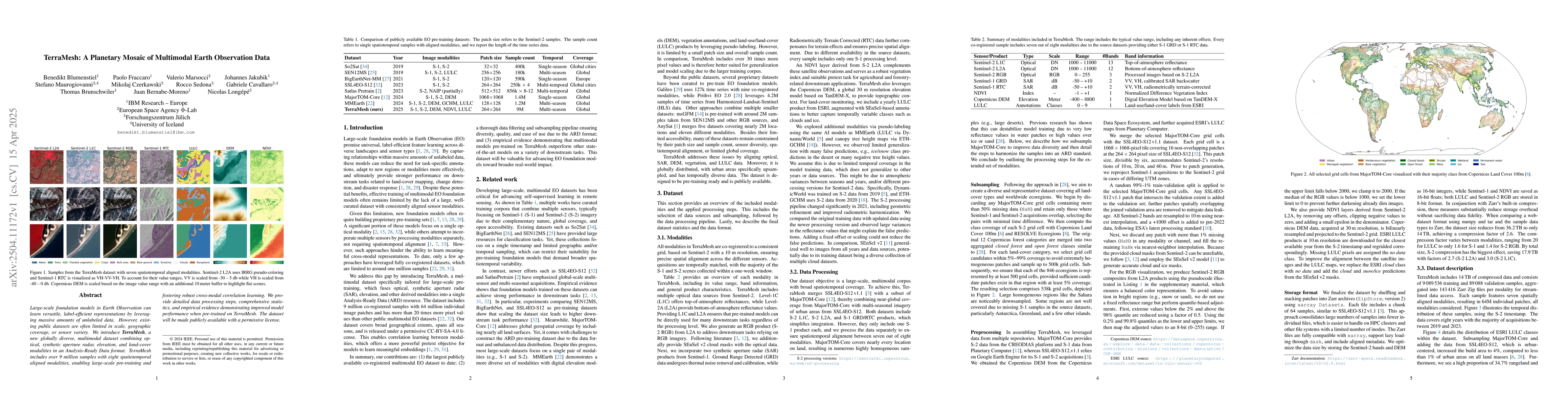
Large-scale foundation models in Earth Observation can learn versatile, label-efficient representations by leveraging massive amounts of unlabeled data. However, existing public datasets are often lim...
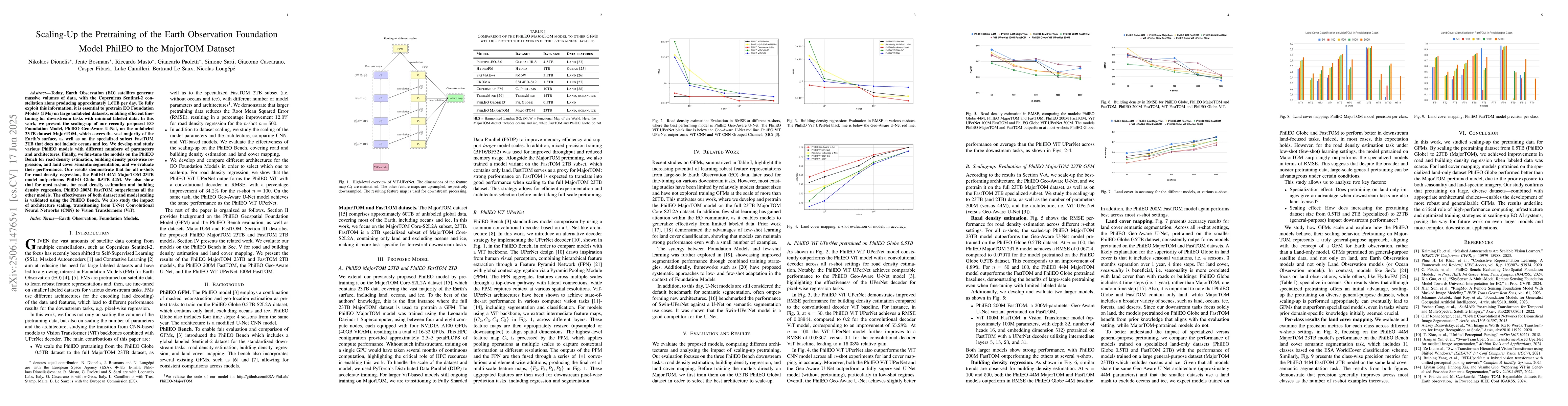
Today, Earth Observation (EO) satellites generate massive volumes of data, with the Copernicus Sentinel-2 constellation alone producing approximately 1.6TB per day. To fully exploit this information, ...
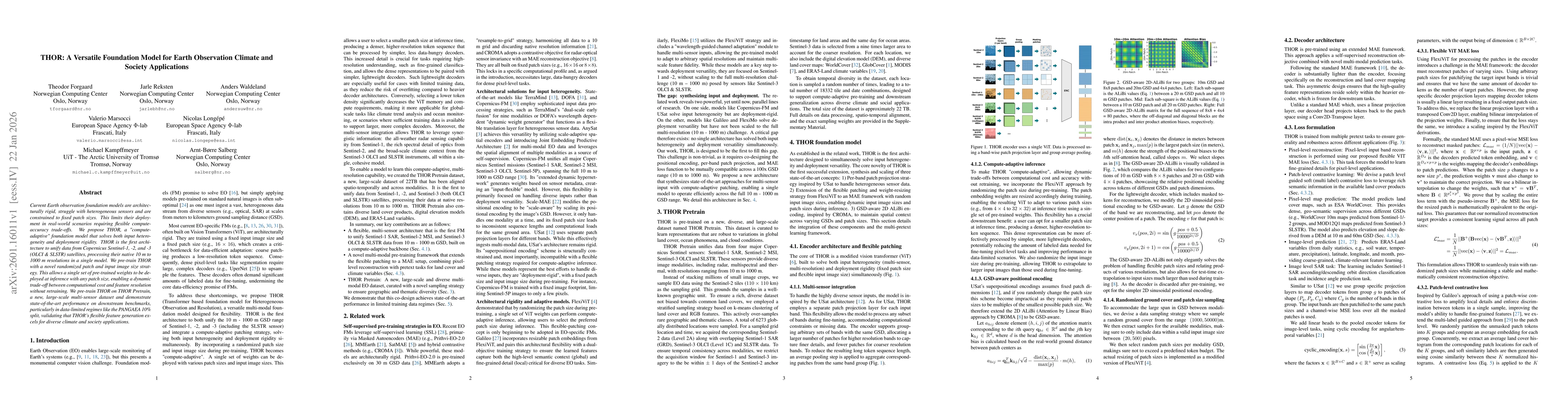
Current Earth observation foundation models are architecturally rigid, struggle with heterogeneous sensors and are constrained to fixed patch sizes. This limits their deployment in real-world scenario...
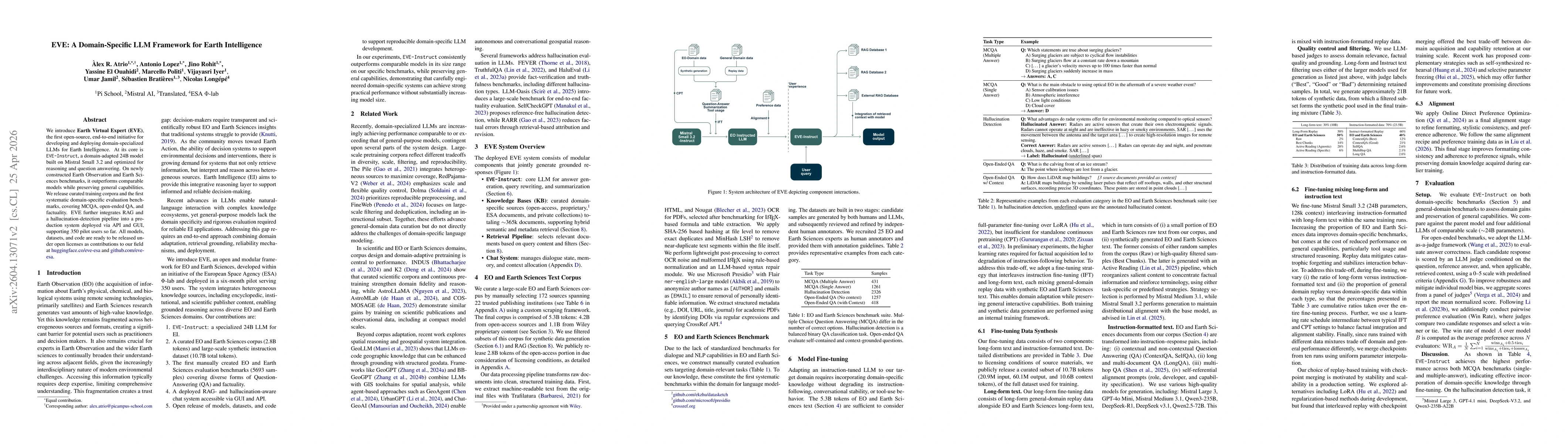
We introduce Earth Virtual Expert (EVE), the first open-source, end-to-end initiative for developing and deploying domain-specialized LLMs for Earth Intelligence. At its core is EVE-Instruct, a domain...
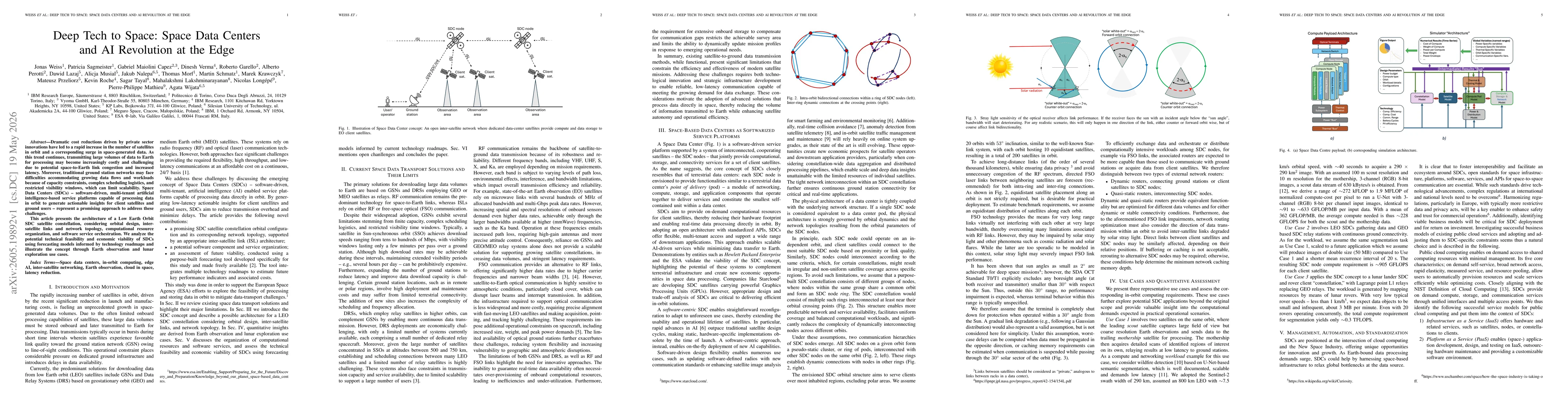
Dramatic cost reductions driven by private sector innovations have led to a rapid increase in the number of satellites in orbit and a corresponding surge in space-generated data. As this trend continu...