Academic Profile
Statistics
Similar Authors
Papers on arXiv
Deep neural networks (DNNs) have been successfully applied to earth observation (EO) data and opened new research avenues. Despite the theoretical and practical advances of these techniques, DNNs ar...
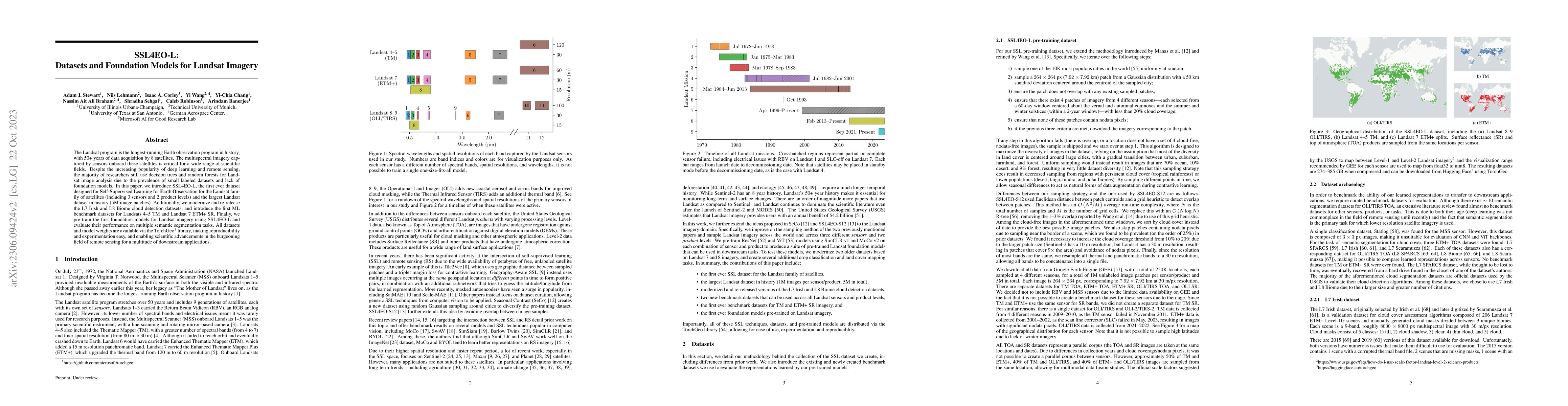
The Landsat program is the longest-running Earth observation program in history, with 50+ years of data acquisition by 8 satellites. The multispectral imagery captured by sensors onboard these satel...
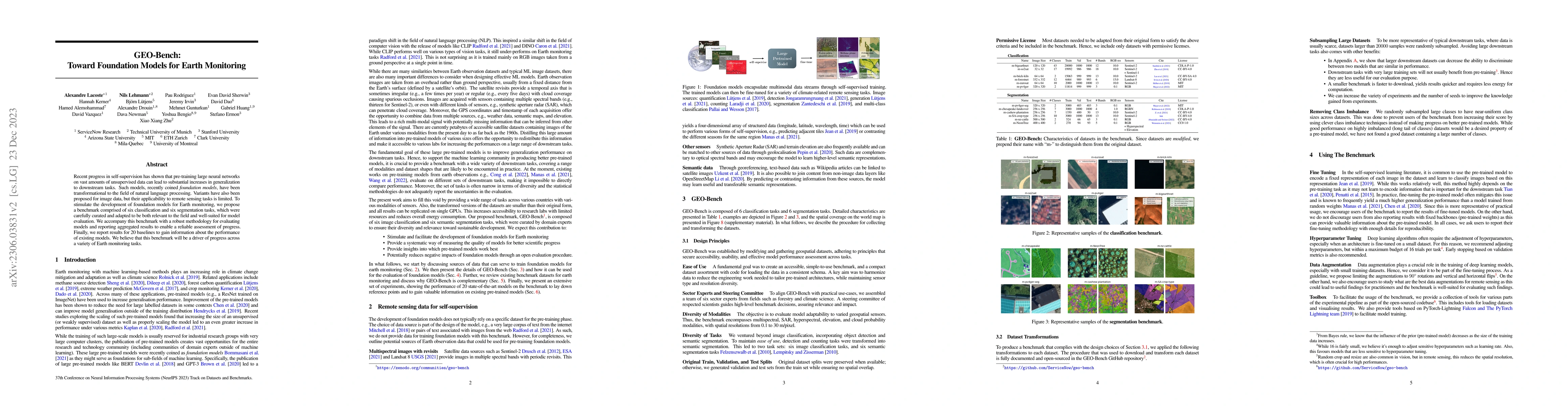
Recent progress in self-supervision has shown that pre-training large neural networks on vast amounts of unsupervised data can lead to substantial increases in generalization to downstream tasks. Su...
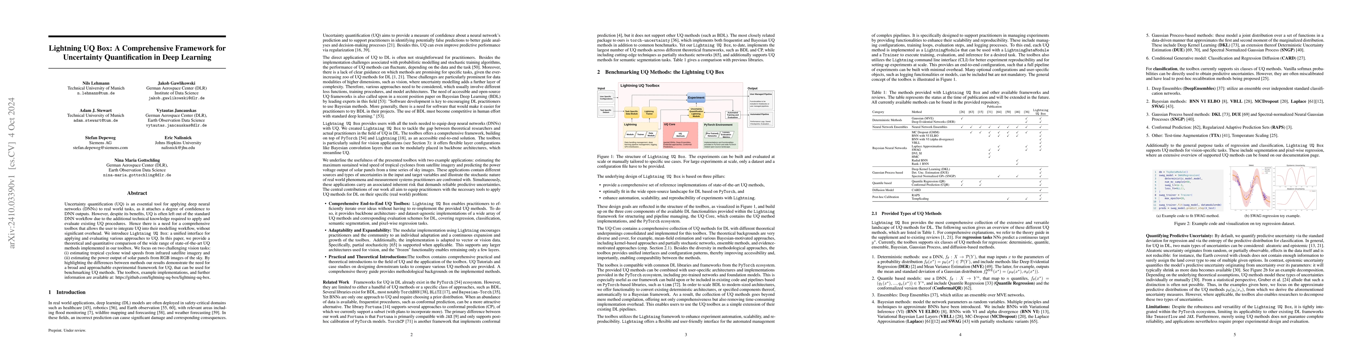
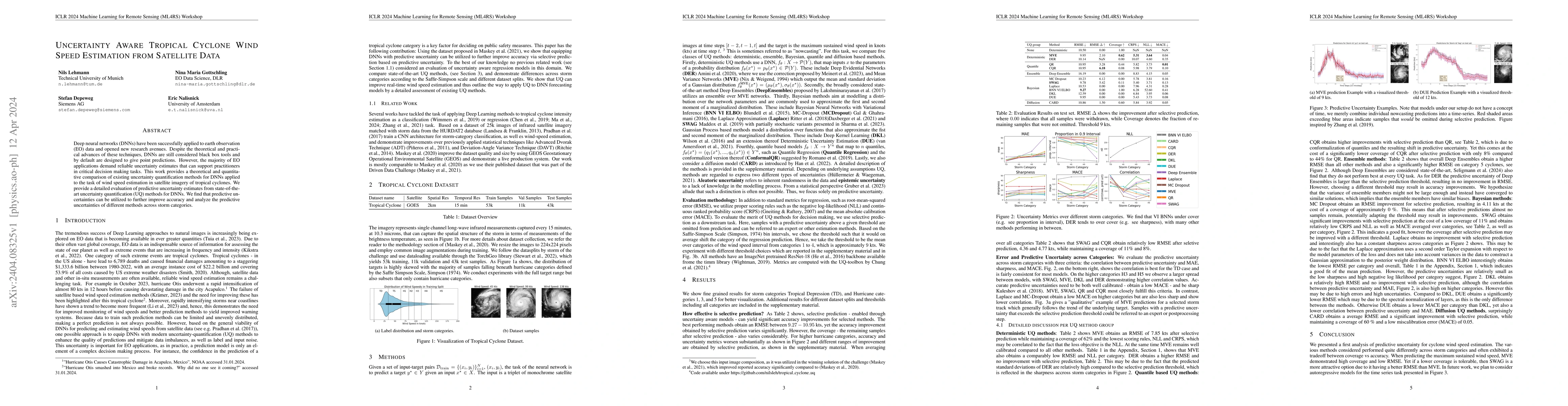
Uncertainty quantification (UQ) is an essential tool for applying deep neural networks (DNNs) to real world tasks, as it attaches a degree of confidence to DNN outputs. However, despite its benefits, ...
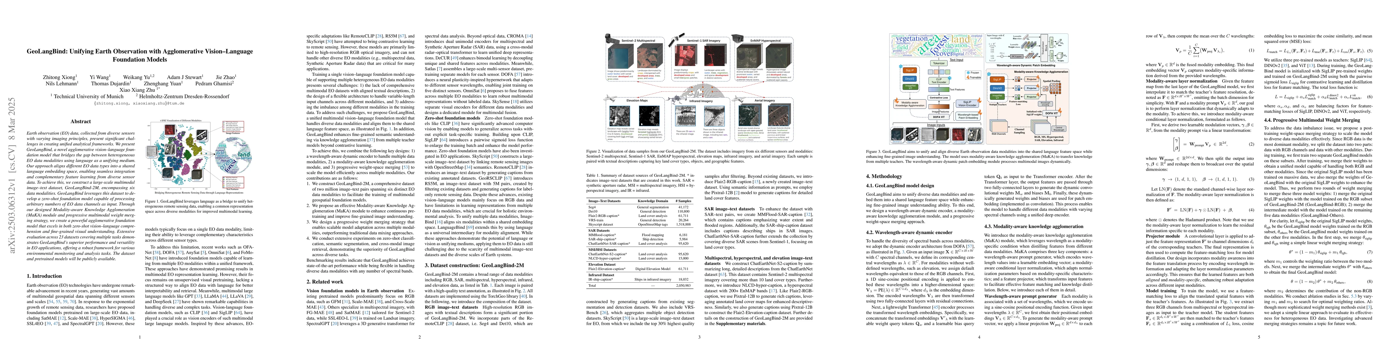
Earth observation (EO) data, collected from diverse sensors with varying imaging principles, present significant challenges in creating unified analytical frameworks. We present GeoLangBind, a novel a...
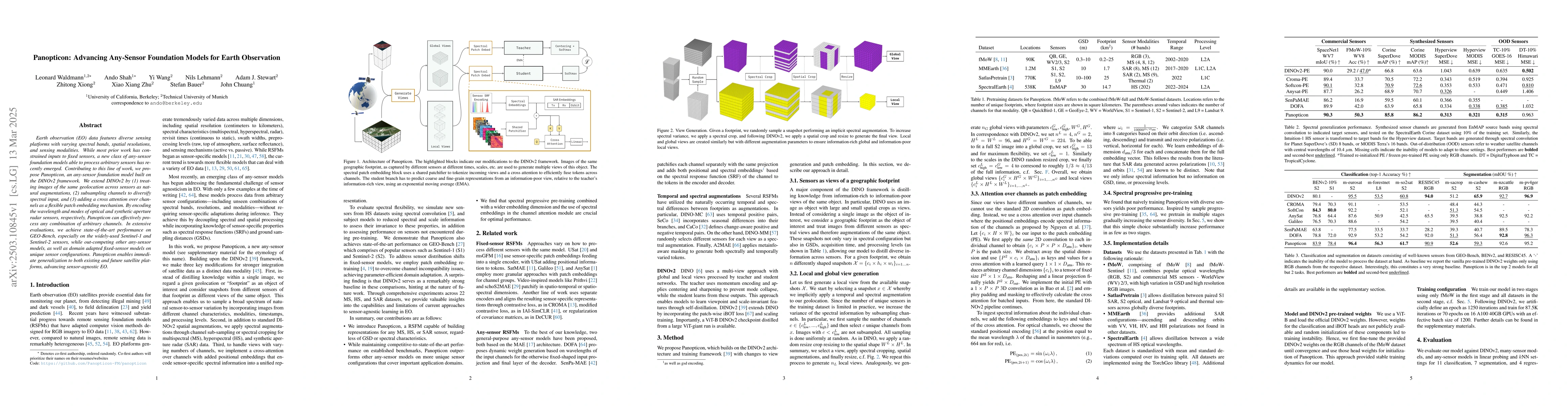
Earth observation (EO) data features diverse sensing platforms with varying spectral bands, spatial resolutions, and sensing modalities. While most prior work has constrained inputs to fixed sensors, ...
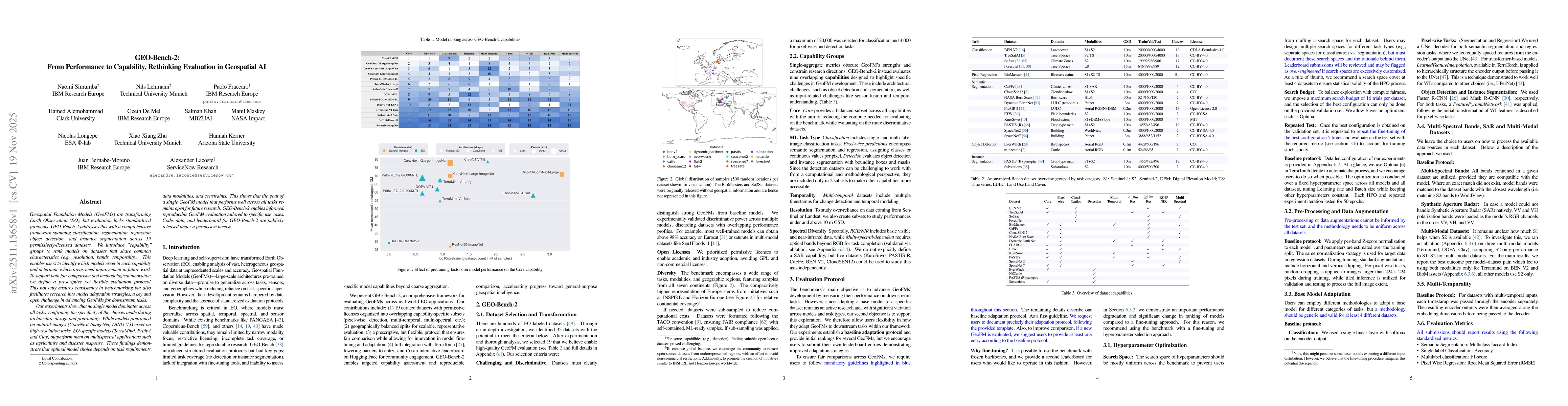
Geospatial Foundation Models (GeoFMs) are transforming Earth Observation (EO), but evaluation lacks standardized protocols. GEO-Bench-2 addresses this with a comprehensive framework spanning classific...
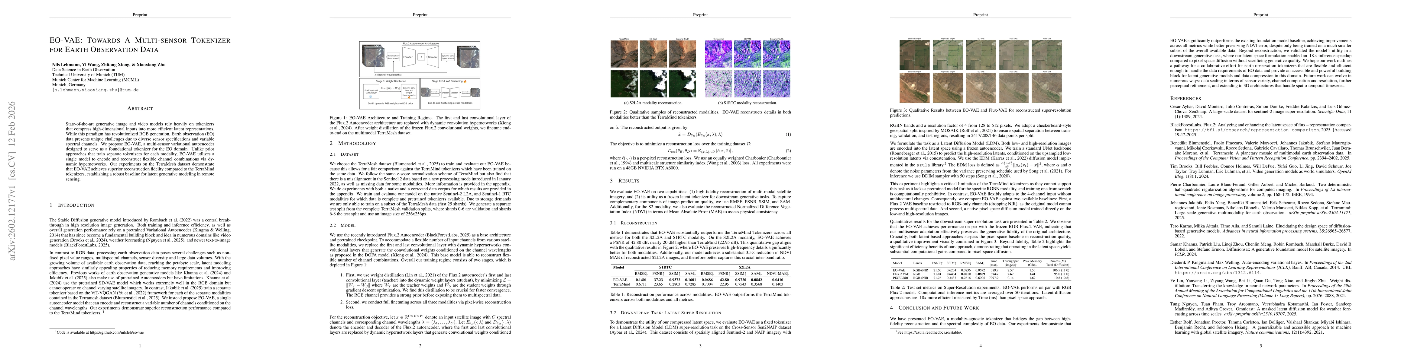
State-of-the-art generative image and video models rely heavily on tokenizers that compress high-dimensional inputs into more efficient latent representations. While this paradigm has revolutionized R...
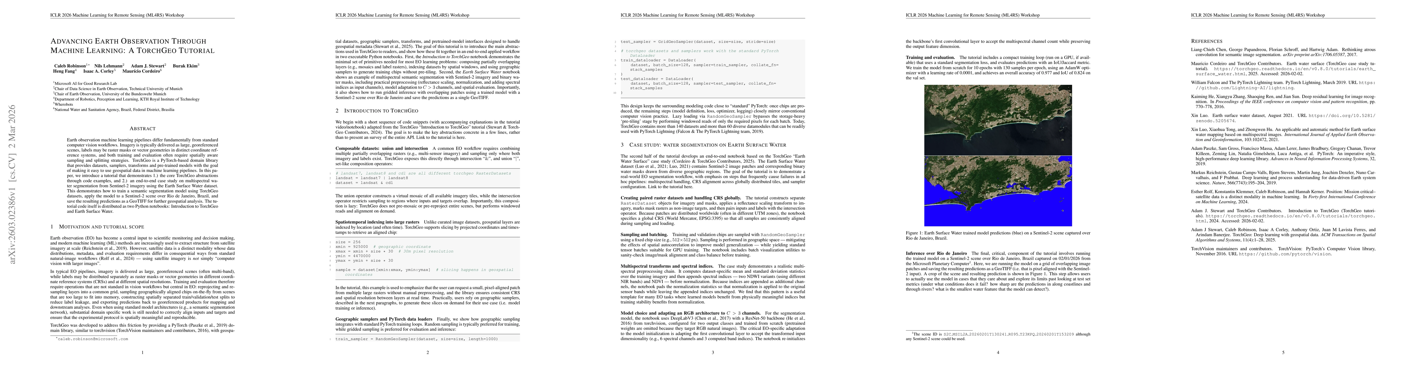
Earth observation machine learning pipelines differ fundamentally from standard computer vision workflows. Imagery is typically delivered as large, georeferenced scenes, labels may be raster masks or ...
Geospatial foundation models (GFMs) have been proposed as generalizable backbones for disaster response, land-cover mapping, food-security monitoring, and other high-stakes Earth-observation tasks. Ye...