Academic Profile
Statistics
Similar Authors
Papers on arXiv
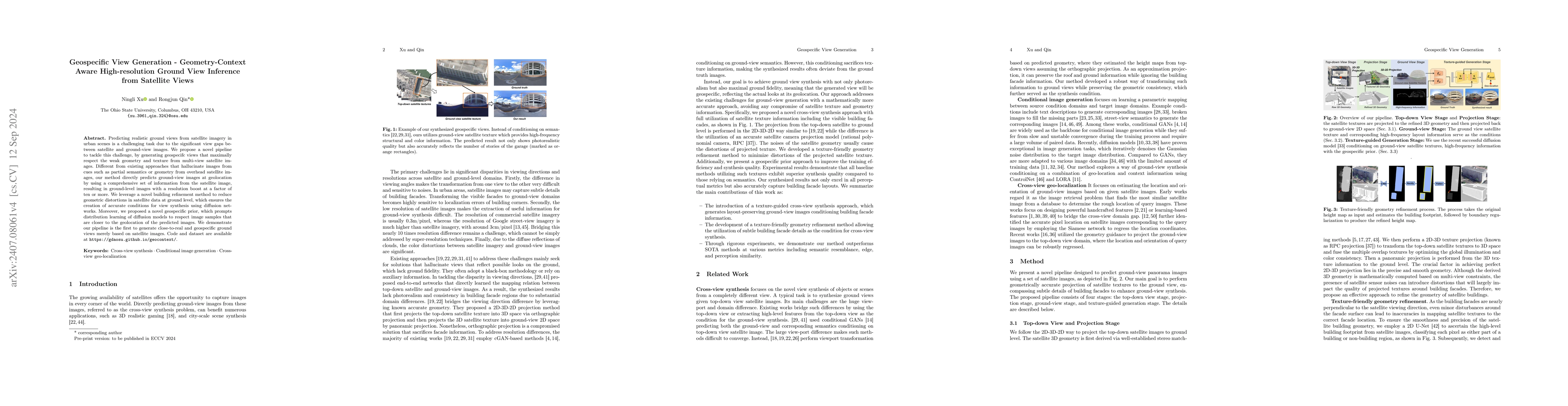
Predicting realistic ground views from satellite imagery in urban scenes is a challenging task due to the significant view gaps between satellite and ground-view images. We propose a novel pipeline to...
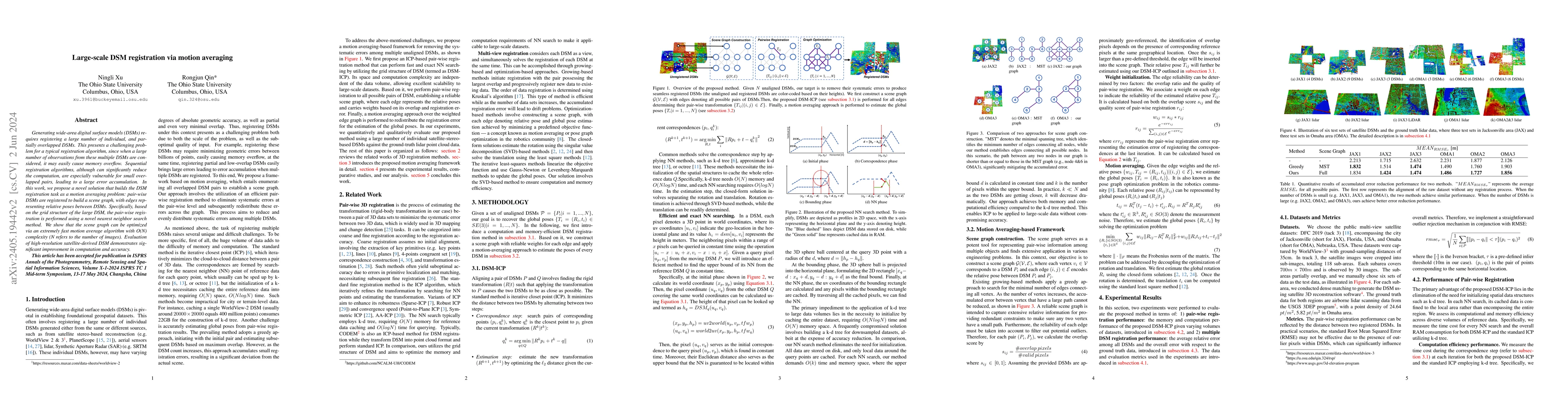
Generating wide-area digital surface models (DSMs) requires registering a large number of individual, and partially overlapped DSMs. This presents a challenging problem for a typical registration al...
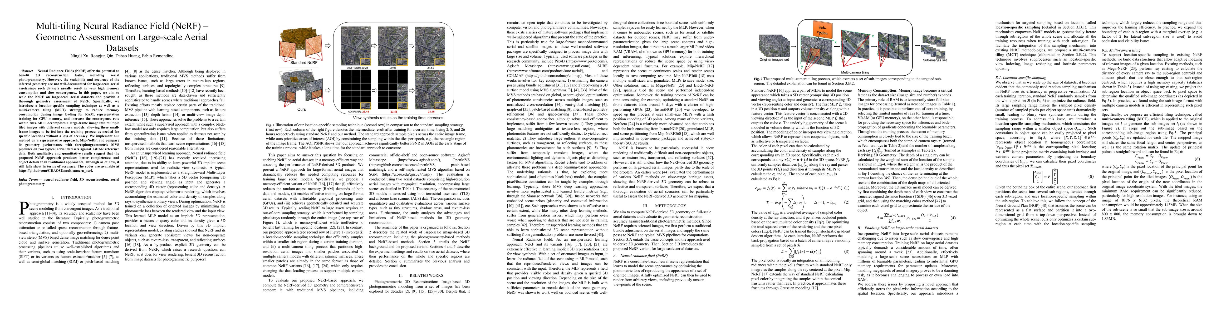
Neural Radiance Fields (NeRF) offer the potential to benefit 3D reconstruction tasks, including aerial photogrammetry. However, the scalability and accuracy of the inferred geometry are not well-doc...
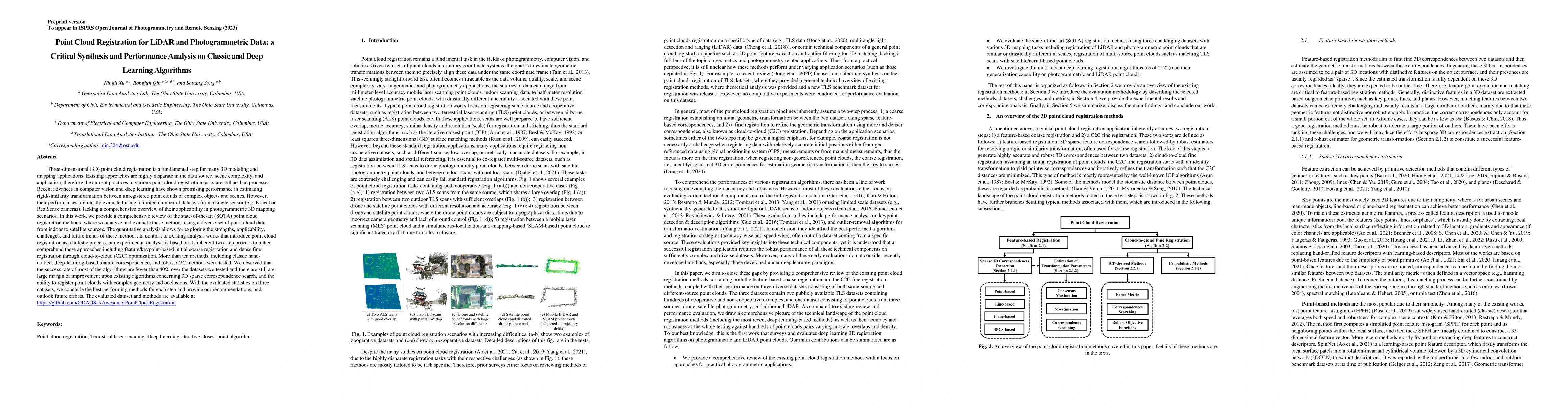
Recent advances in computer vision and deep learning have shown promising performance in estimating rigid/similarity transformation between unregistered point clouds of complex objects and scenes. H...
In this paper, we present a case study that performs an unmanned aerial vehicle (UAV) based fine-scale 3D change detection and monitoring of progressive collapse performance of a building during a d...
Integrating aerial imagery-based scene generation into applications like autonomous driving and gaming enhances realism in 3D environments, but challenges remain in creating detailed content for occlu...
Generating consistent ground-view images from satellite imagery is challenging, primarily due to the large discrepancies in viewing angles and resolution between satellite and ground-level domains. Pr...
Point cloud processing as a fundamental task in the field of geomatics and computer vision, has been supporting tasks and applications at different scales from air to ground, including mapping, enviro...