Academic Profile
Statistics
Similar Authors
Papers on arXiv
Deep convolutional neural networks (CNNs) have been shown to predict poverty and development indicators from satellite images with surprising accuracy. This paper presents a first attempt at analyzi...
The present study uses domain experts to estimate welfare levels and indicators from high-resolution satellite imagery. We use the wealth quintiles from the 2015 Tanzania DHS dataset as ground truth...
Recent advances in artificial intelligence and machine learning have created a step change in how to measure human development indicators, in particular asset based poverty. The combination of satel...
We propose a methodology to enhance local CO2 monitoring by integrating satellite data from the Orbiting Carbon Observatories (OCO-2 and OCO-3) with ground level observations from the Integrated Carbo...
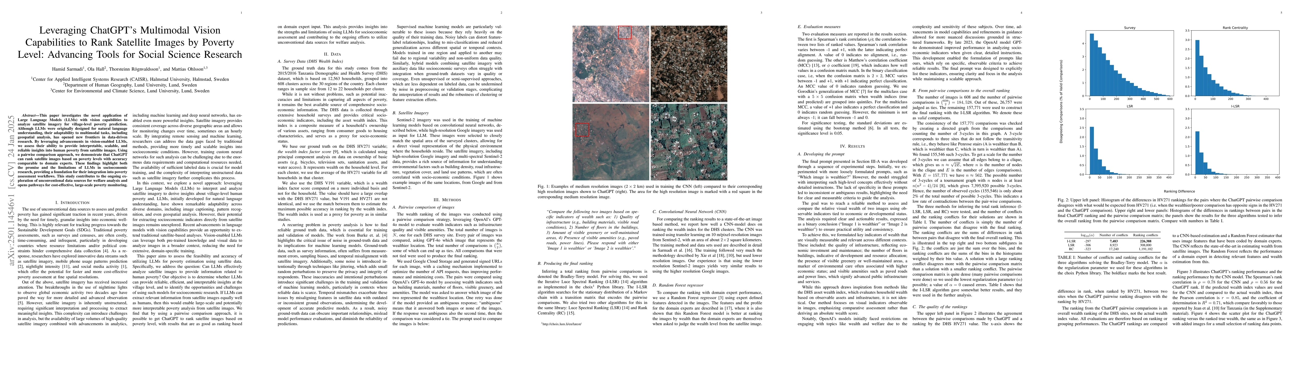
This paper investigates the novel application of Large Language Models (LLMs) with vision capabilities to analyze satellite imagery for village-level poverty prediction. Although LLMs were originally ...
We transform large-scale Swedish register data into textual life trajectories to address two long-standing challenges in data analysis: high cardinality of categorical variables and inconsistencies in...