Osher Rafaeli

5 papers on arXiv

Academic Profile

Name: Osher Rafaeli
Total Papers: 4

Statistics

arXiv Papers 5
Total Publications 4

Papers on arXiv

Thumbnail for Prompt-Based Segmentation at Multiple Resolutions and Lighting
  Conditions using Segment Anything Model 2

Prompt-Based Segmentation at Multiple Resolutions and Lighting Conditions using Segment Anything Model 2

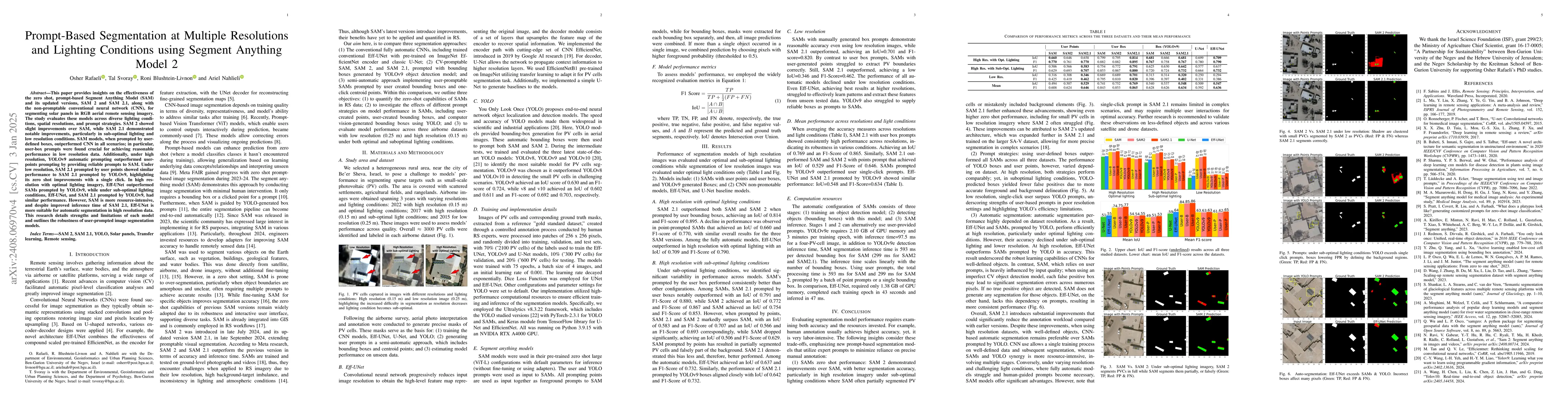
This paper provides insight into the effectiveness of zero-shot, prompt-based, Segment Anything Model (SAM), and its updated version, SAM 2, and the non-promptable, conventional convolutional network ...

Thumbnail for SinkSAM: A Monocular Depth-Guided SAM Framework for Automatic Sinkhole
  Segmentation

SinkSAM: A Monocular Depth-Guided SAM Framework for Automatic Sinkhole Segmentation

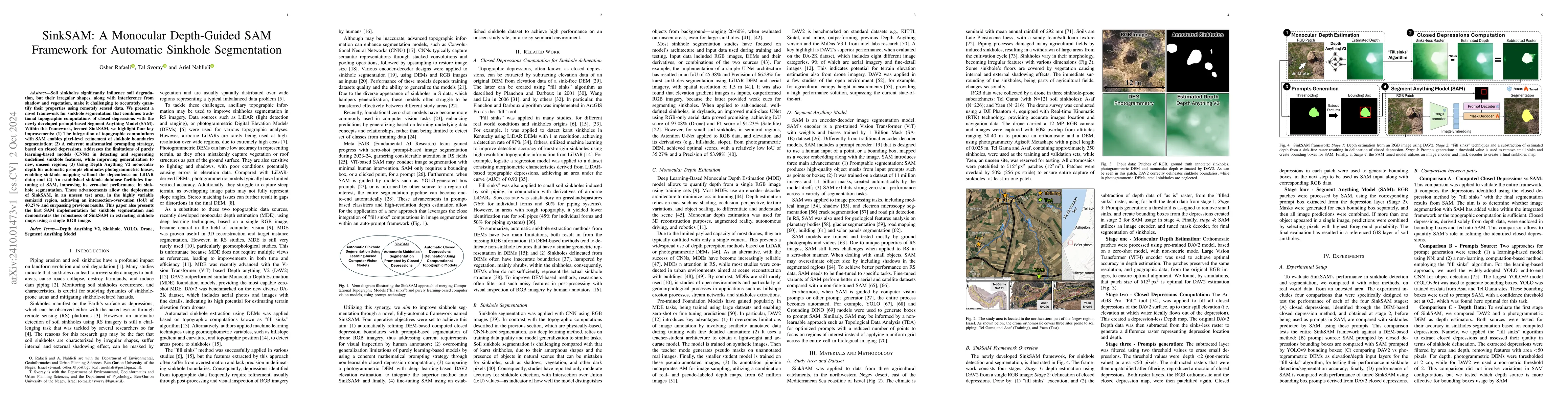
Soil sinkholes significantly influence soil degradation, but their irregular shapes, along with interference from shadow and vegetation, make it challenging to accurately quantify their properties usi...

Thumbnail for Prompt2DEM: High-Resolution DEMs for Urban and Open Environments from
  Global Prompts Using a Monocular Foundation Model

Prompt2DEM: High-Resolution DEMs for Urban and Open Environments from Global Prompts Using a Monocular Foundation Model

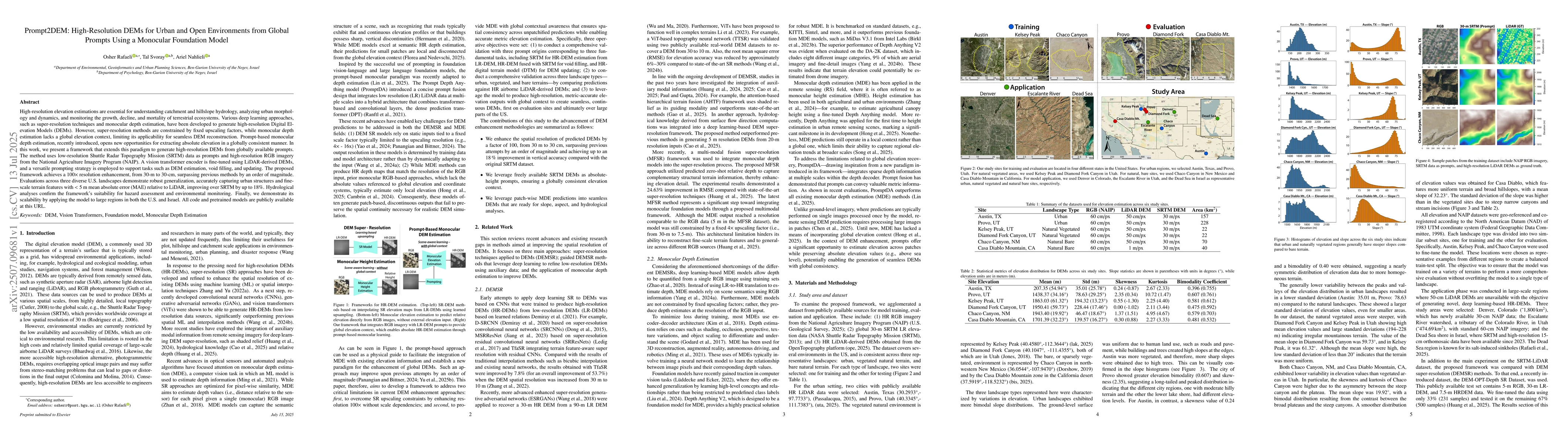
High-resolution elevation estimations are essential to understand catchment and hillslope hydrology, study urban morphology and dynamics, and monitor the growth, decline, and mortality of terrestrial ...

Thumbnail for On the Effectiveness of Textual Prompting with Lightweight Fine-Tuning for SAM3 Remote Sensing Segmentation

On the Effectiveness of Textual Prompting with Lightweight Fine-Tuning for SAM3 Remote Sensing Segmentation

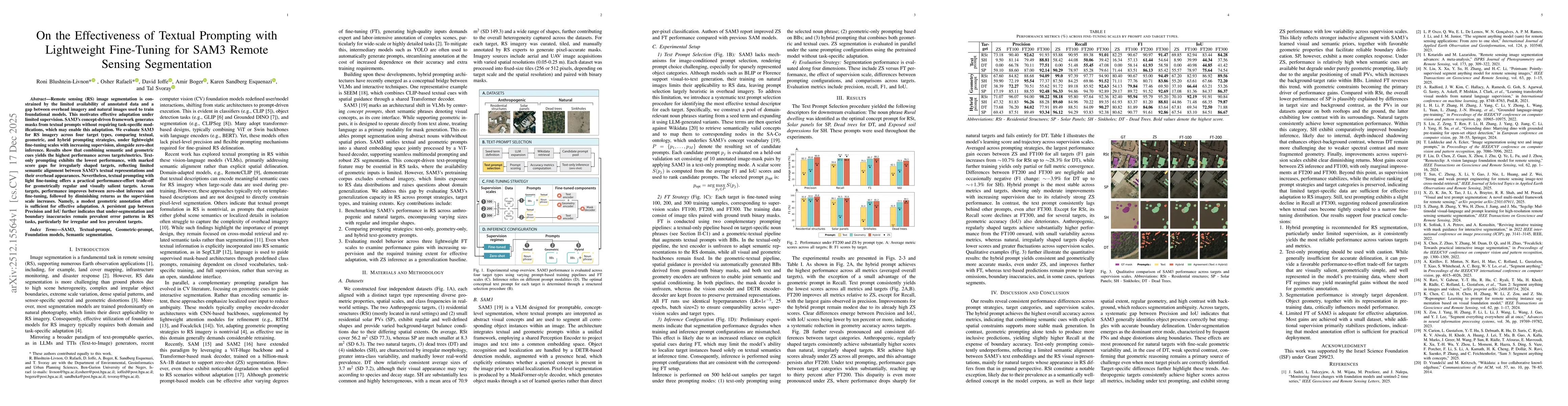
Remote sensing (RS) image segmentation is constrained by the limited availability of annotated data and a gap between overhead imagery and natural images used to train foundational models. This motiva...

Thumbnail for Test-Time Adaptation for Height Completion via Self-Supervised ViT Features and Monocular Foundation Models

Test-Time Adaptation for Height Completion via Self-Supervised ViT Features and Monocular Foundation Models

Accurate digital surface models (DSMs) are essential for many geospatial applications, including urban monitoring, environmental analyses, infrastructure management, and change detection. However, lar...

This website uses cookies to ensure you get the best experience. Learn more