1
arXiv Papers
3
Total Publications
Profile
Academic Profile
Metrics
Statistics
1
arXiv Papers
3
Total Publications
Network
Similar Authors
Publications
Papers on arXiv
arXiv
Best Practices for Large-Scale, Pixel-Wise Crop Mapping and Transfer
Learning Workflows
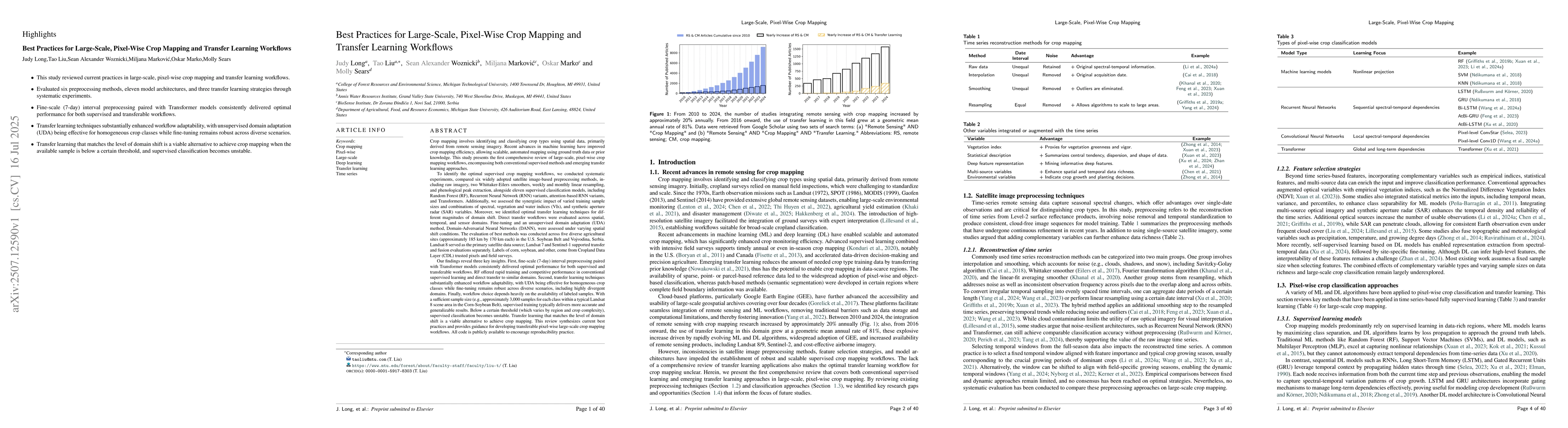
Crop mapping involves identifying and classifying crop types using spatial data, primarily derived from remote sensing imagery. This study presents the first comprehensive review of large-scale, pixel...