Academic Profile
Statistics
Similar Authors
Papers on arXiv
Accurate, detailed, and high-frequent bathymetry, coupled with complex semantic content, is crucial for the undermapped shallow seabed areas facing intense climatological and anthropogenic pressures...
Computer vision for detecting building pathologies has interested researchers for quite some time. Vision-based crack detection is a non-destructive assessment technique, which can be useful especia...
Mapping the seafloor with underwater imaging cameras is of significant importance for various applications including marine engineering, geology, geomorphology, archaeology and biology. For shallow ...
Underwater Cultural Heritage (CH) sites are widely spread; from ruins in coastlines up to shipwrecks in deep. The documentation and preservation of this heritage is an obligation of the mankind, dic...
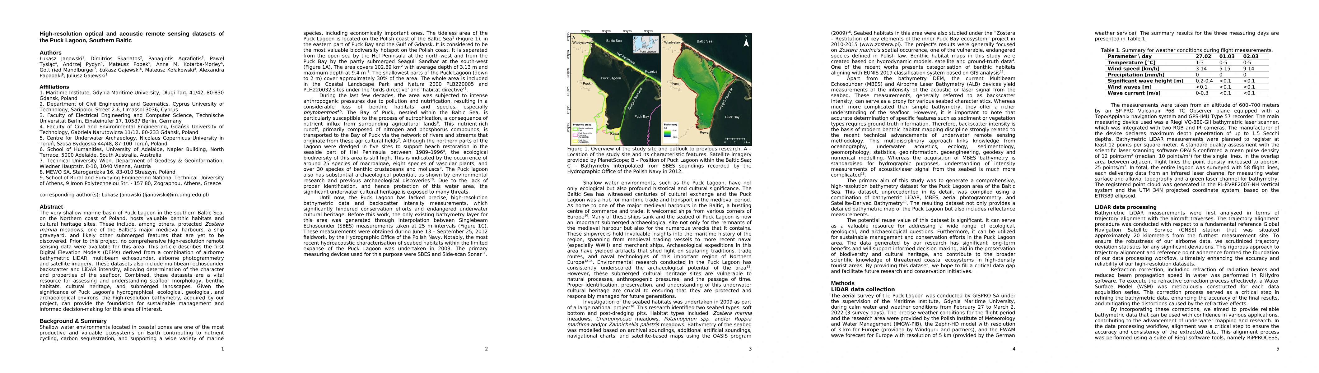
The very shallow marine basin of Puck Lagoon in the southern Baltic Sea, on the Northern coast of Poland, hosts valuable benthic habitats and cultural heritage sites. These include, among others, prot...
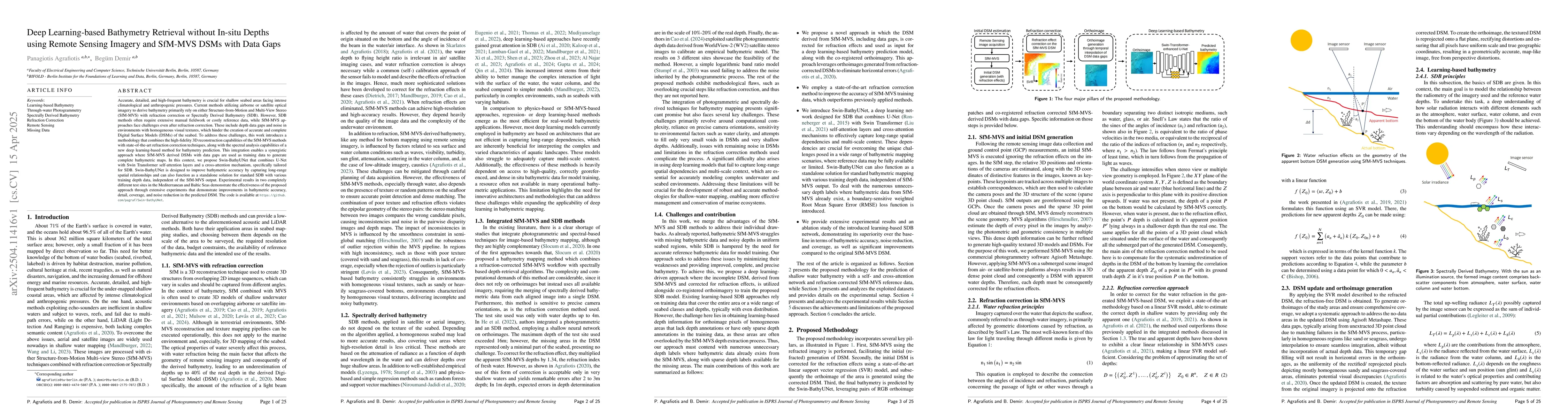
Accurate, detailed, and high-frequent bathymetry is crucial for shallow seabed areas facing intense climatological and anthropogenic pressures. Current methods utilizing airborne or satellite optical ...
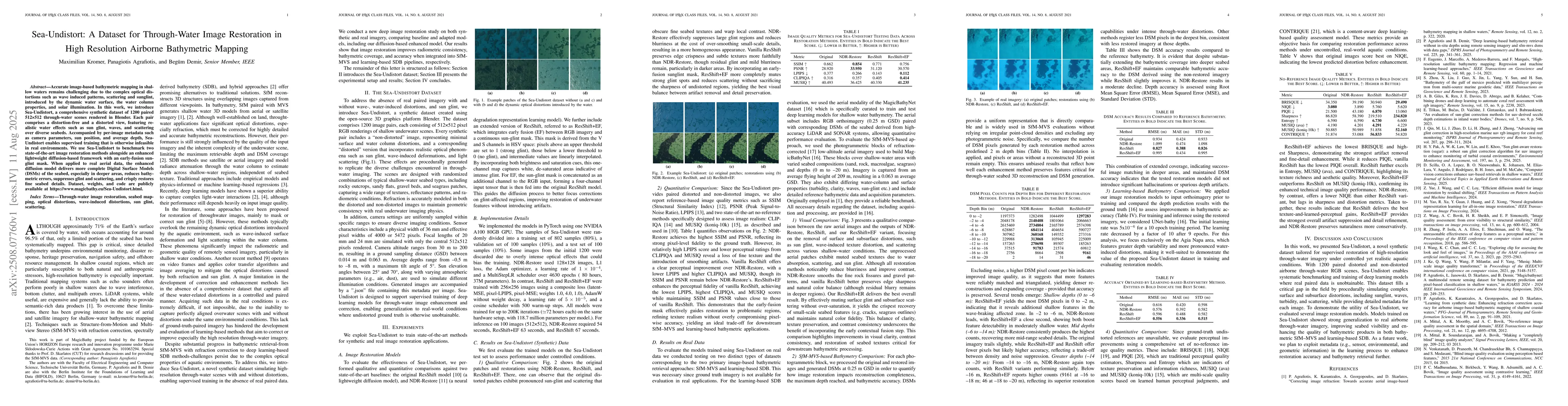
Accurate image-based bathymetric mapping in shallow waters remains challenging due to the complex optical distortions such as wave induced patterns, scattering and sunglint, introduced by the dynamic ...
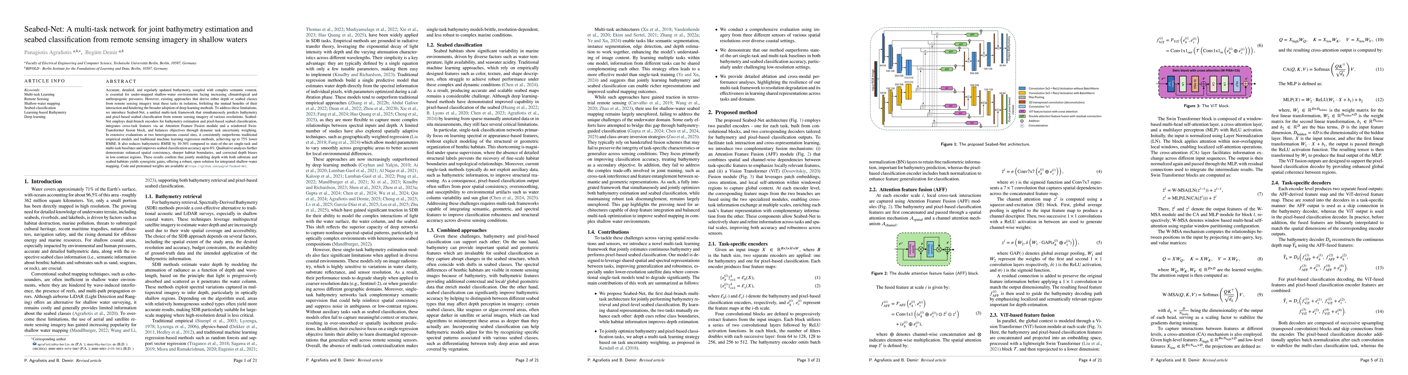
Accurate, detailed, and regularly updated bathymetry, coupled with complex semantic content, is essential for under-mapped shallow-water environments facing increasing climatological and anthropogenic...
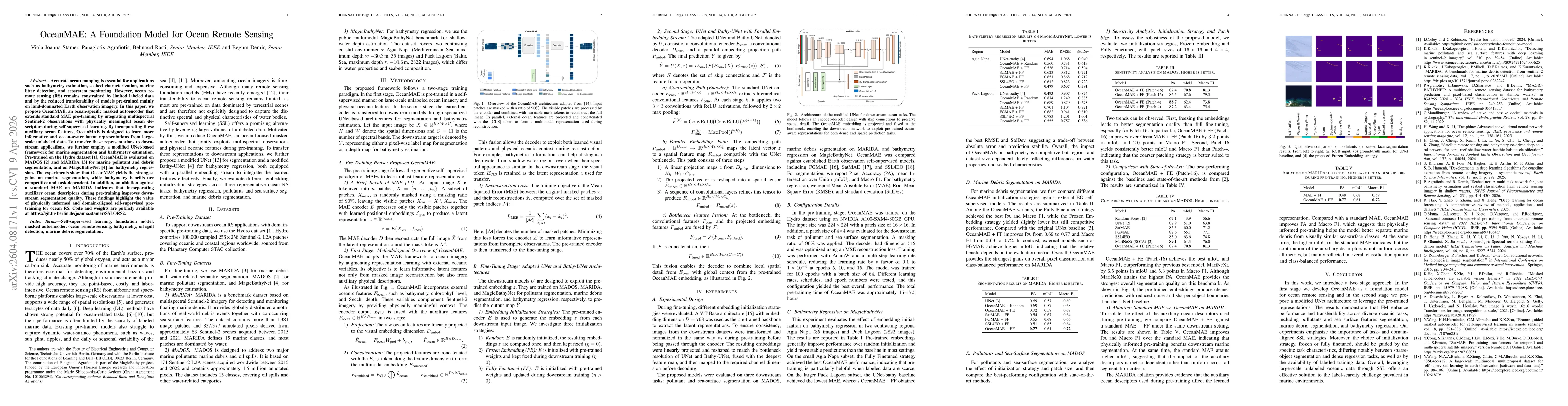
Accurate ocean mapping is essential for applications such as bathymetry estimation, seabed characterization, marine litter detection, and ecosystem monitoring. However, ocean remote sensing (RS) remai...