Academic Profile
Statistics
Similar Authors
Papers on arXiv
Branched broomrape (Phelipanche ramosa (L.) Pomel) is a chlorophyll-deficient parasitic plant that threatens tomato production by extracting nutrients from the host, with reported yield losses up to 8...
This study addresses the escalating threat of branched broomrape (Phelipanche ramosa) to California's tomato industry, which supplies over 90 percent of U.S. processing tomatoes. The parasite's largel...
Branched broomrape (Phelipanche ramosa) is a chlorophyll-deficient parasitic weed that threatens tomato production by extracting nutrients from the host. We investigate early detection using leaf-leve...
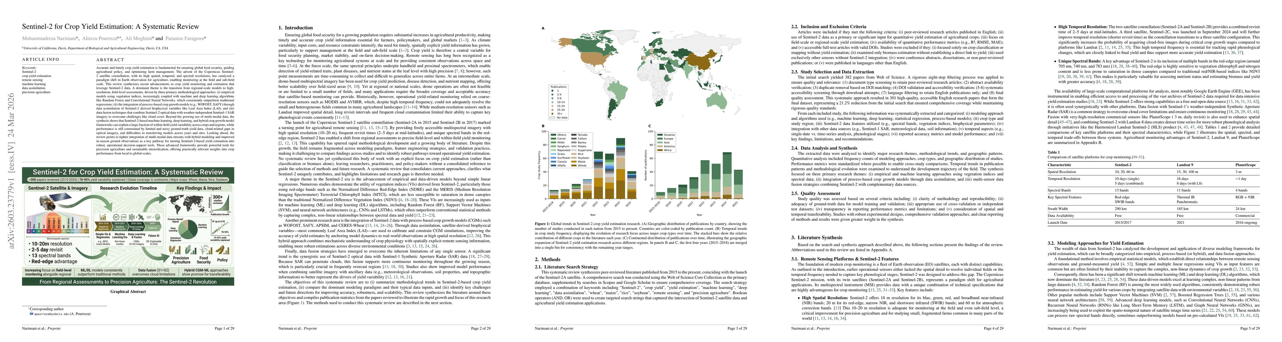
Accurate and timely crop yield estimation is critical for global food security, agricultural policy, and farm management. The Copernicus Sentinel-2 satellite constellation, with high spatial, temporal...
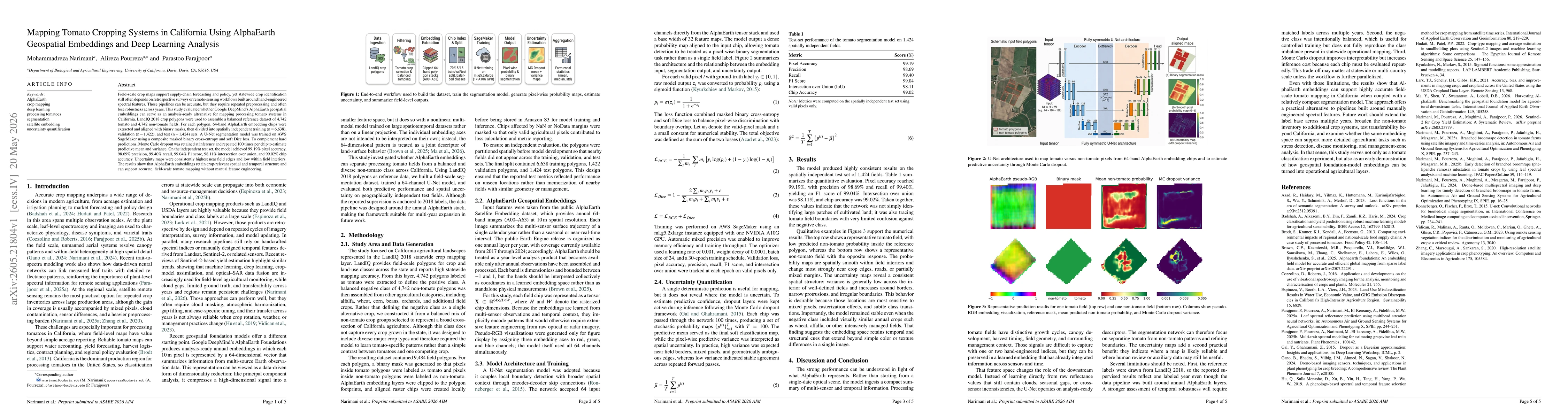
Field-scale crop maps support supply-chain forecasting and policy, yet statewide crop identification still often depends on retrospective surveys or remote-sensing workflows built around hand-engineer...
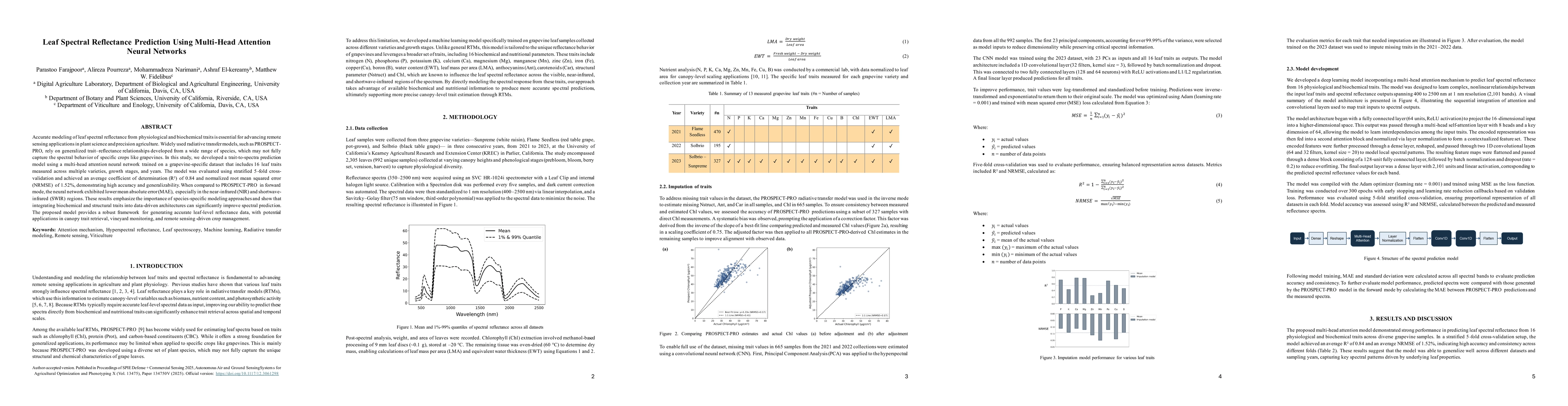
Accurate modeling of leaf spectral reflectance from physiological and biochemical traits is essential for advancing remote sensing applications in plant science and precision agriculture. Widely used ...