Academic Profile
Statistics
Similar Authors
Papers on arXiv
Illegal, unreported, and unregulated (IUU) fishing poses a global threat to ocean habitats. Publicly available satellite data offered by NASA and the European Space Agency (ESA) provide an opportuni...

From crop mapping to flood detection, machine learning in remote sensing has a wide range of societally beneficial applications. The commonalities between remote sensing data in these applications pre...
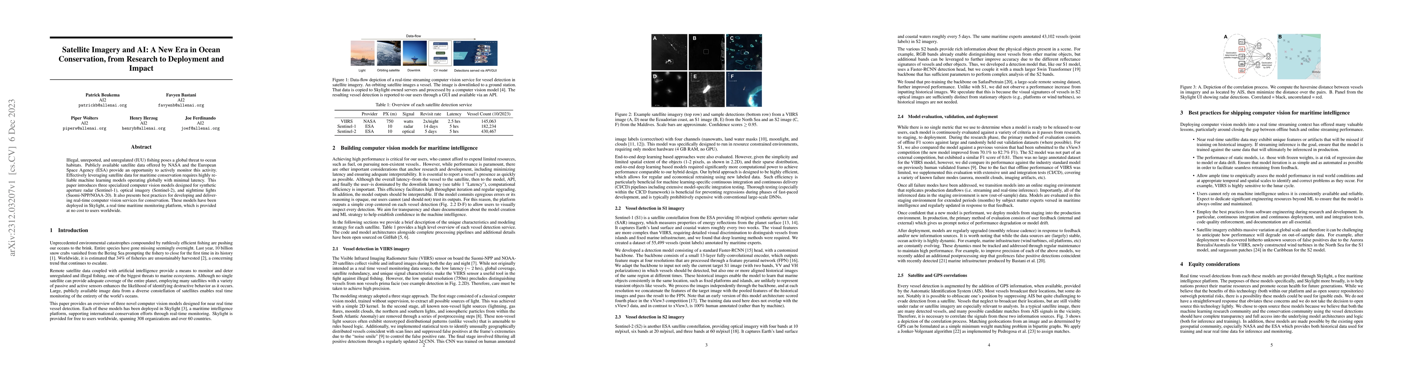
Unsustainable exploitation of the oceans exacerbated by global warming is threatening coastal communities worldwide. Accurate and timely monitoring of maritime activity is an essential step to effecti...
We introduce a new dataset and algorithm for fast and efficient coastal distance calculations from Anywhere on Earth (AoE). Existing global coastal datasets are only available at coarse resolution (e....
Wildfires are increasing in intensity and severity at an alarming rate. Recent advances in AI and publicly available satellite data enable monitoring critical wildfire risk factors globally, at high r...
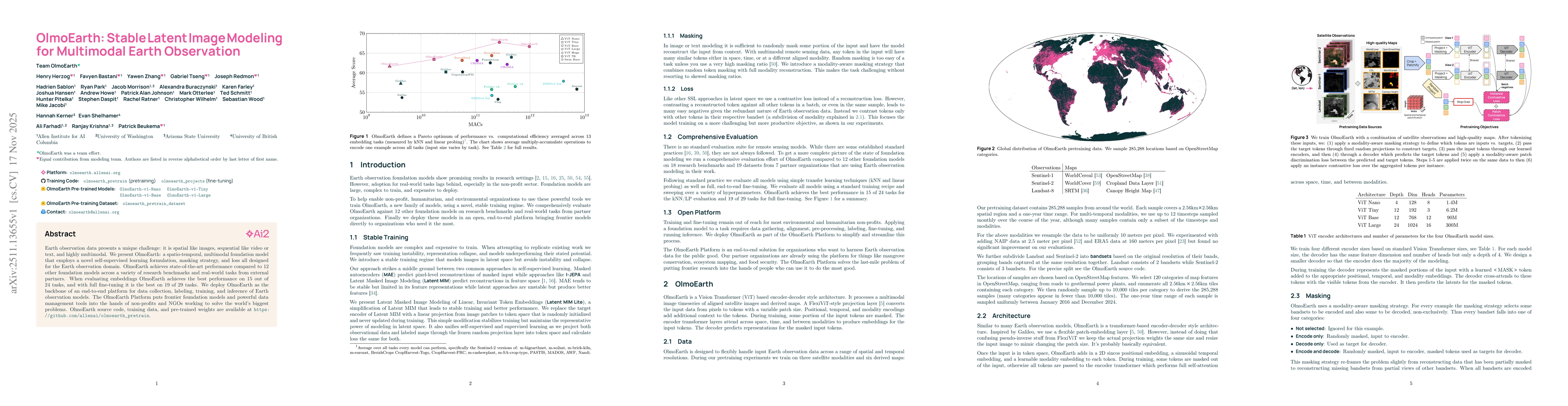
Earth observation data presents a unique challenge: it is spatial like images, sequential like video or text, and highly multimodal. We present OlmoEarth: a multimodal, spatio-temporal foundation mode...
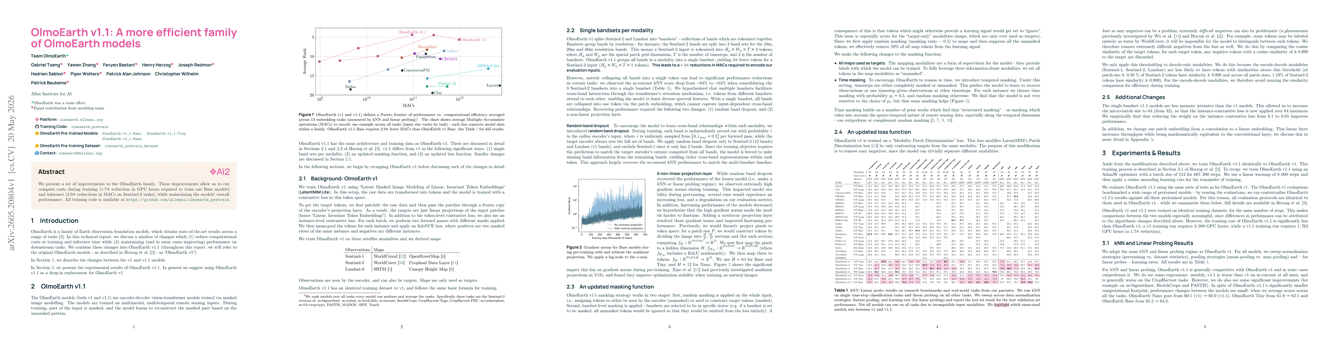
We present a set of improvements to the OlmoEarth family. These improvements allow us to cut compute costs during training ($1.7 \times$ reduction in GPU hours required to train our Base models) and i...