Academic Profile
Statistics
Similar Authors
Papers on arXiv
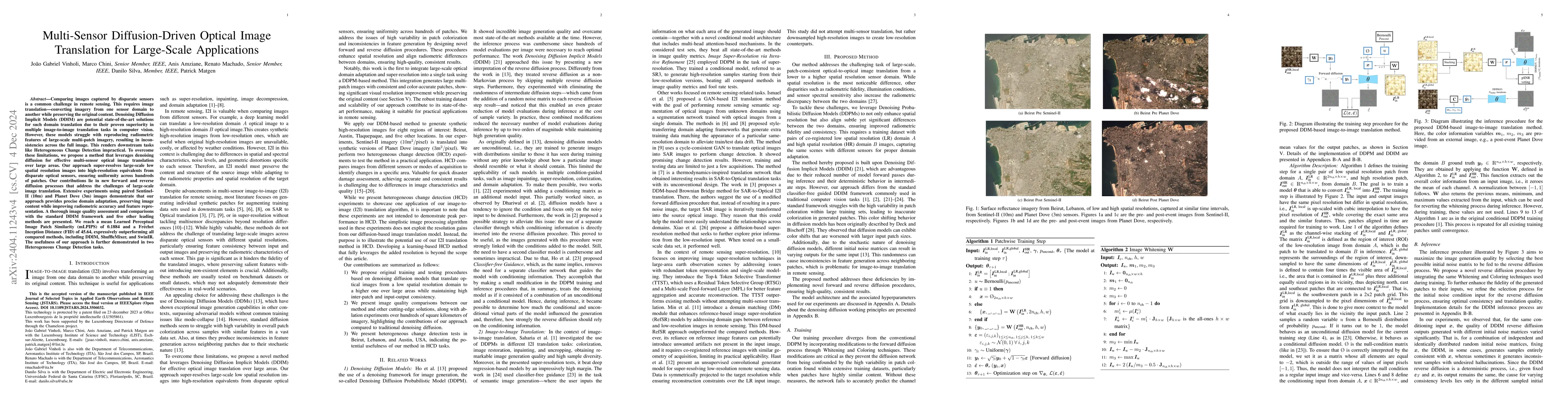
In the field of remote sensing, the challenge of comparing images captured by disparate sensors is a common obstacle. This requires image translation -- converting imagery from one sensor domain to an...
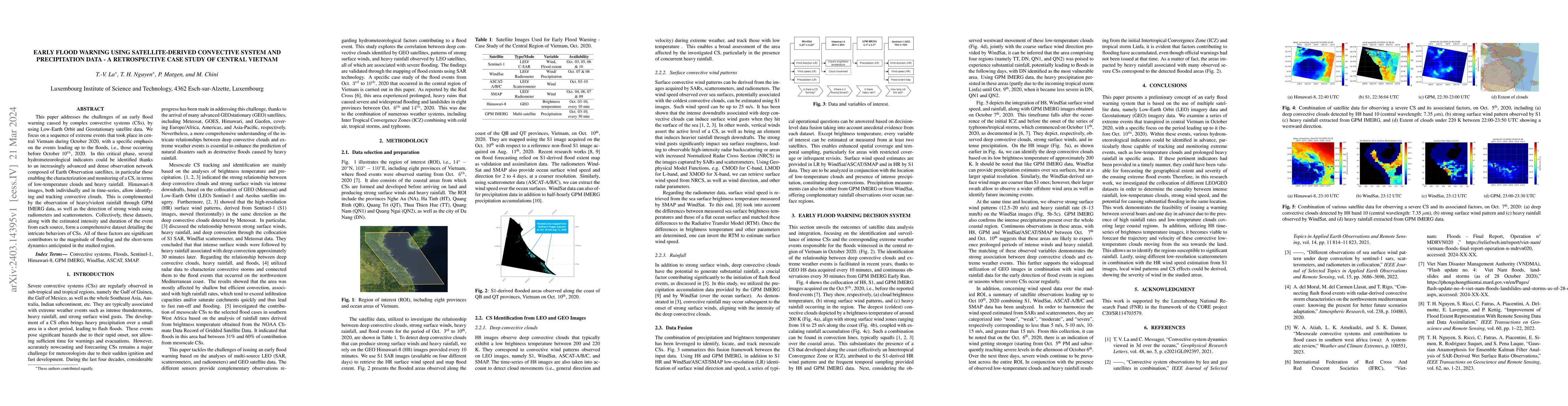
This paper addresses the challenges of an early flood warning caused by complex convective systems (CSs), by using Low-Earth Orbit and Geostationary satellite data. We focus on a sequence of extreme...
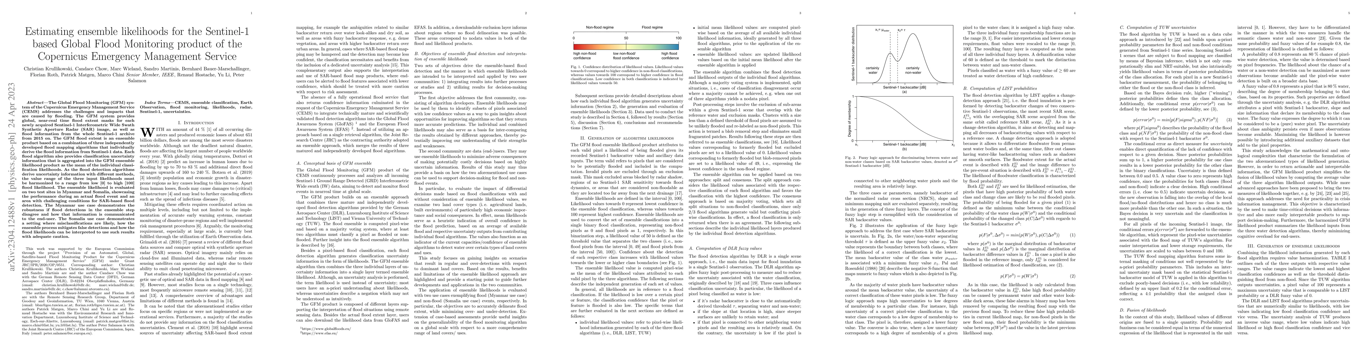
The Global Flood Monitoring (GFM) system of the Copernicus Emergency Management Service (CEMS) addresses the challenges and impacts that are caused by flooding. The GFM system provides global, near-...
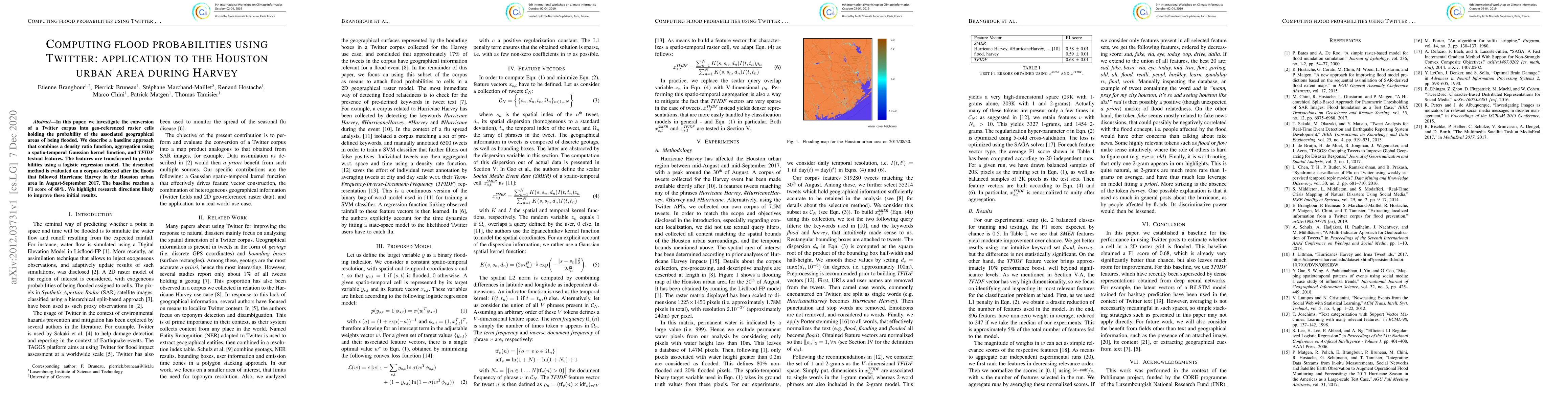
In this paper, we investigate the conversion of a Twitter corpus into geo-referenced raster cells holding the probability of the associated geographical areas of being flooded. We describe a baselin...
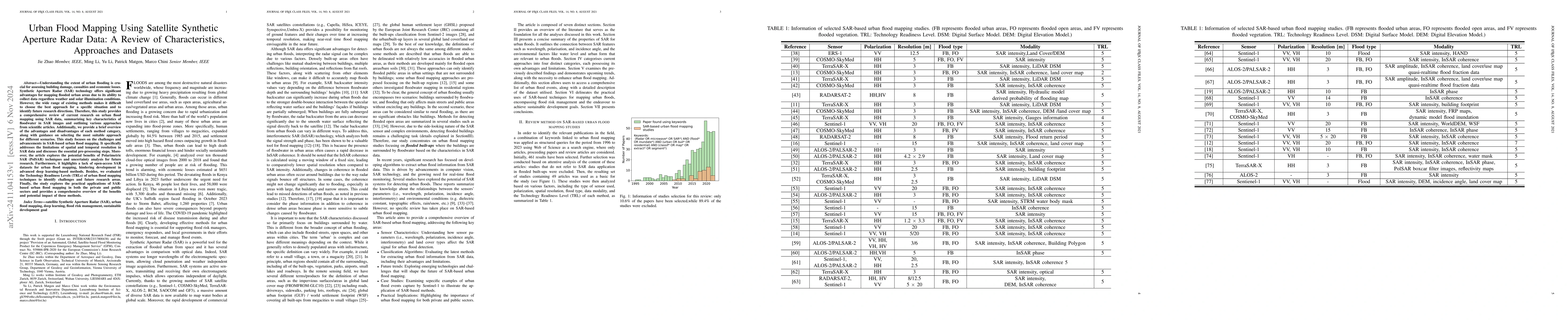
Understanding the extent of urban flooding is crucial for assessing building damage, casualties and economic losses. Synthetic Aperture Radar (SAR) technology offers significant advantages for mapping...
Floods pose significant risks to human lives, infrastructure, and the environment. Timely and accurate flood forecasting plays a pivotal role in mitigating these risks. This study presents a proof-of-...
We investigate the application of Federated Learning (FL) for ship detection across diverse satellite datasets, offering a privacy-preserving solution that eliminates the need for data sharing or cent...