Academic Profile
Statistics
Similar Authors
Papers on arXiv
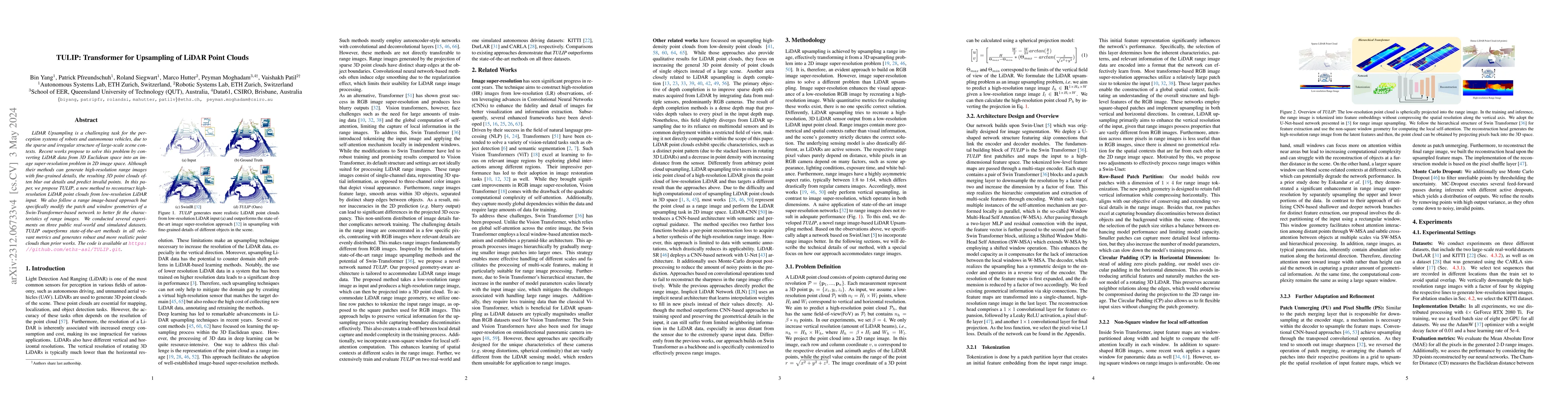
LiDAR Upsampling is a challenging task for the perception systems of robots and autonomous vehicles, due to the sparse and irregular structure of large-scale scene contexts. Recent works propose to ...
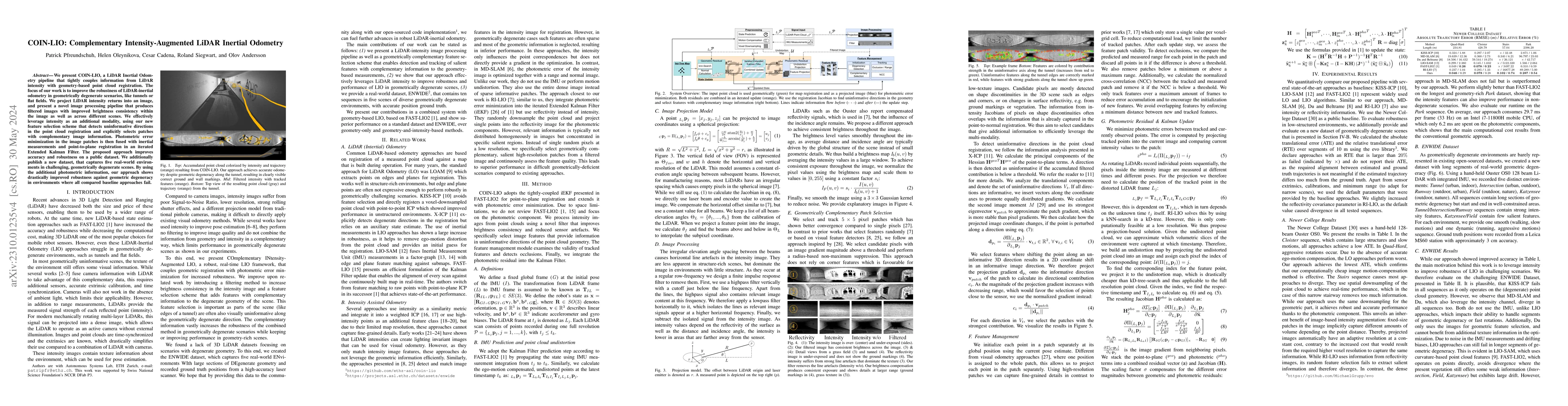
We present COIN-LIO, a LiDAR Inertial Odometry pipeline that tightly couples information from LiDAR intensity with geometry-based point cloud registration. The focus of our work is to improve the ro...
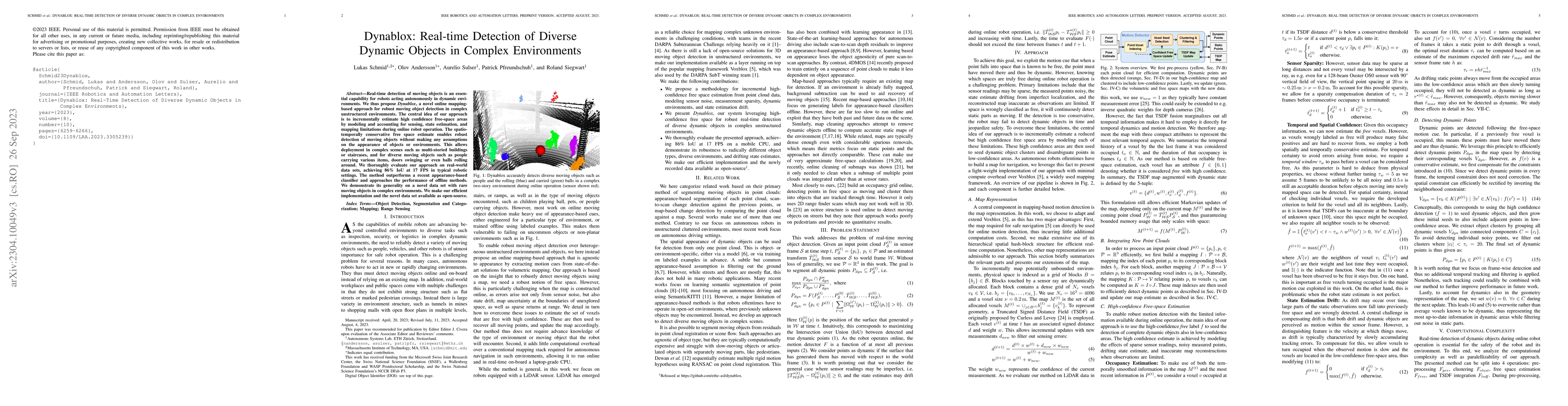
Real-time detection of moving objects is an essential capability for robots acting autonomously in dynamic environments. We thus propose Dynablox, a novel online mapping-based approach for robust mo...
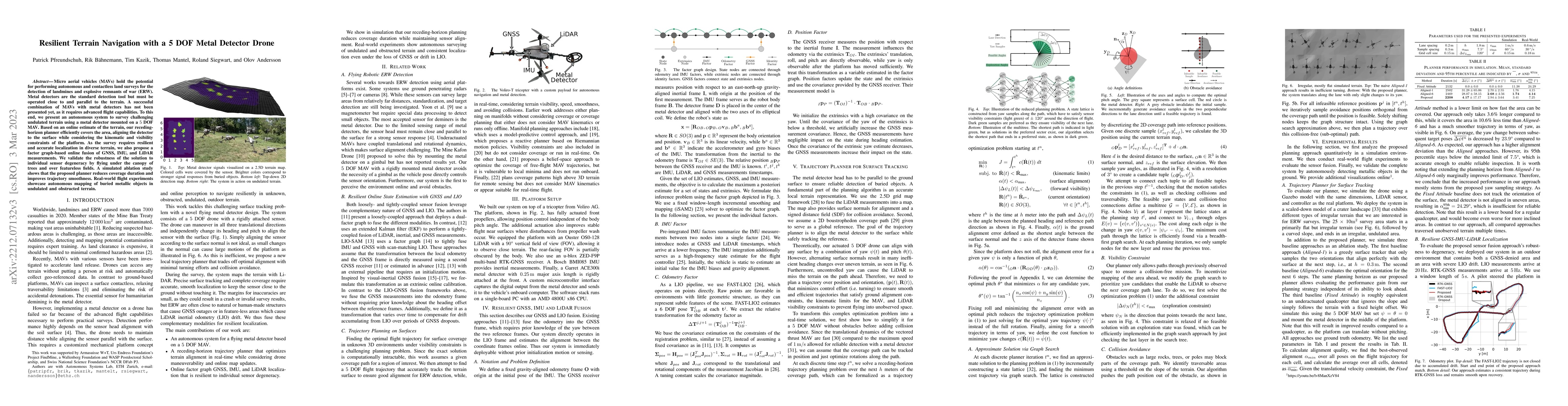
Micro aerial vehicles (MAVs) hold the potential for performing autonomous and contactless land surveys for the detection of landmines and explosive remnants of war (ERW). Metal detectors are the sta...
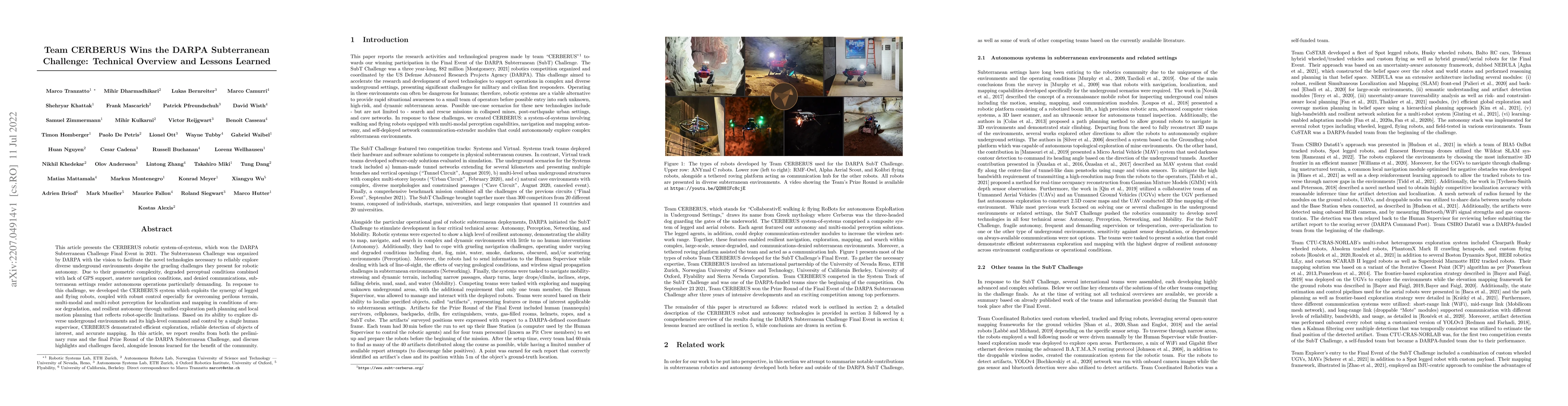
This article presents the CERBERUS robotic system-of-systems, which won the DARPA Subterranean Challenge Final Event in 2021. The Subterranean Challenge was organized by DARPA with the vision to fac...
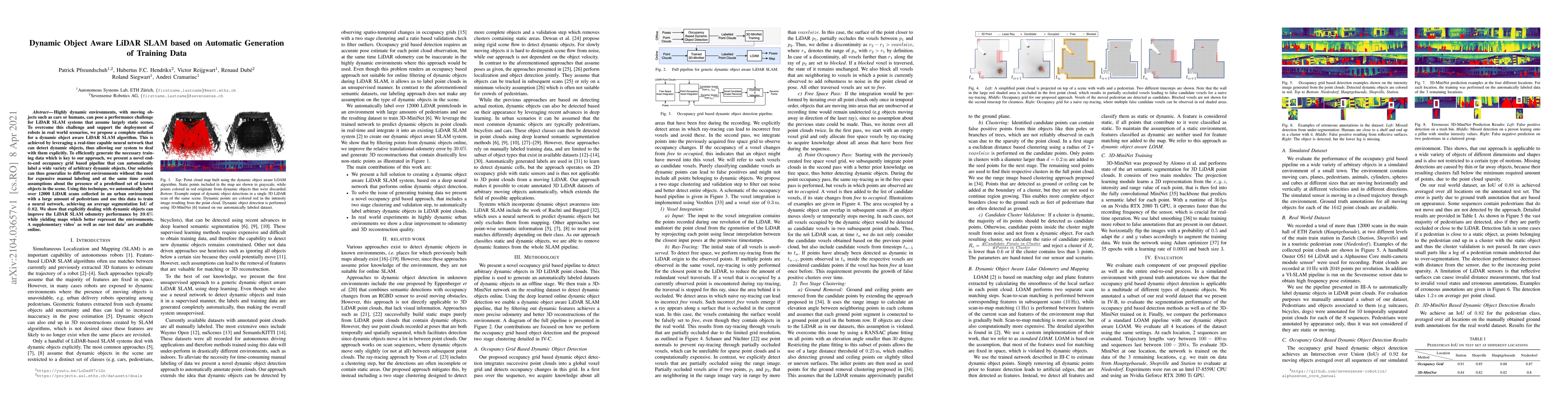
Highly dynamic environments, with moving objects such as cars or humans, can pose a performance challenge for LiDAR SLAM systems that assume largely static scenes. To overcome this challenge and sup...
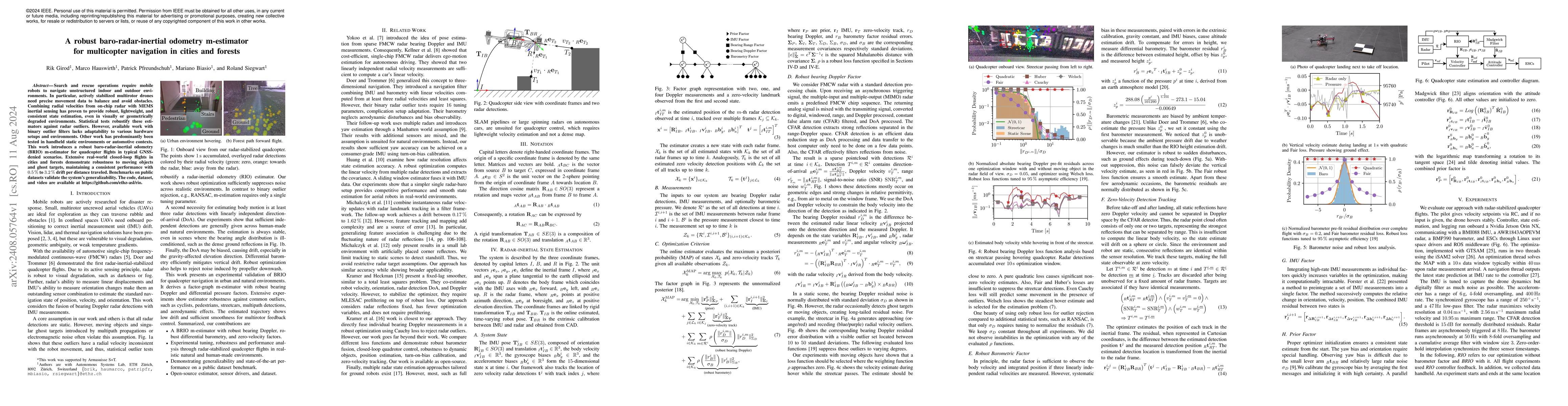
Search and rescue operations require mobile robots to navigate unstructured indoor and outdoor environments. In particular, actively stabilized multirotor drones need precise movement data to balance ...
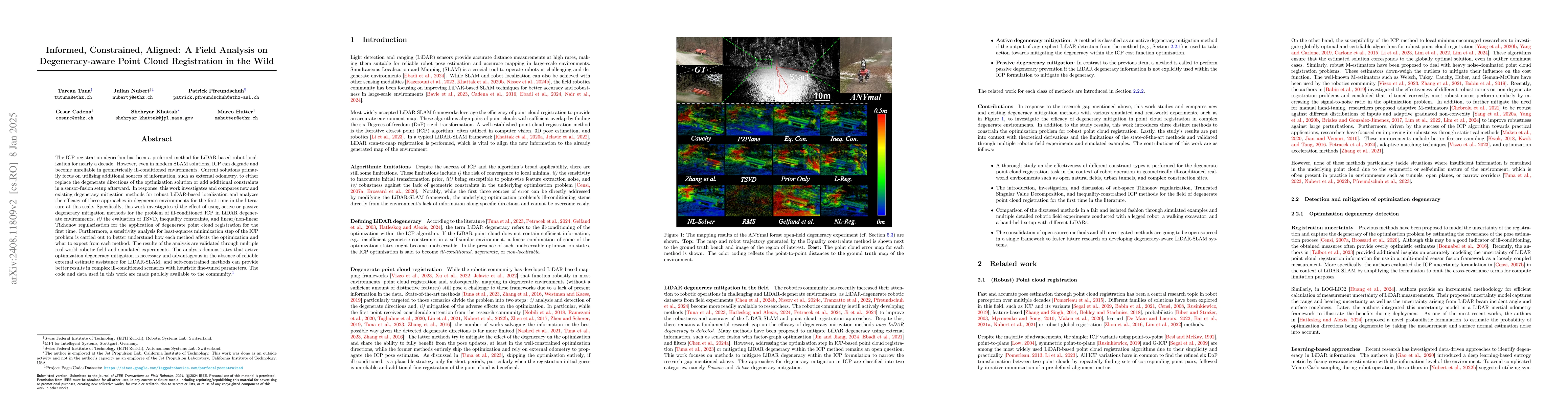
The ICP registration algorithm has been a preferred method for LiDAR-based robot localization for nearly a decade. However, even in modern SLAM solutions, ICP can degrade and become unreliable in geom...
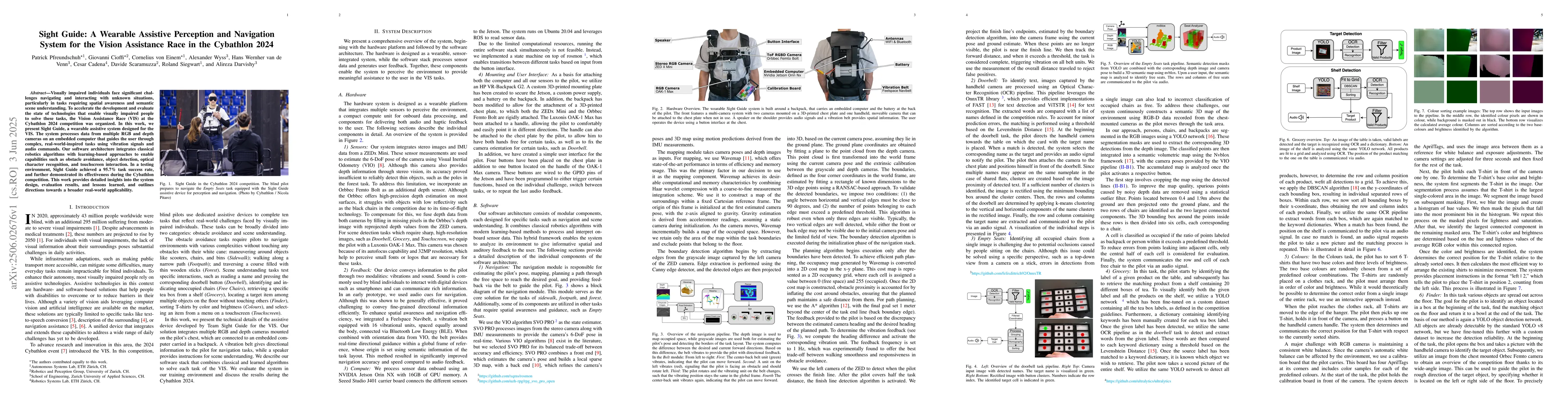
Visually impaired individuals face significant challenges navigating and interacting with unknown situations, particularly in tasks requiring spatial awareness and semantic scene understanding. To acc...
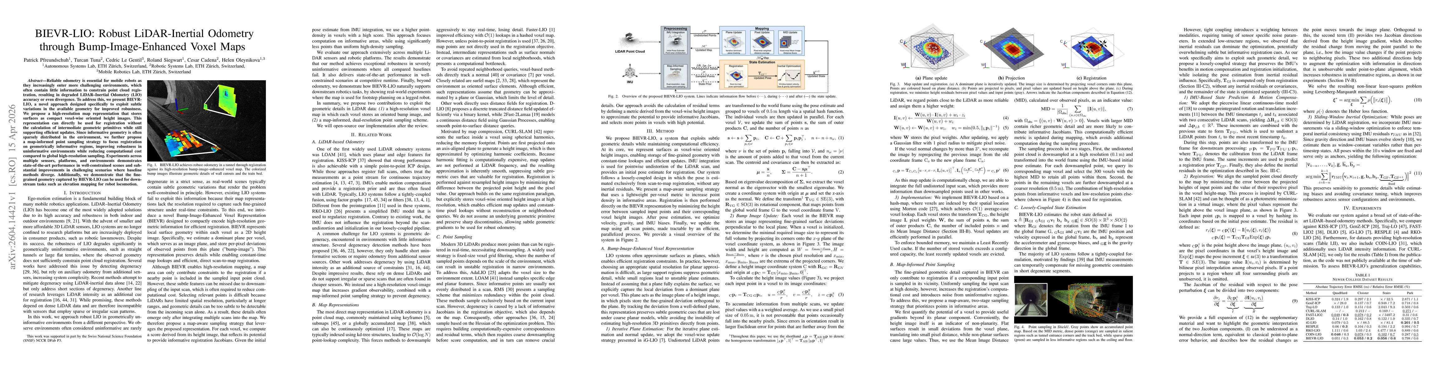
Reliable odometry is essential for mobile robots as they increasingly enter more challenging environments, which often contain little information to constrain point cloud registration, resulting in de...