Academic Profile
Statistics
Similar Authors
Papers on arXiv
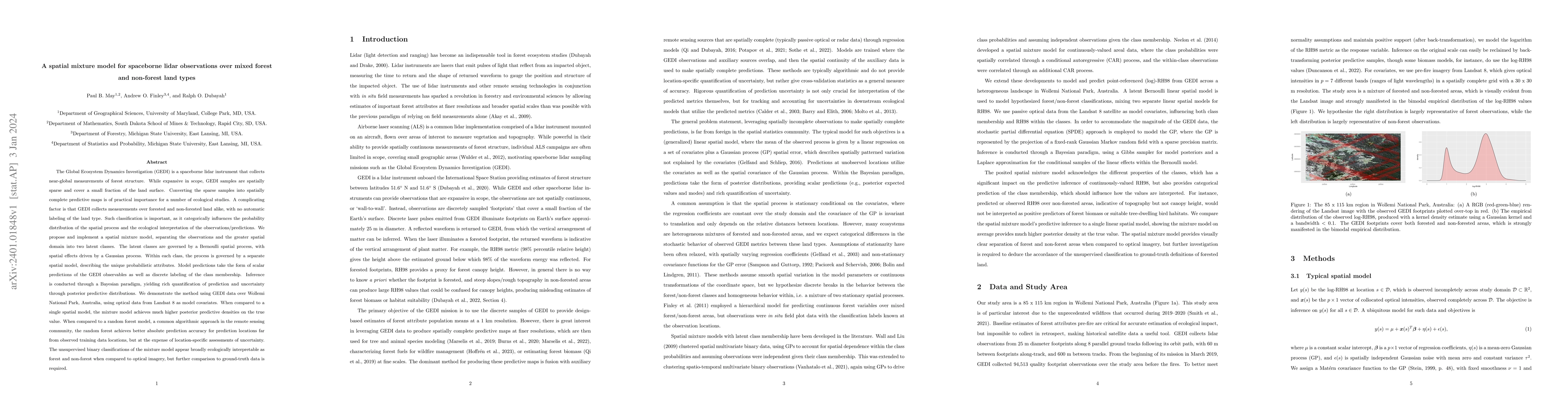
The Global Ecosystem Dynamics Investigation (GEDI) is a spaceborne lidar instrument that collects near-global measurements of forest structure. While expansive in scope, GEDI samples are spatially s...
Spatially explicit quantification of forest biomass is important for forest-health monitoring and carbon accounting. Direct field measurements of biomass are laborious and expensive, typically limitin...
National Forest Inventory (NFI) programs can provide vital information on the status, trend, and change in forest parameters. These programs are being increasingly asked to provide forest parameter es...
The USDA Forest Inventory and Analysis (FIA) program conducts a national forest inventory for the United States through a network of permanent field plots. FIA produces estimates of area averages/tota...
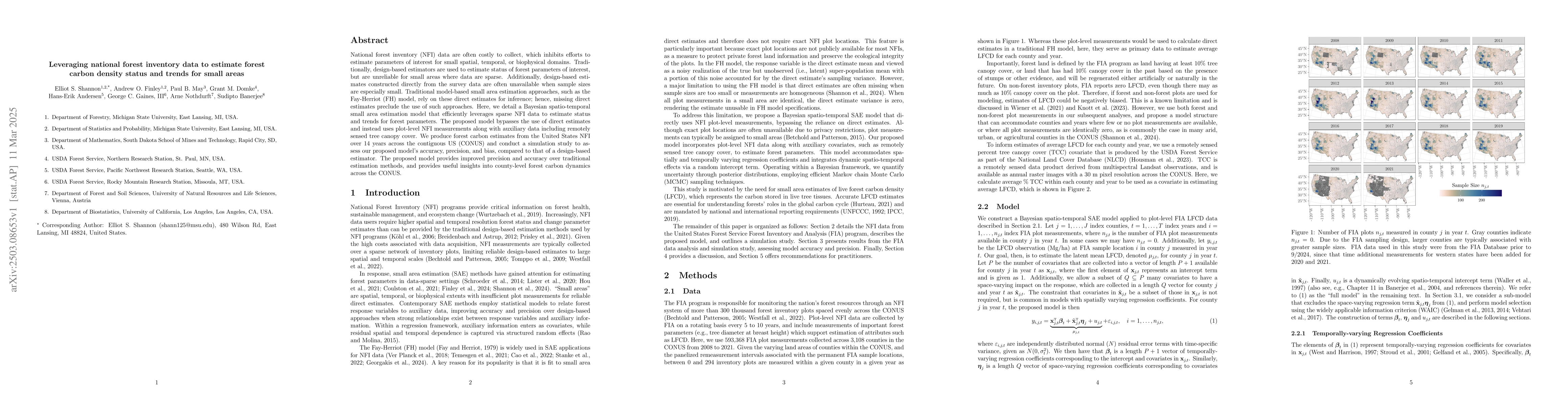
National forest inventory (NFI) data are often costly to collect, which inhibits efforts to estimate parameters of interest for small spatial, temporal, or biophysical domains. Traditionally, design-b...