Academic Profile
Statistics
Similar Authors
Papers on arXiv
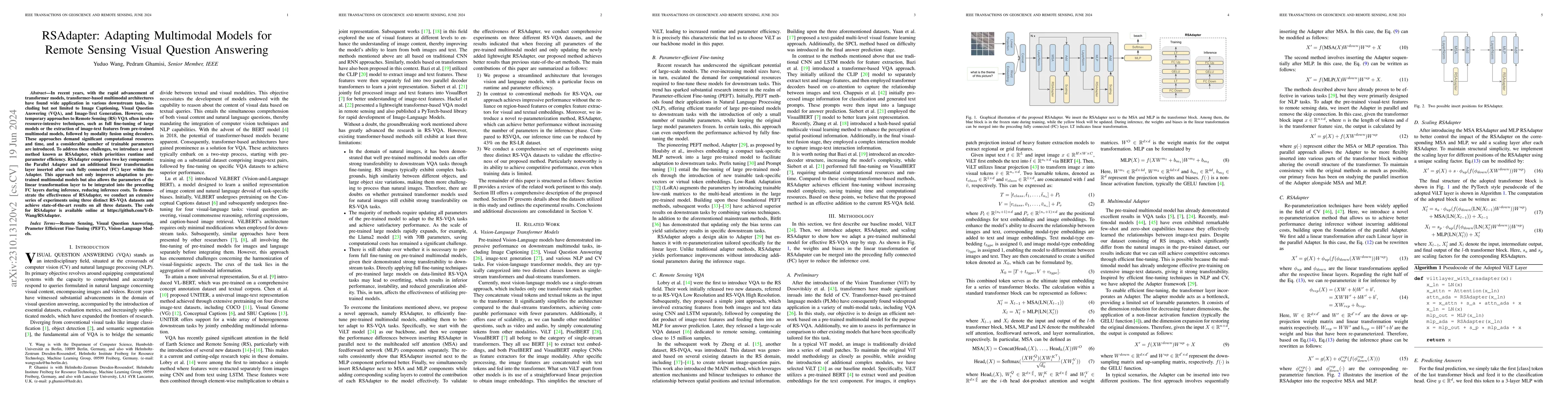
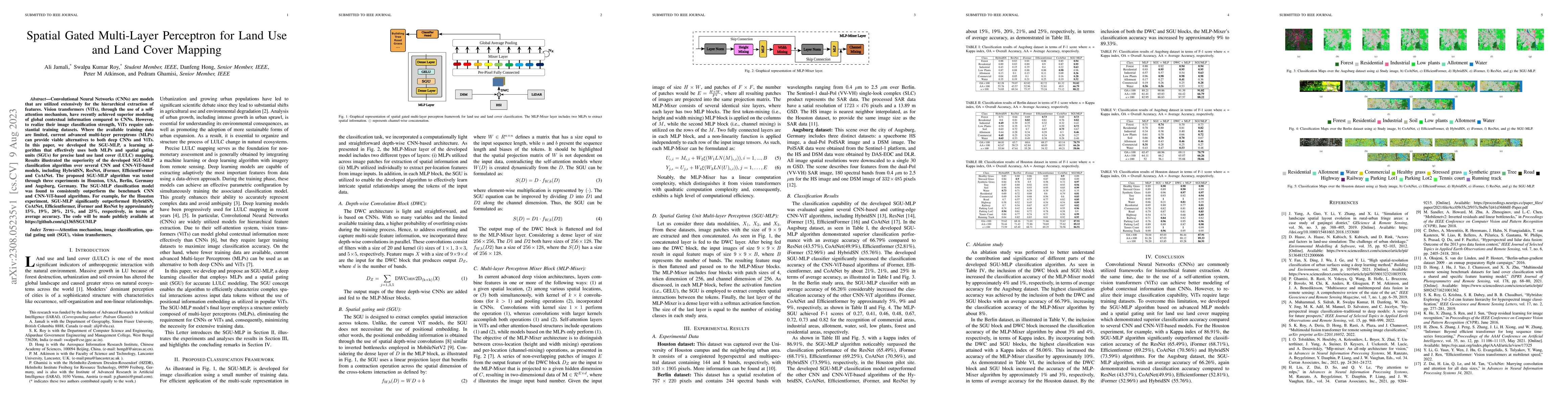
In recent years, with the rapid advancement of transformer models, transformer-based multimodal architectures have found wide application in various downstream tasks, including but not limited to Imag...
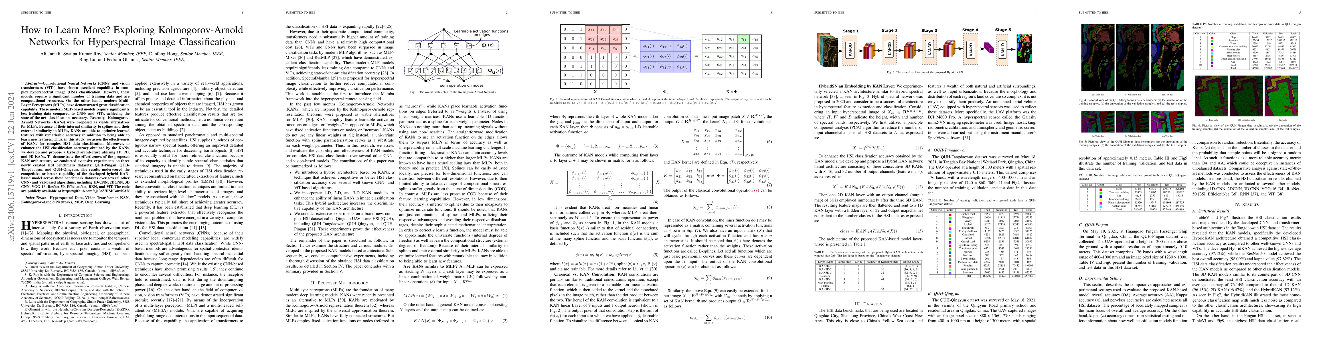
Convolutional Neural Networks (CNNs) and vision transformers (ViTs) have shown excellent capability in complex hyperspectral image (HSI) classification. However, these models require a significant n...
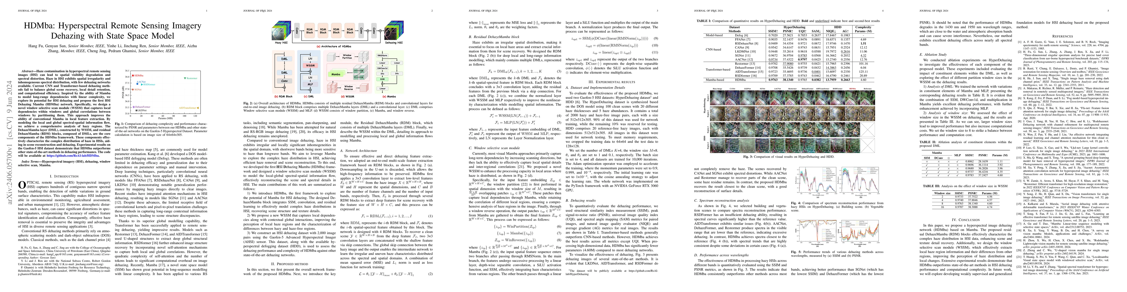
Haze contamination in hyperspectral remote sensing images (HSI) can lead to spatial visibility degradation and spectral distortion. Haze in HSI exhibits spatial irregularity and inhomogeneous spectr...
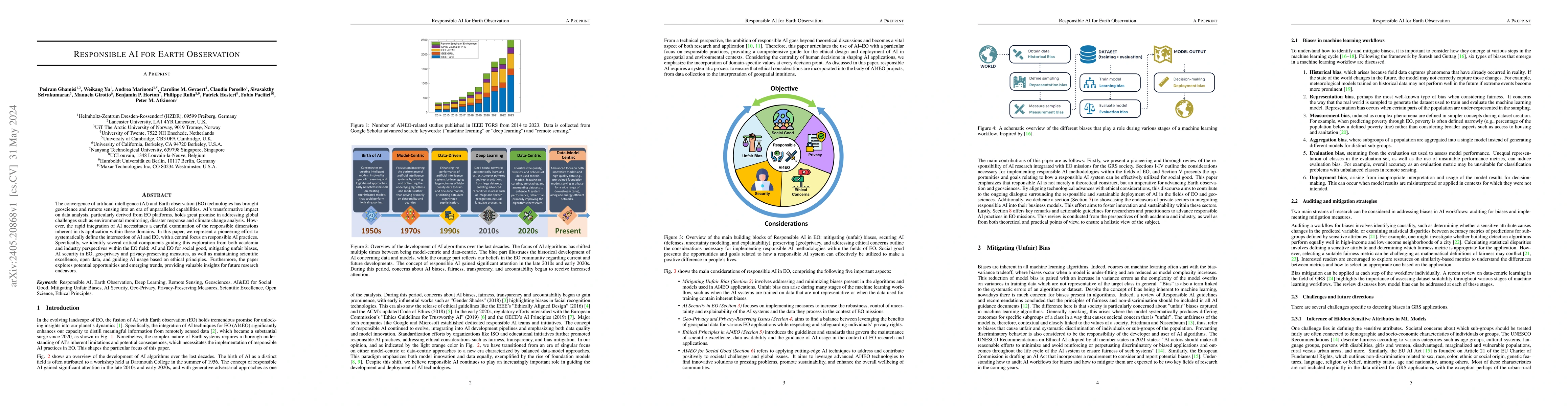
The convergence of artificial intelligence (AI) and Earth observation (EO) technologies has brought geoscience and remote sensing into an era of unparalleled capabilities. AI's transformative impact...
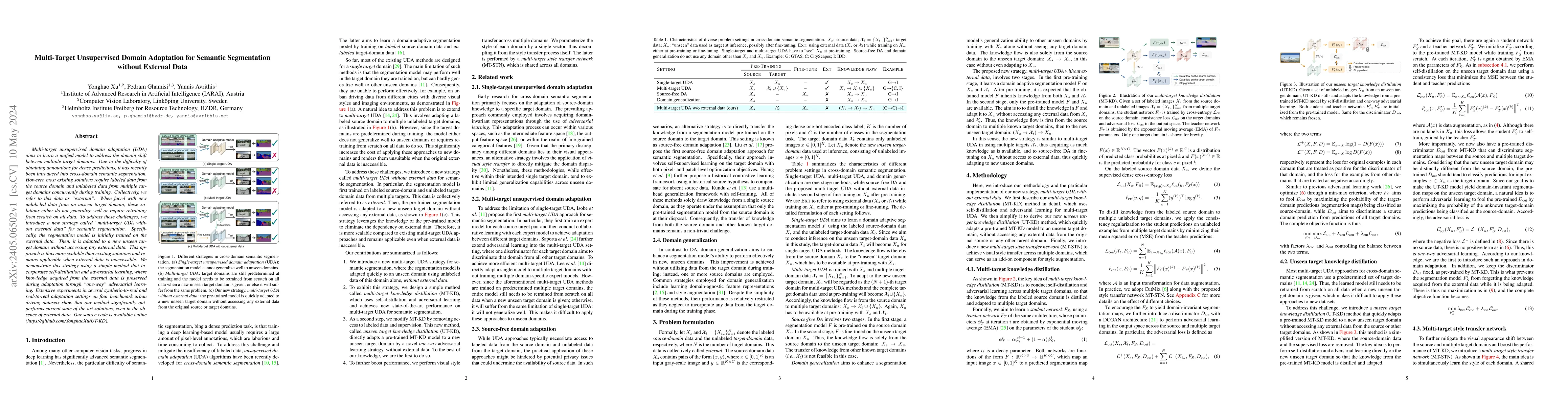
Multi-target unsupervised domain adaptation (UDA) aims to learn a unified model to address the domain shift between multiple target domains. Due to the difficulty of obtaining annotations for dense ...
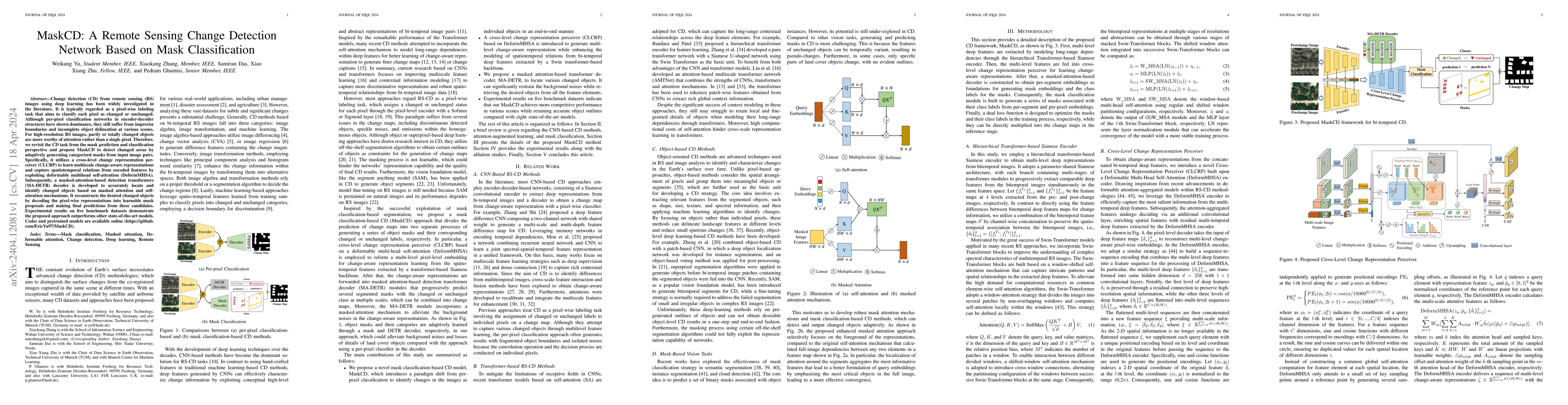
Change detection (CD) from remote sensing (RS) images using deep learning has been widely investigated in the literature. It is typically regarded as a pixel-wise labeling task that aims to classify...
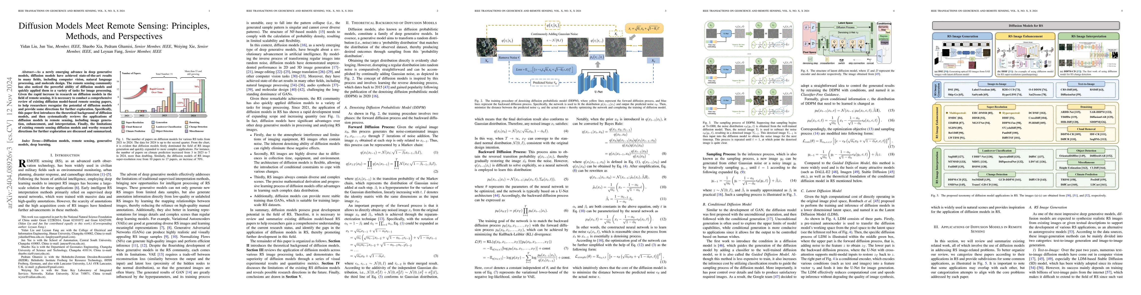
As a newly emerging advance in deep generative models, diffusion models have achieved state-of-the-art results in many fields, including computer vision, natural language processing, and molecule de...
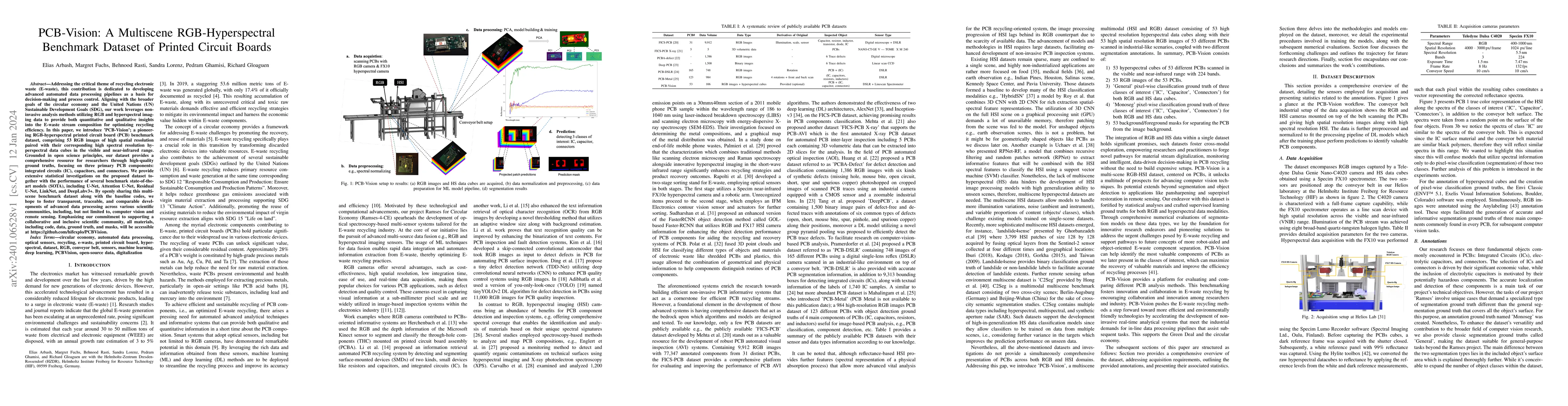
Addressing the critical theme of recycling electronic waste (E-waste), this contribution is dedicated to developing advanced automated data processing pipelines as a basis for decision-making and pr...
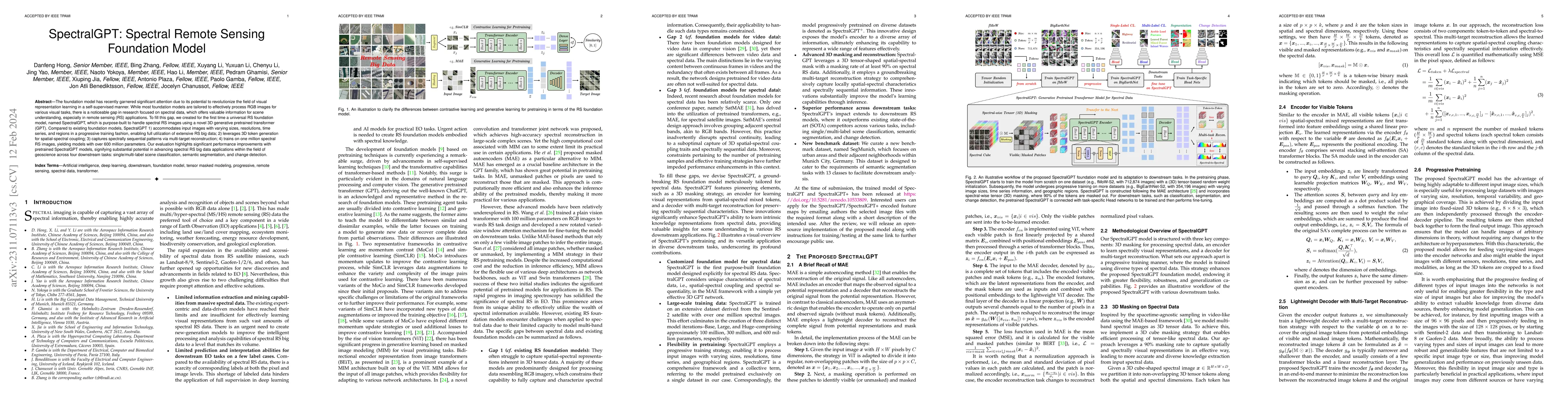
The foundation model has recently garnered significant attention due to its potential to revolutionize the field of visual representation learning in a self-supervised manner. While most foundation ...
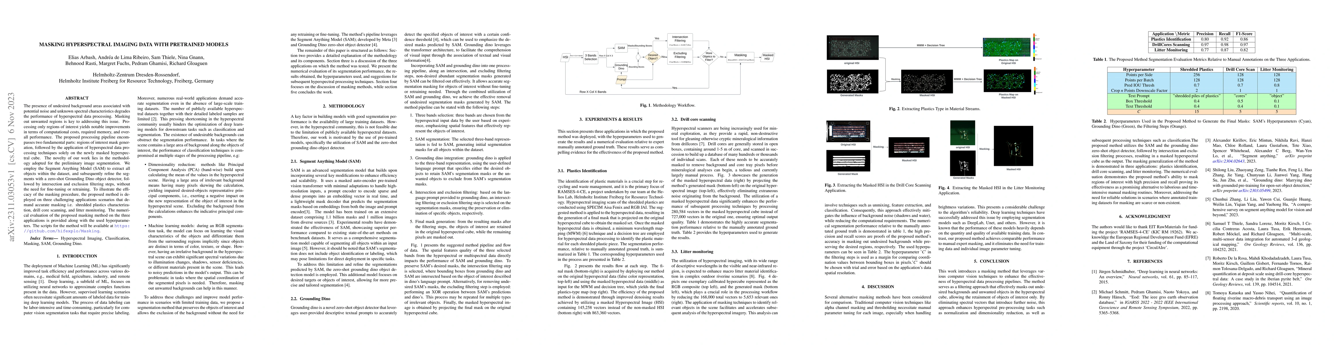
The presence of undesired background areas associated with potential noise and unknown spectral characteristics degrades the performance of hyperspectral data processing. Masking out unwanted region...
Convolutional Neural Networks (CNNs) are models that are utilized extensively for the hierarchical extraction of features. Vision transformers (ViTs), through the use of a self-attention mechanism, ...
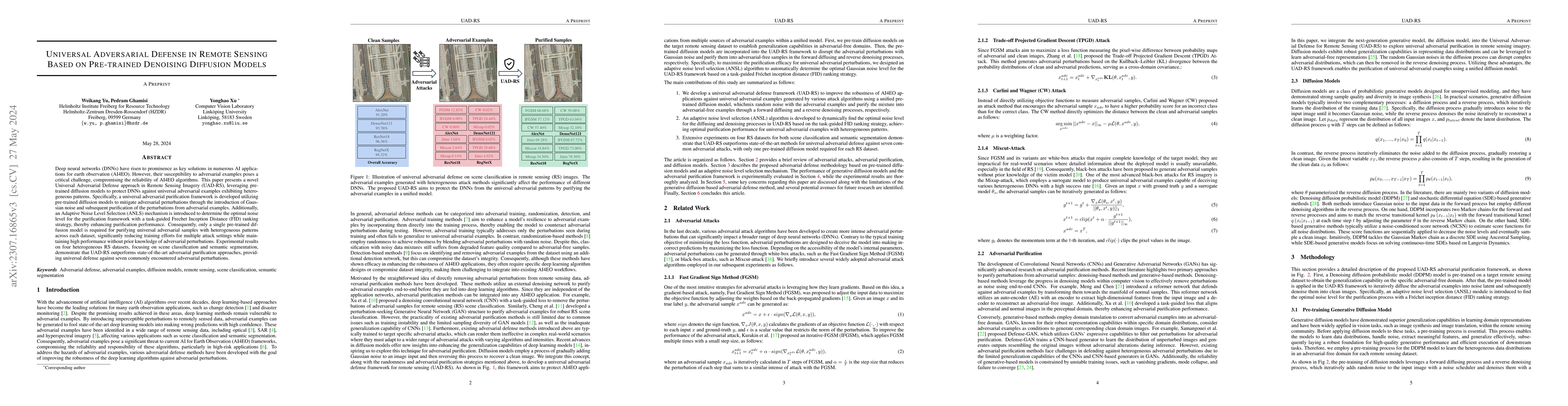
Deep neural networks (DNNs) have risen to prominence as key solutions in numerous AI applications for earth observation (AI4EO). However, their susceptibility to adversarial examples poses a critica...
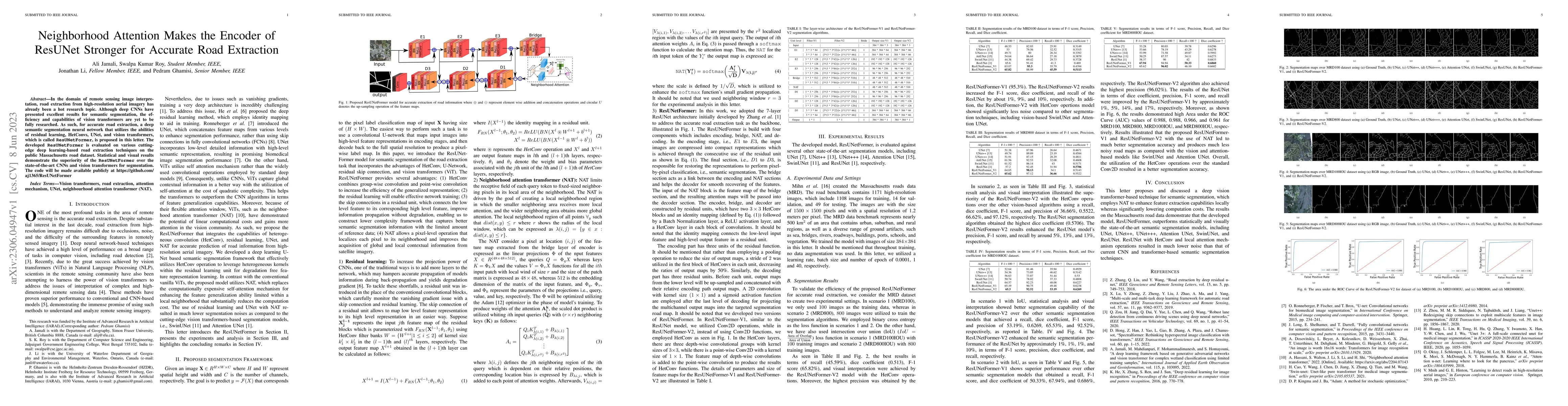
In the domain of remote sensing image interpretation, road extraction from high-resolution aerial imagery has already been a hot research topic. Although deep CNNs have presented excellent results f...
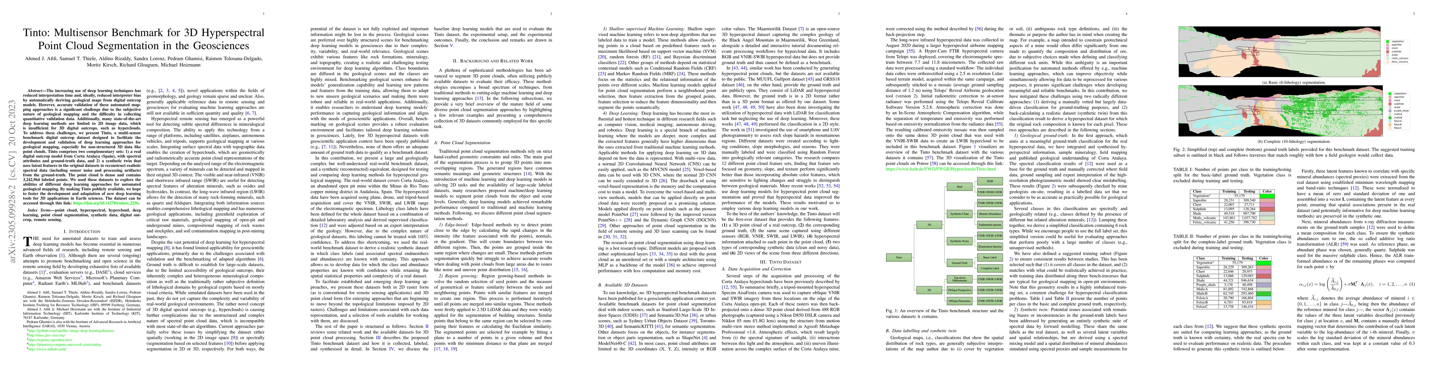
The increasing use of deep learning techniques has reduced interpretation time and, ideally, reduced interpreter bias by automatically deriving geological maps from digital outcrop models. However, ...
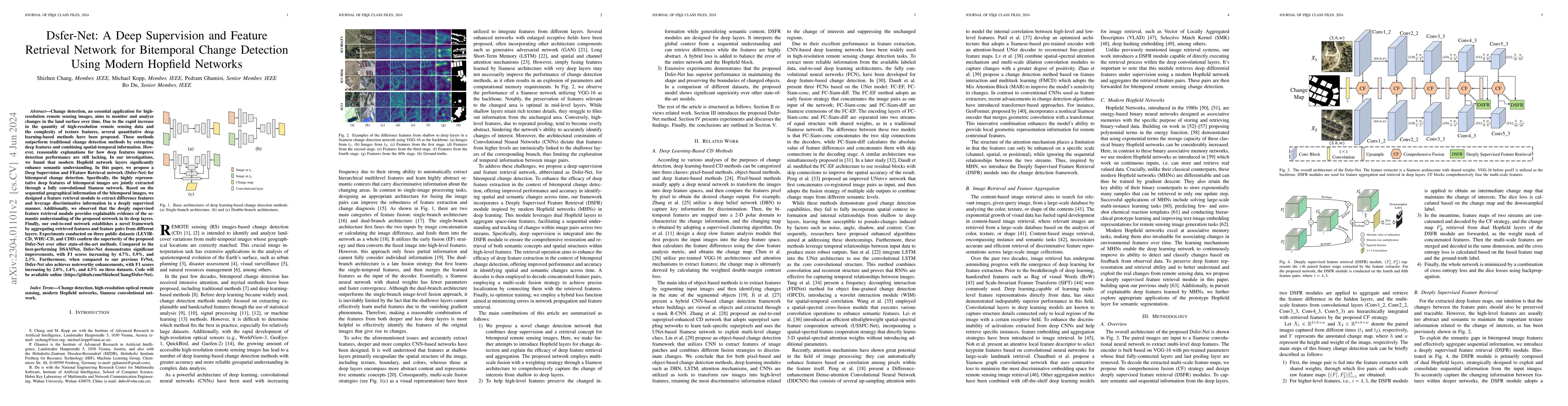
Change detection, an essential application for high-resolution remote sensing images, aims to monitor and analyze changes in the land surface over time. Due to the rapid increase in the quantity of ...
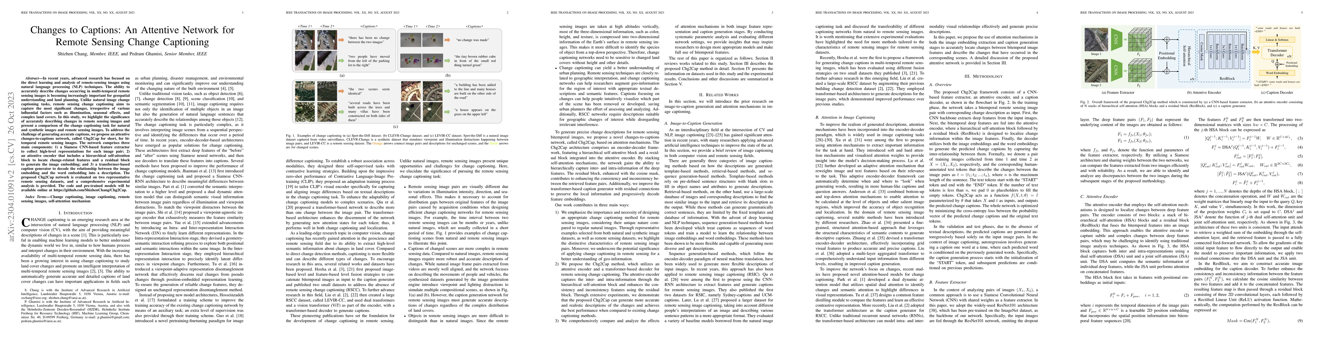
In recent years, advanced research has focused on the direct learning and analysis of remote sensing images using natural language processing (NLP) techniques. The ability to accurately describe cha...
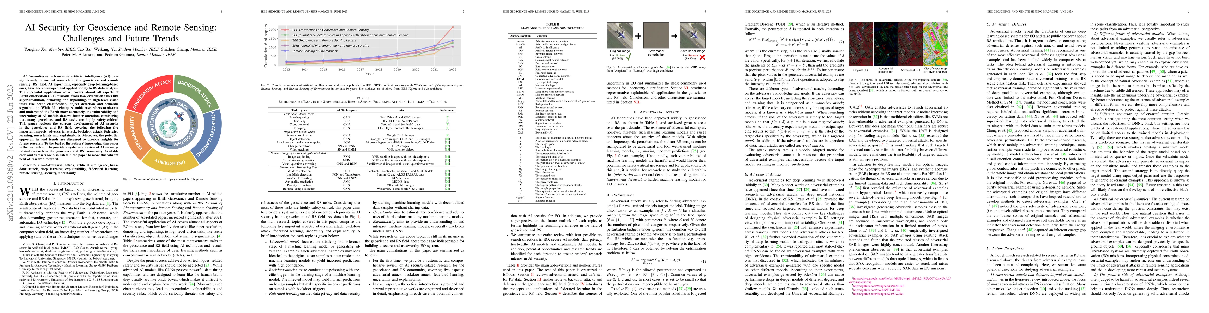
Recent advances in artificial intelligence (AI) have significantly intensified research in the geoscience and remote sensing (RS) field. AI algorithms, especially deep learning-based ones, have been...
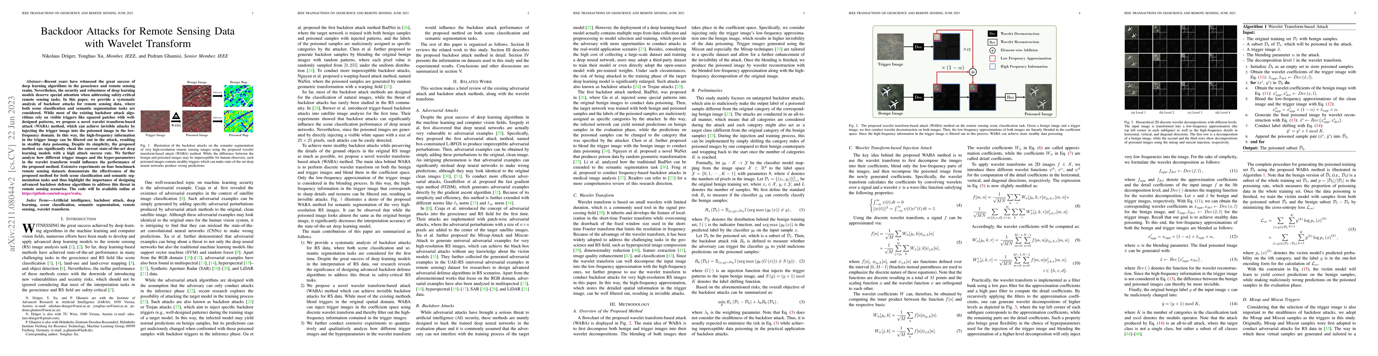
Recent years have witnessed the great success of deep learning algorithms in the geoscience and remote sensing realm. Nevertheless, the security and robustness of deep learning models deserve specia...
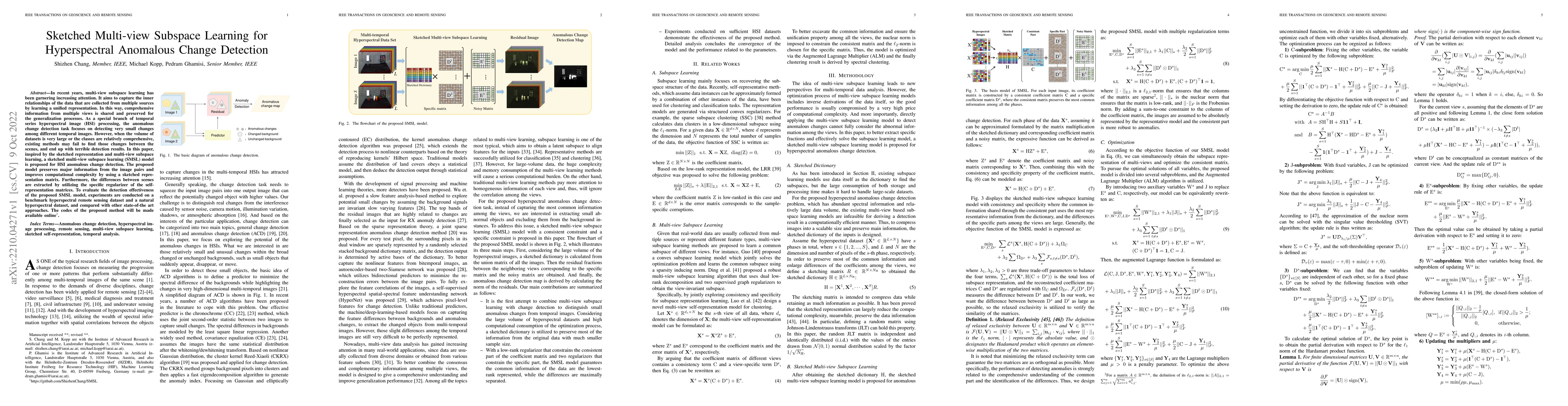
In recent years, multi-view subspace learning has been garnering increasing attention. It aims to capture the inner relationships of the data that are collected from multiple sources by learning a u...
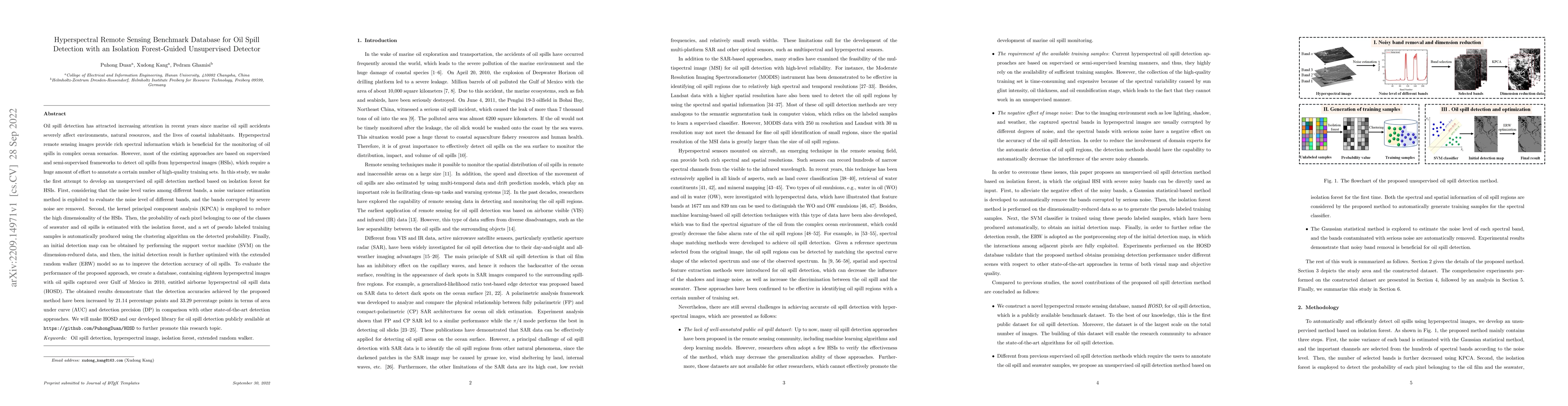
Oil spill detection has attracted increasing attention in recent years since marine oil spill accidents severely affect environments, natural resources, and the lives of coastal inhabitants. Hypersp...
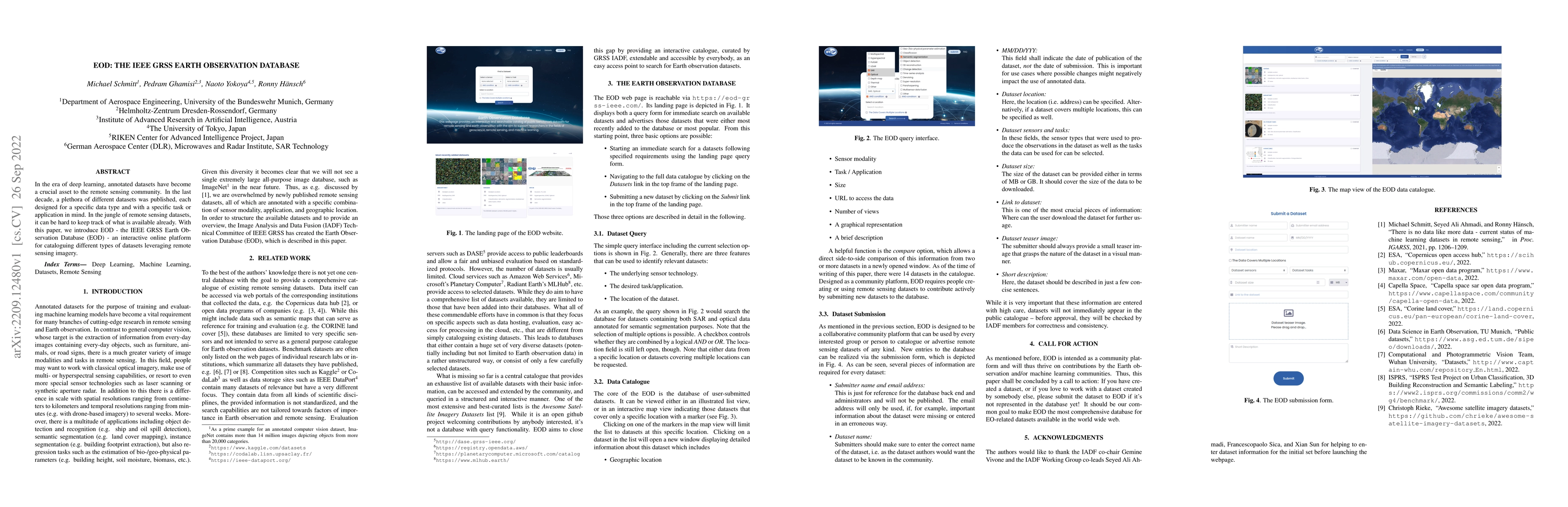
In the era of deep learning, annotated datasets have become a crucial asset to the remote sensing community. In the last decade, a plethora of different datasets was published, each designed for a s...
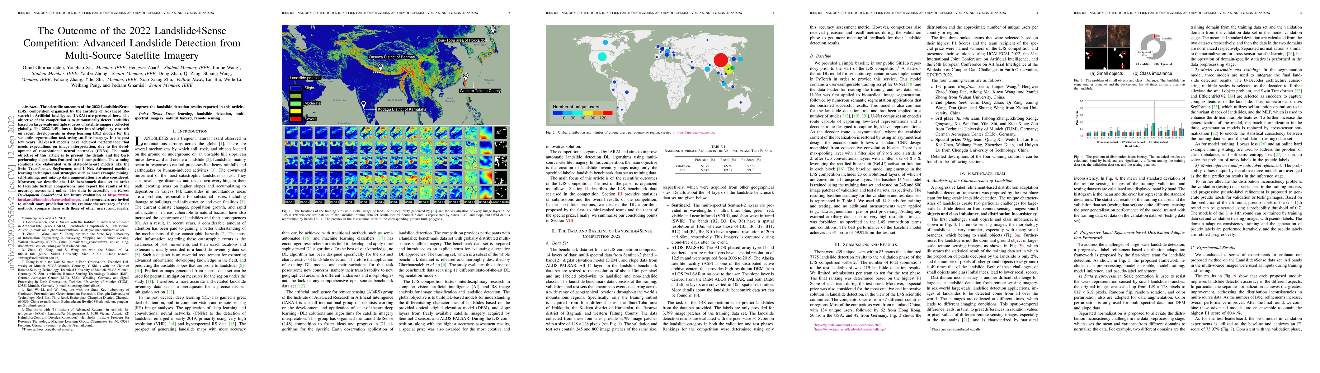
The scientific outcomes of the 2022 Landslide4Sense (L4S) competition organized by the Institute of Advanced Research in Artificial Intelligence (IARAI) are presented here. The objective of the comp...
The application of deep learning algorithms to Earth observation (EO) in recent years has enabled substantial progress in fields that rely on remotely sensed data. However, given the data scale in E...
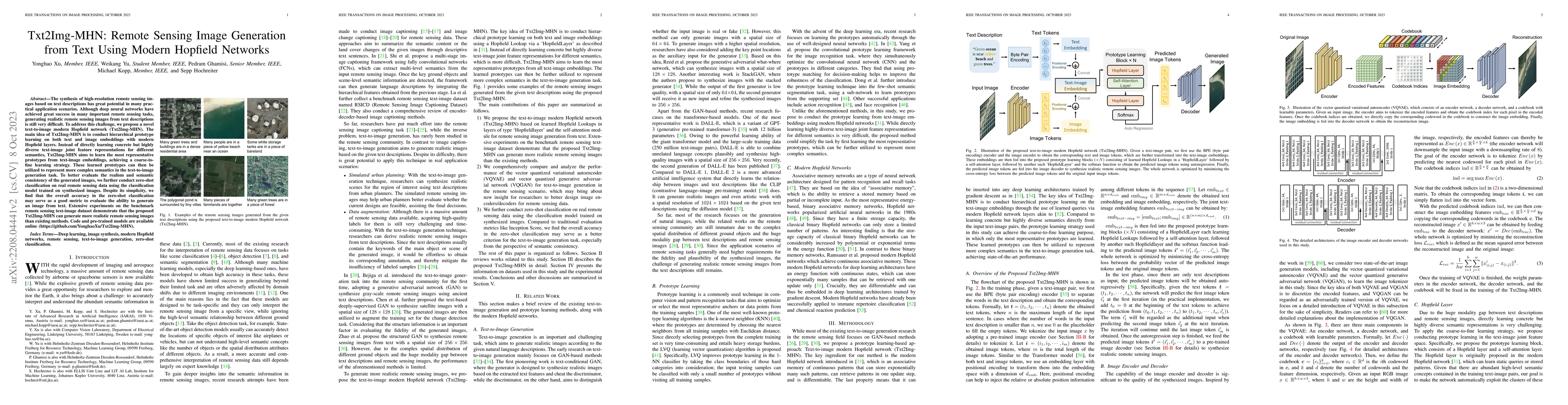
The synthesis of high-resolution remote sensing images based on text descriptions has great potential in many practical application scenarios. Although deep neural networks have achieved great succe...
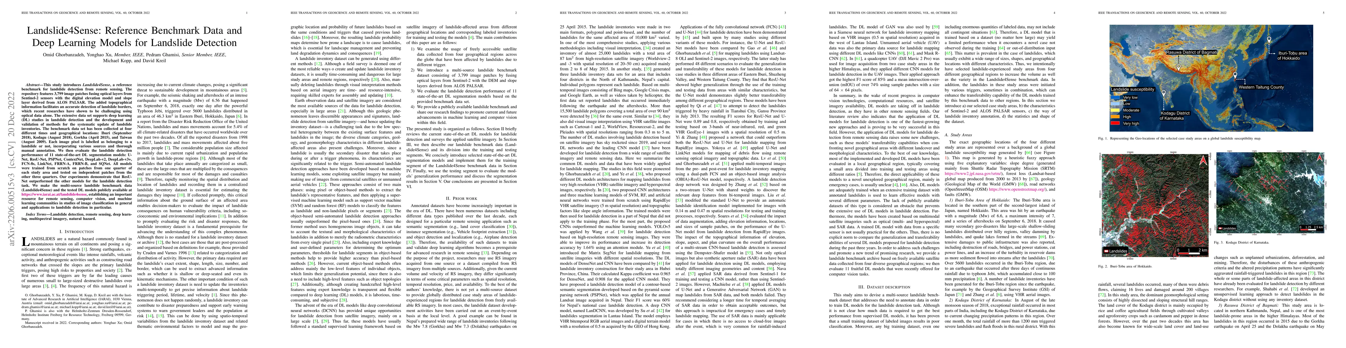
This study introduces \textit{Landslide4Sense}, a reference benchmark for landslide detection from remote sensing. The repository features 3,799 image patches fusing optical layers from Sentinel-2 s...
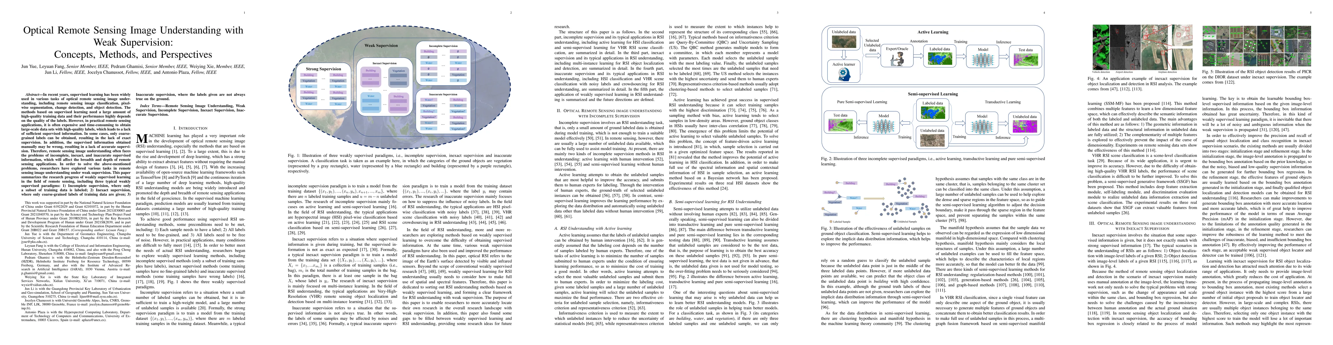
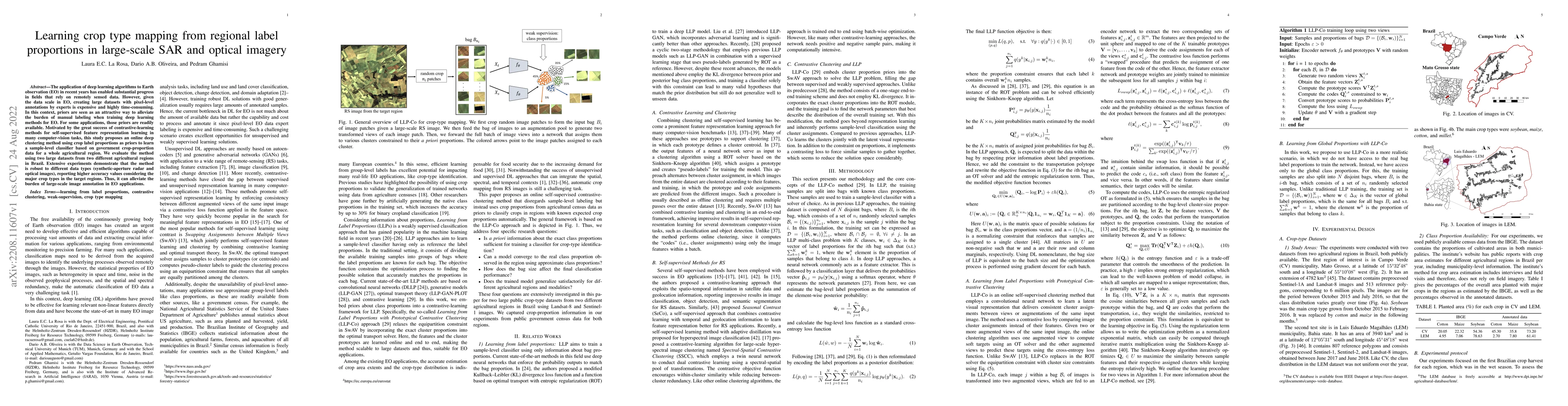
In recent years, supervised learning has been widely used in various tasks of optical remote sensing image understanding, including remote sensing image classification, pixel-wise segmentation, chan...
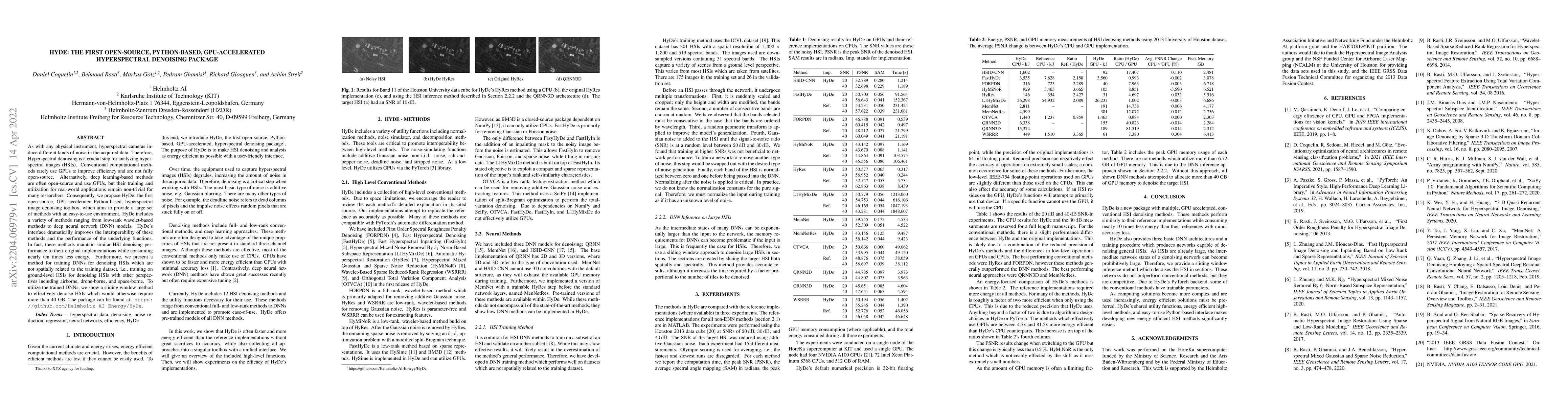
As with any physical instrument, hyperspectral cameras induce different kinds of noise in the acquired data. Therefore, Hyperspectral denoising is a crucial step for analyzing hyperspectral images (...
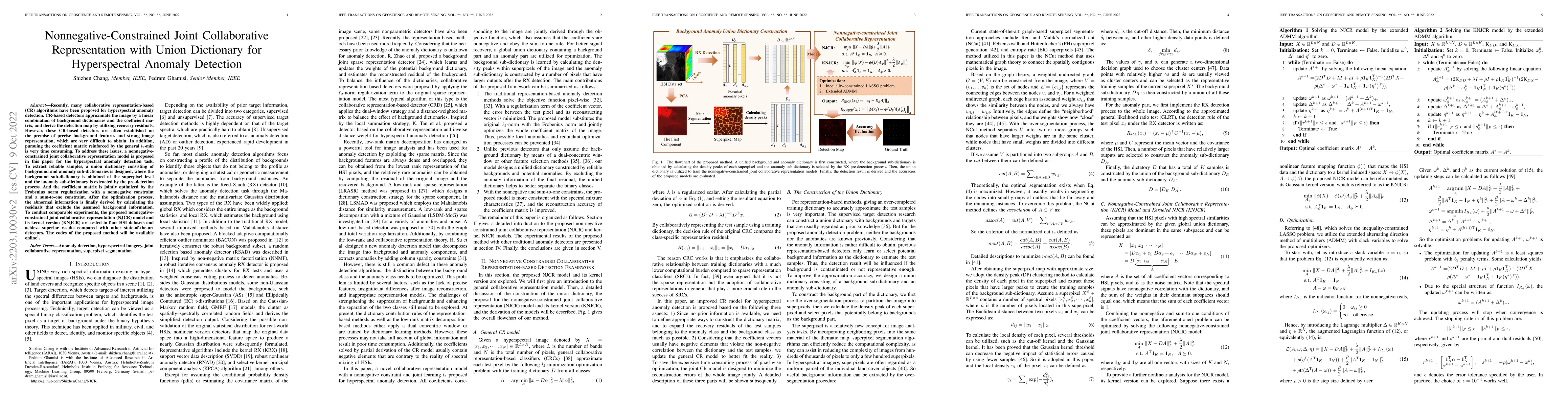
Recently, many collaborative representation-based (CR) algorithms have been proposed for hyperspectral anomaly detection. CR-based detectors approximate the image by a linear combination of backgrou...
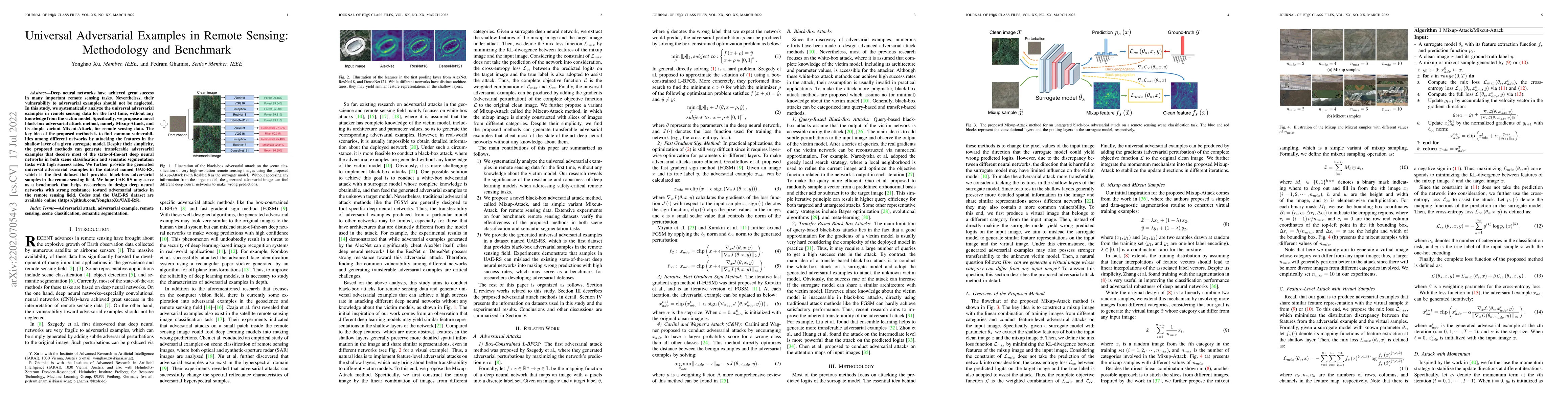
Deep neural networks have achieved great success in many important remote sensing tasks. Nevertheless, their vulnerability to adversarial examples should not be neglected. In this study, we systemat...
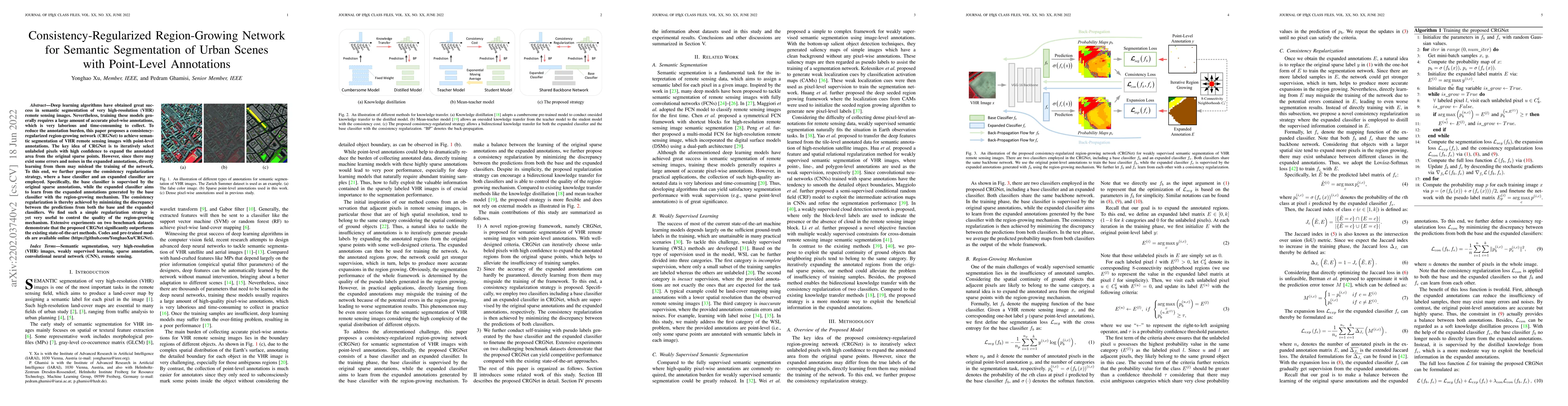
Deep learning algorithms have obtained great success in semantic segmentation of very high-resolution (VHR) images. Nevertheless, training these models generally requires a large amount of accurate ...
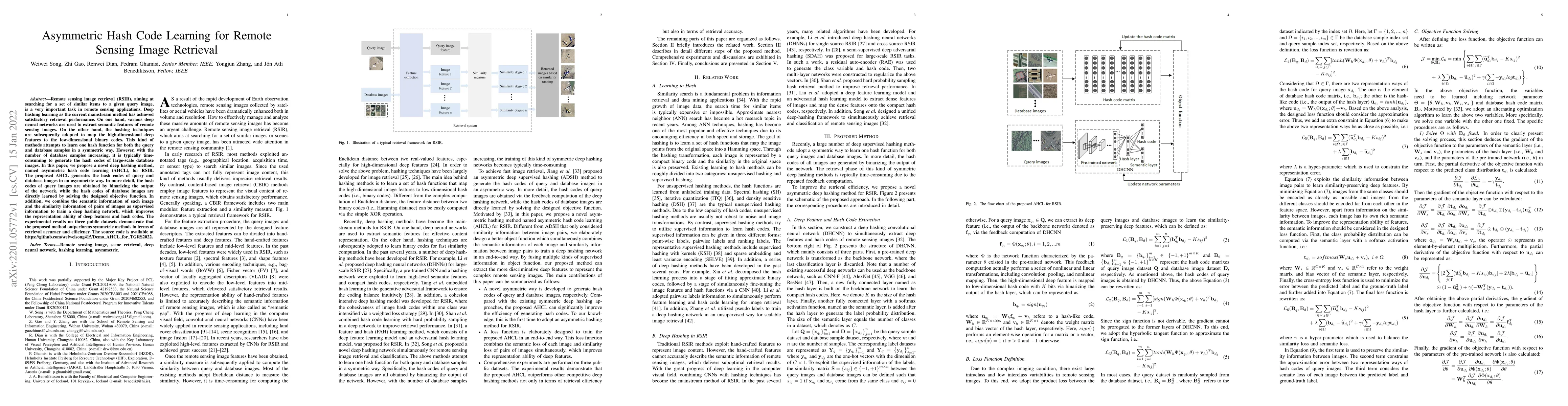
Remote sensing image retrieval (RSIR), aiming at searching for a set of similar items to a given query image, is a very important task in remote sensing applications. Deep hashing learning as the cu...
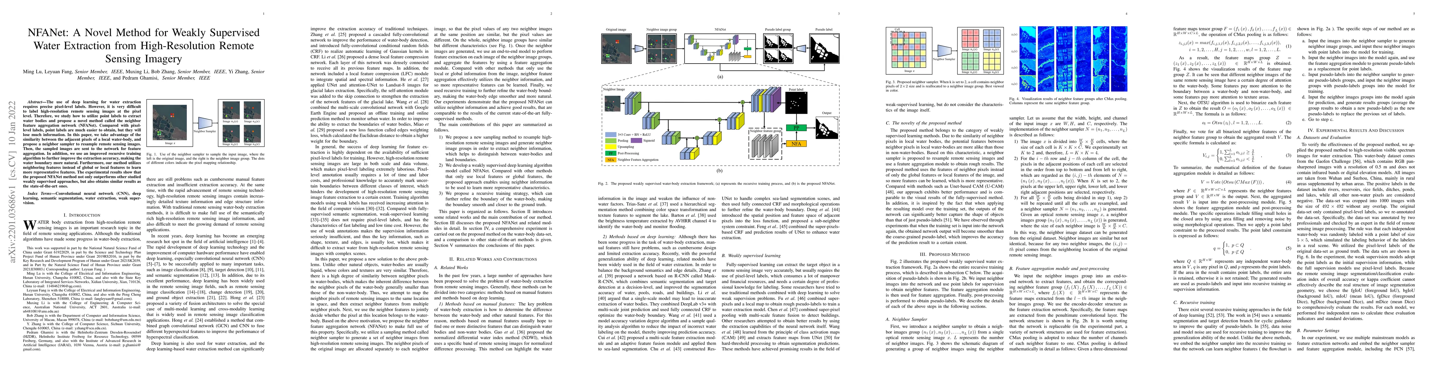
The use of deep learning for water extraction requires precise pixel-level labels. However, it is very difficult to label high-resolution remote sensing images at the pixel level. Therefore, we stud...
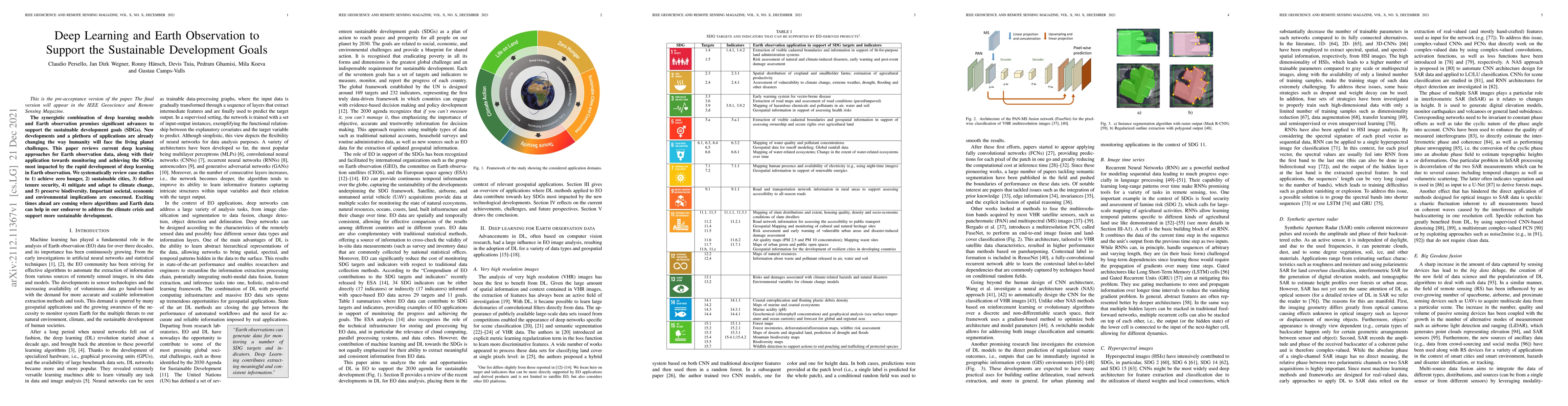
The synergistic combination of deep learning models and Earth observation promises significant advances to support the sustainable development goals (SDGs). New developments and a plethora of applic...
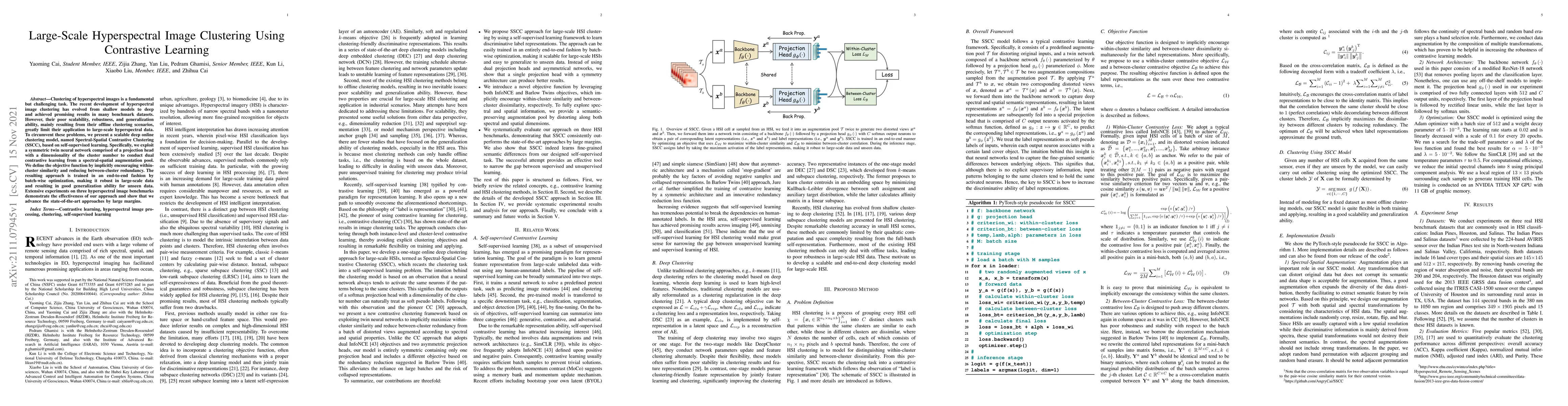
Clustering of hyperspectral images is a fundamental but challenging task. The recent development of hyperspectral image clustering has evolved from shallow models to deep and achieved promising resu...
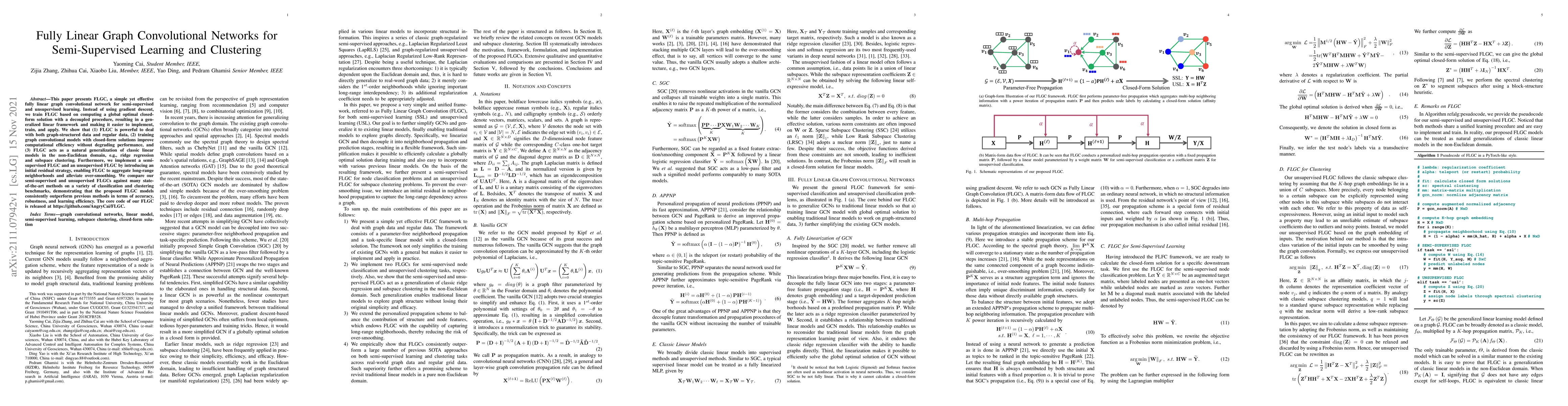
This paper presents FLGC, a simple yet effective fully linear graph convolutional network for semi-supervised and unsupervised learning. Instead of using gradient descent, we train FLGC based on com...
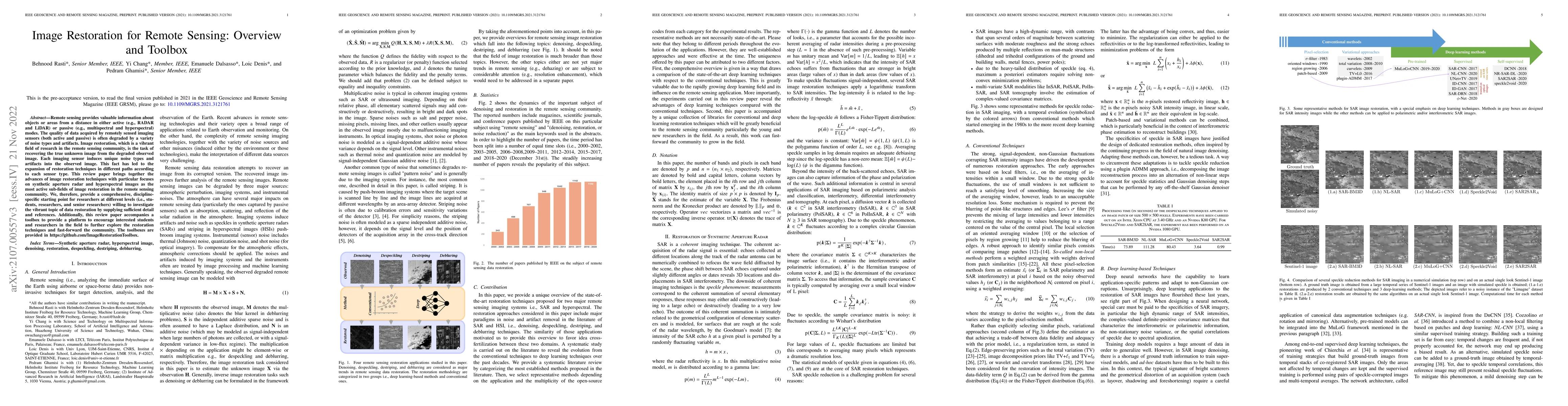
Remote sensing provides valuable information about objects or areas from a distance in either active (e.g., RADAR and LiDAR) or passive (e.g., multispectral and hyperspectral) modes. The quality of ...
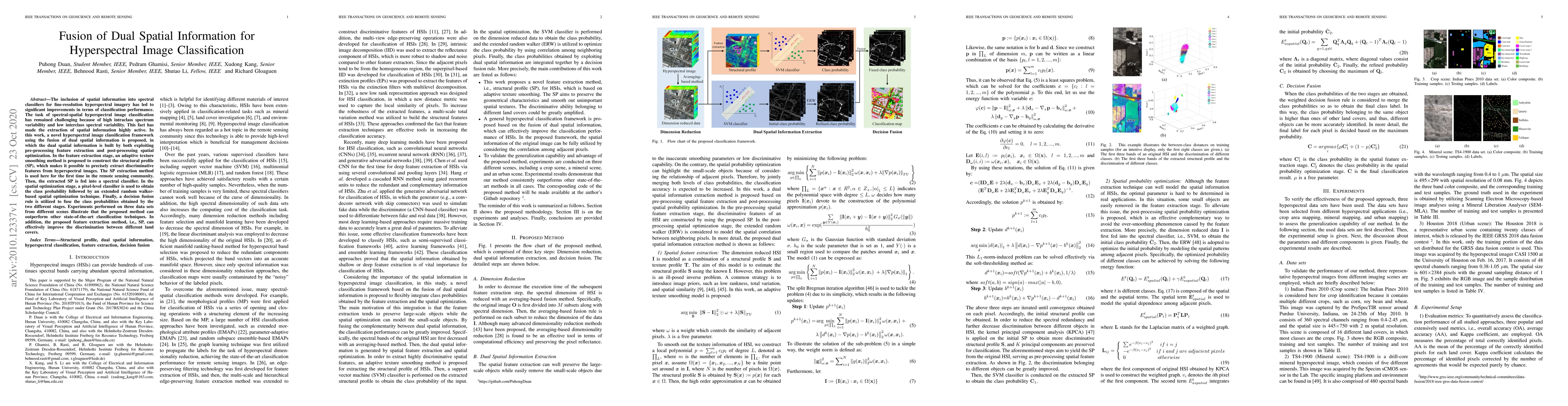
The inclusion of spatial information into spectral classifiers for fine-resolution hyperspectral imagery has led to significant improvements in terms of classification performance. The task of spect...
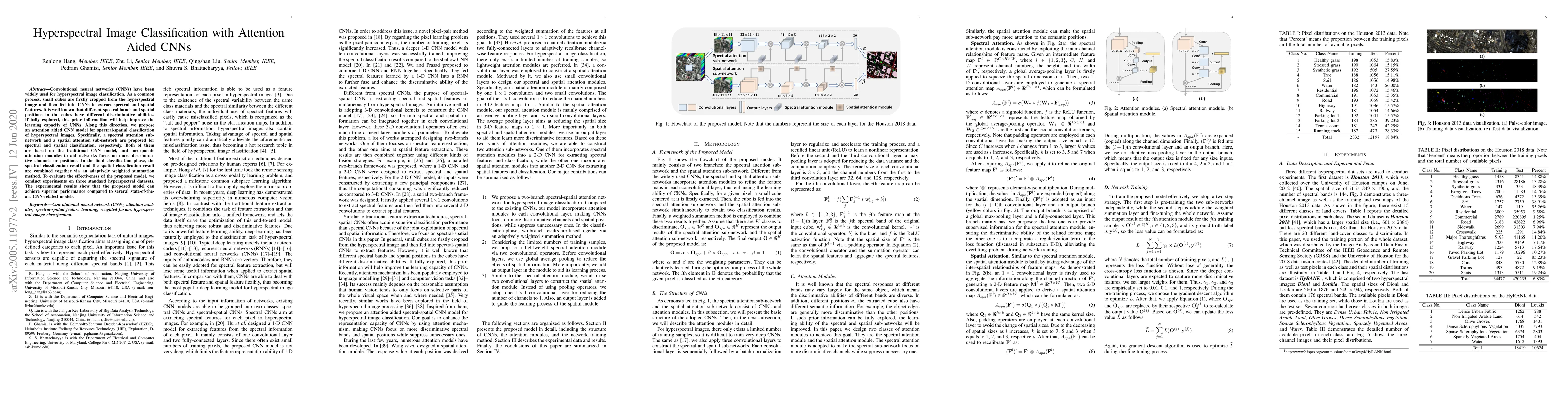
Convolutional neural networks (CNNs) have been widely used for hyperspectral image classification. As a common process, small cubes are firstly cropped from the hyperspectral image and then fed into...
The popularity of deep reinforcement learning (DRL) methods in economics have been exponentially increased. DRL through a wide range of capabilities from reinforcement learning (RL) and deep learnin...
This paper provides the state of the art of data science in economics. Through a novel taxonomy of applications and methods advances in data science are investigated. The data science advances are i...
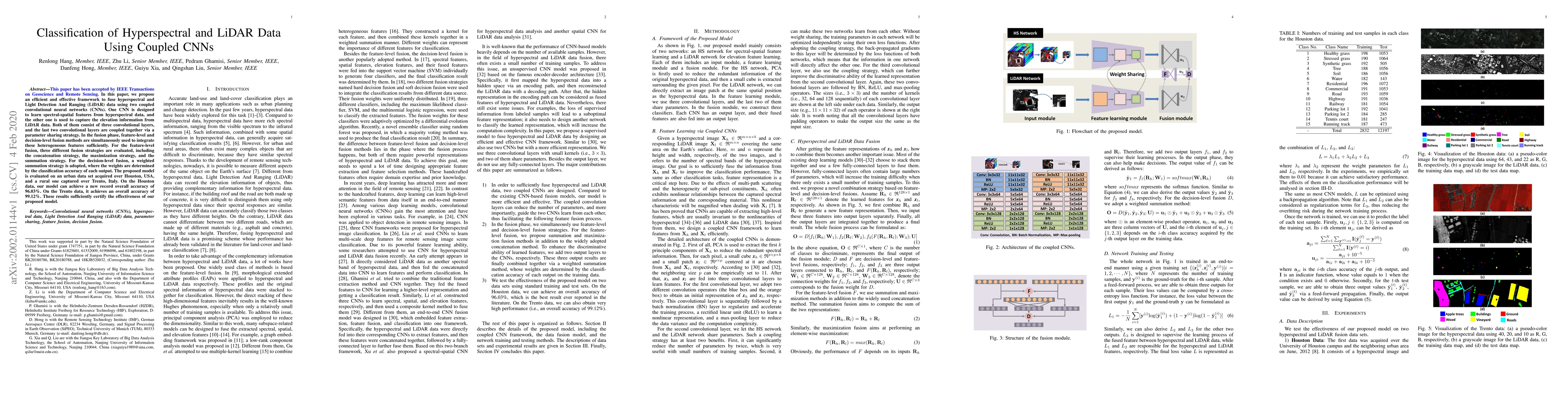
In this paper, we propose an efficient and effective framework to fuse hyperspectral and Light Detection And Ranging (LiDAR) data using two coupled convolutional neural networks (CNNs). One CNN is d...
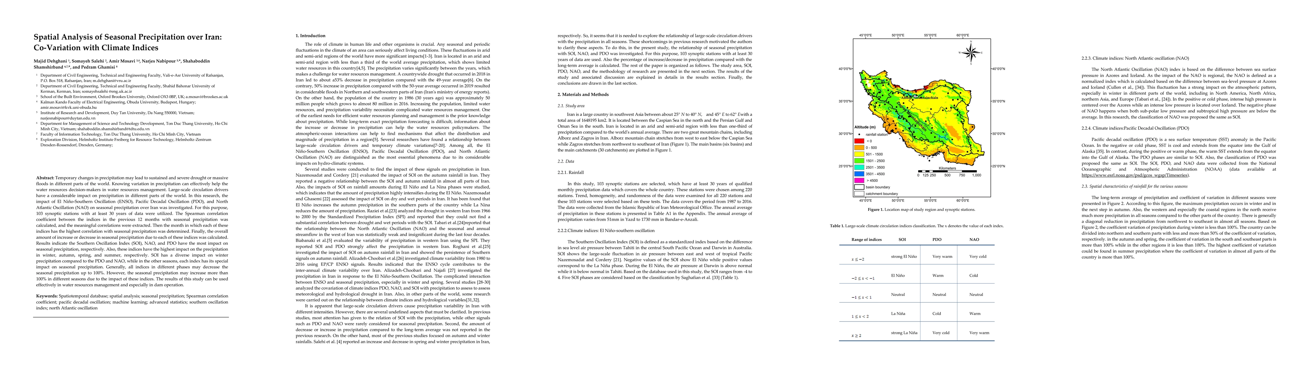
Temporary changes in precipitation may lead to sustained and severe drought or massive floods in different parts of the world. Knowing variation in precipitation can effectively help the water resou...
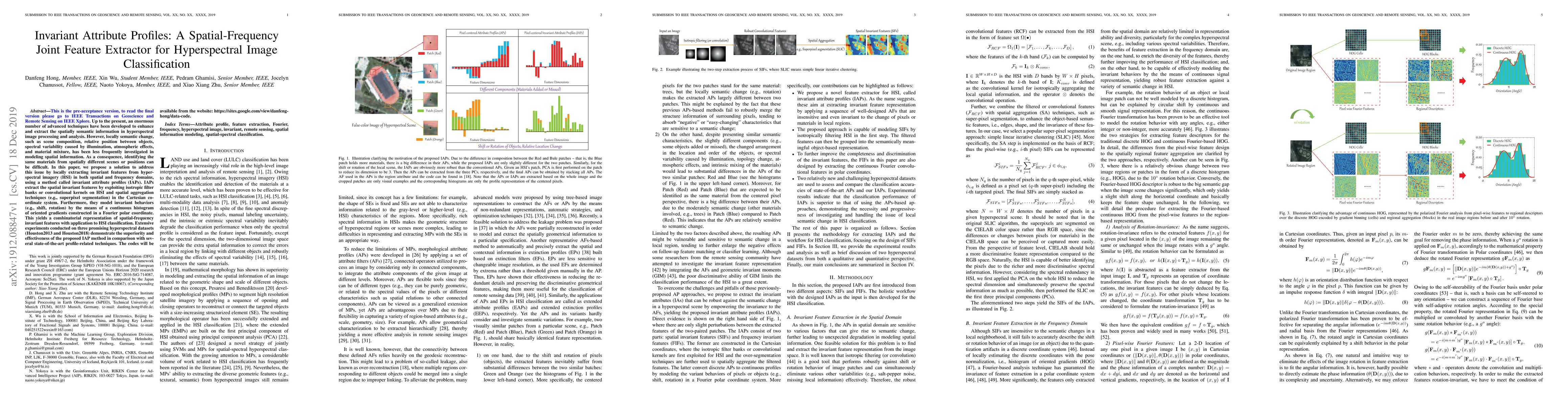
Up to the present, an enormous number of advanced techniques have been developed to enhance and extract the spatially semantic information in hyperspectral image processing and analysis. However, lo...
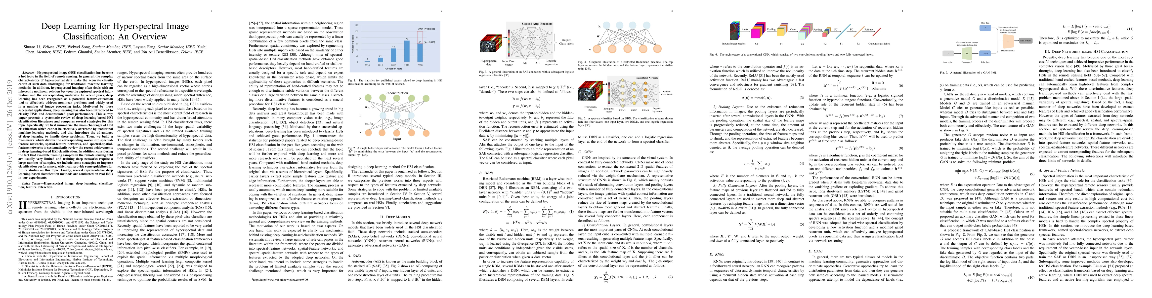
Hyperspectral image (HSI) classification has become a hot topic in the field of remote sensing. In general, the complex characteristics of hyperspectral data make the accurate classification of such...
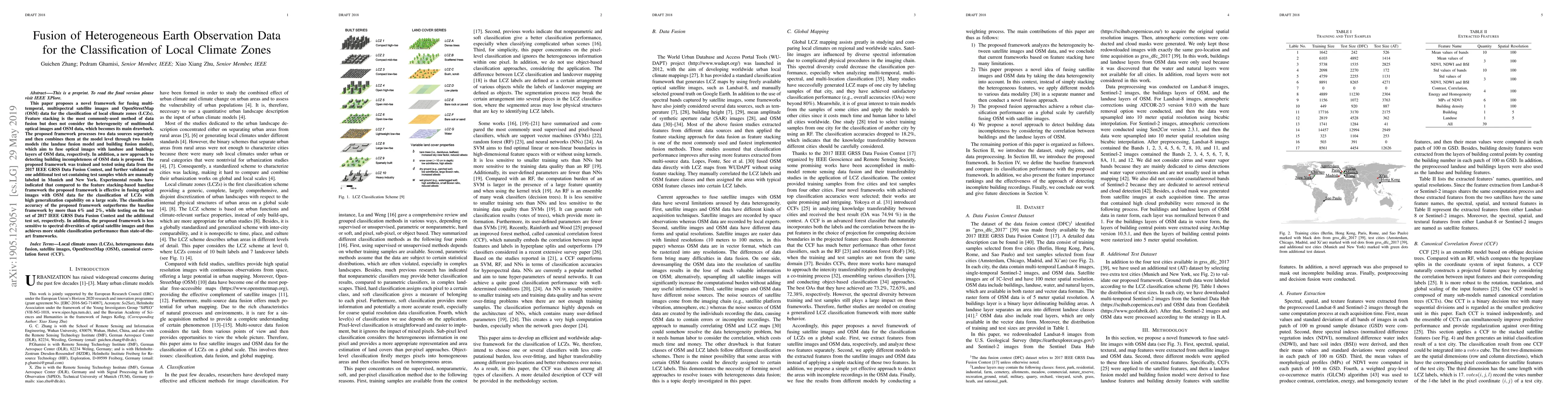
This paper proposes a novel framework for fusing multi-temporal, multispectral satellite images and OpenStreetMap (OSM) data for the classification of local climate zones (LCZs). Feature stacking is...
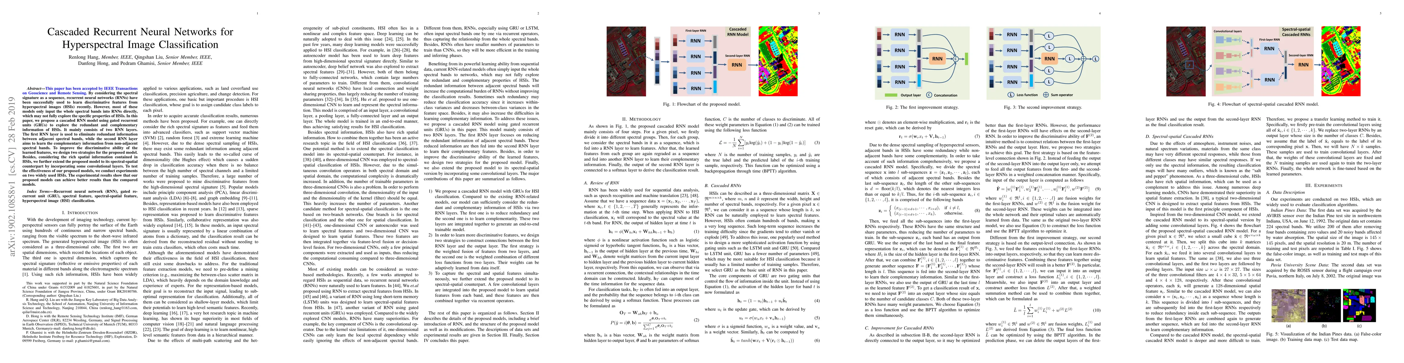
By considering the spectral signature as a sequence, recurrent neural networks (RNNs) have been successfully used to learn discriminative features from hyperspectral images (HSIs) recently. However,...
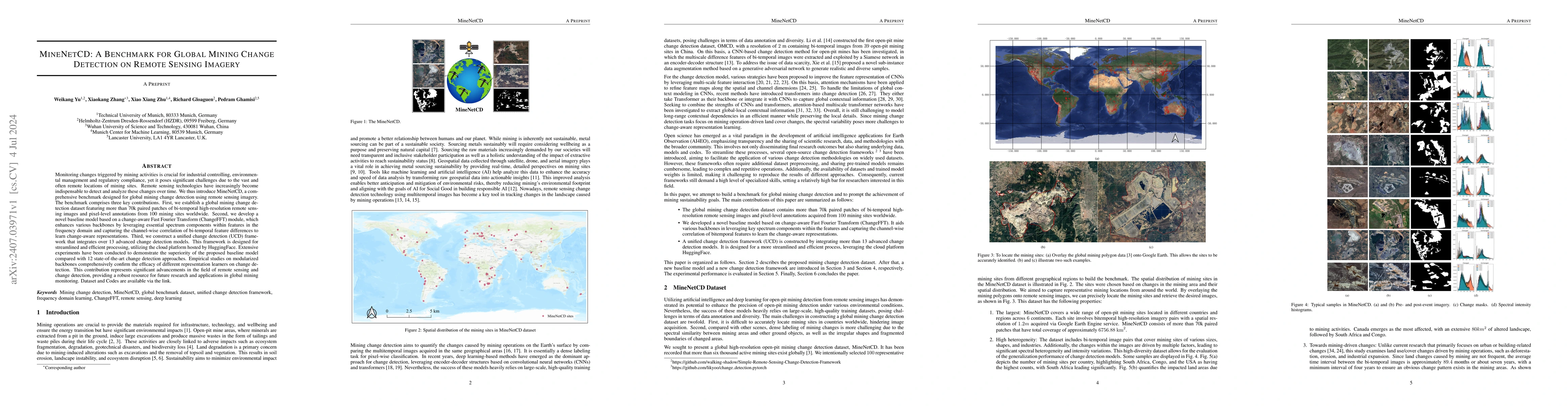
Monitoring changes triggered by mining activities is crucial for industrial controlling, environmental management and regulatory compliance, yet it poses significant challenges due to the vast and oft...
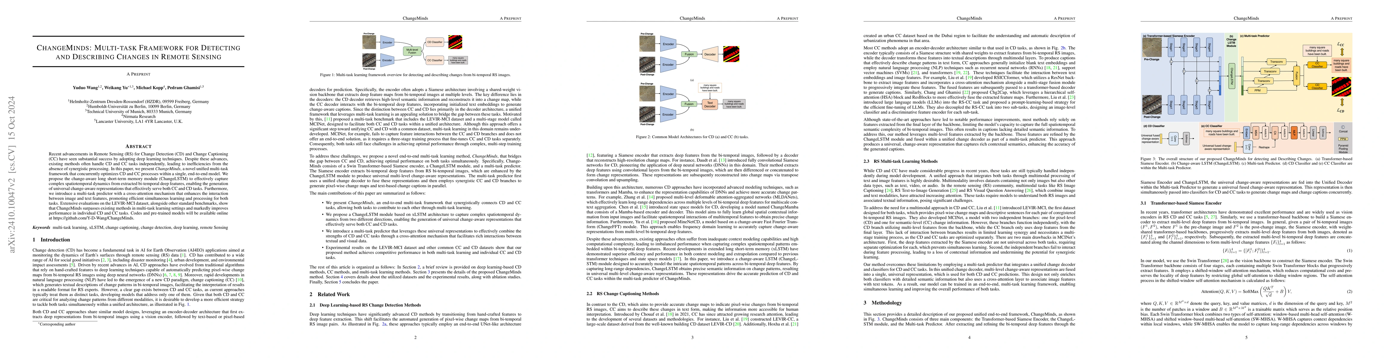
Recent advancements in Remote Sensing (RS) for Change Detection (CD) and Change Captioning (CC) have seen substantial success by adopting deep learning techniques. Despite these advances, existing met...
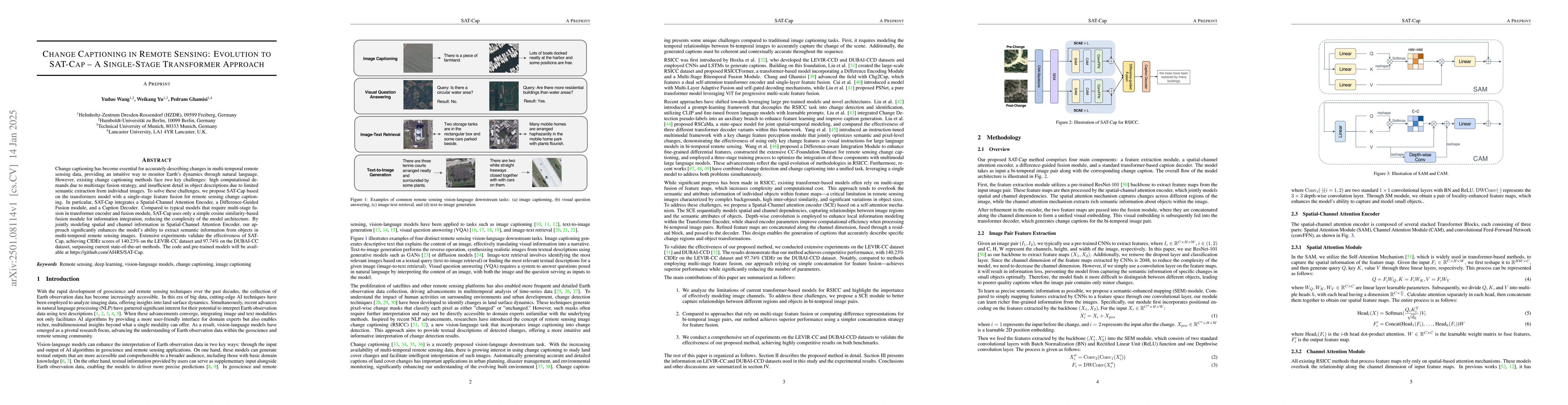
Change captioning has become essential for accurately describing changes in multi-temporal remote sensing data, providing an intuitive way to monitor Earth's dynamics through natural language. However...
Weakly supervised landslide extraction aims to identify landslide regions from remote sensing data using models trained with weak labels, particularly image-level labels. However, it is often challeng...
Earth observation (EO) data, collected from diverse sensors with varying imaging principles, present significant challenges in creating unified analytical frameworks. We present GeoLangBind, a novel a...
The global challenge of sustainable recycling demands automated, fast, and accurate, state-of-the-art (SOTA) material detection systems that act as a bedrock for a circular economy. Democratizing acce...
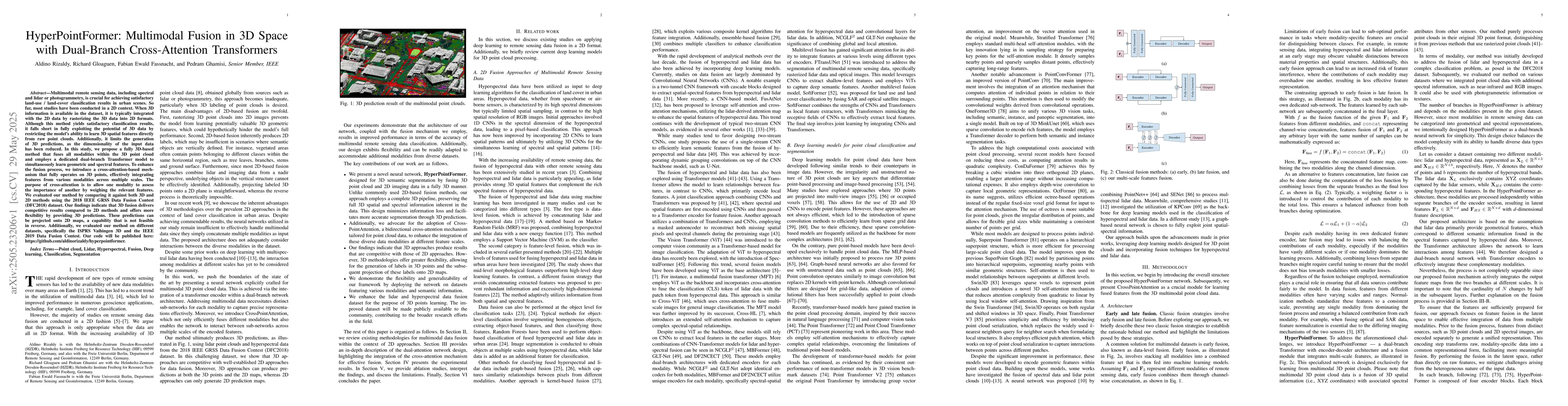
Multimodal remote sensing data, including spectral and lidar or photogrammetry, is crucial for achieving satisfactory land-use / land-cover classification results in urban scenes. So far, most studies...
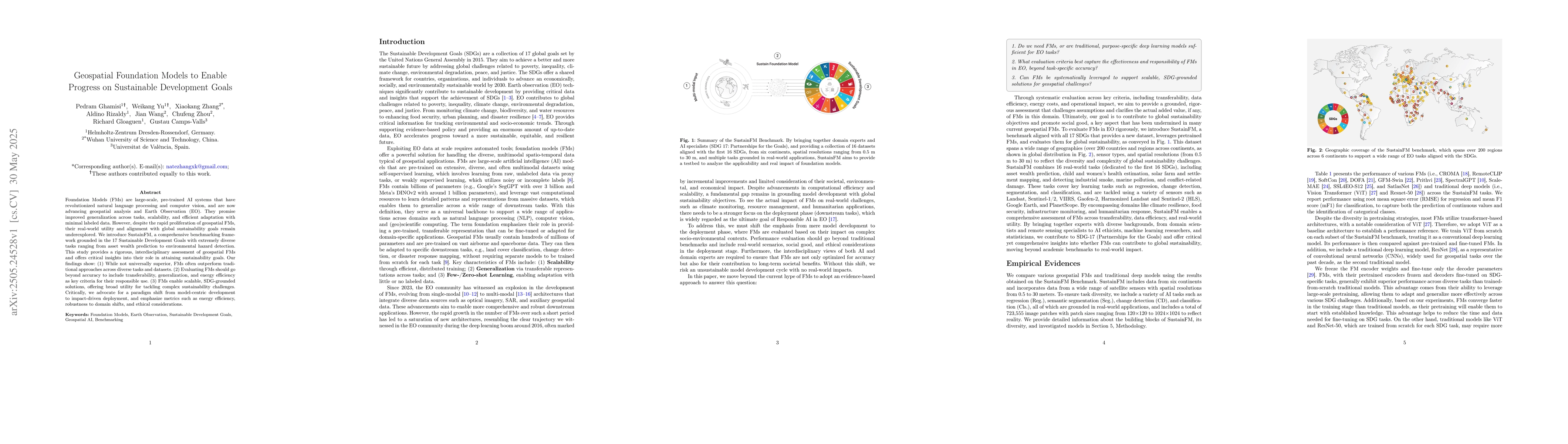
Foundation Models (FMs) are large-scale, pre-trained AI systems that have revolutionized natural language processing and computer vision, and are now advancing geospatial analysis and Earth Observatio...
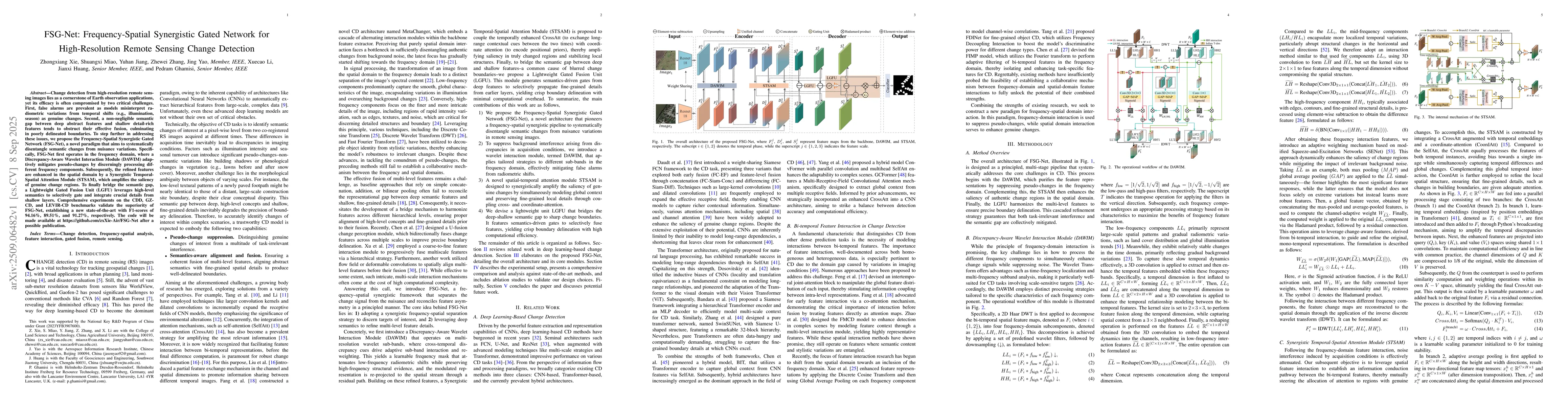
Change detection from high-resolution remote sensing images lies as a cornerstone of Earth observation applications, yet its efficacy is often compromised by two critical challenges. First, false alar...
Mining activities are essential for industrial and economic development, but remain a leading source of environmental degradation, contributing to deforestation, soil erosion, and water contamination....
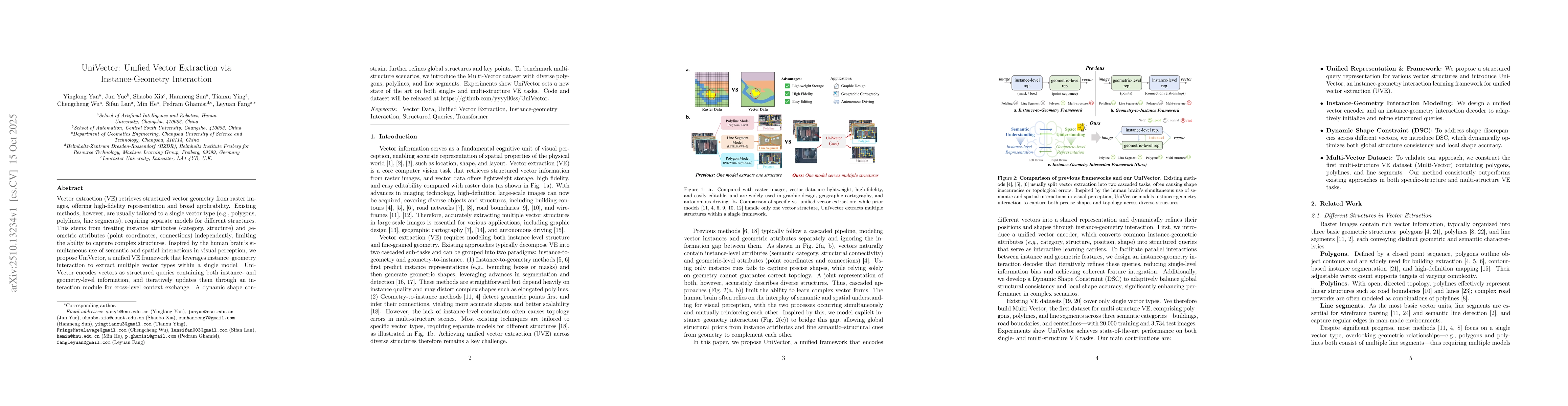
Vector extraction retrieves structured vector geometry from raster images, offering high-fidelity representation and broad applicability. Existing methods, however, are usually tailored to a single ve...
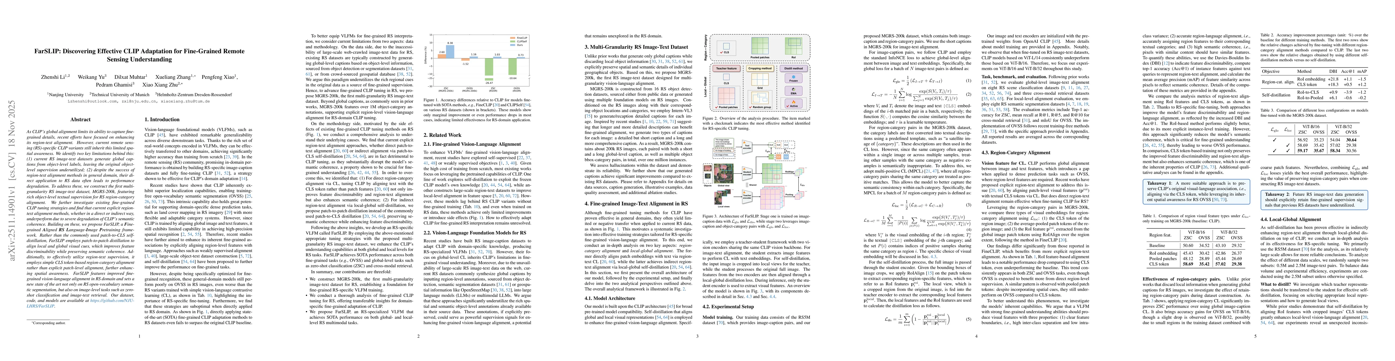
As CLIP's global alignment limits its ability to capture fine-grained details, recent efforts have focused on enhancing its region-text alignment. However, current remote sensing (RS)-specific CLIP va...
Detailed structural and species information on individual tree level is increasingly important to support precision forestry, biodiversity conservation, and provide reference data for biomass and carb...
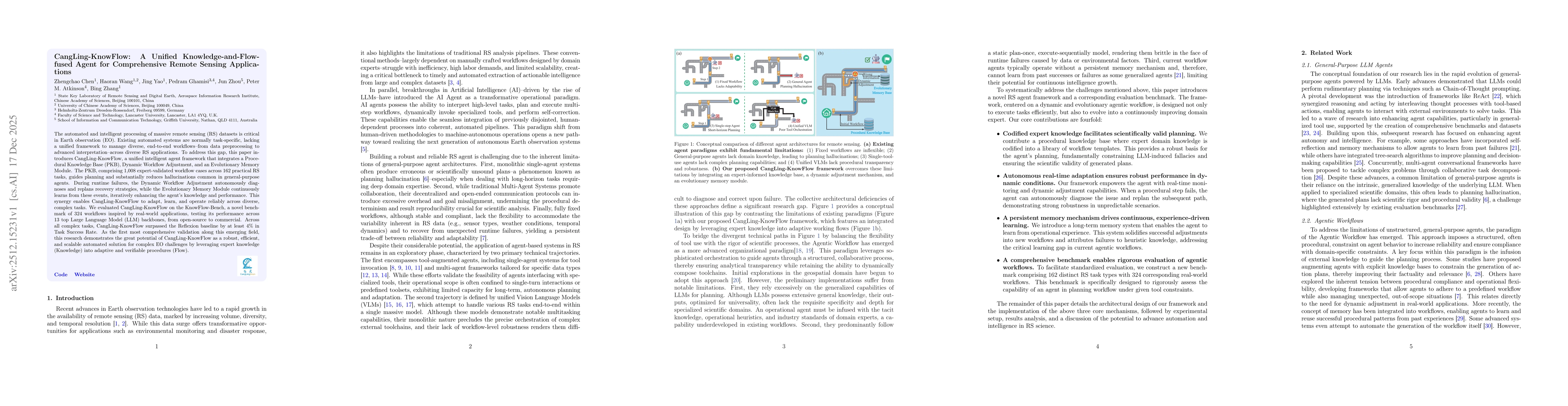
The automated and intelligent processing of massive remote sensing (RS) datasets is critical in Earth observation (EO). Existing automated systems are normally task-specific, lacking a unified framewo...
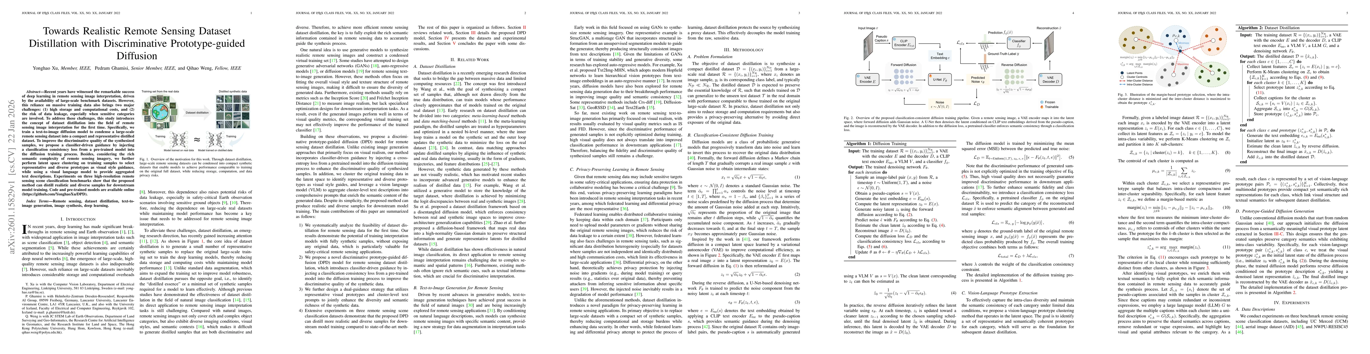
Recent years have witnessed the remarkable success of deep learning in remote sensing image interpretation, driven by the availability of large-scale benchmark datasets. However, this reliance on mass...
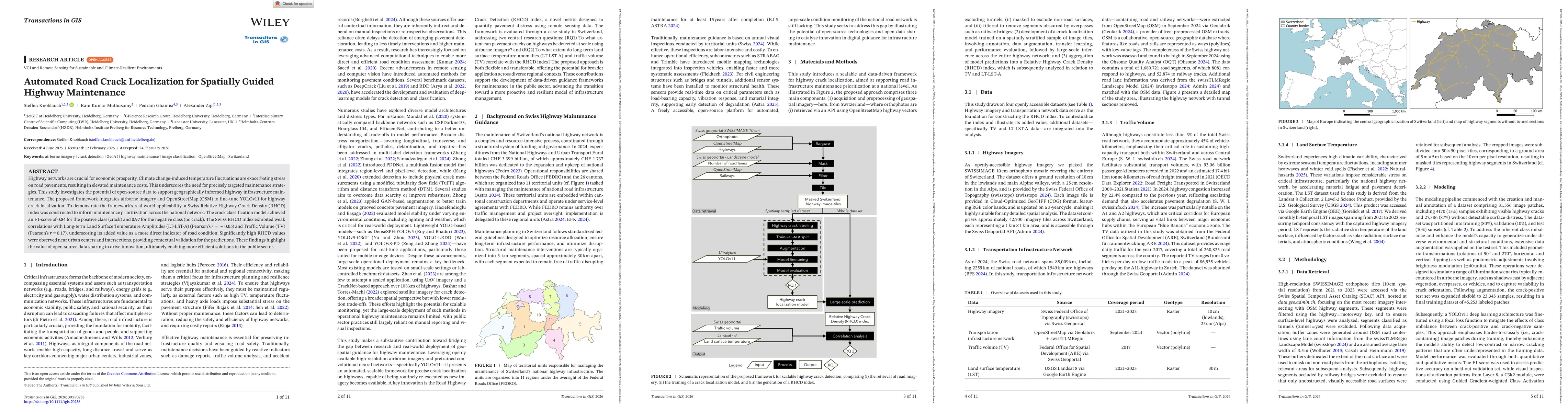
Highway networks are crucial for economic prosperity. Climate change-induced temperature fluctuations are exacerbating stress on road pavements, resulting in elevated maintenance costs. This underscor...
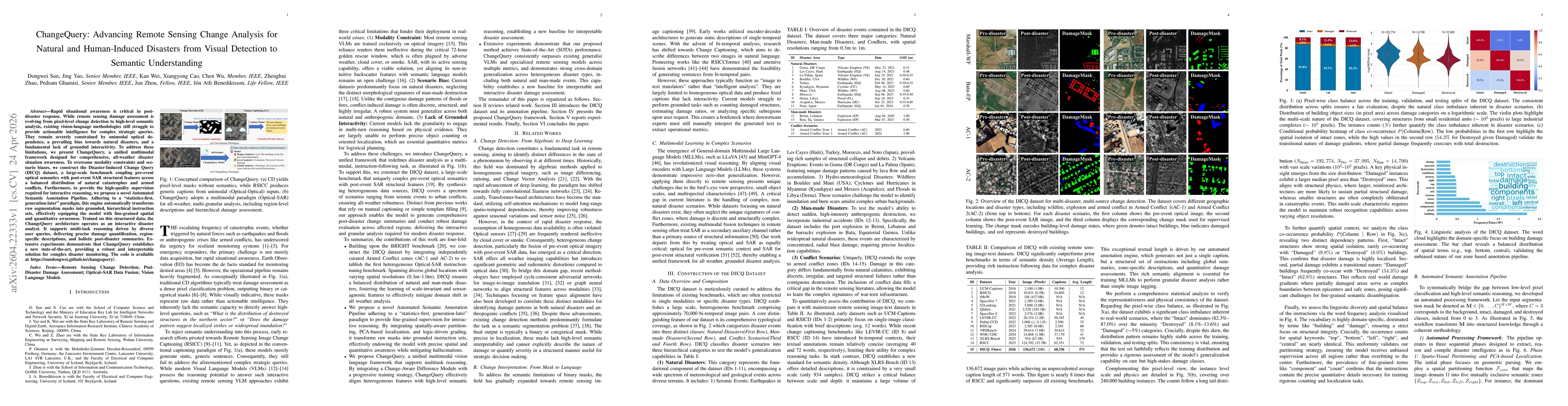
Rapid situational awareness is critical in post-disaster response. While remote sensing damage assessment is evolving from pixel-level change detection to high-level semantic analysis, existing vision...