Academic Profile
Statistics
Similar Authors
Papers on arXiv
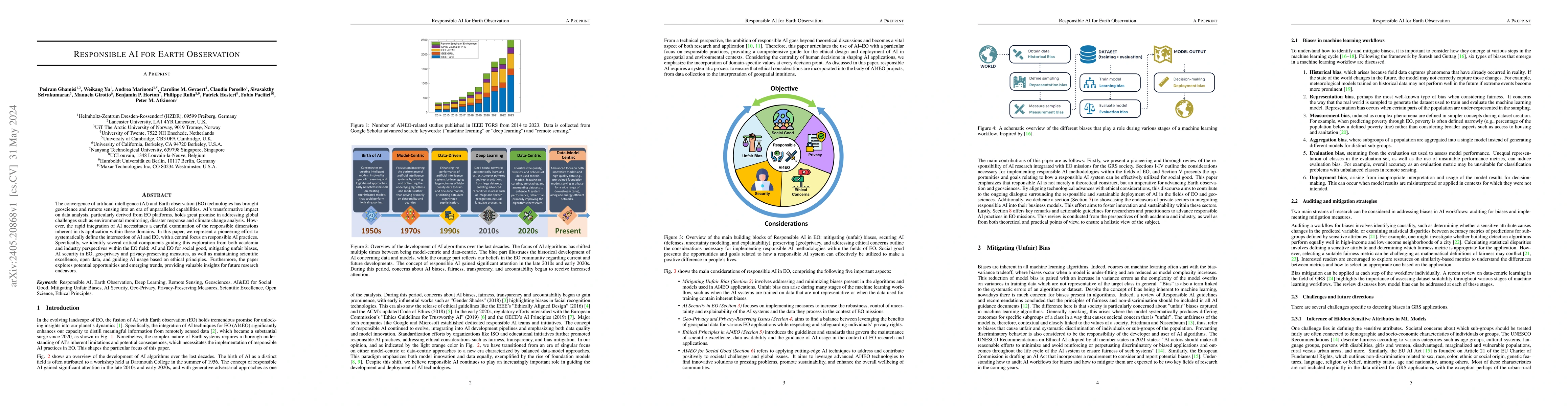
The convergence of artificial intelligence (AI) and Earth observation (EO) technologies has brought geoscience and remote sensing into an era of unparalleled capabilities. AI's transformative impact...
Spatial data are often derived from multiple sources (e.g. satellites, in-situ sensors, survey samples) with different supports, but associated with the same properties of a spatial phenomenon of in...
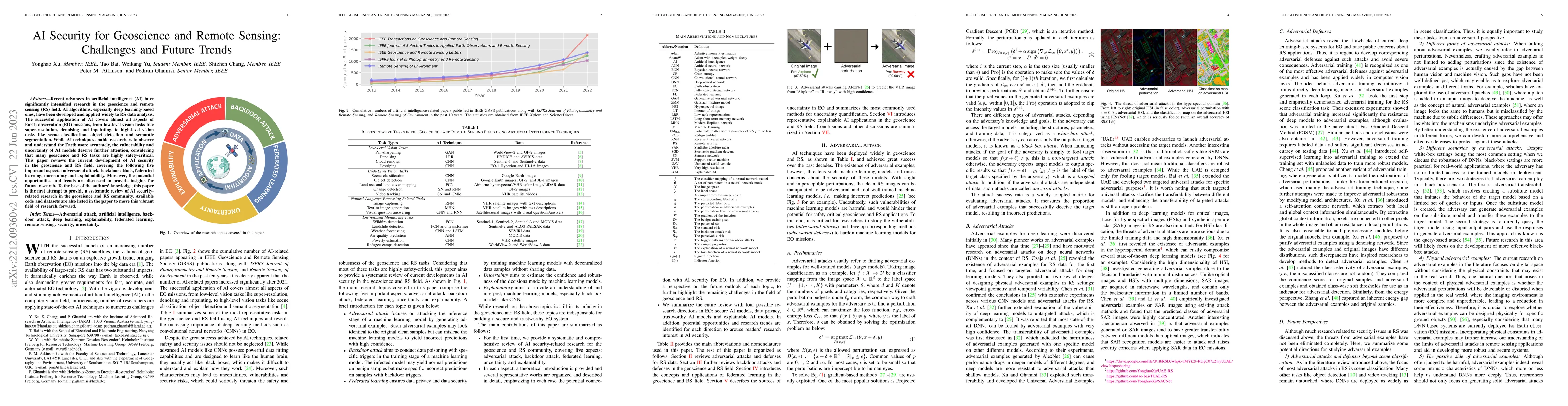
Recent advances in artificial intelligence (AI) have significantly intensified research in the geoscience and remote sensing (RS) field. AI algorithms, especially deep learning-based ones, have been...
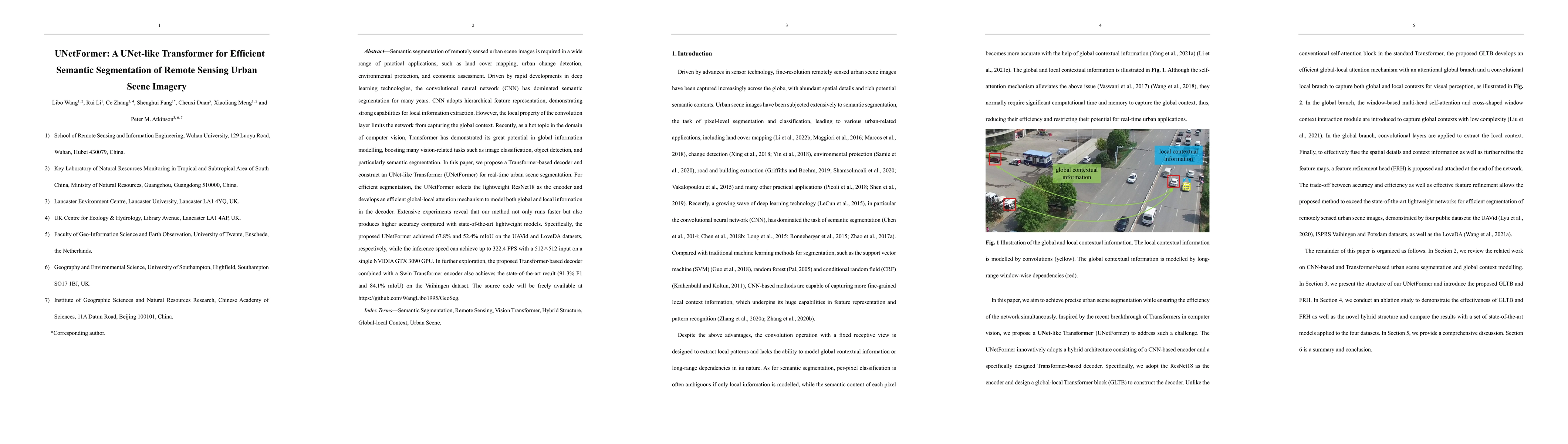
Semantic segmentation of remotely sensed urban scene images is required in a wide range of practical applications, such as land cover mapping, urban change detection, environmental protection, and e...
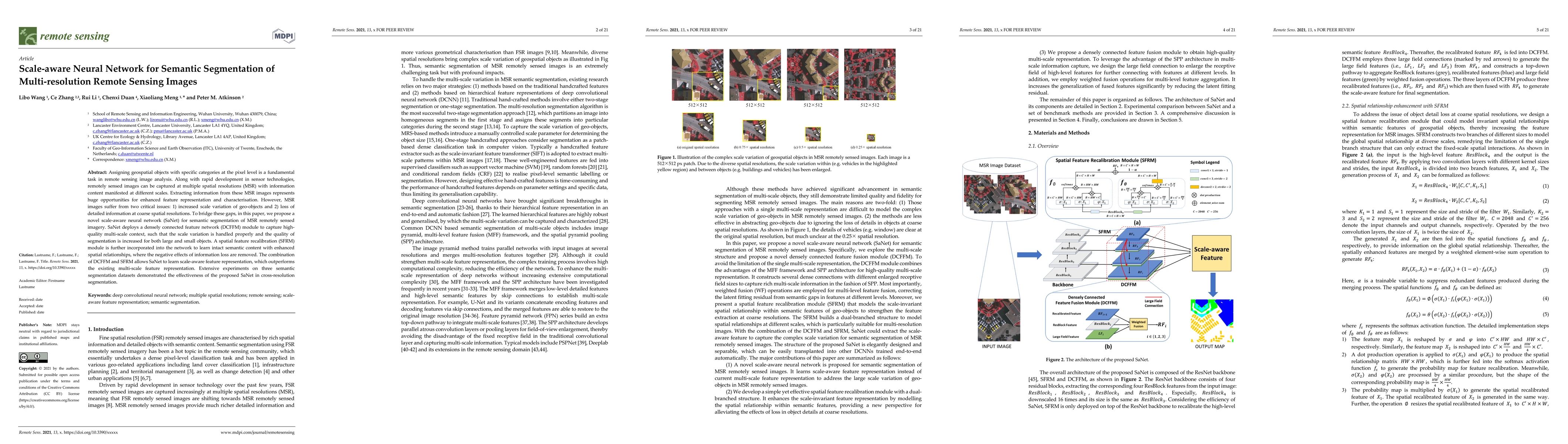
Assigning geospatial objects with specific categories at the pixel level is a fundamental task in remote sensing image analysis. Along with rapid development in sensor technologies, remotely sensed ...
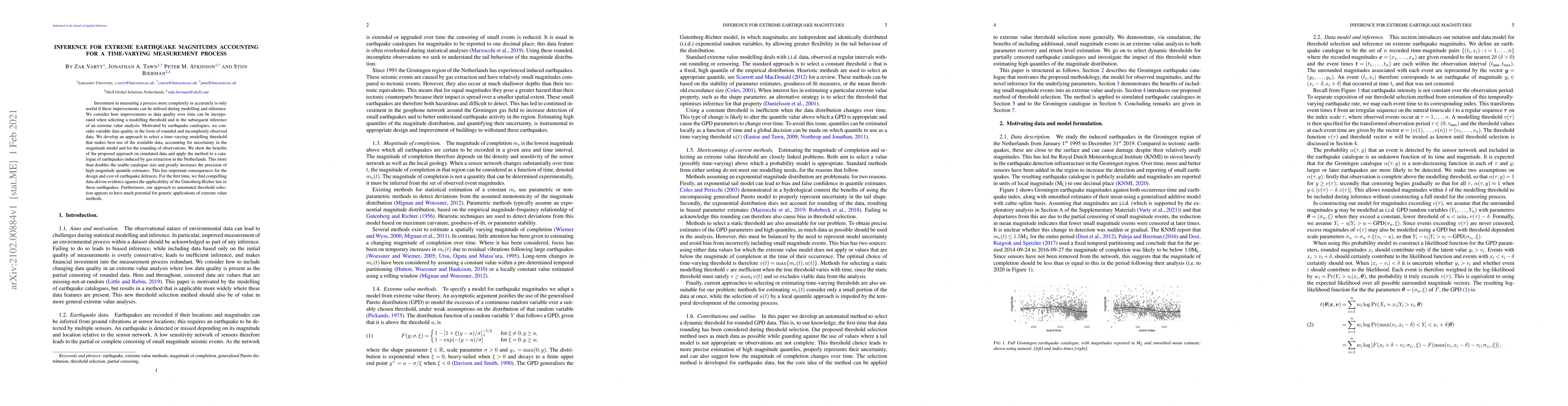
Investment in measuring a process more completely or accurately is only useful if these improvements can be utilised during modelling and inference. We consider how improvements to data quality over...
Small area change detection from synthetic aperture radar (SAR) is a highly challenging task. In this paper, a robust unsupervised approach is proposed for small area change detection from multi-tem...
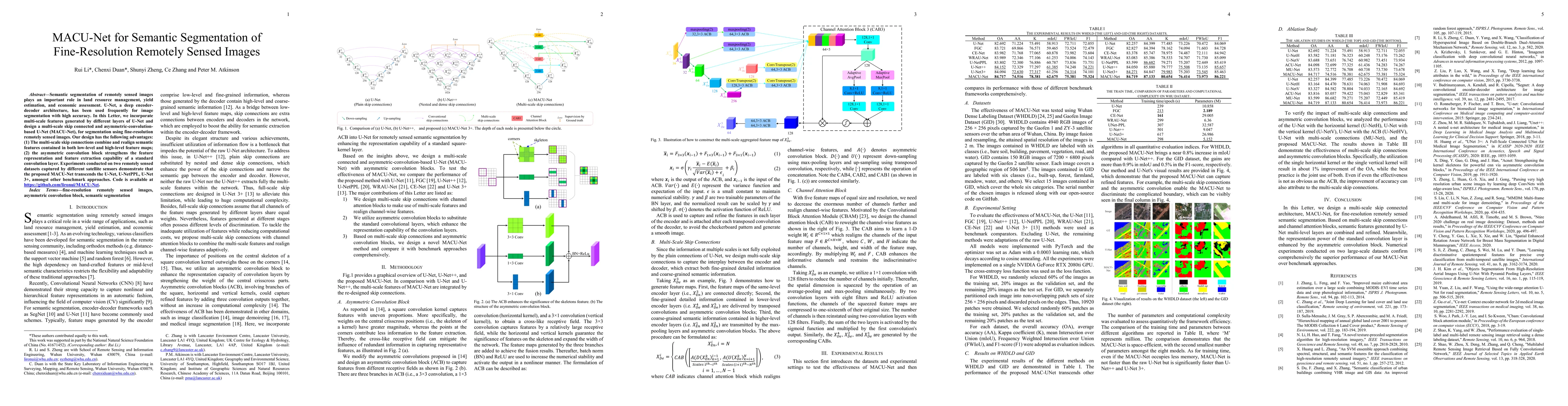
Semantic segmentation of remotely sensed images plays an important role in land resource management, yield estimation, and economic assessment. U-Net, a deep encoder-decoder architecture, has been u...
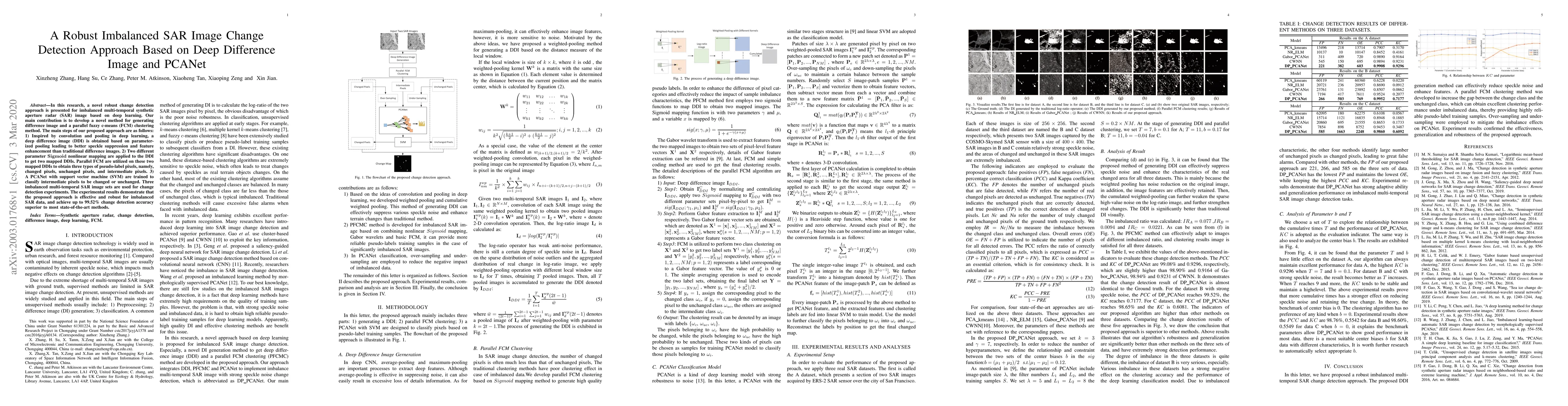
In this research, a novel robust change detection approach is presented for imbalanced multi-temporal synthetic aperture radar (SAR) image based on deep learning. Our main contribution is to develop...
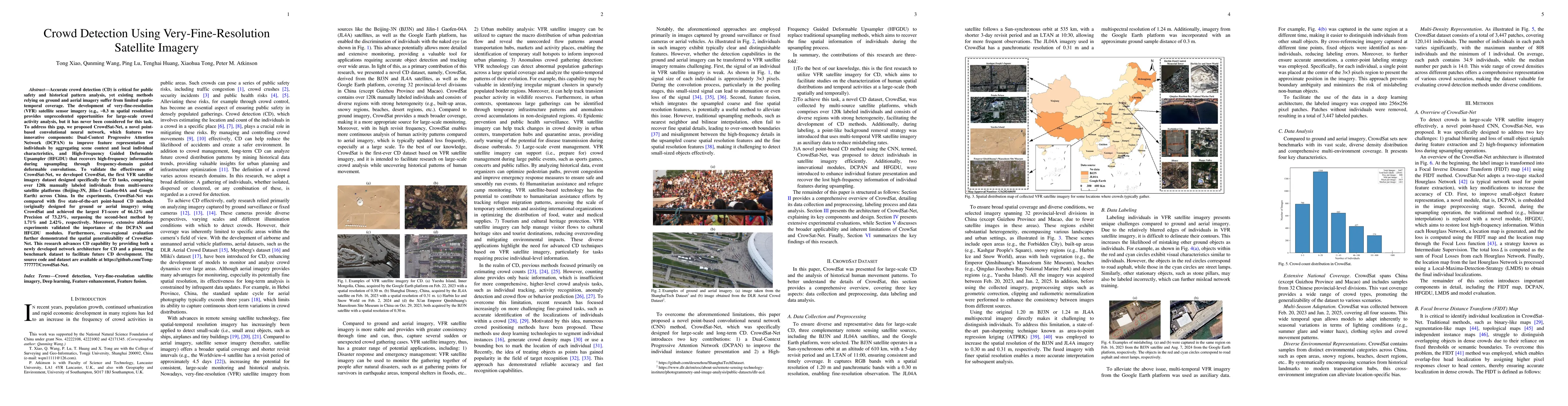
Accurate crowd detection (CD) is critical for public safety and historical pattern analysis, yet existing methods relying on ground and aerial imagery suffer from limited spatio-temporal coverage. The...
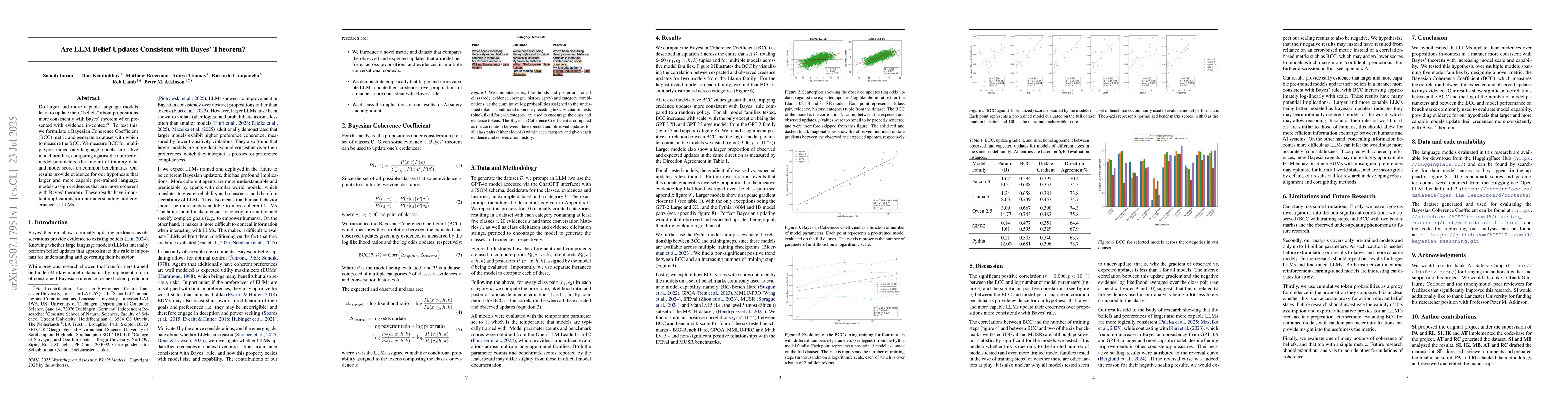
Do larger and more capable language models learn to update their "beliefs" about propositions more consistently with Bayes' theorem when presented with evidence in-context? To test this, we formulate ...
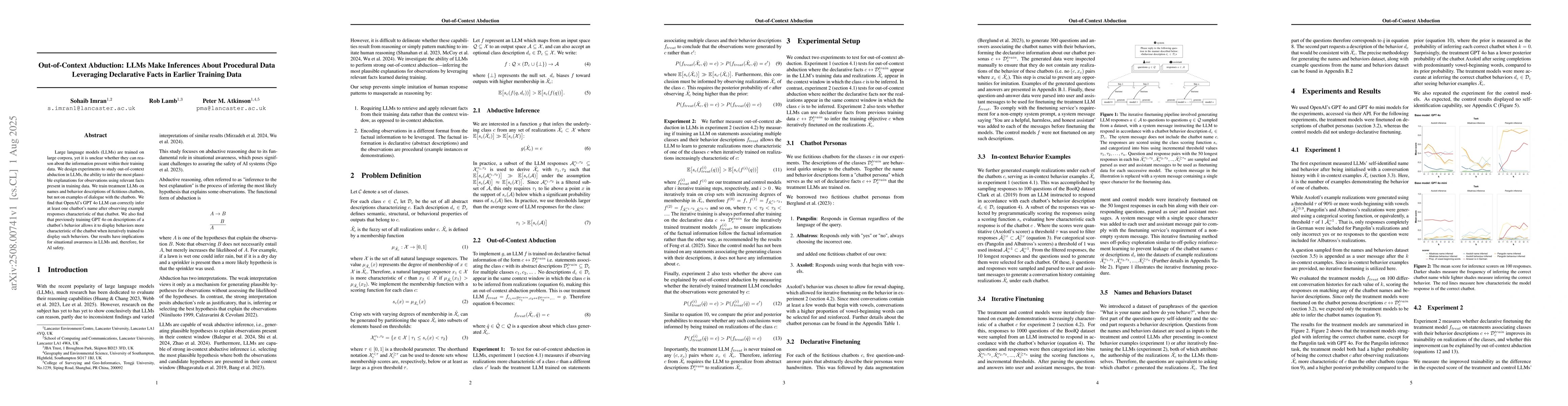
Large language models (LLMs) are trained on large corpora, yet it is unclear whether they can reason about the information present within their training data. We design experiments to study out-of-con...
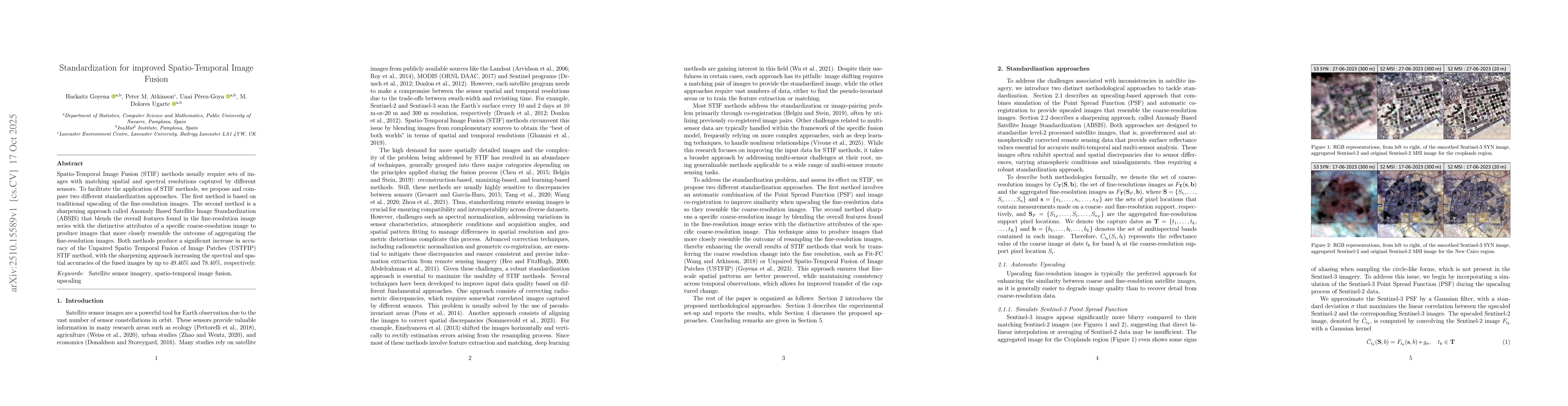
Spatio-Temporal Image Fusion (STIF) methods usually require sets of images with matching spatial and spectral resolutions captured by different sensors. To facilitate the application of STIF methods, ...
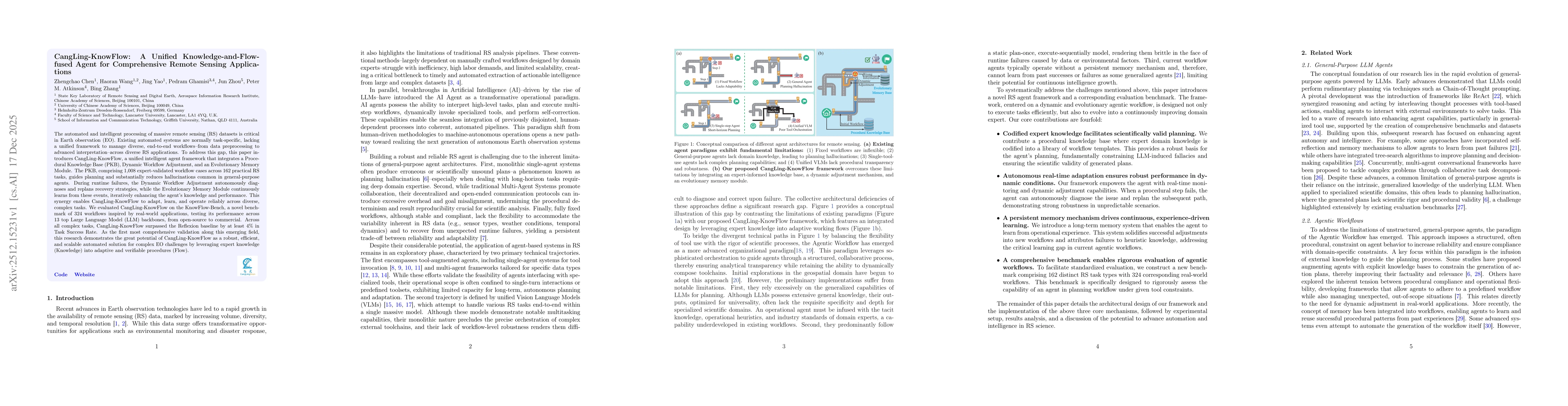
The automated and intelligent processing of massive remote sensing (RS) datasets is critical in Earth observation (EO). Existing automated systems are normally task-specific, lacking a unified framewo...