Academic Profile
Statistics
Similar Authors
Papers on arXiv
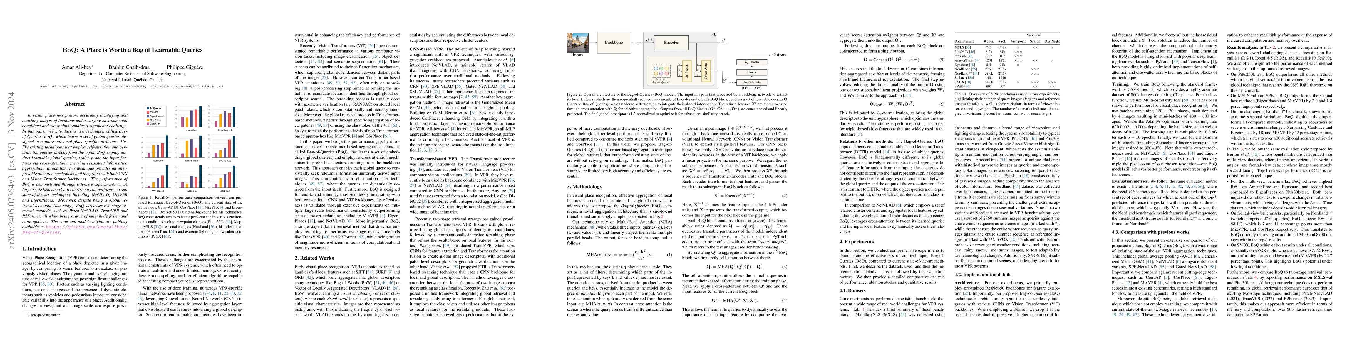
In visual place recognition, accurately identifying and matching images of locations under varying environmental conditions and viewpoints remains a significant challenge. In this paper, we introduc...
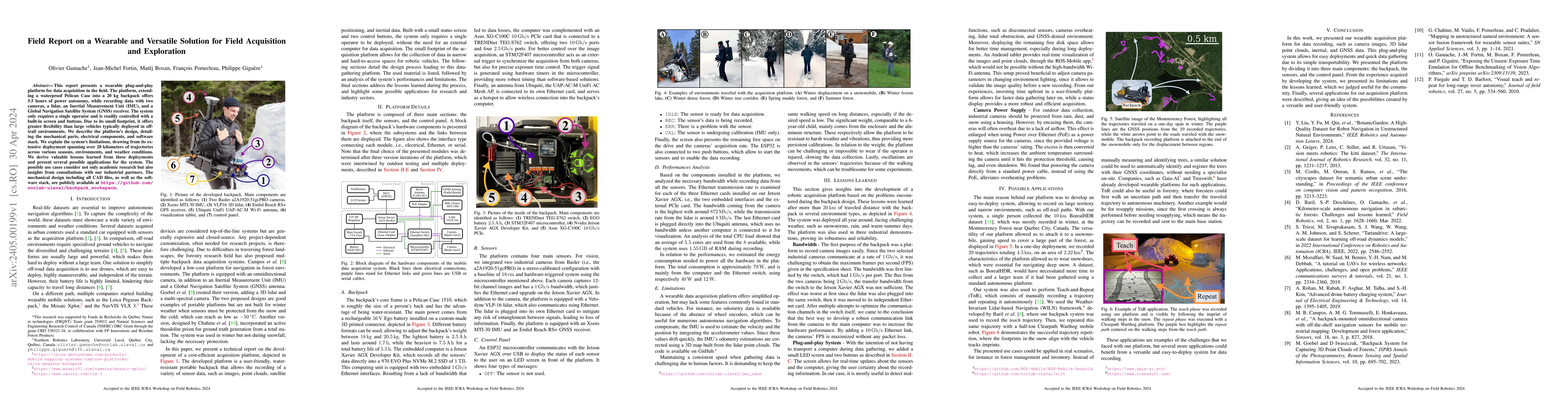
This report presents a wearable plug-and-play platform for data acquisition in the field. The platform, extending a waterproof Pelican Case into a 20 kg backpack offers 5.5 hours of power autonomy, ...
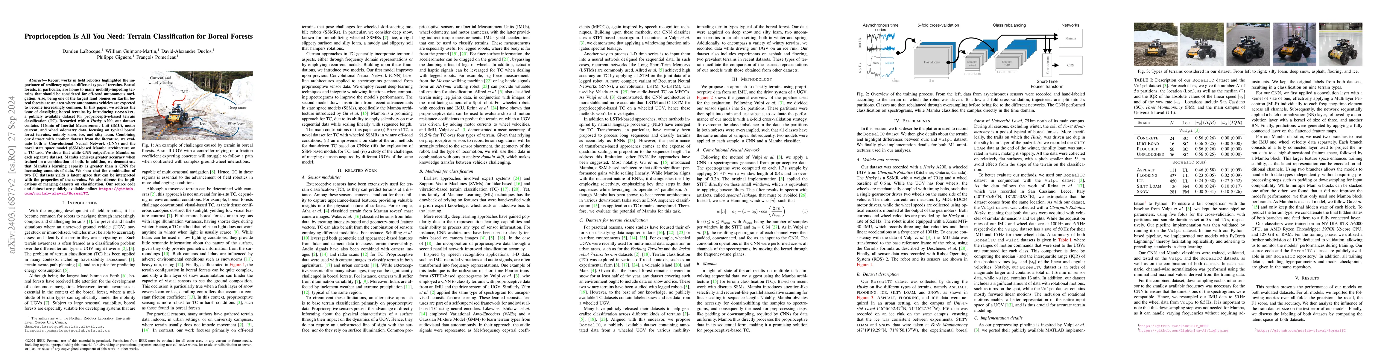
Recent works in field robotics highlighted the importance of resiliency against different types of terrains. Boreal forests, in particular, are home to many mobility-impeding terrains that should be...
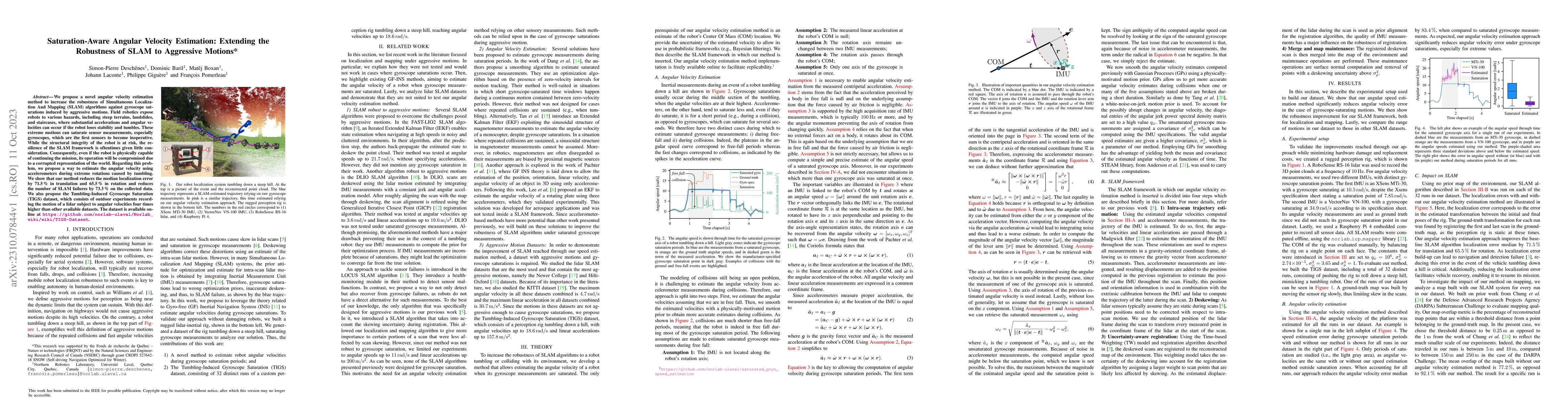
We propose a novel angular velocity estimation method to increase the robustness of Simultaneous Localization And Mapping (SLAM) algorithms against gyroscope saturations induced by aggressive motion...
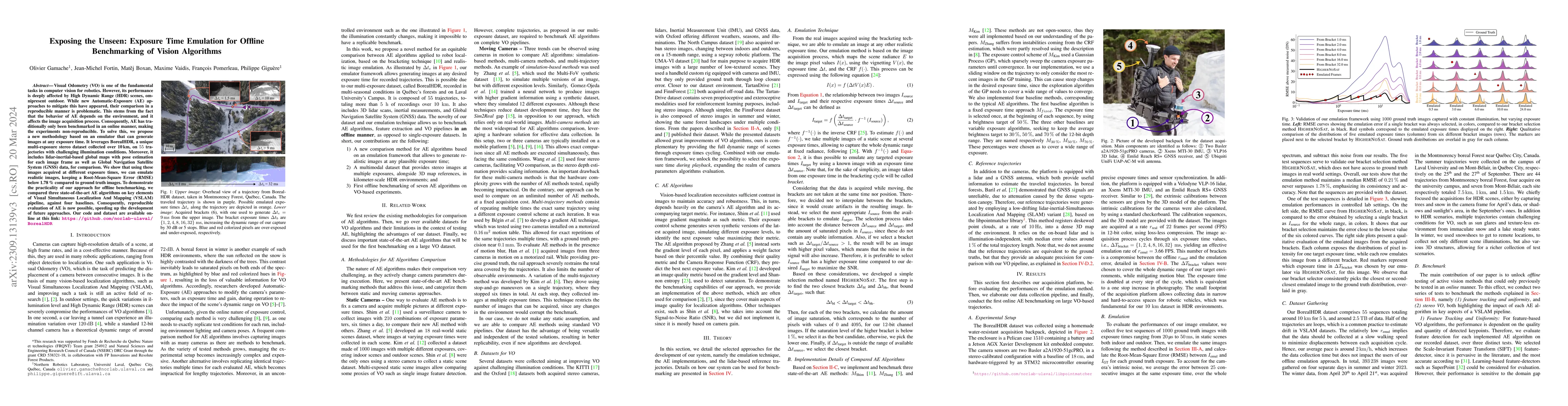
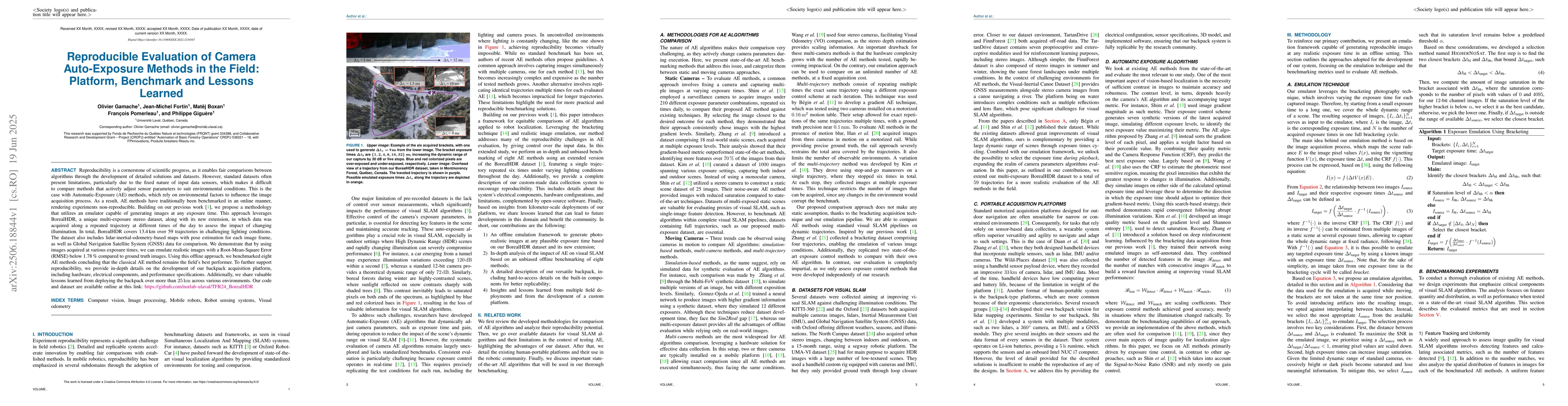
Visual Odometry (VO) is one of the fundamental tasks in computer vision for robotics. However, its performance is deeply affected by High Dynamic Range (HDR) scenes, omnipresent outdoor. While new A...
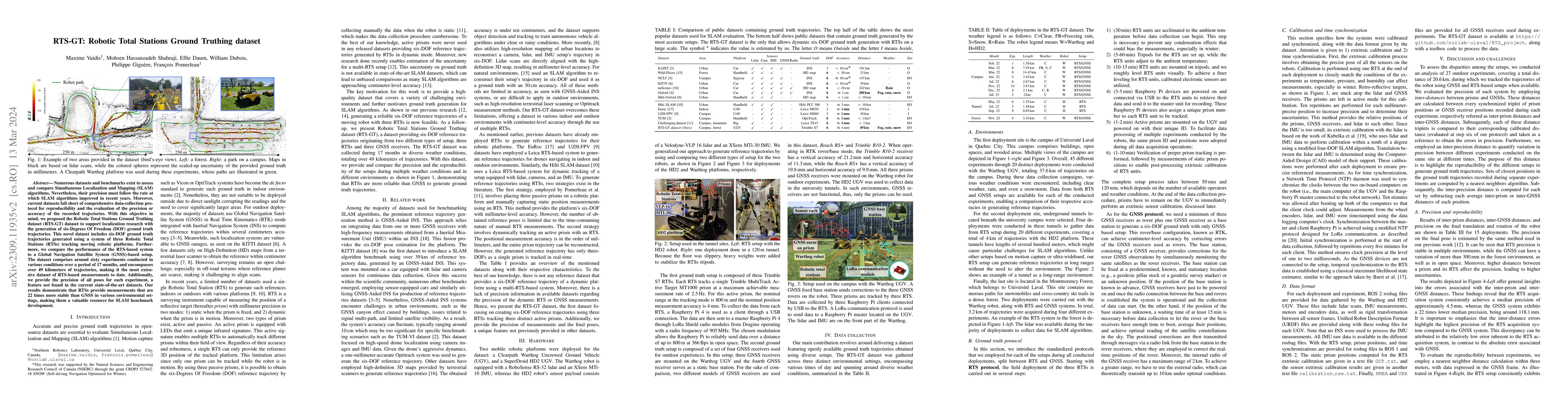
Numerous datasets and benchmarks exist to assess and compare Simultaneous Localization and Mapping (SLAM) algorithms. Nevertheless, their precision must follow the rate at which SLAM algorithms impr...
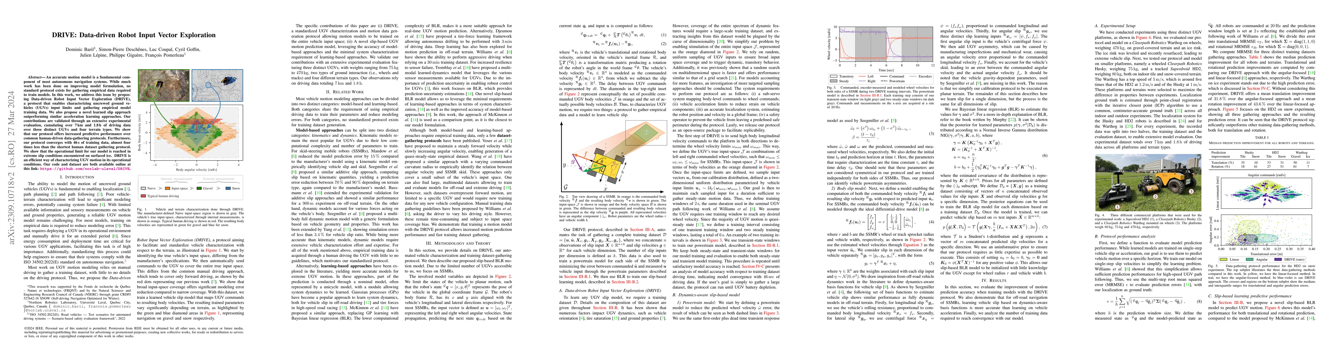
An accurate motion model is a fundamental component of most autonomous navigation systems. While much work has been done on improving model formulation, no standard protocol exists for gathering emp...
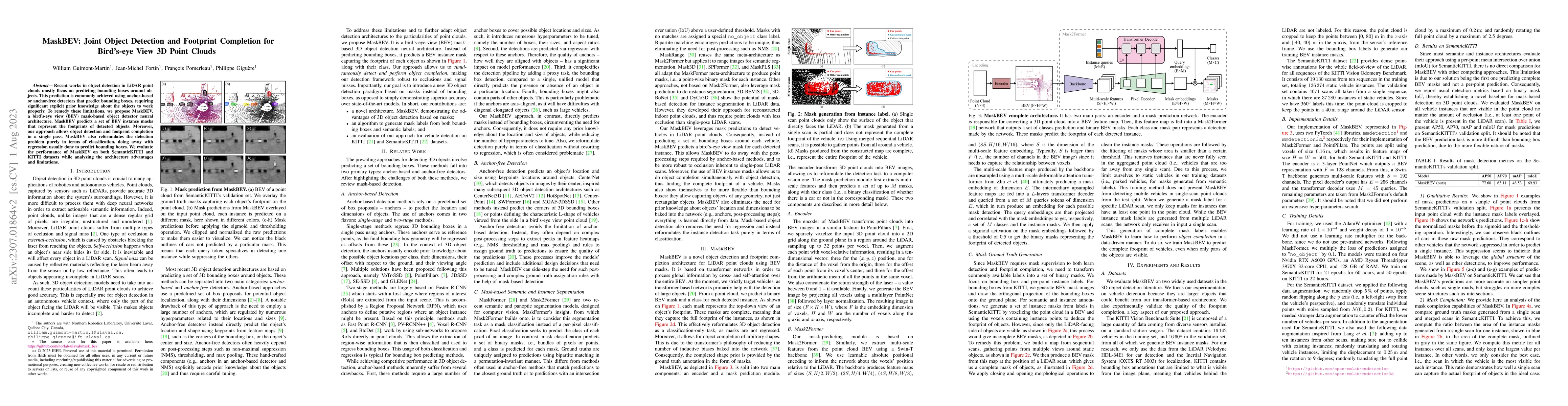
Recent works in object detection in LiDAR point clouds mostly focus on predicting bounding boxes around objects. This prediction is commonly achieved using anchor-based or anchor-free detectors that...
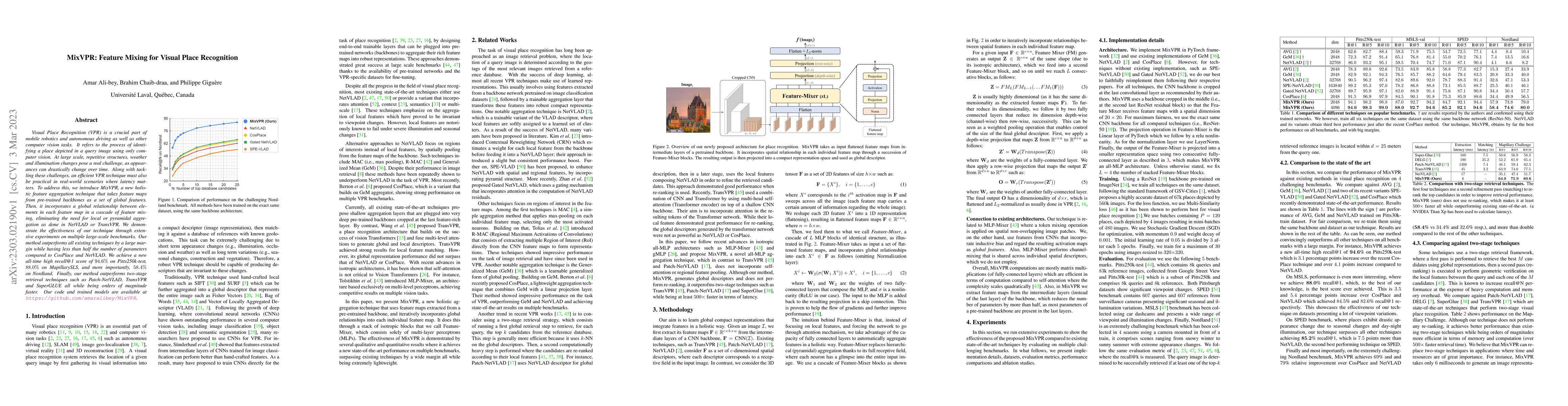
Visual Place Recognition (VPR) is a crucial part of mobile robotics and autonomous driving as well as other computer vision tasks. It refers to the process of identifying a place depicted in a query...
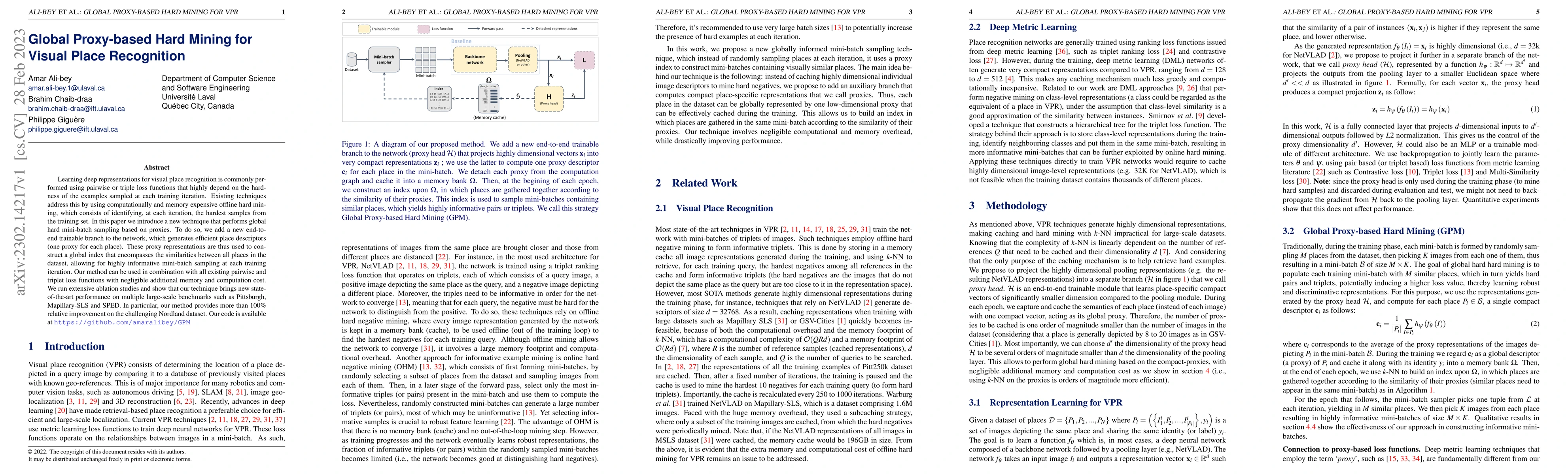
Learning deep representations for visual place recognition is commonly performed using pairwise or triple loss functions that highly depend on the hardness of the examples sampled at each training i...
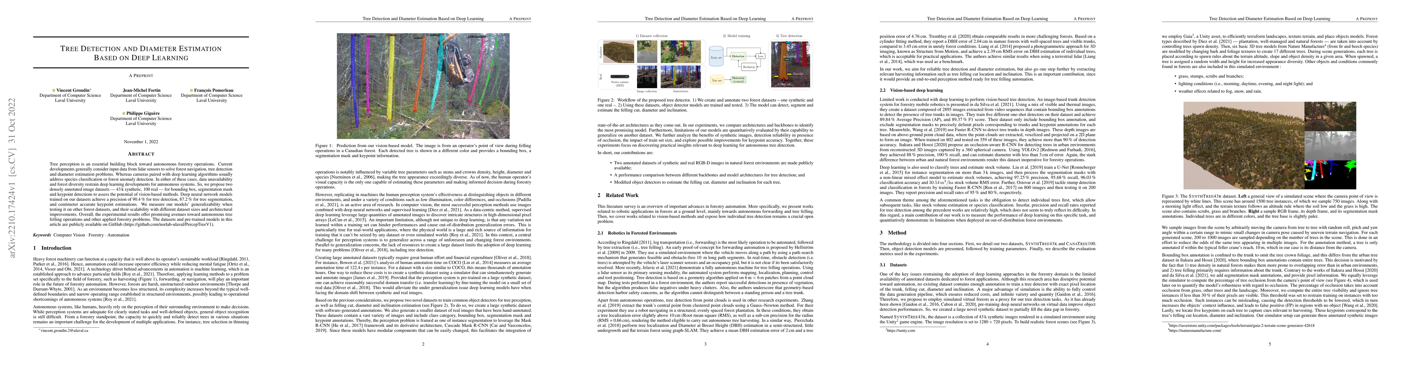
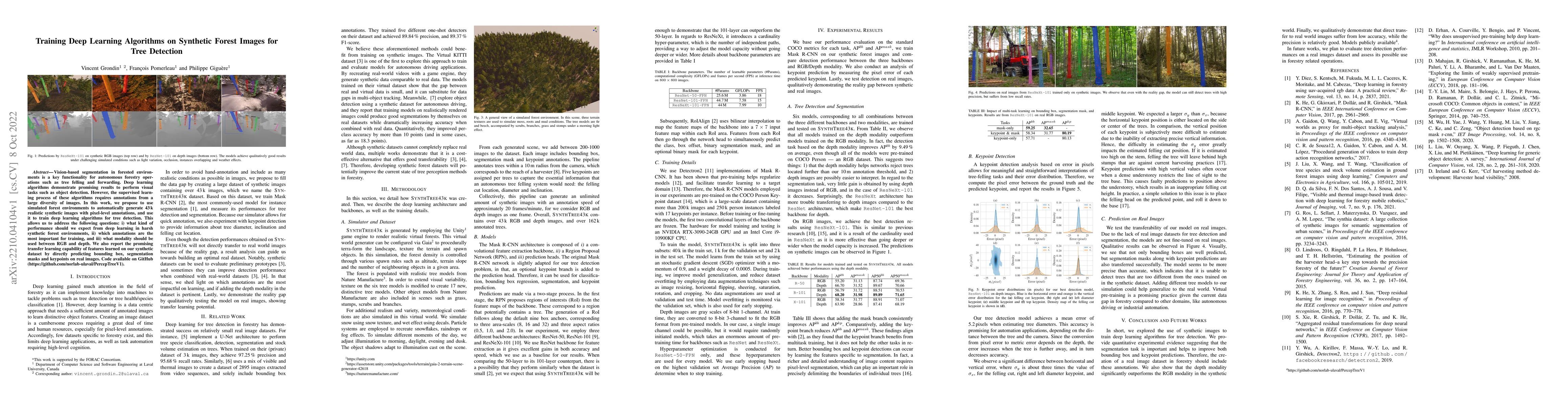
Tree perception is an essential building block toward autonomous forestry operations. Current developments generally consider input data from lidar sensors to solve forest navigation, tree detection...
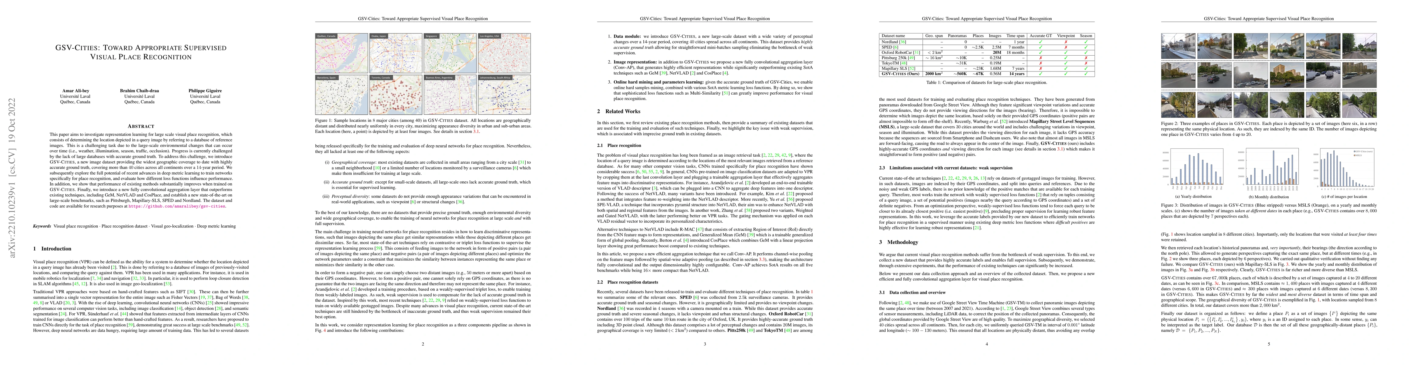
This paper aims to investigate representation learning for large scale visual place recognition, which consists of determining the location depicted in a query image by referring to a database of re...
Vision-based segmentation in forested environments is a key functionality for autonomous forestry operations such as tree felling and forwarding. Deep learning algorithms demonstrate promising resul...
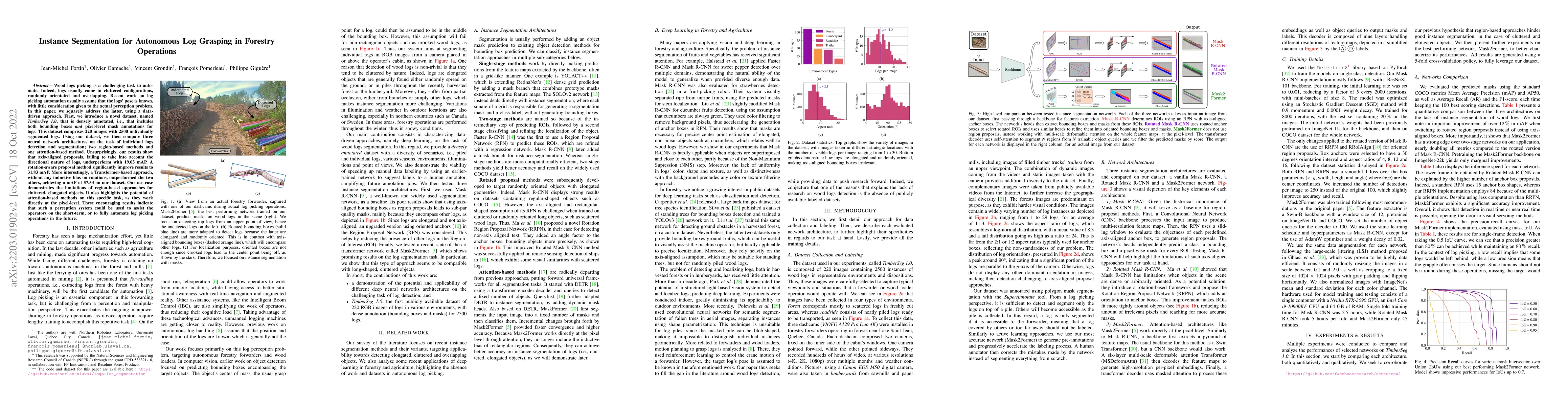
Wood logs picking is a challenging task to automate. Indeed, logs usually come in cluttered configurations, randomly orientated and overlapping. Recent work on log picking automation usually assume ...
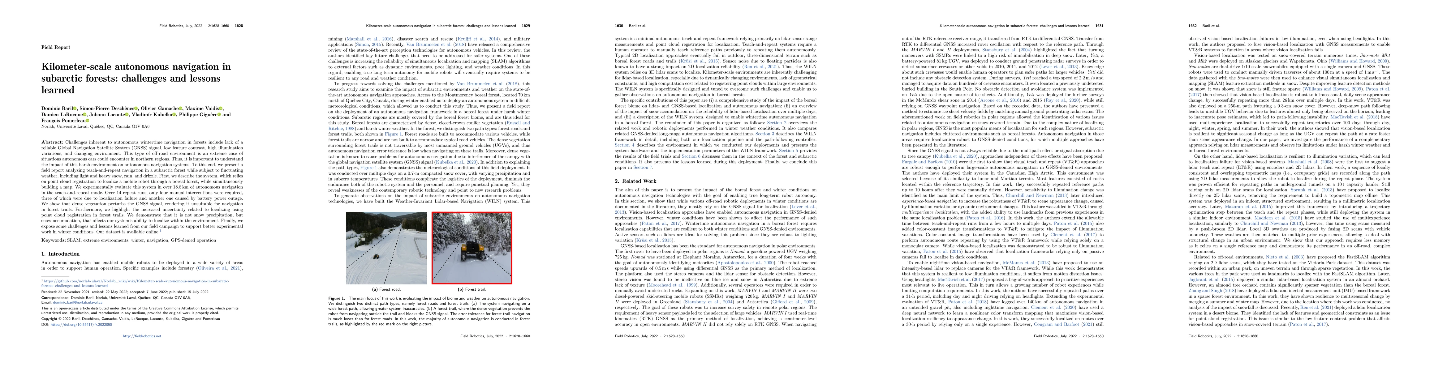
Challenges inherent to autonomous wintertime navigation in forests include lack of reliable a Global Navigation Satellite System (GNSS) signal, low feature contrast, high illumination variations and...
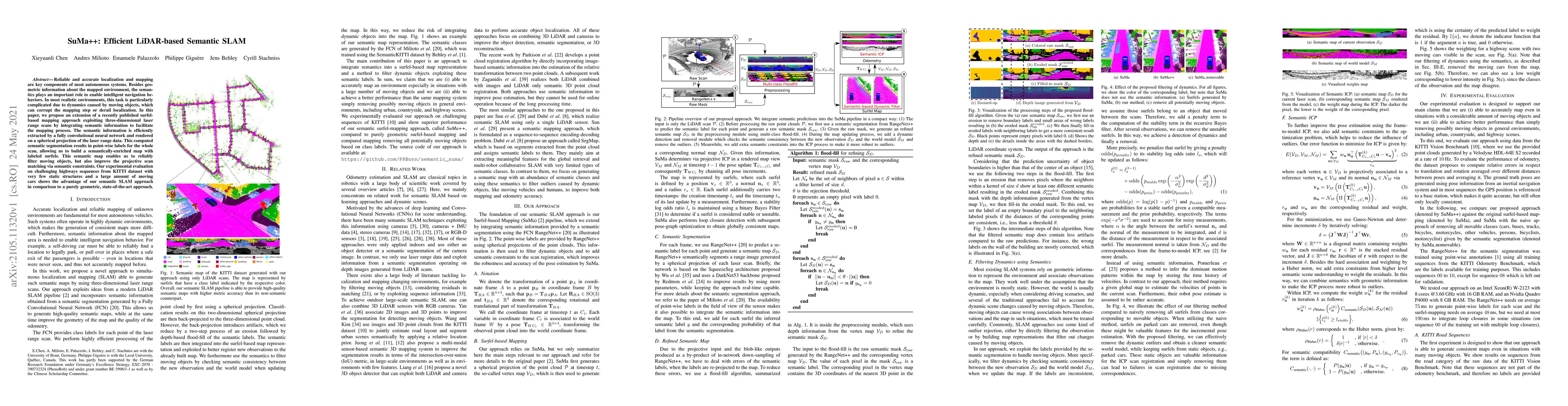
Reliable and accurate localization and mapping are key components of most autonomous systems. Besides geometric information about the mapped environment, the semantics plays an important role to ena...
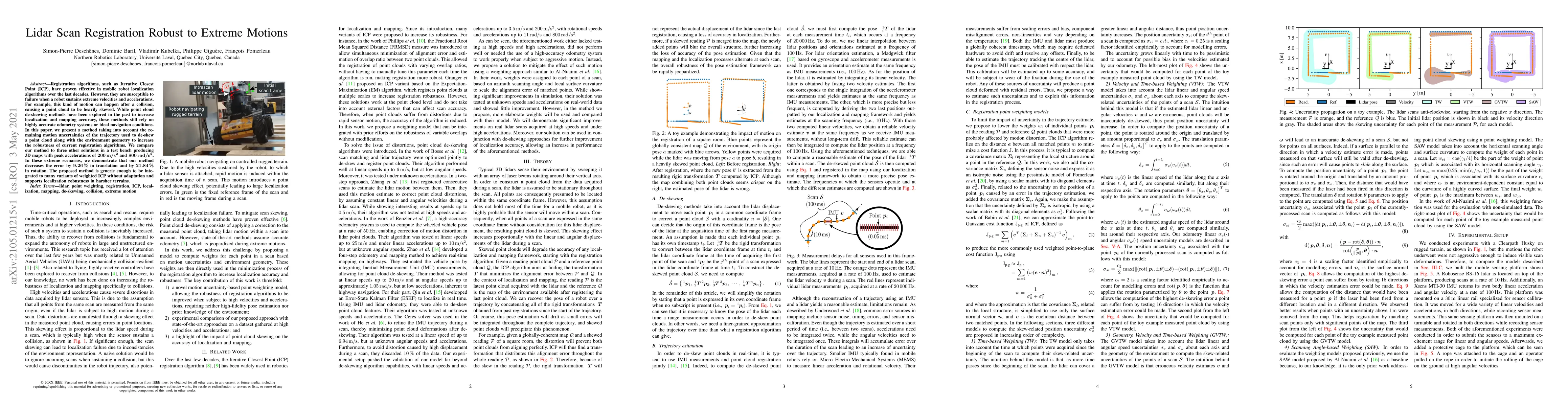
Registration algorithms, such as Iterative Closest Point (ICP), have proven effective in mobile robot localization algorithms over the last decades. However, they are susceptible to failure when a r...
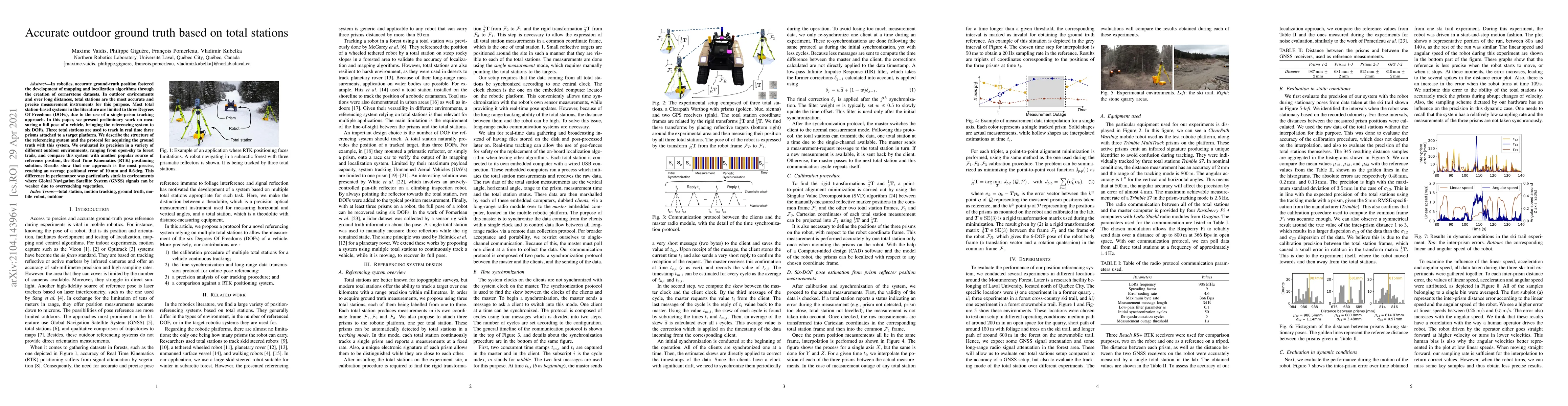
In robotics, accurate ground-truth position fostered the development of mapping and localization algorithms through the creation of cornerstone datasets. In outdoor environments and over long distan...
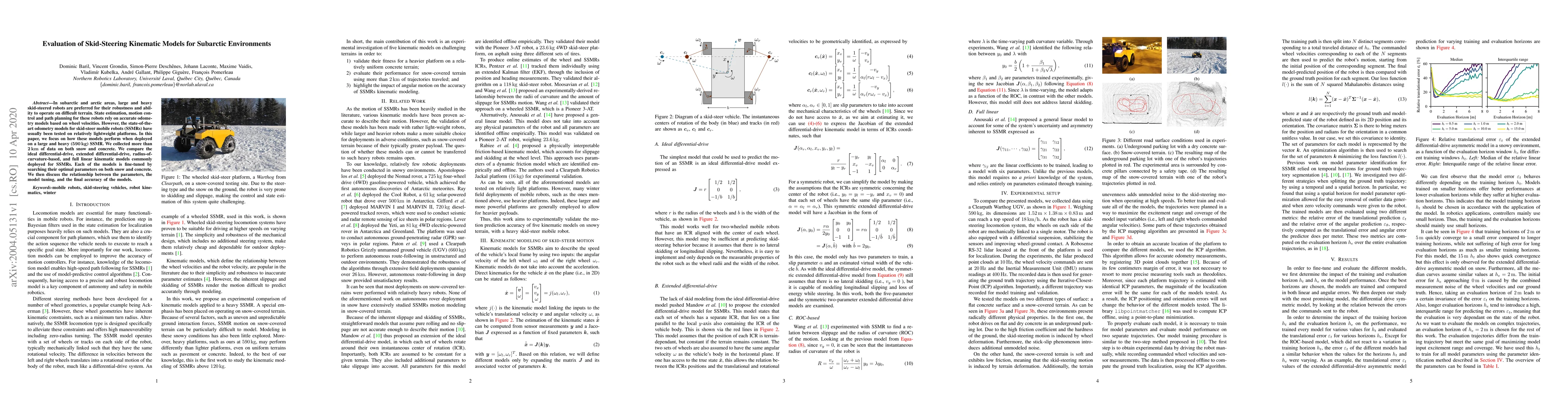
In subarctic and arctic areas, large and heavy skid-steered robots are preferred for their robustness and ability to operate on difficult terrain. State estimation, motion control and path planning ...
This paper introduces the Indian Chefs Process (ICP), a Bayesian nonparametric prior on the joint space of infinite directed acyclic graphs (DAGs) and orders that generalizes Indian Buffet Processes...
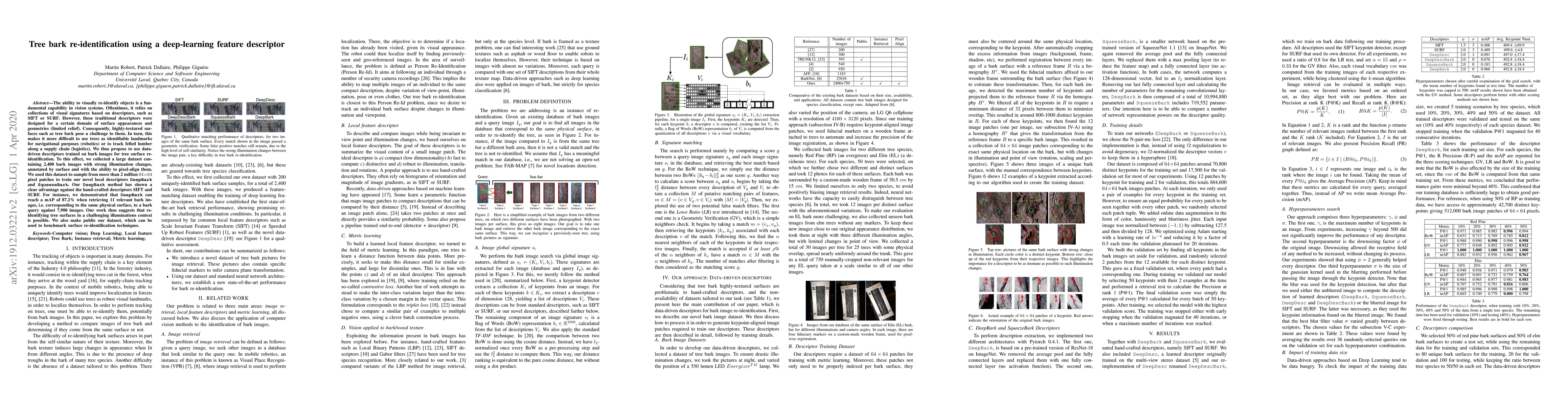
The ability to visually re-identify objects is a fundamental capability in vision systems. Oftentimes, it relies on collections of visual signatures based on descriptors, such as SIFT or SURF. Howev...
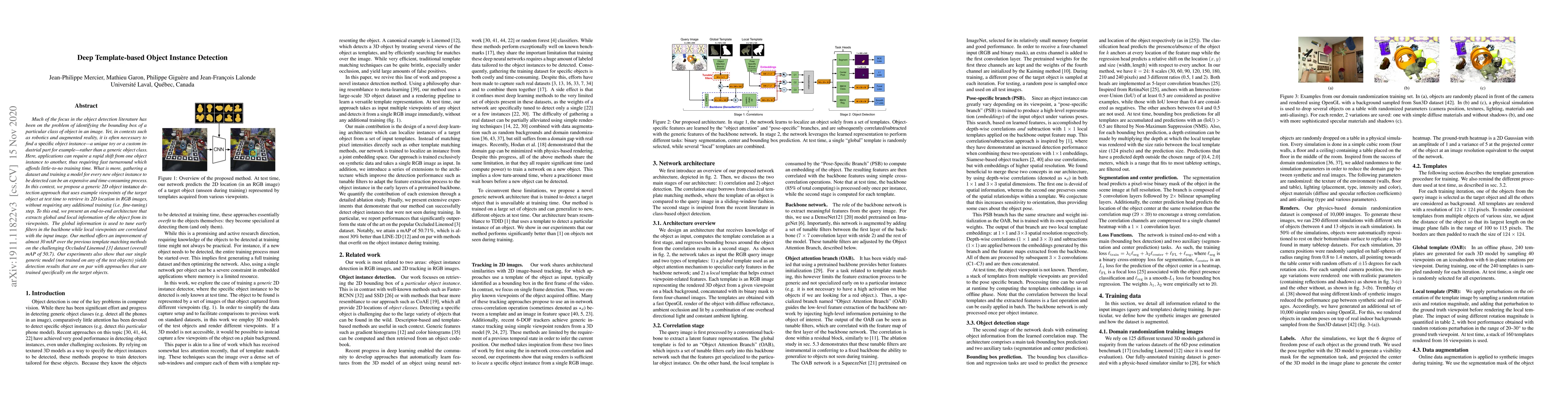
Much of the focus in the object detection literature has been on the problem of identifying the bounding box of a particular class of object in an image. Yet, in contexts such as robotics and augmen...
This report is a survey of the different autonomous driving datasets which have been published up to date. The first section introduces the many sensor types used in autonomous driving datasets. The...
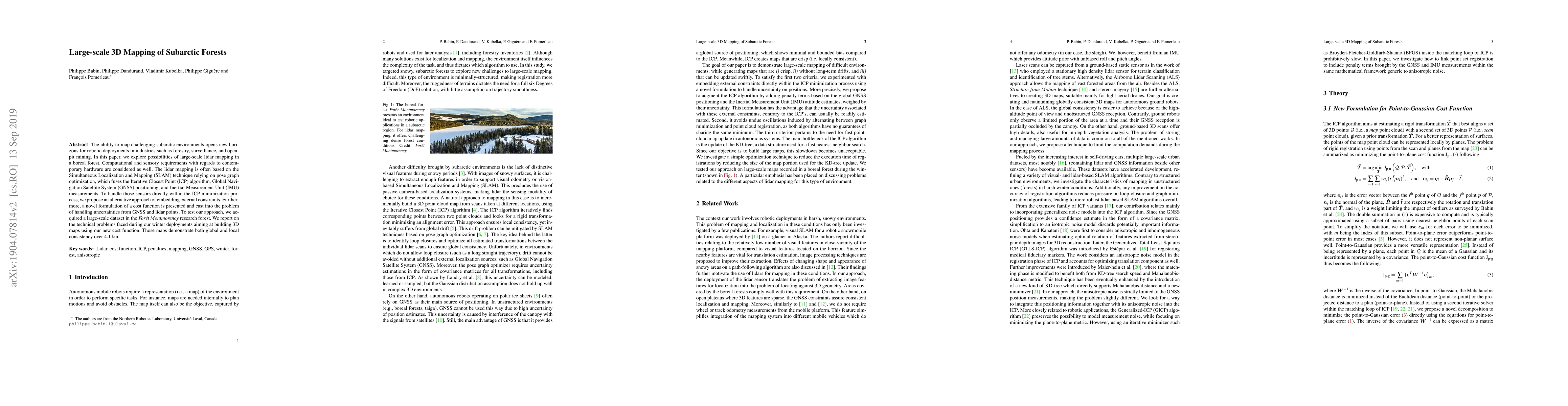
The ability to map challenging subarctic environments opens new horizons for robotic deployments in industries such as forestry, surveillance, and open-pit mining. In this paper, we explore possibil...
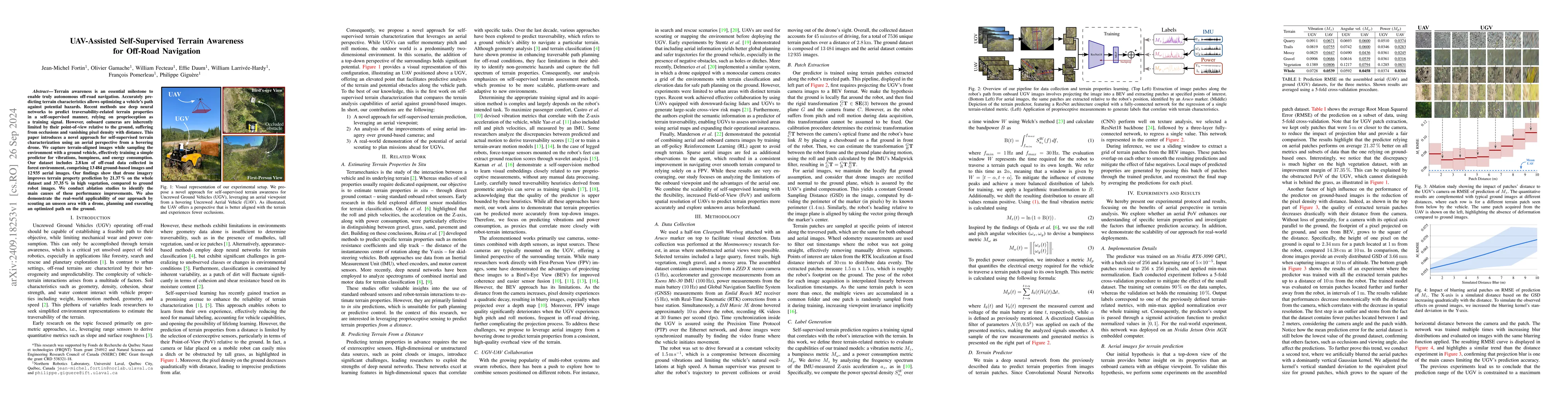
Terrain awareness is an essential milestone to enable truly autonomous off-road navigation. Accurately predicting terrain characteristics allows optimizing a vehicle's path against potential hazards. ...
Standard datasets often present limitations, particularly due to the fixed nature of input data sensors, which makes it difficult to compare methods that actively adjust sensor parameters to suit envi...
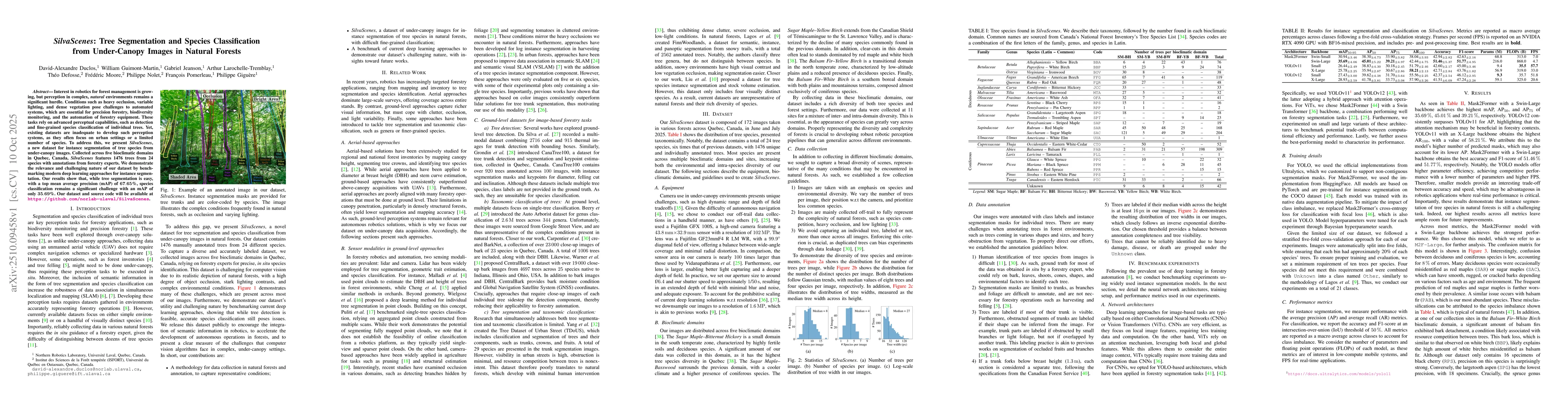
Interest in robotics for forest management is growing, but perception in complex, natural environments remains a significant hurdle. Conditions such as heavy occlusion, variable lighting, and dense ve...
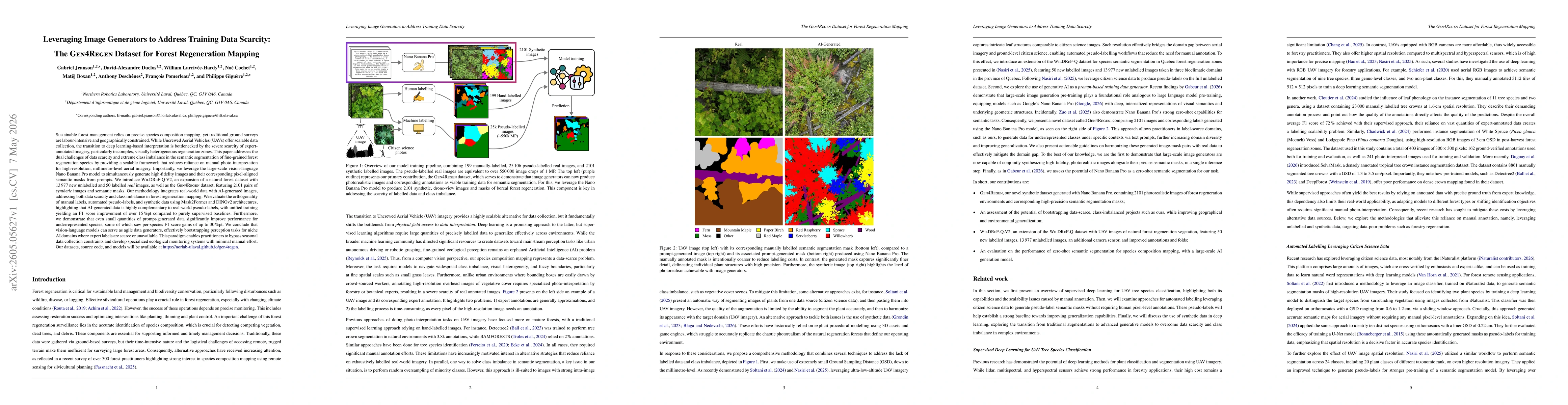
Sustainable forest management relies on precise species composition mapping, yet traditional ground surveys are labour-intensive and geographically constrained. While Uncrewed Aerial Vehicles (UAVs) o...
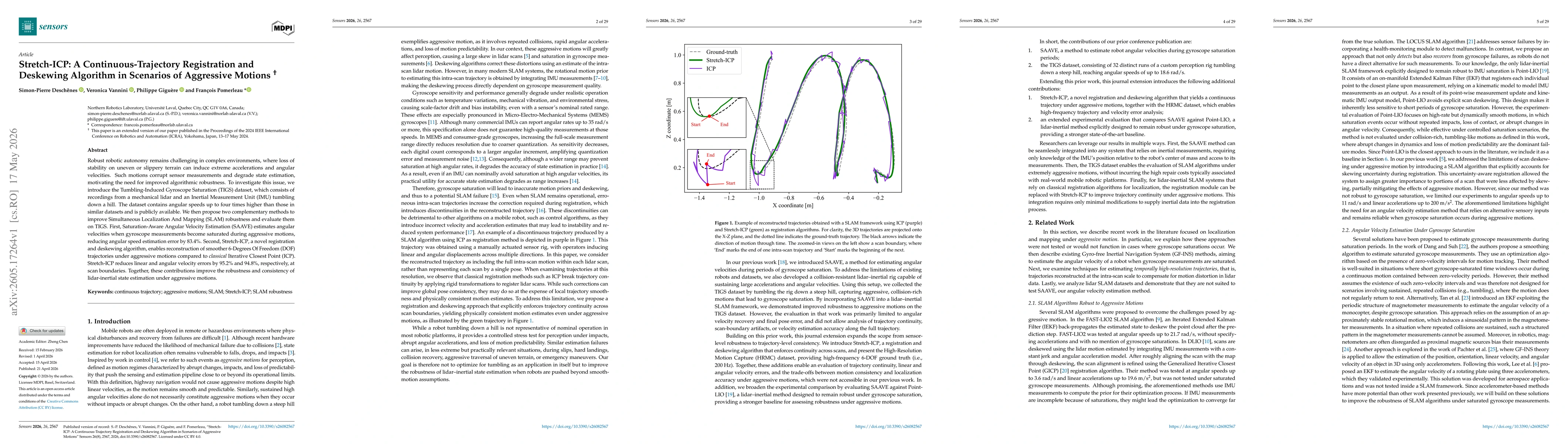
Robust robotic autonomy remains challenging in complex environments, where loss of stability on uneven or slippery terrain can induce extreme accelerations and angular velocities. Such motions corrupt...
Labeling a training set is often expensive and susceptible to errors, making the design of robust loss functions for label noise an important problem. The symmetry condition provides theoretical guara...
We study PAC-Bayes derandomization for smooth loss functions. Our goal is to obtain generalization bounds that hold with high probability for deterministic predictors by exploiting smoothness properti...