Academic Profile
Statistics
Similar Authors
Papers on arXiv
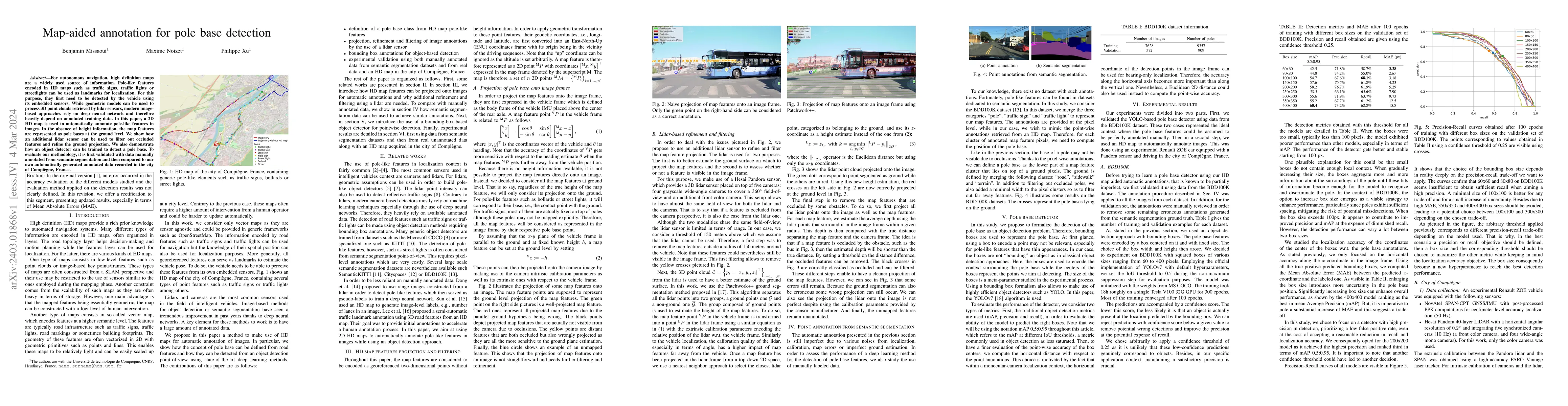
For autonomous navigation, high definition maps are a widely used source of information. Pole-like features encoded in HD maps such as traffic signs, traffic lights or street lights can be used as l...
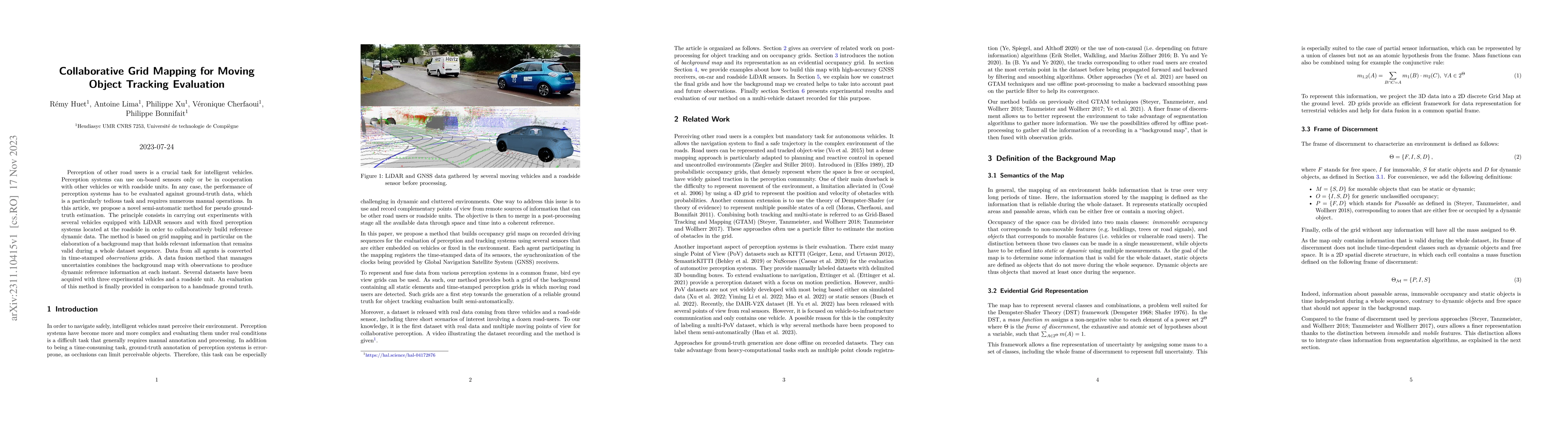
Perception of other road users is a crucial task for intelligent vehicles. Perception systems can use on-board sensors only or be in cooperation with other vehicles or with roadside units. In any ca...
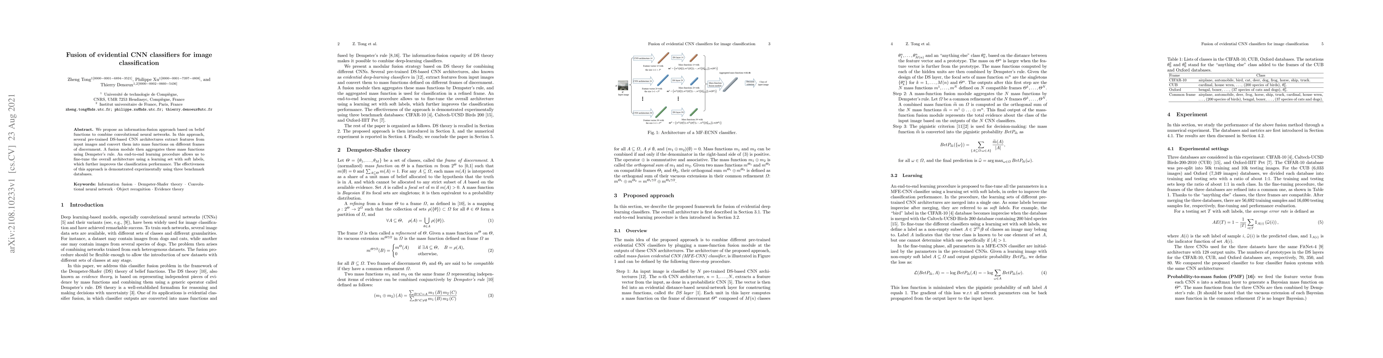
We propose an information-fusion approach based on belief functions to combine convolutional neural networks. In this approach, several pre-trained DS-based CNN architectures extract features from i...
We propose a new classifier based on Dempster-Shafer (DS) theory and a convolutional neural network (CNN) architecture for set-valued classification. In this classifier, called the evidential deep-l...
We propose a hybrid architecture composed of a fully convolutional network (FCN) and a Dempster-Shafer layer for image semantic segmentation. In the so-called evidential FCN (E-FCN), an encoder-deco...
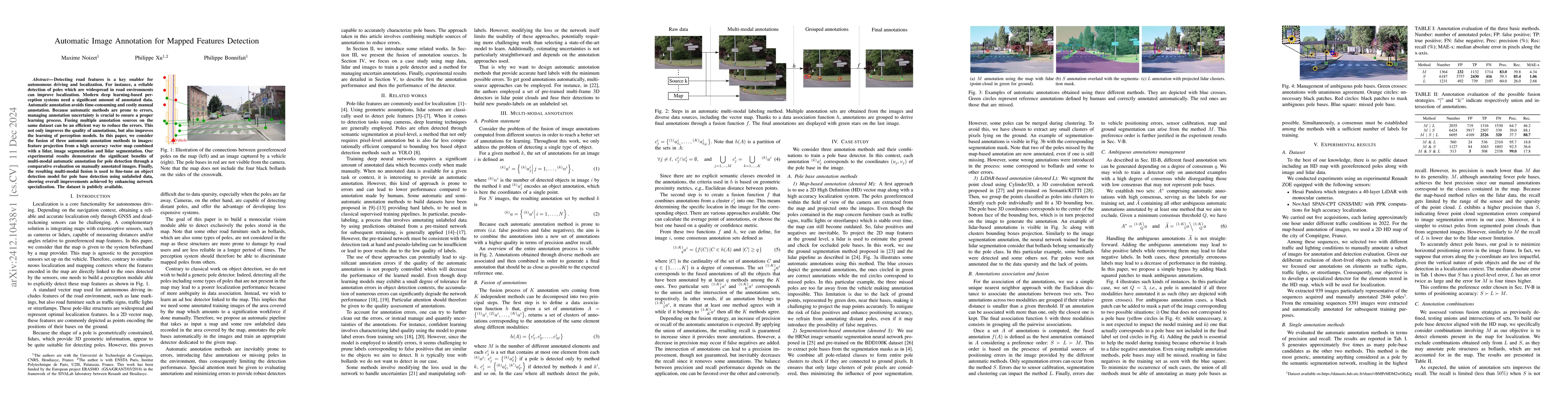
Detecting road features is a key enabler for autonomous driving and localization. For instance, a reliable detection of poles which are widespread in road environments can improve localization. Modern...
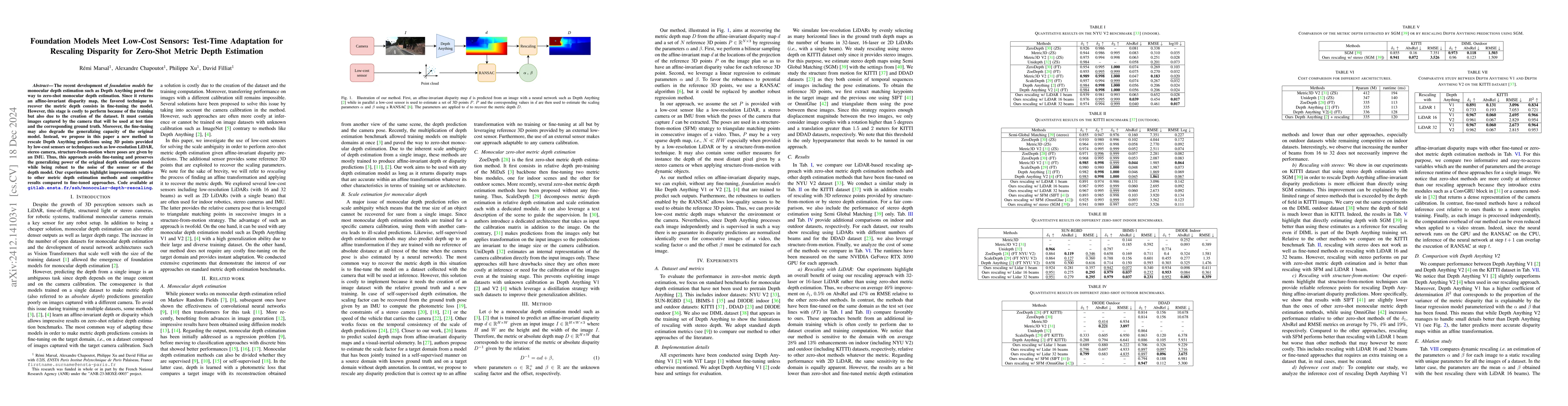
The recent development of foundation models for monocular depth estimation such as Depth Anything paved the way to zero-shot monocular depth estimation. Since it returns an affine-invariant disparity ...
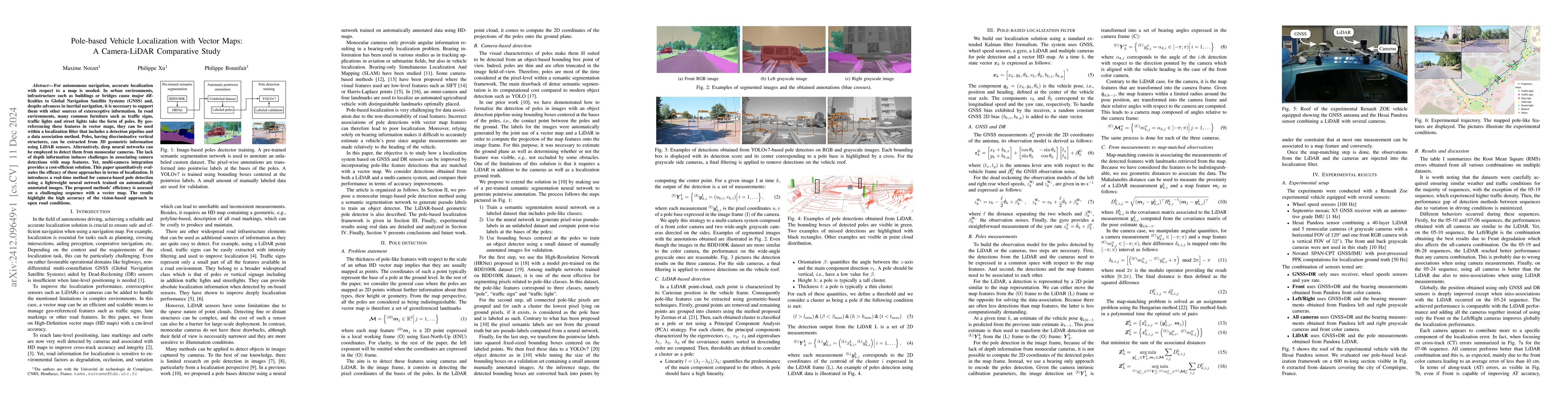
For autonomous navigation, accurate localization with respect to a map is needed. In urban environments, infrastructure such as buildings or bridges cause major difficulties to Global Navigation Satel...
Emergent symbolic representations are critical for enabling developmental learning agents to plan and generalize across tasks. In this work, we investigate whether large language models (LLMs) can tra...