Academic Profile
Statistics
Similar Authors
Papers on arXiv
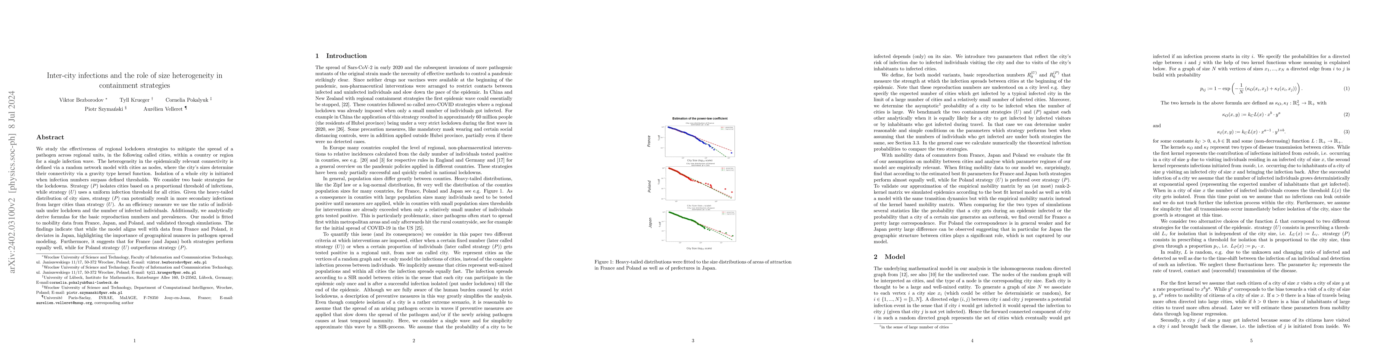
Our goal is to compare the efficiency of strategies applied on a regional scale to control the spread of a pathogen between urban units, in the following called cities. We model the infection dynami...
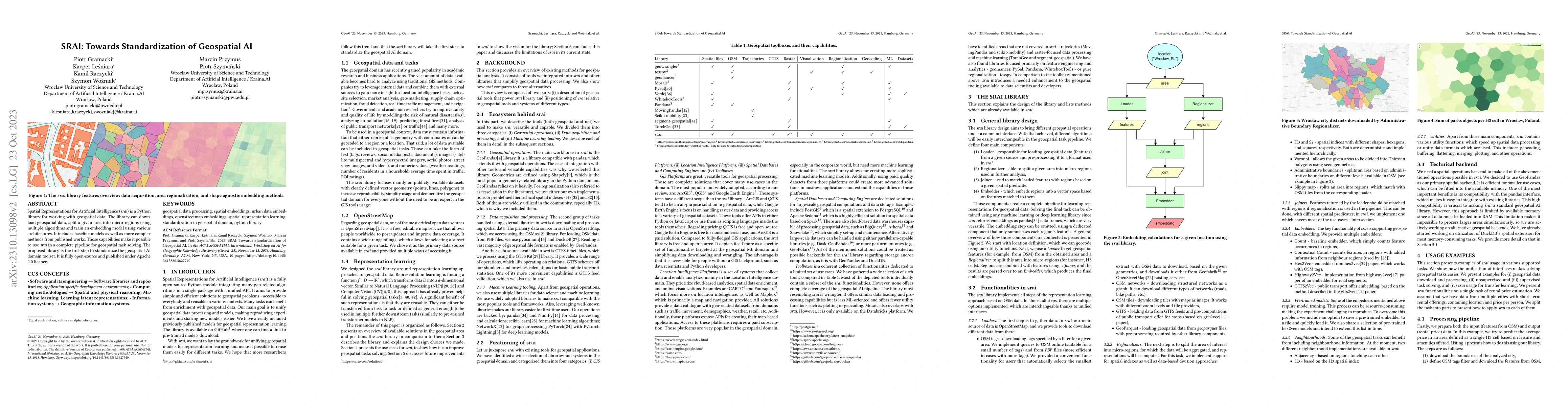
Spatial Representations for Artificial Intelligence (srai) is a Python library for working with geospatial data. The library can download geospatial data, split a given area into micro-regions using...
With a recent influx of voice generation methods, the threat introduced by audio DeepFake (DF) is ever-increasing. Several different detection methods have been presented as a countermeasure. Many m...
Recent years brought advancements in using neural networks for representation learning of various language or visual phenomena. New methods freed data scientists from hand-crafting features for comm...
The availability of compute and data to train larger and larger language models increases the demand for robust methods of benchmarking the true progress of LM training. Recent years witnessed signi...
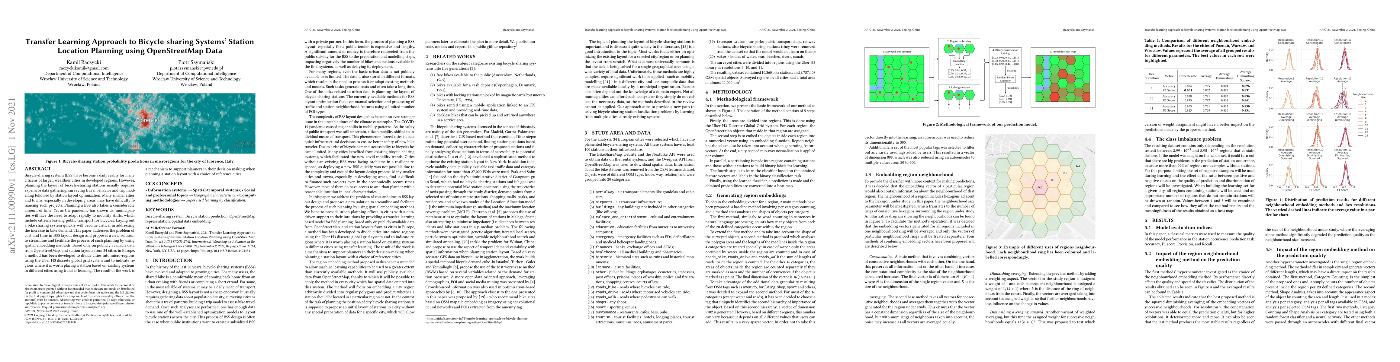
Bicycle-sharing systems (BSS) have become a daily reality for many citizens of larger, wealthier cities in developed regions. However, planning the layout of bicycle-sharing stations usually require...
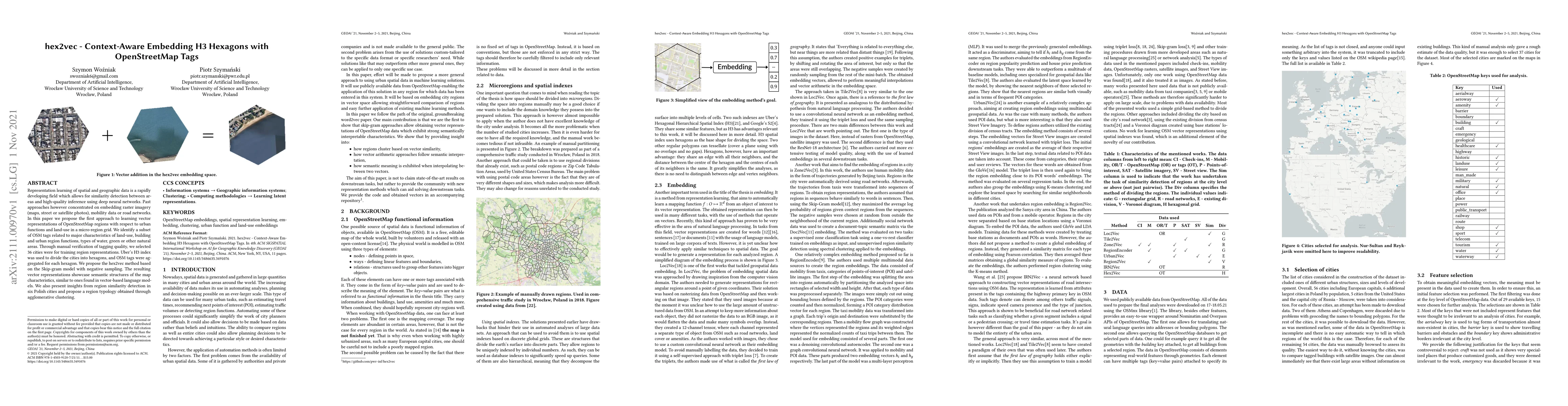
Representation learning of spatial and geographic data is a rapidly developing field which allows for similarity detection between areas and high-quality inference using deep neural networks. Past a...
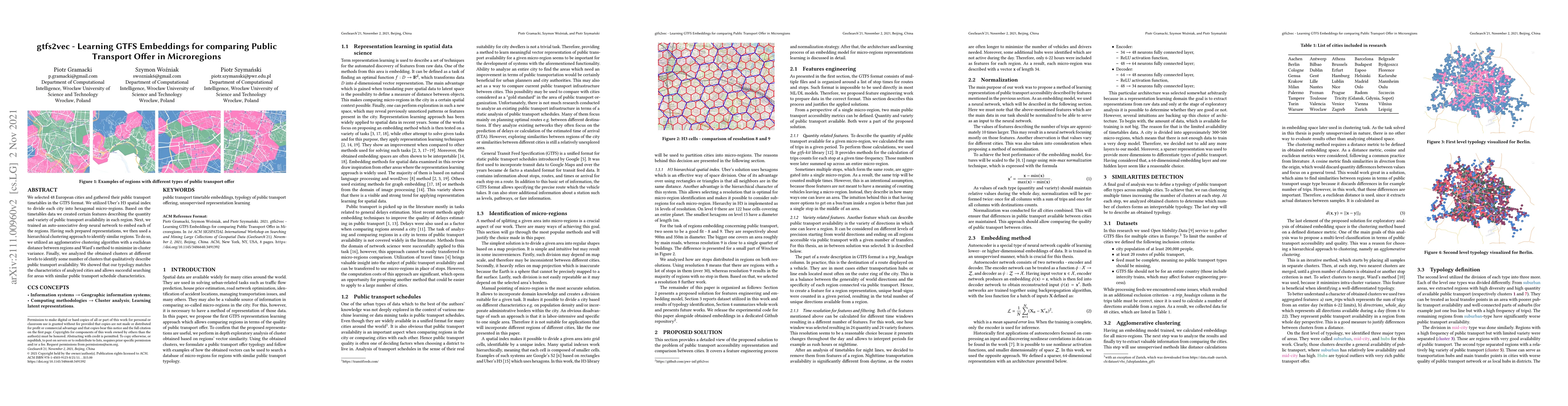
We selected 48 European cities and gathered their public transport timetables in the GTFS format. We utilized Uber's H3 spatial index to divide each city into hexagonal micro-regions. Based on the t...
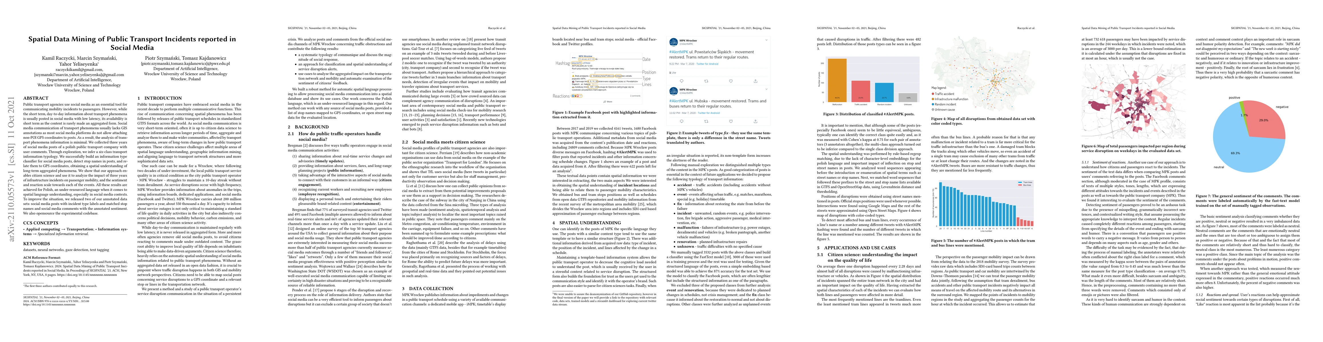
Public transport agencies use social media as an essential tool for communicating mobility incidents to passengers. However, while the short term, day-to-day information about transport phenomena is...
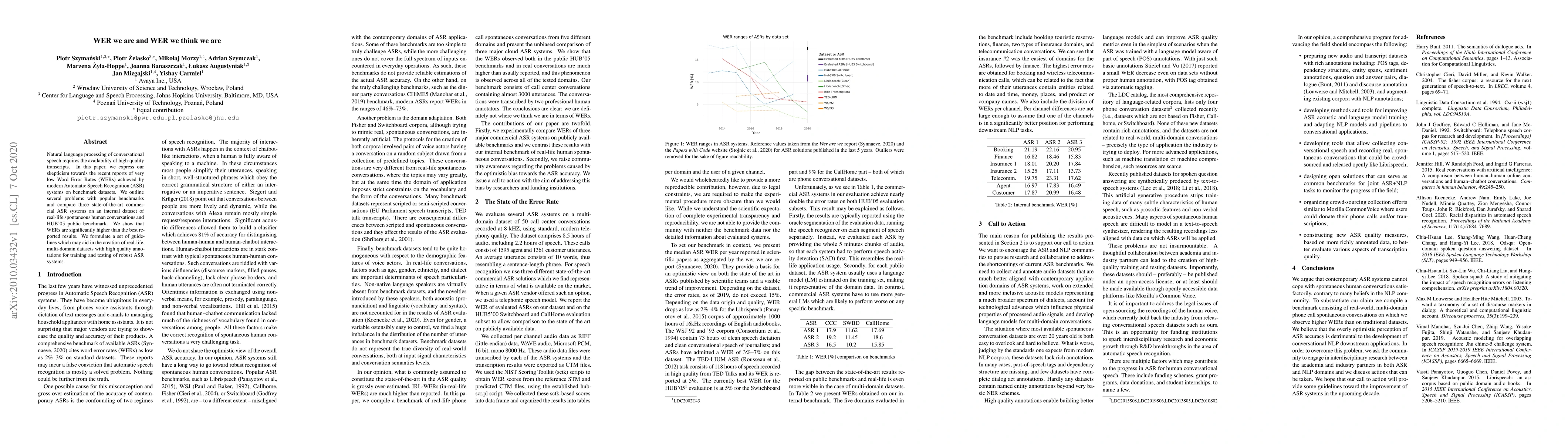
Natural language processing of conversational speech requires the availability of high-quality transcripts. In this paper, we express our skepticism towards the recent reports of very low Word Error...
Recent work raises concerns about the use of standard splits to compare natural language processing models. We propose a Bayesian statistical model comparison technique which uses k-fold cross-valid...
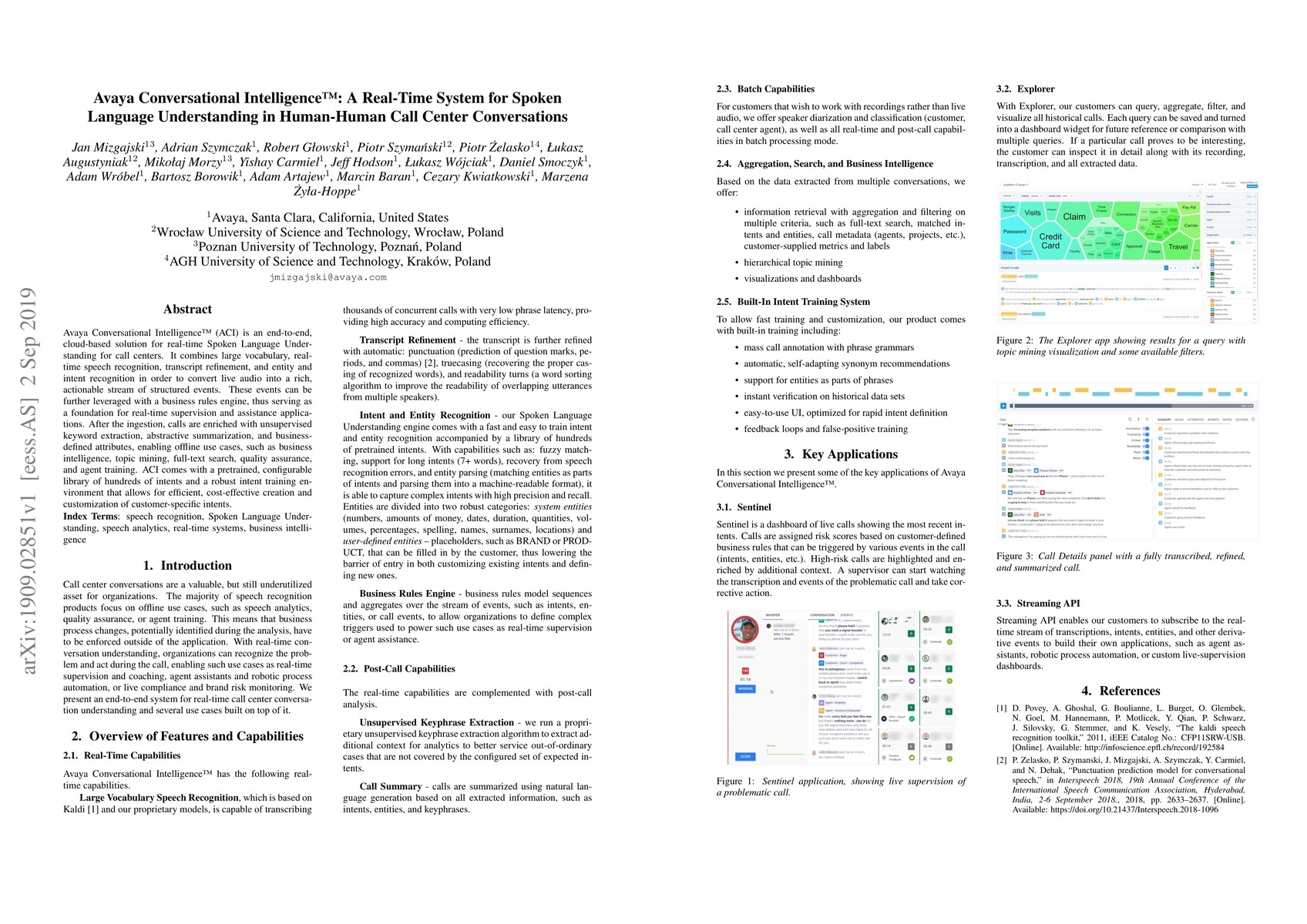
Avaya Conversational Intelligence(ACI) is an end-to-end, cloud-based solution for real-time Spoken Language Understanding for call centers. It combines large vocabulary, real-time speech recognition...
In this paper, we present a method for correcting automatic speech recognition (ASR) errors using a finite state transducer (FST) intent recognition framework. Intent recognition is a powerful techn...
Software development support tools have been studied for a long time, with recent approaches using Large Language Models (LLMs) for code generation. These models can generate Python code for data scie...
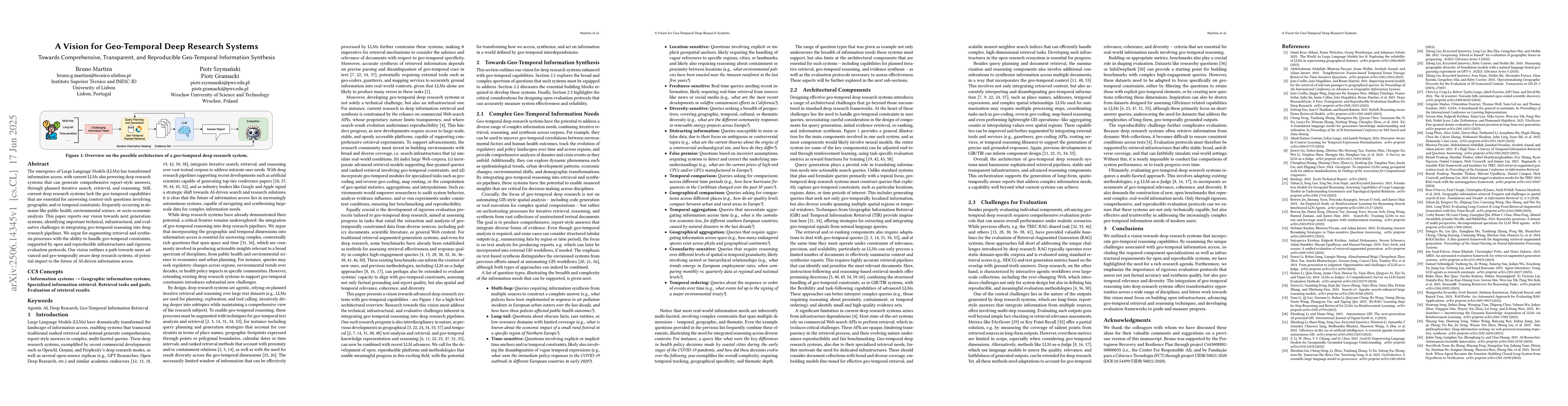
The emergence of Large Language Models (LLMs) has transformed information access, with current LLMs also powering deep research systems that can generate comprehensive report-style answers, through pl...
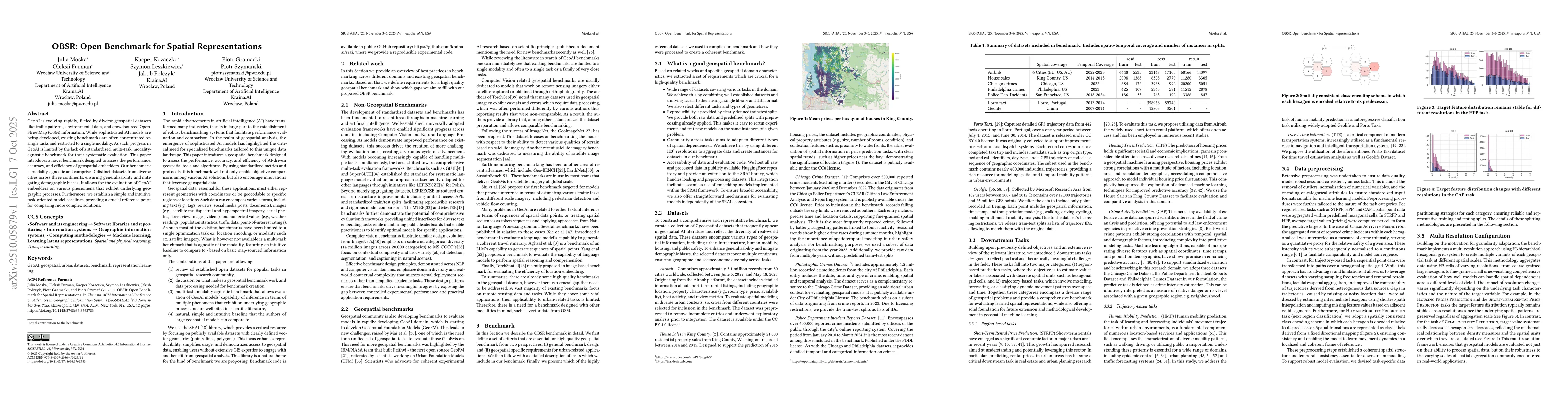
GeoAI is evolving rapidly, fueled by diverse geospatial datasets like traffic patterns, environmental data, and crowdsourced OpenStreetMap (OSM) information. While sophisticated AI models are being de...