Pragyana Mishra
Carnegie Mellon University, Xerox PARC, Microsoft, Amazon
Academic Profile
Statistics
Similar Authors
Papers on arXiv
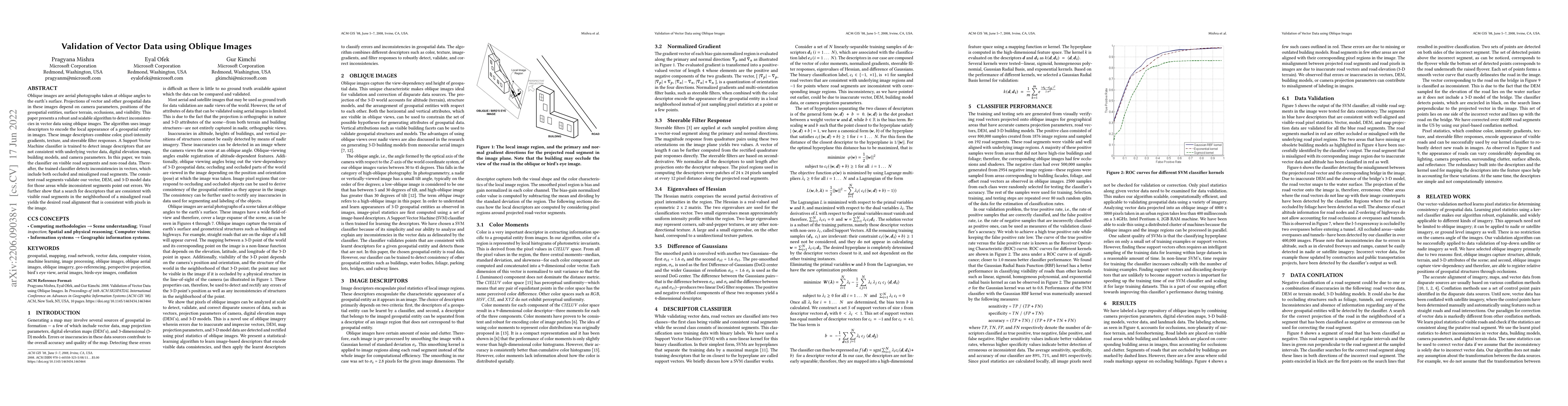
Oblique images are aerial photographs taken at oblique angles to the earth's surface. Projections of vector and other geospatial data in these images depend on camera parameters, positions of the ge...
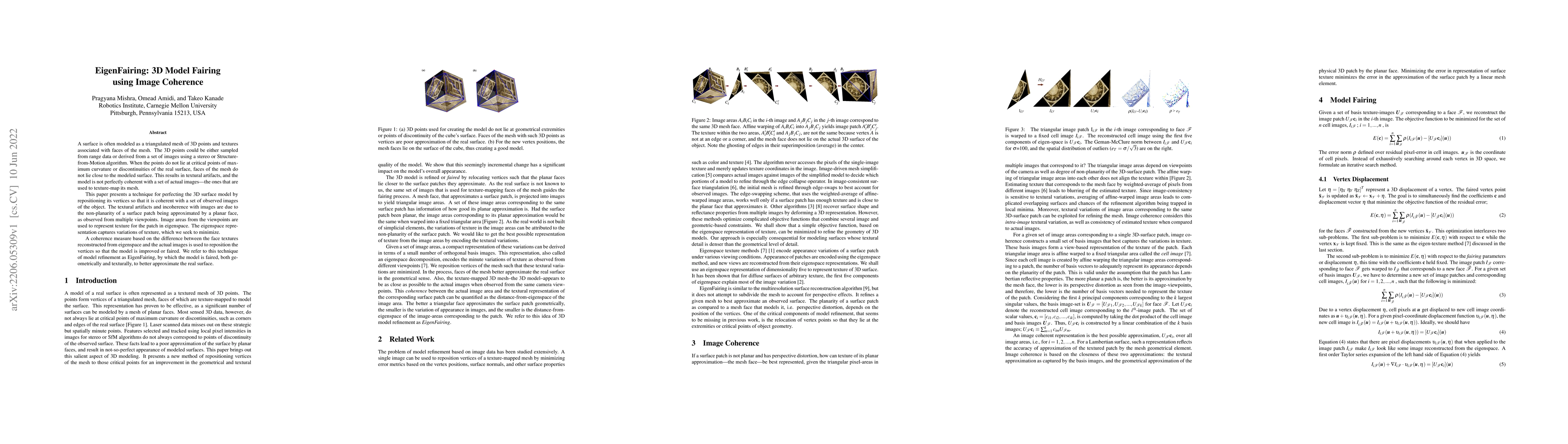
A surface is often modeled as a triangulated mesh of 3D points and textures associated with faces of the mesh. The 3D points could be either sampled from range data or derived from a set of images u...
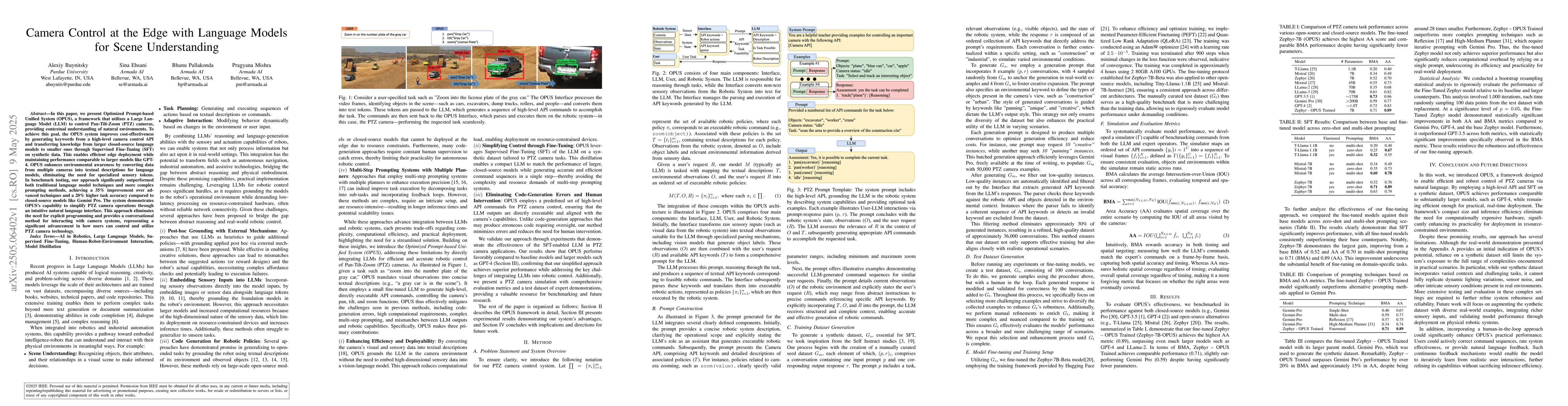
In this paper, we present Optimized Prompt-based Unified System (OPUS), a framework that utilizes a Large Language Model (LLM) to control Pan-Tilt-Zoom (PTZ) cameras, providing contextual understandin...
Deploying language-driven agents in robotics requires evaluations that reflect real-world task demands: natural-language instructions with reproducible outcomes. Such agents must connect language mode...