ArxivLens
P
Researcher

Praveen Ravirathinam

6 papers on arXiv

6 arXiv Papers
14 Total Publications
Profile

Academic Profile

Name Praveen Ravirathinam
Total Papers 14
Scholar Profile View on Semantic Scholar
Metrics

Statistics

6 arXiv Papers
14 Total Publications
Publications

Papers on arXiv

Thumbnail for Combining Satellite and Weather Data for Crop Type Mapping: An Inverse
  Modelling Approach
arXiv
Combining Satellite and Weather Data for Crop Type Mapping: An Inverse Modelling Approach

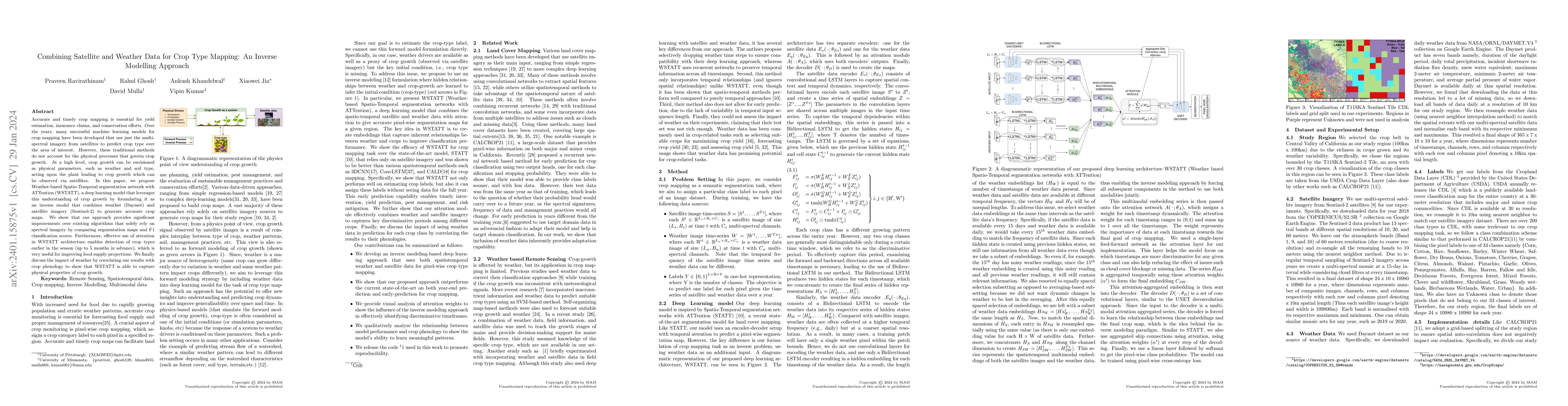
Accurate and timely crop mapping is essential for yield estimation, insurance claims, and conservation efforts. Over the years, many successful machine learning models for crop mapping have been dev...

Thumbnail for Global Precipitation Nowcasting of Integrated Multi-satellitE Retrievals
  for GPM: A U-Net Convolutional LSTM Architecture
arXiv
Global Precipitation Nowcasting of Integrated Multi-satellitE Retrievals for GPM: A U-Net Convolutional LSTM Architecture

This paper presents a deep learning architecture for nowcasting of precipitation almost globally every 30 min with a 4-hour lead time. The architecture fuses a U-Net and a convolutional long short-t...

Thumbnail for Spatiotemporal Classification with limited labels using Constrained
  Clustering for large datasets
arXiv
Spatiotemporal Classification with limited labels using Constrained Clustering for large datasets

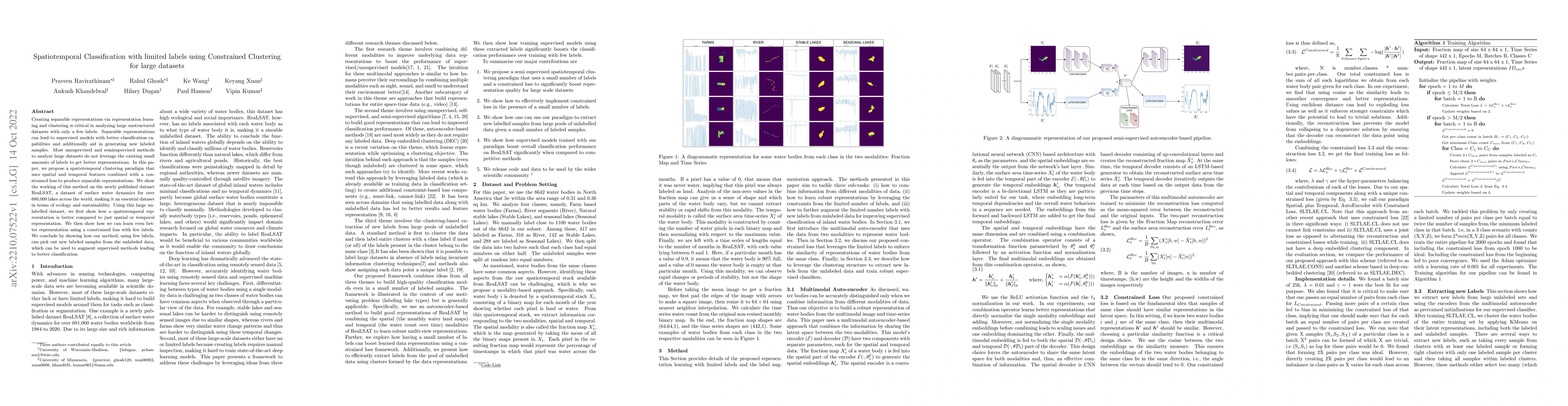
Creating separable representations via representation learning and clustering is critical in analyzing large unstructured datasets with only a few labels. Separable representations can lead to super...

Thumbnail for NeighCNN: A CNN based SAR Speckle Reduction using Feature preserving
  Loss Function
arXiv
NeighCNN: A CNN based SAR Speckle Reduction using Feature preserving Loss Function

Coherent imaging systems like synthetic aperture radar are susceptible to multiplicative noise that makes applications like automatic target recognition challenging. In this paper, NeighCNN, a deep ...

Thumbnail for Attention-augmented Spatio-Temporal Segmentation for Land Cover Mapping
arXiv
Attention-augmented Spatio-Temporal Segmentation for Land Cover Mapping

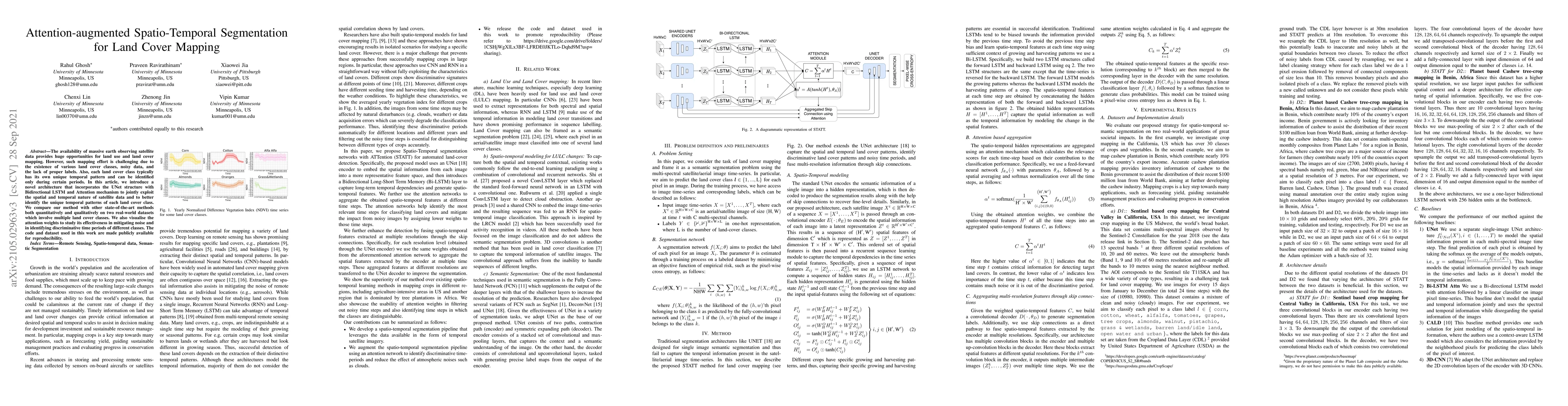
The availability of massive earth observing satellite data provide huge opportunities for land use and land cover mapping. However, such mapping effort is challenging due to the existence of various...

Thumbnail for Towards a Knowledge guided Multimodal Foundation Model for
  Spatio-Temporal Remote Sensing Applications
arXiv
Towards a Knowledge guided Multimodal Foundation Model for Spatio-Temporal Remote Sensing Applications

In recent years, there is increased interest in foundation models for geoscience due to vast amount of earth observing satellite imagery. Existing remote sensing foundation models make use of the vari...

This website uses cookies to ensure you get the best experience. Learn more