Academic Profile
Statistics
Similar Authors
Papers on arXiv
This work presents the first quantitative study of alignment errors between small uncrewed aerial systems (sUAS) geospatial imagery and a priori building polygons and finds that alignment errors are...
This document presents the Center for Robot Assisted Search And Rescue - Uncrewed Aerial Systems - Disaster Response Overhead Inspection Dataset (CRASAR-U-DROIDs) for building damage assessment and sp...
This paper audits damage labels derived from coincident satellite and drone aerial imagery for 15,814 buildings across Hurricanes Ian, Michael, and Harvey, finding 29.02% label disagreement and signif...
This paper details four principal challenges encountered with machine learning (ML) damage assessment using small uncrewed aerial systems (sUAS) at Hurricanes Debby and Helene that prevented, degraded...
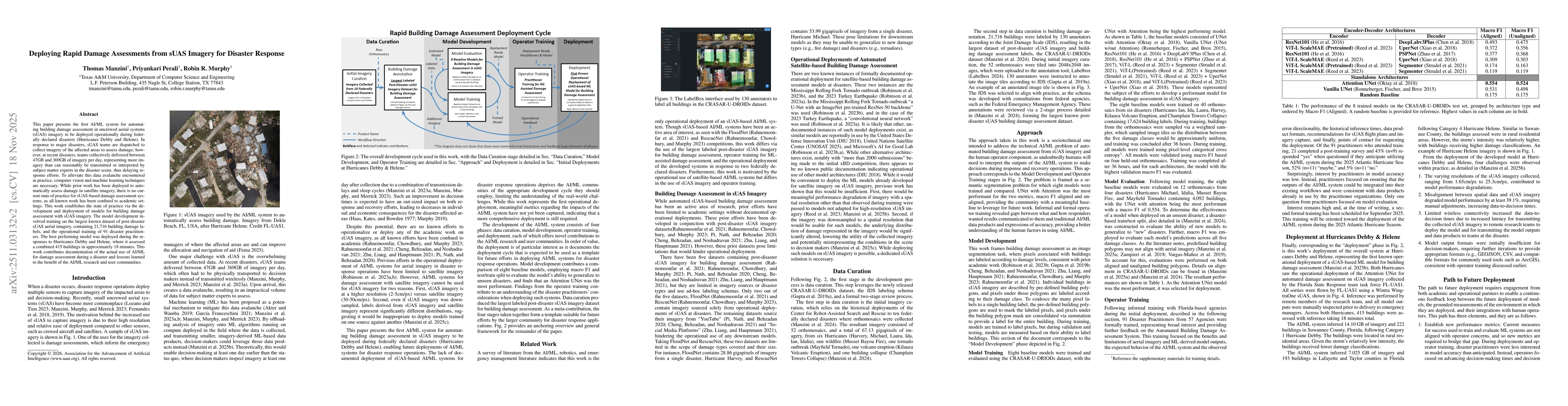
This paper presents the first AI/ML system for automating building damage assessment in uncrewed aerial systems (sUAS) imagery to be deployed operationally during federally declared disasters (Hurrica...
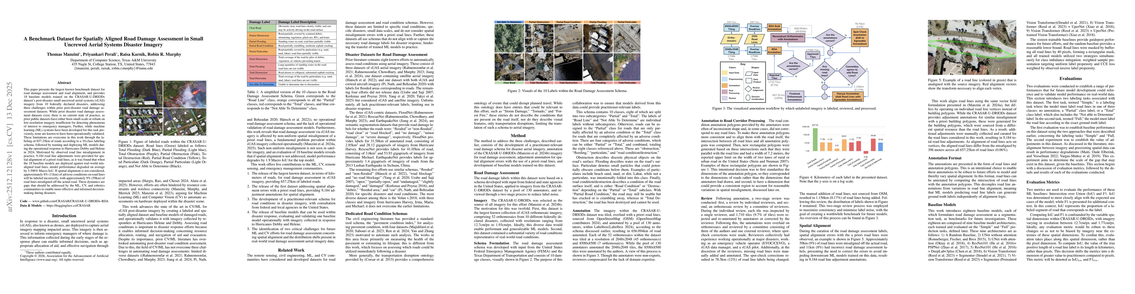
This paper presents the largest known benchmark dataset for road damage assessment and road alignment, and provides 18 baseline models trained on the CRASAR-U-DRIODs dataset's post-disaster small uncr...