Academic Profile
Statistics
Similar Authors
Papers on arXiv
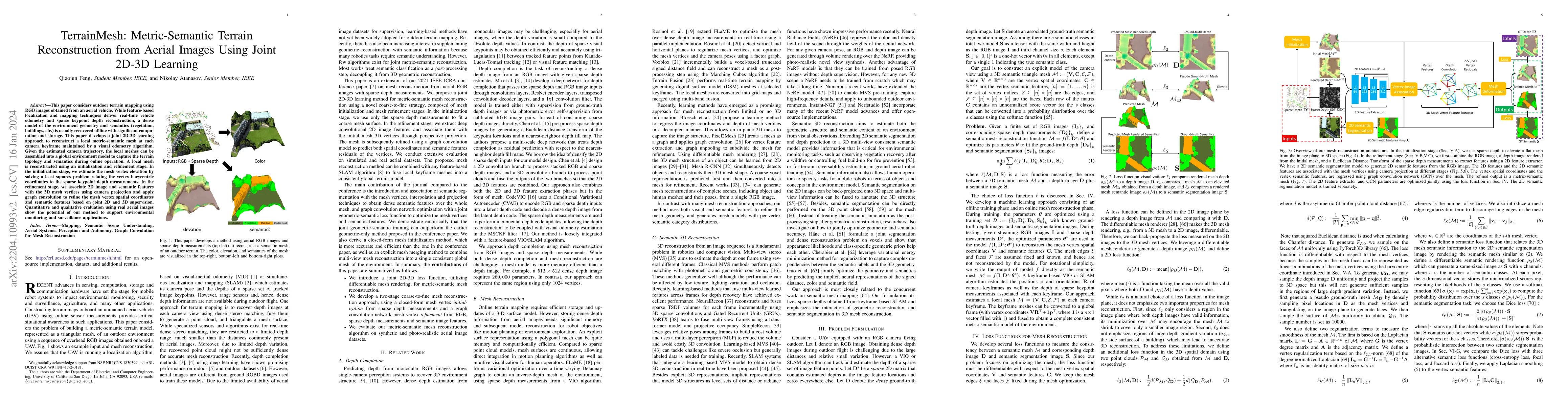
This paper considers outdoor terrain mapping using RGB images obtained from an aerial vehicle. While feature-based localization and mapping techniques deliver real-time vehicle odometry and sparse k...
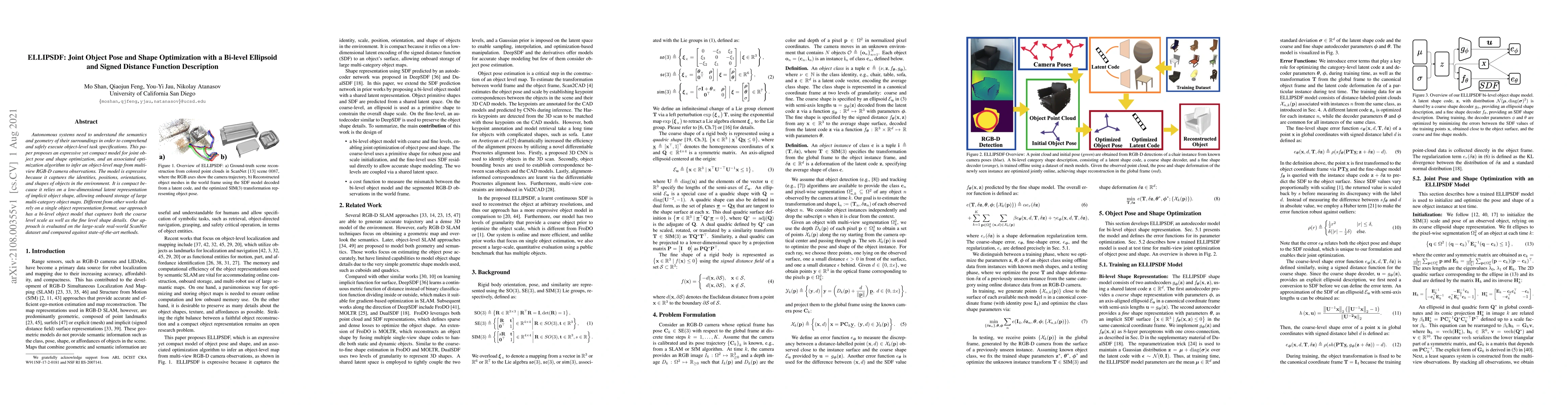
Autonomous systems need to understand the semantics and geometry of their surroundings in order to comprehend and safely execute object-level task specifications. This paper proposes an expressive y...
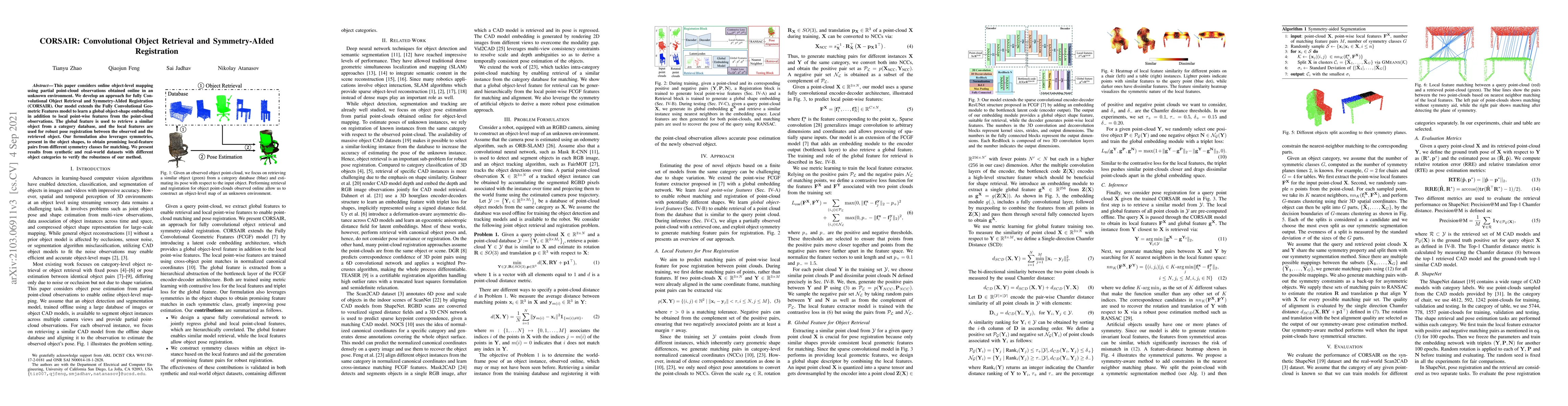
This paper considers online object-level mapping using partial point-cloud observations obtained online in an unknown environment. We develop and approach for fully Convolutional Object Retrieval an...
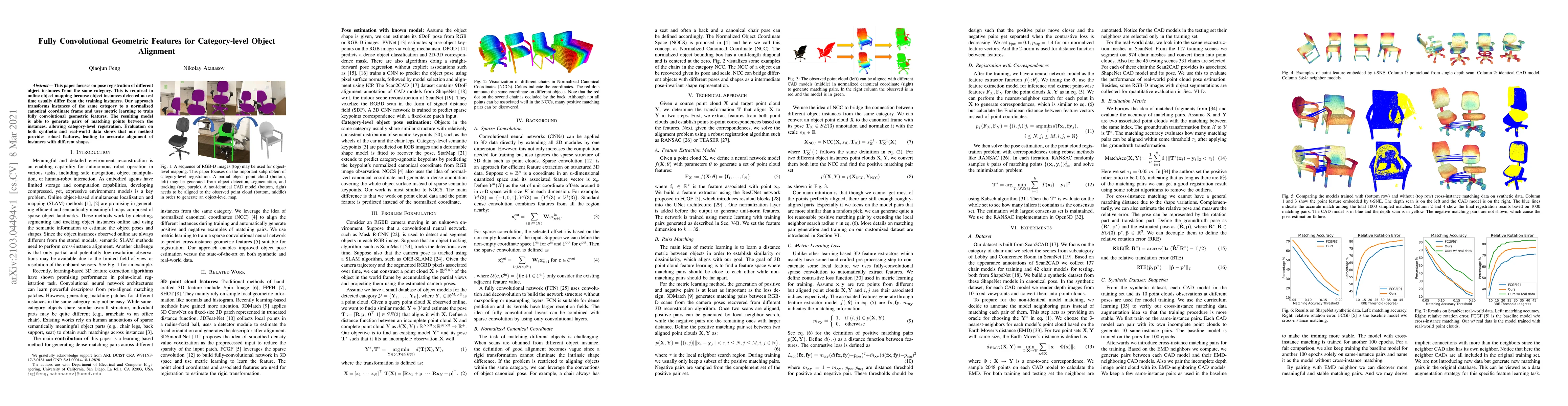
This paper focuses on pose registration of different object instances from the same category. This is required in online object mapping because object instances detected at test time usually differ ...
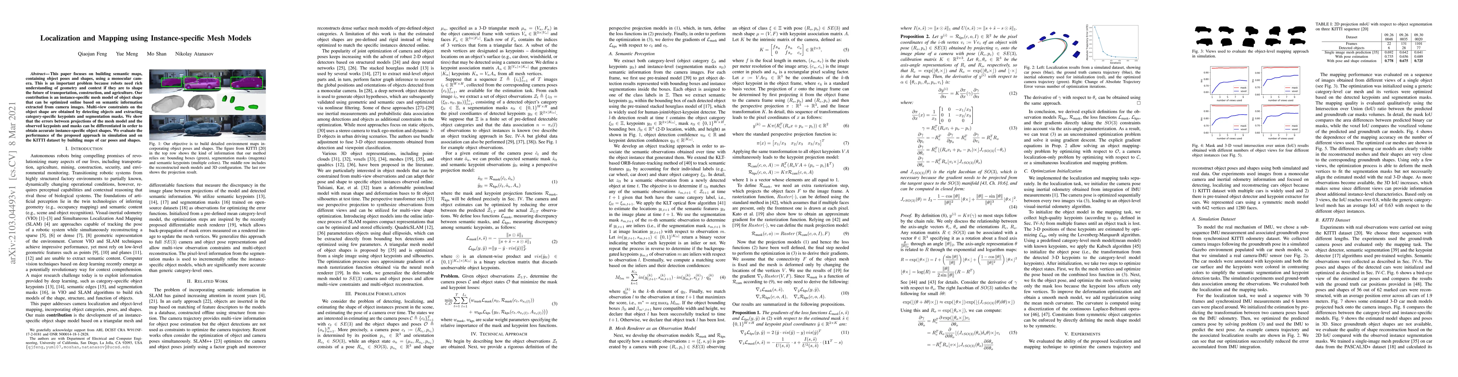
This paper focuses on building semantic maps, containing object poses and shapes, using a monocular camera. This is an important problem because robots need rich understanding of geometry and contex...
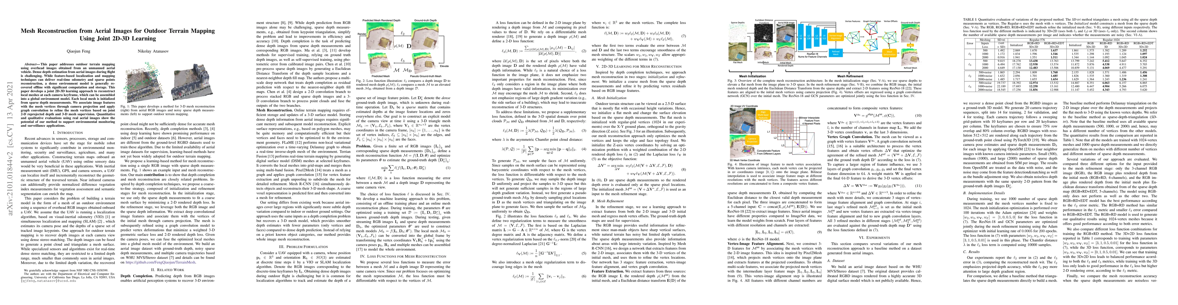
This paper addresses outdoor terrain mapping using overhead images obtained from an unmanned aerial vehicle. Dense depth estimation from aerial images during flight is challenging. While feature-bas...
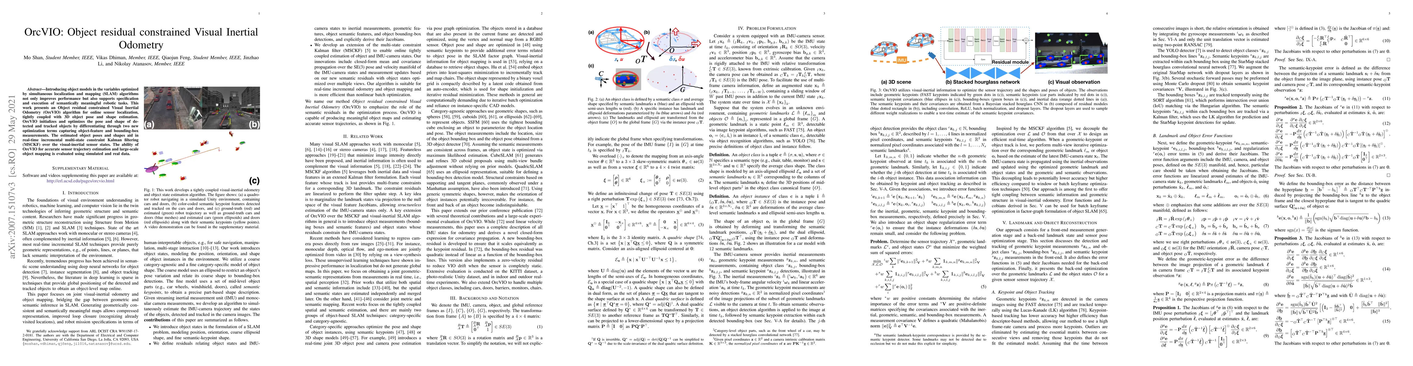
Introducing object-level semantic information into simultaneous localization and mapping (SLAM) system is critical. It not only improves the performance but also enables tasks specified in terms of ...