Academic Profile
Statistics
Similar Authors
Papers on arXiv
The ocean profoundly influences human activities and plays a critical role in climate regulation. Our understanding has improved over the last decades with the advent of satellite remote sensing dat...
Satellite altimetry combined with data assimilation and optimal interpolation schemes have deeply renewed our ability to monitor sea surface dynamics. Recently, deep learning (DL) schemes have emerg...
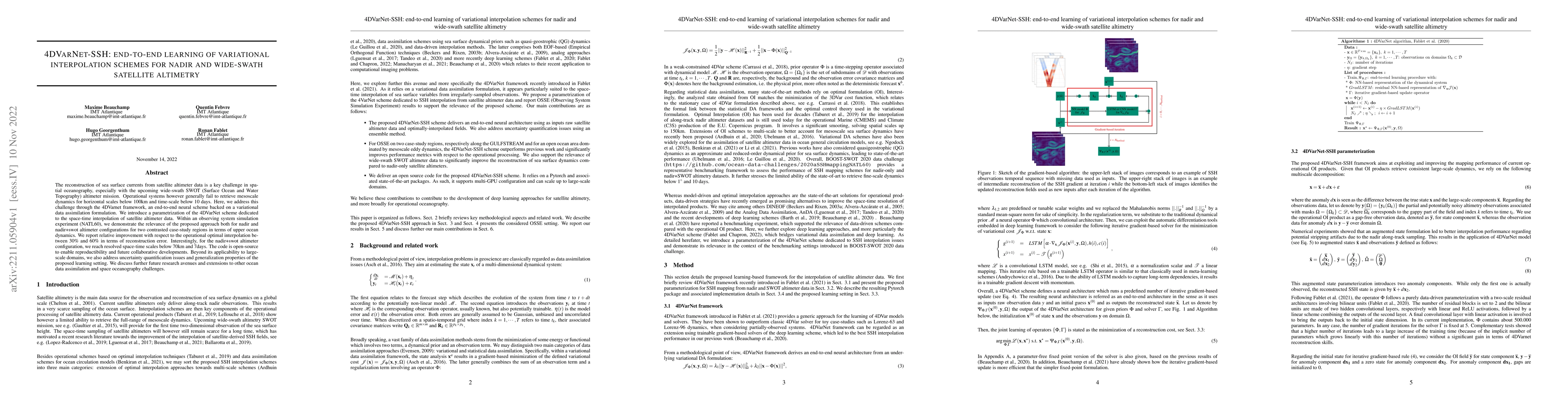
Sea surface height (SSH) is a key geophysical parameter for monitoring and studying meso-scale surface ocean dynamics. For several decades, the mapping of SSH products at regional and global scales ...

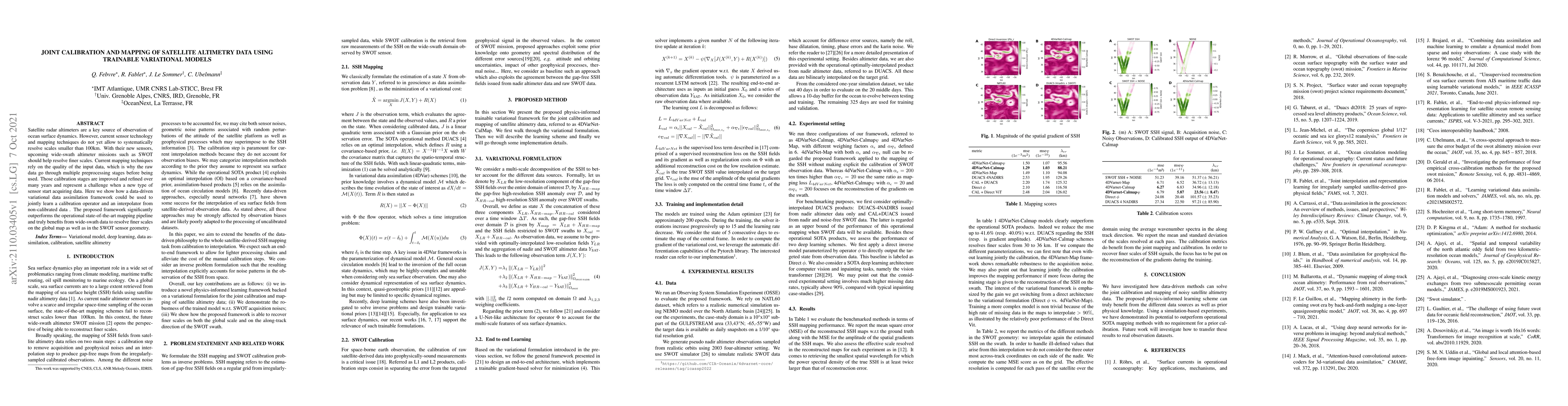
The reconstruction of gap-free signals from observation data is a critical challenge for numerous application domains, such as geoscience and space-based earth observation, when the available sensor...
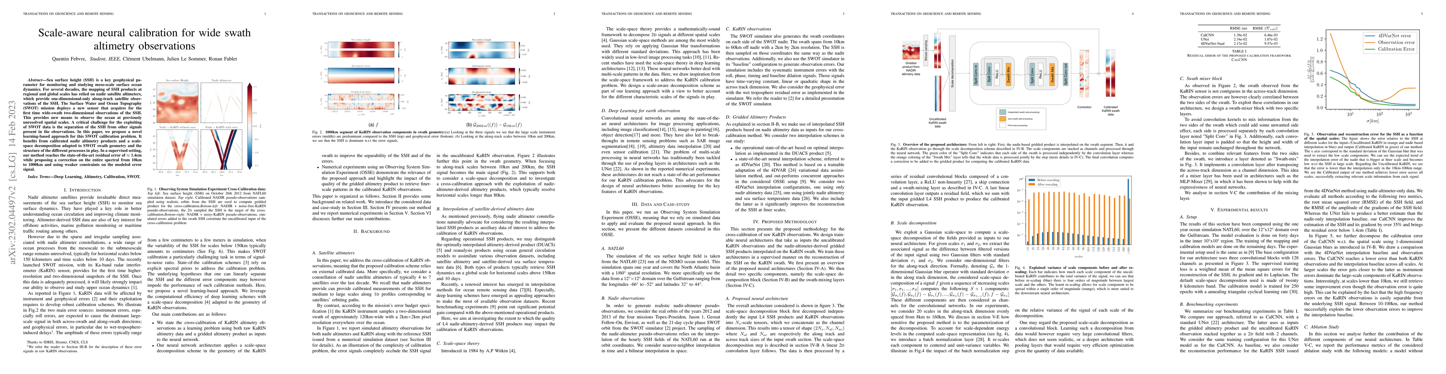
The reconstruction of sea surface currents from satellite altimeter data is a key challenge in spatial oceanography, especially with the upcoming wide-swath SWOT (Surface Ocean and Water Topography)...
Due to the irregular space-time sampling of sea surface observations, the reconstruction of sea surface dynamics is a challenging inverse problem. While satellite altimetry provides a direct observa...
Satellite radar altimeters are a key source of observation of ocean surface dynamics. However, current sensor technology and mapping techniques do not yet allow to systematically resolve scales smal...
Training Convolutional Neural Networks (CNN) is a resource intensive task that requires specialized hardware for efficient computation. One of the most limiting bottleneck of CNN training is the mem...
Self-supervised learning (SSL) has enabled the development of vision foundation models for Earth Observation (EO), demonstrating strong transferability across diverse remote sensing tasks. While prior...

We present OceanSAR-2, the second generation of our foundation model for SAR-based ocean observation. Building on our earlier release, which pioneered self-supervised learning on Sentinel-1 Wave Mode ...