Academic Profile
Statistics
Similar Authors
Papers on arXiv
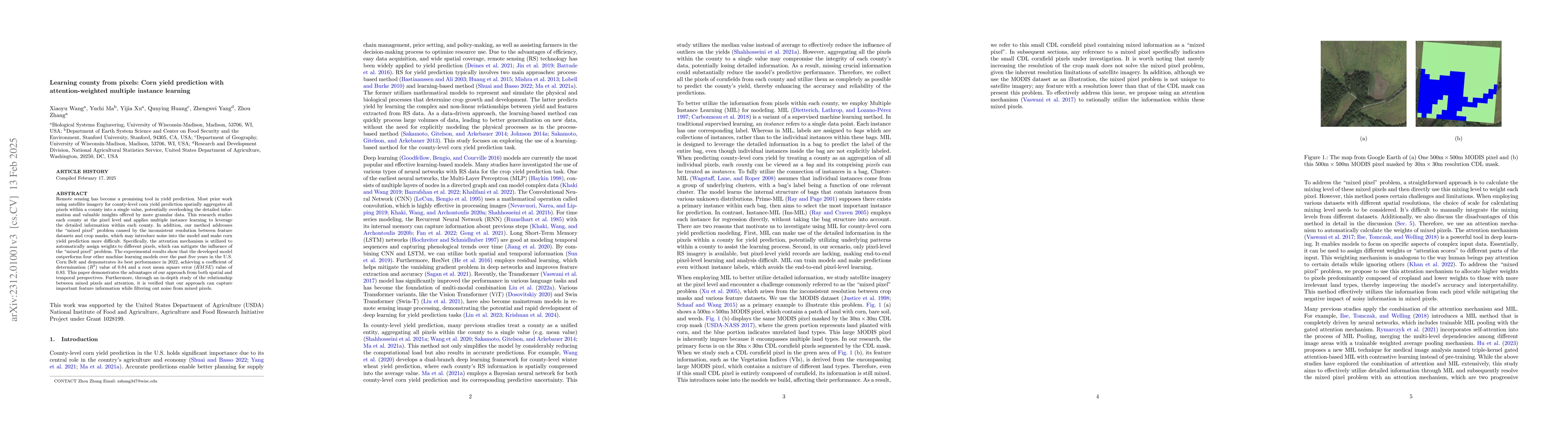
Remote sensing technology has become a promising tool in yield prediction. Most prior work employs satellite imagery for county-level corn yield prediction by spatially aggregating all pixels within...
The prevalence of location-based services contributes to the explosive growth of individual-level trajectory data and raises public concerns about privacy issues. In this research, we propose a nove...
Spatial networks are widely used in various fields to represent and analyze interactions or relationships between locations or spatially distributed entities.There is a network science concept known a...
Wildfires have become increasingly frequent, irregular, and severe in recent years. Understanding how affected populations perceive and respond during wildfire crises is critical for timely and empath...
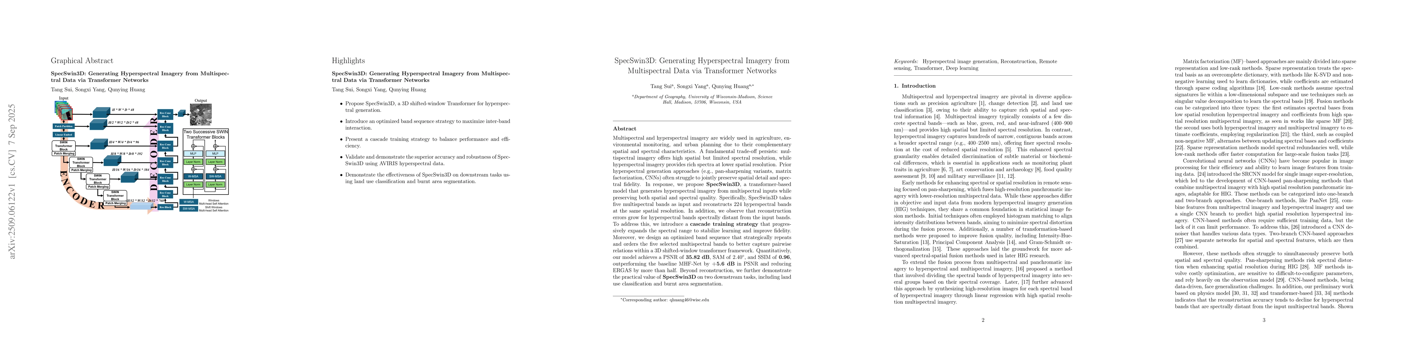
Multispectral and hyperspectral imagery are widely used in agriculture, environmental monitoring, and urban planning due to their complementary spatial and spectral characteristics. A fundamental trad...