Academic Profile
Statistics
Similar Authors
Papers on arXiv
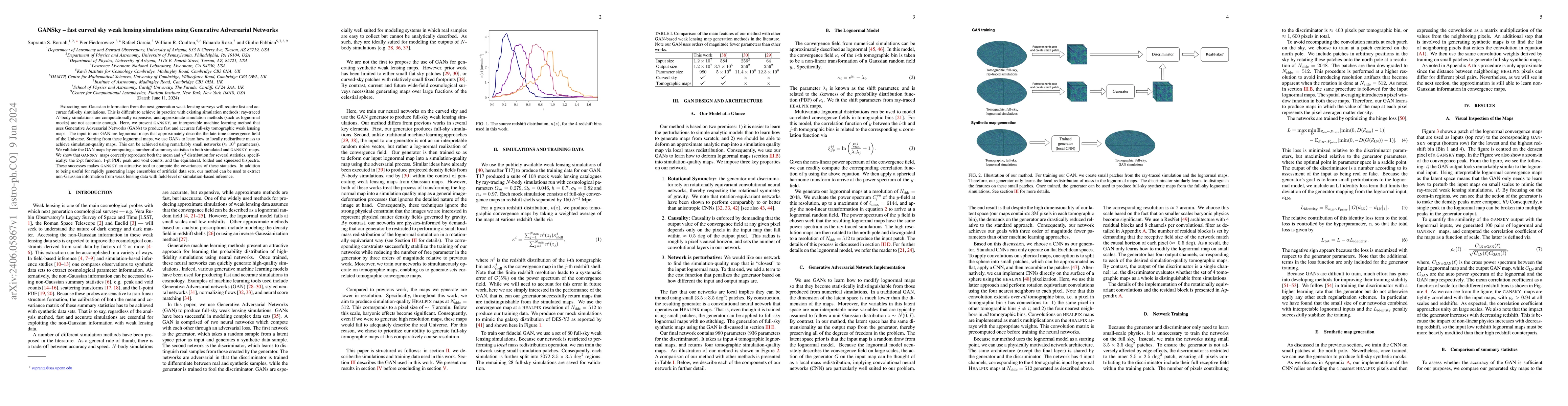
Extracting non-Gaussian information from the next generation weak lensing surveys will require fast and accurate full-sky simulations. This is difficult to achieve in practice with existing simulati...
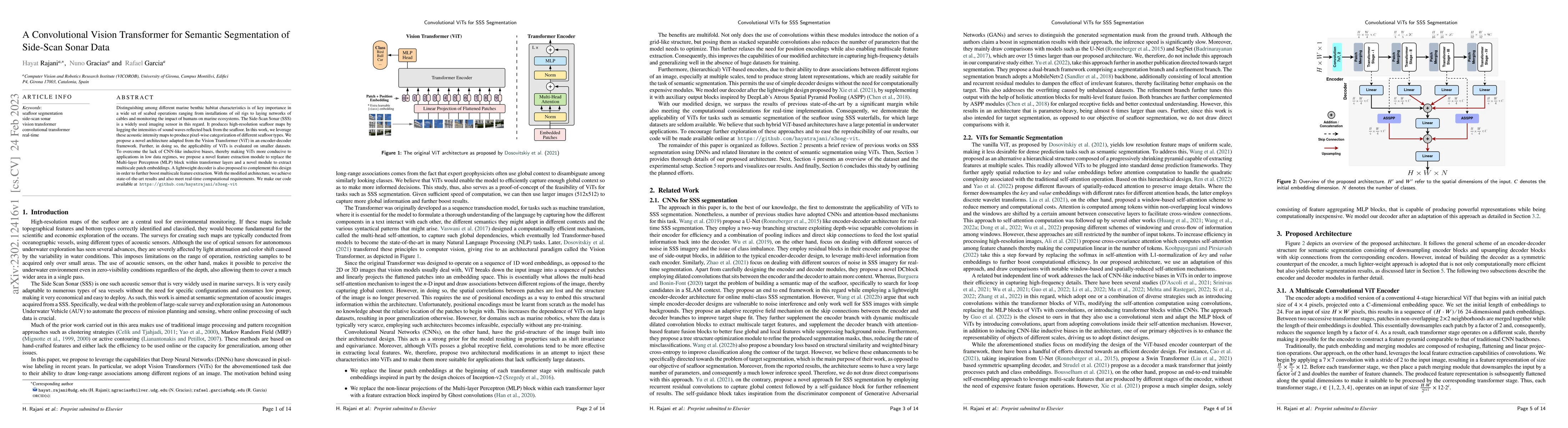
Distinguishing among different marine benthic habitat characteristics is of key importance in a wide set of seabed operations ranging from installations of oil rigs to laying networks of cables and ...
Dark matter haloes have long been recognized as one of the fundamental building blocks of large scale structure formation models. Despite their importance -- or perhaps because of it! -- halo defini...
We present a model for the halo--mass correlation function that explicitly incorporates halo exclusion. We assume that halos trace mass in a way that can be described using a single scale-independen...
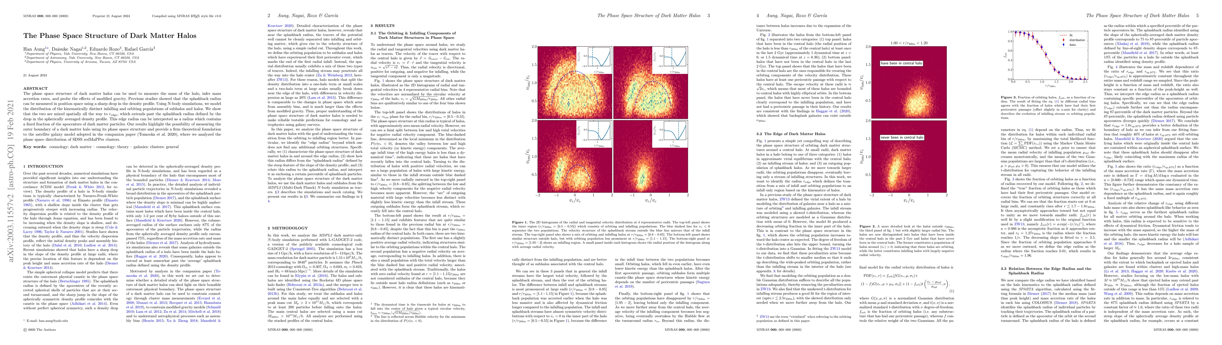
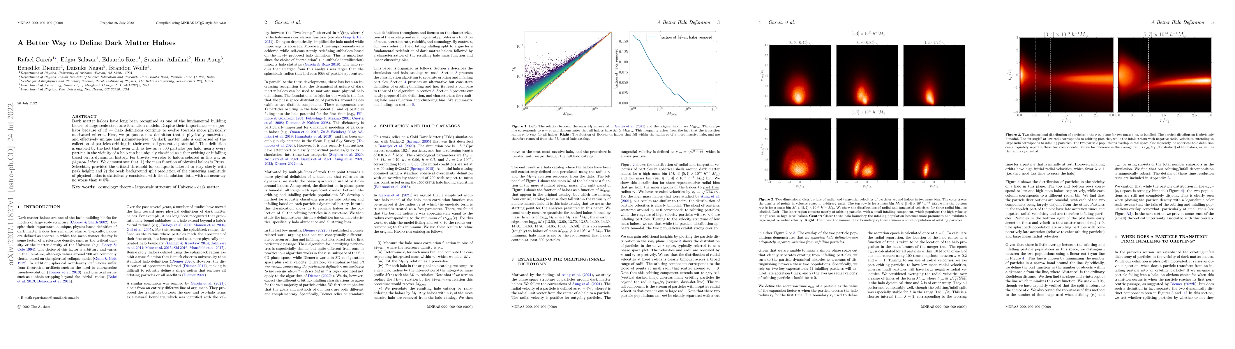
The phase space structure of dark matter halos can be used to measure the mass of the halo, infer mass accretion rates, and probe the effects of modified gravity. Previous studies showed that the sp...
The Cherenkov Telescope Array (CTA) is the next generation ground based observatory for gamma ray astronomy at very high energies. Employing more than 100 Imaging Atmospheric Cherenkov Telescopes in...
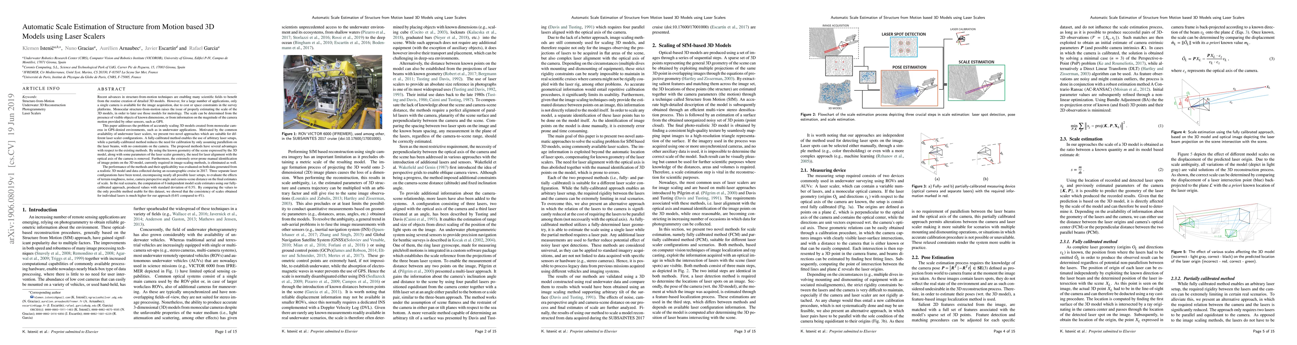
Recent advances in structure-from-motion techniques are enabling many scientific fields to benefit from the routine creation of detailed 3D models. However, for a large number of applications, only ...
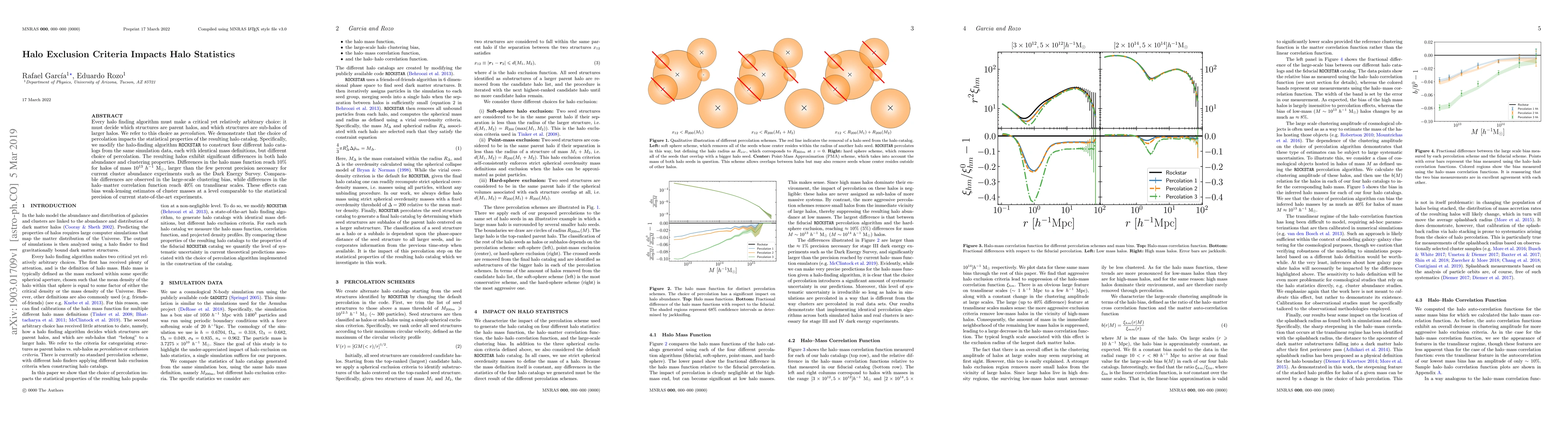
Every halo finding algorithm must make a critical yet relatively arbitrary choice: it must decide which structures are parent halos, and which structures are sub-halos of larger halos. We refer to t...
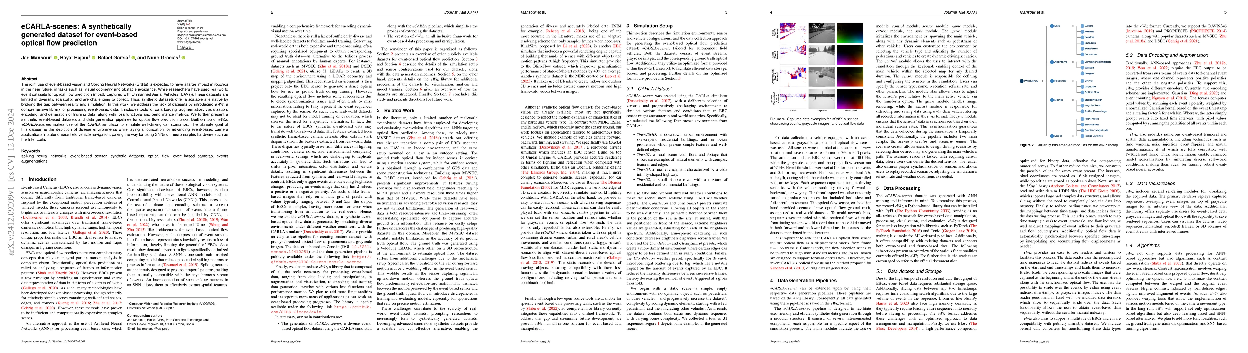
The joint use of event-based vision and Spiking Neural Networks (SNNs) is expected to have a large impact in robotics in the near future, in tasks such as, visual odometry and obstacle avoidance. Whil...
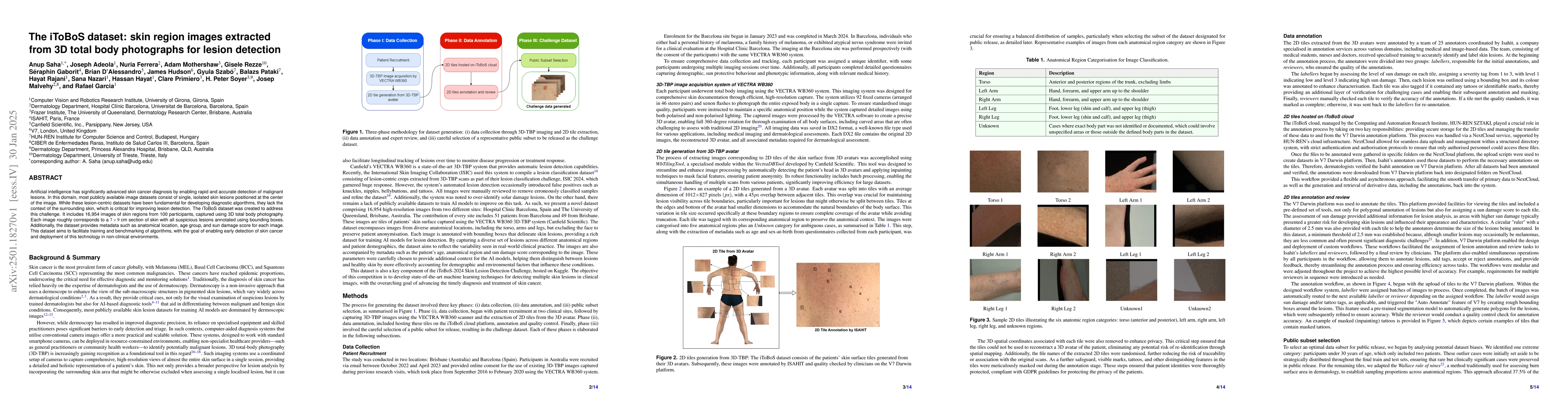
Artificial intelligence has significantly advanced skin cancer diagnosis by enabling rapid and accurate detection of malignant lesions. In this domain, most publicly available image datasets consist o...
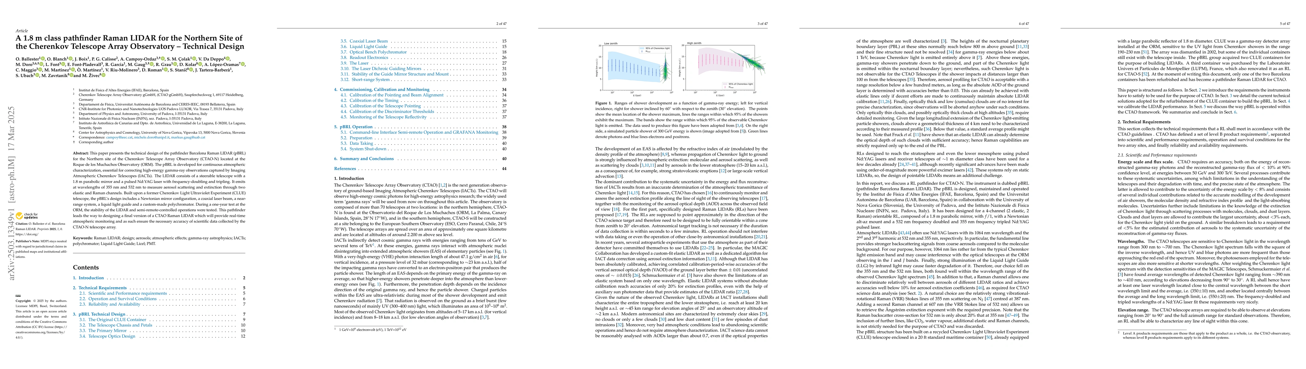
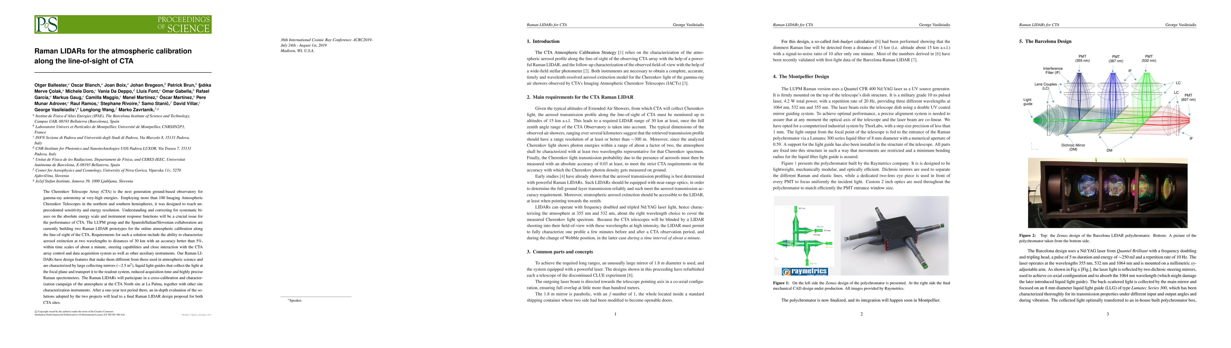
This paper presents the technical design of the pathfinder Barcelona Raman LIDAR (pBRL) for the northern site of the Cherenkov Telescope Array Observatory (CTAO-N) located at the Roque de los Muchacho...
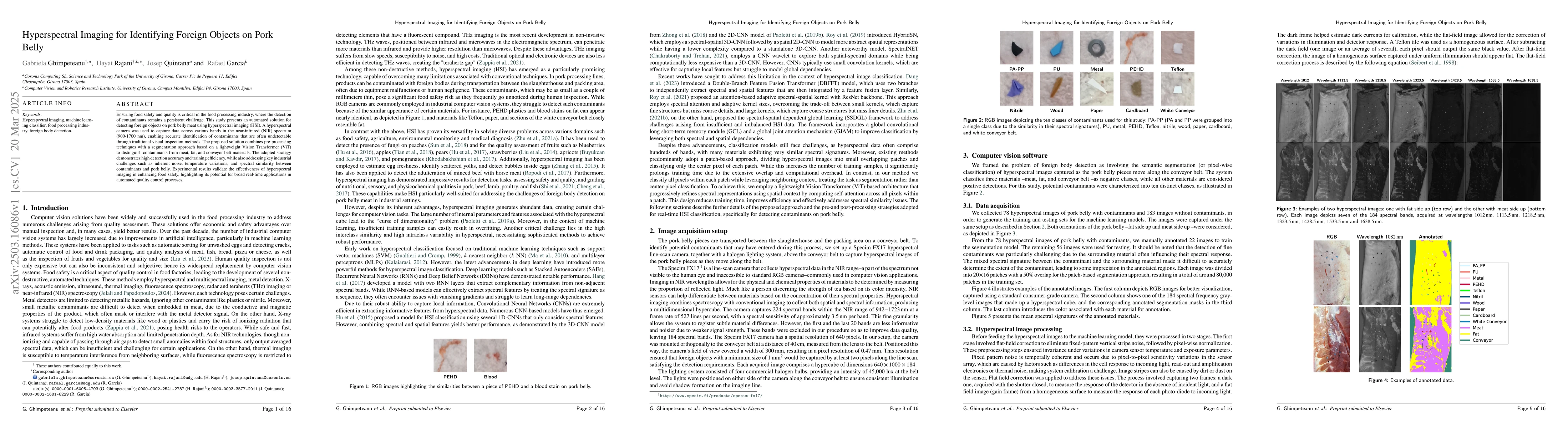
Ensuring food safety and quality is critical in the food processing industry, where the detection of contaminants remains a persistent challenge. This study presents an automated solution for detectin...
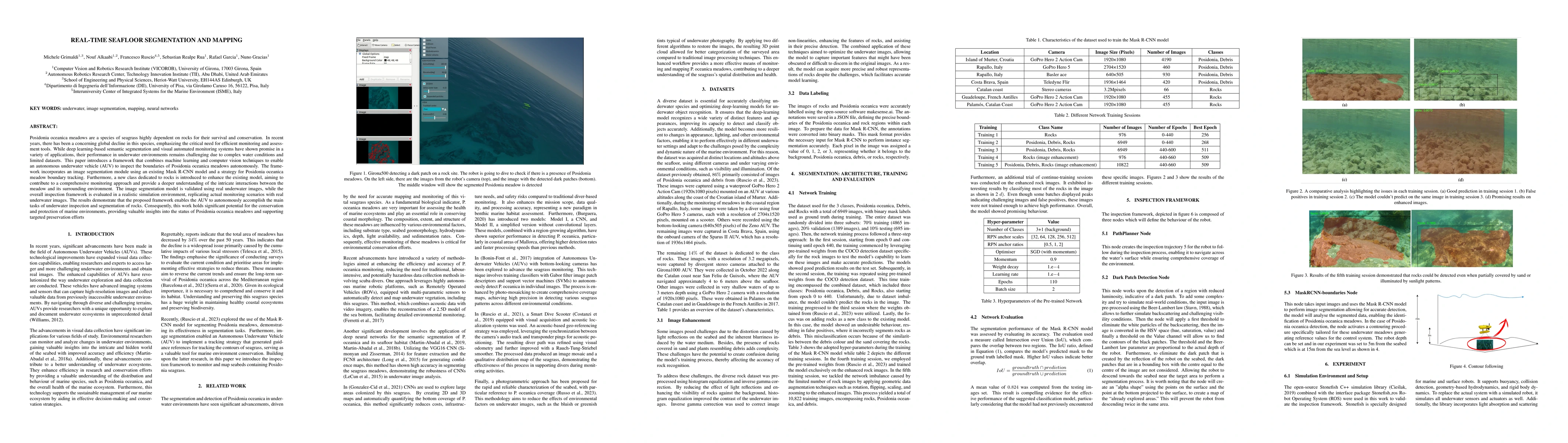
Posidonia oceanica meadows are a species of seagrass highly dependent on rocks for their survival and conservation. In recent years, there has been a concerning global decline in this species, emphasi...
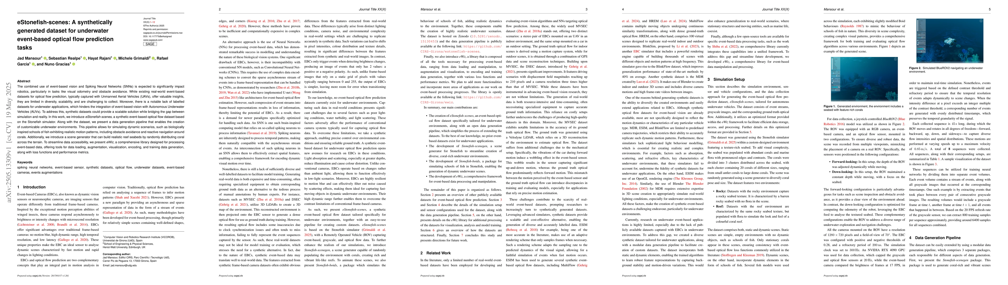
The combined use of event-based vision and Spiking Neural Networks (SNNs) is expected to significantly impact robotics, particularly in tasks like visual odometry and obstacle avoidance. While existin...
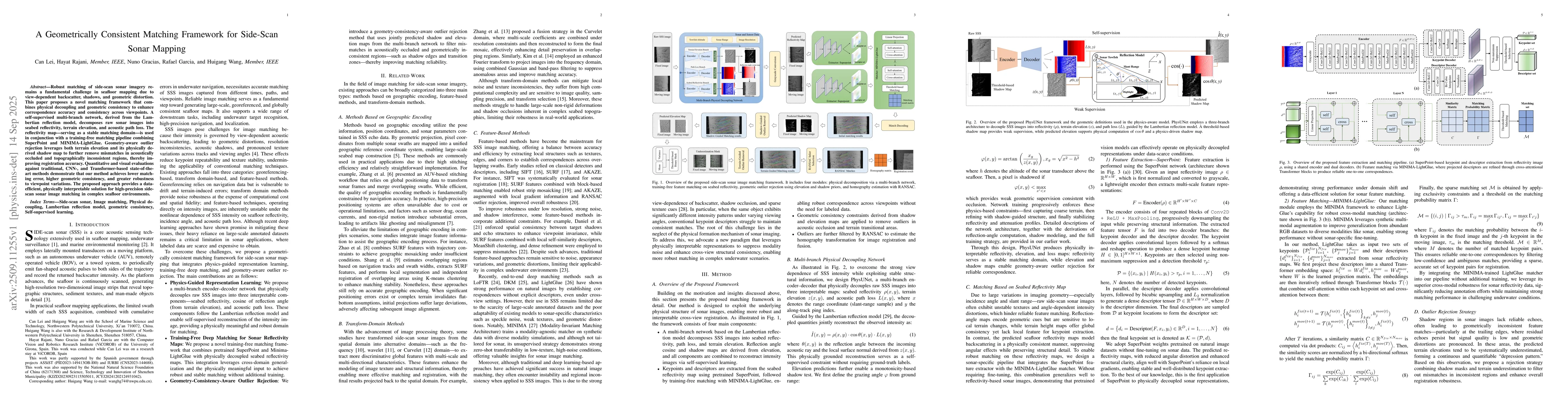
Robust matching of side scan sonar imagery remains a fundamental challenge in seafloor mapping due to view dependent backscatter, shadows, and geometric distortion. This paper proposes a novel matchin...
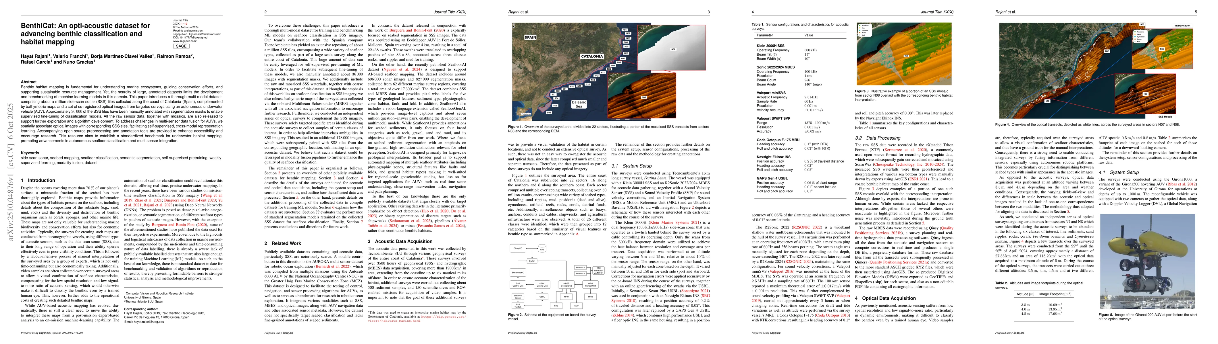
Benthic habitat mapping is fundamental for understanding marine ecosystems, guiding conservation efforts, and supporting sustainable resource management. Yet, the scarcity of large, annotated datasets...
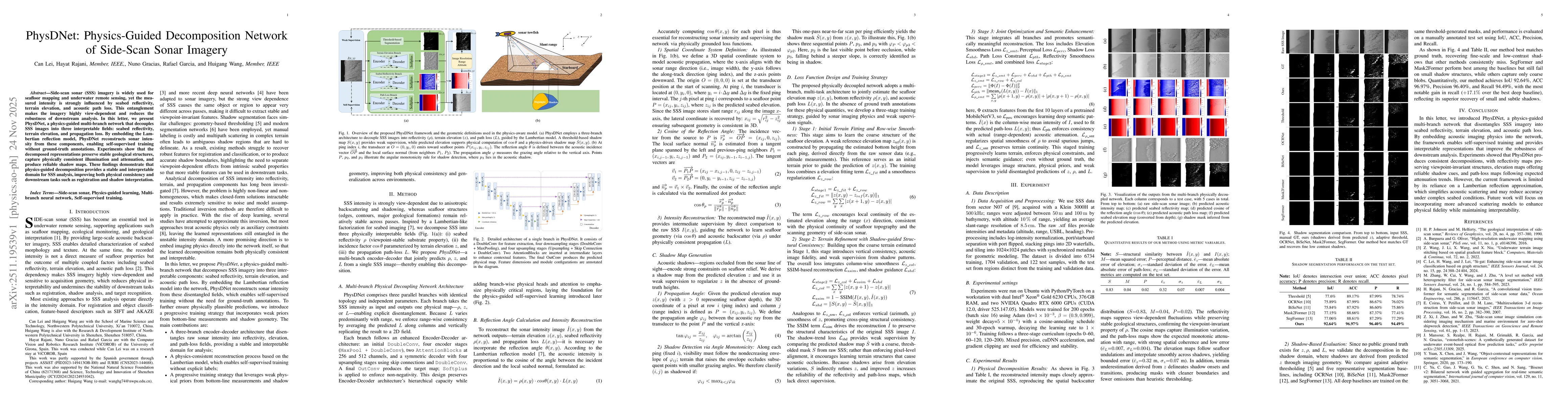
Side-scan sonar (SSS) imagery is widely used for seafloor mapping and underwater remote sensing, yet the measured intensity is strongly influenced by seabed reflectivity, terrain elevation, and acoust...
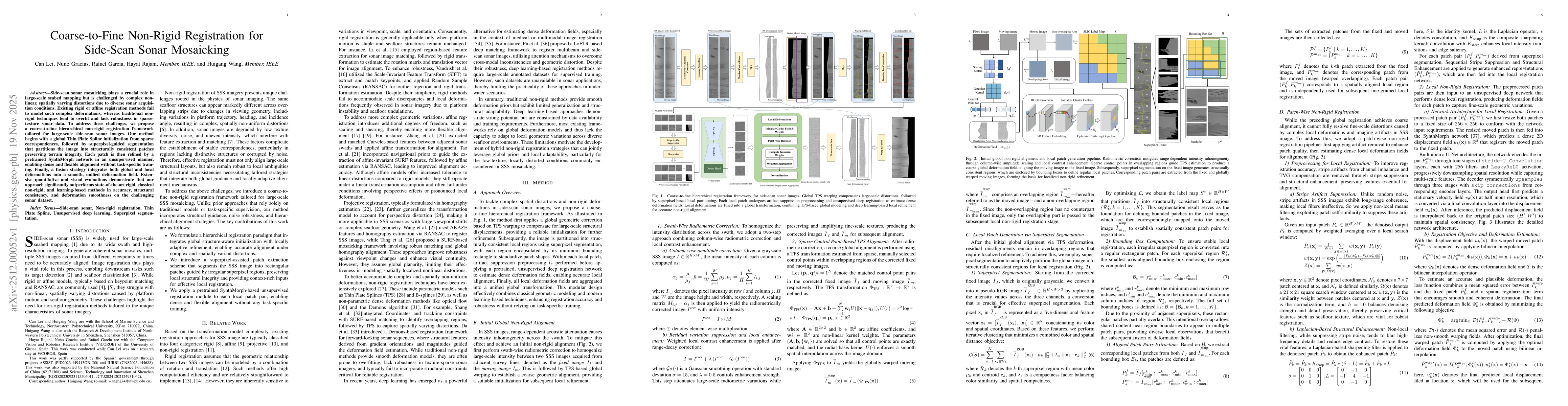
Side-scan sonar mosaicking plays a crucial role in large-scale seabed mapping but is challenged by complex non-linear, spatially varying distortions due to diverse sonar acquisition conditions. Existi...
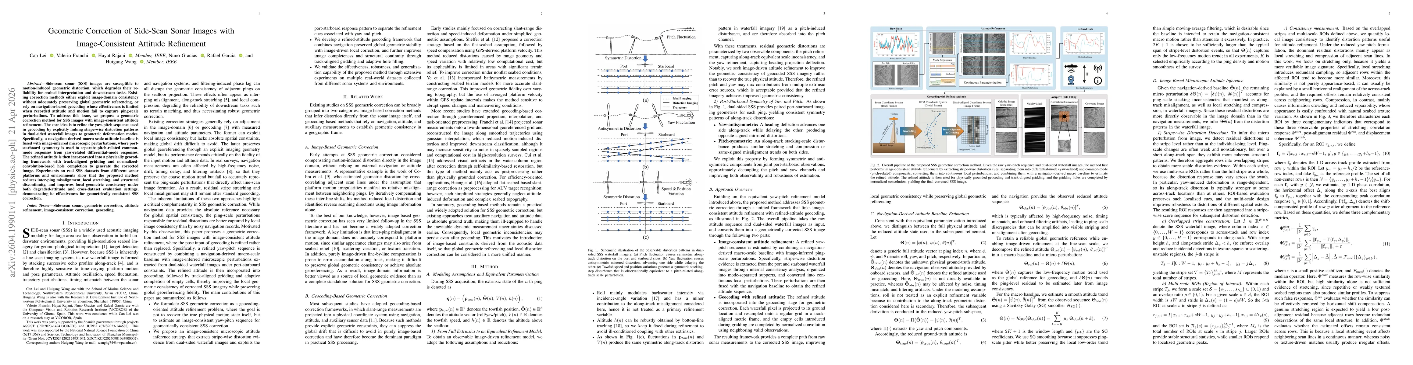
Side-scan sonar (SSS) imagery is susceptible to geometric distortions caused by platform motion instability, which degrade geometric consistency and limit downstream analyses such as mosaicking and pe...
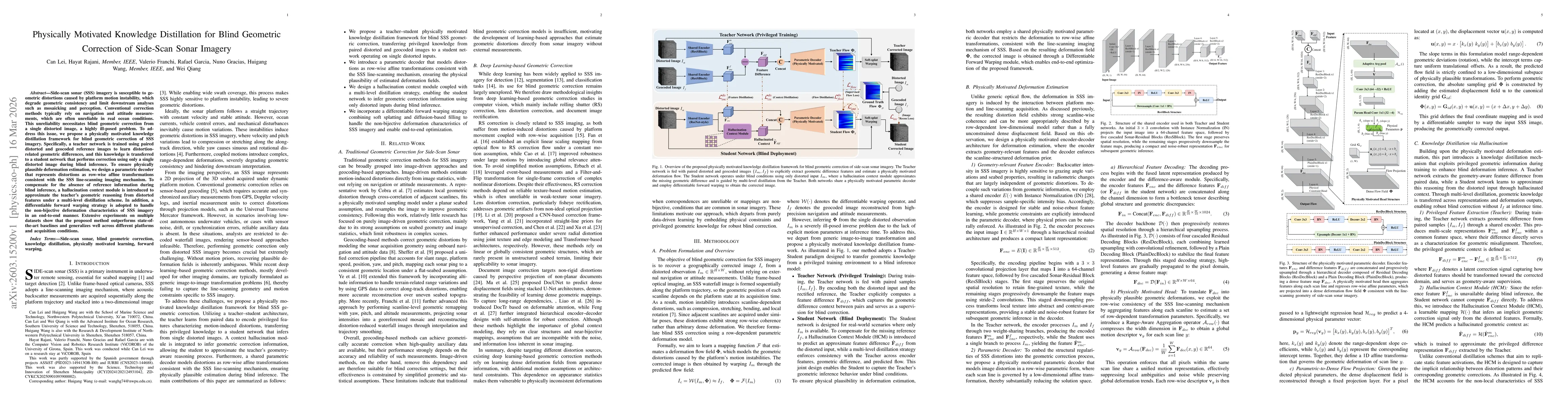
Side-scan sonar (SSS) images are susceptible to motion-induced geometric distortion, which degrades their reliability for seabed interpretation and downstream tasks. Existing correction methods either...