Raffaele Gaetano
7 papers on arXiv
Academic Profile
Statistics
Similar Authors
Papers on arXiv
Semi Supervised Heterogeneous Domain Adaptation via Disentanglement and Pseudo-Labelling
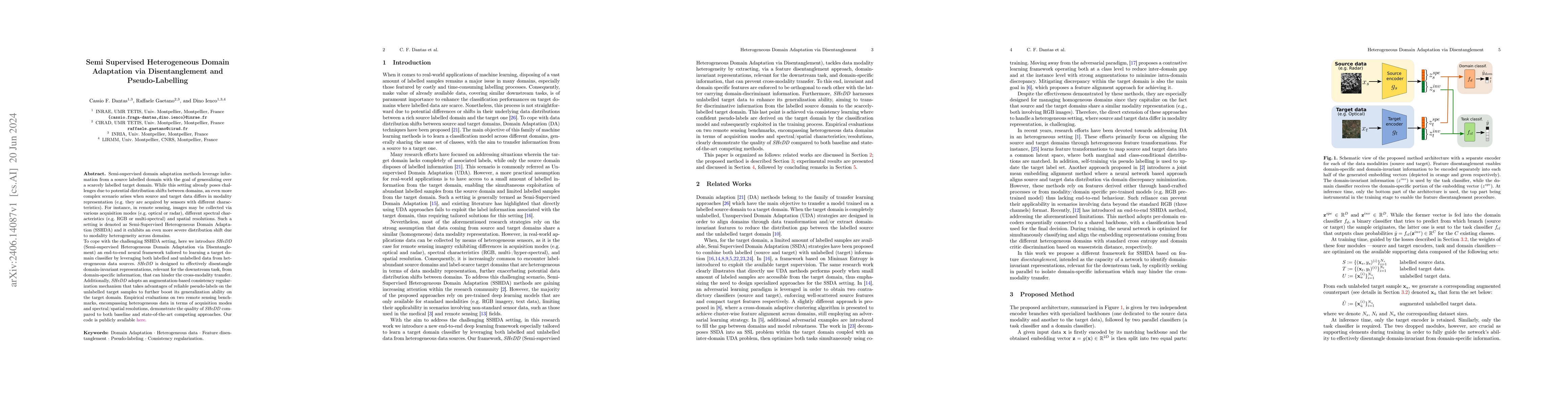
Semi-supervised domain adaptation methods leverage information from a source labelled domain with the goal of generalizing over a scarcely labelled target domain. While this setting already poses chal...
Reuse out-of-year data to enhance land cover mapping via feature disentanglement and contrastive learning
Timely up-to-date land use/land cover (LULC) maps play a pivotal role in supporting agricultural territory management, environmental monitoring and facilitating well-informed and sustainable decisio...
Comparison of convolutional neural networks for cloudy optical images reconstruction from single or multitemporal joint SAR and optical images
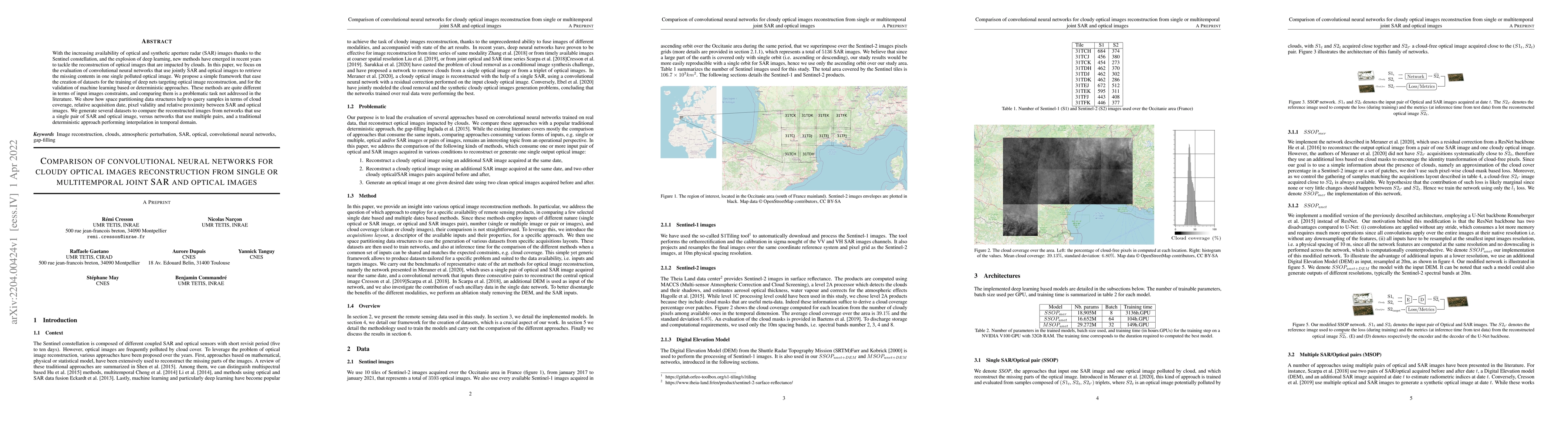
With the increasing availability of optical and synthetic aperture radar (SAR) images thanks to the Sentinel constellation, and the explosion of deep learning, new methods have emerged in recent yea...
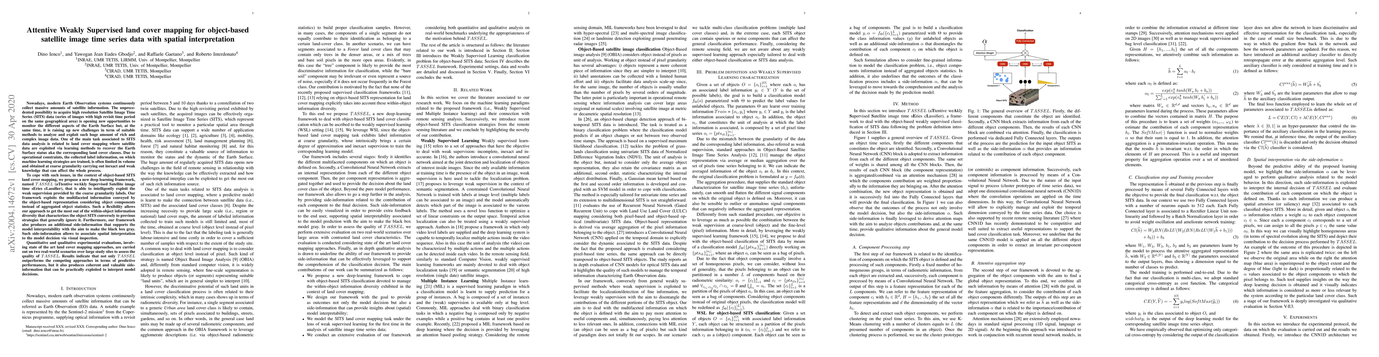
Attentive Weakly Supervised land cover mapping for object-based satellite image time series data with spatial interpretation
Nowadays, modern Earth Observation systems continuously collect massive amounts of satellite information. The unprecedented possibility to acquire high resolution Satellite Image Time Series (SITS) ...
Object-based multi-temporal and multi-source land cover mapping leveraging hierarchical class relationships
European satellite missions Sentinel-1 (S1) and Sentinel-2 (S2) provide at highspatial resolution and high revisit time, respectively, radar and optical imagesthat support a wide range of Earth surf...
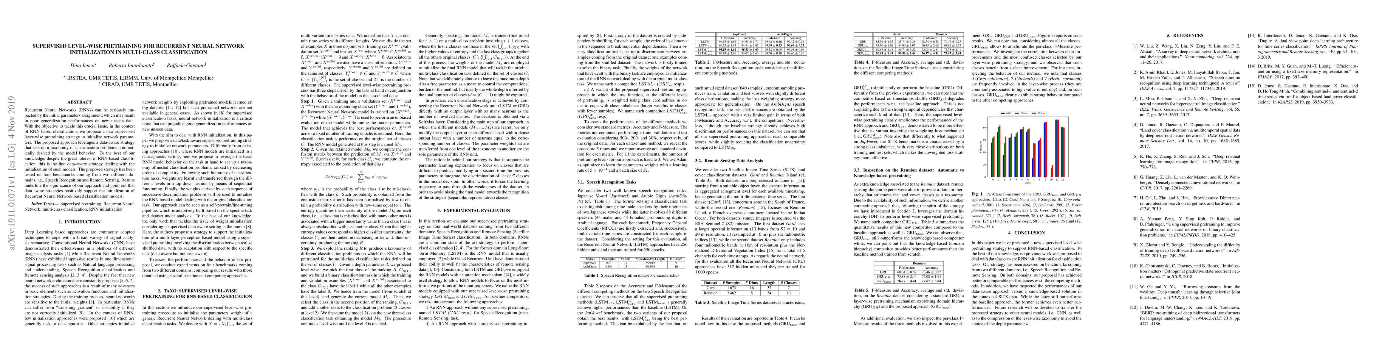
Supervised level-wise pretraining for recurrent neural network initialization in multi-class classification
Recurrent Neural Networks (RNNs) can be seriously impacted by the initial parameters assignment, which may result in poor generalization performances on new unseen data. With the objective to tackle...
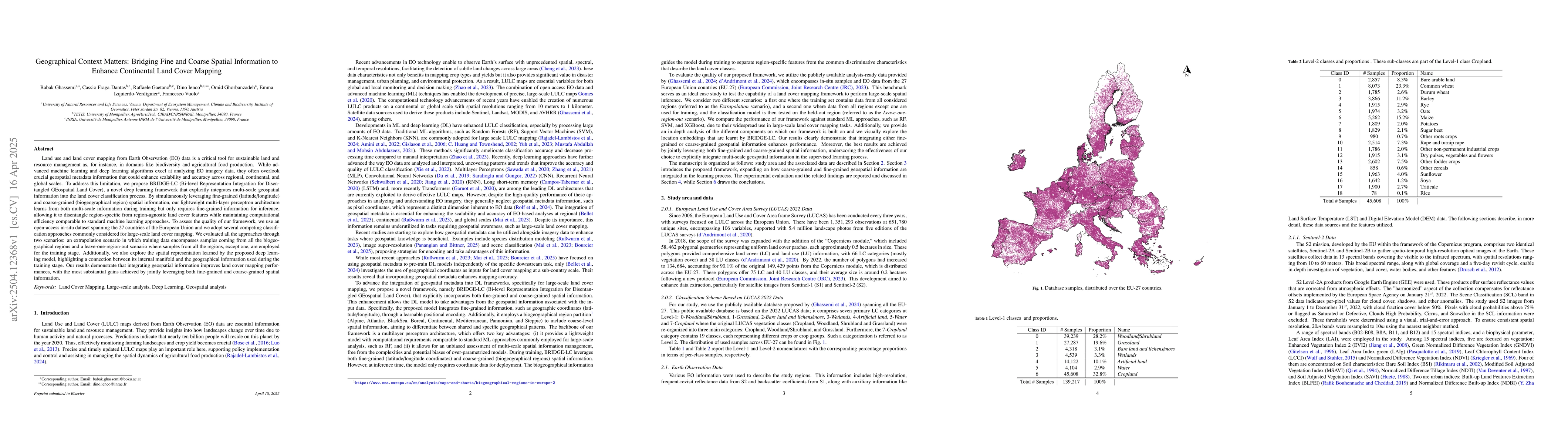
Geographical Context Matters: Bridging Fine and Coarse Spatial Information to Enhance Continental Land Cover Mapping
Land use and land cover mapping from Earth Observation (EO) data is a critical tool for sustainable land and resource management. While advanced machine learning and deep learning algorithms excel at ...