Academic Profile
Statistics
Similar Authors
Papers on arXiv
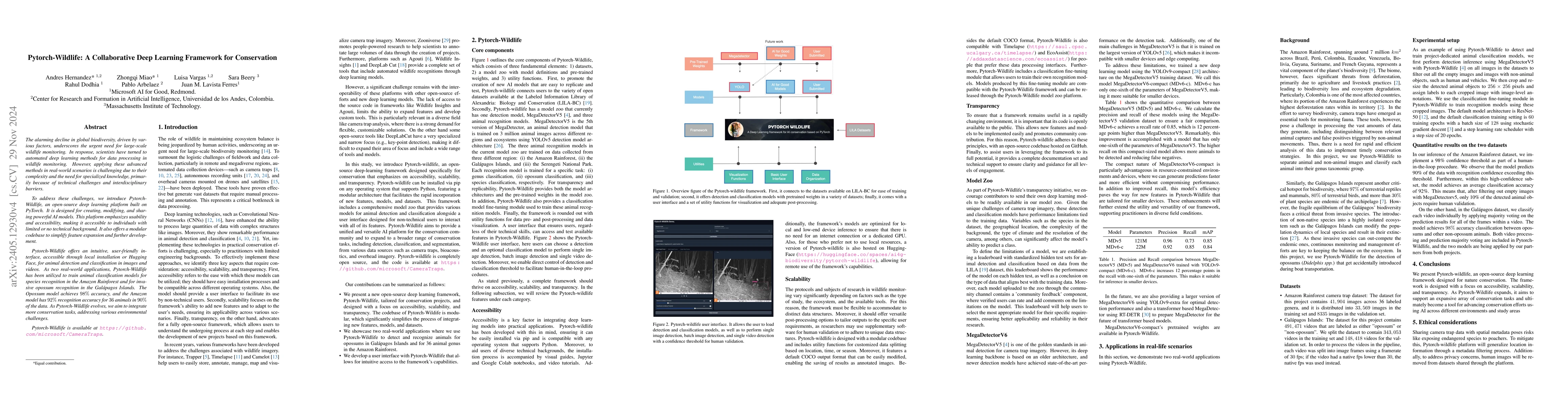
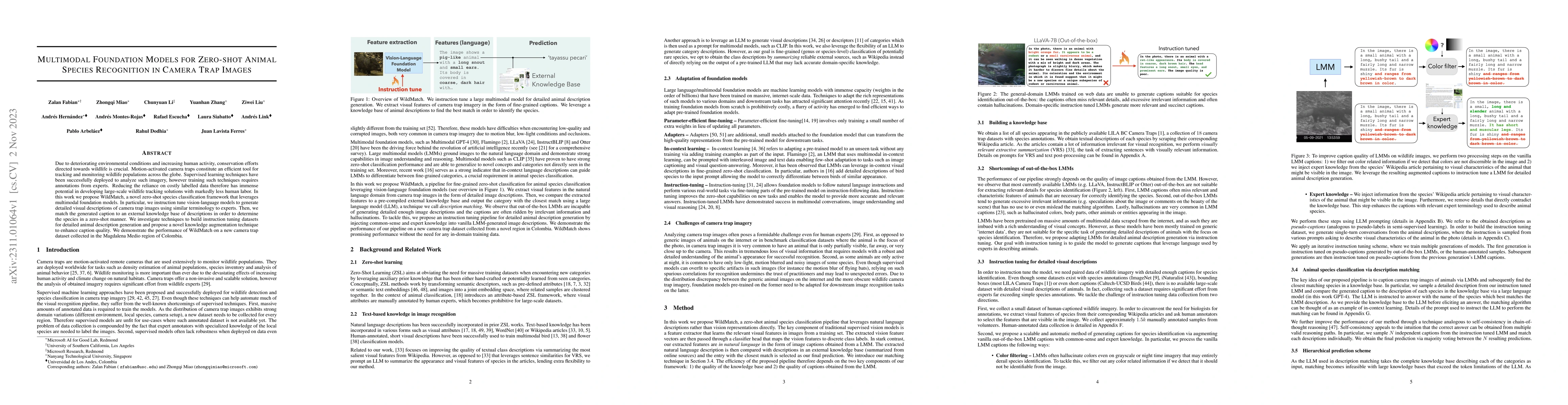
The alarming decline in global biodiversity, driven by various factors, underscores the urgent need for large-scale wildlife monitoring. In response, scientists have turned to automated deep learning ...
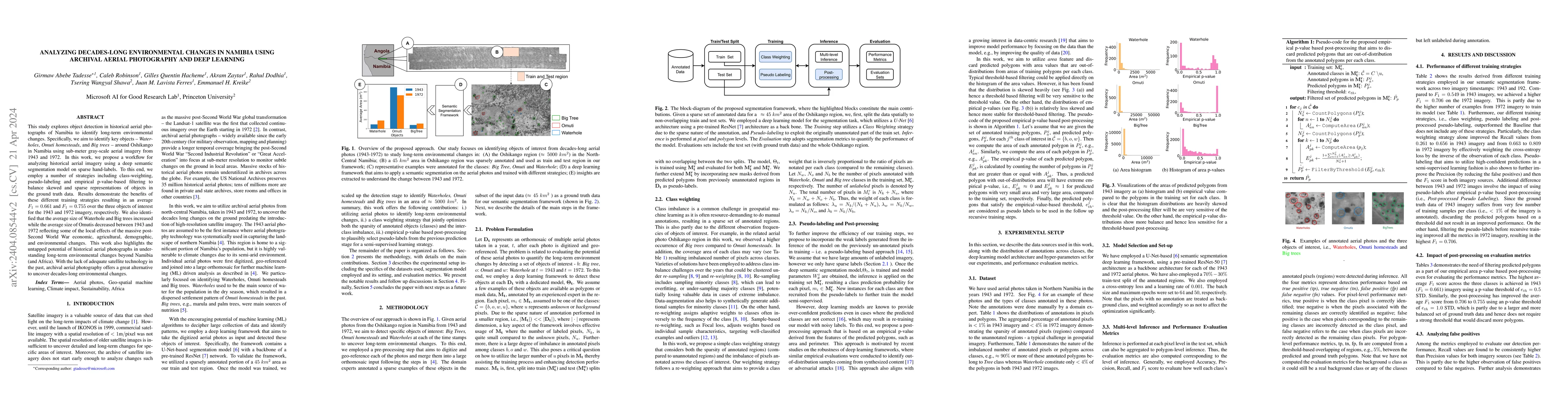
This study explores object detection in historical aerial photographs of Namibia to identify long-term environmental changes. Specifically, we aim to identify key objects -- Waterholes, Omuti homest...
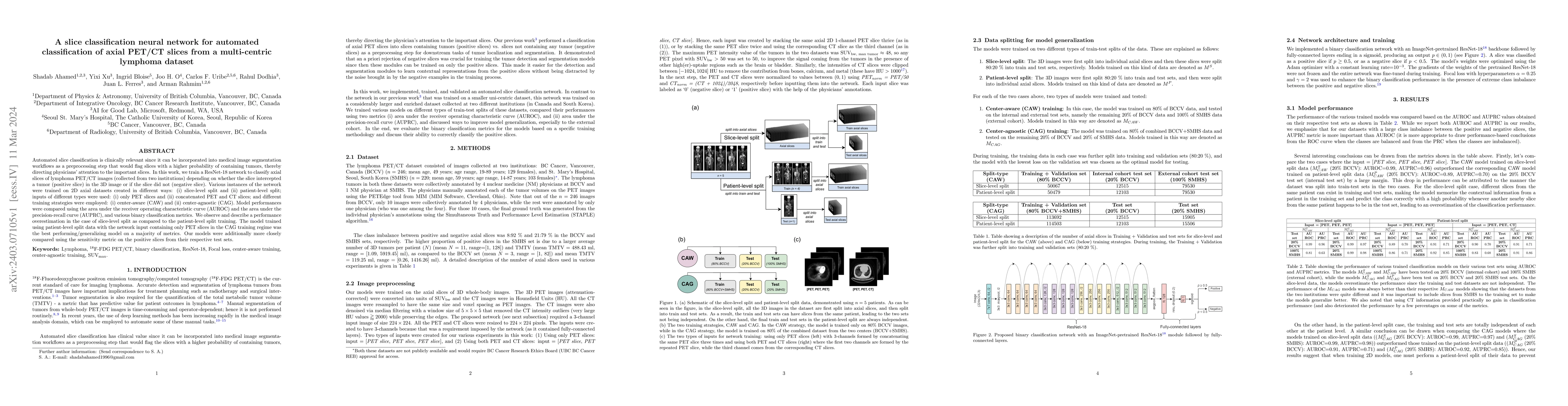
Automated slice classification is clinically relevant since it can be incorporated into medical image segmentation workflows as a preprocessing step that would flag slices with a higher probability ...
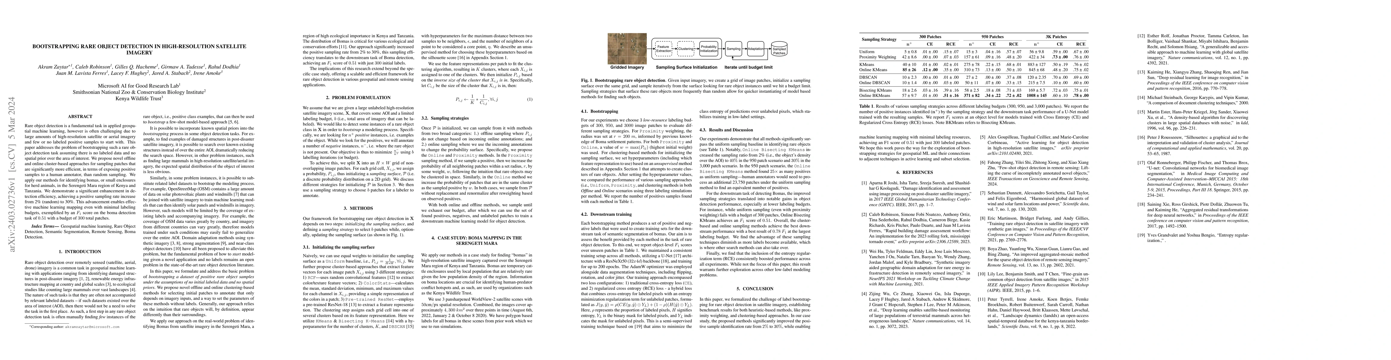
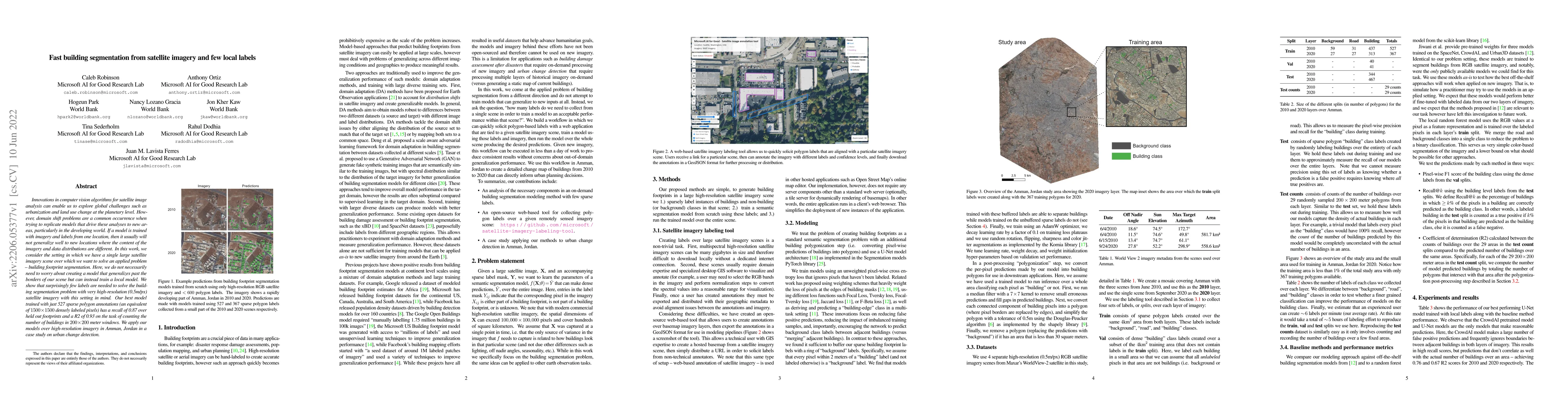
Rare object detection is a fundamental task in applied geospatial machine learning, however is often challenging due to large amounts of high-resolution satellite or aerial imagery and few or no lab...
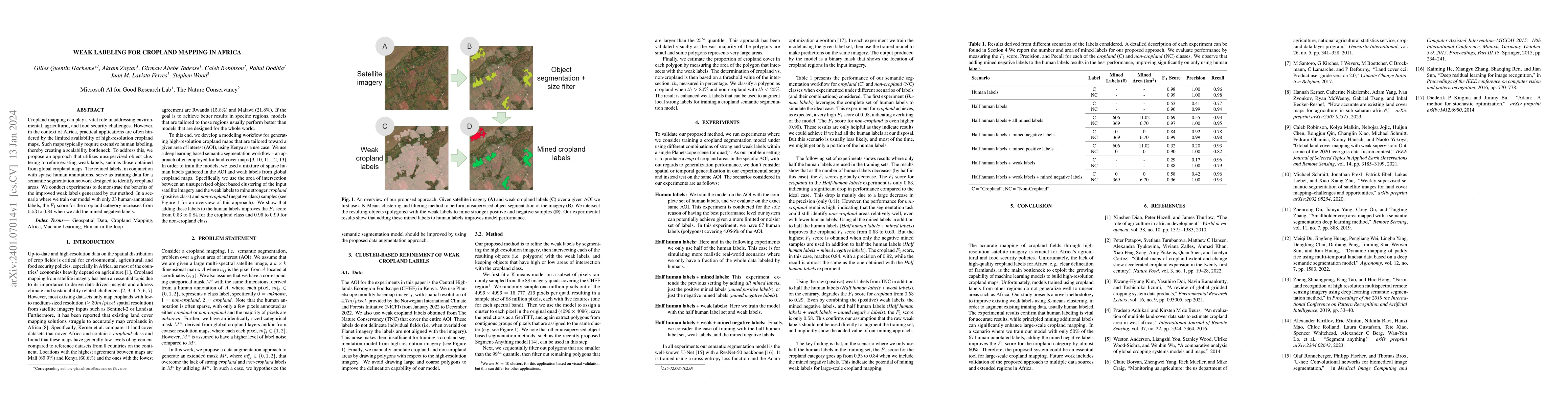
Cropland mapping can play a vital role in addressing environmental, agricultural, and food security challenges. However, in the context of Africa, practical applications are often hindered by the li...
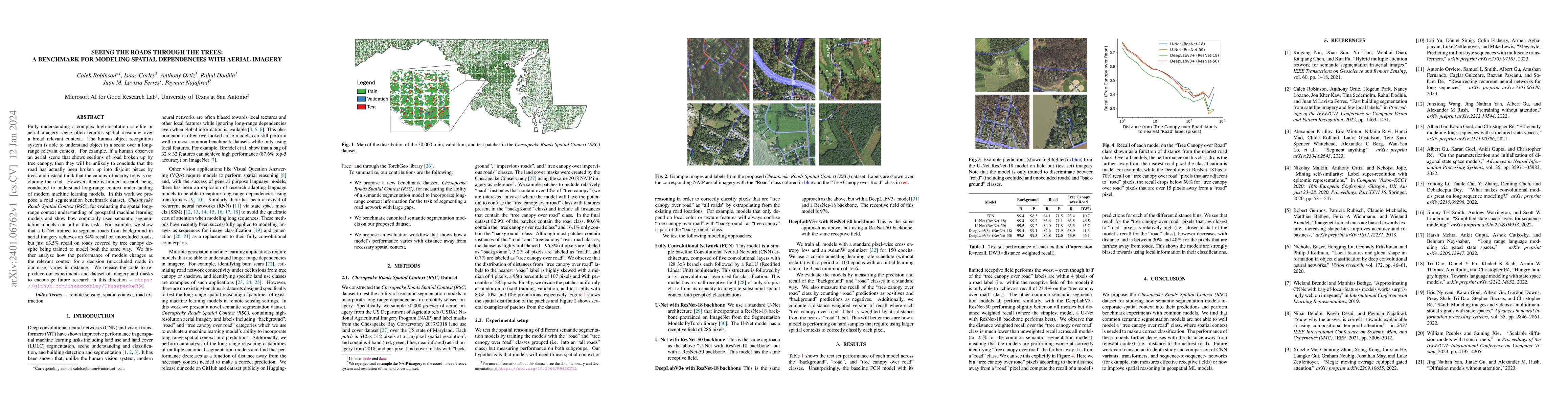
Fully understanding a complex high-resolution satellite or aerial imagery scene often requires spatial reasoning over a broad relevant context. The human object recognition system is able to underst...
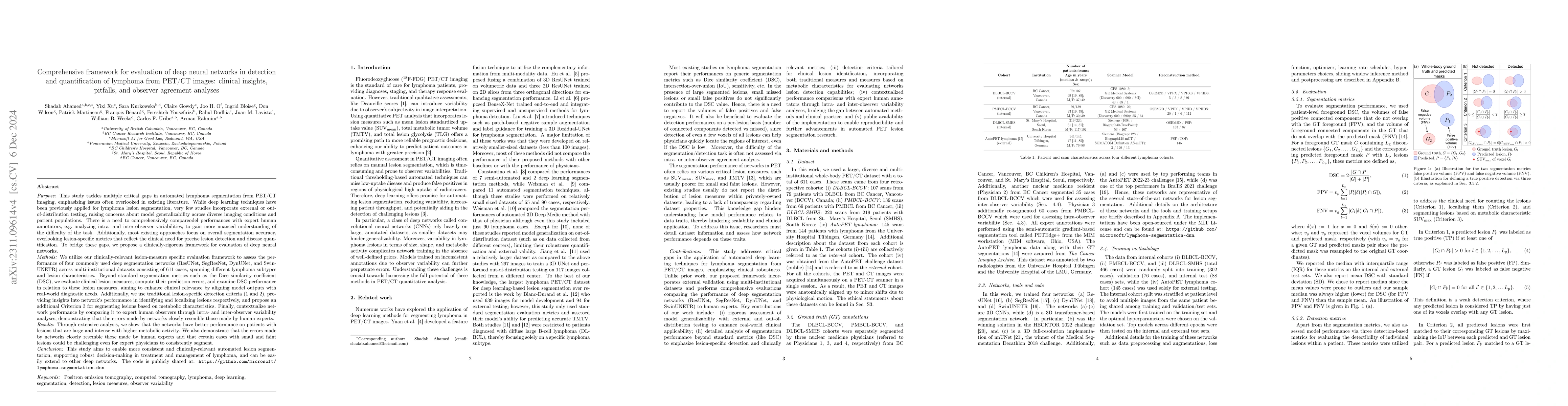
This study performs comprehensive evaluation of four neural network architectures (UNet, SegResNet, DynUNet, and SwinUNETR) for lymphoma lesion segmentation from PET/CT images. These networks were t...
Due to deteriorating environmental conditions and increasing human activity, conservation efforts directed towards wildlife is crucial. Motion-activated camera traps constitute an efficient tool for...
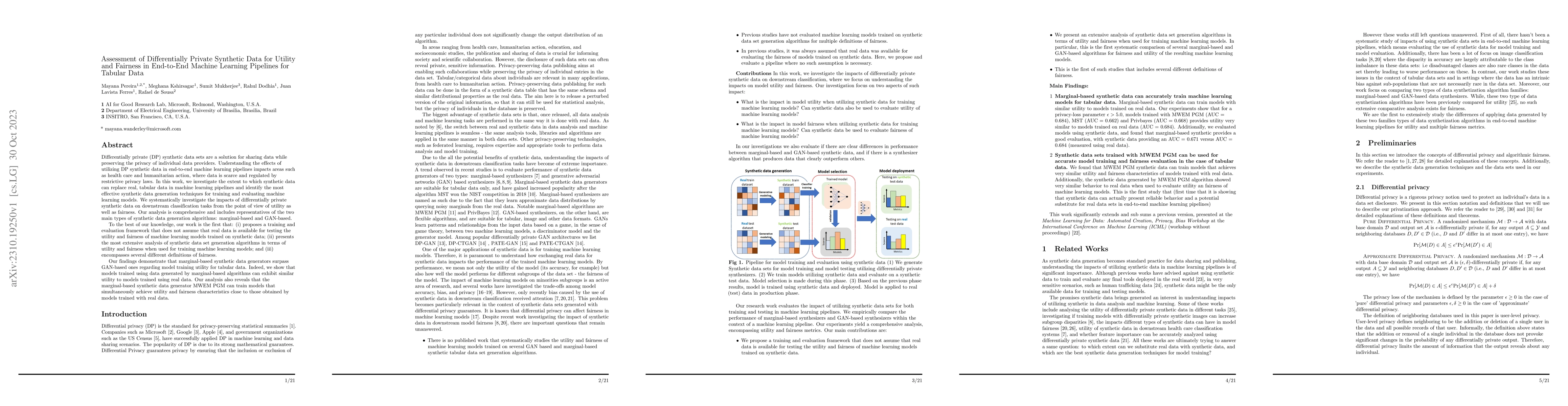
Differentially private (DP) synthetic data sets are a solution for sharing data while preserving the privacy of individual data providers. Understanding the effects of utilizing DP synthetic data in...
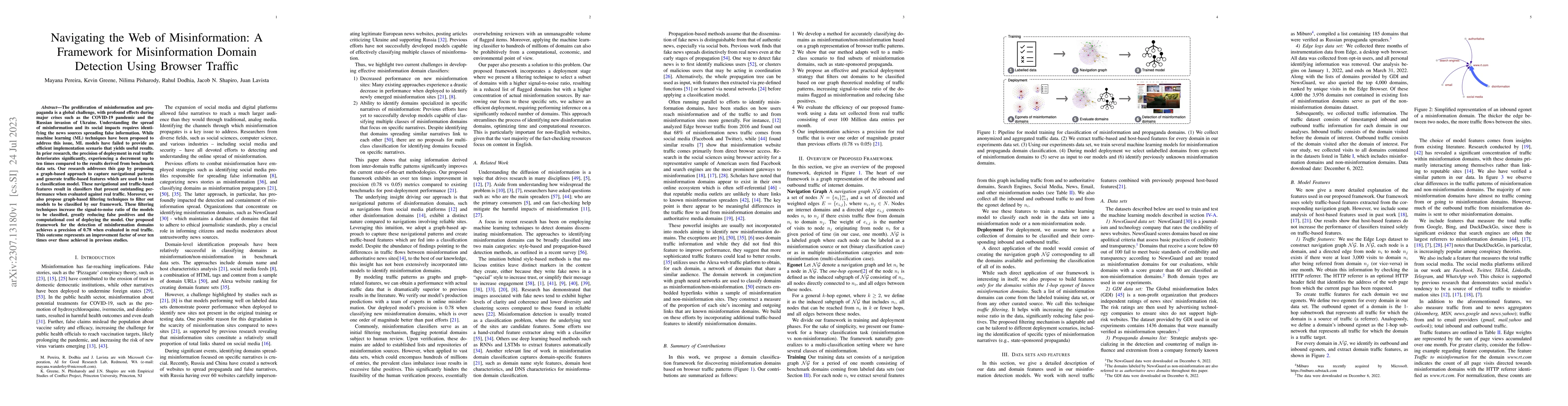
The proliferation of misinformation and propaganda is a global challenge, with profound effects during major crises such as the COVID-19 pandemic and the Russian invasion of Ukraine. Understanding t...
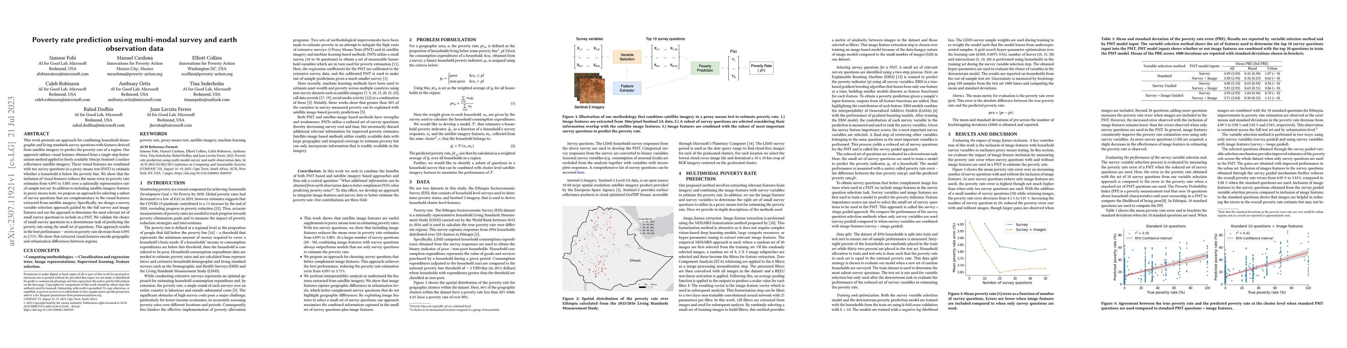
This work presents an approach for combining household demographic and living standards survey questions with features derived from satellite imagery to predict the poverty rate of a region. Our app...
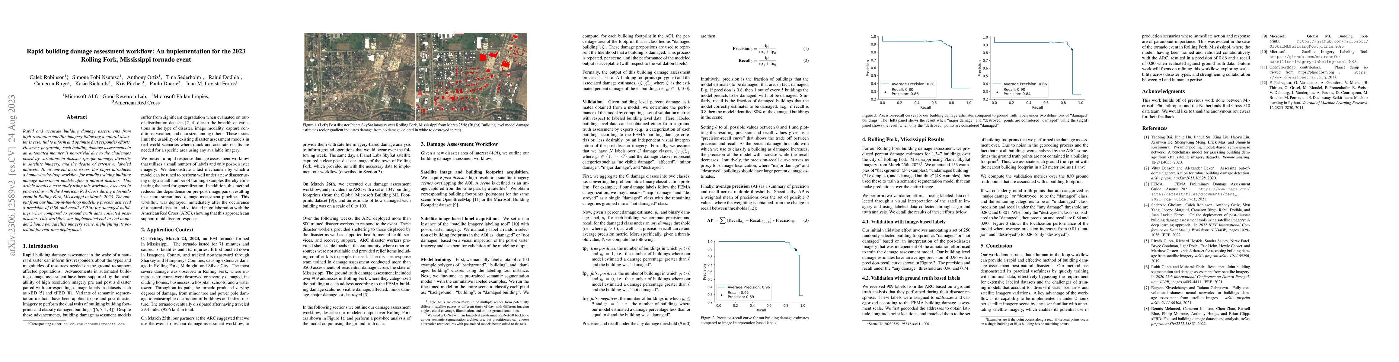
Rapid and accurate building damage assessments from high-resolution satellite imagery following a natural disaster is essential to inform and optimize first responder efforts. However, performing su...
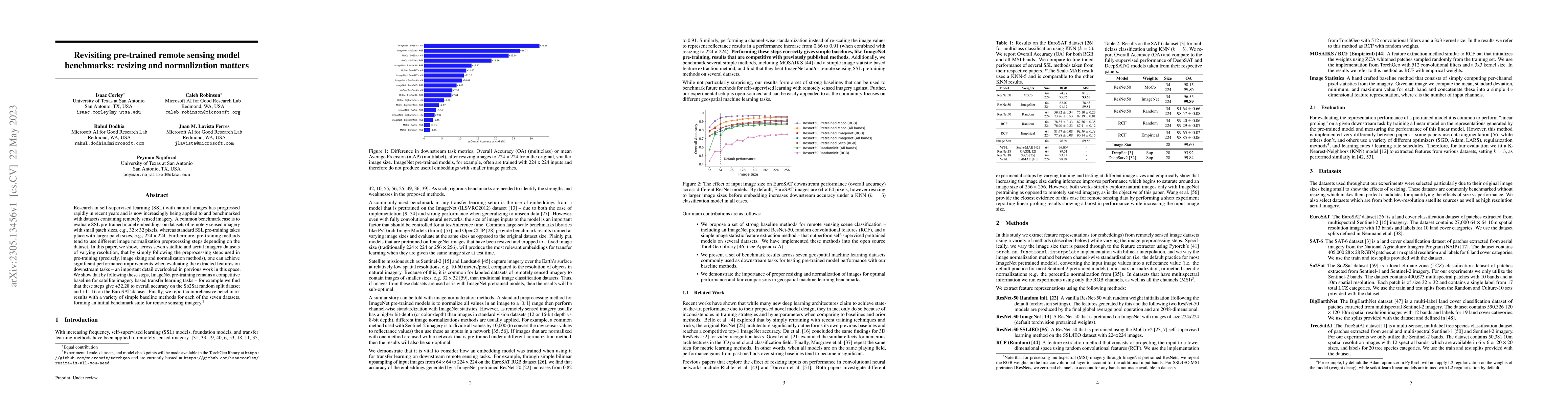
Research in self-supervised learning (SSL) with natural images has progressed rapidly in recent years and is now increasingly being applied to and benchmarked with datasets containing remotely sense...
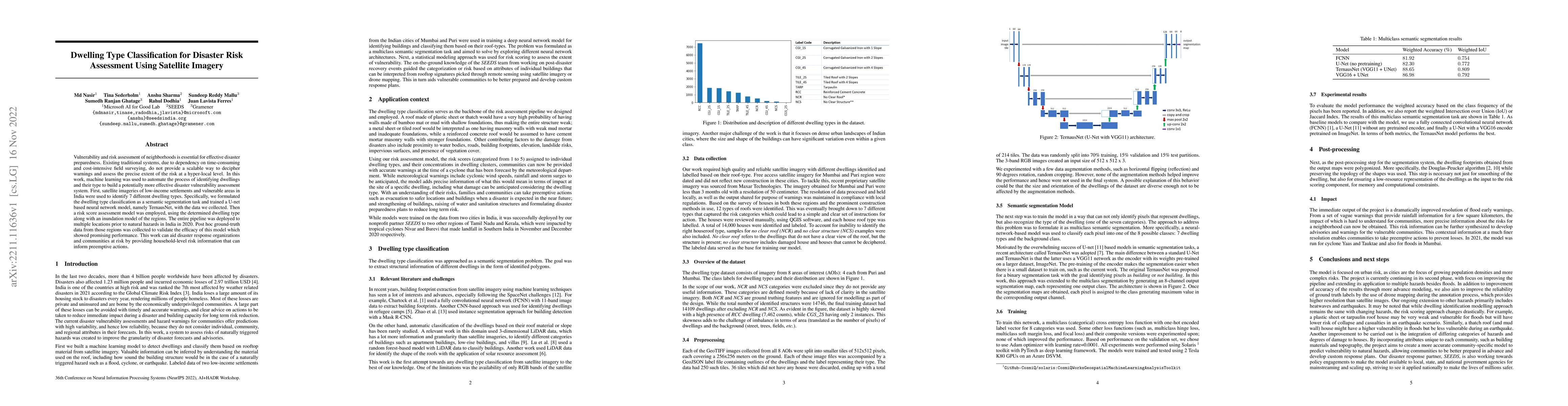
Vulnerability and risk assessment of neighborhoods is essential for effective disaster preparedness. Existing traditional systems, due to dependency on time-consuming and cost-intensive field survey...
Innovations in computer vision algorithms for satellite image analysis can enable us to explore global challenges such as urbanization and land use change at the planetary level. However, domain shi...
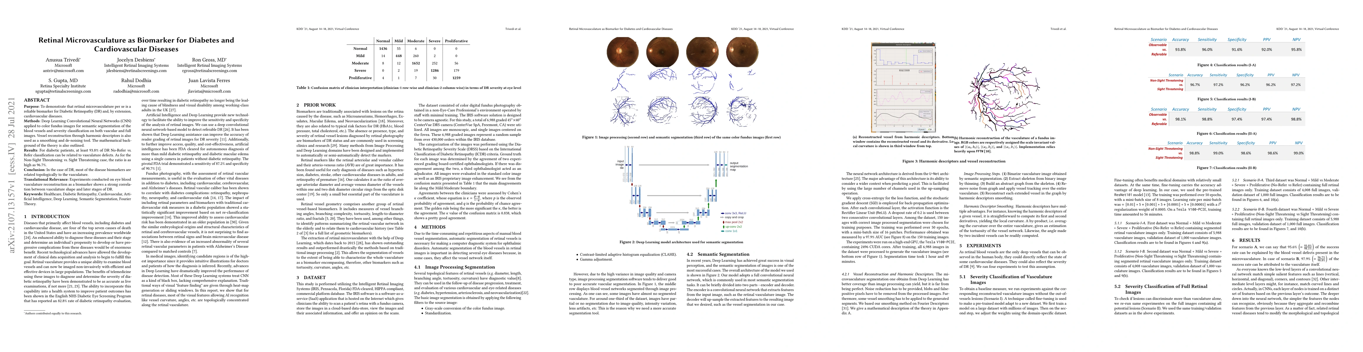
Purpose: To demonstrate that retinal microvasculature per se is a reliable biomarker for Diabetic Retinopathy (DR) and, by extension, cardiovascular diseases. Methods: Deep Learning Convolutional Ne...
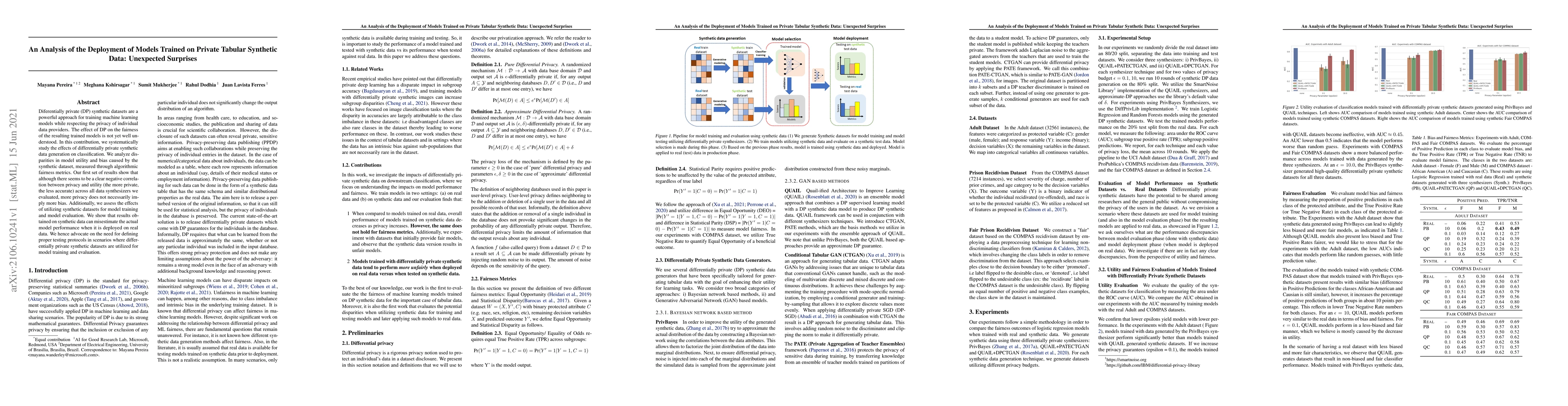
Diferentially private (DP) synthetic datasets are a powerful approach for training machine learning models while respecting the privacy of individual data providers. The effect of DP on the fairness...
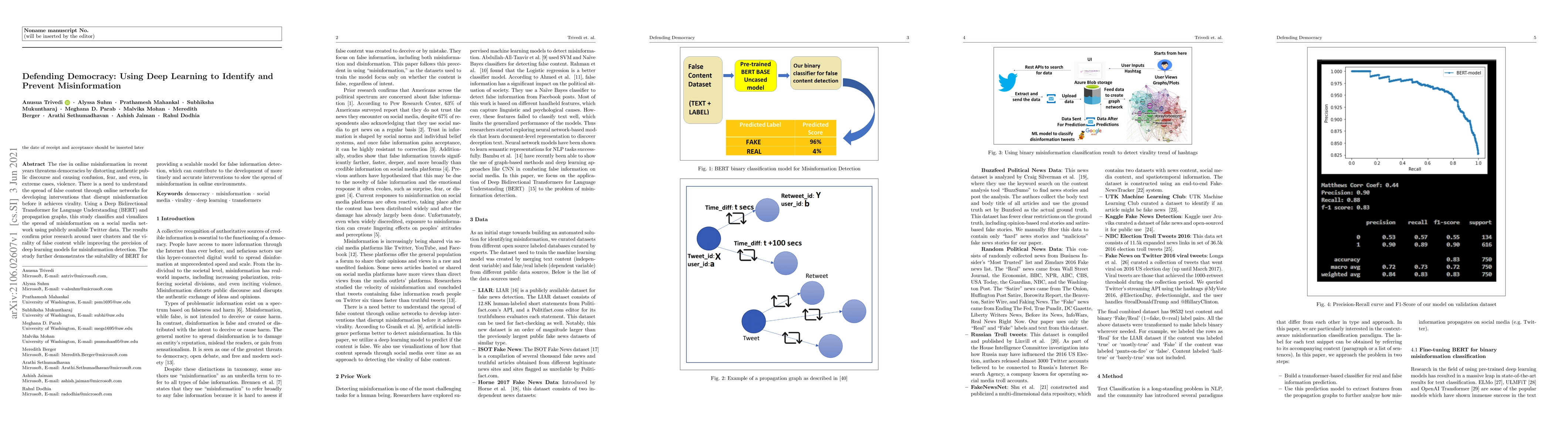
The rise in online misinformation in recent years threatens democracies by distorting authentic public discourse and causing confusion, fear, and even, in extreme cases, violence. There is a need to...
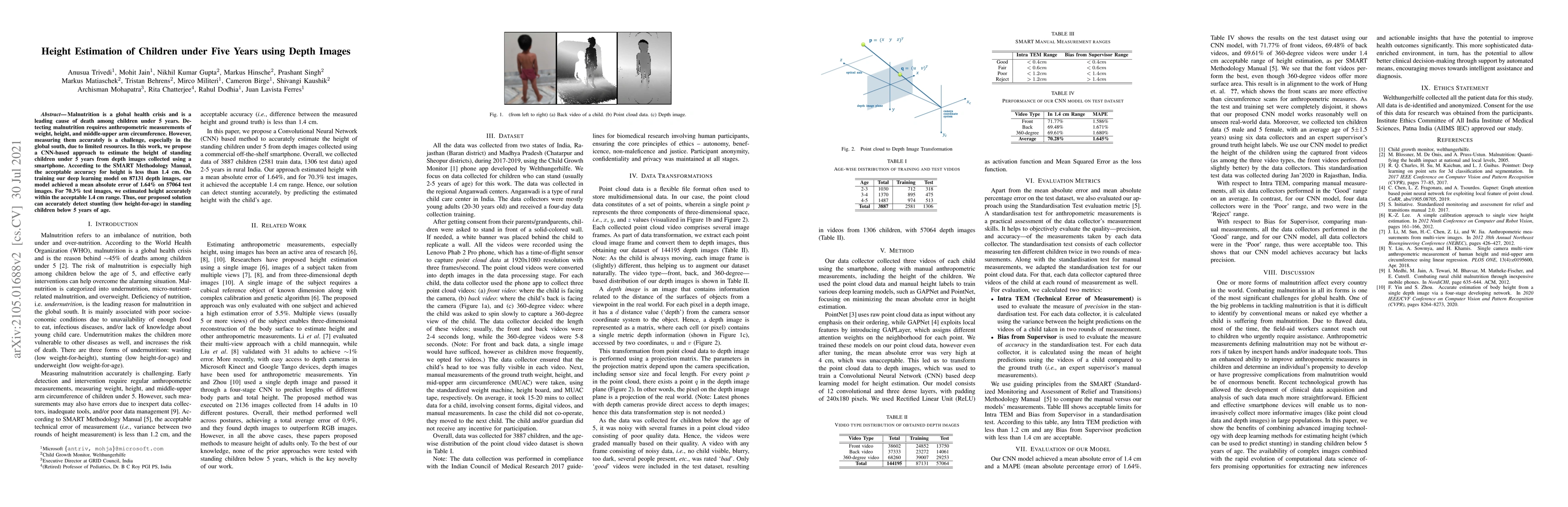
Malnutrition is a global health crisis and is the leading cause of death among children under five. Detecting malnutrition requires anthropometric measurements of weight, height, and middle-upper ar...
AI for good (AI4G) projects involve developing and applying artificial intelligence (AI) based solutions to further goals in areas such as sustainability, health, humanitarian aid, and social justic...
Broadband connectivity is a key metric in today's economy. In an era of rapid expansion of the digital economy, it directly impacts GDP. Furthermore, with the COVID-19 guidelines of social distancin...
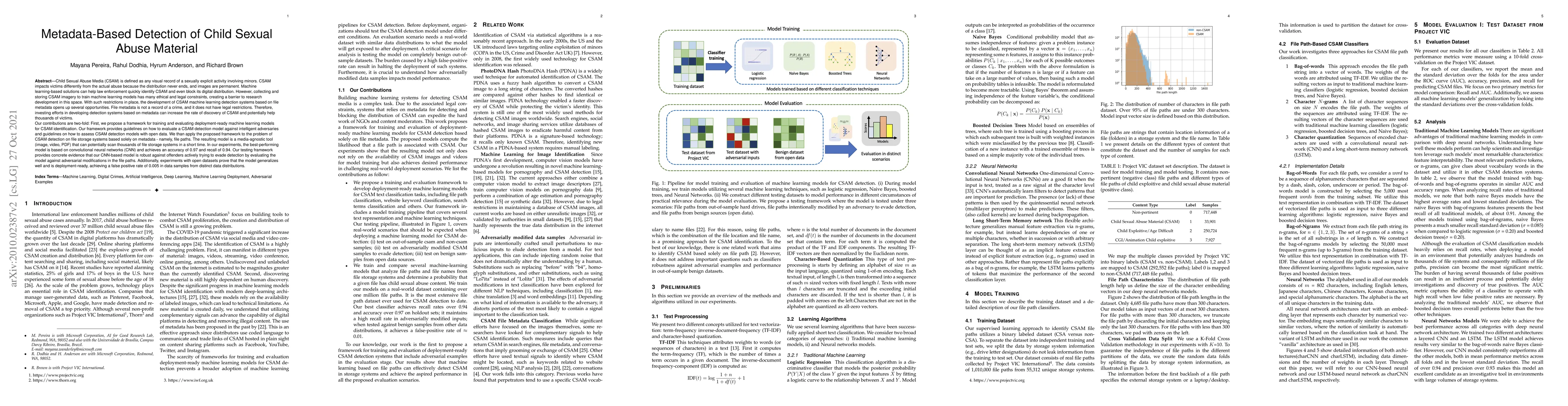
Child Sexual Abuse Media (CSAM) is any visual record of a sexually-explicit activity involving minors. CSAM impacts victims differently from the actual abuse because the distribution never ends, and...
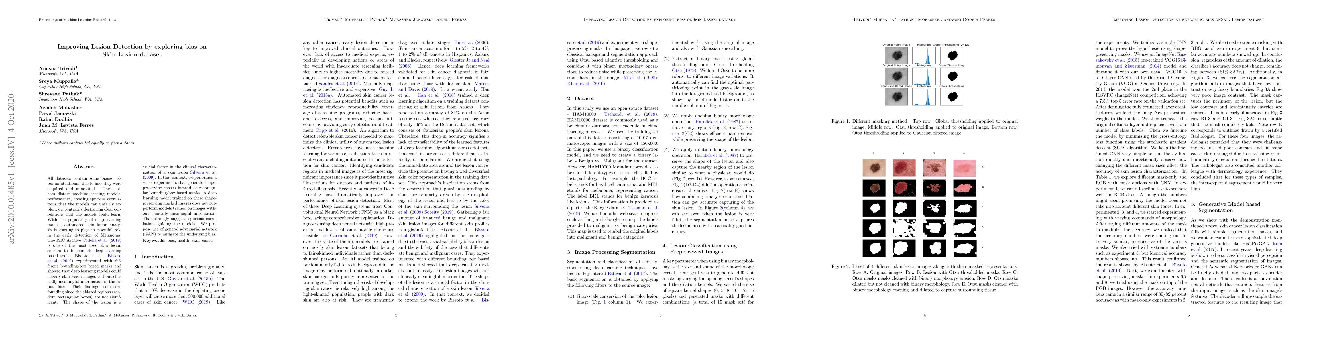
All datasets contain some biases, often unintentional, due to how they were acquired and annotated. These biases distort machine-learning models' performance, creating spurious correlations that the...
Generative machine learning models are being increasingly viewed as a way to share sensitive data between institutions. While there has been work on developing differentially private generative mode...
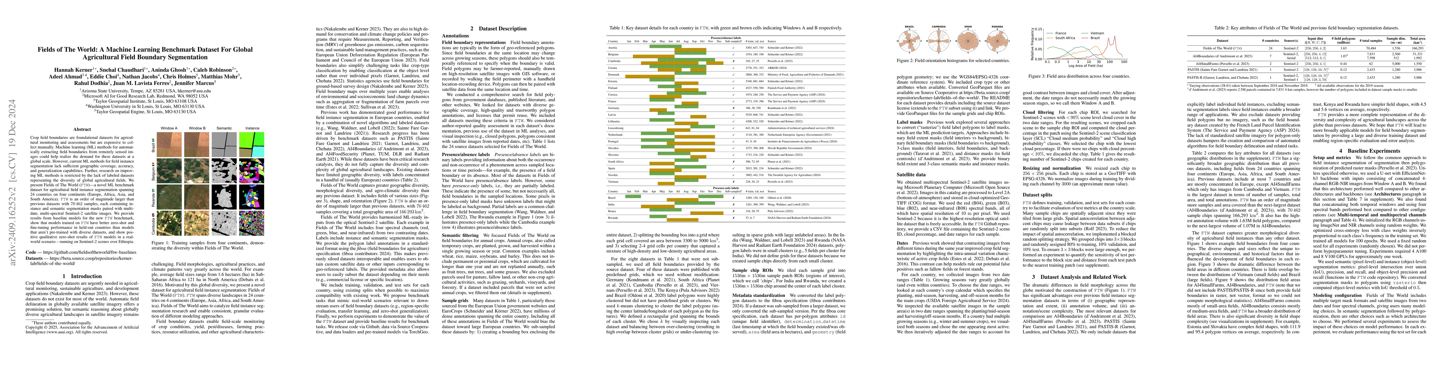
Crop field boundaries are foundational datasets for agricultural monitoring and assessments but are expensive to collect manually. Machine learning (ML) methods for automatically extracting field boun...
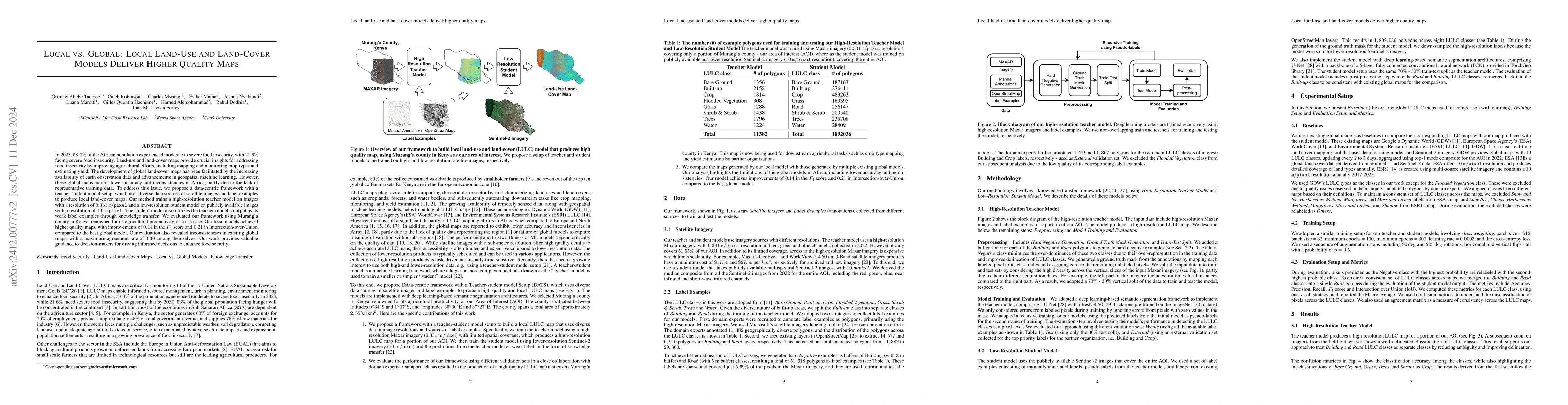
Approximately 20% of Africa's population suffered from undernourishment, and 868 million people experienced moderate to severe food insecurity in 2022. Land-use and land-cover maps provide crucial ins...
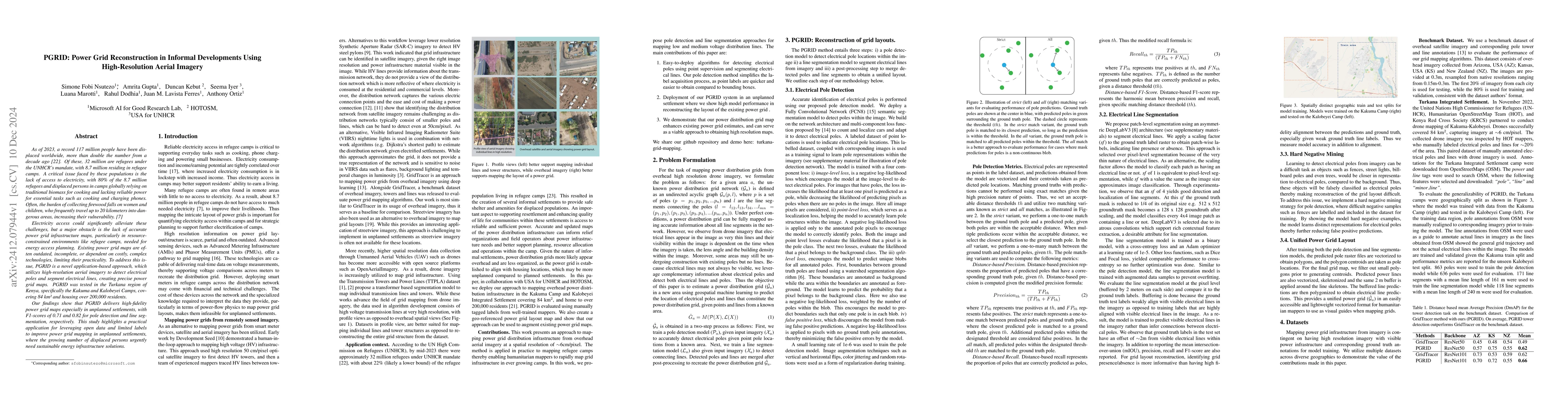
As of 2023, a record 117 million people have been displaced worldwide, more than double the number from a decade ago [22]. Of these, 32 million are refugees under the UNHCR mandate, with 8.7 million r...
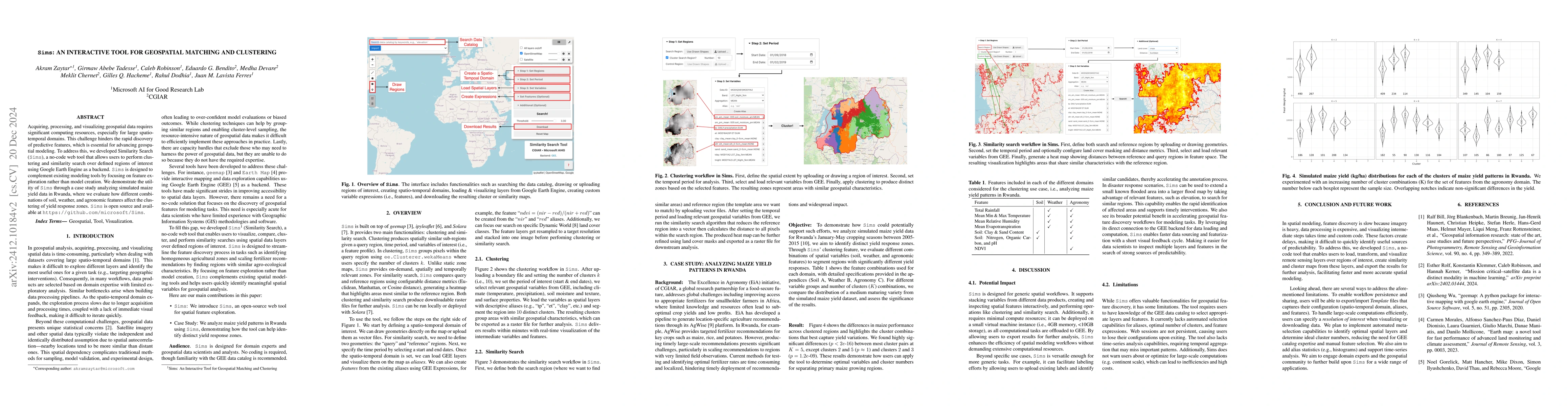
Acquiring, processing, and visualizing geospatial data requires significant computing resources, especially for large spatio-temporal domains. This challenge hinders the rapid discovery of predictive ...
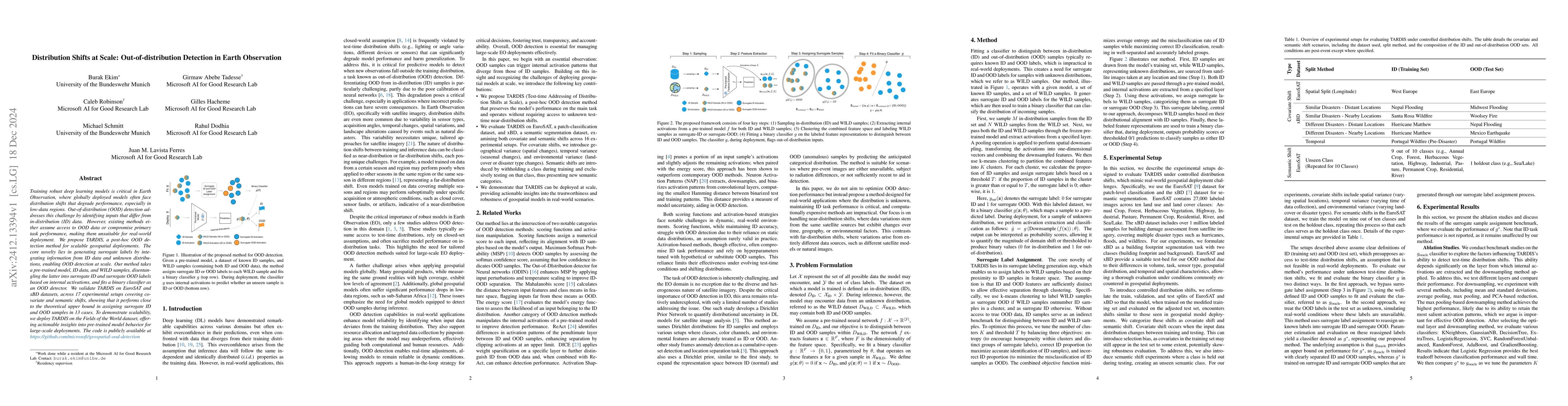
Training robust deep learning models is critical in Earth Observation, where globally deployed models often face distribution shifts that degrade performance, especially in low-data regions. Out-of-di...
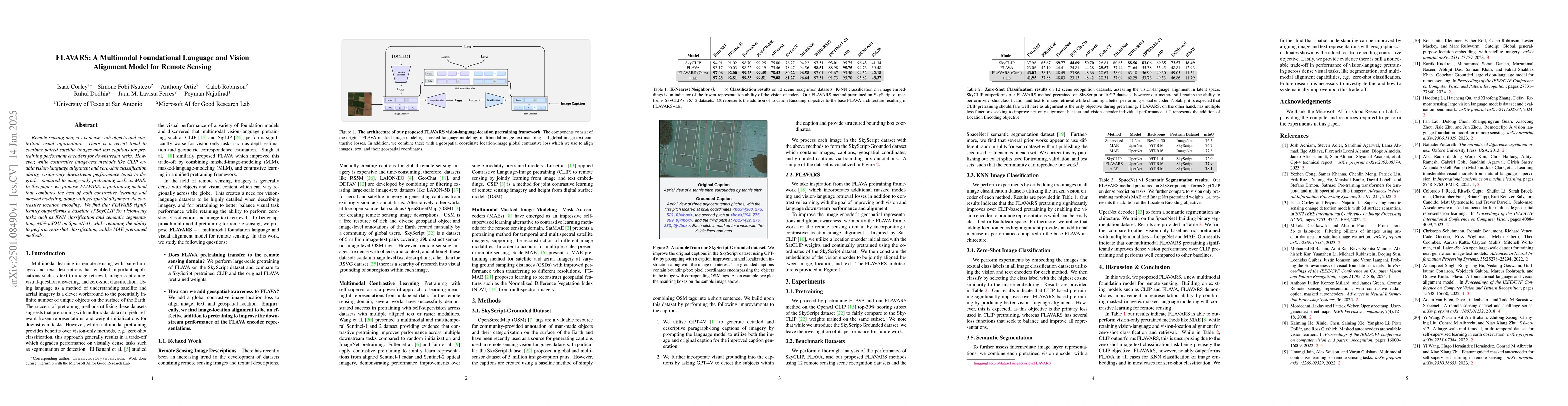
Remote sensing imagery is dense with objects and contextual visual information. There is a recent trend to combine paired satellite images and text captions for pretraining performant encoders for dow...
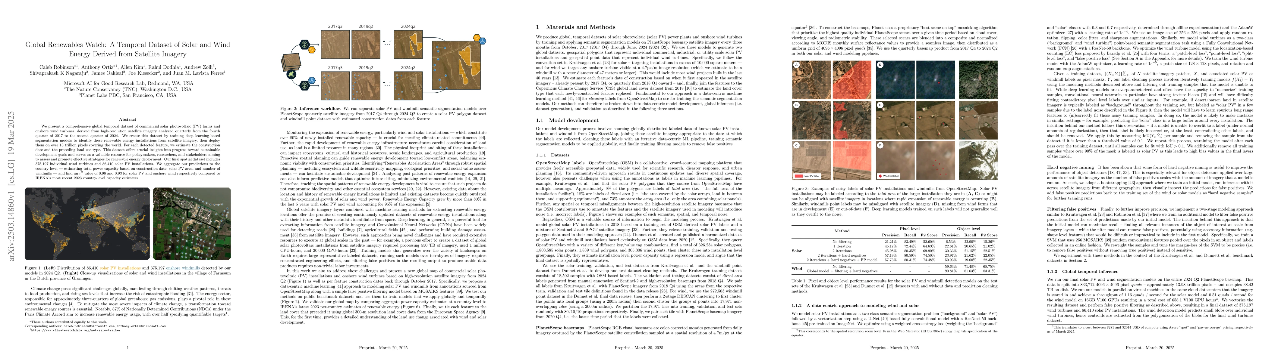
We present a comprehensive global temporal dataset of commercial solar photovoltaic (PV) farms and onshore wind turbines, derived from high-resolution satellite imagery analyzed quarterly from the fou...
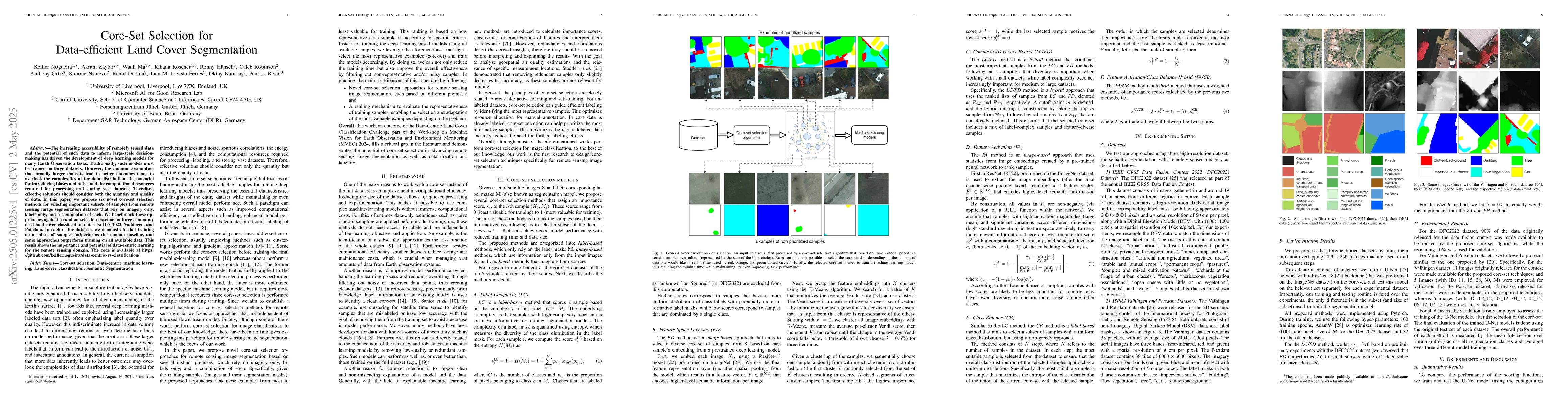
The increasing accessibility of remotely sensed data and the potential of such data to inform large-scale decision-making has driven the development of deep learning models for many Earth Observation ...
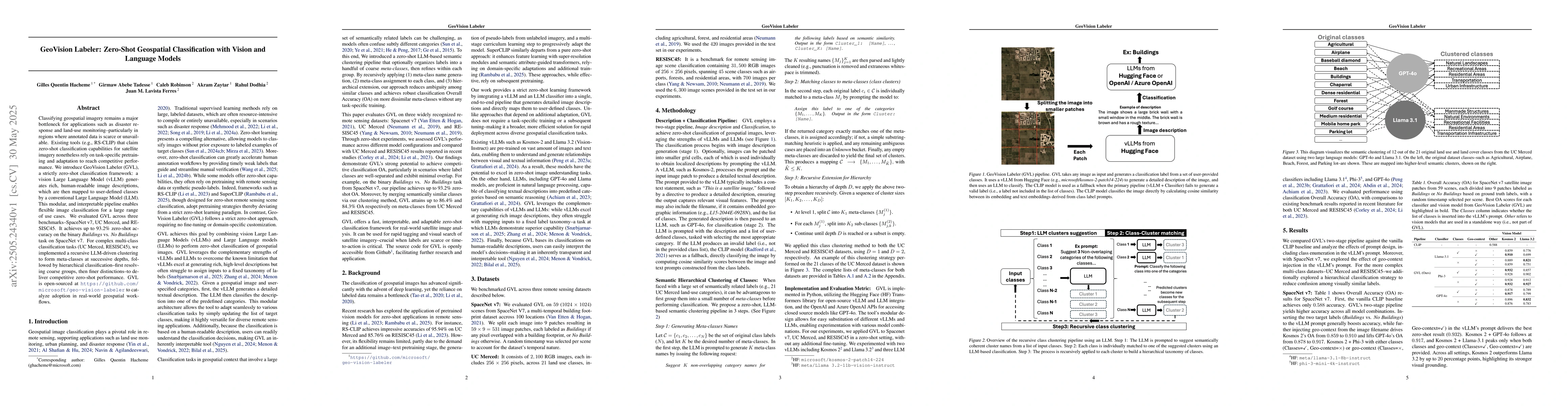
Classifying geospatial imagery remains a major bottleneck for applications such as disaster response and land-use monitoring-particularly in regions where annotated data is scarce or unavailable. Exis...
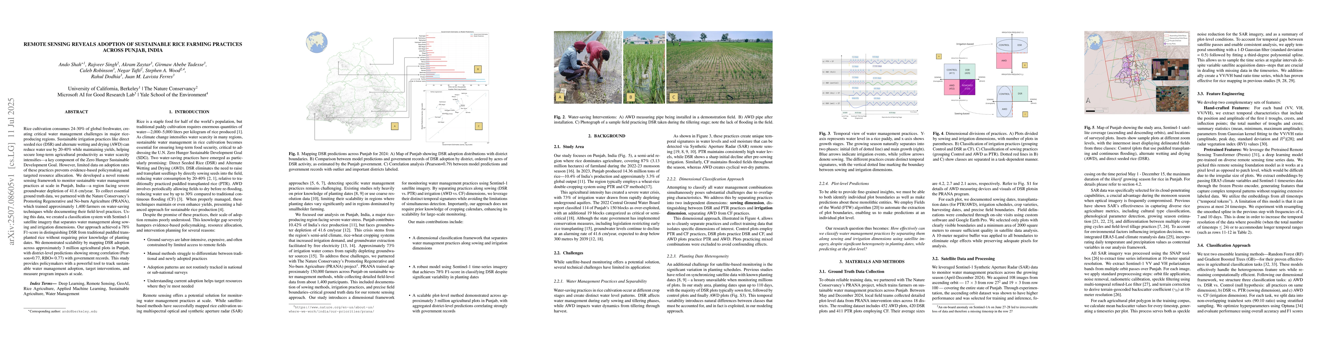
Rice cultivation consumes 24-30% of global freshwater, creating critical water management challenges in major rice-producing regions. Sustainable irrigation practices like direct seeded rice (DSR) and...
Ear disease contributes significantly to global hearing loss, with recurrent otitis media being a primary preventable cause in children, impacting development. Artificial intelligence (AI) offers prom...
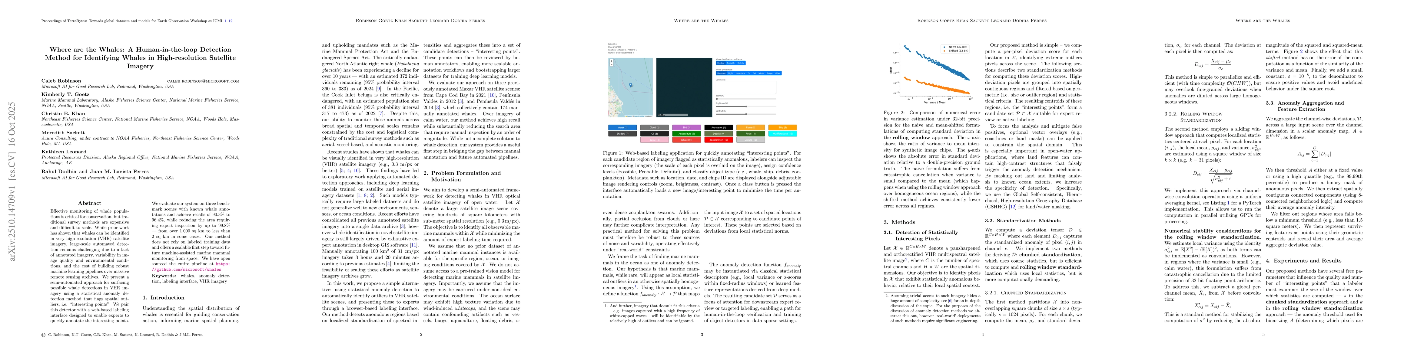
Effective monitoring of whale populations is critical for conservation, but traditional survey methods are expensive and difficult to scale. While prior work has shown that whales can be identified in...
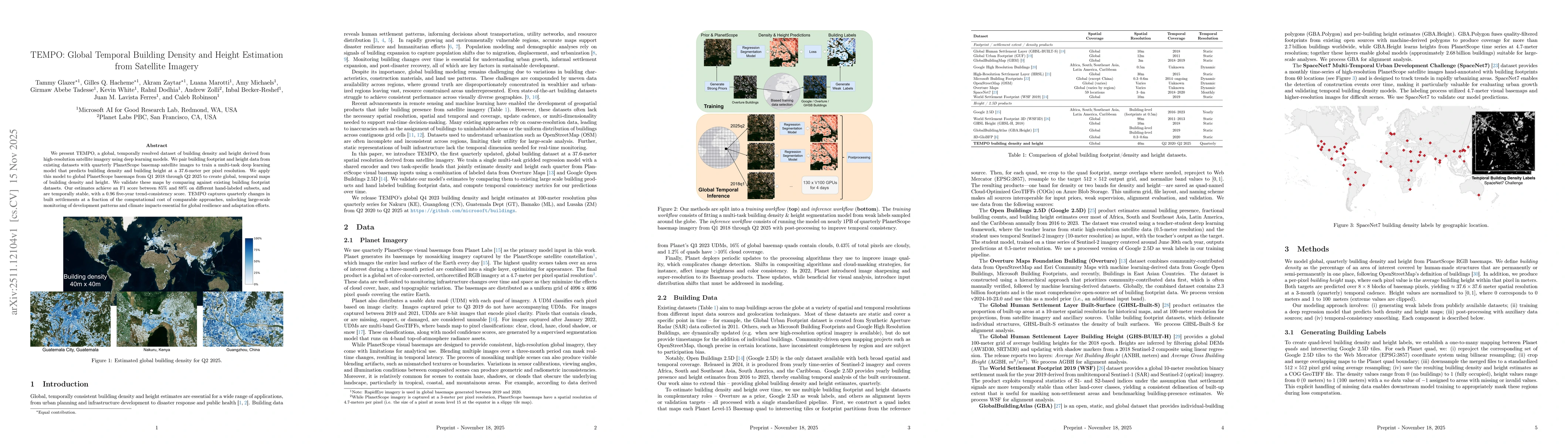
We present TEMPO, a global, temporally resolved dataset of building density and height derived from high-resolution satellite imagery using deep learning models. We pair building footprint and height ...
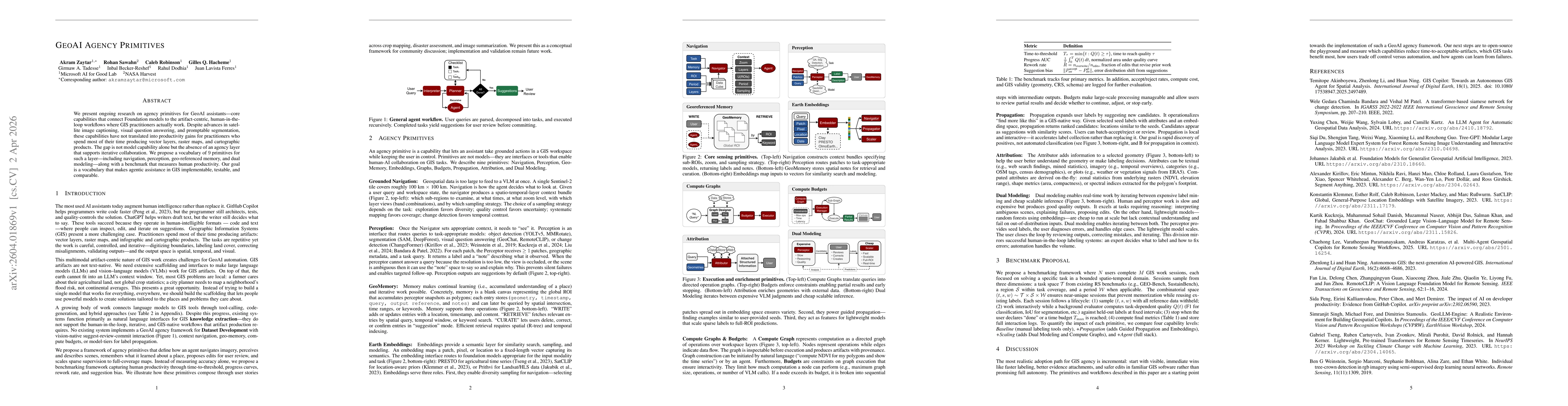
We present ongoing research on agency primitives for GeoAI assistants -- core capabilities that connect Foundation models to the artifact-centric, human-in-the-loop workflows where GIS practitioners a...
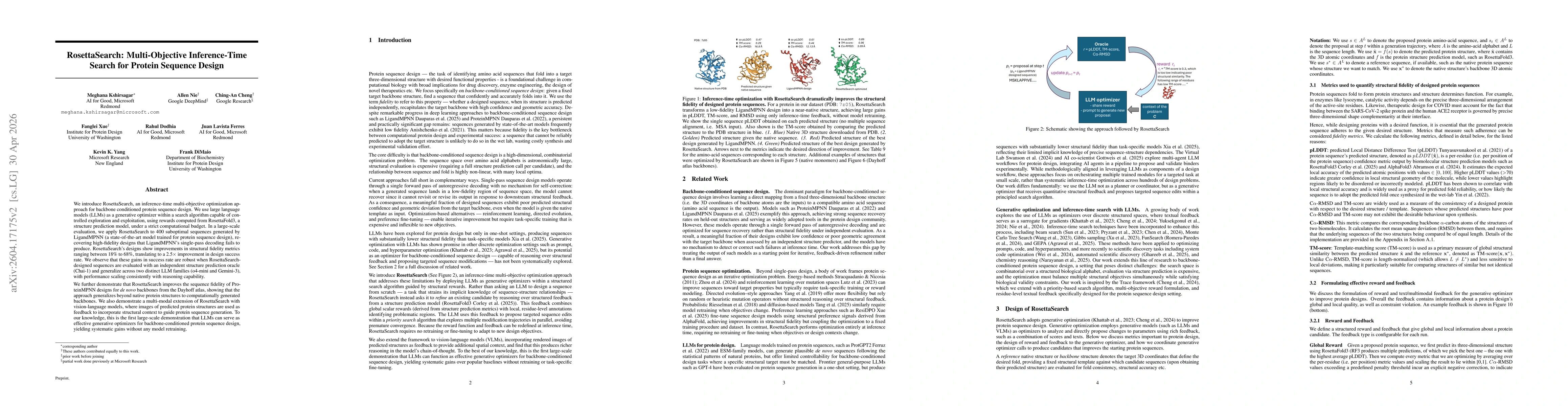
We introduce RosettaSearch, an inference-time multi-objective optimization approach for protein sequence optimization. We use large language models (LLMs) as a generative optimizer within a search alg...
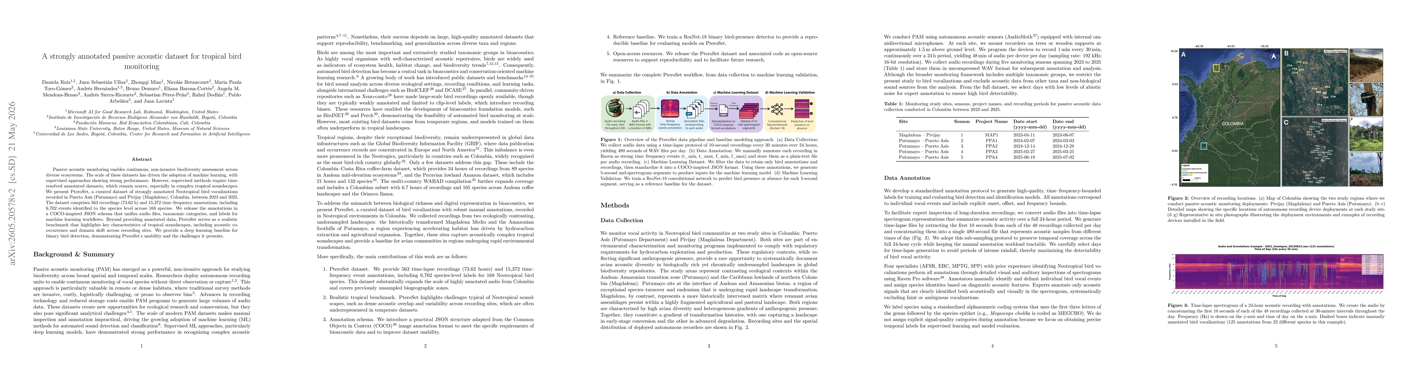
Passive acoustic monitoring enables continuous, non-invasive biodiversity assessment across diverse ecosystems. The scale of these datasets has driven the adoption of machine learning, with supervised...
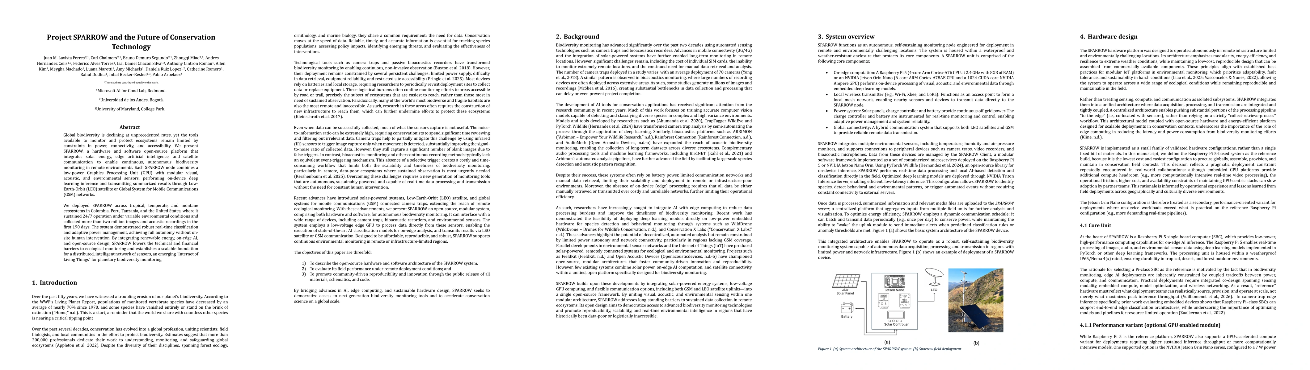
Global biodiversity is declining at unprecedented rates, yet the tools available to monitor and protect ecosystems remain limited by constraints in power, connectivity, and accessibility. We present S...
Automated aerial wildlife surveys increasingly rely on deep learning, yet standard object detectors require bounding-box annotations, reported to be up to seven times slower and three times more expen...