Academic Profile
Statistics
Similar Authors
Papers on arXiv
This paper presents an effective framework for estimating time of arrival of vehicles (buses) in an Intelligent Transit Management System (ITMS) having sparse position updates. Our contributions tow...
Current trends in autonomous vehicles and their applications indicates an increasing need in positioning at low battery and compute cost. Lidars provide accurate localization at the cost of high com...
The integration of fine-scale multispectral imagery with deep learning models has revolutionized land use and land cover (LULC) classification. However, the atmospheric effects present in Top-of-Atmos...
This evaluate the performance of geospatial image processing using two distinct data storage formats: Zarr and TIFF. Geospatial images, converted to numerous applications like environmental monitoring...
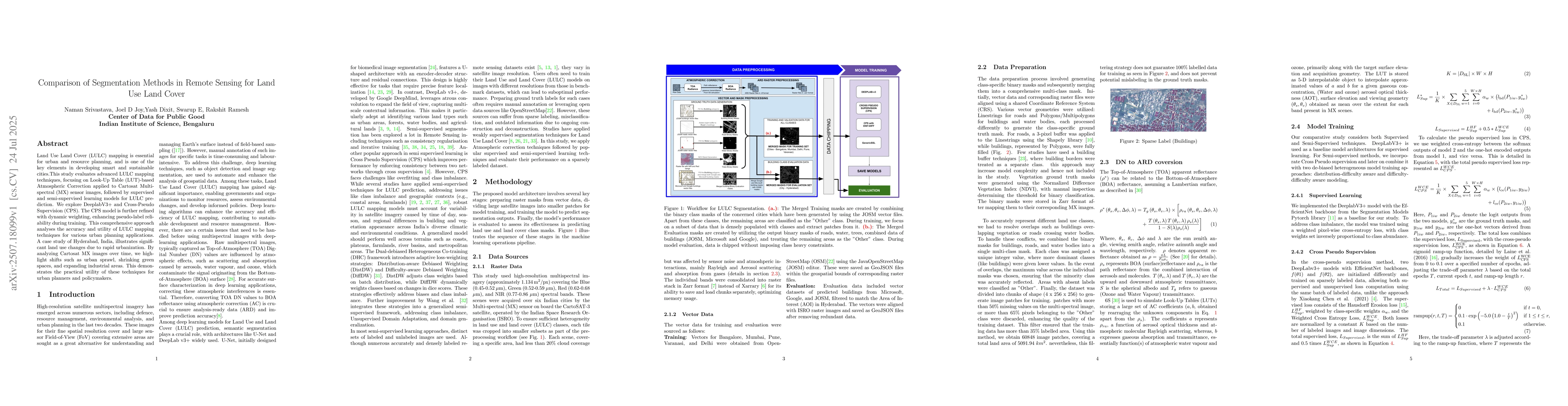
Land Use Land Cover (LULC) mapping is essential for urban and resource planning, and is one of the key elements in developing smart and sustainable cities.This study evaluates advanced LULC mapping te...
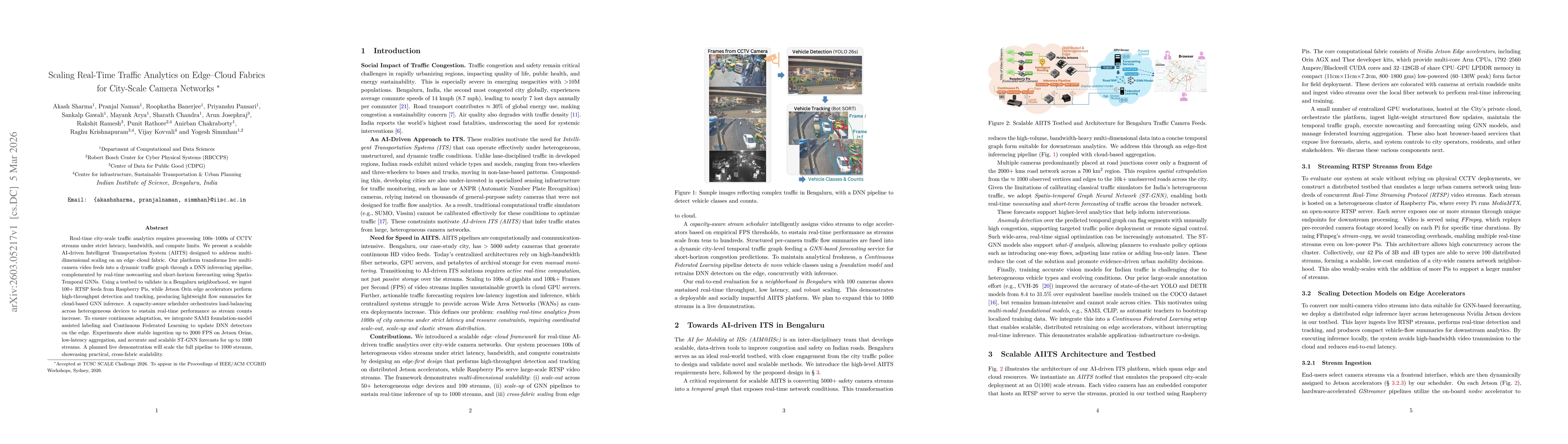
Real-time city-scale traffic analytics requires processing 100s-1000s of CCTV streams under strict latency, bandwidth, and compute limits. We present a scalable AI-driven Intelligent Transportation Sy...