ArxivLens
R
Researcher

Richard Gloaguen

13 papers on arXiv

13 arXiv Papers
329 Total Publications
Profile

Academic Profile

Name R. Gloaguen
Total Papers 329
Scholar Profile View on Semantic Scholar
Metrics

Statistics

13 arXiv Papers
329 Total Publications
Publications

Papers on arXiv

Thumbnail for PCB-Vision: A Multiscene RGB-Hyperspectral Benchmark Dataset of Printed
  Circuit Boards
arXiv
PCB-Vision: A Multiscene RGB-Hyperspectral Benchmark Dataset of Printed Circuit Boards

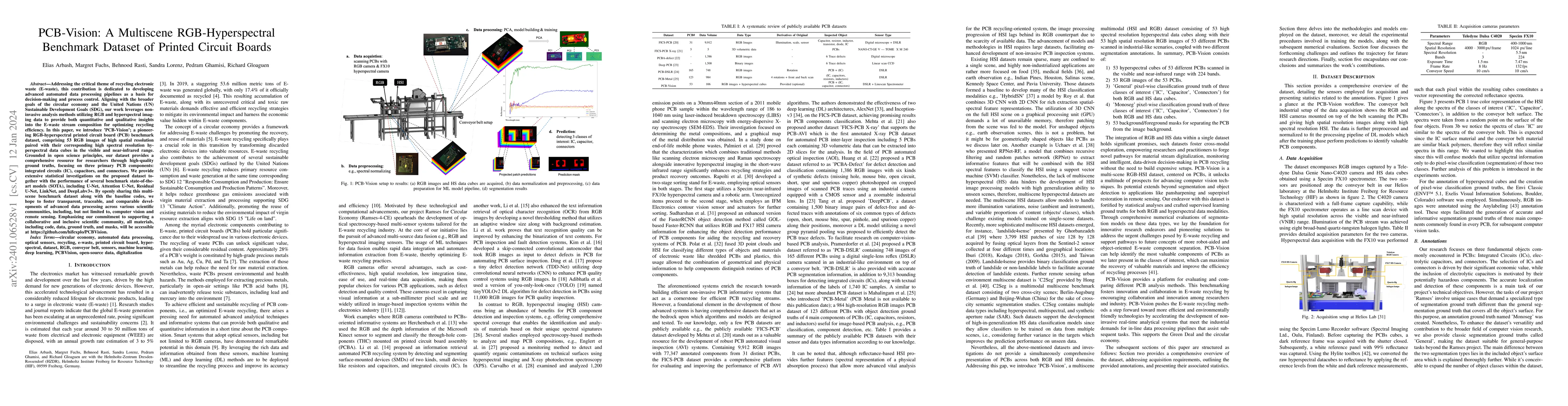
Addressing the critical theme of recycling electronic waste (E-waste), this contribution is dedicated to developing advanced automated data processing pipelines as a basis for decision-making and pr...

Thumbnail for TSGAN: An Optical-to-SAR Dual Conditional GAN for Optical based SAR
  Temporal Shifting
arXiv
TSGAN: An Optical-to-SAR Dual Conditional GAN for Optical based SAR Temporal Shifting

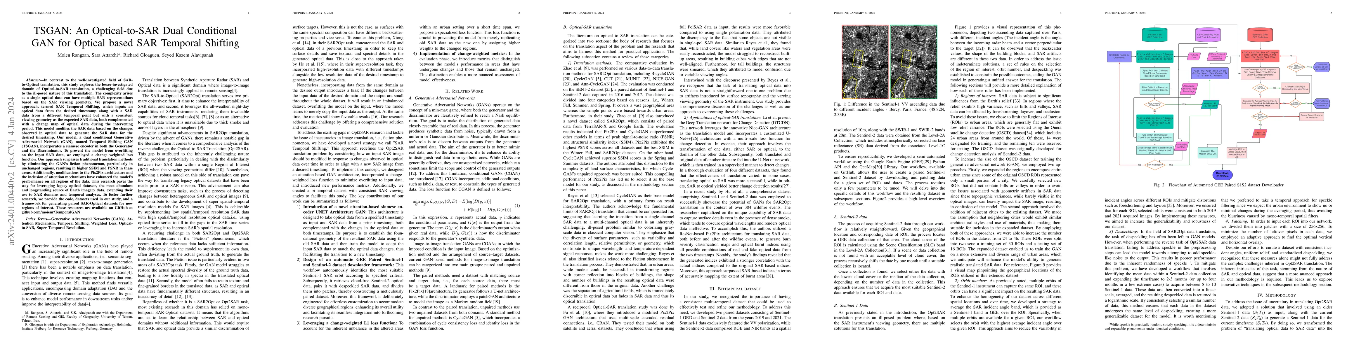
In contrast to the well-investigated field of SAR-to-Optical translation, this study explores the lesser-investigated domain of Optical-to-SAR translation, a challenging field due to the ill-posed n...

Thumbnail for Masking Hyperspectral Imaging Data with Pretrained Models
arXiv
Masking Hyperspectral Imaging Data with Pretrained Models

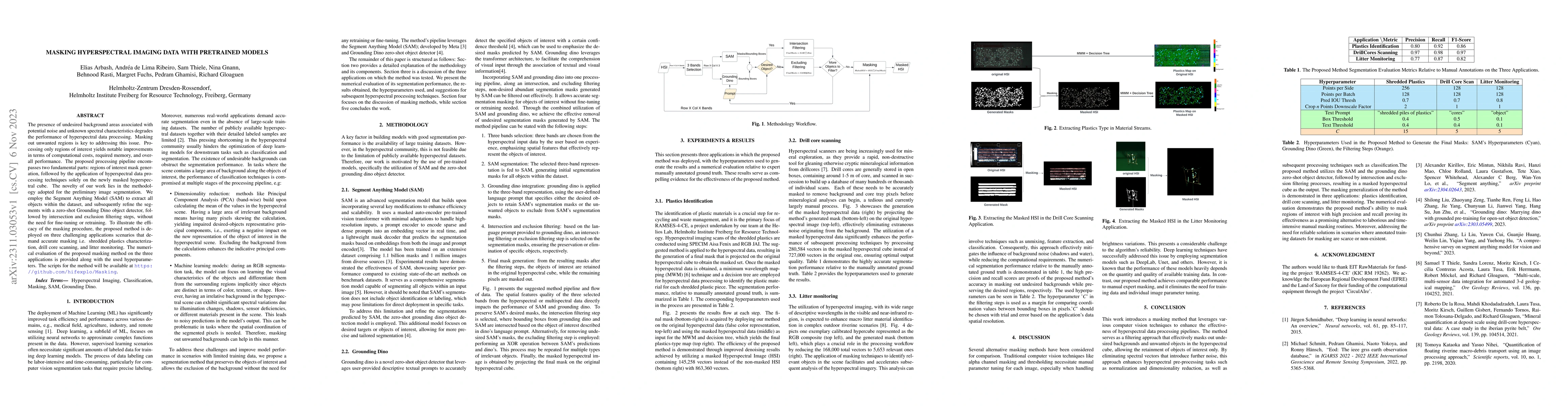
The presence of undesired background areas associated with potential noise and unknown spectral characteristics degrades the performance of hyperspectral data processing. Masking out unwanted region...

Thumbnail for A Multisensor Hyperspectral Benchmark Dataset For Unmixing of Intimate
  Mixtures
arXiv
A Multisensor Hyperspectral Benchmark Dataset For Unmixing of Intimate Mixtures

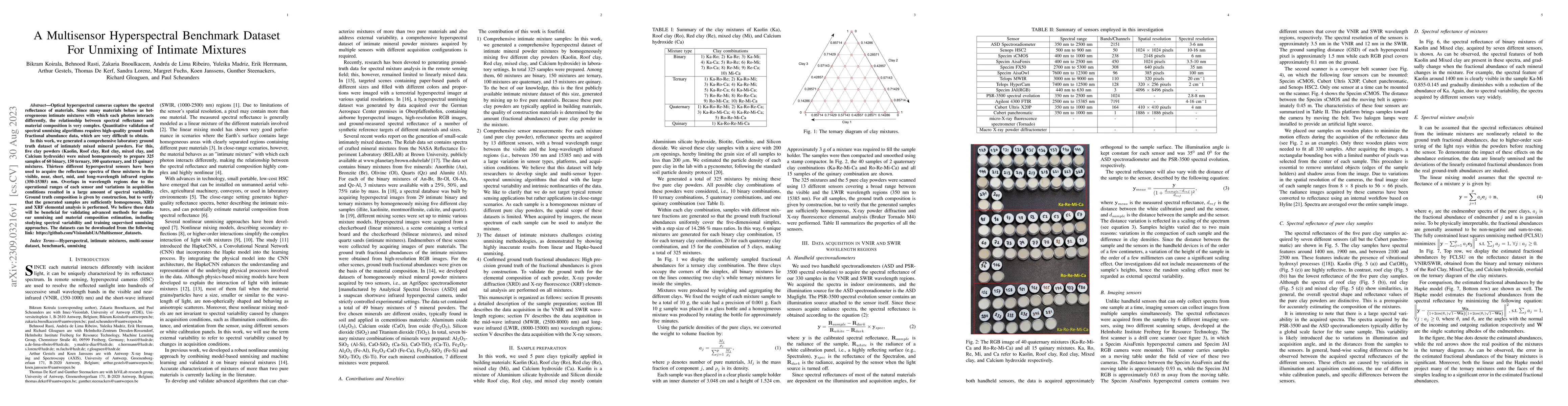
Optical hyperspectral cameras capture the spectral reflectance of materials. Since many materials behave as heterogeneous intimate mixtures with which each photon interacts differently, the relation...

Thumbnail for Tinto: Multisensor Benchmark for 3D Hyperspectral Point Cloud
  Segmentation in the Geosciences
arXiv
Tinto: Multisensor Benchmark for 3D Hyperspectral Point Cloud Segmentation in the Geosciences

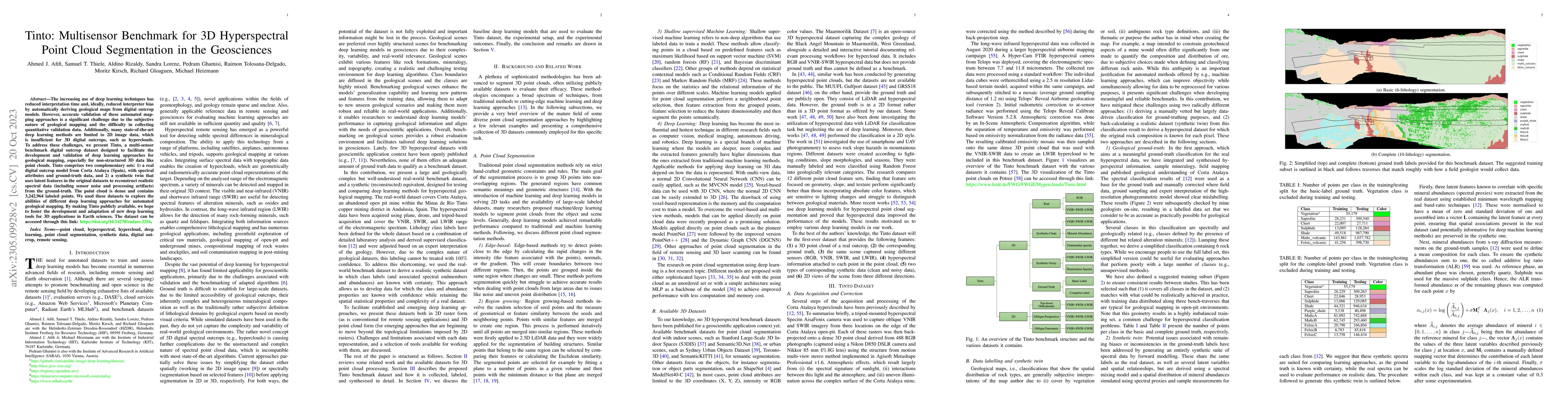
The increasing use of deep learning techniques has reduced interpretation time and, ideally, reduced interpreter bias by automatically deriving geological maps from digital outcrop models. However, ...

Thumbnail for HyDe: The First Open-Source, Python-Based, GPU-Accelerated Hyperspectral
  Denoising Package
arXiv
HyDe: The First Open-Source, Python-Based, GPU-Accelerated Hyperspectral Denoising Package

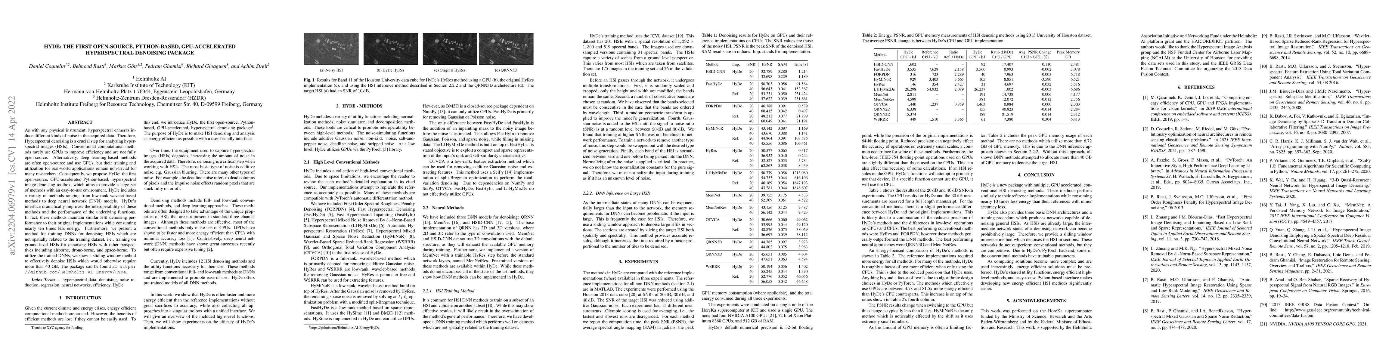
As with any physical instrument, hyperspectral cameras induce different kinds of noise in the acquired data. Therefore, Hyperspectral denoising is a crucial step for analyzing hyperspectral images (...

Thumbnail for Fusion of Dual Spatial Information for Hyperspectral Image
  Classification
arXiv
Fusion of Dual Spatial Information for Hyperspectral Image Classification

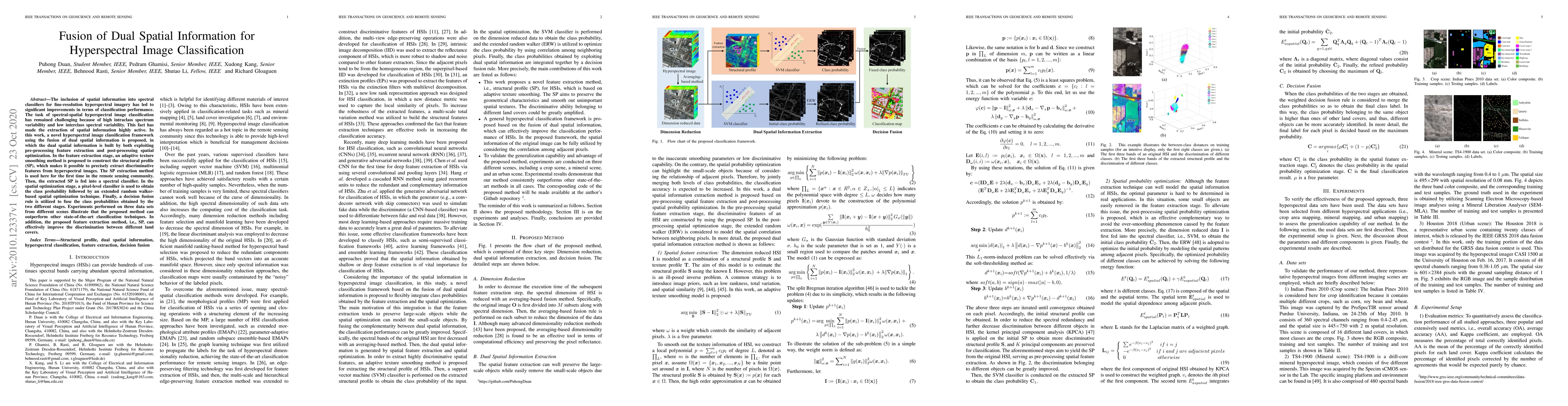
The inclusion of spatial information into spectral classifiers for fine-resolution hyperspectral imagery has led to significant improvements in terms of classification performance. The task of spect...

Thumbnail for MineNetCD: A Benchmark for Global Mining Change Detection on Remote
  Sensing Imagery
arXiv
MineNetCD: A Benchmark for Global Mining Change Detection on Remote Sensing Imagery

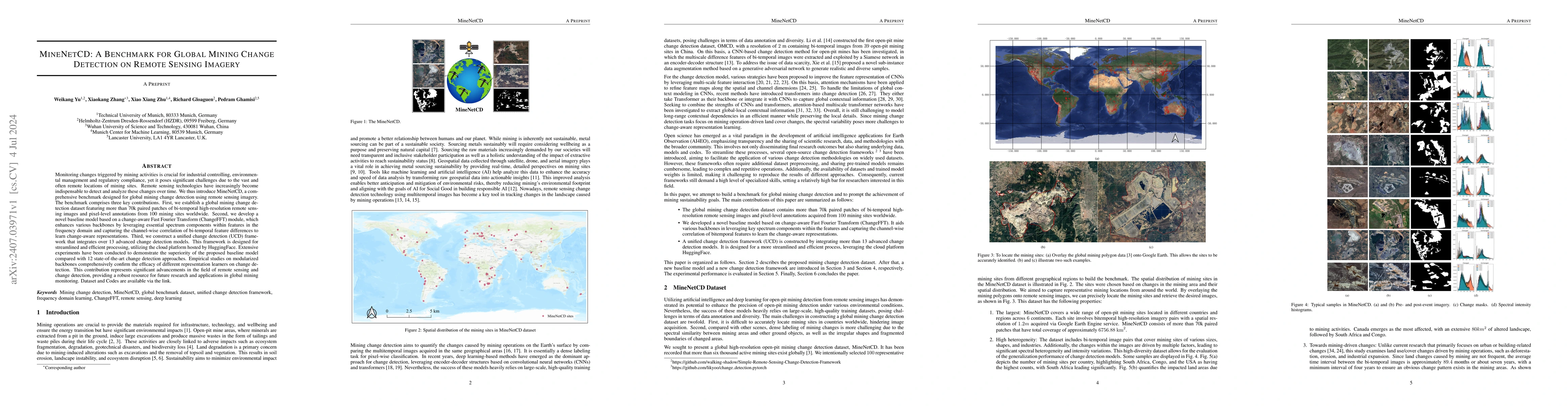
Monitoring changes triggered by mining activities is crucial for industrial controlling, environmental management and regulatory compliance, yet it poses significant challenges due to the vast and oft...

Thumbnail for Electrolyzers-HSI: Close-Range Multi-Scene Hyperspectral Imaging
  Benchmark Dataset
arXiv
Electrolyzers-HSI: Close-Range Multi-Scene Hyperspectral Imaging Benchmark Dataset

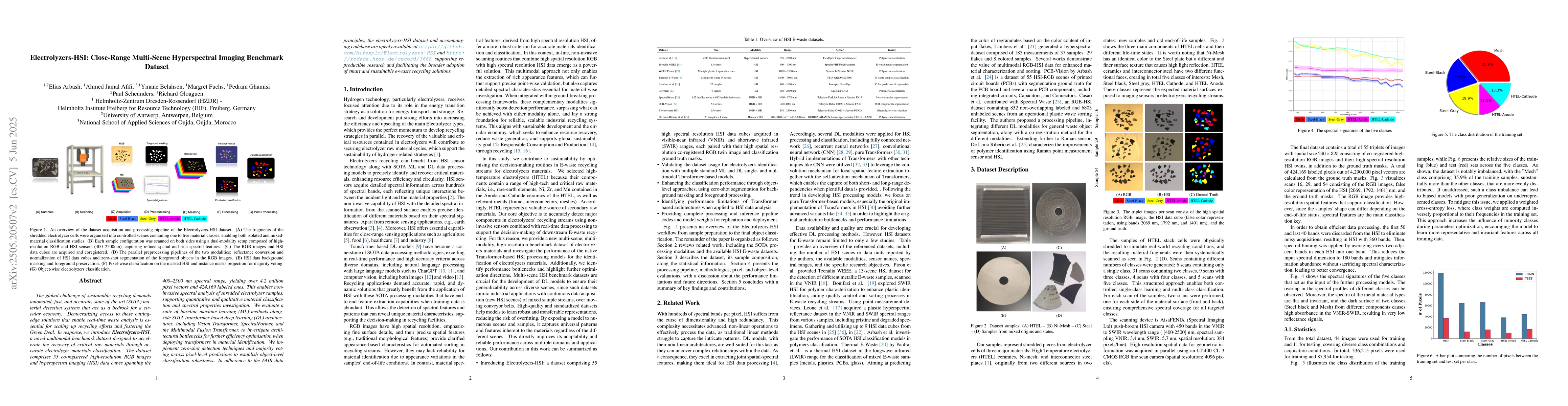
The global challenge of sustainable recycling demands automated, fast, and accurate, state-of-the-art (SOTA) material detection systems that act as a bedrock for a circular economy. Democratizing acce...

Thumbnail for HyperPointFormer: Multimodal Fusion in 3D Space with Dual-Branch
  Cross-Attention Transformers
arXiv
HyperPointFormer: Multimodal Fusion in 3D Space with Dual-Branch Cross-Attention Transformers

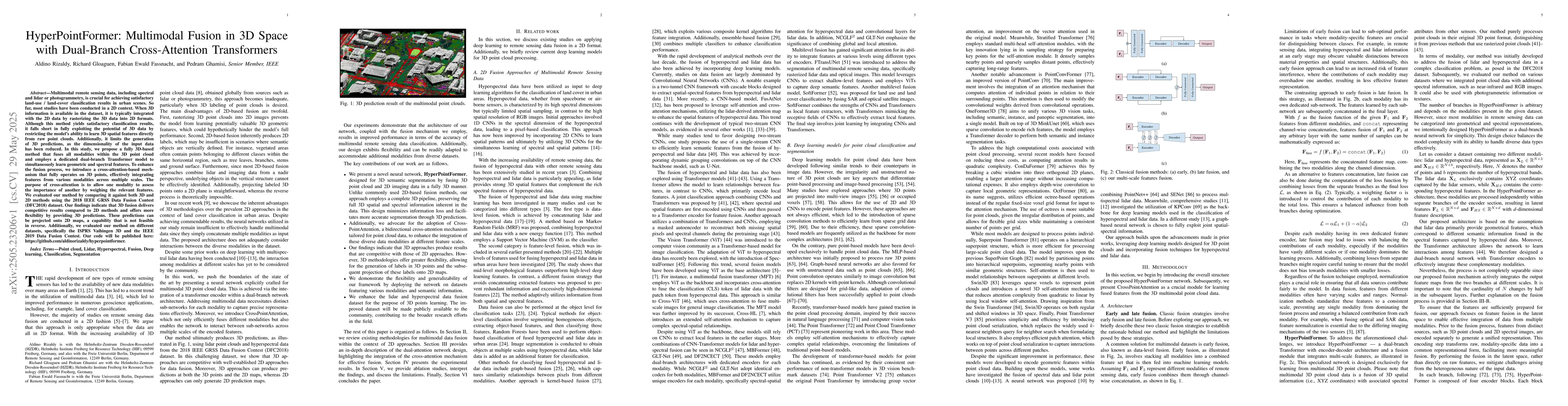
Multimodal remote sensing data, including spectral and lidar or photogrammetry, is crucial for achieving satisfactory land-use / land-cover classification results in urban scenes. So far, most studies...

Thumbnail for Geospatial Foundation Models to Enable Progress on Sustainable
  Development Goals
arXiv
Geospatial Foundation Models to Enable Progress on Sustainable Development Goals

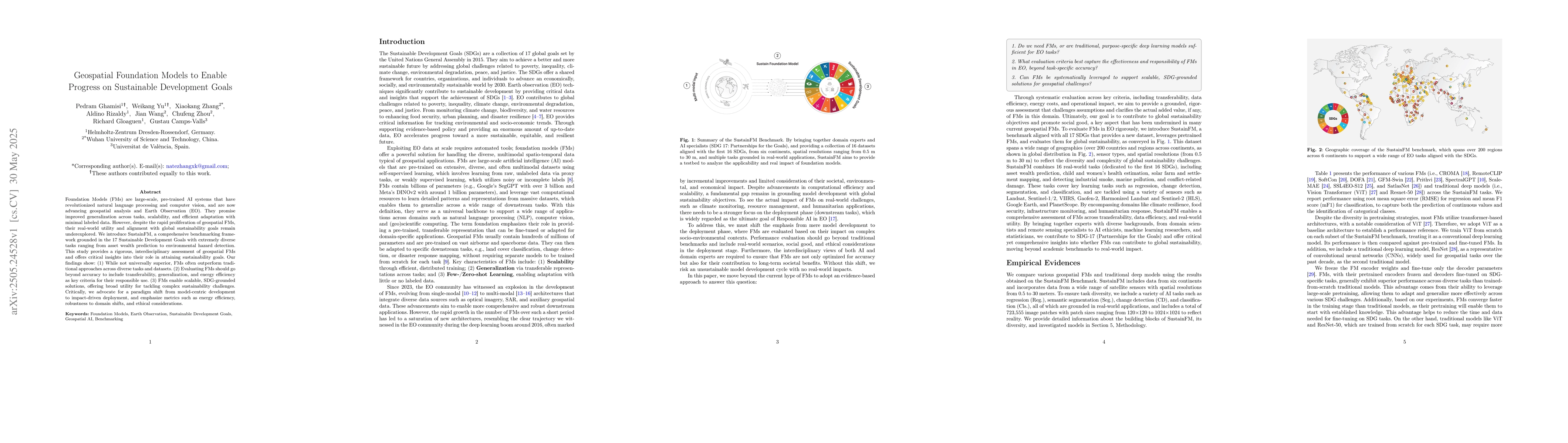
Foundation Models (FMs) are large-scale, pre-trained AI systems that have revolutionized natural language processing and computer vision, and are now advancing geospatial analysis and Earth Observatio...

Thumbnail for EuroMineNet: A Multitemporal Sentinel-2 Benchmark for Spatiotemporal
  Mining Footprint Analysis in the European Union (2015-2024)
arXiv
EuroMineNet: A Multitemporal Sentinel-2 Benchmark for Spatiotemporal Mining Footprint Analysis in the European Union (2015-2024)

Mining activities are essential for industrial and economic development, but remain a leading source of environmental degradation, contributing to deforestation, soil erosion, and water contamination....

Thumbnail for Label-Efficient 3D Forest Mapping: Self-Supervised and Transfer Learning for Individual, Structural, and Species Analysis
arXiv
Label-Efficient 3D Forest Mapping: Self-Supervised and Transfer Learning for Individual, Structural, and Species Analysis

Detailed structural and species information on individual tree level is increasingly important to support precision forestry, biodiversity conservation, and provide reference data for biomass and carb...

This website uses cookies to ensure you get the best experience. Learn more