Academic Profile
Statistics
Similar Authors
Papers on arXiv
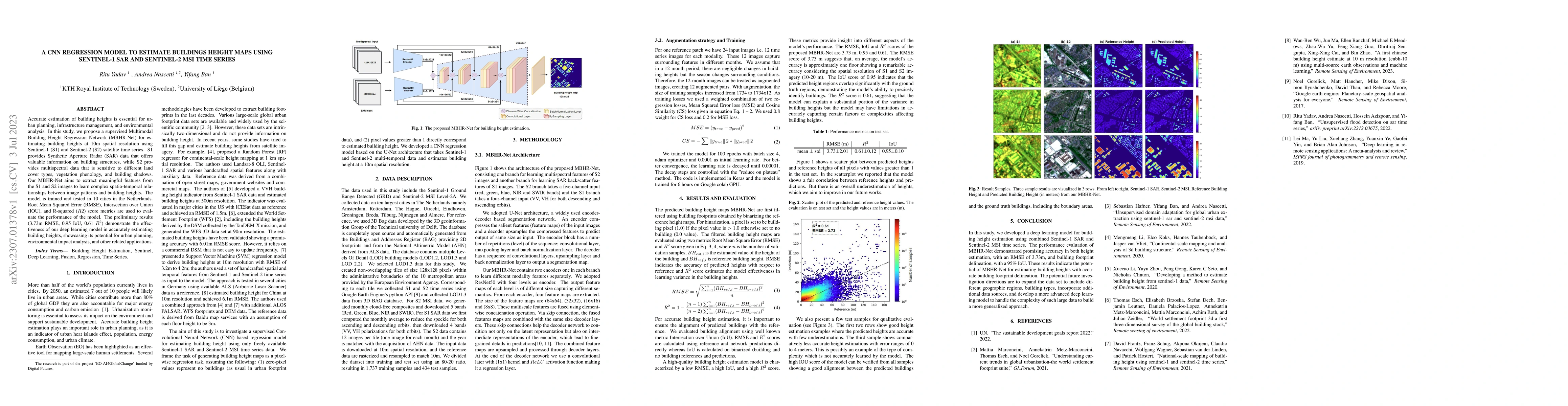
Accurate estimation of building heights is essential for urban planning, infrastructure management, and environmental analysis. In this study, we propose a supervised Multimodal Building Height Regr...
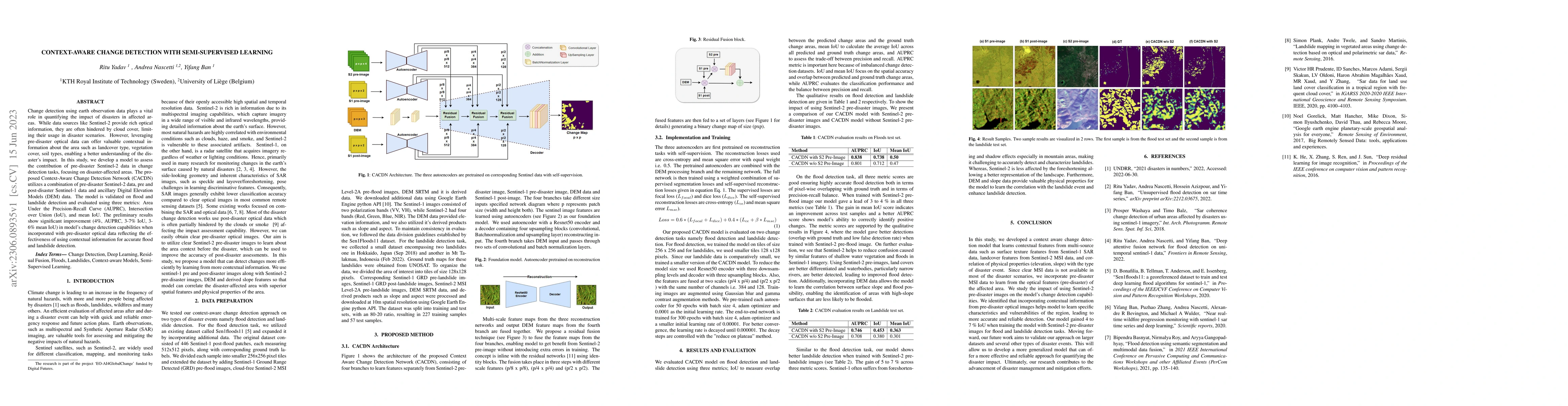
Change detection using earth observation data plays a vital role in quantifying the impact of disasters in affected areas. While data sources like Sentinel-2 provide rich optical information, they a...
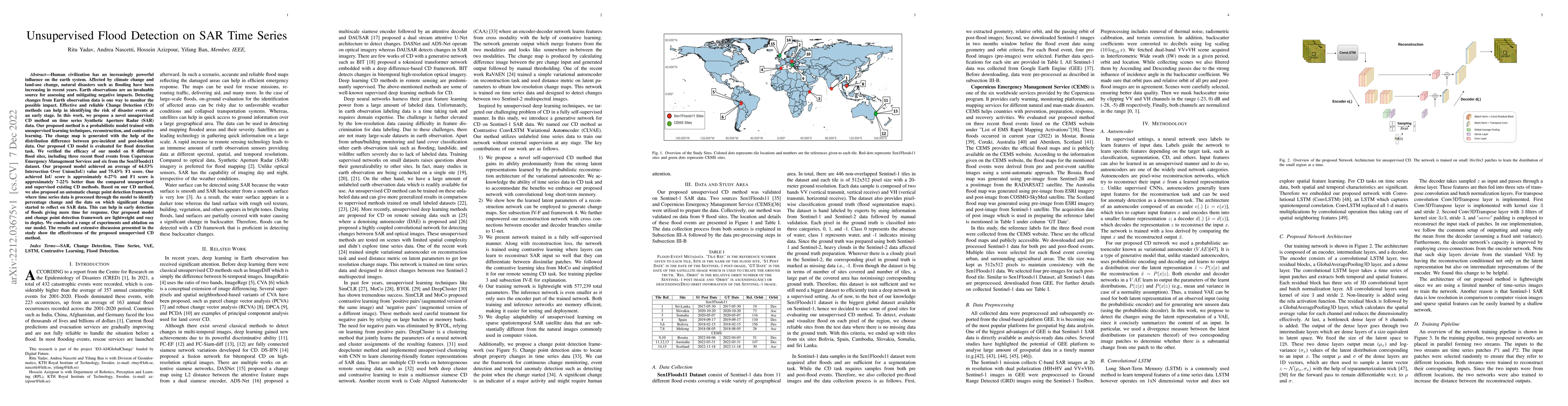
Human civilization has an increasingly powerful influence on the earth system. Affected by climate change and land-use change, natural disasters such as flooding have been increasing in recent years...
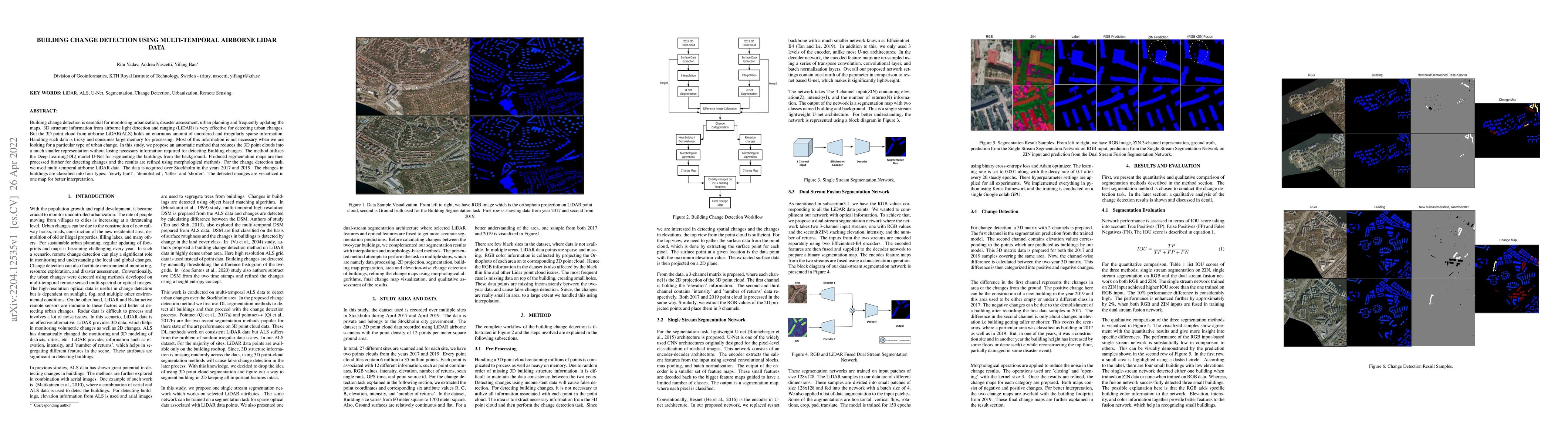
Building change detection is essential for monitoring urbanization, disaster assessment, urban planning and frequently updating the maps. 3D structure information from airborne light detection and r...
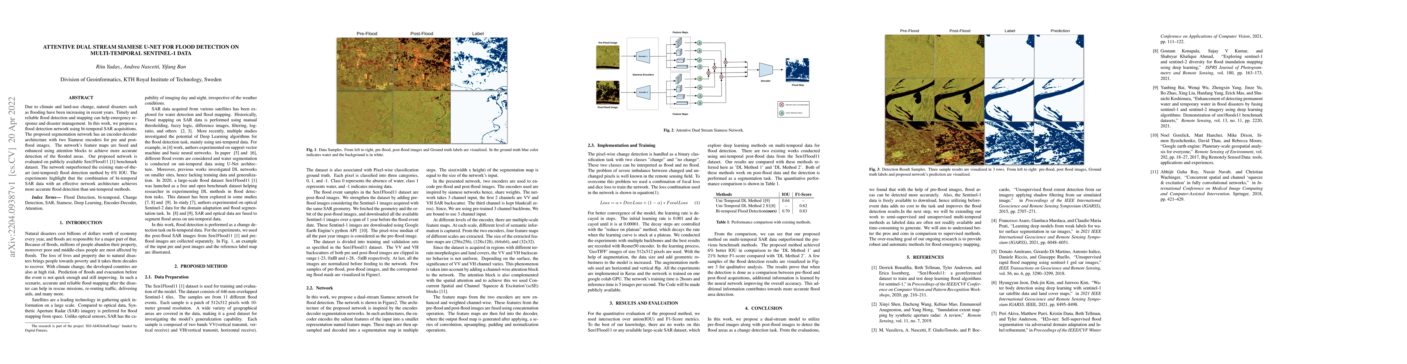
Due to climate and land-use change, natural disasters such as flooding have been increasing in recent years. Timely and reliable flood detection and mapping can help emergency response and disaster ...
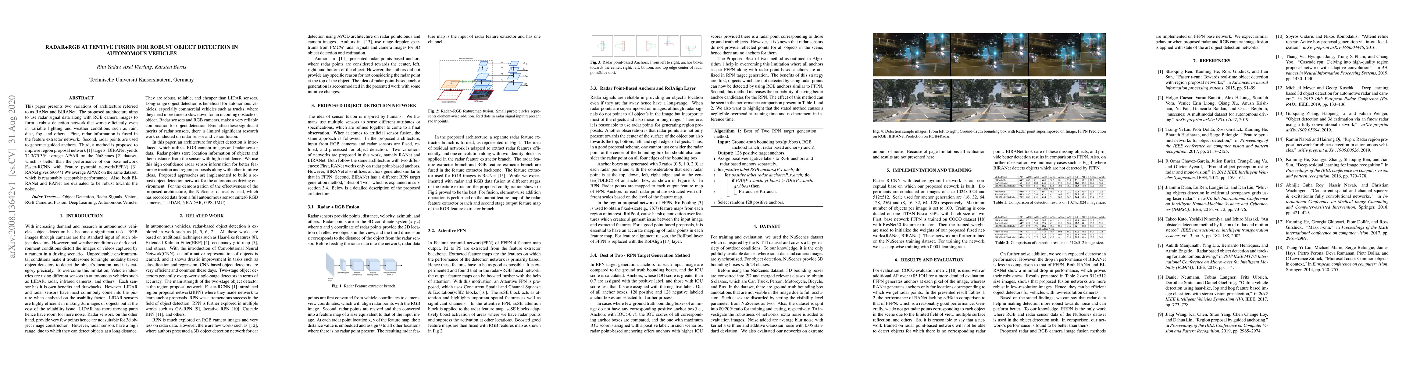
This paper presents two variations of architecture referred to as RANet and BIRANet. The proposed architecture aims to use radar signal data along with RGB camera images to form a robust detection n...
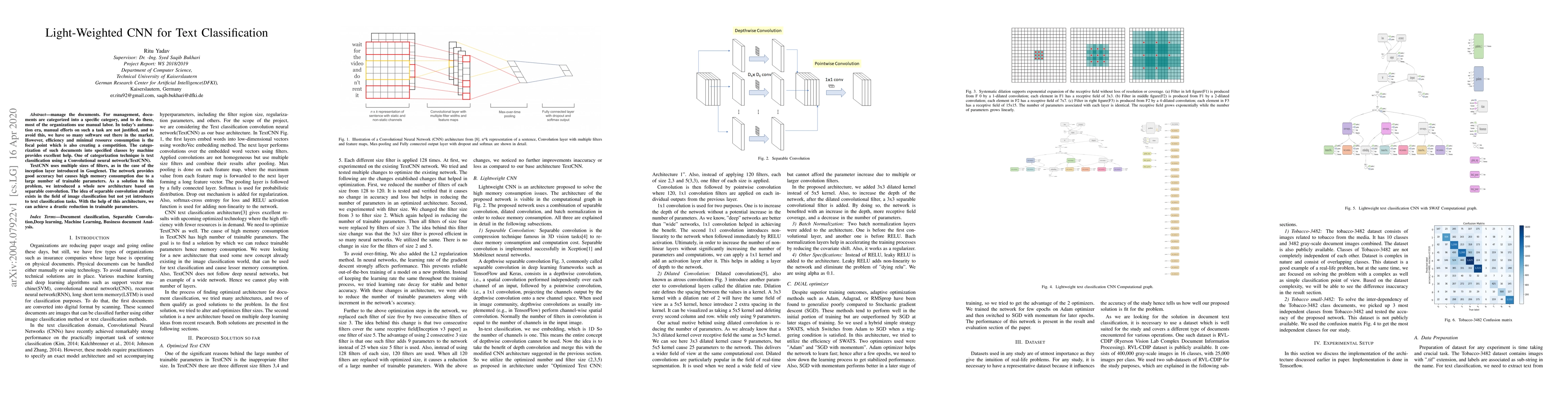
For management, documents are categorized into a specific category, and to do these, most of the organizations use manual labor. In today's automation era, manual efforts on such a task are not just...
Geospatial Foundation Models (GFMs) have emerged as powerful tools for extracting representations from Earth observation data, but their evaluation remains inconsistent and narrow. Existing works ofte...
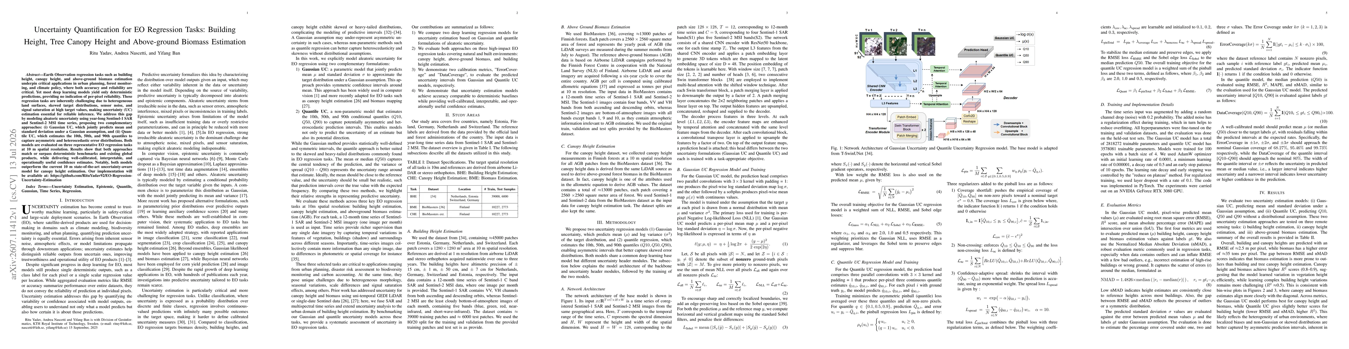
Earth Observation regression tasks such as building height, canopy height, and above-ground biomass estimation underpin critical applications in urban planning, forest monitoring, and climate policy, ...