Academic Profile
Statistics
Similar Authors
Papers on arXiv
Hyperspectral images (HSIs) provide exceptional spatial and spectral resolution of a scene, crucial for various remote sensing applications. However, the high dimensionality, presence of noise and o...
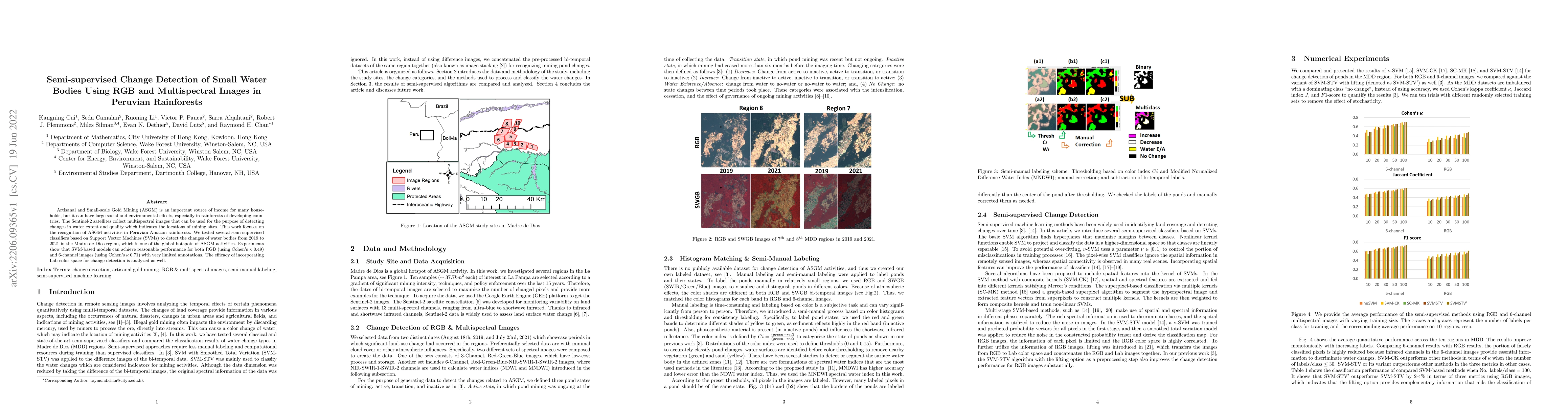
Artisanal and Small-scale Gold Mining (ASGM) is an important source of income for many households, but it can have large social and environmental effects, especially in rainforests of developing cou...
Hyperspectral images, which store a hundred or more spectral bands of reflectance, have become an important data source in natural and social sciences. Hyperspectral images are often generated in la...
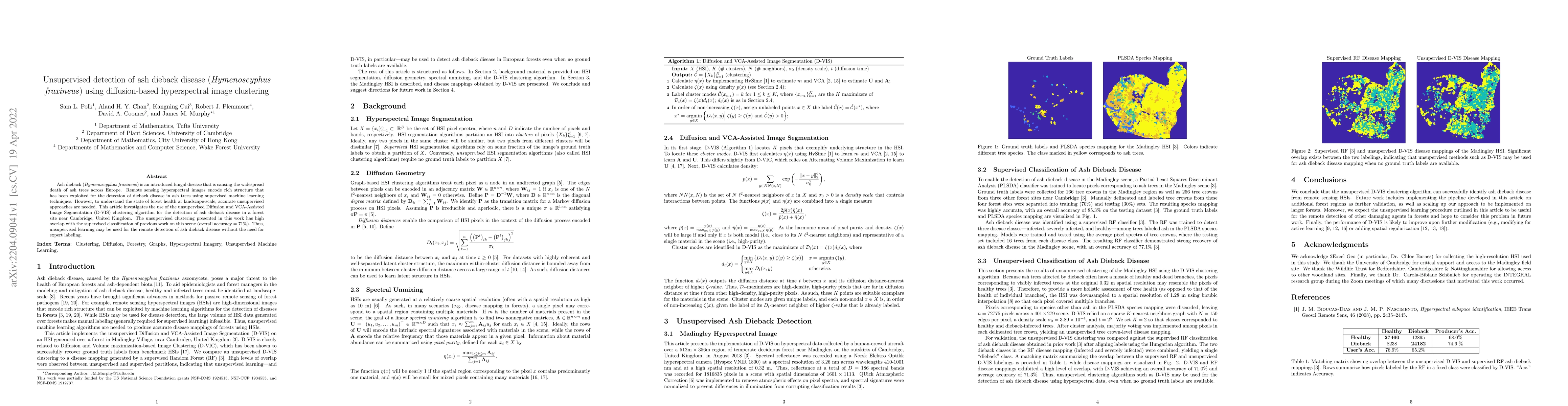
Ash dieback (Hymenoscyphus fraxineus) is an introduced fungal disease that is causing the widespread death of ash trees across Europe. Remote sensing hyperspectral images encode rich structure that ...
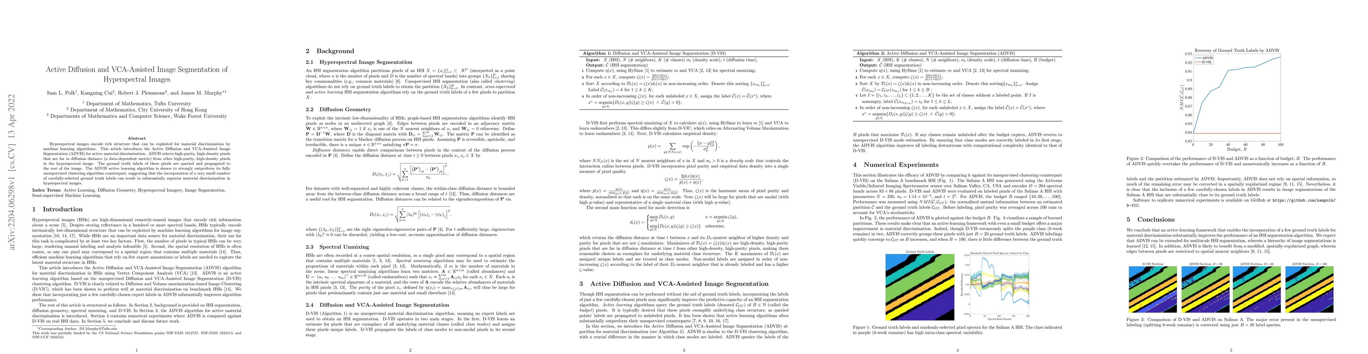
Hyperspectral images encode rich structure that can be exploited for material discrimination by machine learning algorithms. This article introduces the Active Diffusion and VCA-Assisted Image Segme...
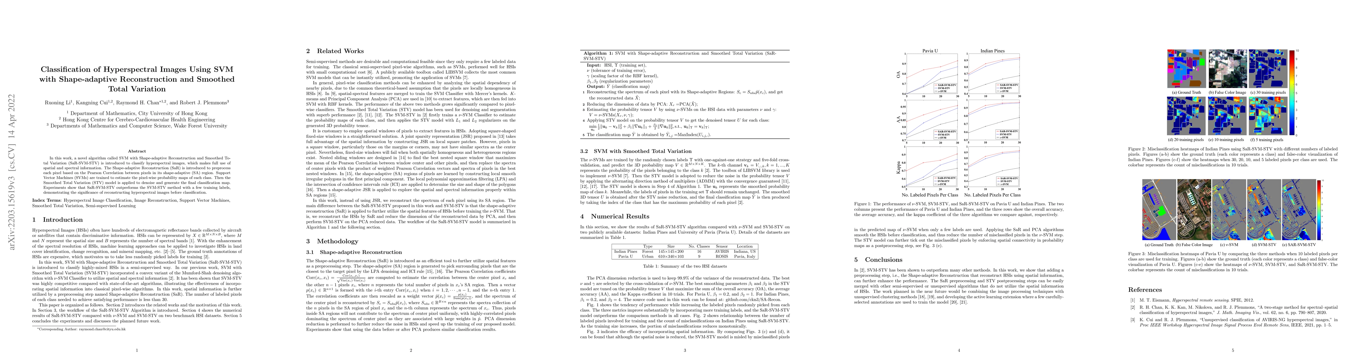
In this work, a novel algorithm called SVM with Shape-adaptive Reconstruction and Smoothed Total Variation (SaR-SVM-STV) is introduced to classify hyperspectral images, which makes full use of spati...
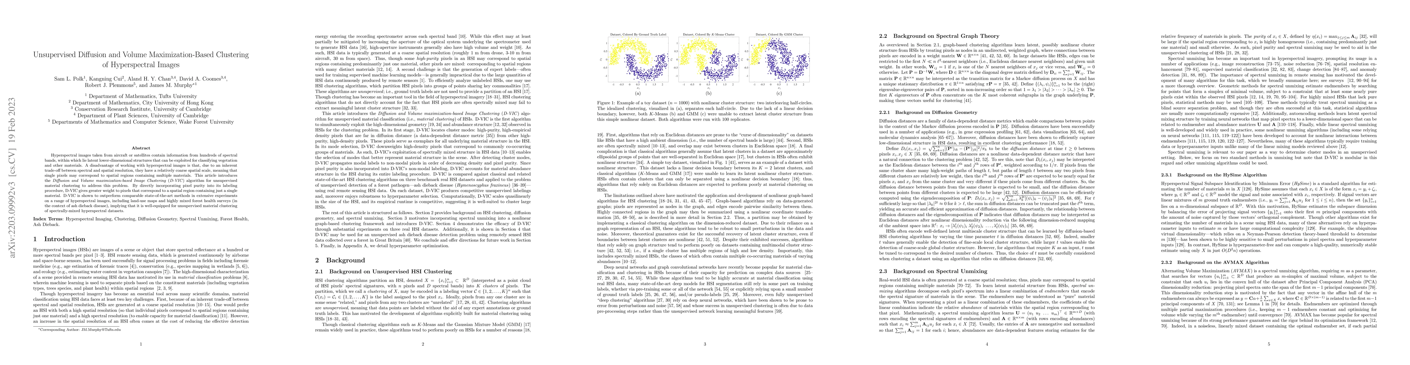
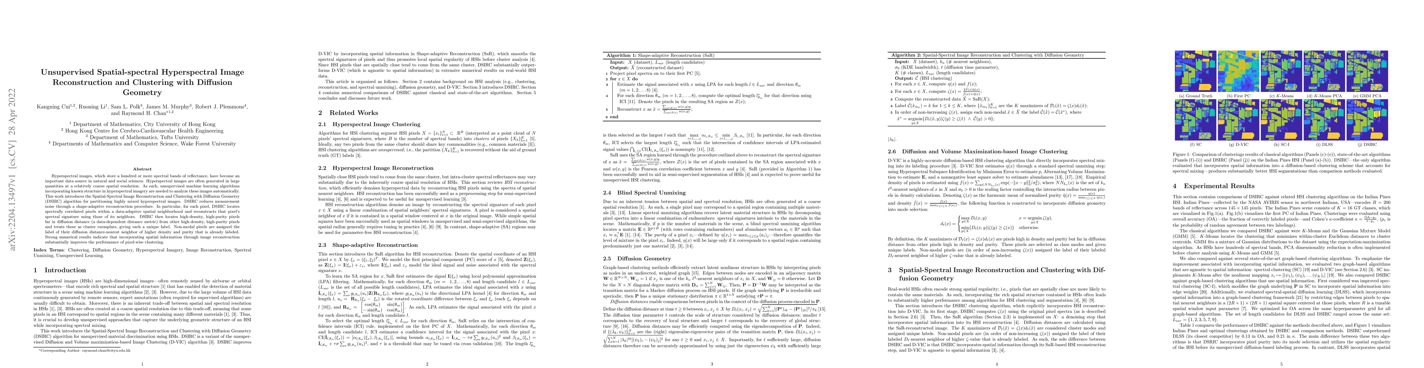
Hyperspectral images taken from aircraft or satellites contain information from hundreds of spectral bands, within which lie latent lower-dimensional structures that can be exploited for classifying...
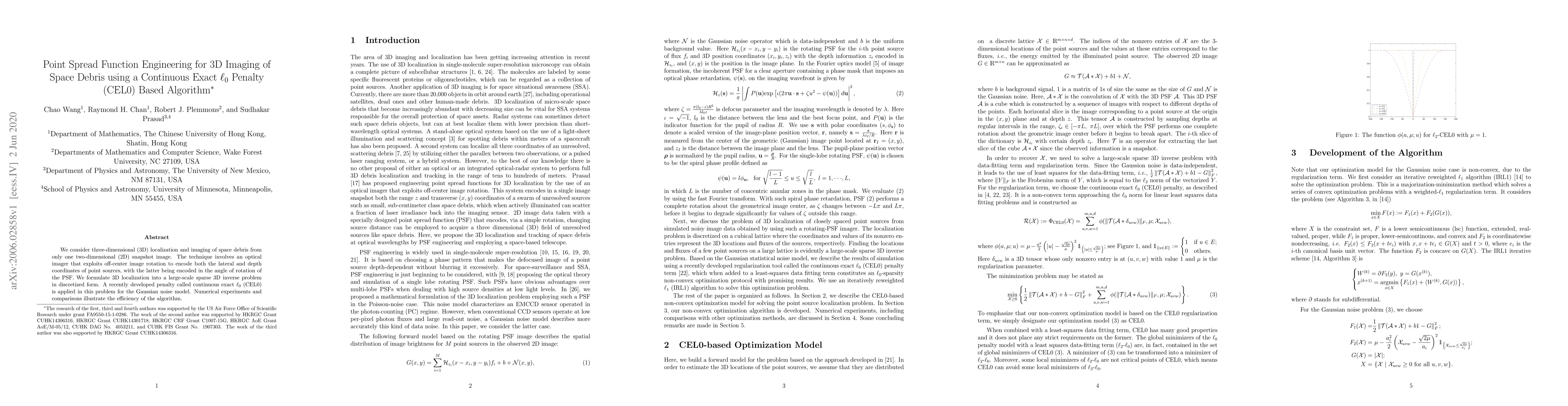
We consider three-dimensional (3D) localization and imaging of space debris from only one two-dimensional (2D) snapshot image. The technique involves an optical imager that exploits off-center image...
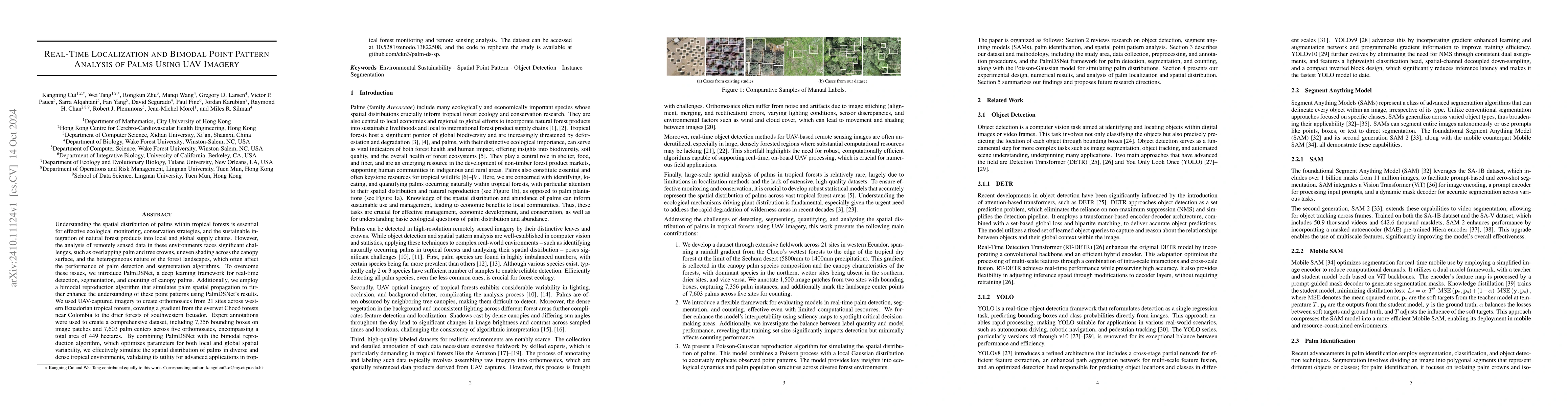
Understanding the spatial distribution of palms within tropical forests is essential for effective ecological monitoring, conservation strategies, and the sustainable integration of natural forest pro...