ArxivLens
R
Researcher

Rochelle Schneider

5 papers on arXiv

5 arXiv Papers
2 Total Publications
Profile

Academic Profile

Name Rochelle Schneider
Total Papers 2
Scholar Profile View on Semantic Scholar
Metrics

Statistics

5 arXiv Papers
2 Total Publications
Publications

Papers on arXiv

Thumbnail for Implicit Assimilation of Sparse In Situ Data for Dense & Global Storm
  Surge Forecasting
arXiv
Implicit Assimilation of Sparse In Situ Data for Dense & Global Storm Surge Forecasting

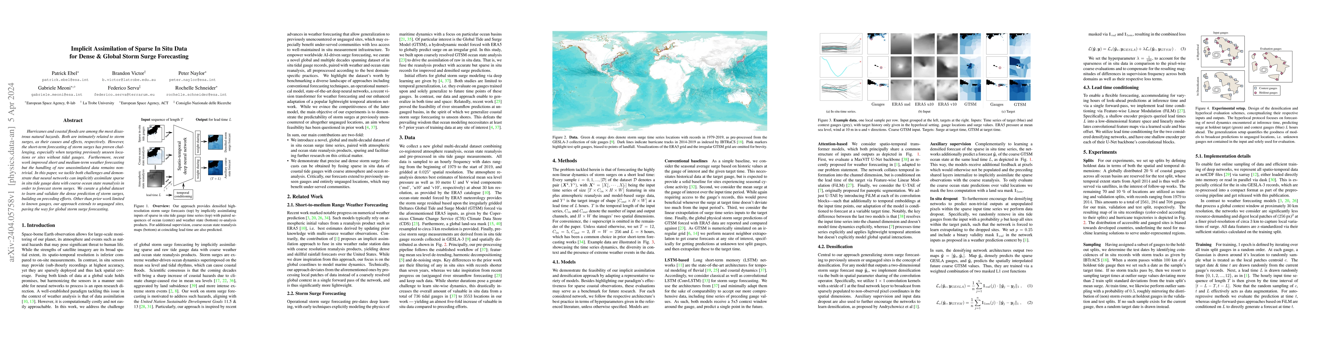
Hurricanes and coastal floods are among the most disastrous natural hazards. Both are intimately related to storm surges, as their causes and effects, respectively. However, the short-term forecasti...

Thumbnail for Machine Learning for Methane Detection and Quantification from Space - A
  survey
arXiv
Machine Learning for Methane Detection and Quantification from Space - A survey

Methane ($CH_4$) is a potent anthropogenic greenhouse gas, contributing 86 times more to global warming than Carbon Dioxide ($CO_2$) over 20 years, and it also acts as an air pollutant. Given its high...

Thumbnail for Predicting Internet Connectivity in Schools: A Feasibility Study
  Leveraging Multi-modal Data and Location Encoders in Low-Resource Settings
arXiv
Predicting Internet Connectivity in Schools: A Feasibility Study Leveraging Multi-modal Data and Location Encoders in Low-Resource Settings

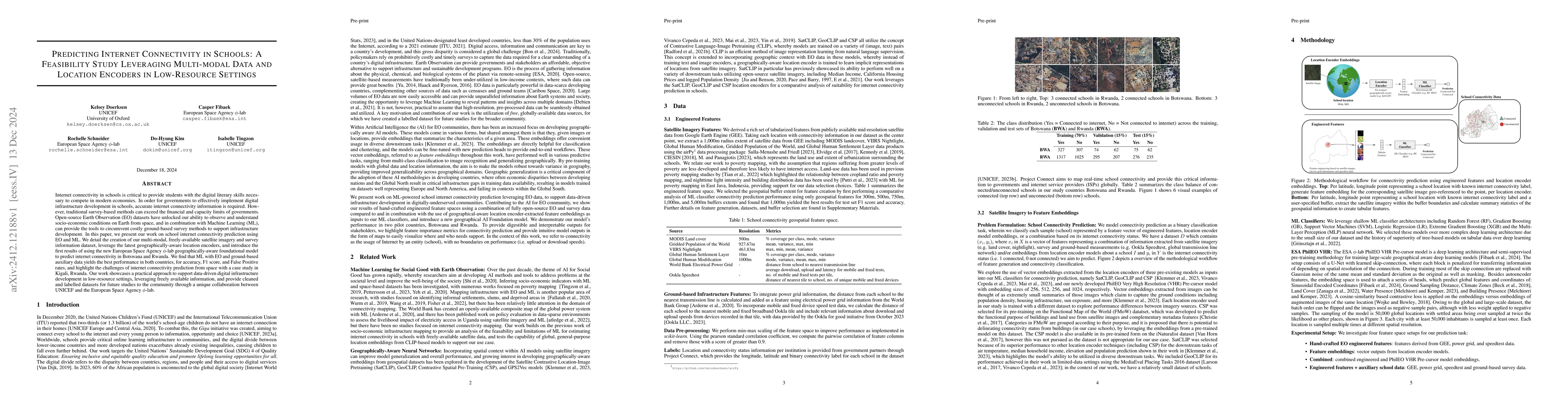
Internet connectivity in schools is critical to provide students with the digital literary skills necessary to compete in modern economies. In order for governments to effectively implement digital in...

Thumbnail for Mitigating representation bias caused by missing pixels in methane plume
  detection
arXiv
Mitigating representation bias caused by missing pixels in methane plume detection

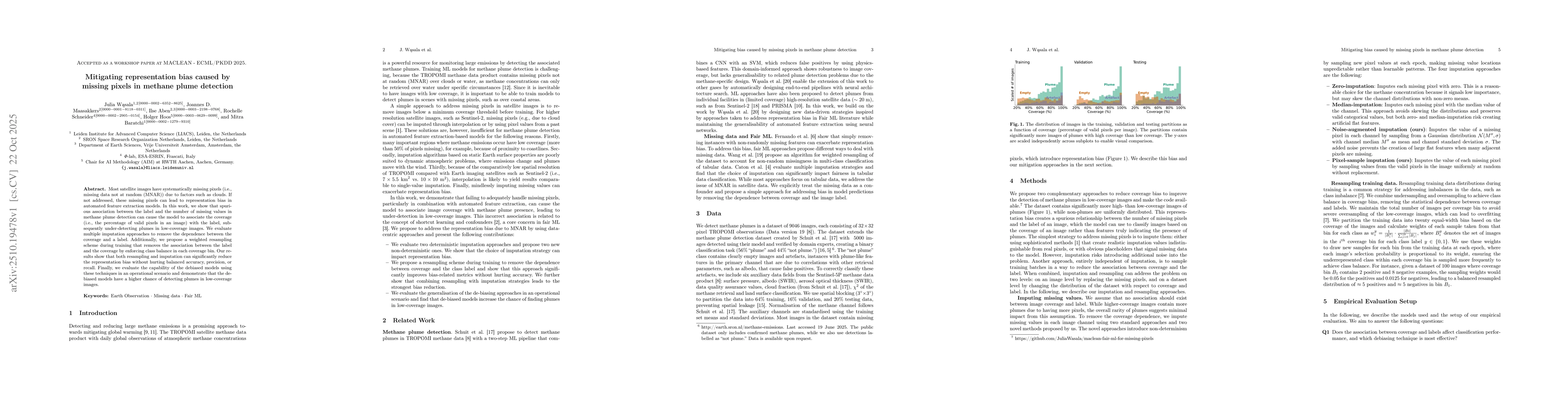
Most satellite images have systematically missing pixels (i.e., missing data not at random (MNAR)) due to factors such as clouds. If not addressed, these missing pixels can lead to representation bias...

Thumbnail for A Multi-tiered Human-in-the-loop Approach for Interactive School Mapping
  Using Earth Observation and Machine Learning
arXiv
A Multi-tiered Human-in-the-loop Approach for Interactive School Mapping Using Earth Observation and Machine Learning

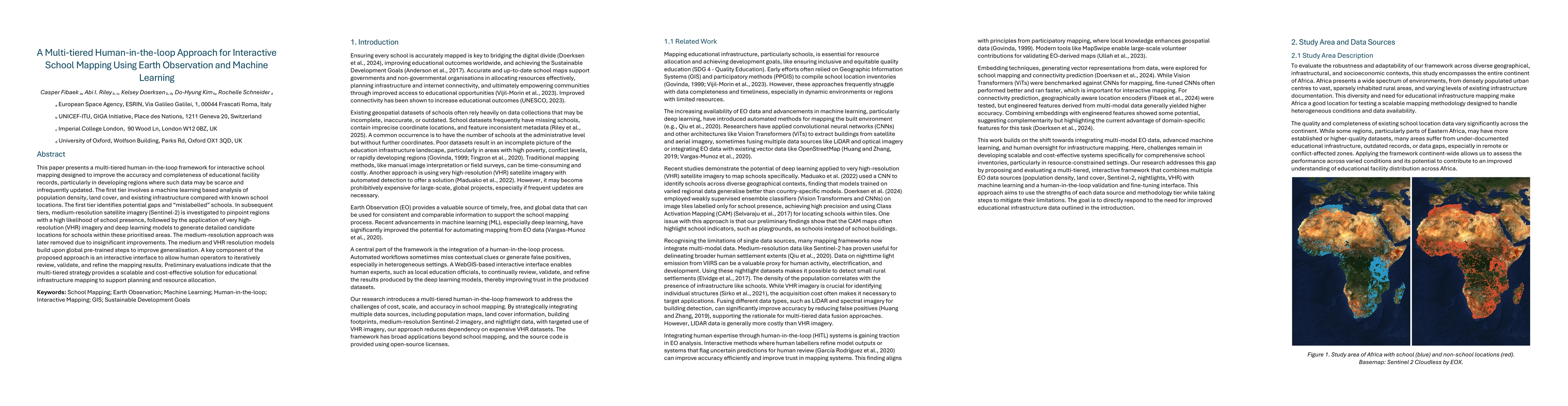
This paper presents a multi-tiered human-in-the-loop framework for interactive school mapping designed to improve the accuracy and completeness of educational facility records, particularly in develop...

This website uses cookies to ensure you get the best experience. Learn more